Results
7 results found
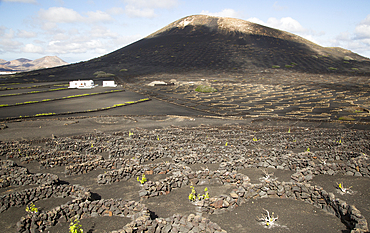
Grape vines growing in black volcanic soil in protected enclosed pits, La Geria, Lanzarote, Canary Islands, Spain, Atlantic, Europe
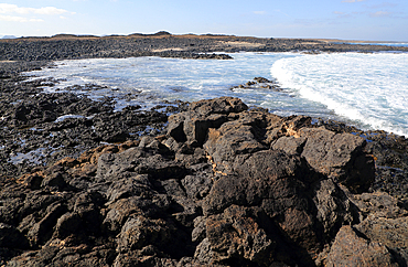
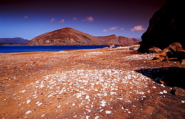
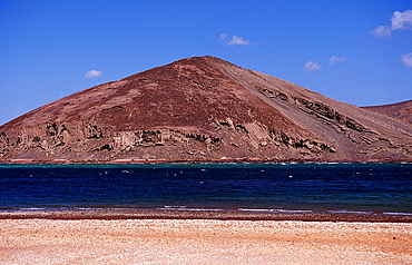
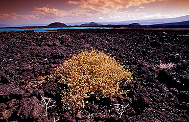
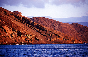
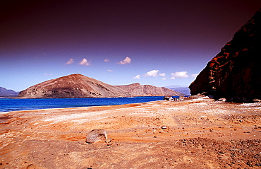
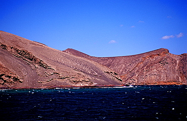
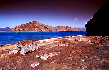
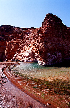
Coastal landscape near Majanicho on north coast of Fuerteventura, Canary Islands, Spain, Atlantic, Europe
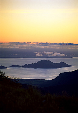
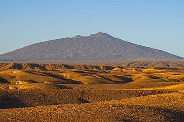
Island view from Puyehue volcano, Lago Puyehue (Lake Puyehue), Chile, South America
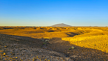
Tousside volcano above Trou du Natron, Tibesti Mountains, Chad

Sheep grazing on remote Heimaey Island, Iceland
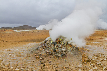
A view of the boiling mud at Namafjall, Iceland
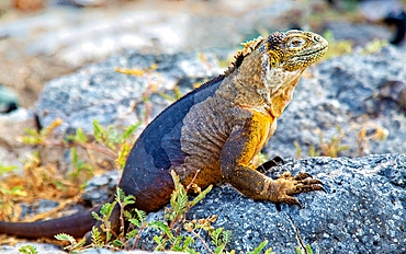
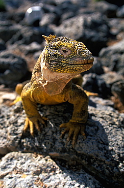
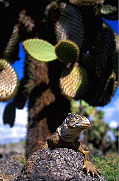
Galapagos Land Iguana (Conolophus subcristatus), large lizard can can grow to five feet long and live for 60 years, South Plaza island, Galapagos, UNESCO World Heritage Site, Ecuador, South America
Tousside volcano above Trou du Natron, Tibesti Mountains, Chad
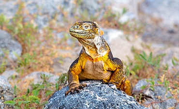
Galapagos Land Iguana (Conolophus subcristatus), large lizard can can grow to five feet long and live for 60 years, South Plaza island, Galapagos, UNESCO World Heritage Site, Ecuador, South America
Views of Dogs Leg Fjord, lying directly east of Ridge Island and opening on Bourgeois Fjord, along the west coast of Graham Land, Norway
Views of Dogs Leg Fjord, lying directly east of Ridge Island and opening on Bourgeois Fjord, along the west coast of Graham Land, Norway
Views of Dogs Leg Fjord, lying directly east of Ridge Island and opening on Bourgeois Fjord, along the west coast of Graham Land, Norway
Views of Dogs Leg Fjord, lying directly east of Ridge Island and opening on Bourgeois Fjord, along the west coast of Graham Land, Norway

Sheep grazing in open field with volcanic mountains in the distance, Kinigi, Rwanda
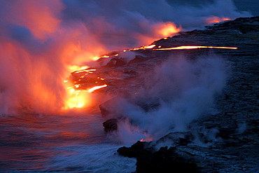
Lava flowing into the Pacific Ocean, Volcanoes National Park, Big Island, Hawaii

Tourists riding camels, in Timanfaya National Park, Lanzarote, Canary Islands, Spain
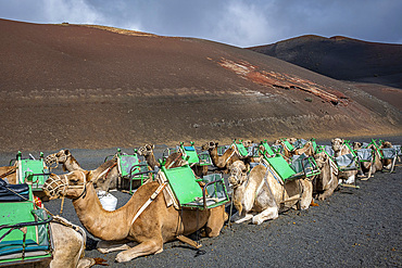
Echadero de Camellos, Camels wait for the next ride with tourists, Timanfaya National Park, Ruta de Los Volcanes, Lanzarote, Spain

Evening atmosphere, Black sand beach, dunes with dry grass, mountains Klifatindur, Eystrahorn and Kambhorn, headland Stokksnes, massif Klifatindur, Austurland, East Iceland, Iceland, Europe
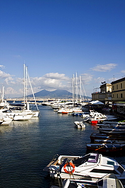
Volcano Vesuvio from small port of Borgo Marinaro, Naples, Campania, Italy, Europe
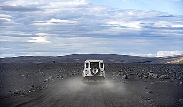
White Land Rover on a dirt road, volcanic landscape, barren landscape, Vatnajoekull National Park, Icelandic Highlands, Iceland, Europe
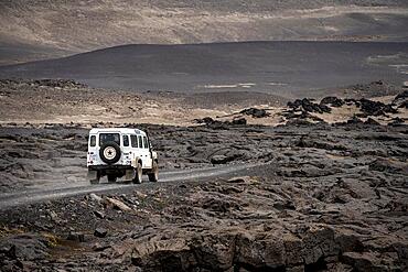
White Land Rover on a dirt road, volcanic landscape, barren landscape, Vatnajoekull National Park, Icelandic Highlands, Iceland, Europe
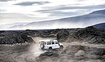
White Land Rover on a dirt road, volcanic landscape, barren landscape, Vatnajoekull National Park, Icelandic Highlands, Iceland, Europe
The Louisiade Archipelago is a string of ten larger volcanic islands frequently fringed by coral reefs, and 90 smaller coral islands located 200 km southeast of New Guinea, stretching over more than 160 km and spread over an ocean area of 26,000 km? between the Solomon Sea to the north and the Coral Sea to the south. The aggregate land area of the islands is about 1,790 km? (690 square miles), with Vanatinai (formerly Sudest or Tagula as named by European claimants on Western maps) being the largest.Sideia Island and Basilaki Island lie closest to New Guinea, while Misima, Vanatinai, and Rossel islands lie further east. The archipelago is divided into the Local Level Government (LLG) areas Louisiade Rural (western part, with Misima), and Yaleyamba (western part, with Rossell and Tagula islands. The LLG areas are part of Samarai-Murua District district of Milne Bay. The seat of the Louisiade Rural LLG is Bwagaoia on Misima Island, the population center of the archipelago.
The Louisiade Archipelago is a string of ten larger volcanic islands frequently fringed by coral reefs, and 90 smaller coral islands located 200 km southeast of New Guinea, stretching over more than 160 km and spread over an ocean area of 26,000 km? between the Solomon Sea to the north and the Coral Sea to the south. The aggregate land area of the islands is about 1,790 km? (690 square miles), with Vanatinai (formerly Sudest or Tagula as named by European claimants on Western maps) being the largest. Sideia Island and Basilaki Island lie closest to New Guinea, while Misima, Vanatinai, and Rossel islands lie further east. The archipelago is divided into the Local Level Government (LLG) areas Louisiade Rural (western part, with Misima), and Yaleyamba (western part, with Rossell and Tagula islands. The LLG areas are part of Samarai-Murua District district of Milne Bay. The seat of the Louisiade Rural LLG is Bwagaoia on Misima Island, the population center of the archipelago.

Nimoa Island - here the island mission will impress. The five-sided church features murals of island life and all mission buildings are surrounded by well maintained paths and gardens filled with flowering plants. Edged by jungle-covered mountains, postcard beaches and crystal clear waters - an island paradise indeed! The Louisiade Archipelago is a string of ten larger volcanic islands frequently fringed by coral reefs, and 90 smaller coral islands located 200 km southeast of New Guinea, stretching over more than 160 km and spread over an ocean area of 26,000 km? between the Solomon Sea to the north and the Coral Sea to the south. The aggregate land area of the islands is about 1,790 km? (690 square miles), with Vanatinai (formerly Sudest or Tagula as named by European claimants on Western maps) being the largest. Sideia Island and Basilaki Island lie closest to New Guinea, while Misima, Vanatinai, and Rossel islands lie further east. The archipelago is divided into the Local Level Government (LLG) areas Loui!

Nimoa Island - here the island mission will impress. The five-sided church features murals of island life and all mission buildings are surrounded by well maintained paths and gardens filled with flowering plants. Edged by jungle-covered mountains, postcard beaches and crystal clear waters - an island paradise indeed! The Louisiade Archipelago is a string of ten larger volcanic islands frequently fringed by coral reefs, and 90 smaller coral islands located 200 km southeast of New Guinea, stretching over more than 160 km and spread over an ocean area of 26,000 km? between the Solomon Sea to the north and the Coral Sea to the south. The aggregate land area of the islands is about 1,790 km? (690 square miles), with Vanatinai (formerly Sudest or Tagula as named by European claimants on Western maps) being the largest. Sideia Island and Basilaki Island lie closest to New Guinea, while Misima, Vanatinai, and Rossel islands lie further east. The archipelago is divided into the Local Level Government (LLG) areas Loui!

Nimoa Island - here the island mission will impress. The five-sided church features murals of island life and all mission buildings are surrounded by well maintained paths and gardens filled with flowering plants. Edged by jungle-covered mountains, postcard beaches and crystal clear waters - an island paradise indeed! The Louisiade Archipelago is a string of ten larger volcanic islands frequently fringed by coral reefs, and 90 smaller coral islands located 200 km southeast of New Guinea, stretching over more than 160 km and spread over an ocean area of 26,000 km? between the Solomon Sea to the north and the Coral Sea to the south. The aggregate land area of the islands is about 1,790 km? (690 square miles), with Vanatinai (formerly Sudest or Tagula as named by European claimants on Western maps) being the largest. Sideia Island and Basilaki Island lie closest to New Guinea, while Misima, Vanatinai, and Rossel islands lie further east. The archipelago is divided into the Local Level Government (LLG) areas Louisiade Rural (western part, with Misima), and Yaleyamba (western part, with Rossell and Tagula islands. The LLG areas are part of Samarai-Murua District district of Milne Bay. The seat of the Louisiade Rural LLG is Bwagaoia on Misima Island, the population center of the archipelago.
Nimoa Island - here the island mission will impress. The five-sided church features murals of island life and all mission buildings are surrounded by well maintained paths and gardens filled with flowering plants. Edged by jungle-covered mountains, postcard beaches and crystal clear waters - an island paradise indeed! The Louisiade Archipelago is a string of ten larger volcanic islands frequently fringed by coral reefs, and 90 smaller coral islands located 200 km southeast of New Guinea, stretching over more than 160 km and spread over an ocean area of 26,000 km? between the Solomon Sea to the north and the Coral Sea to the south. The aggregate land area of the islands is about 1,790 km? (690 square miles), with Vanatinai (formerly Sudest or Tagula as named by European claimants on Western maps) being the largest. Sideia Island and Basilaki Island lie closest to New Guinea, while Misima, Vanatinai, and Rossel islands lie further east.
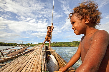
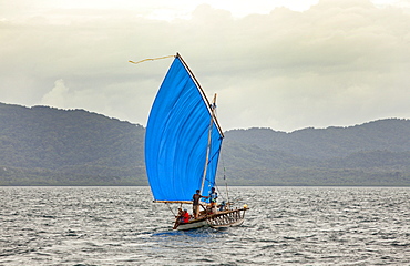
Children playing with a outrigger canoe in the village of Hessessai Bay at PanaTinai (Panatinane)island in the Louisiade Archipelago in Milne Bay Province, Papua New Guinea. The island has an area of 78 km2. The Louisiade Archipelago is a string of ten larger volcanic islands frequently fringed by coral reefs, and 90 smaller coral islands located 200 km southeast of New Guinea, stretching over more than 160 km and spread over an ocean area of 26,000 km? between the Solomon Sea to the north and the Coral Sea to the south. The aggregate land area of the islands is about 1,790 km? (690 square miles), with Vanatinai (formerly Sudest or Tagula as named by European claimants on Western maps) being the largest. Sideia Island and Basilaki Island lie closest to New Guinea, while Misima, Vanatinai, and Rossel islands lie further east. The archipelago is divided into the Local Level Government (LLG) areas Louisiade Rural (western part, with Misima), and Yaleyamba (western part, with Rossell and Tagula islands. The LLG areas are part of Samarai-Murua District district of Milne Bay. The seat of the Louisiade Rural LLG is Bwagaoia on Misima Island, the population center of the archipelago.PanaTinai (Panatinane) is an island in the Louisiade Archipelago in Milne Bay Province, Papua New Guinea.

Nimoa Island - here the island mission will impress. The five-sided church features murals of island life and all mission buildings are surrounded by well maintained paths and gardens filled with flowering plants. Edged by jungle-covered mountains, postcard beaches and crystal clear waters - an island paradise indeed! The Louisiade Archipelago is a string of ten larger volcanic islands frequently fringed by coral reefs, and 90 smaller coral islands located 200 km southeast of New Guinea, stretching over more than 160 km and spread over an ocean area of 26,000 km? between the Solomon Sea to the north and the Coral Sea to the south. The aggregate land area of the islands is about 1,790 km? (690 square miles), with Vanatinai (formerly Sudest or Tagula as named by European claimants on Western maps) being the largest. Sideia Island and Basilaki Island lie closest to New Guinea, while Misima, Vanatinai, and Rossel islands lie further east. The archipelago is divided into the Local Level Government (LLG) areas Louisiade Rural (western part, with Misima), and Yaleyamba (western part, with Rossell and Tagula islands. The LLG areas are part of Samarai-Murua District district of Milne Bay. The seat of the Louisiade Rural LLG is Bwagaoia on Misima Island, the population center of the archipelago.

Nimoa Island - here the island mission will impress. The five-sided church features murals of island life and all mission buildings are surrounded by well maintained paths and gardens filled with flowering plants. Edged by jungle-covered mountains, postcard beaches and crystal clear waters - an island paradise indeed! The Louisiade Archipelago is a string of ten larger volcanic islands frequently fringed by coral reefs, and 90 smaller coral islands located 200 km southeast of New Guinea, stretching over more than 160 km and spread over an ocean area of 26,000 km? between the Solomon Sea to the north and the Coral Sea to the south. The aggregate land area of the islands is about 1,790 km? (690 square miles), with Vanatinai (formerly Sudest or Tagula as named by European claimants on Western maps) being the largest. Sideia Island and Basilaki Island lie closest to New Guinea, while Misima, Vanatinai, and Rossel islands lie further east. The archipelago is divided into the Local Level Government (LLG) areas Louisiade Rural (western part, with Misima), and Yaleyamba (western part, with Rossell and Tagula islands. The LLG areas are part of Samarai-Murua District district of Milne Bay. The seat of the Louisiade Rural LLG is Bwagaoia on Misima Island, the population center of the archipelago.

Nimoa Island - here the island mission will impress. The five-sided church features murals of island life and all mission buildings are surrounded by well maintained paths and gardens filled with flowering plants. Edged by jungle-covered mountains, postcard beaches and crystal clear waters - an island paradise indeed! The Louisiade Archipelago is a string of ten larger volcanic islands frequently fringed by coral reefs, and 90 smaller coral islands located 200 km southeast of New Guinea, stretching over more than 160 km and spread over an ocean area of 26,000 km? between the Solomon Sea to the north and the Coral Sea to the south. The aggregate land area of the islands is about 1,790 km? (690 square miles), with Vanatinai (formerly Sudest or Tagula as named by European claimants on Western maps) being the largest. Sideia Island and Basilaki Island lie closest to New Guinea, while Misima, Vanatinai, and Rossel islands lie further east. The archipelago is divided into the Local Level Government (LLG) areas Loui!

The Pahoehoe lava flowing from Kilauea has reached the Pacific ocean near Kalapana, Big Island, Island of Hawaii, Hawaii, United States of America

Japan, Kyushu, Beppu, volcanic pool, spa thermal blood red lake

Pahoehoe lava flowing from Kilauea has reached the Pacific ocean near Kalapana, Island of Hawaii, Hawaii, United States of America

Hawaii, Big Island, Hawaii Volcanoes National Park, Pahoehoe Lava field, Chain of Craters Road
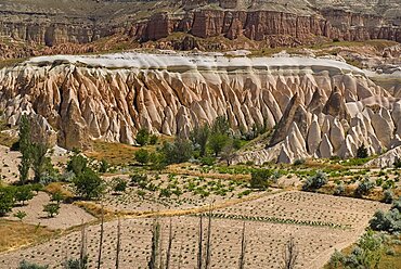
Turkey, Cappadocia, Goreme, View across Rose Valley in foreground towards Red Valley behind. Cultivated land and eroded peaks of volcanic tufa rock formations.
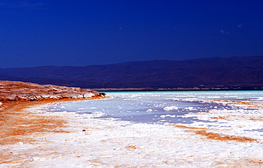
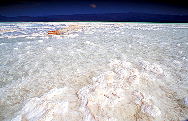
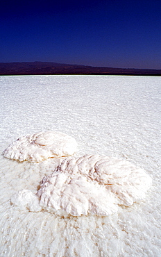
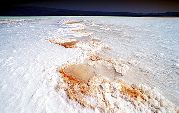
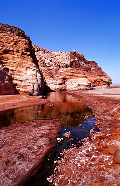
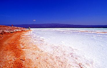
Lac Assal, Lake Assal, Djibouti, Djibuti, Africa, Afar Triangle
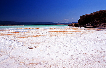
Lac Assal, Lake Assal, Djibouti, Djibuti, Africa, Afar Triangle
Lac Assal, Lake Assal, Djibouti, Djibuti, Africa, Afar Triangle
Lac Assal, Lake Assal, Djibouti, Djibuti, Africa, Afar Triangle

Lac Assal, Lake Assal, Djibouti, Djibuti, Africa, Afar Triangle
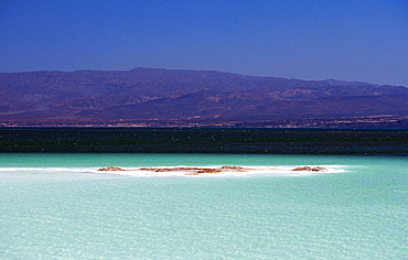
Lac Assal, Lake Assal, Djibouti, Djibuti, Africa, Afar Triangle
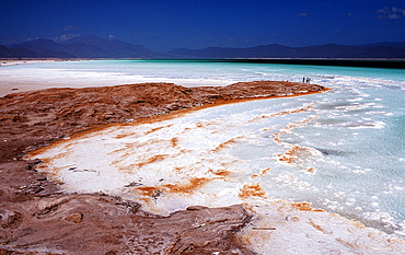
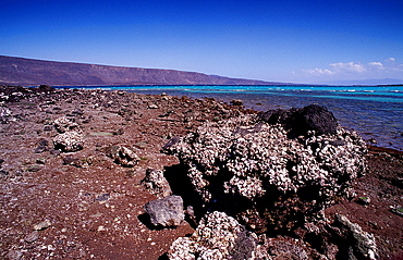
Volcanic spring beside Lac Assal, Lake Assal, Djibouti, Djibuti, Africa, Afar Triangle
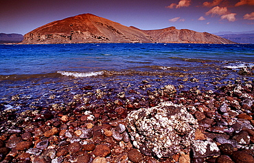
Le Goubet, goubet volcanos, Djibouti, Djibuti, Africa, Afar Triangle, Gulf of Aden, Gulf of Tadjourah
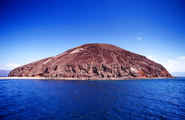
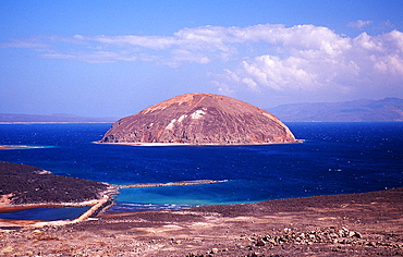
Guinni Koma, Devils island, Djibouti, Djibuti, Africa, Afar Triangle, Gulf of Aden, Gulf of Tadjourah

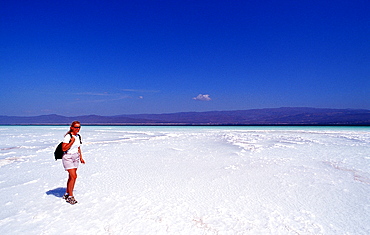
tourist in front of Afar Valley, Djibouti, Djibuti, Africa, Afar Triangle

Afar Valley, Djibouti, Djibuti, Africa, Afar Triangle
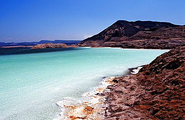
Lac Assal, Lake Assal, Djibouti, Djibuti, Africa, Afar Triangle
desert, Djibouti, Djibuti, Africa, Afar Triangle
Lac Assal, Lake Assal, Djibouti, Djibuti, Africa, Afar Triangle
Guinni Koma, Devils island, Djibouti, Djibuti, Africa, Afar Triangle, Gulf of Aden, Gulf of Tadjourah
Lac Assal, Lake Assal, Djibouti, Djibuti, Africa, Afar Triangle
Le Goubet, goubet volcanos, Djibouti, Djibuti, Africa, Afar Triangle, Gulf of Aden, Gulf of Tadjourah
Guinni Koma, Devils island, Djibouti, Djibuti, Africa, Afar Triangle, Gulf of Aden, Gulf of Tadjourah

desert, Djibouti, Djibuti, Africa, Afar Triangle
Le Goubet, goubet volcanos, Djibouti, Djibuti, Africa, Afar Triangle, Gulf of Aden, Gulf of Tadjourah
Afar Valley, Djibouti, Djibuti, Africa, Afar Triangle
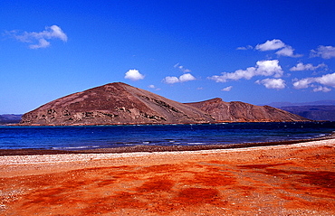
Le Goubet, goubet volcanos, Djibouti, Djibuti, Africa, Afar Triangle, Gulf of Aden, Gulf of Tadjourah

Le Goubet, goubet volcanos, Djibouti, Djibuti, Africa, Afar Triangle, Gulf of Aden, Gulf of Tadjourah
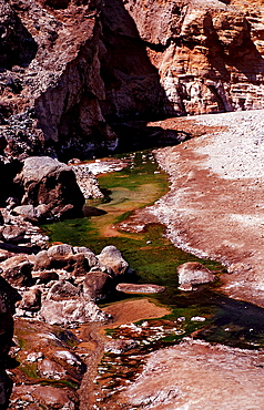
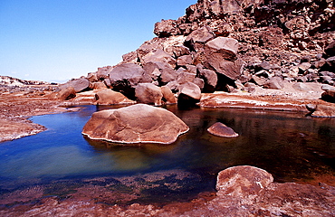
Volcanic spring beside Lac Assal, Lake Assal, Djibouti, Djibuti, Africa, Afar Triangle
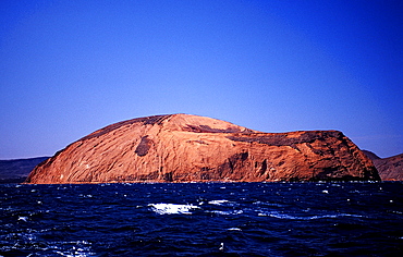
Guinni Koma, Devils island, Djibouti, Djibuti, Africa, Afar Triangle, Gulf of Aden, Gulf of Tadjourah
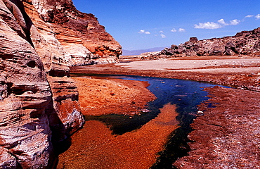
Volcanic spring beside Lac Assal, Lake Assal, Djibouti, Djibuti, Africa, Afar Triangle

Afar Valley, Djibouti, Djibuti, Africa, Afar Triangle

Afar Valley, Djibouti, Djibuti, Africa, Afar Triangle
Plants in the desert, Djibouti, Djibuti, Africa, Afar Triangle
Le Goubet, goubet volcanos, Djibouti, Djibuti, Africa, Afar Triangle, Gulf of Aden, Gulf of Tadjourah
Le Goubet, goubet volcanos, Djibouti, Djibuti, Africa, Afar Triangle, Gulf of Aden, Gulf of Tadjourah
Lac Assal, Lake Assal, Djibouti, Djibuti, Africa, Afar Triangle
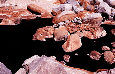
Volcanic spring beside Lac Assal, Lake Assal, Djibouti, Djibuti, Africa, Afar Triangle

Plants in the desert, Djibouti, Djibuti, Africa, Afar Triangle
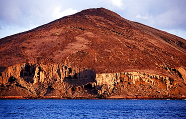
Le Goubet, goubet volcanos, Djibouti, Djibuti, Africa, Afar Triangle, Gulf of Aden, Gulf of Tadjourah
Volcanic spring beside Lac Assal, Lake Assal, Djibouti, Djibuti, Africa, Afar Triangle

Afar Valley, Djibouti, Djibuti, Africa, Afar Triangle
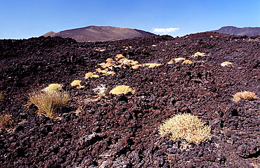
Plants in the desert, Djibouti, Djibuti, Africa, Afar Triangle
Le Goubet, goubet volcanos, Djibouti, Djibuti, Africa, Afar Triangle, Gulf of Aden, Gulf of Tadjourah
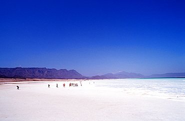
Tourist at Lac Assal, Lake Assal, Djibouti, Djibuti, Africa, Afar Triangle
Le Goubet, goubet volcanos, Djibouti, Djibuti, Africa, Afar Triangle, Gulf of Aden, Gulf of Tadjourah
Lac Assal, Lake Assal, Djibouti, Djibuti, Africa, Afar Triangle
Volcanic spring beside Lac Assal, Lake Assal, Djibouti, Djibuti, Africa, Afar Triangle

Afar Valley, Djibouti, Djibuti, Africa, Afar Triangle

Le Goubet, goubet volcanos, Djibouti, Djibuti, Africa, Afar Triangle, Gulf of Aden, Gulf of Tadjourah

Afar Valley, Djibouti, Djibuti, Africa, Afar Triangle
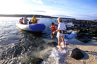
Eco-tourists coming from scuba diving boat for land excursion to see sea lions on Mosquera Island near Bartolome Island, Galapagos Islands, Ecuador
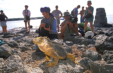
Land Iguana Conolophus subcristatus eco-tourists observing iguanas on South Plazas Island, Galapagos Islands, Ecuador
Land Iguana Conolophus subcristatus main food source is fruit from cactus, on South Plazas Island, Galapagos Islands, Ecuador
Land Iguana Conolophus subcristatus main food source is fruit from cactus, on South Plazas Island, Galapagos Islands, Ecuador
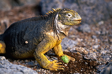
Land Iguana Conolophus subcristatus iguana eating cactus fruit after rolling off thorns on South Plazas Island, Galapagos Islands, Ecuador