Results
5 results found
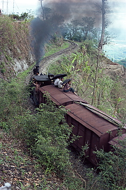
Steam train on the way to Darjeeling, West Bengal state, India, Asia
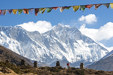
A trekker on their way to Everest Base Camp, Mount Everest is the peak to the left with some spindrift blowing from the top, Himalayas, Nepal, Asia
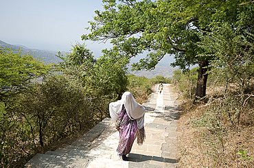
Jain pilgrim covered in white shawl, climbing Shatrunjaya Hill to Jain shrines, hoping to achieve Nirvana, Palitana, Gujarat, India, Asia

A walker at the top of the Devils Staircase while hiking along the West Highland Way near Glencoe in the Scottish Highlands, Scotland, United Kingdom, Europe

A cairn and a walker at the top of the Devils Staircase while hiking along the West Highland Way near Glencoe in the Scottish Highlands, Scotland, United Kingdom, Europe
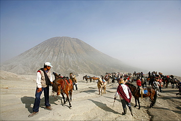
Horses and riders on the way to the top of the Bromo vulcano, with the small Batok volcano in the background, Tengger Caldera, Java, Indonesia, Southeast Asia, Asia
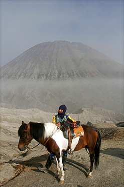
Horse and rider on the way to the top of the Bromo volcano, in the background the small Batok volcano, Tengger caldera, Java, Indonesia, Southeast Asia, Asia
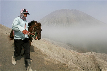
Horse and rider on the way to the top of the Bromo volcano, in the background the small Batok volcano, Tengger's caldera, Java, Indonesia, Southeast Asia, Asia
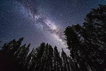
The summer Milky Way overhead and through the Summer Triangle stars in July, looking up through trees in Banff National Park at Herbert Lake. Deneb is at top left, Vega at top right, and Altair is at bottom. The bright Cygnus star cloud is obvious. As are the dark lanes in the Milky Way, including the Funnel Nebula at top, aka Le Gentil 3.

A horizon-to-zenith panorama of the winter consellations on a March evening as they set into the southwest. Orion is at bottom centre, with his Belt pointing down to Canis Major and up to Taurus. Gemini and Auriga are at top, in this case near the zenith overhead. The bright star clusters, M44, the Beehive, (at left) and M45, the Pleiades, (at right) flank the Milky Way. M45 is embedded in the Zodiacal Light. The star clusters M35 in Gemini and M41 in Canis Major are also visible as diffuse spots, as are several other star clusters. A couple of satellite trails are visible.

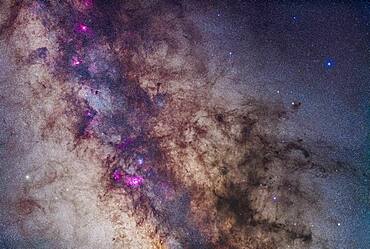
The centre of the galaxy area of the Milky Way toward Sagittarius and Scorpius, with the Sagittarius Starcloud right of centre, and the Lagoon Nebula (M8) left of centre. The Cat's Paw Nebula (NGC 6334) in Scorpius is at upper right, the Swan Nebula (M17) and Eagle Nebula (M16) are at lower left. To the right of them is the Small Sagittarius Starcloud (M24). At the very top is the Snake Nebula (B72). The main mass of dark nebula is the Pipe Nebula (B78). Above M24 at left is the open cluster M23 while below the M24 star cloud is the cluster M25. The globular M22 is at the bottom edge. At right of frame are the open clusters M6 (in the dark area of the Milky Way) and M7 (in the bright starcloud).

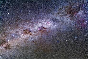
All of Scorpius, plus parts of Lupus and Ara regions of the southern Milky Way. This area was directly overhead when I took this at about 4:30 am local time on April 6, 2014 from near Coonabarabran, Australia. The head of Scorpius is at top his tail at bottom though you could turn this image any direction and it would be correct as seen in the sky at this latitude, depending on the time of night. But in portrait mode like this north is at top. Along the Milky Way are numerous nebulas, including the False Comet area, the Cat's Paw area, and the colourful nebulas around Antares at top. The dark Pipe Nebula is at left of frame.

A mosaic of the region around the centre of the Milky Way in Sagittarius and Scorpius. The field takes in the Milky Way from the Cat's Paw Nebula at bottom edge to the Eagle Nebula at top left. In between from top to bottom are the Swan Nebula (M17), the Small Sagittarius Starcloud (M24), the Trifid and Lagoon Nebulas (M20 and M8) and the open clusters M6 and M7. The prominent dark nebula at right is the large Pipe Nebula (B78) with the small Snake Nebula (B72) above it. The whole complex is visible to the naked eye as the Dark Horse.
A mosaic of the region around the Small Sagittarius Starcloud and Dark Horse dark nebula complex. The field takes in the Milky Way from the Lagoon Nebula at bottom to the Eagle Nebula at top left. In between from top to bottom are the Swan Nebula (M17), and the Small Sagittarius Starcloud (M24). Flanking the bright M24 starcloud are the large open clusters M23 (right) and M25 (left). At bottom left is the M22 globular star cluster. The prominent dark nebula at right is the large Pipe Nebula (B78) with the small Snake Nebula (B72) above it. The whole complex is visible to the naked eye as the Dark Horse.
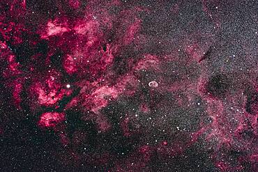
This is the central area of Cygnus and its bright Milky Way starcloud surrounded by red nebulosity. At left is the star Sadr (gamma Cygni) with the complex of nebulosity catalogued as IC 1318. At centre is the distinct Crescent Nebula, NGC 6888, a expanding nebula created by winds from a hot Wolf-Rayet star. At bottom left is the star cluster Messier 29, though looking a little lost in the rich starfields here. At top is the cluster IC 1311, looking more obvious than M29 but not observed visually and included in the NGC catalog. Odd. At far right are the large and loose star clusters NGC 6883 and NGC 6871, the latter an obvious binocular sight. To the left of Sadr is the small cluster NGC 6910. The dark nebulas B145 and LDN 862 are at right. The small emission nebula at bottom is Sharpless 2-104.
Splendours of the southern Milky Way from Vela (at top right) to Centaurus (at bottom left), including the Carina Nebula, Crux and Coal Sack, and Alpha and Beta Centauri. A part of the huge Gum Nebula is at far right. The False Cross is at right, with the large cluster NGC 2516, the Diamond Cluster, below it. The globular cluster Omega Centauri is at upper left.
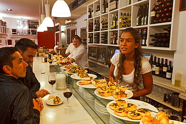
Arrabal 11, Pintxos, Tapas Bar, calle Arrabal 11, Santander, Camino de la Costa, Coastal route, Camino del Norte, Way of Saint James, Camino de Santiago, pilgrims way, province of Cantabria, Cantabria, Northern Spain, Spain, Europe
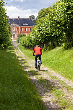
Cyclist on his way to Bothmer Castle, Feston Alley, Bothmer Castle, biggest Baroque Style castle in Mecklenburg, Kluetzer Winkel, backcountry, coast of the Baltic Sea, Kluetz, Mecklenburg-West Pomerania, Germany
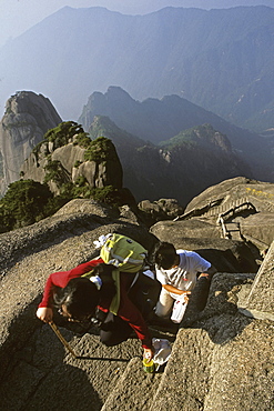
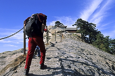
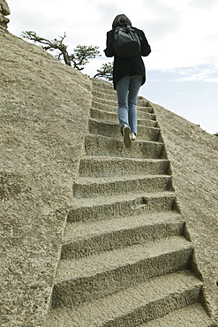
steep rock carved stone steps to Lotus Peak, Huang Shan, Anhui province, steep climb, stone steps, World Heritage, UNESCO, China, Asia

padlocks, locked and the key thrown down the mountain, symbol for couples to pledge faithfulness, Huang Shan, Anhui province, China, Asia, World Heritage, UNESCO
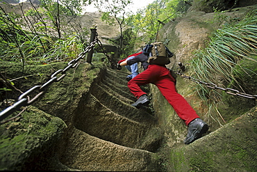
western tourist on steep pilgrim path along stone steps with worn down chain handrail, Hua Shan, Shaanxi province, Taoist mountain, China, Asia
Fish Back Ridge, pilgrim path along stone steps with worn down chain handrail to South Peak Monastery, western tourist with backpack, Hua Shan, Shaanxi province, Taoist mountain, China, Asia
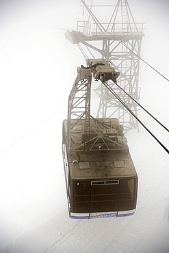
Cabin of the Schilthornbahn in fog on the way to Piz Gloria and top station of the Schilthornbahn (location for James Bond novel and film On Her Majesty's Secret Service), Schilthorn (2970 m), near Muerren, Bernese Oberland (highlands), Canton of Bern, Switzerland
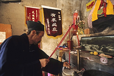
Taoist hermit monk prays at his altar, cliff hermiatge, Hua Shan, Shaanxi province, Taoist mountain, China, Asia
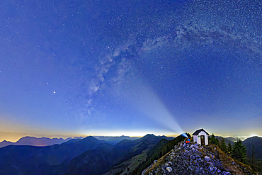
Milky Way spans the starry sky with a view of the Inn Valley, Brünnstein, Mangfall Mountains, Bavarian Alps, Upper Bavaria, Bavaria, Germany
steep rock carved stone steps to Lotus Peak, Huang Shan, Anhui province, steep climb, stone steps, World Heritage, UNESCO, China, Asia
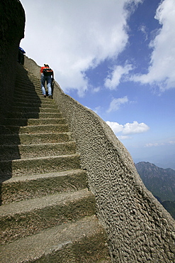
steep rock carved stone steps to Lotus Peak, Huang Shan, Anhui province, steep climb, stone steps, World Heritage, UNESCO, China, Asia
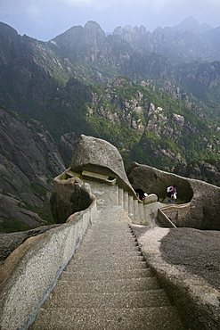
steep rock carved stone steps to Lotus Peak, Huang Shan, Anhui province, steep climb, stone steps, World Heritage, UNESCO, China, Asia
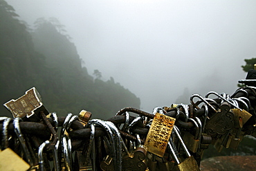
padlocks, locked and the key thrown down the mountain, symbol for couples to pledge faithfulness, Huang Shan, Anhui province, China, Asia, World Heritage, UNESCO
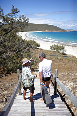
Geoff Mercer, owns a hotel and lives on Great Keppel Island, with tourist on the way to the beach, Great Keppel Island, Great Barrier Reef Marine Park, UNESCO World Heritage Site, Queensland, Australia
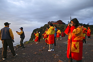
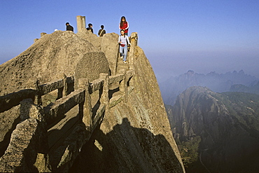
pilgrims and tourists, early morning sunrise and sea of clouds, 3077 metre altitude, Golden Summit, summit of Emei Shan mountains, World Heritage Site, UNESCO, China, Asia
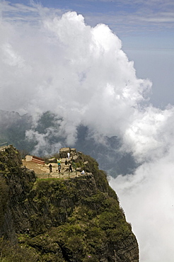
viewing platform near Jinding Monastery, clouds, summit of Emei Shan mountains, Sacrifice Cliff, China, Asia, World Heritage Site, UNESCO
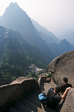
steep rock carved stone steps to Lotus Peak, Huang Shan, Anhui province, steep climb, stone steps, World Heritage, UNESCO, China, Asia
pilgrim path along steep and cut stone steps, Hua Shan, Shaanxi province, Taoist mountain, China, Asia
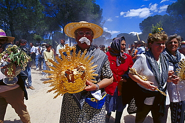
Pilgrims carrying liturgical items on their way, Andalusia, Spain
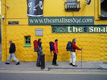
Hikers walking the Dingle Way outside a colorful pub, Dingle, Dingle Peninsula, County Kerry, Ireland
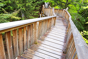
Longest treetop path of the world, Kopfing, Upper Austria, Europe
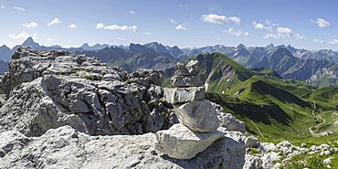
Mountain panorama from the Koblat-Höhenweg on the Nebelhorn, behind left the Hochvogel, 2592m, in the centre the Schneck, 2268m, and on the right the Höfats, 2258m, Allgäu Alps, Allgäu, Bavaria, Germany
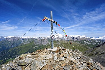
Böses Weibl summit with summit cross and colourful prayer flags, view of picturesque mountain landscape with snow-covered summit of the Großglockner, Wiener Höhenweg, Schober group, Hohe Tauern National Park, Carinthia, Austria
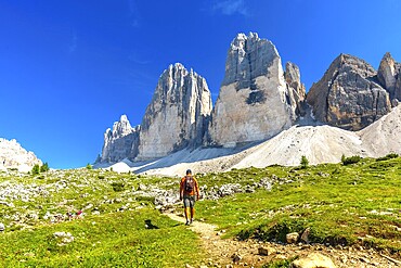
Tourist enjoying a summer hike on a scenic trail leading to the majestic tre cime di lavaredo peaks in the dolomites, Italy
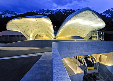
Hungerburgbahn Railway, summit station designed by stararchitect Zaha Hadid, Innsbruck, Tyrol, Austria, Europe
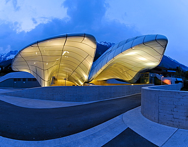
Hungerburgbahn Railway, summit station designed by stararchitect Zaha Hadid, Innsbruck, Tyrol, Austria, Europe
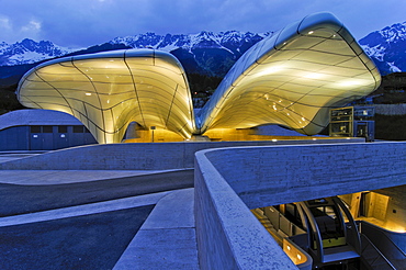
Hungerburgbahn Railway, summit station designed by stararchitect Zaha Hadid, Innsbruck, Tyrol, Austria, Europe
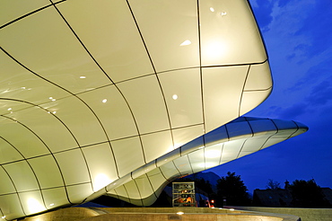
Hungerburgbahn Railway, summit station designed by stararchitect Zaha Hadid, Innsbruck, Tyrol, Austria, Europe
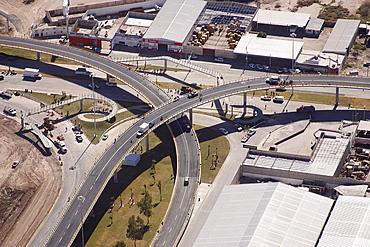
Aerial view of Torreon, Coahuila, Mexico, America
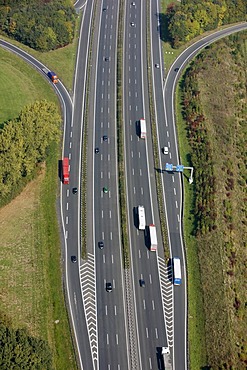
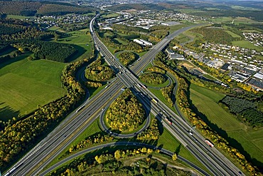
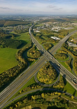
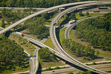
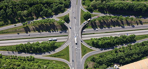
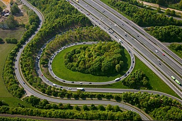
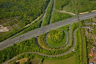
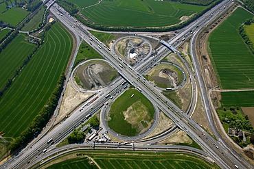
Traffic lanes of the A1 motorway, Muenster-Nord junction, on- and off- ramps, North Rhine-Westphalia, Germany, Europe
Traffic lanes of the A1 motorway, Muenster-Nord junction, on- and off- ramps, North Rhine-Westphalia, Germany, Europe
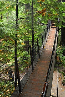
Treetops Adventure walkway at the Capilano Suspension Bridge, tourist attraction, Vancouver, British Columbia, Canada, North America
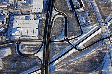
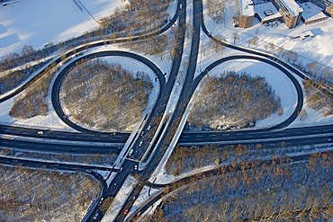
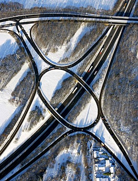
Aerial photo, autobahn A42, junction Gelsenkirchen-Bismarck, snow, Gelsenkirchen, Ruhr Area, North Rhine-Westphalia, Germany, Europe
Aerial photograph, Autobahnkreuz, motorway intersection, A59 and A40 Ruhr highway, Duisburg, Ruhr Area, North Rhine-Westphalia, Germany, Europe
Aerial view of a pathway, Ennepetal, Ruhr Area, North Rhine-Westphalia, Germany, Europe
Aerial photo, autobahn motorway junction Olpe Sued, Wenden, Olpe, Sauerland, North Rhine-Westphalia, Germany, Europe

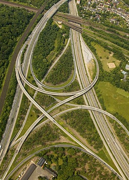
Aerial photo, Dortmund north west motorway junction, A2, A45, start of the so-called Sauerlandlinie, Castrop-Rauxel, Ruhr area, North Rhine-Westphalia, Germany, Europe
Aerial photograph, motorway junction, A40, A1, Unna, Ruhr Area, North Rhine-Westphalia, Germany, Europe

Aerial photo, freeway bridge, viaduct, autobahn A46 near Eversberg, Meschede, Sauerland, North Rhine-Westphalia, Germany, Europe
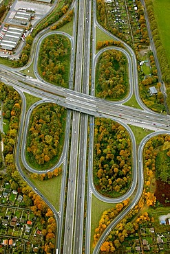
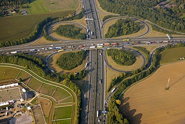
Aerial photograph, 4-leafed clover, Autobahnkreuz Leverkusen motorway intersection, traffic jam, Leverkusen, North Rhine-Westphalia, Germany, Europe
Aerial photo, city autobahn and exits, snow, Wiemelhausen Nordhausenring Universitaetsstrasse, Bochum, Ruhr district, North Rhine-Westphalia, Germany, Europe
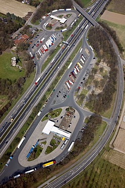
Aerial photograph, A2 Autobahn, Rhynern motorway service area, Hamm, Ruhr district, North Rhine-Westphalia, Germany, Europe
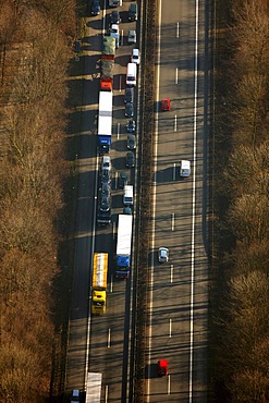
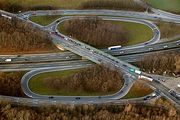
Aerial photo, traffic jam on the A43 autobahn, Bochum, Ruhr district, North Rhine-Westphalia, Germany, Europe

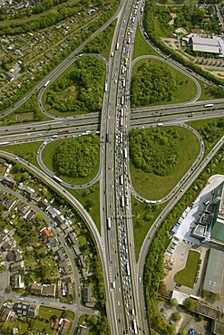
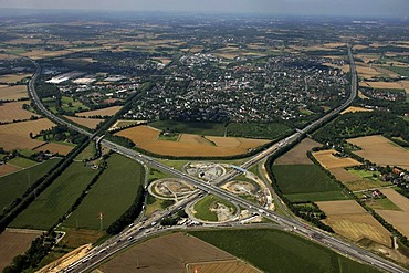
Aerial view, Stadtkrone Ost, intersection A40 B236n, Dortmund, Ruhr Area, North Rhine-Westphalia, Germany, Europe
Aerial photograph, Logport Logistic Centre, Autobahnkreuz, motorway intersection, spaghetti knot of A3 and A40, North Rhine-Westphalia, Germany, Europe

Aerial view, traffic jam on Autobahn A2, Dortmund, Ruhr Area, North Rhine-Westphalia, Germany, Europe
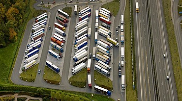
Aerial picture, Peppenhoven motorway restaurant on the motorway A61 between Swifttal and Rheinbach, North Rhine-Westphalia, Germany, Europe
Aerial photo, autobahn motorway junction Olpe Sued, Wenden, Olpe, Sauerland, North Rhine-Westphalia, Germany, Europe

Aerial photo of a car-boot sale, Ruhrort district, North Duisburg, North Rhine-Westphalia, Germany, Europe
Aerial photo, federal highway B224, junction Gelsenkirchen-Buer-West Nordring, snow, Gelsenkirchen-Buer, Gelsenkirchen, Ruhr Area, North Rhine-Westphalia, Germany, Europe
Aerial view, town of Kamen at top, Kamener Kreuz, motorway junction, A1 and A2 motorways, structural alteration works, Kamen, Ruhr Area, North Rhine-Westphalia, Germany, Europe
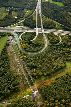
Aerial photograph, motorway loop, Autobahn ramp A45, B1 Ruhr Highway exit, Bochum-Stahlhausen, Wattenscheider Strasse, Bochum, Ruhr Area, North Rhine-Westphalia, Germany, Europe
Stuck pile, snow, Himmelstreppe, sky stairs, Himmelsleiter, sky ladder, by Hermann Prigann, Halde Rhein-Elbe, Gelsenkirchen, Ruhr Area, North Rhine-Westphalia, Germany, Europe

Aerial picture, motorway intersection, A42 and B224 Gladbecker Street, Altenessen, Essen, Ruhr area, North-Rhine Westphalia, Germany, Europe
Aerial photograph, Logport Logistic Centre, Autobahnkreuz, motorway intersection, spaghetti knot of A3 and A40, North Rhine-Westphalia, Germany, Europe

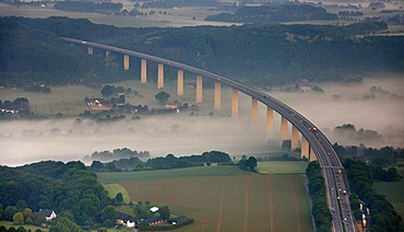
Aerial view, Moseltalbruecke, Moselvalley bridge, motorway bridge, motorway A61, Winningen, Koblenz, Rhineland-Palatinate, Germany, Europe

Aerial photograph, A2 Autobahn, Rhynern motorway service area, Hamm, Ruhr district, North Rhine-Westphalia, Germany, Europe
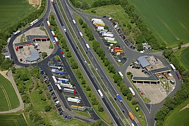
Aerial photo, Buer, A2, Resser Mark mototway restaurant, Gelsenkirchen, Ruhr area, North Rhine-Westphalia, Germany, Europe

Aerial photo, Duisburg motorway junction A40 and A59, allotment gardens, Duisburg, Ruhr area, North Rhine-Westphalia, Germany, Europe
Aerial view of Tetraeder, Bottrop, Ruhr Area, North Rhine-Westphalia, Germany, Europe
Aerial photo, Castrop central motorway slip-road on the A42, Castrop-Rauxel, Ruhr area, North Rhine-Westphalia, Germany, Europe

Aerial view, Kamener Kreuz, motorway junction, A1 and A2 motorways, structural alteration works, Kamen, Ruhr Area, North Rhine-Westphalia, Germany, Europe
Aerial picture, Dortmund North-West highway junction, high tension road, A2, A45, Sauerlandlinie, Castrop-Rauxel, Ruhr area, North Rhine-Westphalia, Germany, Europe
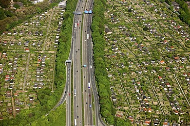
Aerial photo, Duisburg motorway junction A40 and A59, allotment gardens, Duisburg, Ruhr area, North Rhine-Westphalia, Germany, Europe
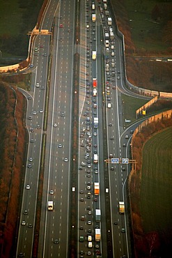
Aerial view, traffic jam on Autobahn A2, Dortmund, Ruhr Area, North Rhine-Westphalia, Germany, Europe
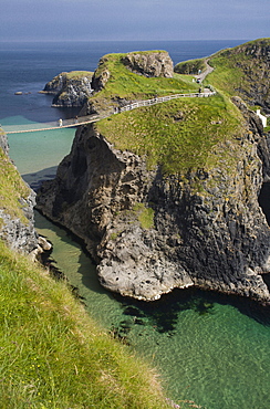
Carrick-a-Rede suspension bridge, connecting the mainland with Carrick Island, County Antrim, Ulster, Northern Ireland, United Kingdom, Europe
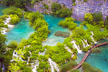
Plitvicka Jezera, Plitvice Lakes National Park, Lika-Senj, Croatia, Europe

Plitvicka Jezera, Plitvice Lakes National Park, Lika-Senj, Croatia, Europe
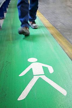
Pictogram, legs, walking zone, occupational safety and health
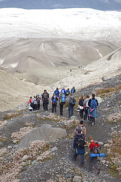
People hike towards Root Glacier in Wrangell-St. Elias National Park, where they will learn ice climbing, Kennicott, Alaska, USA

Aerial view of sand dunes in the Gobi desert with caravan route, Silk Road, Dunhuang, Gansu, China, Asia

Aerial photo, Leverkusener Kreuz intersection, intersection A1 A3 motorways, fisheye, Leverkusen, North Rhine-Westphalia, Germany, Europe
Aerial photo, A2 and A31 Friesenspiess motorway junction, Bottrop, Ruhrgebiet area, North Rhine-Westphalia, Germany, Europe

Aerial photo, A2 and A31 Friesenspiess motorway junction, Bottrop, Ruhrgebiet area, North Rhine-Westphalia, Germany, Europe
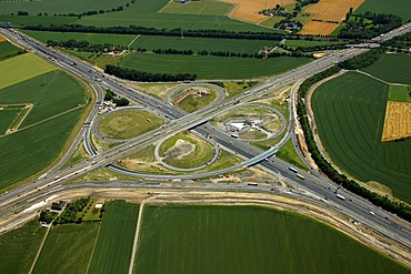
Aerial view, clover, motorway reconstruction, Kamener Kreuz junction of the A1 and A2 motorways, BAB-Kreuz junction, Derne, Kamen, Ruhrgebiet region, North Rhine-Westphalia, Germany, Europe
Aerial photo, A2 and A31 Friesenspiess motorway junction, Bottrop, Ruhrgebiet area, North Rhine-Westphalia, Germany, Europe
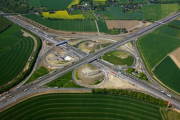
Aerial view, clover, motorway reconstruction, Kamener Kreuz junction of the A1 and A2 motorways, BAB-Kreuz junction, Derne, Kamen, Ruhrgebiet region, North Rhine-Westphalia, Germany, Europe
Aerial view, clover, motorway reconstruction, Kamener Kreuz junction of the A1 and A2 motorways, BAB-Kreuz junction, Derne, Kamen, Ruhrgebiet region, North Rhine-Westphalia, Germany, Europe

Aerial photo, Leverkusener Kreuz intersection, intersection A1 A3 motorways, fisheye, Leverkusen, North Rhine-Westphalia, Germany, Europe
Aerial view, clover, motorway reconstruction, Kamener Kreuz junction of the A1 and A2 motorways, BAB-Kreuz junction, Derne, Kamen, Ruhrgebiet region, North Rhine-Westphalia, Germany, Europe
Aerial view, clover, motorway reconstruction, Kamener Kreuz junction of the A1 and A2 motorways, BAB-Kreuz junction, Derne, Kamen, Ruhrgebiet region, North Rhine-Westphalia, Germany, Europe
Aerial photo, Ruhr River with morning mist between Kupferdreh, Muengsener Bruecke A52 autobahn bridge, Ruhr Valley, Heisingen, Werden and Kettwig, Essen, Ruhr area, North Rhine-Westphalia, Germany, Europe
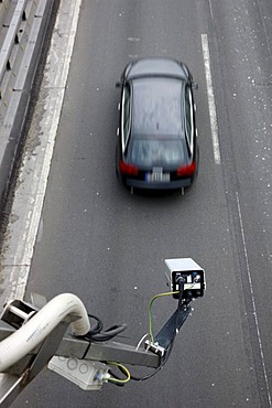
Mobile tollbooth, sensors at a highway construction site on the A2 motorway near Boenen, North Rhine-Westphalia, Germany, Europe
A57 motorway, near Krefeld, roadhouse Geismuehle West and Ost, Krefeld, North Rhine-Westphalia, Germany, Europe