Results
4 results found

Dual-polarized X-Band mobile radar known as NOAA X-POL (NOXP), a mobile Doppler radar that operates on a 3cm wavelength (X-Band), National Weather Center, Oklahoma, United States of America, North America
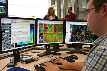
Jonathan Kurtz, forecaster and meteorologist at the National Weather Center Forecast Office in Norman, Oklahoma, United States of America, North America

Jonathan Kurtz, forecaster and meteorologist at the National Weather Center Forecast Office in Norman, Oklahoma, United States of America, North America

Dual-polarized X-Band mobile radar known as NOAA X-POL (NOXP), a mobile Doppler radar that operates on a 3cm wavelength (X-Band), National Weather Center, Oklahoma, United States of America, North America

Mackerel skies, a sign that weather is breaking down and a storm is on the way, Ambleside, Cumbria, chatsworth house
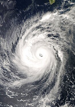
Hurricane Norbert, Pacific Ocean, In 2008, True Colour Satellite Image. Hurricane Norbert on 8 October 2008 over the Pacific ocean off Mexico. True-colour satellite image using MODIS data.
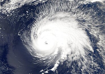
Hurricane Gordon, Atlantic Ocean, In 2006, True Colour Satellite Image. Hurricane Gordon on 14 September 2006 over the Atlantic ocean. True-colour satellite image using MODIS data.

Typhoon Mitag, Philippine Sea, Asia, In 2002, True Colour Satellite Image. Typhoon Mitag on 6 March 2002 in the Philippine Sea, north of the Philippines (lower left-hand corner of the image). True-colour satellite image using MODIS data.

Hurricane Wilma, Atlantic Ocean, On 24/10/2005, True Colour Satellite Image. Hurricane Wilma on 24 October 2005 over Florida, US. True-colour satellite image using MODIS data.

Hurricane Frances, Atlantic Ocean, On 31/08/2004, True Colour Satellite Image. Hurricane Frances on 31 August 2004 north of San Juan, Puerto Rico. True-colour satellite image using MODIS data.

Hurricane Bertha, Atlantic Ocean, In 2008, True Colour Satellite Image. Hurricane Bertha on 9 July 2008 over the Atlantic ocean. True-colour satellite image using MODIS data.
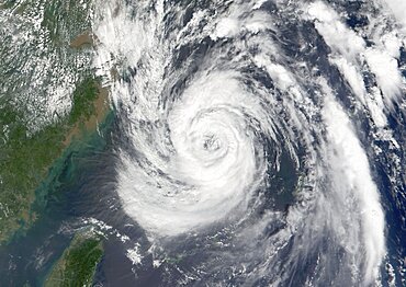
Typhoon Nari, Taiwan, China, Asia, In 2001, True Colour Satellite Image. Typhoon Nari in September 2001 northeast of Taiwan and west of Shanghai, China. True-colour satellite image using MODIS data.
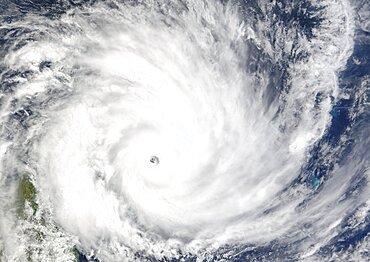
Cyclone Gafilo, Indian Ocean, In 2004, True Colour Satellite Image. Tropical Cyclone Gafilo over the Indian Ocean, Northwest of Madagascar, on 6 March 2004. True-colour satellite image using MODIS data.
