Results
50 results found
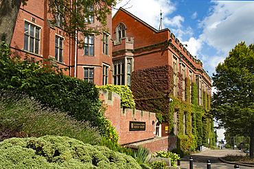
Edwardian Building (Firth Court), part of the Western Bank Campus of the University of Sheffield, Brook Hill, Sheffield, Yorkshire, England
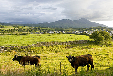
Cow in the countryside around Wesport, with Croagh Patrick in background, County Mayo, Connacht, Republic of Ireland

Inishbofin island, Connemara, County Galway, Connacht, Republic of Ireland
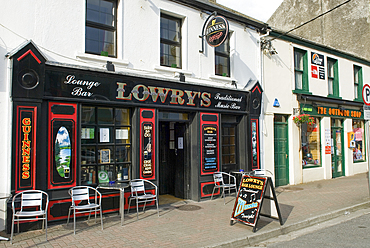
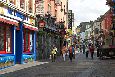
Shopping street in Clifden, Connemara, County Galway, Connacht, Republic of Ireland
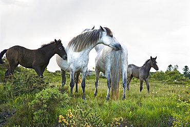
Connemara pony, Connemara, County Galway, Connacht, Republic of Ireland
Galway, Connemara, County Galway, Connacht, Republic of Ireland
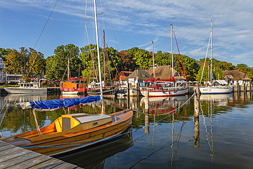
Kloster port, Hiddensee Island, Mecklenburg-Western Pomerania, Germany
Sassnitz harbour, Rügen Island, Mecklenburg-Western Pomerania, Germany
Kloster port, Hiddensee Island, Mecklenburg-Western Pomerania, Germany
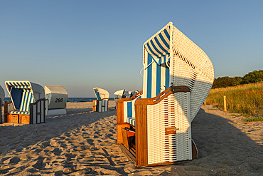
Beach chairs at the beach of Zingst, Fisch-Darv�-Zingst Peninsula, Fischland, Mecklenburg-Western Pomerania, Germany
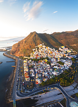
Drone view of San Andres at sunrise, Santa Cruz de Tenerife, Tenerife, Canary Islands, Macaronesia, Spain, Western Europe
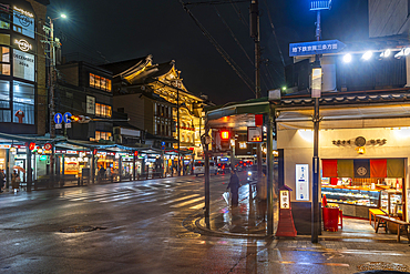
Shops, Gion Shopping Street near Yasaka Jinja Nishiromon Gate (Western Tower Gate), Gionmachi Kitagawa, Higashiyama-ku, Kyoto, Honshu, Japan
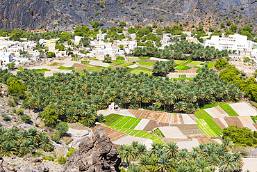
Al Bardah, village on edge of Wadi Bani Awf, NE slope of Jebel Akhdar, Western Hajar Mountains, Al-Dakhiliyah region, Oman, Arabian Peninsula
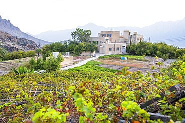
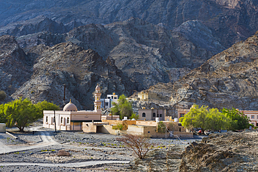
Wakan village, Western Hajar Mountains, border South Batinah Governorate and Al Dakhiliyah Governorates, Sultanate of Oman, Arabian Peninsula
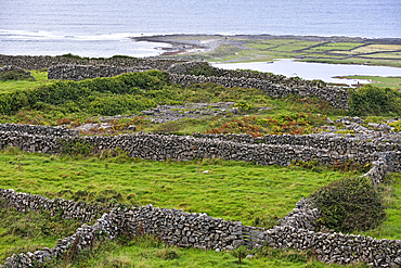
Enclosures with dry stone walls, Inishmore, largest of the Aran Islands, Galway Bay, County Galway, Connacht, Republic of Ireland
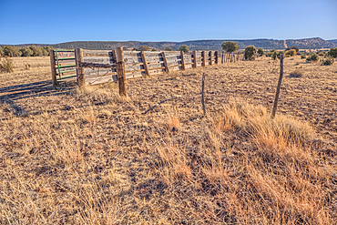
A livestock corral for the Thirteen Mile Cattle Tank off of Corva Road, Kaibab National Forest, Arizona, USA
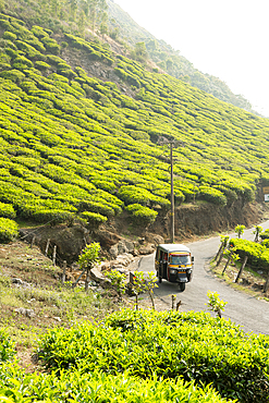
Auto rickshaw (Tuk tuk travelling through the tea plantations near Munnar, Western Ghat, Kerala, India
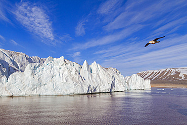
A view of the tidewater glacier in Isbukta (Ice Bay) on the western side of Spitsbergen Island, Svalbard Archipelago, Norway
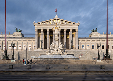
Vienna, Austria ��� View of the Austrian Parliament's grand neo-Greek entrance facade on Ringstrasse, featuring the monumental Pallas Athena fountain and sculpted ramp of the Theophil Hansen-designed building.
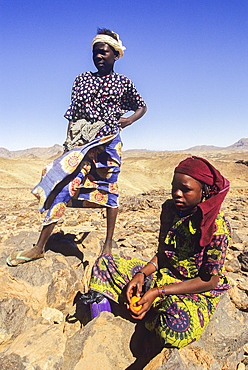
jeunes filles nomades de l'Avdz?r, Niger, Afrique de l'Ouest//nomadic young girl in rocky vastness of Avdz?r, Niger, Western Africa
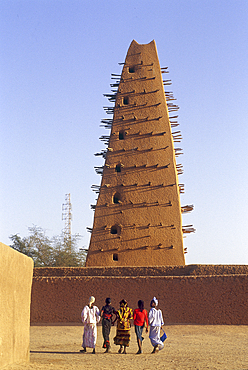
Minaret of Grand Mosque, Agadez, Niger, Western Africa
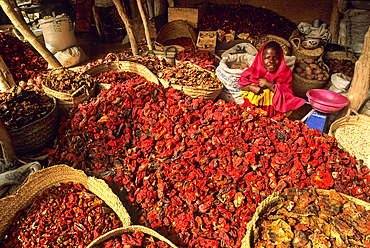
Red chilli at the market, Agadez, Niger, Western Africa
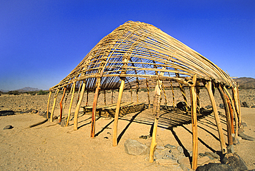
Structure of tuareg nomadic hut in Avdz?r, Niger, Western Africa
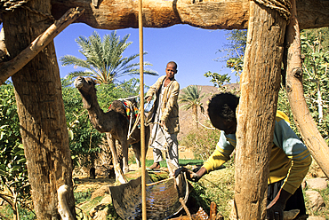
Well in garden and palm grove of Timia, Avdz?r, Niger, Western Africa
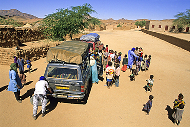
Children forming a crowd around a touristic vehicule having broken down, Aouderas village of Avdz?r, Niger, Western Africa
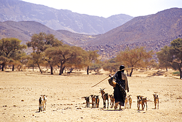
Shepherdess of Avdz?r, Niger, Western Africa
Garden and palm grove of Timia, Avdz?r, Niger, Western Africa
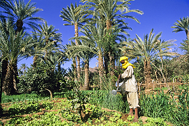
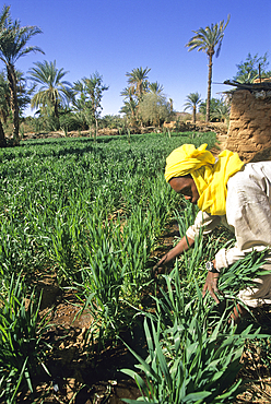
Young man watering lettuce, garden and palm grove of Timia, Avdz?r, Niger, Western Africa
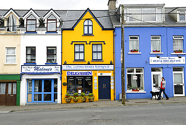
Shopping street in Clifden, Connemara, County Galway, Connacht, Republic of Ireland
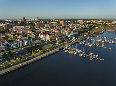
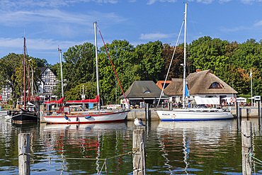
View over Warnow River to Marienkirche church, Rostock, Mecklenburg-Western Pomerania, Germany
Bryan Museum, Galveston island, Gulf of Mexico, Texas, United States of America
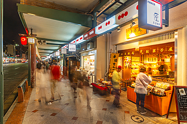
Shop, Gion Shopping Street near Yasaka Jinja Nishiromon Gate (Western Tower Gate), Gionmachi Kitagawa, Higashiyama-ku, Kyoto, Honshu, Japan
Palm trees, Wakan village, Western Hajar Mountains, border South Batinah Governorate and Al Dakhiliyah Governorates, Oman, Arabian Peninsula
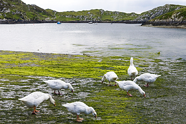
Geese, Inishbofin island, Connemara, County Galway, Connacht, Republic of Ireland
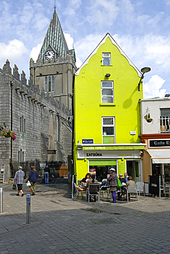
Galway, Connemara, County Galway, Connacht, Republic of Ireland
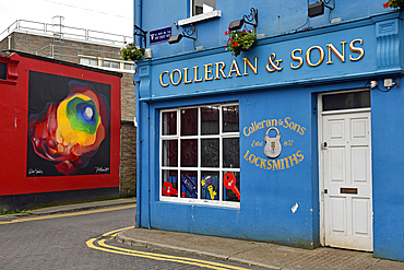
New Street W, Galway, Connemara, County Galway, Connacht, Republic of Ireland
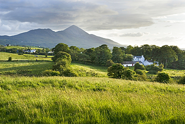
Countryside around Wesport, with Croagh Patrick in background, County Mayo, Connacht, Republic of Ireland
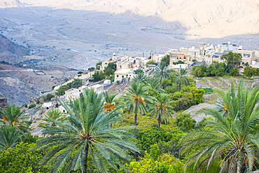
Wakan village in the Western Hajar Mountains, border South Batinah and Al Dakhiliyah Governorates, Sultanate of Oman, Arabian Peninsula
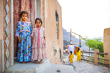
Two little girls, Mosque, Wakan village, Western Hajar Mountains, border South Batinah and Al Dakhiliyah Governorates, Oman, Arabian Peninsula
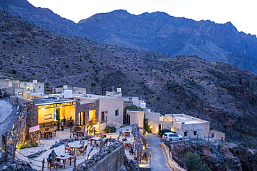
Sama Wakan Heritage hotel by night, Wakan village, Western Hajar Mountains, South Batinah and Al Dakhiliyah Governorates, Oman, Arabian Peninsula
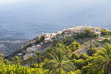
Wakan village, Western Hajar Mountains, border South Batinah Governorate and Al Dakhiliyah Governorates, Sultanate of Oman, Arabian Peninsula
Al Hajir seen from track (Al Barida Road) on western slope of Djebel Ahkdar below Sharaf al Alamayn Pass, 2036m, Oman, Arabian Peninsula

Inishbofin island, Connemara, County Galway, Connacht, Republic of Ireland
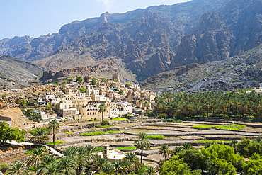
Bilad Sayt village, edge of Wadi Bani Awf, north east slope of Jebel Akhdar, Western Hajar Mountains, Al-Dakhiliyah region, Oman, Arabian Peninsula
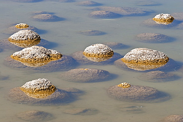
Thrombolites, a variey of microbialite or living rock that produce oxygen and deposit calcium carbonate, similar to some of the earliest fossil forms of life found on Earth, Lake Clifton, Yalgorup National Park, Mandurah, Western Australia, Australia, Pacific
Thrombolites, a variey of microbialite or living rock that produce oxygen and deposit calcium carbonate, similar to some of the earliest fossil forms of life found on Earth, Lake Clifton, Yalgorup National Park, Mandurah, Western Australia, Australia, Pacific

Thrombolites, a variey of microbialite or living rock that produce oxygen and deposit calcium carbonate, similar to some of the earliest fossil forms of life found on Earth, Lake Clifton, Yalgorup National Park, Mandurah, Western Australia, Australia, Pacific
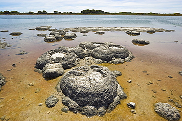
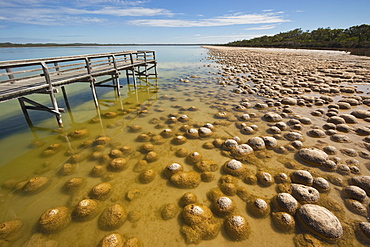
Stromatolites, one of the most ancient life forms on earth, mats of micro-organisms that become rock-like structures through accretion of calcium carbonate, in highly saline lagoons like here in Lake Thetis, Cervantes, Dandaragan Shire, Western Australia, Australia, Pacific

Stromatolites, one of the most ancient life forms on earth, mats of micro-organisms that become rock-like structures through accretion of calcium carbonate, in highly saline lagoons like here in Lake Thetis, Cervantes, Dandaragan Shire, Western Australia, Australia, Pacific
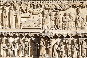
Life of the Virgin Mary, St. Anne portal, Western facade, Notre Dame de Paris Cathedral, Paris, France, Europe
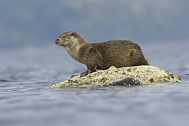
Eurasian river otter (Lutra lutra). Otters in western Scotland have adapted well to life in a marine environment, though proximity to sources of fresh water is essential. Hebrides, Scotland
Eurasian river otter (Lutra lutra). Otters in western Scotland have adapted well to life in a marine environment, though proximity to sources of fresh water is essential. Hebrides, Scotland

Eurasian river otter (Lutra lutra). Otters in western Scotland have adapted well to life in a marine environment, though proximity to sources of fresh water is essential. Hebrides, Scotland
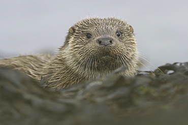
Eurasian river otter (Lutra lutra). Otters in western Scotland have adapted well to life in a marine environment, though proximity to sources of fresh water is essential. Hebrides, Scotland
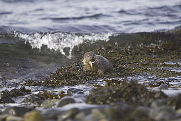
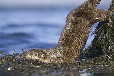
Eurasian river otter (Lutra lutra) eating fish. Otters in western Scotland have adapted well to life in a marine environment, though proximity to sources of fresh water is essential. Hebrides, Scotland
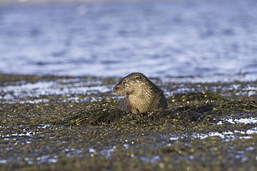
Eurasian river otter (Lutra lutra). Otters in western Scotland have adapted well to life in a marine environment, though proximity to sources of fresh water is essential. Hebrides, Scotland
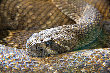
western diamondback rattlesnake or Texas diamond-back (Crotalus atrox).
Park of the Nature of Cabarceno. Cabarceno, Cantabria, Spain.
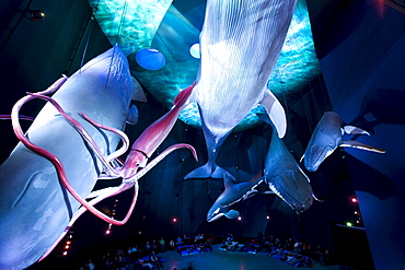
Ozeaneum, german sea museum about sealife, exposition with life size whales, exhibition hall Riesen der Meere, Stralsund, Mecklenburg-Western Pomerania, Germany, Europe
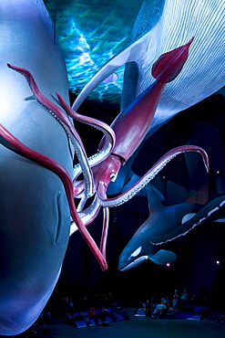
Ozeaneum, german sea museum about sealife, exposition with life size whales, exhibition hall Riesen der Meere, Stralsund, Mecklenburg-Western Pomerania, Germany, Europe
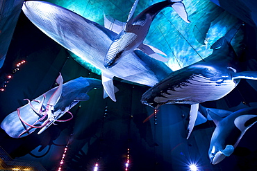
Ozeaneum, german sea museum about sealife, exposition with life size whales, exhibition hall Riesen der Meere, Stralsund, Mecklenburg-Western Pomerania, Germany, Europe
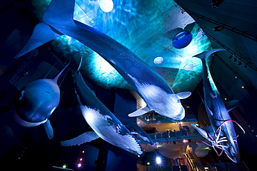
Ozeaneum, german sea museum about sealife, exposition with life size whales, exhibition hall Riesen der Meere, Stralsund, Mecklenburg-Western Pomerania, Germany, Europe
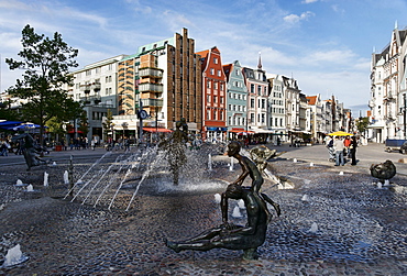
Fountain of the Zest for Life, University Square, Kroepelin Street, Hanseatic Town Rostock, Mecklenburg-Western Pomerania, Germany
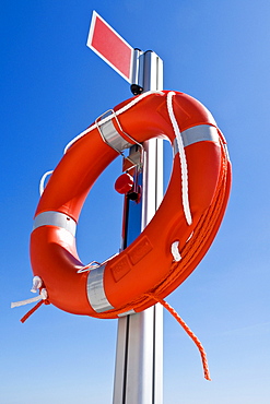
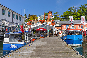
Rescue buoy at a harbour basin, Nordwestmecklenburg, Mecklenburg-Western Pomerania, Germany, Europe
Surf Life Savers boats colliding during a competition at Scarborough Beach, Perth, Western Australia, Australia
Salmon Beach, D'Entrecasteaux National Park, Western Australia
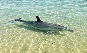
Common Bottlenose Dolphin (Tursiops truncatus) in shallow water, Monkey Mia, Shark Bay, Western Australia
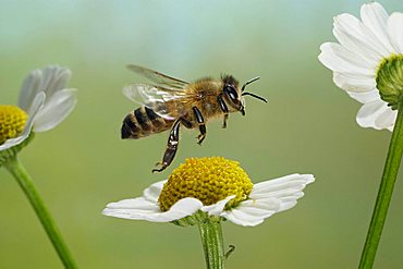
Western honey bee (Apis mellifera)

Competition Surf boats and a female Surf Life Saver running on, Scarborough Beach, Perth, Western Australia, Australia
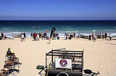
Surf Life Savers Trailer on Scarborough Beach, Perth, Western Australia, Australia
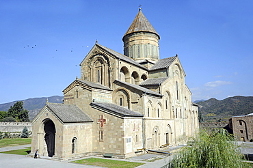
Church of Sveti Zchoweli, Life-giving Pillar Church, Mtskheta, Kartli, Georgia, Middle East
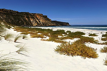
Coastal white sand dunes, Western Australia, Australia

Church of Sveti Zchoweli, Life-giving Pillar Church, Mtskheta, Kartli, Georgia, Middle East
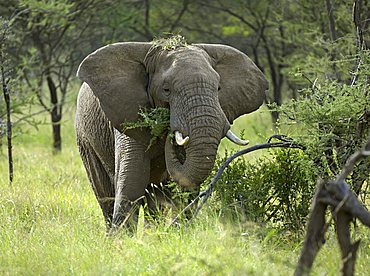
African Bush Elephant (Loxodonta africana), eating bush, Western Corridor, Serengeti, Tanzania
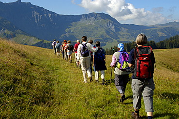
Group is hiking one after another on grass covered mountains Mont Joux Haute-Savoie France
Vegetated dune, Rugia island, Mecklenburg-Western Pomerania, Germany, Europe
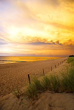
Beach at sunset, Fischland-Darss-Zingst peninsula, Baltic Sea, Mecklenburg-Western Pomerania, Germany, Europe

Dune landscape, Westrand Darss, Western Pomerania Lagoon Area National Park, Mecklenburg-Western Pomerania, Germany, Europe
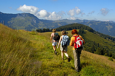
Three women are hiking on grass covered mountains Mont Joux Haute-Savoie France
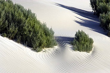
Coastal white sand dunes, Western Australia, Australia

Fountain Brunnen der Lebensfreude ( lust for life ) at the Kroepeliner Strasse. The hanseatic city of Rostock at the coast of the german baltic sea. Europe,Germany, Mecklenburg-Western Pomerania, June

Nimoa Island - here the island mission will impress. The five-sided church features murals of island life and all mission buildings are surrounded by well maintained paths and gardens filled with flowering plants. Edged by jungle-covered mountains, postcard beaches and crystal clear waters - an island paradise indeed! The Louisiade Archipelago is a string of ten larger volcanic islands frequently fringed by coral reefs, and 90 smaller coral islands located 200 km southeast of New Guinea, stretching over more than 160 km and spread over an ocean area of 26,000 km? between the Solomon Sea to the north and the Coral Sea to the south. The aggregate land area of the islands is about 1,790 km? (690 square miles), with Vanatinai (formerly Sudest or Tagula as named by European claimants on Western maps) being the largest. Sideia Island and Basilaki Island lie closest to New Guinea, while Misima, Vanatinai, and Rossel islands lie further east. The archipelago is divided into the Local Level Government (LLG) areas Loui!

Nimoa Island - here the island mission will impress. The five-sided church features murals of island life and all mission buildings are surrounded by well maintained paths and gardens filled with flowering plants. Edged by jungle-covered mountains, postcard beaches and crystal clear waters - an island paradise indeed! The Louisiade Archipelago is a string of ten larger volcanic islands frequently fringed by coral reefs, and 90 smaller coral islands located 200 km southeast of New Guinea, stretching over more than 160 km and spread over an ocean area of 26,000 km? between the Solomon Sea to the north and the Coral Sea to the south. The aggregate land area of the islands is about 1,790 km? (690 square miles), with Vanatinai (formerly Sudest or Tagula as named by European claimants on Western maps) being the largest. Sideia Island and Basilaki Island lie closest to New Guinea, while Misima, Vanatinai, and Rossel islands lie further east. The archipelago is divided into the Local Level Government (LLG) areas Loui!

Nimoa Island - here the island mission will impress. The five-sided church features murals of island life and all mission buildings are surrounded by well maintained paths and gardens filled with flowering plants. Edged by jungle-covered mountains, postcard beaches and crystal clear waters - an island paradise indeed! The Louisiade Archipelago is a string of ten larger volcanic islands frequently fringed by coral reefs, and 90 smaller coral islands located 200 km southeast of New Guinea, stretching over more than 160 km and spread over an ocean area of 26,000 km? between the Solomon Sea to the north and the Coral Sea to the south. The aggregate land area of the islands is about 1,790 km? (690 square miles), with Vanatinai (formerly Sudest or Tagula as named by European claimants on Western maps) being the largest. Sideia Island and Basilaki Island lie closest to New Guinea, while Misima, Vanatinai, and Rossel islands lie further east. The archipelago is divided into the Local Level Government (LLG) areas Louisiade Rural (western part, with Misima), and Yaleyamba (western part, with Rossell and Tagula islands. The LLG areas are part of Samarai-Murua District district of Milne Bay. The seat of the Louisiade Rural LLG is Bwagaoia on Misima Island, the population center of the archipelago.
Nimoa Island - here the island mission will impress. The five-sided church features murals of island life and all mission buildings are surrounded by well maintained paths and gardens filled with flowering plants. Edged by jungle-covered mountains, postcard beaches and crystal clear waters - an island paradise indeed! The Louisiade Archipelago is a string of ten larger volcanic islands frequently fringed by coral reefs, and 90 smaller coral islands located 200 km southeast of New Guinea, stretching over more than 160 km and spread over an ocean area of 26,000 km? between the Solomon Sea to the north and the Coral Sea to the south. The aggregate land area of the islands is about 1,790 km? (690 square miles), with Vanatinai (formerly Sudest or Tagula as named by European claimants on Western maps) being the largest. Sideia Island and Basilaki Island lie closest to New Guinea, while Misima, Vanatinai, and Rossel islands lie further east.

Nimoa Island - here the island mission will impress. The five-sided church features murals of island life and all mission buildings are surrounded by well maintained paths and gardens filled with flowering plants. Edged by jungle-covered mountains, postcard beaches and crystal clear waters - an island paradise indeed! The Louisiade Archipelago is a string of ten larger volcanic islands frequently fringed by coral reefs, and 90 smaller coral islands located 200 km southeast of New Guinea, stretching over more than 160 km and spread over an ocean area of 26,000 km? between the Solomon Sea to the north and the Coral Sea to the south. The aggregate land area of the islands is about 1,790 km? (690 square miles), with Vanatinai (formerly Sudest or Tagula as named by European claimants on Western maps) being the largest. Sideia Island and Basilaki Island lie closest to New Guinea, while Misima, Vanatinai, and Rossel islands lie further east. The archipelago is divided into the Local Level Government (LLG) areas Louisiade Rural (western part, with Misima), and Yaleyamba (western part, with Rossell and Tagula islands. The LLG areas are part of Samarai-Murua District district of Milne Bay. The seat of the Louisiade Rural LLG is Bwagaoia on Misima Island, the population center of the archipelago.

Nimoa Island - here the island mission will impress. The five-sided church features murals of island life and all mission buildings are surrounded by well maintained paths and gardens filled with flowering plants. Edged by jungle-covered mountains, postcard beaches and crystal clear waters - an island paradise indeed! The Louisiade Archipelago is a string of ten larger volcanic islands frequently fringed by coral reefs, and 90 smaller coral islands located 200 km southeast of New Guinea, stretching over more than 160 km and spread over an ocean area of 26,000 km? between the Solomon Sea to the north and the Coral Sea to the south. The aggregate land area of the islands is about 1,790 km? (690 square miles), with Vanatinai (formerly Sudest or Tagula as named by European claimants on Western maps) being the largest. Sideia Island and Basilaki Island lie closest to New Guinea, while Misima, Vanatinai, and Rossel islands lie further east. The archipelago is divided into the Local Level Government (LLG) areas Louisiade Rural (western part, with Misima), and Yaleyamba (western part, with Rossell and Tagula islands. The LLG areas are part of Samarai-Murua District district of Milne Bay. The seat of the Louisiade Rural LLG is Bwagaoia on Misima Island, the population center of the archipelago.

Nimoa Island - here the island mission will impress. The five-sided church features murals of island life and all mission buildings are surrounded by well maintained paths and gardens filled with flowering plants. Edged by jungle-covered mountains, postcard beaches and crystal clear waters - an island paradise indeed! The Louisiade Archipelago is a string of ten larger volcanic islands frequently fringed by coral reefs, and 90 smaller coral islands located 200 km southeast of New Guinea, stretching over more than 160 km and spread over an ocean area of 26,000 km? between the Solomon Sea to the north and the Coral Sea to the south. The aggregate land area of the islands is about 1,790 km? (690 square miles), with Vanatinai (formerly Sudest or Tagula as named by European claimants on Western maps) being the largest. Sideia Island and Basilaki Island lie closest to New Guinea, while Misima, Vanatinai, and Rossel islands lie further east. The archipelago is divided into the Local Level Government (LLG) areas Loui!
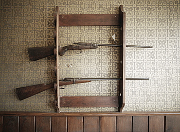
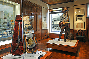
Gun Rack With Guns
A group of calves with ear tags looking at the camera; Eastend, Saskatchewan, Canada
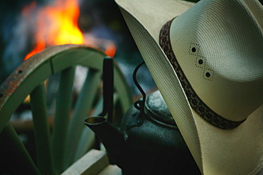
Cowboy Hat Near A Campfire
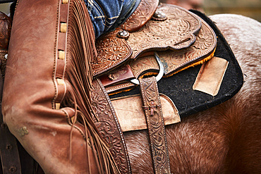
Leatherwork and closer details of a saddle and chaps to the left side; Eastend, Saskatchewan, Canada
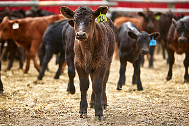
A calf tagged 26 stands alone amongst a group; Eastend, Saskatchewan, Canada
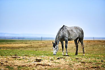
A grey horse eating in a pasture with straw on the ground, an open blue sky behind and a fence line on the horizon; Eastend, Saskatchewan, Canada

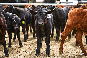
A single calf tagged 162 looking straight at you cropped tightly; Eastend, Saskatchewan, Canada
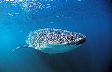
Whale shark, Rhincodon thypus, Australia, Western Australia, Ningaloo Reef, Indian Ocean
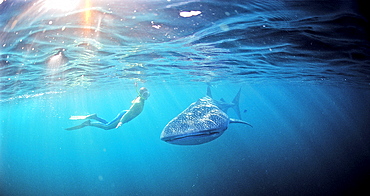
Female snorkeler swims with Whale shark, Rhincodon thypus, Australia, Western Australia, Ningaloo Reef, Indian Ocean
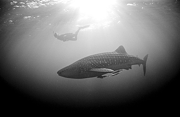
Female snorkeler swims with Whale shark, Rhincodon thypus, Australia, Western Australia, Ningaloo Reef, Indian Ocean
Female snorkeler swims with Whale shark, Rhincodon thypus, Australia, Western Australia, Ningaloo Reef, Indian Ocean
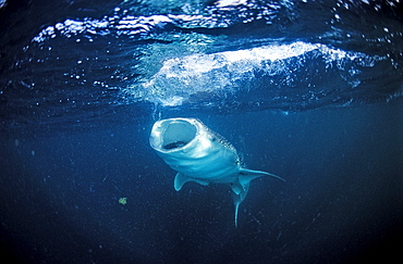
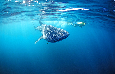
Eating Whale shark, Rhincodon thypus, Australia, Western Australia, Ningaloo Reef, Indian Ocean
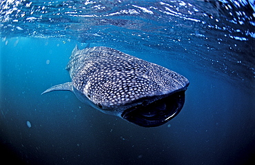
Eating Whale shark, Rhincodon thypus, Australia, Western Australia, Ningaloo Reef, Indian Ocean