Results
52 results found
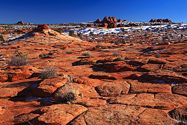
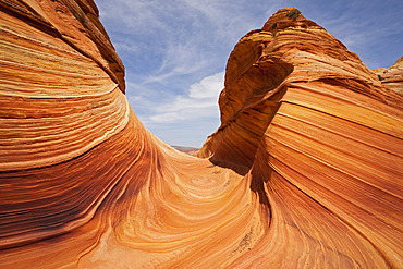
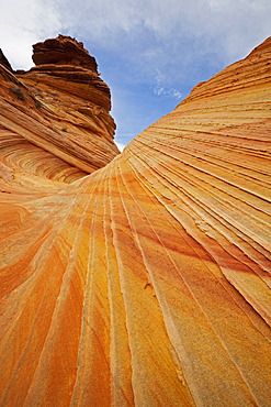
Coyote Buttes North, fragil sandstone formed by wind and water, Paria Wilderness Area, Arizona, United States of America, North America
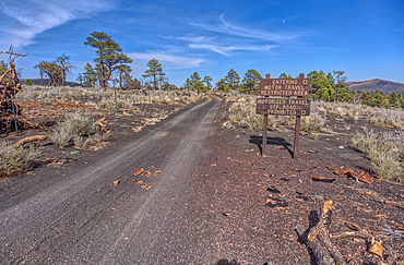
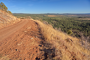
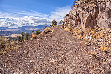
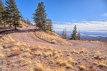
Fire Road 546 where it branches off from Sunset Crater National Monument into Coconino National Forest of Arizona, USA
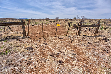
An entry gate to Silver Creek Canyon in Agua Fria National Monument Arizona, USA
Silver Creek Canyon in the Agua Fria National Monument, Black Canyon City Arizona, USA
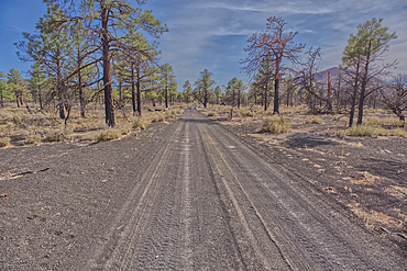
Fire Road 546 where it branches off from Sunset Crater National Monument into Coconino National Forest of Arizona, USA
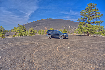
An SUV traveling near Volcanic cinder hills in Coconino National Forest, Arizona, USA
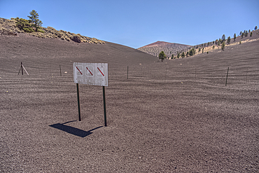
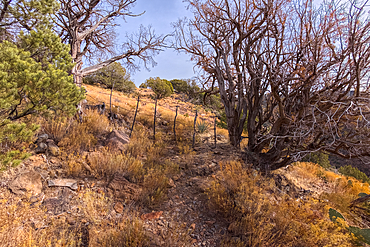
The boundary fence between Coconino National Forest and Sunset Crater National Monument of Arizona, USA
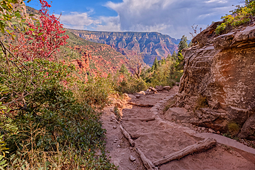
A curve in the North Kaibab Trail between Coconino Overlook and the Supai Tunnel Rest Area, Grand Canyon, Arizona, United States of America
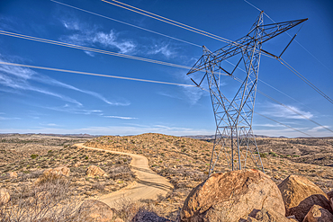
High Tension Power Lines stretching across Bloody Basin in Agua Fria National Monument north of Black Canyon City Arizona
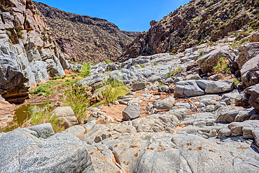
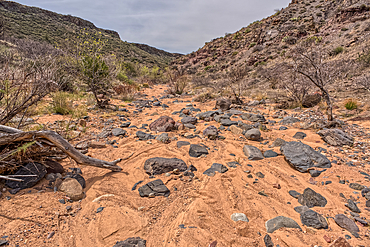
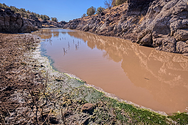
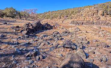
The granite riverbed of the Agua Fria River Canyon in the Agua Fria National Monument of Arizona.
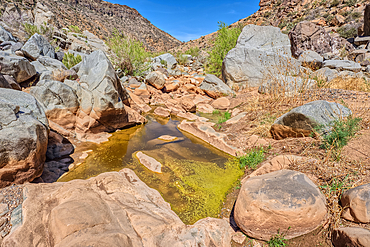
An ephemeral pool of water in the granite riverbed of the Agua Fria River Canyon in the Agua Fria National Monument of Arizona.
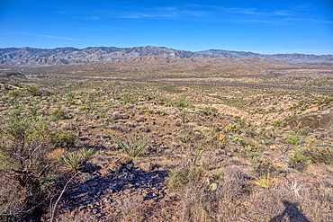
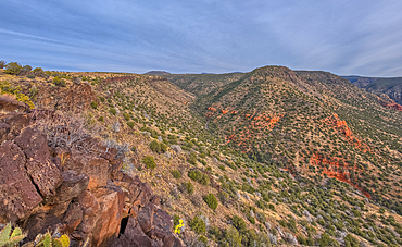
View of Black Canyon on the west side of the Agua Fria National Monument of Arizona with the Bradshaw Mountains in the distance.
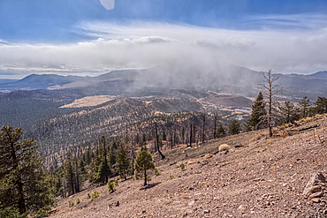
A snow squall storm building up over Humphrey's Peak. Viewed from O'Leary Peak in the Coconino National Forest of Arizona. Adjacent to Sunset Crater National Monument.
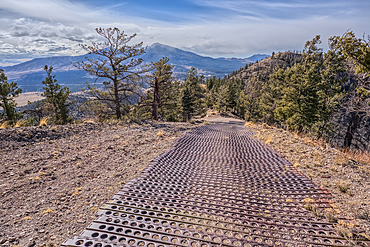
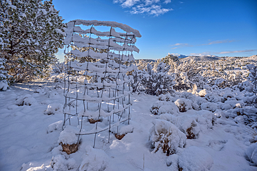
End of the Forest Service Road that leads to the O'Leary Peak Watchtower and Overlook. The metal grating is to add traction for vehicles. Adjacent to Sunset Crater National Monument Arizona in the Coconino National Forest.
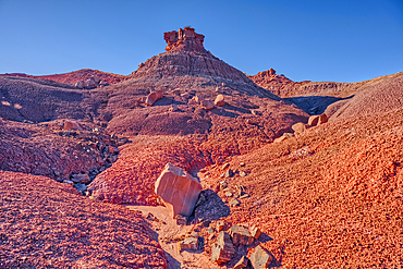
An island of rock in an unnamed canyon that leads to Dead Wash in Petrified Forest National Park, Arizona, United States of America
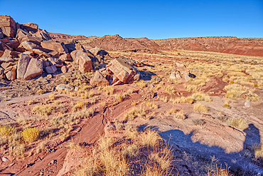
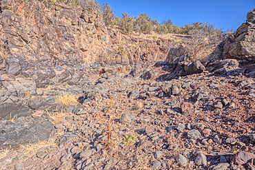
Boulder pile in a valley leading to Dead Wash in Petrified Forest National Park, Arizona, United States of America

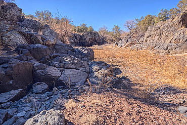
Wet Beaver Creek Canyon in the Coconino National Forest, Arizona, United States of America
Boundary gate and cattle-proof fence between Coconino National Forest and Wet Beaver Creek Wilderness, Arizona, United States of America
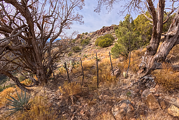
Boundary gate and cattle-proof fence between Coconino National Forest and Wet Beaver Creek Wilderness, Arizona, United States of America
Casner Canyon in Wet Beaver Creek Wilderness viewed from White Mesa summit, in Coconino National Forest, Arizona, United States of America
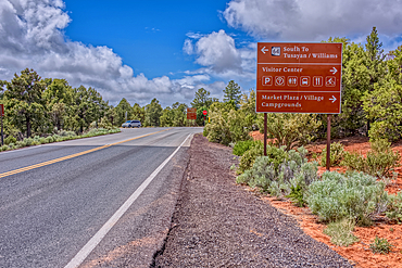
A sign along State Route 64 in Arizona directing travelers in Grand Canyon National Park, Arizona, USA
Snow covered landscape, Chino Valley, Arizona, USA
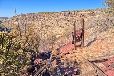
The remains of a Guard Shack above the Johnson Canyon Railroad Tunnel, Kaibab National Forest of Arizona, USA
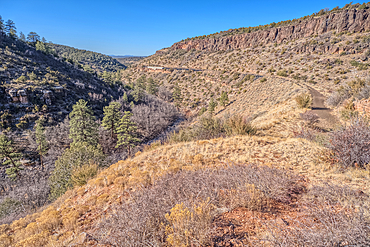
View of Johnson Canyon from above the abandoned Johnson Canyon Railroad Tunnel in the Kaibab National Forest of Arizona, USA
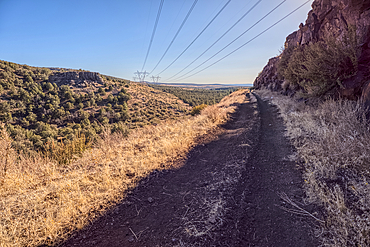
High voltage power lines stretching across Johnson Canyon in the Kaibab National Forest of Arizona, USA

Forest Service Road 709 in the Kaibab National Forest of Arizona, USA
A metal retaining wall along the Johnson Canyon Railroad, Kaibab National Forest of Arizona, USA

Sport Utility Vehicle traveling on Forest Service Road 709 in the Kaibab National Forest of Arizona, USA

Sport Utility Vehicle traveling on Forest Service Road 709 in the Kaibab National Forest of Arizona, USA

Forest Service Road 709 in the Kaibab National Forest of Arizona, USA
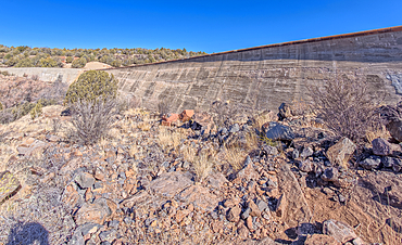
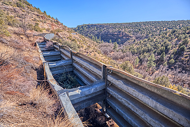
View from below the Stone Dam in the Kaibab National Forest, Arizona, USA
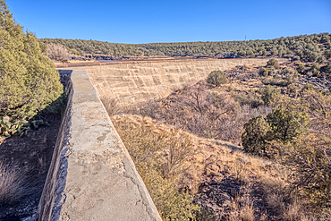
Johnson Canyon face of the Stone Dam in the Kaibab National Forest, Arizona, USA
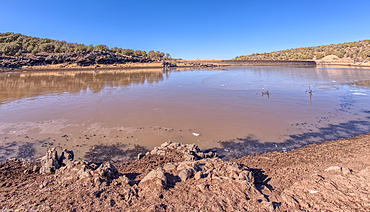
View from the shore of Stone Dam Lake in the Kaibab National Forest, Arizona, USA
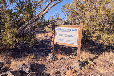
Historical information sign at Stone Dam Lake in the Kaibab National Forest, Arizona, USA

Overhead view of the Icy shore of Stone Dam Lake in the Kaibab National Forest, Arizona, USA
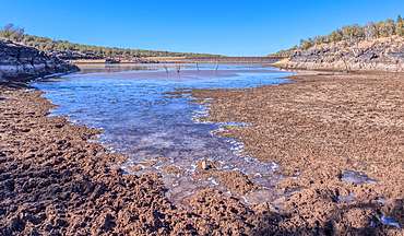
View from the shore of Stone Dam Lake in the Kaibab National Forest, Arizona, USA
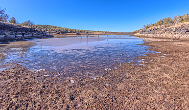
View from the shore of Stone Dam Lake in the Kaibab National Forest, Arizona, USA
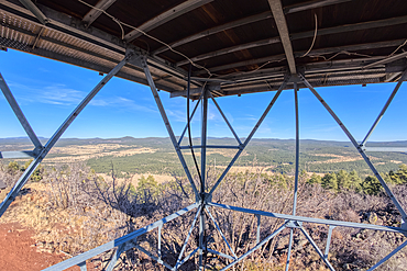
View from second deck of fire watchtower on summit of Apache Maid Mountain, Coconino National Forest, Arizona, United States of America
Road to the summit of Apache Maid Mountain, Coconino National Forest, Arizona, United States of America
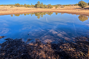
A cattle pond, Rarick Tank, Coconino National Forest, Arizona, United States of America
View of the lake created by the historic Bainbridge Steel Dam near Ash Fork, Kaibab National Forest, Arizona, United States of America
Basalt boulders and cliffs, Johnson Canyon east of Bainbridge Steel Dam Lake near Ash Fork, Kaibab National Forest, Arizona, United States of America
Basalt formation in Johnson Canyon east of the Bainbridge Steel Dam Lake near Ash Fork, Kaibab National Forest, Arizona, United States of America
Basalt boulders and cliffs, Johnson Canyon east of Bainbridge Steel Dam Lake near Ash Fork, Kaibab National Forest, Arizona, United States of America
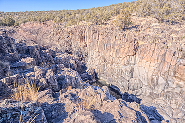
Dry waterfall cliffs, Johnson Canyon between Bainbridge Steel and Stone Dams near Ash Fork, Kaibab National Forest, Arizona, United States of America
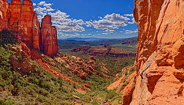
Southwestern view from a cliff in the saddle area of Cathedral Rock, Sedona, Arizona, United States of America, North America
The Forest Service Road that leads to the summit of O'Leary Peak in the Coconino National Forest of Arizona.
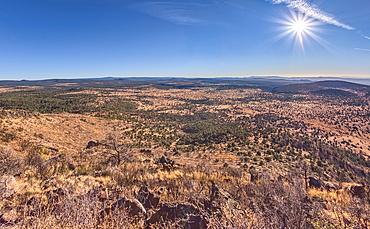
Coconino National Forest from the southwest summit of Apache Maid Mountain, Coconino National Forest, Arizona, United States of America

The Salt River Canyon, hazy view as smoke in the air from wildfire in the area, north of Globe, Arizona, United States of America, North America
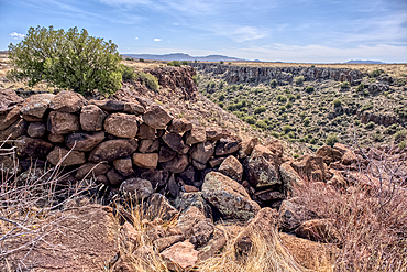
Ancient wall of the Fort Silver Indian Ruins overlooking Silver Creek Canyon in Agua Fria National Monument of Arizona
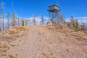
The fire watchtower on the summit of O'Leary Peak in the Coconino National Forest of Arizona. Adjacent to the Sunset Crater National Monument.
Forest Service Road that leads to the O'Leary Peak Watchtower and Overlook. Adjacent to Sunset Crater National Monument Arizona in the Coconino National Forest.
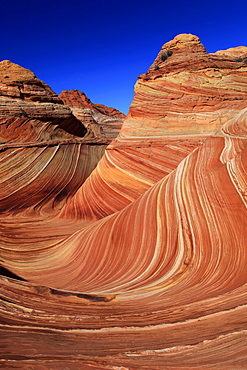
Coyote buttes north, the wave, sandstone formed by wind and water, paria wilderness area, arizona, usa
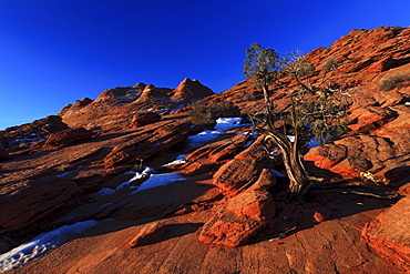
Coyote buttes north, juniper tree, juniperus, wacholder baum, sandstone formed by wind and water, paria wilderness area, arizona, usa
Coyote buttes north, fragile sandstone formed by wind and water, paria wilderness area, arizona, usa
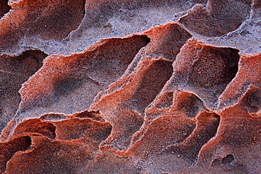
Coyote buttes north, fragile sandstone formed by wind and water, paria wilderness area, arizona, usa
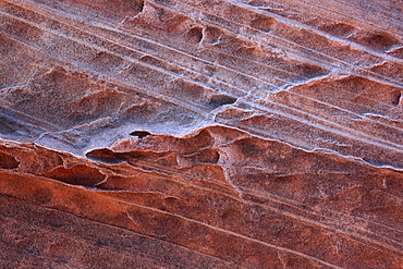
Coyote buttes north, fragile sandstone formed by wind and water, paria wilderness area, arizona, usa
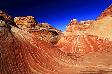
Coyote buttes north, the wave, sandstone formed by wind and water, paria wilderness area, arizona, usa
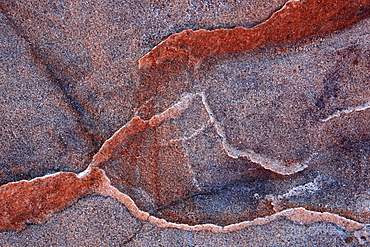
Coyote buttes north, fragile sandstone formed by wind and water, paria wilderness area, arizona, usa

Coyote buttes north, sandstone formed by wind and water, paria wilderness area, arizona, usa
Coyote buttes north, the wave, sandstone formed by wind and water, paria wilderness area, arizona, usa
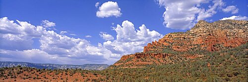
Red Rock Secret Mountain Wilderness Area Sedona AZ USA
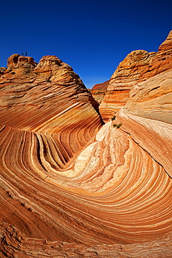
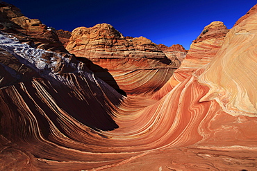
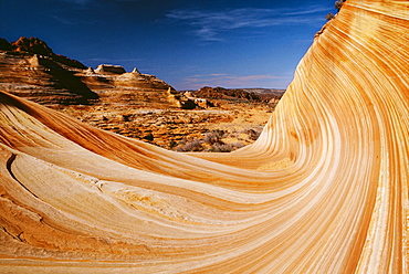
The Wave, rock formation in Coyote Buttes North, Paria Canyon-Vermilion Cliffs Wilderness, Utah, Arizona, USA
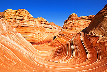
The Wave, rock formation in Coyote Buttes North, Paria Canyon-Vermilion Cliffs Wilderness, Utah, Arizona, USA
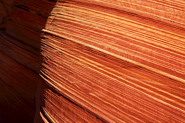
Stone Wave, rock formation in Coyote Buttes North, Paria Canyon-Vermilion Cliffs Wilderness, Utah, Arizona, USA
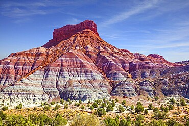
Grandiose mountains of red sandstone. Arizona, Utah.Paria Canyon-Vermilion Cliffs Wilderness Area. Independent travel to the USA. The concept of active, extreme and photo tourism
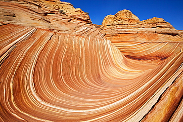
The Wave, rock formation in Coyote Buttes North, Paria Canyon-Vermilion Cliffs Wilderness, Utah, Arizona, USA
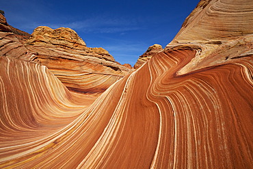
The Wave, rock formation in Coyote Buttes North, Paria Canyon-Vermilion Cliffs Wilderness, Utah, Arizona, USA
Colorful rock formations in the Coyote Buttes South, Paria Canyon-Vermilion Cliffs Wilderness, Utah, Arizona, America, United States
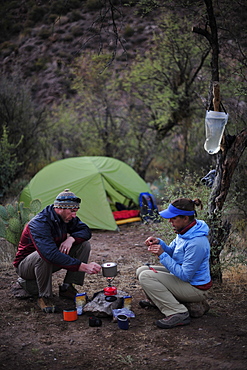
Woman and man backpackers prepare dinner with a camp stove at camp close to Charleboise Springs in La Barge Canyon on the Dutchmans Trail in the Superstition Wilderness Area, Tonto National Forest near Phoenix, Arizona November 2011. The trail links up with the popular Peralta Trail and offers a spectacular tour through the rugged Sonoran desert.
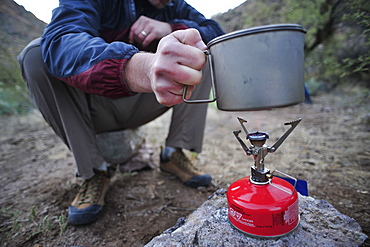
Woman and man backpackers prepare dinner with a camp stove at camp close to Charleboise Springs in La Barge Canyon on the Dutchmans Trail in the Superstition Wilderness Area, Tonto National Forest near Phoenix, Arizona November 2011. The trail links up with the popular Peralta Trail and offers a spectacular tour through the rugged Sonoran desert.

Hikers on the Devil's Bridge in Red Rock-Secret Mountain Wilderness Area outside Sedona, Arizona May 2011. The Devil's Bridge is an easy two-mile hike with spectacular views.

Hikers on the Devil's Bridge in Red Rock-Secret Mountain Wilderness Area outside Sedona, Arizona May 2011. The Devil's Bridge is an easy two-mile hike with spectacular views.

Man and woman backpackers explore the rock formations at Fremont Saddle on the popular Peralta Trail in the Superstition Wilderness Area, Tonto National Forest near Phoenix, Arizona November 2011. The trail offers spectacular views of Weavers Needle and the rugged Sonoran desert.
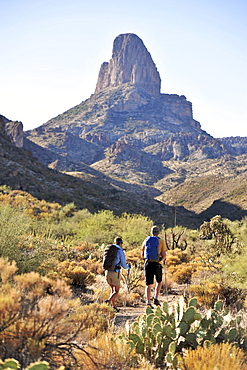
Man and woman backpackers hike on the popular Peralta Trail in the Superstition Wilderness Area, Tonto National Forest near Phoenix, Arizona November 2011. The trail offers spectacular views of Weavers Needle and the rugged Sonoran desert.

Man and woman backpackers hike on the popular Peralta Trail in the Superstition Wilderness Area, Tonto National Forest near Phoenix, Arizona November 2011. The trail offers spectacular views of Weavers Needle and the rugged Sonoran desert.
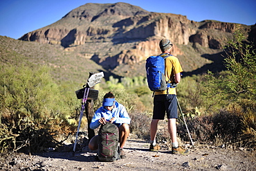
Man and woman backpackers hike on the Dutchmans Trail in the Superstition Wilderness Area, Tonto National Forest near Phoenix, Arizona November 2011. The trail links up with the popular Peralta Trail and offers a spectacular tour through the rugged Sonoran desert.
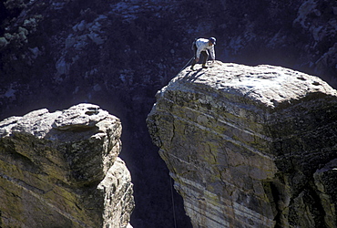
A rock climber in the Windy Point area of the Santa Catalina Mountains, north of Tucson, Arizona

A rock climber in the Windy Point area of the Santa Catalina Mountains, north of Tucson, Arizona

View of geometric patterns on rocky hills referred to as Brain Rocks, against a cloudy sky forming part of the alien landscape of amazing lines, contours and shapes in the wondrous area known as White Pocket, situated in Arizona, Arizona, United States of America
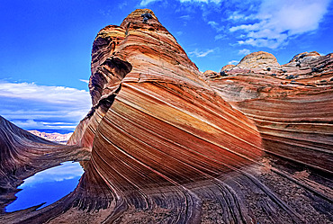
Spectacular formation of vibrant colors in swirls of fragile sandstone is known as The Wave and is located in the Coyote Buttes section of Vermilion Cliffs National Monument. An unmarked wilderness trail limits hikers and requires a permit from the Bureau of Land Management, Arizona, United States of America
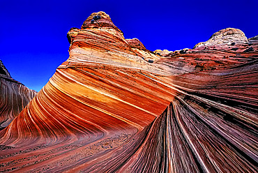
Spectacular formation of vibrant colors in swirls of fragile sandstone is known as The Wave and is located in the Coyote Buttes section of Vermilion Cliffs National Monument. An unmarked wilderness trail limits hikers and requires a permit from the Bureau of Land Management, Arizona, United States of America
The Wave, Paria Canyon-Vermilion Cliffs Wilderness Area, Arizona, Usa