Results
1 2 Next »
199 results found
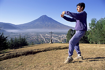
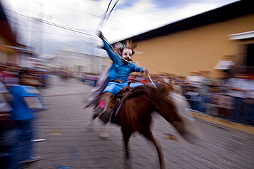
T'ai chi exercises at dawn, Agua volcano, Antigua, Guatemala, Central America
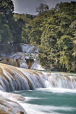
Rio Tulija, Agua Azul, National Park, near Palenque, Chiapas, Mexico, North America
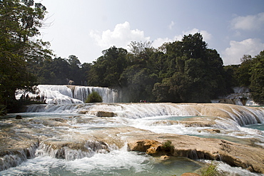
Tourists viewing the cascades, Rio Tulija, Agua Azul National Park, near Palenque, Chiapas, Mexico, North America
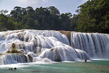
Rio Tulija, Agua Azul, National Park, near Palenque, Chiapas, Mexico, North America
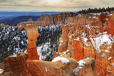
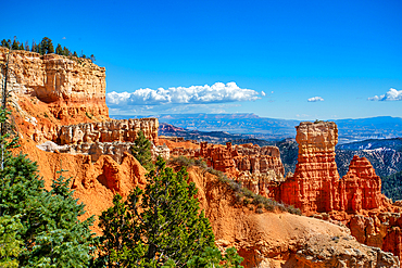
Top-heavy hoodoo, pine trees and cliffs with snow and a cloudy sky, Agua Canyon, Bryce Canyon National Park, Utah, United States of America, North America
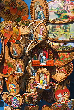
Catholic ornaments outside Basilica de Nuestra Senora de Agua Santa (the Virgin of the Holy Water) which is famous for miracles, on the Parque de la Basilica, Banos, Ambato Province, Central Highlands, Ecuador, South America
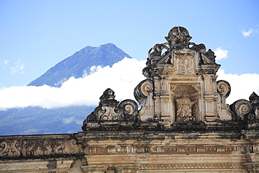
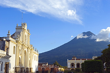
Volcano, Vulcan Agua and colonial architecture, Antigua, Guatemala, Central America
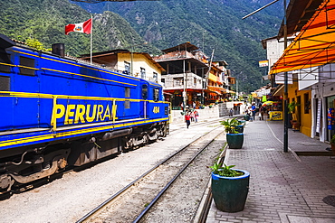
Train at Aguas Calientes, the stop for Machu Picchu, about to leave for Ollantaytambo, Cusco Region, Peru, South America
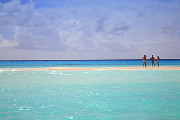
Tourists chatting on sandbank, Cayo De Agua, Archipelago Los Roques National Park, Venezuela, South America
Cayo de Agua, Archipelago Los Roques National Park, Venezuela, South America
San Antonio Aguas Calientes, Guatemala, Central America
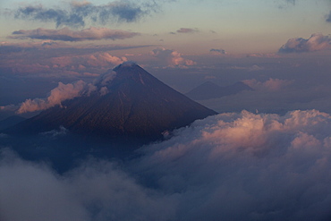
Agua Volcano, Guatemala, Central America
View from the main square to the Agua Volcano, Antigua, Sacatepequez, Guatemala, Central America
Limestone desert landscape, Los Molinos del Río Aguas, Paraje Natural de Karst en Yesos de Sorbas, Almeria, Andalusia, Spain, Europe
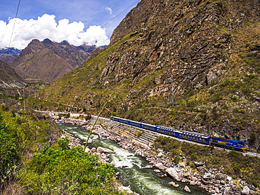
Train between Aguas Calientes and Ollantaytambo through the Sacred Valley, Cusco Region, Peru, South America
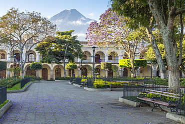
Parque Central (Central Park), Plaza, with the volcano Vulcan Agua behind, Antigua, Guatemala, Central America
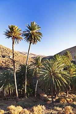
Palm trees, Barranco de la Madre de Agua, near Ajuy, Fuerteventura, Canary Islands, Spain, Atlantic, Europe
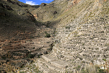
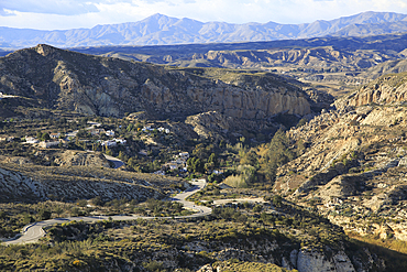
Hillside terraces countryside landscape, near Huebro, Ruta del Agua, Sierra Alhamilla mountains, Nijar, Almeria, Andalusia, Spain, Europe
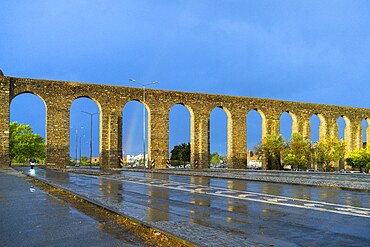
Água de Prata aqueduct, Évora, Alentejo, Portugal
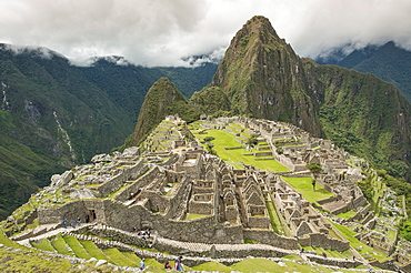
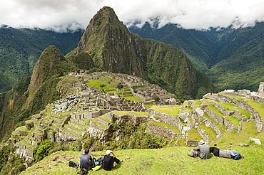
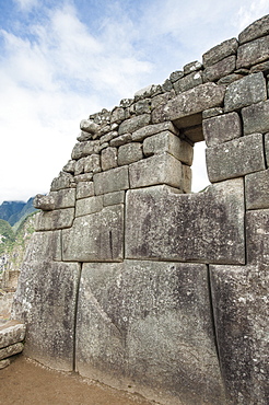
Machu Picchu, UNESCO World Heritage Site, near Aguas Calientes, Peru, South America
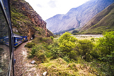
Train between Aguas Calientes (Machu Picchu stop) and Ollantaytambo, Cusco Region, Peru, South America
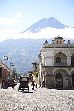
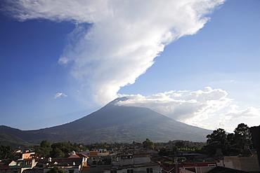
Volcan de Agua, 3765m, and Cathedral, Antigua, UNESCO World Heritage Site, Guatemala, Central America

Train between Aguas Calientes, the stop for Machu Picchu, and Ollantaytambo, Cusco Region, Peru, South America
Volcano, Vulcan Agua, Antigua, Guatemala, Central America
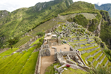
Machu Picchu, UNESCO World Heritage Site, near Aguas Calientes, Peru, South America
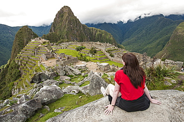
Machu Picchu, UNESCO World Heritage Site, near Aguas Calientes, Peru, South America
Countryside landscape, near Huebro, Ruta del Agua, Sierra Alhamilla mountains, Nijar, Almeria, Andalusia, Spain, Europe
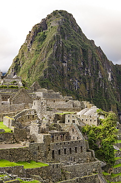
Machu Picchu, UNESCO World Heritage Site, near Aguas Calientes, Peru, South America
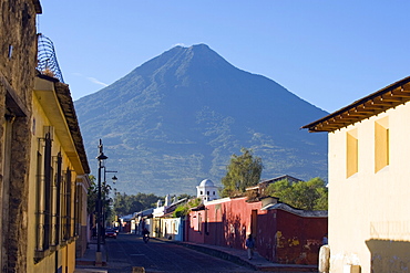
Volcan de Agua, 3765m, Antigua, Guatemala, Central America
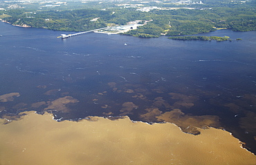
Aerial view of Encontro das Aguas, meeting of the Rio Negro and Rio Solimoes, Manaus, Amazonas, Brazil, South America
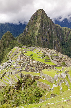
Machu Picchu, UNESCO World Heritage Site, near Aguas Calientes, Peru, South America
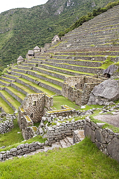
Machu Picchu, UNESCO World Heritage Site, near Aguas Calientes, Peru, South America
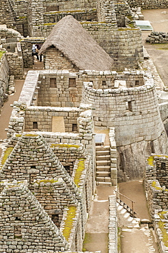
Machu Picchu, UNESCO World Heritage Site, near Aguas Calientes, Peru, South America
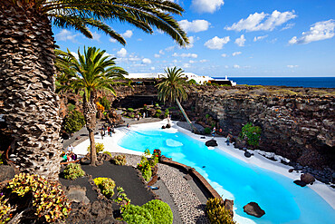
Blue and white pool, Jameos del Agua, near Arrieta, Lanzarote, Canary Islands, Spain
Machu Picchu, UNESCO World Heritage Site, near Aguas Calientes, Peru, South America
Machu Picchu, UNESCO World Heritage Site, near Aguas Calientes, Peru, South America
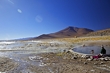
Hot springs and mud pools, Aguas Calientes, Southwest Highlands, Bolivia, South America
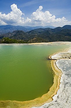
Hot springs, Hierve el Agua, Oaxaca, Mexico, North America
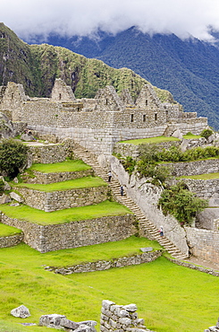
Machu Picchu, UNESCO World Heritage Site, near Aguas Calientes, Peru, South America
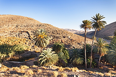
Barranco de la Madre de Agua, Ajuy, Fuerteventura, Canary Islands, Spain, Europe
San Antonio Aguas Calientes, Guatemala, Central America

Machu Picchu, UNESCO World Heritage Site, near Aguas Calientes, Peru, South America
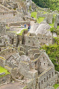
Machu Picchu, UNESCO World Heritage Site, near Aguas Calientes, Peru, South America
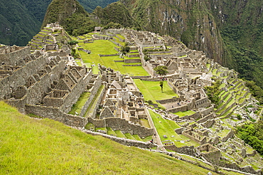
Machu Picchu, UNESCO World Heritage Site, near Aguas Calientes, Peru, South America
Silver Creek Canyon in the Agua Fria National Monument. Located north of Black Canyon City Arizona.
Silver Creek Canyon in the Agua Fria National Monument. Located north of Black Canyon City Arizona.
Silver Creek Canyon in the Agua Fria National Monument. Located north of Black Canyon City Arizona.
Silver Creek Canyon in the Agua Fria National Monument. Located north of Black Canyon City Arizona.
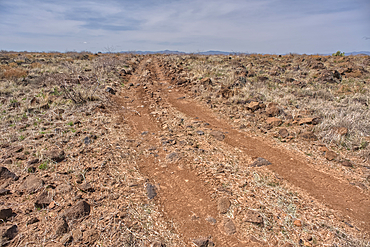
A primitive road in the Agua Fria National Monument that branches off from Forest Service Road 9023 near Silver Creek Canyon Arizona.
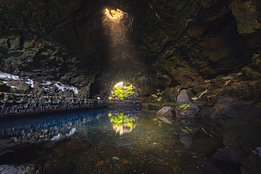
The interior beauty of Jameos del Agua with a ray of light, Haria, Las Palmas, Lanzarote, Canary Islands, Spain, Atlantic, Europe
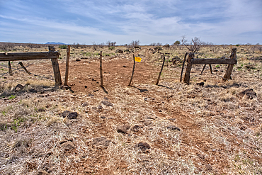
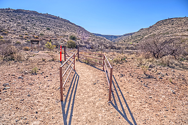
An entry gate to Silver Creek Canyon in Agua Fria National Monument Arizona. The gate is to keep cattle from wandering down into the canyon.
Silver Creek Canyon in the Agua Fria National Monument. Located north of Black Canyon City Arizona.
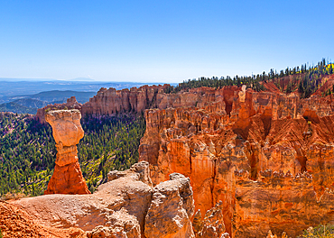
The famous Hunter and Rabbit Hoodoos at Agua Canyon, Bryce Canyon National Park, Utah. The Hunter is on the left and the Rabbit the lighter coloured rock on the right. Hoodoos are pinnacles of rock shaped by wind, rain and erosion.
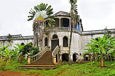
Former ruined hospital of the roca (plantation) Agua Ize, Sao Tome Island, Republic of Sao Tome and Principe,Africa
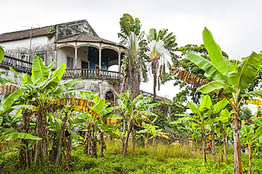
Former ruined hospital of the roca (plantation) Agua Ize, Sao Tome Island, Republic of Sao Tome and Principe,Africa
Agua Canyon, Bryce Canyon National Park, Utah, USA
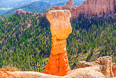
Hoodoo known as The Hunter at Agua Canyon, Bryce Canyon National Park, Utah, USA. Hoodoos are rock formations, shaped by wind, weather and erosion.
Banos de Agua Santa, Tungurahua Province, Ecuador
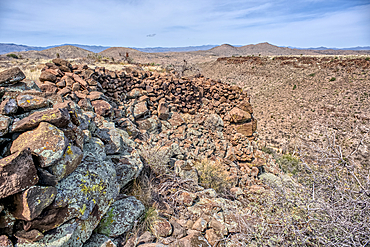
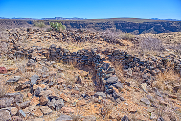
Ancient wall of the Fort Silver Indian Ruins overlooking Silver Creek Canyon in Agua Fria National Monument of Arizona. Located near the Pueblo La Plata ruins.
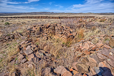
The Pueblo La Plata Indian Ruins near Silver Creek Canyon in the Agua Fria National Monument of Arizona. Located north of Black Canyon City.
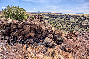
Ancient wall of the Fort Silver Indian Ruins overlooking Silver Creek Canyon in Agua Fria National Monument of Arizona. Located near the Pueblo La Plata ruins.
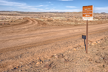
Road sign along Bloody Basin Road in the Agua Fria National Monument of Arizona directing the way to the Pueblo La Plata Indian Ruins.
The primitive Bloody Basin Road winding thru the Agua Fria National Monument north of Black Canyon City Arizona.
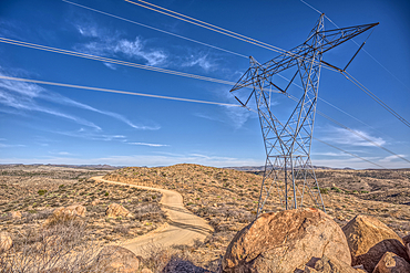
High Tension Power Lines stretching across Bloody Basin in Agua Fria National Monument north of Black Canyon City Arizona.
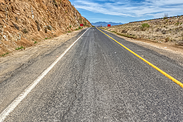
Look back up the freeway exit ramp for Bloody Basin Road in the Agua Fria National Monument of Arizona. Located north of Black Canyon City.
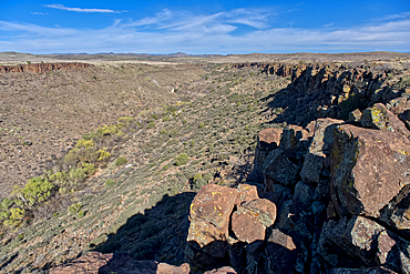
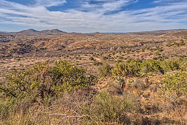
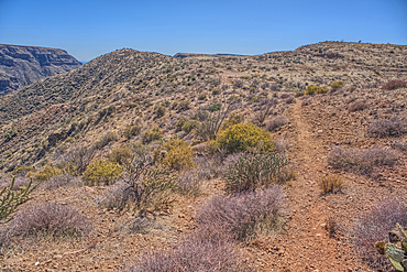
A Saguaro covered scenic ridge overlooking the Agua Fria River in the Agua Fria National Monument of Arizona.
Path leading to a scenic overlook in the Agua Fria National Monument near the abandoned Richinbar Mine.
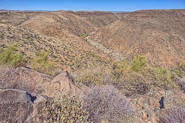
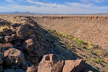
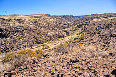
The Agua Fria River Canyon in the Agua Fria National Monument north of Black Canyon City Arizona.
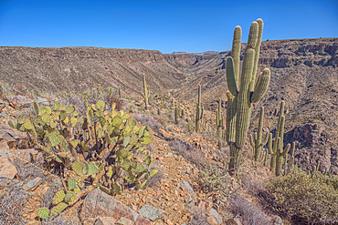
A Saguaro covered scenic ridge overlooking the Agua Fria River in the Agua Fria National Monument of Arizona.
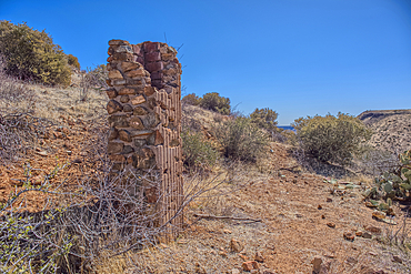
Remnants of the Richinbar Mine within the Agua Fria National Monument north of Black Canyon City Arizona. Mine was established in 1905 but was abandoned in 1940 when the company that owned it went bankrupt.
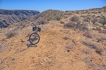
A bicycle parked near the abandoned Richinbar Mine in the Agua Fria National Monument.
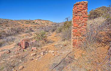
Remnants of the Richinbar Mine within the Agua Fria National Monument north of Black Canyon City Arizona. Mine was established in 1905 but was abandoned in 1940 when the company that owned it went bankrupt.
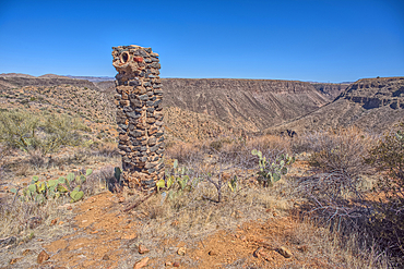
Remnants of the Richinbar Mine within the Agua Fria National Monument north of Black Canyon City Arizona. Mine was established in 1905 but was abandoned in 1940 when the company that owned it went bankrupt.
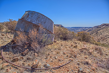
Remnants of the Richinbar Mine within the Agua Fria National Monument north of Black Canyon City Arizona. Mine was established in 1905 but was abandoned in 1940 when the company that owned it went bankrupt.
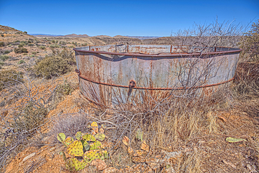
Remnants of the Richinbar Mine within the Agua Fria National Monument north of Black Canyon City Arizona. Mine was established in 1905 but was abandoned in 1940 when the company that owned it went bankrupt.
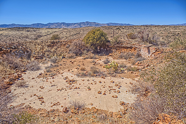
Remnants of the Richinbar Mine within the Agua Fria National Monument north of Black Canyon City Arizona. Mine was established in 1905 but was abandoned in 1940 when the company that owned it went bankrupt.
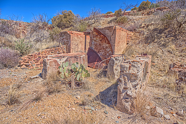
Remnants of the Richinbar Mine within the Agua Fria National Monument north of Black Canyon City Arizona. Mine was established in 1905 but was abandoned in 1940 when the company that owned it went bankrupt.
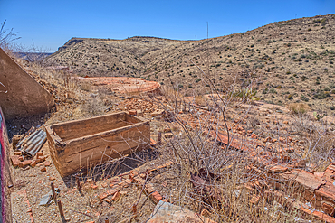
Remnants of the Richinbar Mine within the Agua Fria National Monument north of Black Canyon City Arizona. Mine was established in 1905 but was abandoned in 1940 when the company that owned it went bankrupt.
Ancient Indian Ruins near the historic Richinbar Mine in the Agua Fria National Monument north of Black Canyon City Arizona.
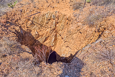
Open mine shaft at the Richinbar Mine within the Agua Fria National Monument north of Black Canyon City Arizona. Mine was established in 1905 but was abandoned in 1940 when the company that owned it went bankrupt.
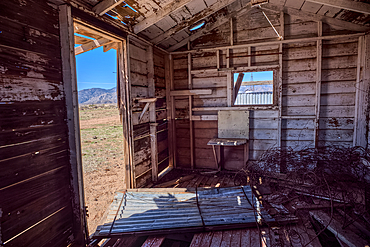
An abandoned cabin next to an active cattle corral in the Agua Fria National Monument north of Black Canyon City Arizona. Public land. No property release needed.
An unnamed tributary canyon that feeds into the Agua Fria River near the Sunset Point Rest Stop off of I-17 north of Black Canyon City AZ.
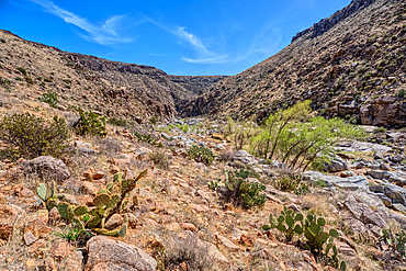
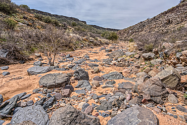
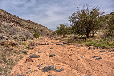
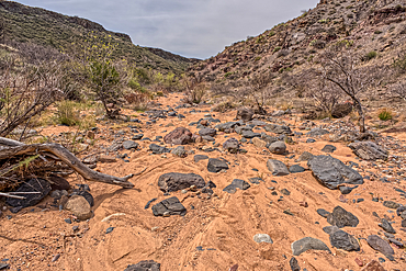
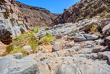
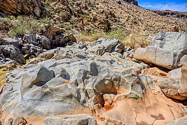
The granite riverbed of the Agua Fria River Canyon in the Agua Fria National Monument of Arizona.
The granite riverbed of the Agua Fria River Canyon in the Agua Fria National Monument of Arizona.
The granite riverbed of the Agua Fria River Canyon in the Agua Fria National Monument of Arizona.
The granite riverbed of the Agua Fria River Canyon in the Agua Fria National Monument of Arizona.
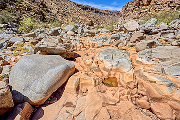
The granite riverbed of the Agua Fria River Canyon in the Agua Fria National Monument of Arizona.
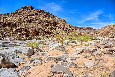
The granite riverbed of the Agua Fria River Canyon in the Agua Fria National Monument of Arizona.
The granite riverbed of the Agua Fria River Canyon in the Agua Fria National Monument of Arizona.
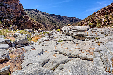
The granite riverbed of the Agua Fria River Canyon in the Agua Fria National Monument of Arizona.
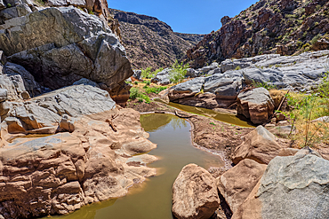
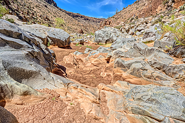
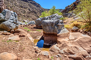
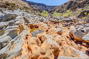
An ephemeral pool of water in the granite riverbed of the Agua Fria River Canyon in the Agua Fria National Monument of Arizona.
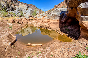
An ephemeral pool of water in the granite riverbed of the Agua Fria River Canyon in the Agua Fria National Monument of Arizona.
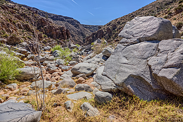
The granite riverbed of the Agua Fria River Canyon in the Agua Fria National Monument of Arizona.
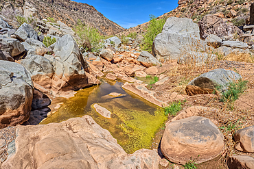
An ephemeral pool of water in the granite riverbed of the Agua Fria River Canyon in the Agua Fria National Monument of Arizona.
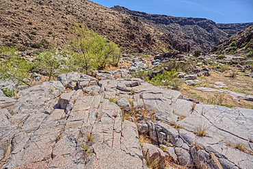
The granite riverbed of the Agua Fria River Canyon in the Agua Fria National Monument of Arizona.
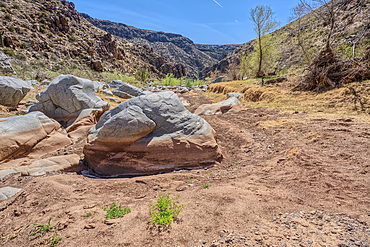
The granite riverbed of the Agua Fria River Canyon in the Agua Fria National Monument of Arizona.
The granite riverbed of the Agua Fria River Canyon in the Agua Fria National Monument of Arizona.
Entrance to the Badger Springs Trailhead in the Agua Fria National Monument of Arizona.
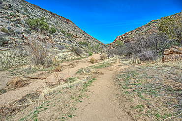
Badger Springs Creek Canyon in the Agua Fria National Monument of Arizona.
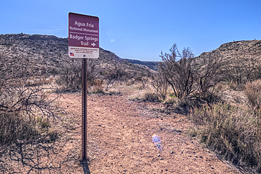
Sign marking the Badger Springs Trail in the Agua Fria National Monument of Arizona.