Results
« Previous 1 … 8 9 10 11 12 … 24 Next »
2347 results found
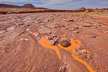
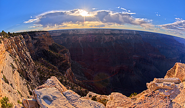
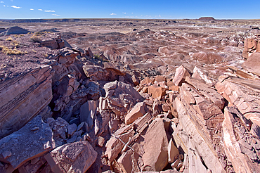
Goblin Garden west of Hamilili Point in Petrified Forest National Park, Arizona, United States of America, North America
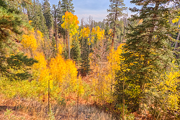
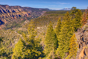
Autumn colored Aspen trees off Cape Royal Road in Grand Canyon North Rim, UNESCO, Arizona, United States of America
The Pueblo La Plata Indian Ruins near Silver Creek Canyon in the Agua Fria National Monument of Arizona. Located north of Black Canyon City.
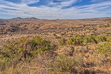
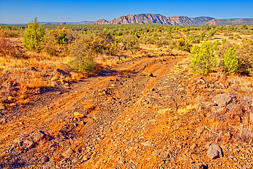
The primitive Bloody Basin Road winding thru the Agua Fria National Monument north of Black Canyon City Arizona.
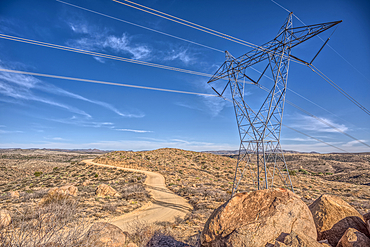
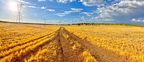
High Tension Power Lines stretching across Bloody Basin in Agua Fria National Monument north of Black Canyon City Arizona.
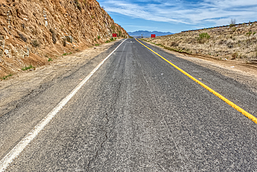
Look back up the freeway exit ramp for Bloody Basin Road in the Agua Fria National Monument of Arizona. Located north of Black Canyon City.
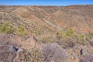
The Agua Fria River Canyon in the Agua Fria National Monument north of Black Canyon City Arizona.
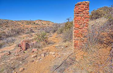
Remnants of the Richinbar Mine within the Agua Fria National Monument north of Black Canyon City Arizona. Mine was established in 1905 but was abandoned in 1940 when the company that owned it went bankrupt.
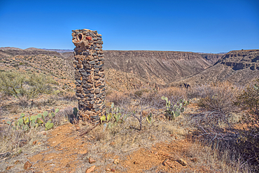
Remnants of the Richinbar Mine within the Agua Fria National Monument north of Black Canyon City Arizona. Mine was established in 1905 but was abandoned in 1940 when the company that owned it went bankrupt.
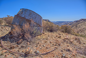
Remnants of the Richinbar Mine within the Agua Fria National Monument north of Black Canyon City Arizona. Mine was established in 1905 but was abandoned in 1940 when the company that owned it went bankrupt.
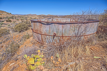
Remnants of the Richinbar Mine within the Agua Fria National Monument north of Black Canyon City Arizona. Mine was established in 1905 but was abandoned in 1940 when the company that owned it went bankrupt.
Remnants of the Richinbar Mine within the Agua Fria National Monument north of Black Canyon City Arizona. Mine was established in 1905 but was abandoned in 1940 when the company that owned it went bankrupt.
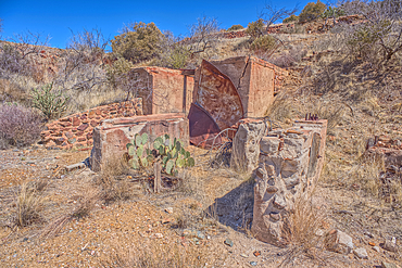
Remnants of the Richinbar Mine within the Agua Fria National Monument north of Black Canyon City Arizona. Mine was established in 1905 but was abandoned in 1940 when the company that owned it went bankrupt.
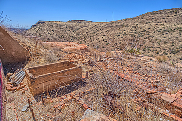
Remnants of the Richinbar Mine within the Agua Fria National Monument north of Black Canyon City Arizona. Mine was established in 1905 but was abandoned in 1940 when the company that owned it went bankrupt.
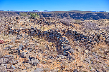
Ancient Indian Ruins near the historic Richinbar Mine in the Agua Fria National Monument north of Black Canyon City Arizona.
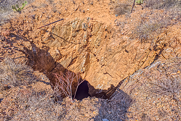
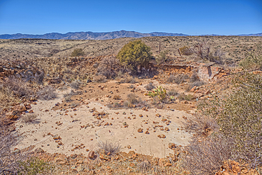
Open mine shaft at the Richinbar Mine within the Agua Fria National Monument north of Black Canyon City Arizona. Mine was established in 1905 but was abandoned in 1940 when the company that owned it went bankrupt.
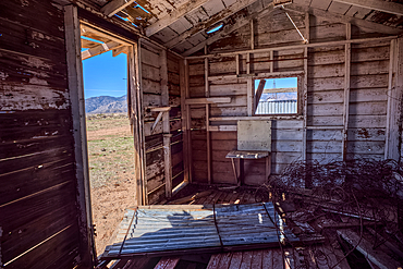
An abandoned cabin next to an active cattle corral in the Agua Fria National Monument north of Black Canyon City Arizona. Public land. No property release needed.
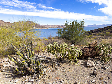
A view from the surrounding mountains of Concepcion Bay, Baja California Sur, Sea of Cortez, Mexico, North America
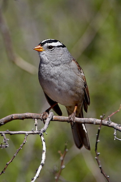
White-crowned sparrow (Zonotrichia leucophrys), Chiricahuas, Coronado National Forest, Arizona, United States of America, North America
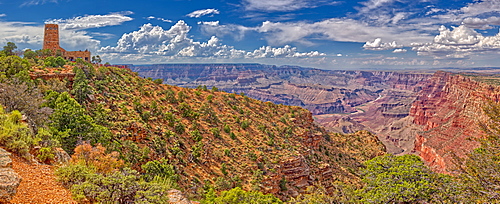
View of the Grand Canyon east of the historic Watch Tower, managed by the National Park Service, Grand Canyon National Park, UNESCO World Heritage Site, Arizona, United States of America, North America
View of San Francisco Peaks from a cliff at the end of the Telephone Trail north of Sedona with Oak Creek Canyon on the left, Arizona, United States of America, North America
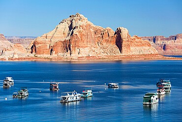
Houseboats moored in Wahweap Bay, Castle Rock beyond, Lake Powell, Glen Canyon National Recreation Area, Page, Arizona, United States of America, North America
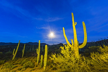
Full moon on saguaro cactus (Carnegiea gigantea), Sweetwater Preserve, Tucson, Arizona, United States of America, North America
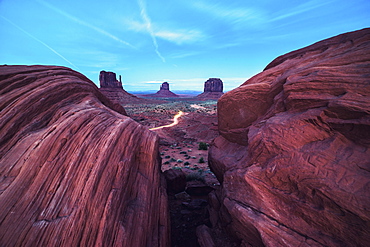
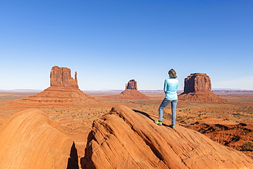
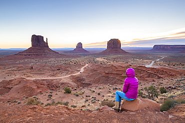
Monument Valley, Arizona, United States of America, North America
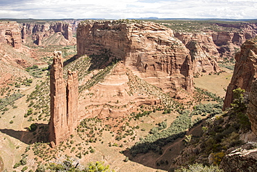
Spider Rock, Canyon de Chelly National Monument, Arizona, United States of America, North America
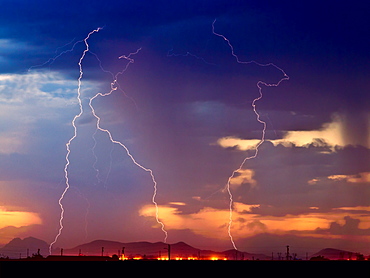
Three bolts of lightning striking near the Palo Verde Nuclear Station in Wintersburg Arizona during the 2012 Monsoon season, Arizona, United States of America, North America
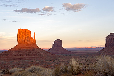
The giant sandstone buttes glowing pink at sunset in Monument Valley Navajo Tribal Park on the Arizona-Utah border, United States of America, North America
Sandstone buttes in Monument Valley Navajo Tribal Park on the Arizona-Utah border, United States of America, North America
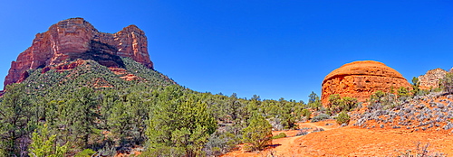
Panorama South view of Courthouse Butte and the Judges Bench from Courthouse Butte Loop Trail in Sedona, Arizona, United States of America, North America
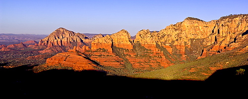
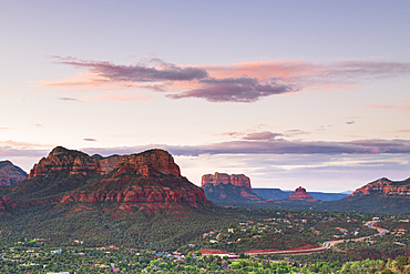
Early morning view of Sedona from Schnebly Hill Vista, Capitol Butte on the left and Wilson Mountain on the right, Sedona, Arizona, United States of America, North America
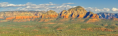
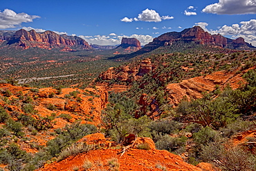
Panorama of Sedona viewed from the summit of Doe Mountain, Arizona, United States of America, North America
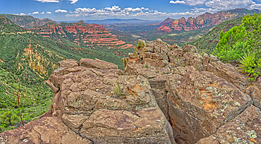
The Craggy Cliffs overlooking Casner Canyon north of Sedona from near the Schnebly Hill Vista, Arizona, United States of America, North America
Rough road leading to the south rim of Rattlesnake Canyon southeast of Sedona in the Wet Beaver Wilderness, Arizona, United States of America, North America
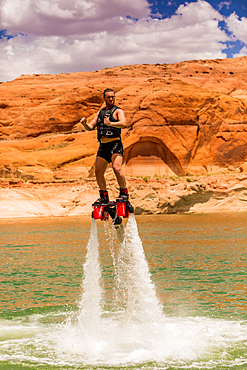
Flyboarding with Bravada Yachts on Lake Powell, border of Arizona and Utah, United States of America, North America

Cathedral Rock seen from Red Rock State Park, Sedona, Arizona, United States of America, North America
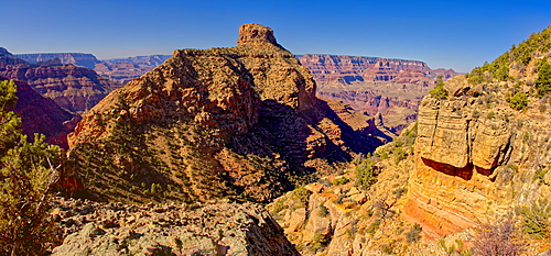
Grand Canyon view just below the summit of Buggeln Hill on the South Rim, Grand Canyon National Park, UNESCO World Heritage Site, Arizona, United States of America, North America
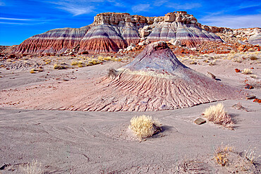
Mounds and cliffs of expansive clay called Bentonite in the Jasper Forest of Petrified Forest National Park, Arizona, United States of America, North America
The Lithodendron Wash in the Petrified Forest National Park, Arizona, United States of America, North America
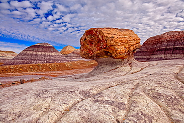
A large petrified log along the Blue Mesa Trail in Petrified Forest National Park, Arizona, United States of America, North America
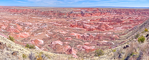
Panorama view of the Painted Desert from Tawa Point in Petrified Forest National Park, Arizona, United States of America, North America

Organ pipe cactus (Stenocereus thurberi), Organ Pipe Cactus National Monument, Sonoran Desert, Arizona, United States of America, North America
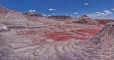
Hills of blood red bentonite clay below Kachina Point in Petrified Forest National Park, Arizona, United States of America, North America
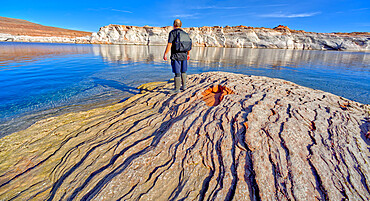
Man hiking along rocky shoreline of Lake Powell in an area called the Chains in the Glen Canyon Recreation Area, Page, Arizona, United States of America, North America
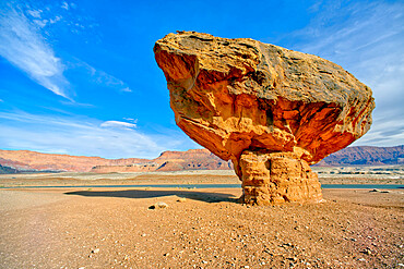
Balanced boulder at the base of Vermilion Cliffs in Glen Canyon Recreation Area, Arizona, United States of America, North America
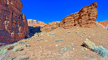
Cliffs of Chocolate Canyon at Vermilion Cliffs National Monument, Arizona, United States of America, North America
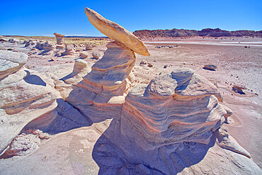
Hoodoo formations in the Devil's Playground in Petrified Forest National Park, Arizona, United States of America, North America

Beautiful light envelops Monument Valley during a summer sunrise, Arizona, United States of America, North America
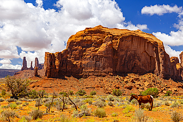
A horse rests in the beautiful Monument Valley on a summer day, Arizona, United States of America, North America
East slopes of Haystack Mesa in Petrified Forest National Park, Arizona, United States of America, North America
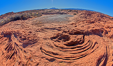
The ripples of fossilized sand dunes in the badlands of Horseshoe Bend, Arizona, United States of America, North America
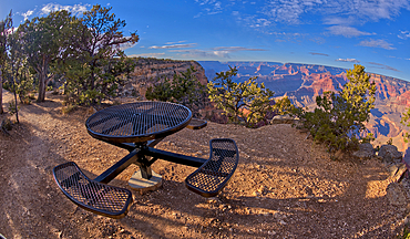
A metal picnic table along the rim trail overlooking Grand Canyon South Rim off of Hermit Road just west of Hopi Point, Grand Canyon, UNESCO World Heritage Site, Arizona, United States of America, North America
View of Grand Canyon Arizona from the west side of Mohave Point near sundown, UNESCO World Heritage Site, Arizona, United States of America, North America
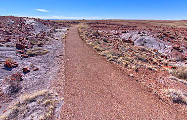
The paved trail that leads to the historic Agate House in Petrified Forest National Park, Arizona, United States of America, North America
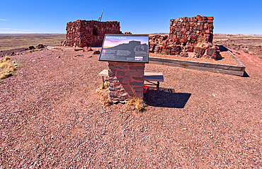
An information sign detailing the history of Agate House in Petrified Forest National Park, Arizona, United States of America, North America
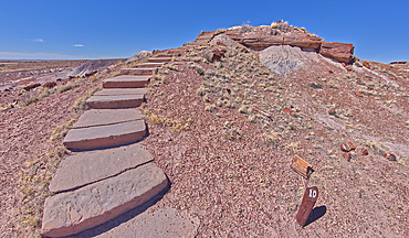
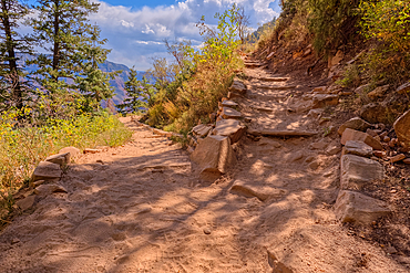
Steps along the Giant Logs Trail leading to a scenic overlook in Petrified Forest National Park, Arizona, United States of America, North America
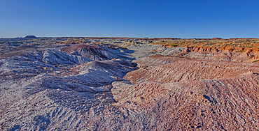
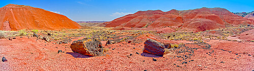
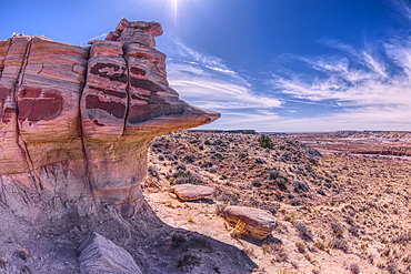
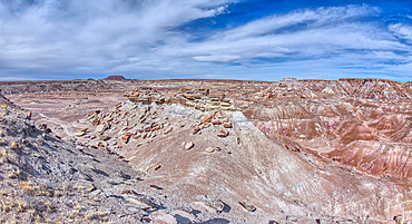
Purple badlands of bentonite near Hamilili Point on the south end of Petrified Forest National Park, Arizona, United States of America, North America
Rock islands above the purple badlands near Hamilili Point on the south end of Petrified Forest National Park, Arizona, United States of America, North America
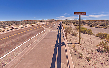
Sign along the path to the Long Logs Trail, marking the Jim Camp Wash along the main road of Petrified Forest National Park, Arizona, United States of America, North America

The sun shade shelter along the Long Logs Trail at Petrified Forest National Park, Arizona, United States of America, North America
A cliff overhang shaped like the head of a Duck west of Hamilili Point on the south end of Petrified Forest National Park, Arizona, United States of America, North America
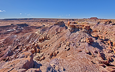
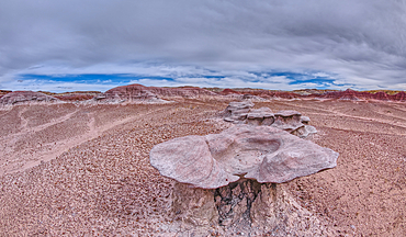
Small mesas with flat tops called Rock Islands on the south end of Petrified Forest National Park, Arizona, United States of America, North America
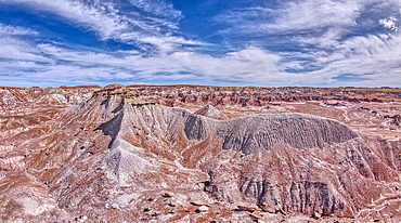
A ridge of gray bentonite viewed from a nearby flat top mesa on the south end of Petrified Forest National Park, Arizona, United States of America, North America
Sandstone that has been eroded into forms that resemble clam shells on the south end of Petrified Forest National Park, Arizona, United States of America, North America
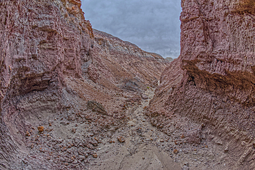
A narrow slot canyon of bentonite on the south end of Petrified Forest National Park, Arizona, United States of America, North America
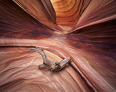
Sandstone wave, Paria Canyon, Vermillion Cliffs Wilderness, Arizona, United States of America (U.S.A.), North America
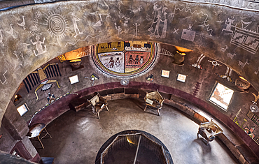
Downward view from the second floor in historic Desert View Watchtower at Grand Canyon South Rim, artwork created by Fred Kobotie in 1933, now owned by the National Park Service, UNESCO World Heritage Site, Arizona, United States of America, North America
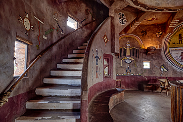
Stairs up to the seconnd floor in the historic Desert View Watchtower at Grand Canyon South Rim, artwork created by Fred Kobotie in 1933, now owned by the National Park Service, UNESCO World Heritage Site, Arizona, United States of America, North America
View from the observation deck of the Desert View Watchtower at Grand Canyon South Rim, UNESCO World Heritage Site, Arizona, United States of America, North America
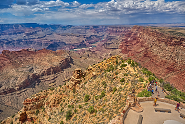
North view of Grand Canyon South Rim Arizona from the top floor of the historic Watchtower, taken through glass window, Grand Canyon, UNESCO World Heritage Site, Arizona, United States of America, North America

The Kiva of the ancient Tusayan Ruins at Grand Canyon South Rim, UNESCO World Heritage Site, Arizona, United States of America, North America
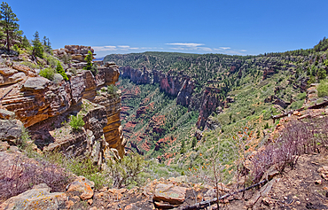
Cliff views south of Naji Point on the North Rim of Grand Canyon National Park, UNESCO World Heritage Site, Arizona, United States of America, North America
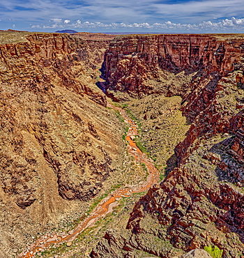
An area of the Little Colorado River Gorge east of the Grand Canyon, Arizona, Uninted States of America, North America
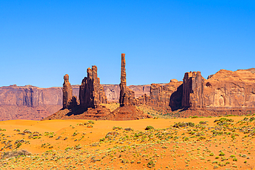
Totem Pole and Yei Bi Chei, Monument Valley, Arizona, United States of America, North America
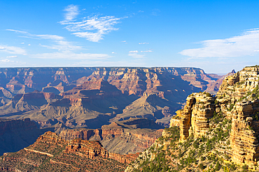
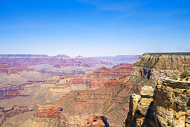
Grand Canyon, near Grandview Point, Grand Canyon National Park, UNESCO World Heritage Site, Arizona, United States of America, North America
Grand Canyon, Pipe Creek Vista, Grand Canyon National Park, UNESCO World Heritage Site, Arizona, United States of America, North America
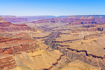
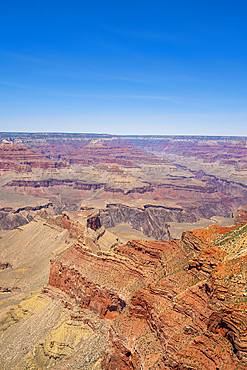
Grand Canyon, Pima Point, Grand Canyon National Park, UNESCO World Heritage Site, Arizona, United States of America, North America
Grand Canyon, Pima Point, Grand Canyon National Park, UNESCO World Heritage Site, Arizona, United States of America, North America
Grand Canyon, Maricopa Point, Grand Canyon National Park, UNESCO World Heritage Site, Arizona, United States of America, North America

Grand Canyon, Powell Point, Grand Canyon National Park, UNESCO World Heritage Site, Arizona, United States of America, North America
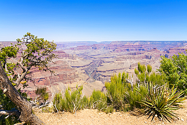
Grand Canyon, Mohave Point, Grand Canyon National Park, UNESCO World Heritage Site, Arizona, United States of America, North America
A massive monsoon storm moving over Matterhorn Mesa north of Drake, viewed from Forest Service Road 492, Arizona, United States of America, North America
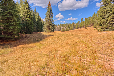
A meadow in Fuller Canyon off Cape Royal Road at Grand Canyon North Rim, Arizona, United States of America
The 7th switchback along the North Kaibab Trail at Grand Canyon North Rim, UNESCO, Arizona, United States of America
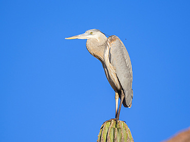
Great blue heron (Ardea herodias), perched on a cardon cactus, Isla Espiritu Santo, BCS, Sea of Cortez, Mexico, North America
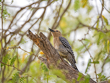
A Gila woodpecker (Melanerpes uropygialis), on perch, San Jose del Cabo, Baja California Sur, Sea of Cortez, Mexico, North America
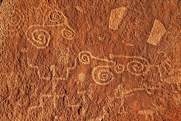
Petroglyphs, Vermilion Cliffs National Monument, Arizona, United States of America, North America
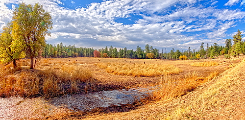
Grassland that used to be the J D Dam Lake, dry due to a drought in Arizona, Kaibab National Forest, south of Williams, Arizona, United States of America, North America
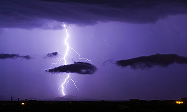
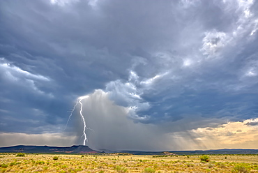
A bright lightning bolt passing through a cloud and striking in the Gila Bend Mountains south of Arlington, Arizona, United States of America, North America
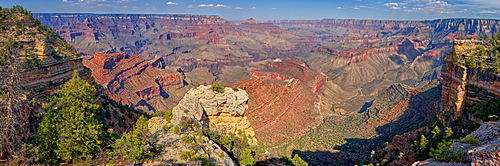
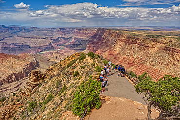
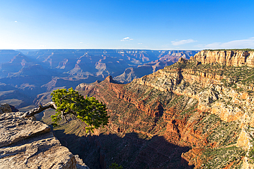
Grand Canyon view east of Shoshone Point on the south rim, Grand Canyon National Park, UNESCO World Heritage Site, Arizona, United States of America, North America
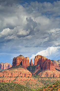
Cathedral Rock, Sedona, Arizona, United States of America, North America
Sandstone buttes in Monument Valley Navajo Tribal Park on the Arizona-Utah border, United States of America, North America

A Sandstone Toadstool near the base of the rock formation called the Rabbit Ears in Sedona, Arizona, United States of America, North America
View of Lee Mountain, Courthouse Butte, and Castle Rock, from the secret trail on the east side of Cathedral Rock in Sedona, Arizona, United States of America, North America
Moody sky over Sedona from Airport Mesa, Sedona, Arizona, United States of America, North America
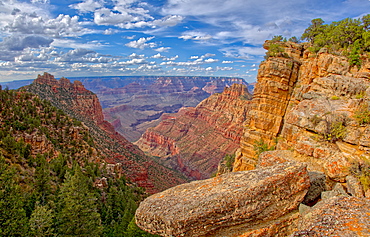
Coronada Butte viewed from the New Hance Trail on the south rim of the Grand Canyon, Grand Canyon National Park, UNESCO World Heritage Site, Arizona, United States of America, North America
Narrow road, Fire Road 182, and grassy prairie in Prescott National Forest near Drake, Arizona, United States of America, North America
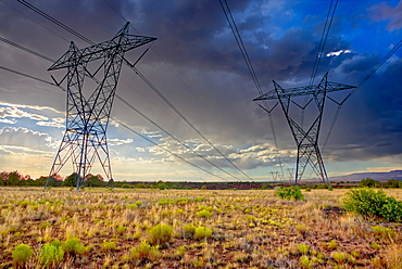
High voltage power lines stretching across Hell Canyon east of Paulden, located in the Prescott National Forest, Arizona, United States of America, North America
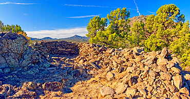
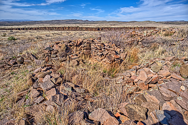
Ancient Indian Ruins near Granite Mountain in the Prescott National Forest, Arizona, United States of America, North America
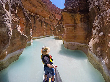
Photographer Skip Brown on a stand up paddle board at the mouth of Havasu Creek in the Grand Canyon, Arizona, United States of America, North America
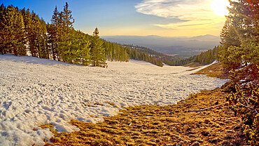
The slopes of Arizona Snow Bowl facing west close to sundown, Coconino National Forest near Flagstaff, Arizona, United States of America, North America