Results
« Previous 1 … 8 9 10 11 12 … 329 Next »
32837 results found
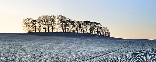
A small copse of trees growing on a drumlin in frosty dawn light, Boroughbridge, North Yorkshire, Yorkshire, England, United Kingdom, Europe
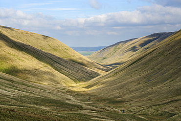
Looking down over Bowerdale Beck in the Howgill Fells, Cumbria, England, United Kingdom, Europe
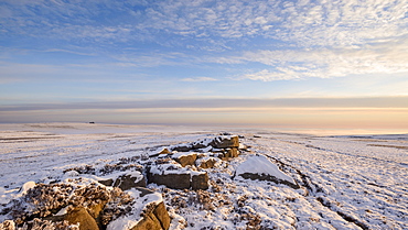
Glorious early morning light bathes the boulders and snow covered moor of Pockstones, with mist clearing in the Washburn Valley, North Yorkshire, Yorkshire, England, United Kingdom, Europe
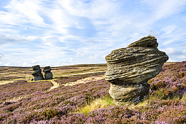
Jenny Twigg and her daughter Tib, gritstone formations on heather covered moors, Upper Nidderdale, North Yorkshire, Yorkshire, England, United Kingdom, Europe
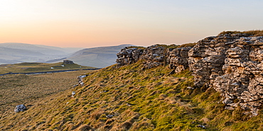
Looking towards Conistone Pie and Hawkswick Moor on a late winter afternoon in Wharfedale, North Yorkshire, Yorkshire, England, United Kingdom, Europe
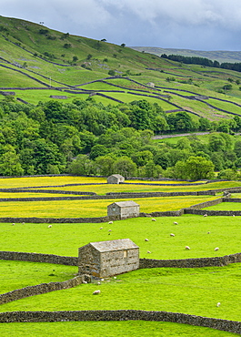
The barns, dry stone walls and buttercup meadows at Gunnerside, Swaledale, North Yorkshire, Yorkshire, England, United Kingdom, Europe
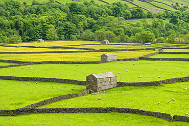
The barns, dry stone walls and buttercup meadows at Gunnerside, Swaledale, North Yorkshire, Yorkshire, England, United Kingdom, Europe
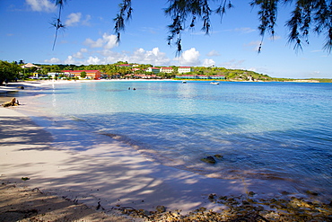
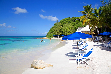
View of Long Bay and beach, Long Bay, Antigua, Leeward Islands, West Indies, Caribbean, Central America
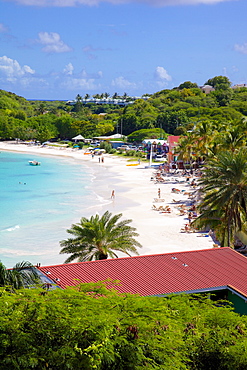
View of Long Bay and beach, Long Bay, Antigua, Leeward Islands, West Indies, Caribbean, Central America
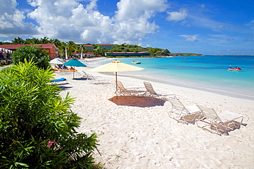
Beach and sunshades, Long Bay, Antigua, Leeward Islands, West Indies, Caribbean, Central America
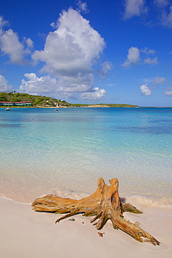
View of Long Bay and beach, Long Bay, Antigua, Leeward Islands, West Indies, Caribbean, Central America
Beach and sunshades, Long Bay, Antigua, Leeward Islands, West Indies, Caribbean, Central America
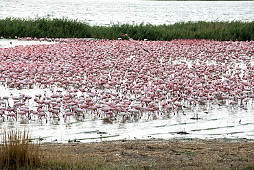
Kamfers Dam, a large pan north Kimberley, an important wetland with breeding colony of lesser flamingoes (Phoenicopterus minor), Northern Cape, South Africa, Africa
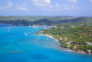
View of Falmouth Harbour, Antigua, Leeward Islands, West Indies, Caribbean, Central America
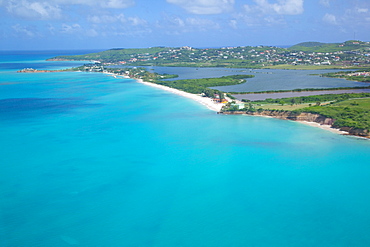
View of Runaway Bay and Beach, Antigua, Leeward Islands, West Indies, Caribbean, Central America
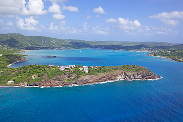
View of entrance to Falmouth Harbour, Antigua, Leeward Islands, West Indies, Caribbean, Central America
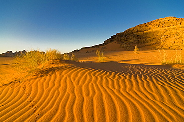
The stunning desert scenery of Wadi Rum, Jordan, Middle East
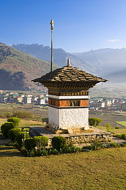
Beautiful Buddhist stupa, Paro, Bhutan, Asia
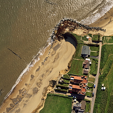
Aerial view of Happisburgh, showing precarious position of several houses as cliffs are eroded by coastal erosion, Norfolk, England, United Kingdom, Europe
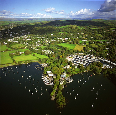
Aerial image of Bowness-on-Windermere, Lake Windermere, Lake District National Park, Cumbria, England, United Kingdom, Europe
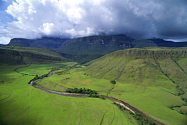
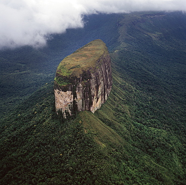
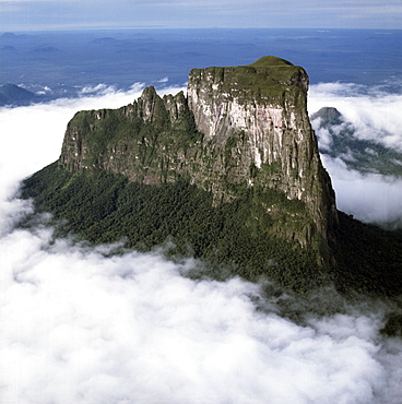
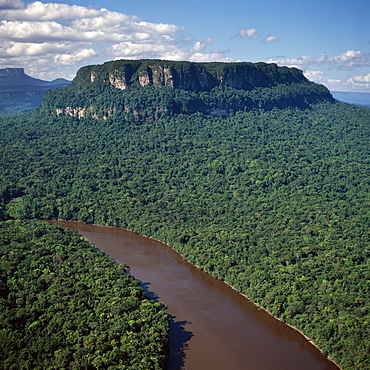
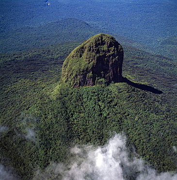
Aerial image of tepuis showing south side of Auyantepui (Auyantepuy) (Devil's Mountain) from Uruyen valley, Canaima National Park, UNESCO World Heritage Site, Venezuela, South America
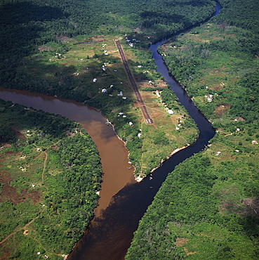
Aerial image of Kamarang Mouth Station and airstrip at the confluence of the unpolluted Kamarang River with the mined and heavily polluted Upper Mazaruni River in March 2005, Guyana, South America
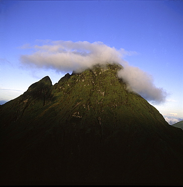
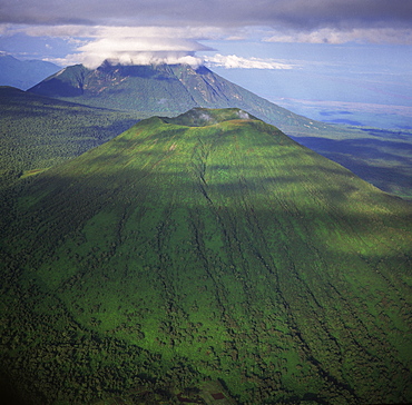
Aerial view of Mount Mikeno, Virunga Volcanoes, Rwanda, Great Rift Valley, Africa
Aerial image of the River Esk flowing into Solway Firth, near Gretna Green, border between Cumbria in England and Dumfries and Galloway in Scotland, United Kingdom, Europe

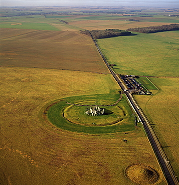
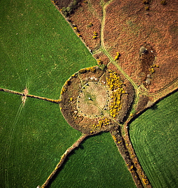
Aerial image of Stonehenge, prehistoric monument and stone circle, UNESCO World Heritage Site, Salisbury Plain, Wiltshire, England, United Kingdom, Europe
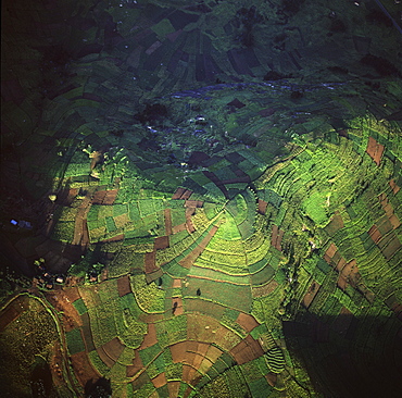
Aerial view of intensive agriculture in Rwanda, Africa
Aerial image of skeleton forest, damaged by forest fire, on La Gran Sabana, Canaima National Park, UNESCO World Heritage Site, Bolivar State, Venezuela, South America
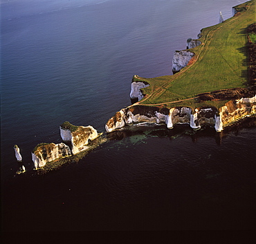
Aerial image of Old Harry Rocks, chalk stacks located directly east of Studland, north of Swanage, Dorset, England, United Kingdom, Europe
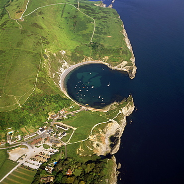
Aerial image of Lulworth Cove, a natural landform harbour, near West Lulworth, on the Jurassic Coast, UNESCO World Heritage Site, Dorset, England, United Kingdom, Europe
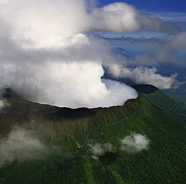
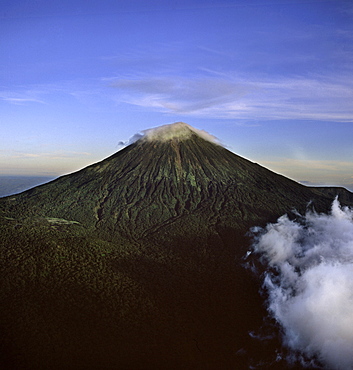
Aerial view of Mount Nyiragongo, an active volcano in the Virunga Mountains in Virunga National Park, near the border with Rwanda, known for its recent devastating eruptions, Democratic Republic of the Congo, Great Rift Valley, Africa
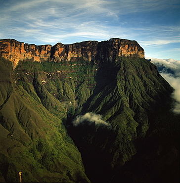
Aerial image of tepuis showing Mount Auyantepui (Auyantepuy) (Devil's Mountain), Venezuela, South America
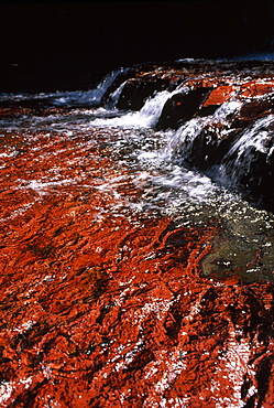
Quebrada de Jaspe, Jasper Rock Waterfall, Gran Sabana, Venezuela, South America
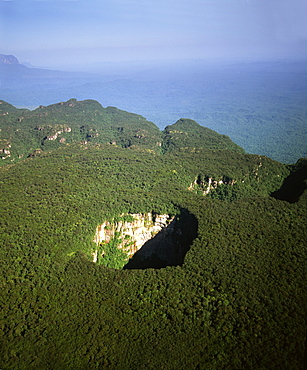
Aerial image of tepuis and Sarisarinama Sinkhole, Jaua-Sarisarinama National Park, Bolivar State, Venezuela, South America
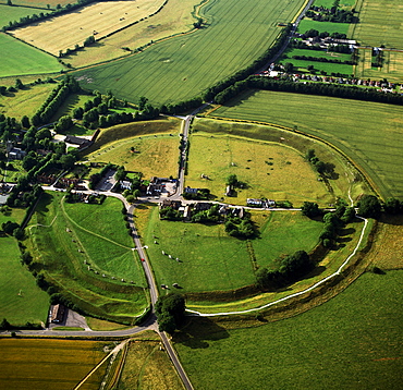
Aerial image of Avebury, Neolithic Monument, site of a large henge and several stone circles, UNESCO World Heritage Site, Wiltshire, England, United Kingdom, Europe
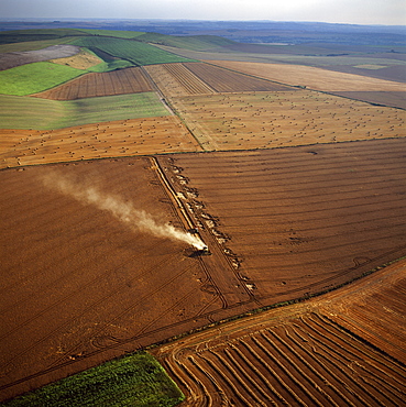
Aerial image of fields and harvest, Wiltshire, England, United Kingdom, Europe
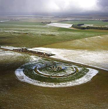
Aerial image of Stonehenge, prehistoric monument and stone circle in snow, UNESCO World Heritage Site, Salisbury Plain, Wiltshire, England, United Kingdom, Europe
Cerro Autana, Kunhardtia rhodantha (Rapataceae), Amazonas territory, Venezuela, South America
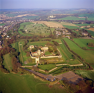
Aerial image of Carisbrooke Castle, a historic motte-and-bailey castle, Carisbrooke, near Newport, Isle of Wight, England, United Kingdom, Europe
Aerial image of tepuis showing Akopantepui, Gran Sabana, Estado Bolivar, Venezuela, South America
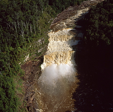
Aerial image of the Peaima Falls, Upper Mazaruni River, Guyana, South America
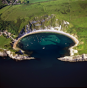
Aerial image of Lulworth Cove, a natural landform harbour, near West Lulworth, on the Jurassic Coast, UNESCO World Heritage Site, Dorset, England, United Kingdom, Europe
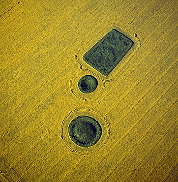
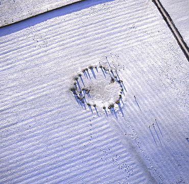
Aerial image of round and square Barrows at North Down in rape field, near Calstone Wellington, Wiltshire, England, United Kingdom, Europe
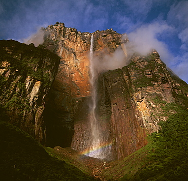
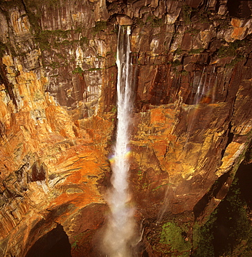
Angel Falls and Mount Auyantepui (Auyantepuy) (Devil's Mountain), Tepuis, Venezuela, South America
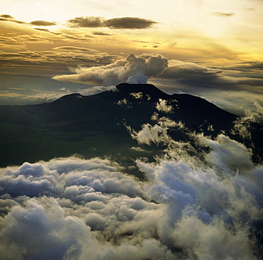
Aerial view of Mount Nyiragongo, an active volcano in the Virunga Mountains in Virunga National Park, near the border with Rwanda, known for its recent devastating eruptions, Democratic Republic of the Congo, Great Rift Valley, Africa
Aerial image of Castlerigg Stone Circle, a prehistoric monument in snow, near Keswick, Lake District National Park, Cumbria, England, United Kingdom, Europe
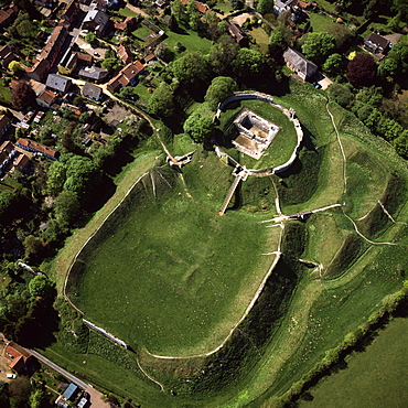
Aerial view of Castle Acre, remains of a motte and bailey castle with extensive earthworks, Castle Acre, Norfolk, England, United Kingdom, Europe
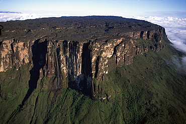
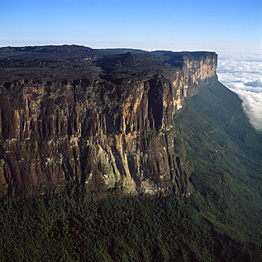
Aerial image of Tepuis showing summit of Mount Roraima (Cerro Roraima), Venezuela, South America
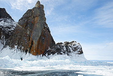
The shore of Lake Baikal, Siberia, Russia, Europe
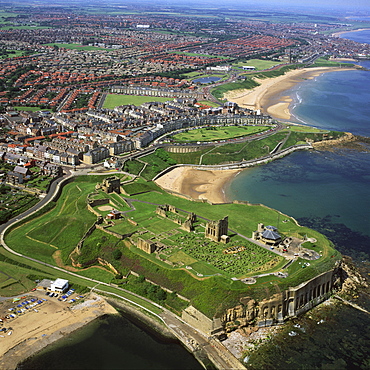
Aerial image of Tynemouth Priory and Castle, on a rocky headland known as Pen Bal Crag, Tyne and Wear, England, United Kingdom, Europe
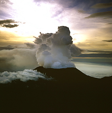
Aerial view of Mount Nyiragongo, an active volcano in the Virunga Mountains in Virunga National Park, near the border with Rwanda, known for its recent devastating eruptions, Democratic Republic of the Congo, Great Rift Valley, Africa
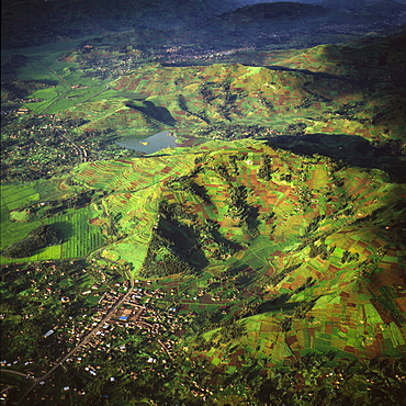
Aerial view of intensive agriculture in Rwanda, Africa
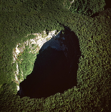
Aerial image of Sarisarinama Sinkhole, Jaua-Sarisarinama National Park, Tepuis, Bolivar State, Venezuela, South America
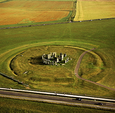
Aerial image of Stonehenge, prehistoric monument and stone circle, UNESCO World Heritage Site, Salisbury Plain, Wiltshire, England, United Kingdom, Europe
Aerial image of Stonehenge, prehistoric monument and stone circle, UNESCO World Heritage Site, Salisbury Plain, Wiltshire, England, United Kingdom, Europe
Aerial image of Angel Falls and Mount Auyantepui (Auyantepuy) (Devil's Mountain), Tepuis, Venezuela, South America

Aerial image of the Cerne Abbas Giant, Cerne Abbas, Dorset, England, United Kingdom, Europe
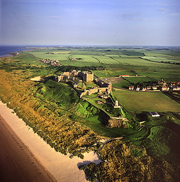
Aerial image of Bamburgh Castle, a Norman castle built on a basalt outcrop on the coast, Bamburgh, Northumberland, England, United Kingdom, Europe
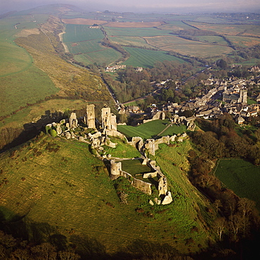
Aerial image of Corfe Castle, Purbeck Hills, between Wareham and Swanage, Dorset, England, United Kingdom, Europe
Aerial image of Boscawen-Un Stone Circle, with gorse flowers, St. Buryan, Cornwall, England, United Kingdom, Europe
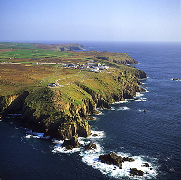
Aerial image of Land's End, a headland on the Penwith peninsula, most westerly point of the English mainland, Cornwall, England, United Kingdom, Europe
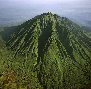
Aerial view of Mount Karisimbi, a dormant volcano in the Virunga Mountains on the border between Rwanda and the Democratic Republic of Congo (DRC), flanked by Mount Mikeno to the north, Mount Bisoke to the east and Mount Nyiragongo to the west, Great Rift Valley, Africa

Didiereaceae plant (Alluaudiopsis sp.), Spiny Forest, Hazofotsy, Southern Madagascar, Africa
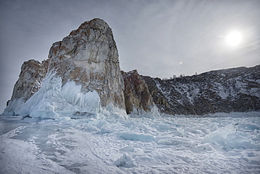
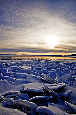
Rough ice formed at Shaman Rock, Olkhon Island as the waves freeze at the beginning of winter, Lake Baikal, Irkutsk Oblast, Siberia, Russia, Eurasia
Rough ice formed at Olkhon Island as the waves freeze at the beginning of winter, Lake Baikal, Irkutsk Oblast, Siberia, Russia, Eurasia
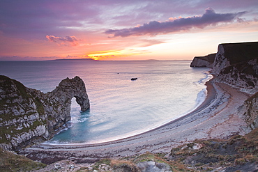
A colourful sunset over Durdle Door on the Jurassic Coast, UNESCO World Heritage Site, Dorset, England, United Kingdom, Europe
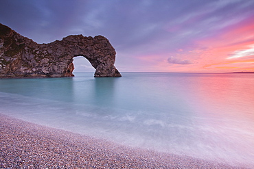
A colourful sunset over Durdle Door on the Jurassic Coast, UNESCO World Heritage Site, Dorset, England, United Kingdom, Europe
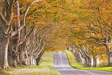
The beech avenue at Kingston Lacy in full autumn colour, Dorset, England, United Kingdom, Europe
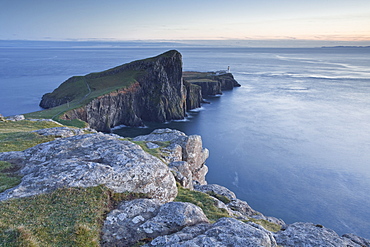
Neist Point lighthouse on the north-west coast of the Isle of Skye, Inner Hebrides, Scotland, United Kingdom, Europe
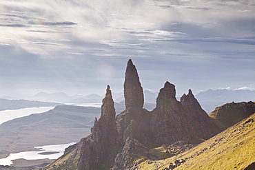
The Old Man of Storr, overlooking Loch Leathan and Raasay Sound, Trotternish, Isle of Skye, Inner Hebrides, Scotland, United Kingdom, Europe
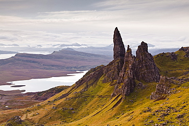
The Old Man of Storr, a rock formation on the edge of the Trotternish Ridge, Isle of Skye, Inner Hebrides, Scotland, United Kingdom, Europe
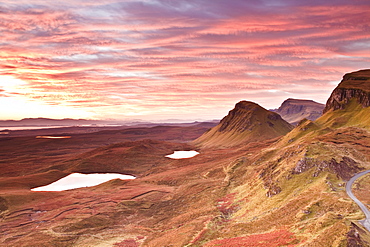
Beautiful pre-dawn light on the Trotternish Ridge, Isle of Skye, Inner Hebrides, Scotland, United Kingdom, Europe
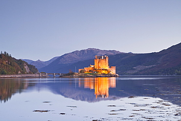
Eilean Donan castle reflecting in Loch Duich, Highlands, Scotland, United Kingdom, Europe
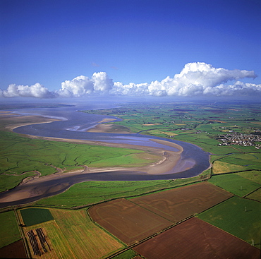
Aerial view of the mouth of Great Ouse River entering The Wash, King's Lynn, Norfolk, England, United Kingdom, Europe
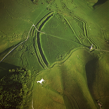
Aerial image of Oldbury Camp Hill Fort with Cherhill White Horse, Cherhill Down, Calne, Wiltshire, England, United Kingdom, Europe
Aerial view of Osmington White Horse, Cherhill Downs, Osmington, Dorset, England, United Kingdom, Europe
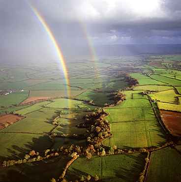
Aerial image of a double rainbow over the Somerset Levels, Somerset, England, United Kingdom, Europe
Aerial view of Mount Karisimbi, a dormant volcano in the Virunga Mountains on the border between Rwanda and the Democratic Republic of Congo (DRC), at 4507m the highest of the mountain range, Great Rift Valley, Africa
Aerial view of Mount Nyiragongo, an active volcano in the Virunga Mountains in Virunga National Park, near the border with Rwanda, known for its recent devastating eruptions, Democratic Republic of the Congo, Great Rift Valley, Africa
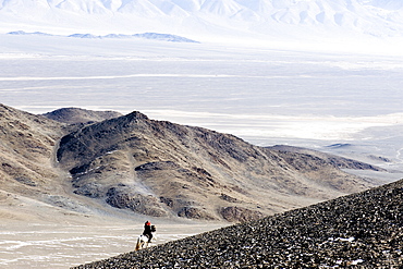
An eagle hunter out on a morning hunt in the Altai Mountains, Bayan Olgii, Mongolia, Asia
Aerial view of Mount Visoke (Mount Bisoke), an extinct volcano, straddling border of Rwanda and the Democratic Republic of the Congo. with Mount Mikeno in background, Virunga Volcanoes, Great Rift Valley, Africa
Aerial image of tepuis showing eastern cliff looking towards Brazil and Guyana, Mount Roraima, Venezuela, South America
Aerial image of tepuis showing Mount Autana (Cerro Autana), Amazonas territory, Venezuela, South America
Aerial view of Mount Sabyinyo, an extinct volcano and oldest of the Virunga Mountains, the summit at 3645ï¾ metres marks the intersection of the borders of Democratic Republic of the Congo (DRC), Rwanda, and Uganda, Virunga Volcanoes, Africa
Aerial image of tepuis showing Mount Autana (Cerro Autana), Amazonas territory, Venezuela, South America
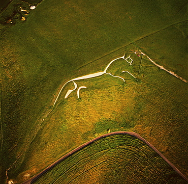
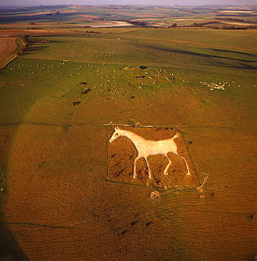
Aerial image of the Uffington White Horse, Berkshire Downs, Vale of White Horse, Oxfordshire, England, United Kingdom, Europe
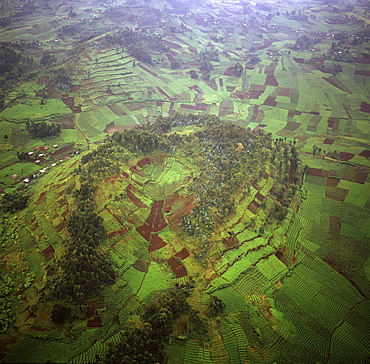
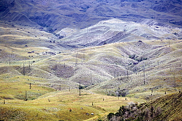
Aerial view of intensive agriculture on Virunga foothills, Rwanda, Africa
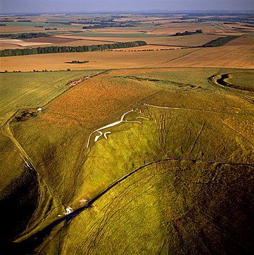
Aerial image of Uffington White Horse with Uffington Castle hill fort, Berkshire Downs, Vale of White Horse, Oxfordshire, England, United Kingdom, Europe
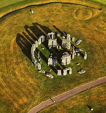
Aerial image of Stonehenge, prehistoric monument and stone circle, UNESCO World Heritage Site, Salisbury Plain, Wiltshire, England, United Kingdom, Europe
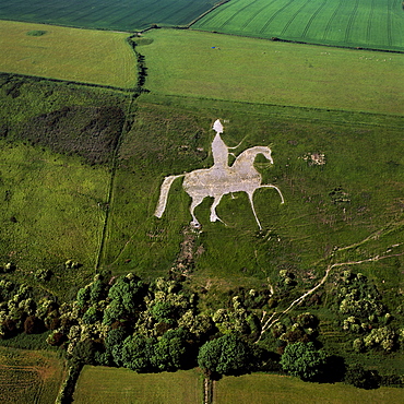
Aerial view of Alton Barnes White Horse, Alton Barnes, Wiltshire, England, United Kingdom, Europe
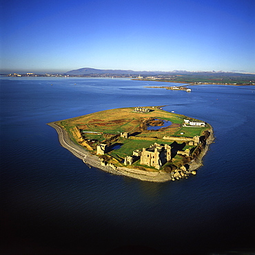
Aerial image of Piel Castle (Fouldry Castle) (Fouldrey Castle), a concentric medieval fortification with a keep and three towers, Piel Island, Furness Peninsula, Barrow in Furness, Cumbria, England, United Kingdom, Europe
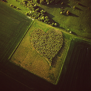
Aerial image of heart shape orchard, near Huish Hill earthwork, Oare, Wiltshire, England, United Kingdom, Europe
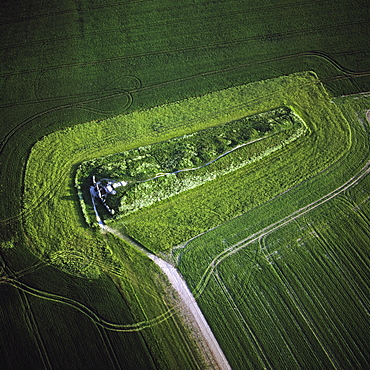
Aerial image of West Kennet Long Barrow, a Neolithic tomb or barrow, on a prominent chalk ridge, near Silbury Hill, Avebury, Wiltshire, England, United Kingdom, Europe
Aerial image of the Upper Mazaruni River, downstream from Kamarang, Guyana, South America
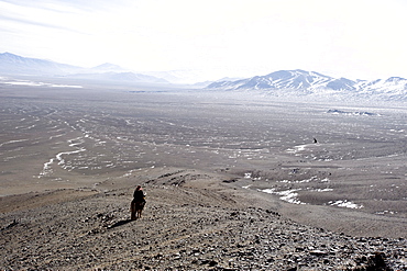
An eagle hunter out on a morning hunt in the Altai Mountains, Bayan Olgii, Mongolia, Asia
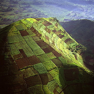
Aerial view of intensive agriculture on Virunga foothills, Democratic Republic of Congo, Africa
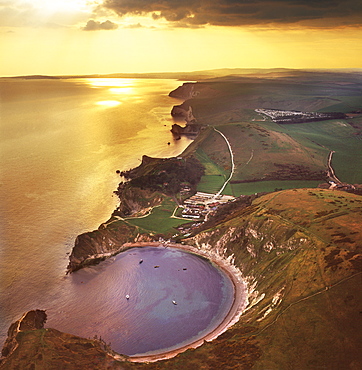
Aerial image of Lulworth Cove, a natural landform harbour, near West Lulworth, on the Jurassic Coast, UNESCO World Heritage Site, Dorset, England, United Kingdom, Europe
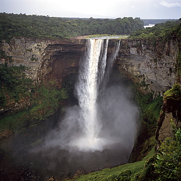
Kaieteur Falls, Potaro River, dry season, Guyana, South Amrica
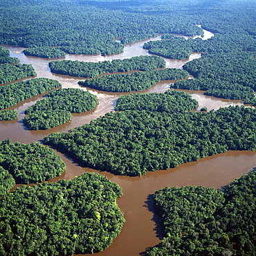
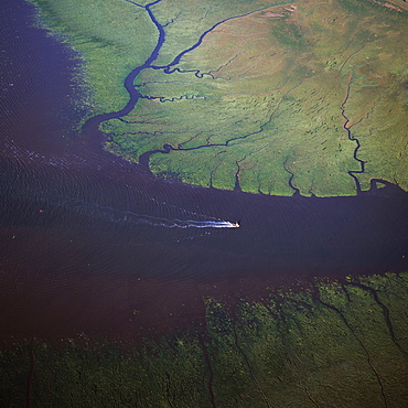
Aerial image of the Lower Mazaruni River with islands of tropical rain forest, Hororabo, near Bartica, Guyana, South America
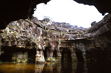
Fosso Sinkhole, summit of Mount Roraima (Cerro Roraima), Tepuis, Venezuela, South America
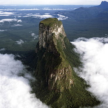
Aerial image of Wadakapiapetepui, Eastern chain of tepuis, Estado Bolivar, Venezuela, South America