Results
« Previous 1 … 9 10 11 12 13 … 294 Next »
29355 results found

Aerial image of the Cerne Abbas Giant, Cerne Abbas, Dorset, England, United Kingdom, Europe
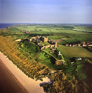
Aerial image of Bamburgh Castle, a Norman castle built on a basalt outcrop on the coast, Bamburgh, Northumberland, England, United Kingdom, Europe
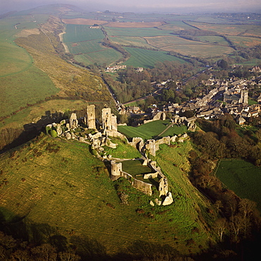
Aerial image of Corfe Castle, Purbeck Hills, between Wareham and Swanage, Dorset, England, United Kingdom, Europe
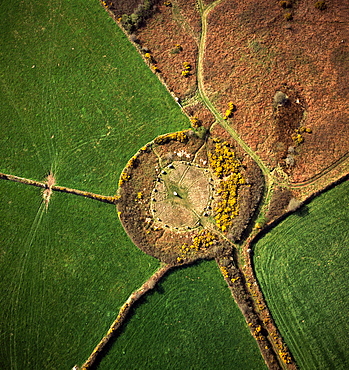
Aerial image of Boscawen-Un Stone Circle, with gorse flowers, St. Buryan, Cornwall, England, United Kingdom, Europe
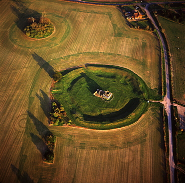
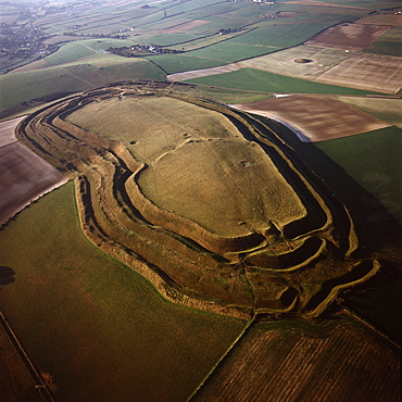
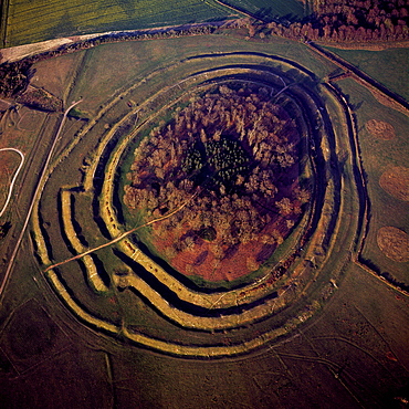
Aerial image of Knowlton Henge, a Neolithic henge monument, and Knowlton Church, a ruined Norman church, Dorset, England, United Kingdom, Europe
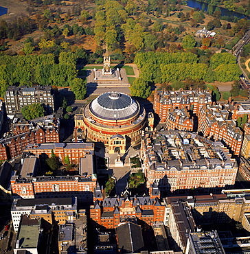
Aerial image of the Royal Albert Hall, and the Albert Memorial in Kensington Gardens, London, England, United Kingdom, Europe
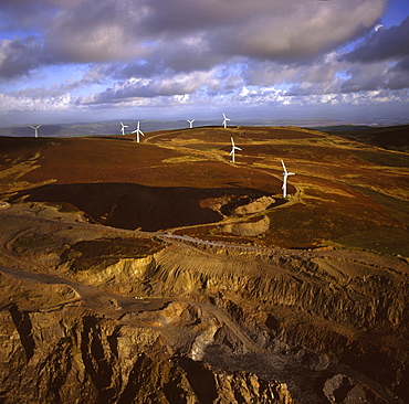
Aerial image of wind farm at Kirkby Moor, Cumbria, England, United Kingdom, Europe
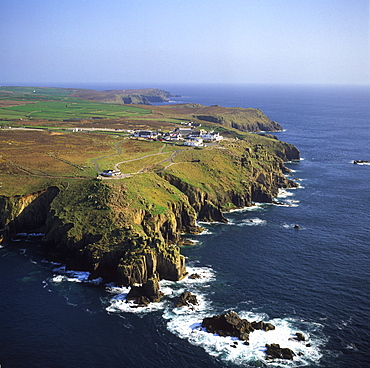
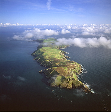
Aerial image of Land's End, a headland on the Penwith peninsula, most westerly point of the English mainland, Cornwall, England, United Kingdom, Europe
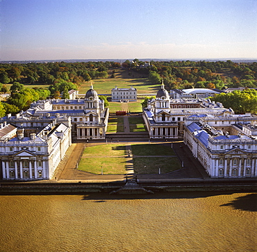
Aerial image of the Royal Naval College and Queen's House, on the south bank of the River Thames, UNESCO World Heritage Site, with the Royal Observatory in the background, Greenwich, London, England, United Kingdom, Europe
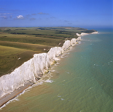
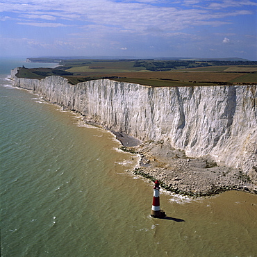
Aerial image of the chalk cliffs of the Seven Sisters, with Belle Tout lighthouse and Beachy Head in the distance, East Sussex, England, United Kingdom, Europe
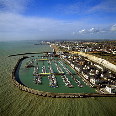
Aerial image of Brighton Marina, Brighton, Sussex, England, United Kingdom, Europe
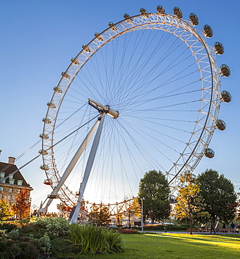
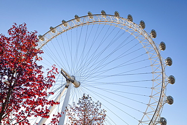
The London Eye on a bright sunny day, London, England, United Kingdom, Europe
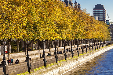
People walking beneath trees bearing autumn coloured leaves along the South Embankment of the River Thames, Westminster, London, England, United Kingdom, Europe
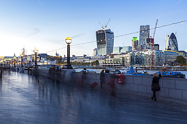
Tourists walking along the South Embankment of the River Thames at London Bridge, with the Gherkin and 'The Walkie-Talkie' amongst the City of London skyline, London, England, United Kingdom, Europe
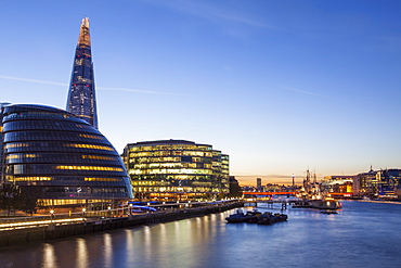
London skyline at dusk including the GLC building, HMS Belfast and the Shard, taken from Tower Bridge, London, England, United Kingdom, Europe
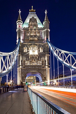
Long exposure of traffic over Tower Bridge at dusk, London, England, United Kingdom, Europe
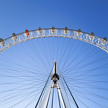
The London Eye on a bright sunny day, London, England, United Kingdom, Europe
The London Eye on a bright sunny day, London, England, United Kingdom, Europe
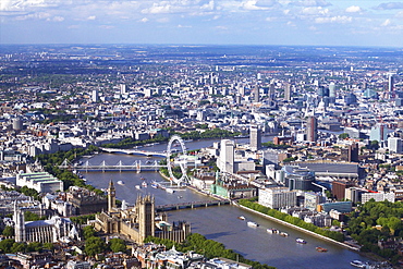
Aerial view of the Houses of Parliament, Westminster Abbey, London Eye and River Thames, London, England, United Kingdom, Europe
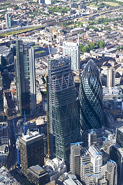
Aerial view of the Gherkin and Leadenhall Building (Cheese-grater), City of London, London, England, United Kingdom, Europe
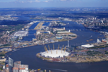
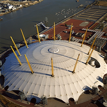
Aerial view of London City Airport and O2 Arena, London, England, United Kingdom, Europe
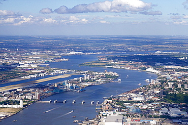
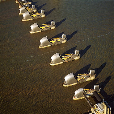
Aerial view of Thames Barrier, River Thames, London, England, United Kingdom, Europe
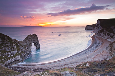
A colourful sunset over Durdle Door on the Jurassic Coast, UNESCO World Heritage Site, Dorset, England, United Kingdom, Europe
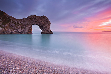
A colourful sunset over Durdle Door on the Jurassic Coast, UNESCO World Heritage Site, Dorset, England, United Kingdom, Europe
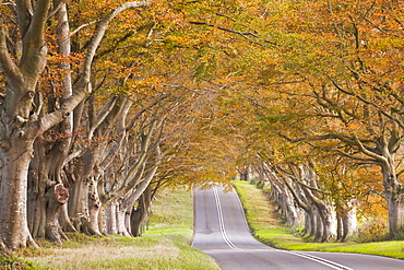
The beech avenue at Kingston Lacy in full autumn colour, Dorset, England, United Kingdom, Europe
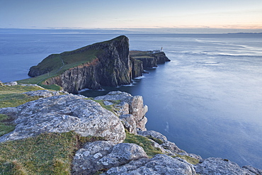
Neist Point lighthouse on the north-west coast of the Isle of Skye, Inner Hebrides, Scotland, United Kingdom, Europe
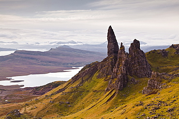
The Old Man of Storr, overlooking Loch Leathan and Raasay Sound, Trotternish, Isle of Skye, Inner Hebrides, Scotland, United Kingdom, Europe
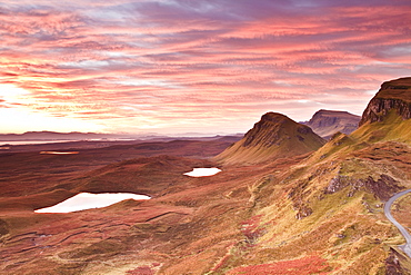
Beautiful pre-dawn light on the Trotternish Ridge, Isle of Skye, Inner Hebrides, Scotland, United Kingdom, Europe
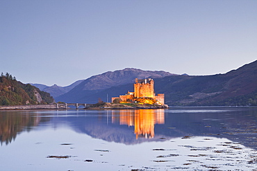
Eilean Donan castle reflecting in Loch Duich, Highlands, Scotland, United Kingdom, Europe
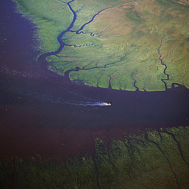
Aerial view of the mouth of Great Ouse River entering The Wash, King's Lynn, Norfolk, England, United Kingdom, Europe
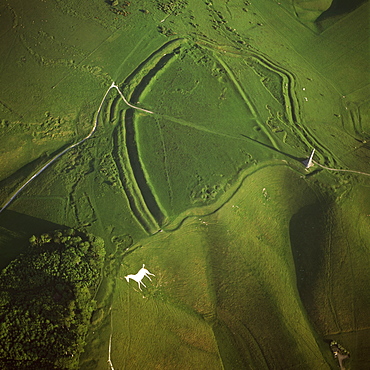
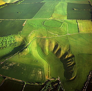
Aerial image of Oldbury Camp Hill Fort with Cherhill White Horse, Cherhill Down, Calne, Wiltshire, England, United Kingdom, Europe
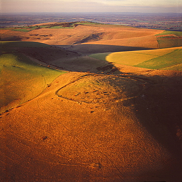
Aerial image of Rybury Camp, an Iron Age hill fort with Neolithic causewayed enclosure, Wiltshire, England, United Kingdom, Europe
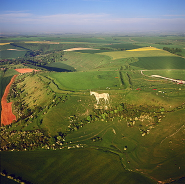
Aerial view of Osmington White Horse, Cherhill Downs, Osmington, Dorset, England, United Kingdom, Europe
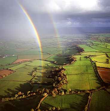
Aerial image of a double rainbow over the Somerset Levels, Somerset, England, United Kingdom, Europe
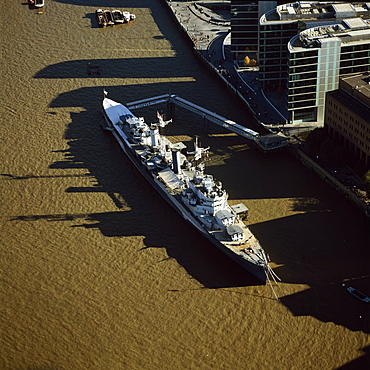
Aerial image of HMS Belfast, a Royal Navy Town-class cruiser, on the River Thames, London, England, United Kingdom, Europe
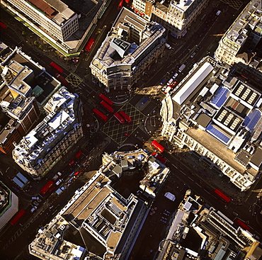
Aerial image of Oxford Circus, a busy intersection of Regent Street and Oxford Street, in the City of Westminster, London, England, United Kingdom, Europe
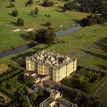
Aerial image of Longleat, an English country house, Horningsham, near Warminster, Wiltshire, England, United Kingdom, Europe
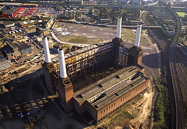
Aerial image of Battersea Power Station, an unused coal-fired power station on the south bank of the River Thames, Battersea, London, England, United Kingdom, Europe
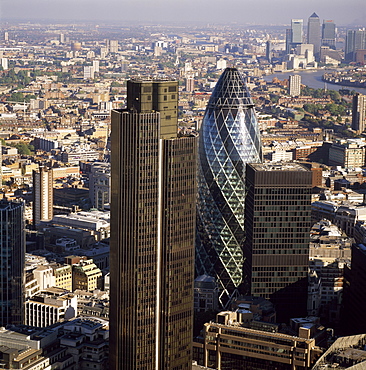
Aerial view of Tower 42, Gherkin (30 St. Mary Axe) (Swiss Re Building) and St. Helen's (Aviva Tower), City of London, London, England, United Kingdom, Europe
Aerial image of Maiden Castle, an Iron Age hill fort, Winterborne Monkton, near Dorchester, Dorset, England, United Kingdom, Europe
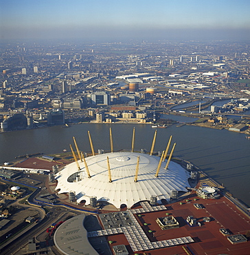
Aerial image of the Millennium Dome and the River Thames, Greenwich Peninsula, South East London, London, England, United Kingdom, Europe
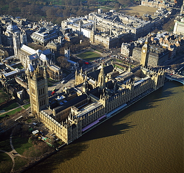
Aerial image of the Houses of Parliament (Palace of Westminster) and Big Ben, UNESCO World Heritage Site, Westminster, London, England, United Kingdom, Europe
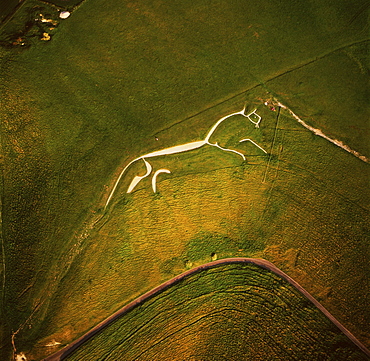
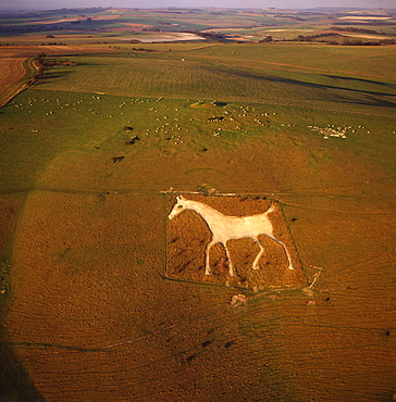
Aerial image of the Uffington White Horse, Berkshire Downs, Vale of White Horse, Oxfordshire, England, United Kingdom, Europe
Aerial view of the River Ant, Norfolk Broads, near How Hill, Norfolk, England, United Kingdom, Europe
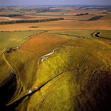
Aerial image of Uffington White Horse with Uffington Castle hill fort, Berkshire Downs, Vale of White Horse, Oxfordshire, England, United Kingdom, Europe
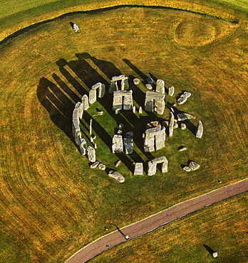
Aerial image of Stonehenge, prehistoric monument and stone circle, UNESCO World Heritage Site, Salisbury Plain, Wiltshire, England, United Kingdom, Europe
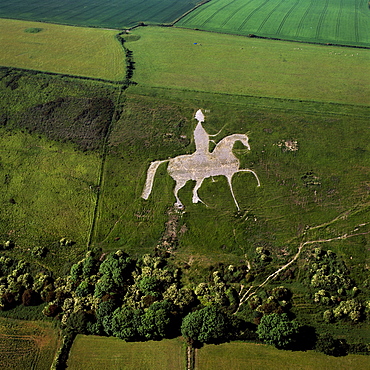
Aerial view of Alton Barnes White Horse, Alton Barnes, Wiltshire, England, United Kingdom, Europe
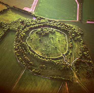
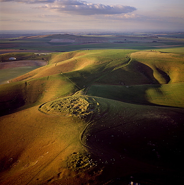
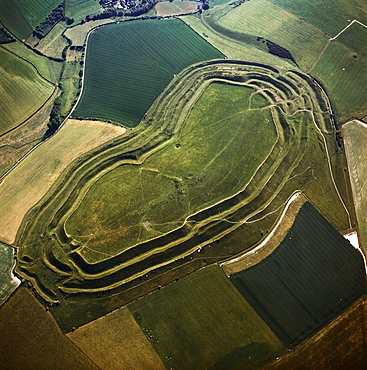
Aerial image of Danebury Ring, an Iron Age hill fort, Wiltshire, England, United Kingdom, Europe

Aerial image of Bodiam Castle, late medieval moated castle, Robertsbridge, East Sussex, England, United Kingdom, Europe
Aerial view of salt marsh at Burnham Overy Staithe, Norfolk, England, United Kingdom, Europe
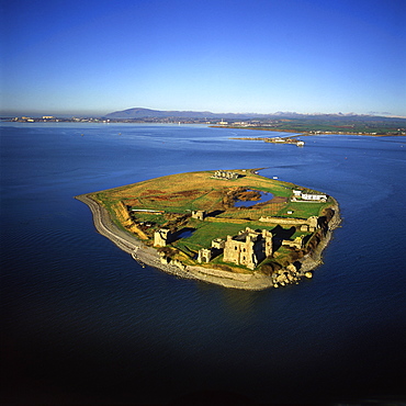
Aerial image of Piel Castle (Fouldry Castle) (Fouldrey Castle), a concentric medieval fortification with a keep and three towers, Piel Island, Furness Peninsula, Barrow in Furness, Cumbria, England, United Kingdom, Europe
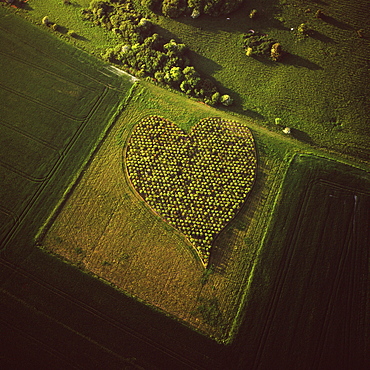
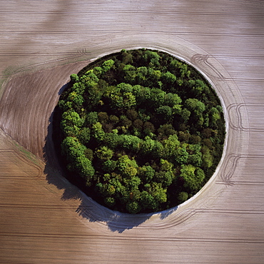
Aerial image of heart shape orchard, near Huish Hill earthwork, Oare, Wiltshire, England, United Kingdom, Europe
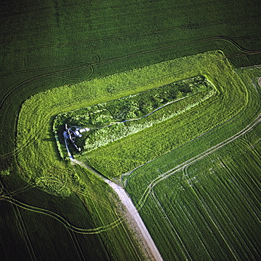
Aerial image of West Kennet Long Barrow, a Neolithic tomb or barrow, on a prominent chalk ridge, near Silbury Hill, Avebury, Wiltshire, England, United Kingdom, Europe
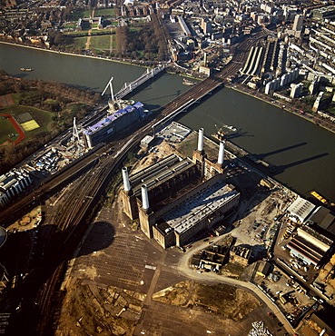
Aerial image of Battersea Power Station, an unused coal-fired power station on the south bank of the River Thames, Battersea, London, England, United Kingdom, Europe
Aerial image of the Millennium Dome and the River Thames, Greenwich Peninsula, South East London, London, England, United Kingdom, Europe
Aerial image of the Thames Flood Barrier across the River Thames, Woolwich Reach, Woolwich, London, England, United Kingdom, Europe
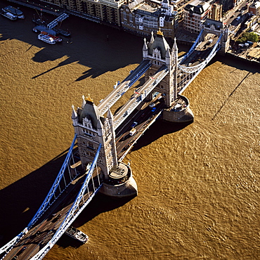
Aerial image of Tower Bridge, a combined bascule and suspension bridge, over the River Thames, London, England, United Kingdom, Europe
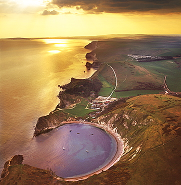
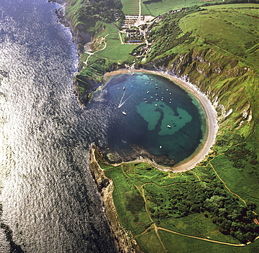
Aerial image of Lulworth Cove, a natural landform harbour, near West Lulworth, on the Jurassic Coast, UNESCO World Heritage Site, Dorset, England, United Kingdom, Europe
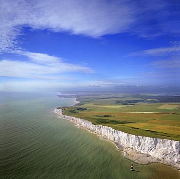
Aerial image of chalk cliffs and lighthouse at Beachy Head, near Eastbourne, East Sussex, England, United Kingdom, Europe
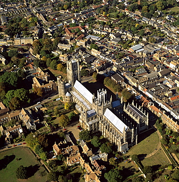
Aerial view of Ely Cathedral, (Cathedral Church of the Holy and Undivided Trinity), known as the Ship of the Fens, Ely, Cambridgeshire, England, United Kingdom, Europe
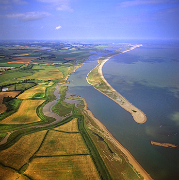
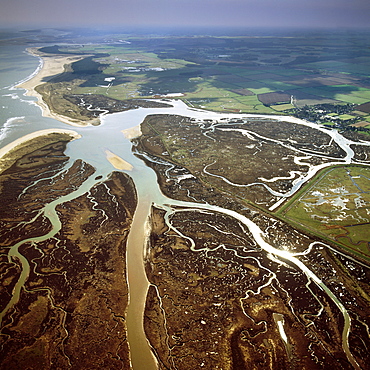
Aerial view of Orford Ness (Orfordness), a cuspate foreland shingle spit, Suffolk, England, United Kingdom, Europe
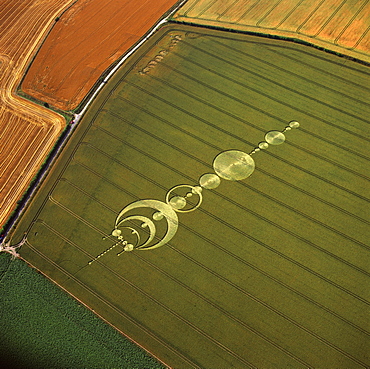
Aerial image of crop circle, Wiltshire, England, united Kingdom, Europe
Aerial view of the Westbury White Horse and the Iron Age Bratton Camp Hill Fort, Wiltshire, England, United Kingdom, Europe
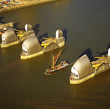
Aerial image of Thames sailing barge and Thames Flood Barrier across the River Thames, Woolwich Reach, Woolwich, London, England, United Kingdom, Europe
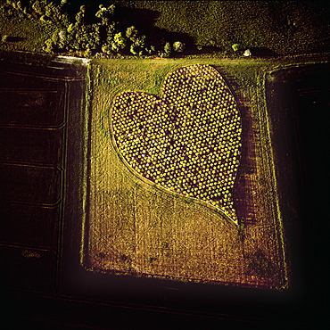
Aerial image of heart shape orchard, near Huish Hill earthwork, Oare, Wiltshire, England, United Kingdom, Europe
Aerial image of the Uffington White Horse with Uffington Castle hill fort, Berkshire Downs, Vale of White Horse, Oxfordshire, England, United Kingdom, Europe
Aerial image of Lulworth Cove, a natural landform harbour, near West Lulworth, on the Jurassic Coast, UNESCO World Heritage Site, Dorset, England, United Kingdom, Europe
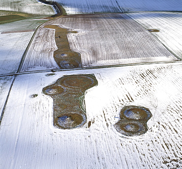
Aerial image of Normanton Down Barrows in snow, consisting of a Neolithic long barrow and Bronze Age round barrows, Wiltshire, England, United Kingdom, Europe
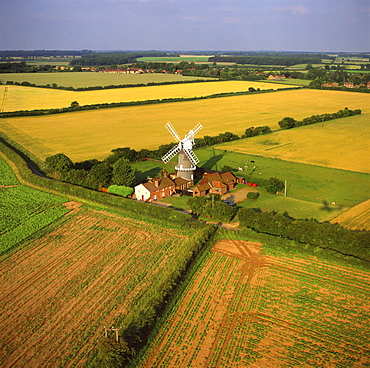
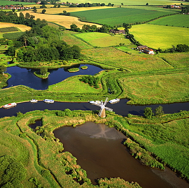
Aerial view of Bircham Windmill, Great Bircham, King's Lynn, Norfolk, England, United Kingdom, Europe
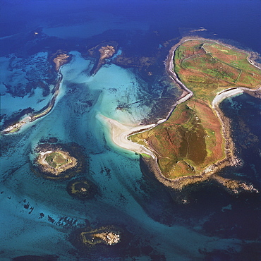
Aerial image of Samson, Isles of Scilly, off Cornwall, England, United Kingdom, Europe
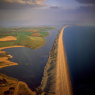
Aerial image of Chesil Beach (Chesil Bank), 29 km long shingle beach, a tombolo connecting mainland to the Isle of Portland, Jurassic Coast, UNESCO World Heritage Site, Dorset, England, United Kingdom, Europe
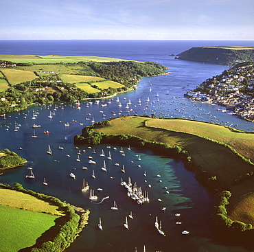
Aerial image of Salcombe and East Portlemouth, Kingsbridge Estuary, Devon, England, United Kingdom, Europe
Aerial image of Battlesbury Camp, an Iron Age Hill fort, Warminster, Wiltshire, England, United Kingdom, Europe
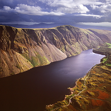
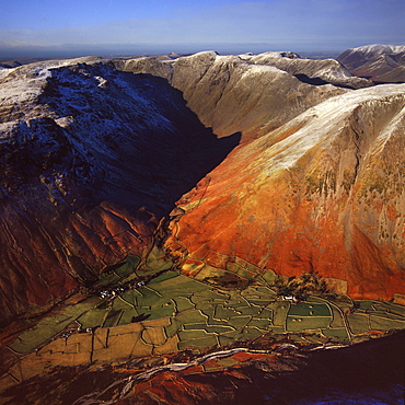
Aerial image of Wastwater Screes and Wast Water (Wastwater), the deepest lake in England, a good example of a glacially over-deepened valley, Wasdale Valley, Lake District National Park, Cumbria, England, United Kingdom, Europe
Aerial image of Maiden Castle, an Iron Age hill fort, Winterborne Monkton, near Dorchester, Dorset, England, United Kingdom, Europe
Aerial image of Mount Caburn with the remains of an Iron Age hill fort, east of Lewes, East Sussex, England, United Kingdom, Europe
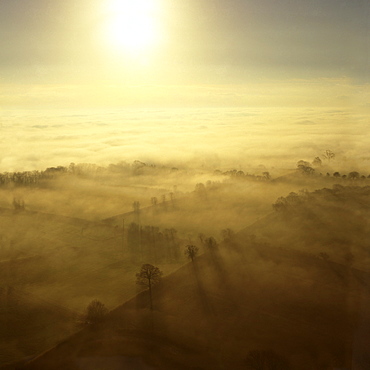
Aerial image of fog over the Somerset Levels, near Glastonbury, Somerset, England, United Kingdom, Europe
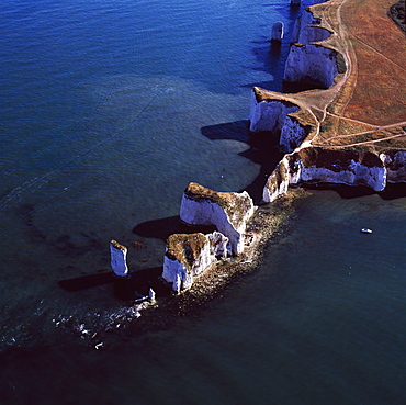
Aerial image of Old Harry Rocks, chalk stacks located directly east of Studland, north of Swanage, Dorset, England, United Kingdom, Europe
Aerial image of Wasdale Head, with St. Olaf's church, the smallest church in England, Brackenclose, Wasdale Fell, Kirk Fell, High Fell and Mosedale, Lake District National Park, Cumbria, England, United Kingdom, Europe
Aerial image of chalk cliffs and lighthouse, Beachy Head, near Eastbourne, East Sussex, England, United Kingdom, Europe
Aerial view of Meggs Hill (Gog Magog Downs) (Gog Magog Hills) (the Gogs), a range of low chalk hills, Cambridgeshire, England, United Kingdom, Europe
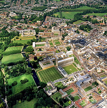
Aerial view of Cambridge including The Backs where several University of Cambridge colleges back on to the River Cam, Cambridge, Cambridgeshire, England, United Kingdom, Europe
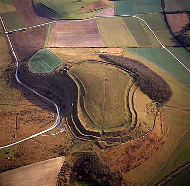
Aerial image of Badbury Rings, an Iron Age hill fort, Dorset, England, United Kingdom, Europe
Aerial image of Lundy Island looking from north to south, Bristol Channel, Devon, England, United Kingdom, Europe
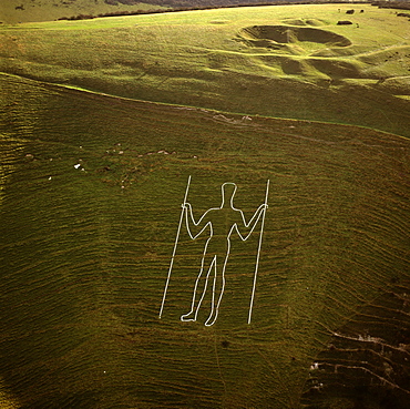
Aerial image of the Long Man of Wilmington, Wilmington, East Sussex, England, United Kingdom, Europe
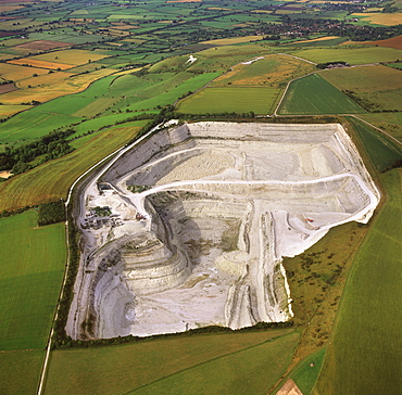
Aerial image of Westbury chalk quarry, with Westbury White Horse and Bratton Camp Hill Fort in background, Wiltshire, England, United Kingdom, Europe
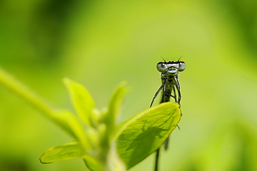
Head on view of a male Azure Damselfly (Coenagrion puella) casting shadow on a leaf, Wiltshire, England, United Kingdom, Europe
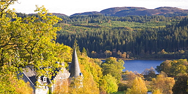
Autumn view to Loch Achray from wooded hillside above the former Trossachs Hotel, near Aberfoyle, Loch Lomond and the Trossachs National Park, Stirling, Scotland, United Kingdom, Europe
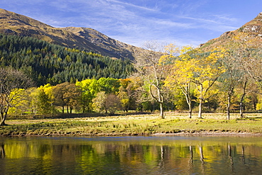
Autumn view across Loch Lubnaig to the slopes of Ben Ledi, near Callander, Loch Lomond and the Trossachs National Park, Stirling, Scotland, United Kingdom, Europe
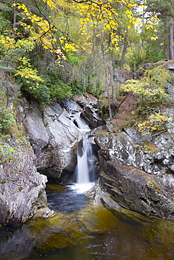
The Falls of Bruar in autumn, near Blair Atholl, Perth and Kinross, Scotland, United Kingdom, Europe
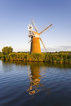
Turf Fen windmill reflected in the River Ant at sunrise, Norfolk Broads, How Hill, near Ludham, Norfolk, England, United Kingdom, Europe
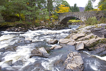
The Falls of Dochart and old stone bridge, Killin, Loch Lomond and the Trossachs National Park, Stirling, Scotland, United Kingdom, Europe
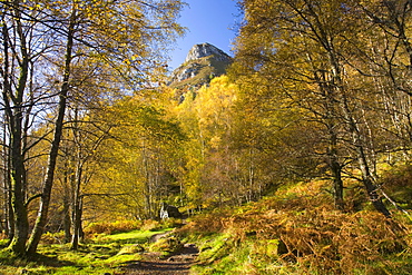
Autumn view along path to the summit of Ben A'an, near Aberfoyle, Loch Lomond and the Trossachs National Park, Stirling, Scotland, United Kingdom, Europe
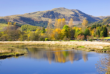
Autumn view from bridge over the River Teith to Ben Ledi, Callander, Loch Lomond and the Trossachs National Park, Stirling, Scotland, United Kingdom, Europe

View across harbour to the Sound of Sleat and hills of the Knoydart Peninsula, sheep grazing, Isleornsay, Isle of Skye, Highland, Scotland, United Kingdom, Europe
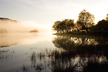
Early morning mist reflected in the still waters of Loch Achray, near Aberfoyle, Loch Lomond and the Trossachs National Park, Stirling, Scotland, United Kingdom, Europe
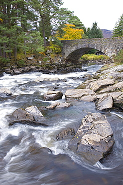
The Falls of Dochart and old stone bridge, Killin, Loch Lomond and the Trossachs National Park, Stirling, Scotland, United Kingdom, Europe
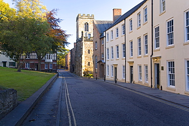
View northwards along North Bailey below the cathedral, St. Chad's College prominent, Durham, County Durham, England, United Kingdom, Europe
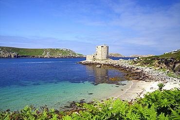
Cromwell's Castle in summer sunshine, Isle of Tresco, Isles of Scilly, United Kingdom, Europe
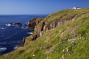
Cliffs and cafe at Lands End, summer sunshine, Cornwall, England, United Kingdom, Europe