Results
« Previous 1 … 10 11 12 13 14 … 41 Next »
4035 results found
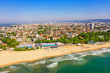
Aerial view by drone, Varna, Bulgaria, Europe
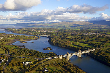
Aerial view of Britannia Bridge and the Menai Bridge, Menai Strait, Gwynedd, North Wales, Wales, United Kingdom, Europe
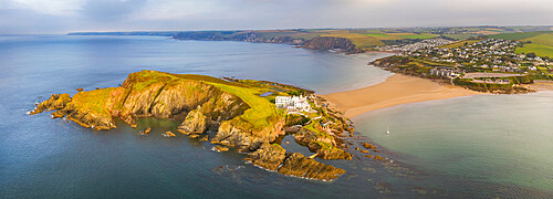
Aerial view of Burgh Island and hotel in the South Hams of Devon, England, United Kingdom, Europe

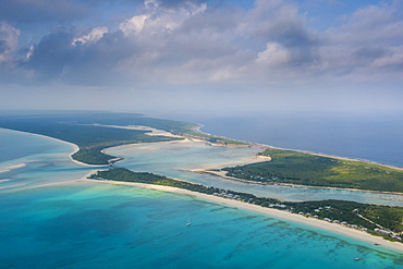
Aerial of Hikueru atoll, Tuamotu archipelago, French Polynesia, South Pacific, Pacific

Aerial of the 14th century Santuari de la Mare de Deu des Puig, UNESCO World Heritage Site, Serra de Tramuntana, Pollenca, Mallorca, Balearic Islands, Spain, Mediterranean, Europe

Sunrise over Le Morne and coral reef in the turquoise lagoon, aerial view by drone, Baie Du Cap, South Mauritius, Indian Ocean, Africa
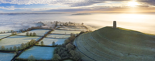
Aerial view by drone of frosty winter morning at Glastonbury Tor, Somerset, England, United Kingdom, Europe
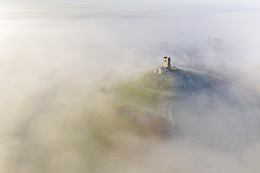
Aerial view by drone of St. Michael's Church on Burrow Mump, surrounded by a blanket of mist, Burrowbridge, Somerset, England, United Kingdom, Europe
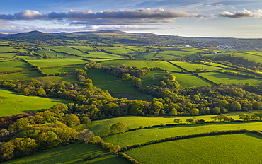
Aerial view by drone of rolling countryside near Dartmoor, Devon, England, United Kingdom, Europe
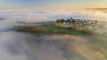
Aerial view by drone of rural village in evening light in winter, surrounded by fog, Coldridge, Devon, England, United Kingdom, Europe
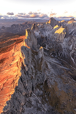
Aerial view of the rocky peaks of Roda Di Vael at sunset, Catinaccio Group (Rosengarten), Dolomites, South Tyrol, Italy, Europe
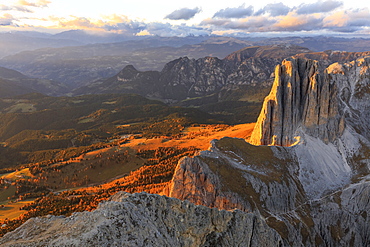
Aerial view of Catinaccio Group (Rosengarten) at sunset, Dolomites, South Tyrol, Italy, Europe
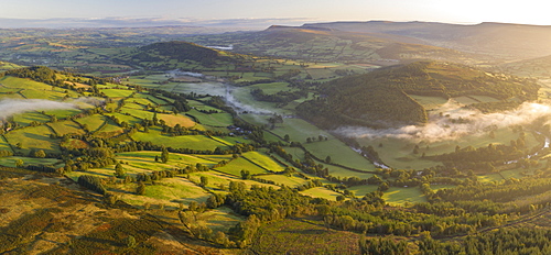
Aerial view by drone of mist floating over the Usk Valley at dawn, Brecon Beacons National Park, Powys, Wales, United Kingdom, Europe
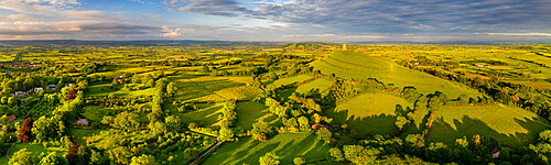
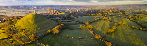
Aerial panorama of Glastonbury Tor and surrounding rolling countryside, Somerset, England, United Kingdom, Europe
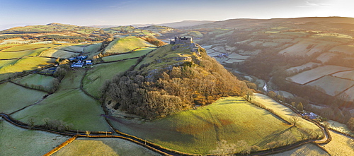
Aerial vista by drone of Carreg Cennen Castle, Brecon Beacons National Park, Carmarthenshire, Wales, United Kingdom, Europe
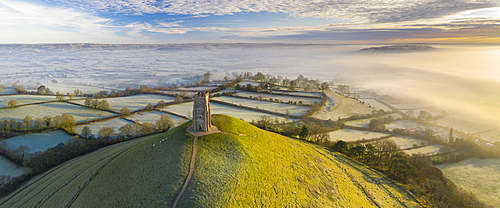
Aerial view by drone of frosty winter morning at Glastonbury Tor, Somerset, England, United Kingdom, Europe
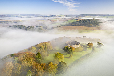
Aerial view by drone of Restormel Castle on a misty autumn morning, Lostwithiel, Cornwall, England, United Kingdom, Europe
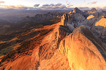
Aerial view of Roda Di Vael at sunset, Catinaccio Group (Rosengarten), Dolomites, South Tyrol, Italy, Europe
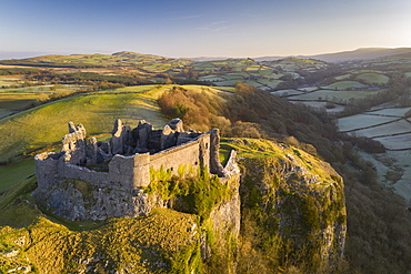
Aerial vista by drone of Carreg Cennen Castle, Brecon Beacons National Park, Carmarthenshire, Wales, United Kingdom, Europe
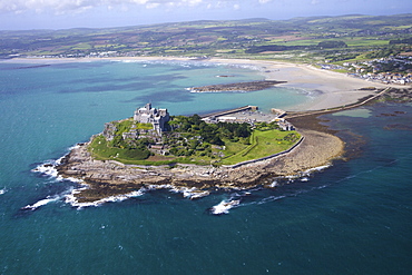
Aerial view of St. Michael's Mount, Penzance, Lands End Peninsula, West Penwith, Cornwall, England, United Kingdom, Europe
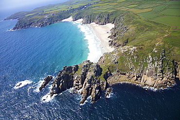
Aerial photo of Treen Cliff and Porthcurno beach looking west to the Minnack Theatre, West Penwith, Cornwall, England, United Kingdom, Europe

Aerial view by drone of frosty winter sunrise over Glastonbury Tor, Somerset, England, United Kingdom, Europe

Aerial view by drone of frosty winter morning at Glastonbury Tor, Somerset, England, United Kingdom, Europe
Aerial view by drone of Glastonbury Tor on a frosty morning on the Somerset Levels, Somerset, England, United Kingdom, Europe
Narvik, The Arctic Highway, Norway, Scandinavia, Europe
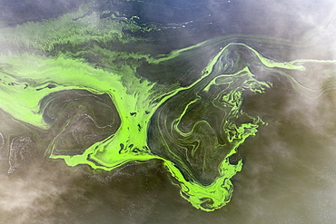
Aerial view by drone of swirls of green algae in a freshwater lake, Roadford Lake, Devon, England, United Kingdom, Europe
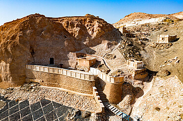
Aerial of Beket-Ata Underground Mosque, Mangystau, Kazakhstan, Central Asia, Asia
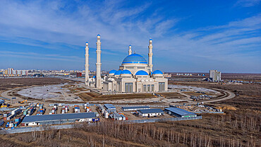
Aerial of the Grand Mosque, Nur Sultan, formerly Astana, capital of Kazakhstan, Central Asia, Asia
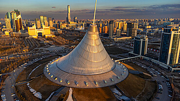
Aerial of Khan Shatyr, Nur Sultan, formerly Astana, capital of Kazakhstan, Central Asia, Asia
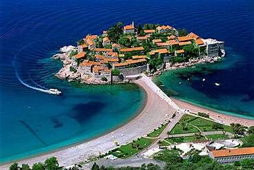
Aerial view over the island and beaches, Sveti Stefan, The Budva Riviera, Montenegro, Europe
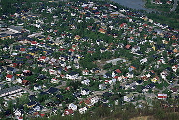
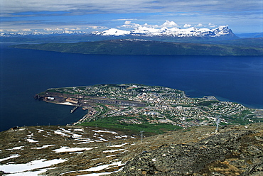
Tromso, Troms County, Norway, Scandinavia, Europe
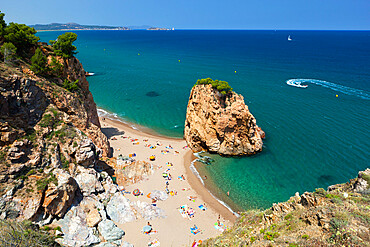
Illa Roja beach, Sa Riera, near Begur, Costa Brava, Catalonia, Spain, Mediterranean, Europe
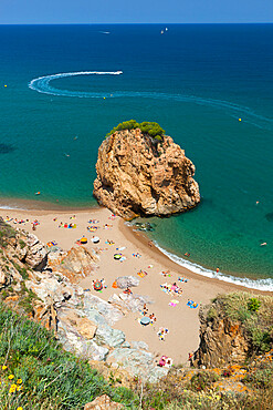
Illa Roja beach, Sa Riera, near Begur, Costa Brava, Catalonia, Spain, Mediterranean, Europe
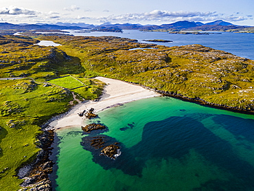
Aerial of white sand and turquoise water at Bosta Beach, Isle of Lewis, Outer Hebrides, Scotland, United Kingdom, Europe
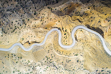
Aerial view by drone of hairpin bends of empty road along Danakil desert from above, Afar Region, Ethiopia, Africa

Aerial view of Oasis amidst rocks of Wadi Saba canyon, Melabday, Asso Bhole, Dallol, Danakil Depression, Afar, Ethiopia, Africa

Panoramic aerial view of the active Erta Ale volcano caldera, Danakil Depression, Afar Region, Ethiopia, Africa

Panoramic aerial view of sunset over the active Erta Ale volcano crater, Danakil Depression, Afar Region, Ethiopia, Africa

Aerial view of stone huts on top of majestic Erta Ale volcano, Danakil Depression, Afar Region, Ethiopia, Africa

Aerial panoramic of Lake Afrera (Lake Afdera) and salt flats, Danakil Depression, Afar Region, Ethiopia, Africa
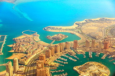
Aerial view of the Pearl-Qatar, the luxurious modern artificial island in the Persian Gulf, Venice at Qanat Quartier, Marsa Malaz Kempinski hotel and towers of Porto Arabia, Doha, Qatar, Middle East.

Aerial view of Tokyo city skyline with Asahi Beer Hall, Asahi Flame, Sumida River Bridges and Asakusa area, Tokyo, Japan, Asia

Aerial view the Gran Teatro de La Habana and El Capitolio, Havana, Cuba, West Indies, Caribbean, Central America
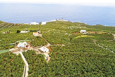
Aerial view of banana plantations. UNESCO Biosphere Site, La Palma, Canary Islands, Spain, Atlantic, Europe
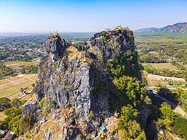
Aerial by drone of Kyauktalon Taung crag with a Hindu temple, near Mawlamyine, Mon state, Myanmar (Burma), Asia

Aerial by drone of the huge sitting Buddhas, Ko Yin Lay, Pupawadoy Monastery near Ye, Mon state, Myanmar (Burma), Asia
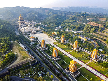
Aerial of Fo Guang Shan Monastery, Fo Guang Mountain (Shan), Taiwan, Asia
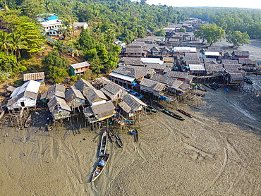
Aerial by drone of Fishing village on stilts in the mangroves of the Mergui (Myeik) Archipelago, Myanmar (Burma), Asia
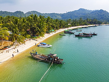
Aerial by drone of a Moken, sea gypsy village on a white sand beach, Mergui (Myeik) Archipelago, Myanmar (Burma), Asia
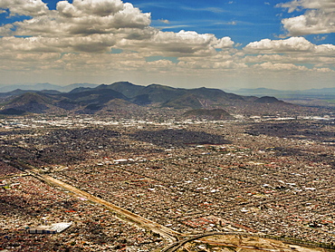
Aerial view of Mexico City, Mexico, North America
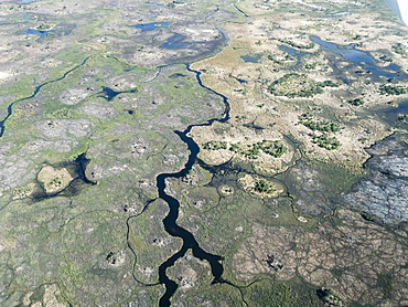
Aerial view of the Okavango Delta during drought conditions in early fall, Botswana, Africa
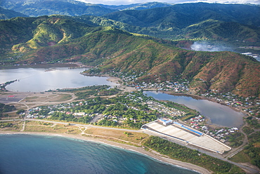
Aerial of Dili, East Timor, Southeast Asia, Asia

Aerial view of Burrow Mump Church on a beautiful autumn morning, Burrowbridge, Somerset, England, United Kingdom, Europe

Aerial view, marina, False Creek, Vancouver, British Columbia, Canada, North America
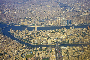
Aerial of the center of Cairo and the River Nile, Egypt, North Africa, Africa

Aerial of suburbs of Cairo with a little channel for irrigation, Egypt, North Africa, Africa

Aerial view, showing Yaletown, downtown, False Creek, Cambie Street Bridge, Vancouver, British Columbia, Canada, North America
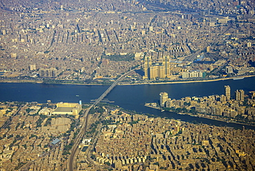
Aerial of the center of Cairo and the River Nile, Egypt, North Africa, Africa

Aerial view of St. Michael's Mount at dawn, Marazion, Cornwall, England, United Kingdom, Europe

Aerial vista of Trevose Head, Padstow Lifeboat Station and Mother Iveys Bay, North Cornwall, England, United Kingdom, Europe

Aerial view of St. Michael's Tower on Glastonbury Tor surrounded by a sea of mist in winter, Glastonbury, Somerset, England, United Kingdom, Europe

Aerial view of traditional dhow boats in the crystal sea, Pingwe, Michamvi, Zanzibar, Tanzania, East Africa, Africa
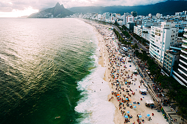
Aerial drone view of Ipanema and Leblon beaches, Rio de Janeiro, Brazil, South America

Aerial drone panorama of Ipanema and Copacabana beaches at sunset with Arpoador Rock closest to foreground and Sugarloaf Mountain visible, Rio de Janeiro, Brazil, South America
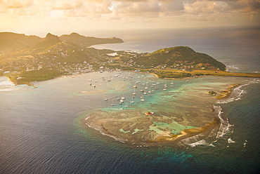
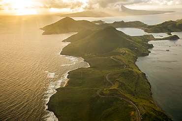
Aerial of Union Island at sunset, The Grenadines, St. Vincent and the Grenadines. Windward Islands, West Indies, Caribbean, Central America

Aerial view by drone of mist over Restormel Castle in Cornwall, England, United Kingdom, Europe

Aerial view by drone of Kingsbridge Estuary and Salcombe in Devon, England, United Kingdom, Europe
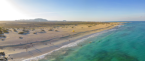
Aerial view of beach and the Atlantic Ocean, Corralejo Natural Park, Fuerteventura, Canary Islands, Spain, Atlantic, Europe
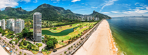
Aerial panoramic view of Gavea Beach in Sao Conrado, an upper-class neighbourhood in the west of Rio, Rio de Janeiro, Brazil, South America

Aerial view by drone of State Opera House, Varna, Bulgaria, Europe

Aerial view by drone of Mother of God Cathedral, Varna, Bulgaria, Europe
Aerial view of a corner of Barbuda, the Frigate Bird Sanctuary touches a thin strip of sand that separates the Caribbean Sea, Barbuda, Antigua and Barbuda, Leeward Islands, West Indies, Caribbean, Central America
Aerial view of the color contrasts of Barbuda, tones change according to the current and the difference of seafloor, Barbuda, Antigua and Barbuda, Leeward Islands, West Indies, Caribbean, Central America

Aerial view of a lagoon on the Caribbean island of Antigua a thin line of sand divides the small salt basin from the sea, Antigua, Leeward Islands, West Indies, Caribbean, Central America
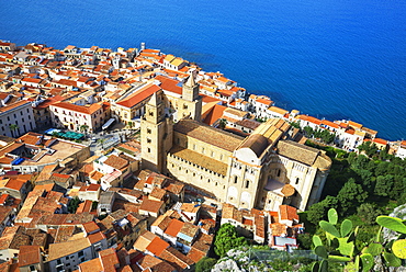
Aerial view of Cefalu from La Rocca, Cefalu, Sicily, Italy, Mediterranean, Europe
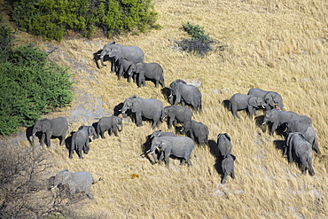
Aerial view of African elephants (Loxodonta africana), Okavango Delta, Botswana, Africa

Aerial view of the Okavango Delta, Botswana, Africa
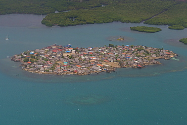
Aerial of a densely populated island, San Blas Islands, Kuna Yala, Panama, Central America
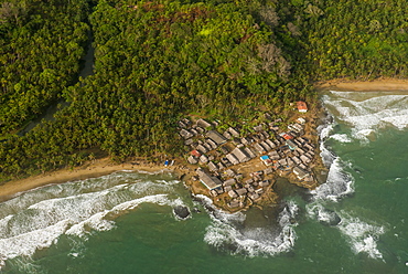
Aerial of a tiny village, San Blas Islands, Kuna Yala, Panama, Central America
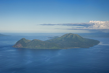
Aerial of Tongoa island, Shepherd Islands, Vanuatu, Pacific
Aerial of Ouvea, Loyalty Islands, New Caledonia, Pacific
Aerial of St. Kitts, St. Kitts and Nevis, West Indies, Caribbean, Central America
Aerial of St. Kitts, St. Kitts and Nevis, West Indies, Caribbean, Central America
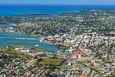
Aerial of Antigua, West Indies, Caribbean, Central America
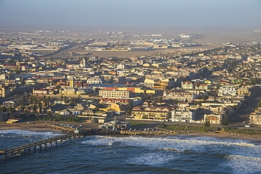
Aerial of Swakopmund, Namibia, Africa

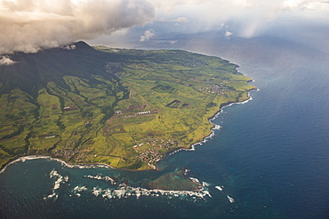
Aerial view, Chateau-d'Oex, Vaud, Swiss Alps, Switzerland, Europe
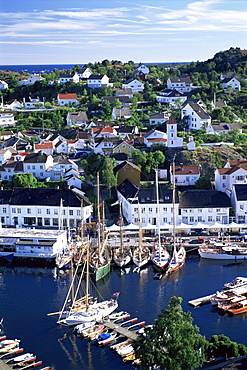
Risor, the White Town on the Skagerrak, south coast, Norway, Scandinavia, Europe
Aerial of Djibouti on the Horn of Africa, Africa

Aerial view of Villefranche, Alpes Maritimes, Cote d'Azur, French Riviera, Provence, France, Europe

Aerial view of tropical beach and palm trees, The Maldives, Indian Ocean, Asia (Drone)

Aerial view of Brisbane city after dark, Brisbane, Queensland, Australia, Pacific
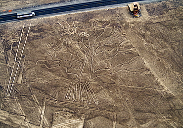
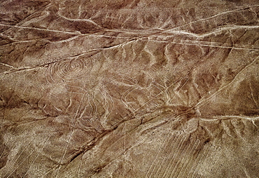
The Tree Geoglyph, aerial view, Nazca, UNESCO World Heritage Site, Ica Region, Peru, South America
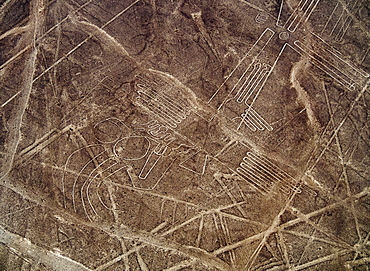
The Bird Geoglyph, aerial view, Nazca, UNESCO World Heritage Site, Ica Region, Peru, South America
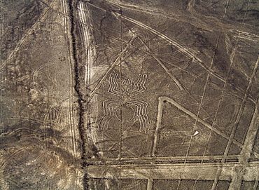
The Spider Geoglyph, aerial view, Nazca, UNESCO World Heritage Site, Ica Region, Peru, South America
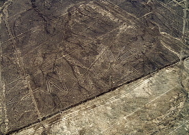
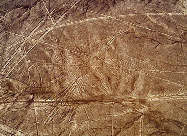
The Heron Geoglyph, aerial view, Nazca, UNESCO World Heritage Site, Ica Region, Peru, South America
The Monkey Geoglyph, aerial view, Nazca, UNESCO World Heritage Site, Ica Region, Peru, South America
The Condor Geoglyph, aerial view, Nazca, UNESCO World Heritage Site, Ica Region, Peru, South America
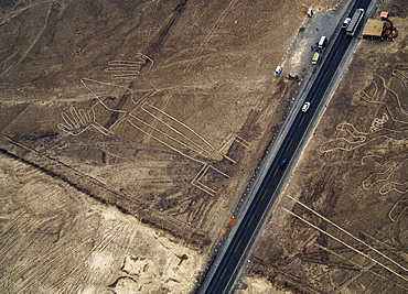
The Lizard Geoglyph, aerial view, Nazca, UNESCO World Heritage Site, Ica Region, Peru, South America
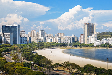
Aerial view of Botafogo Beach, Rio de Janeiro, Brazil, South America
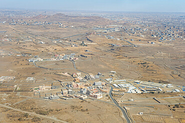
Aerial of Abha, Saudi Arabia, Middle East