Results
« Previous 1 … 10 11 12 13 14 … 44 Next »
4396 results found
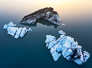
Aerial view taken by drone of iceberg in Jokusarloon Glacier Lagoon during a summer day, Iceland, Polar Regions
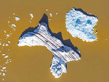
Aerial view taken by drone of iceberg in Fjallsjokull Glacier Lagoon during a summer day, Iceland, Polar Regions
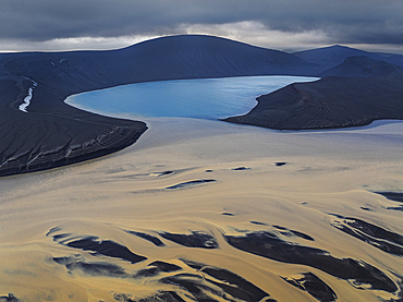
Aerial view taken by drone of Skyggnisvtn lake in Landmannalaugar area, during a summer day, Iceland, Polar Regions
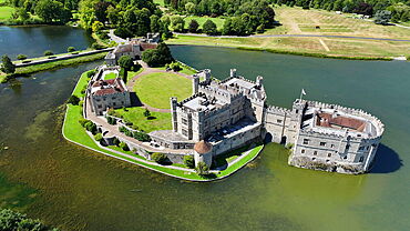
Aerial view of Leeds Castle and moat, southeast of Maidstone, Kent, England, United Kingdom, Europe
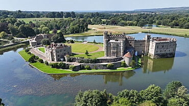
Aerial view of Leeds Castle and moat, southeast of Maidstone, Kent, England, United Kingdom, Europe
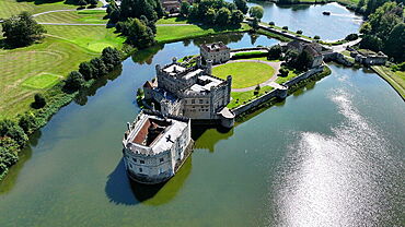
Aerial view of Leeds Castle and moat, southeast of Maidstone, Kent, England, United Kingdom, Europe
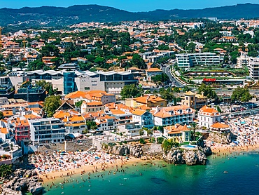
Aerial view of Cascais beaches and colourful rooftops of coastal town under bright sunlight with Sintra mountains in the background, Cascais, Portugal, Europe
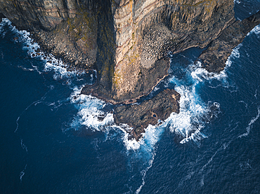
Aerial view of the rugged coastline of the Faroe Islands, showcasing towering sea cliffs that plunge into the deep blue ocean.
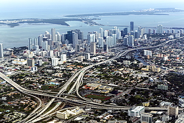
Aerial view of Miami, Florida, United States of America, North America
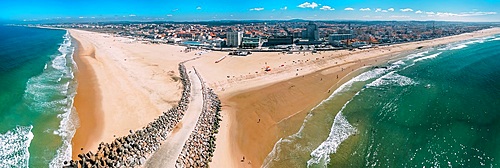
Aerial drone panoramic view of Espinho, near Porto, Norte, Portugal, Europe
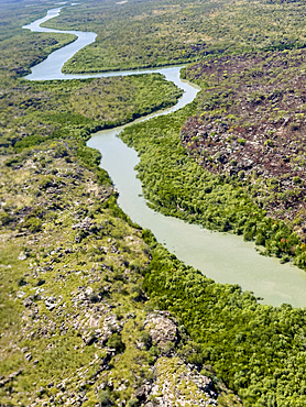
A view of the Mitchell River meandering towards Swift Bay as seen from a commercial helicopter, Kimberley, Western Australia, Australia, Pacific

A view of the Mitchell River meandering towards Swift Bay as seen from a commercial helicopter, Kimberley, Western Australia, Australia, Pacific
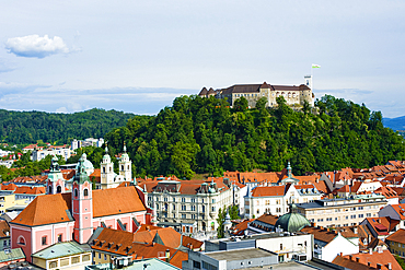
An aerial view of the city centre and Castle Hill, Ljubljana, Slovenia, Europe
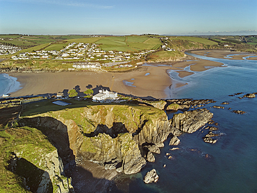
An aerial view of Burgh Island, Bigbury, and the estuary of the River Avon, on the south coast of Devon, England, United Kingdom, Europe
An aerial view of Burgh Island, Bigbury, and the estuary of the River Avon, on the south coast of Devon, England, United Kingdom, Europe
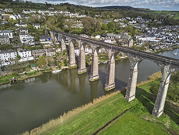
A view of the River Tamar at Calstock, with a railway viaduct crossing it, on the Devon-Cornwall border, Cornwall, England, United Kingdom, Europe
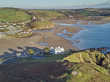
An early morning view of the town of Salcombe beside the Kingsbridge Estuary, Devon, England, United Kingdom, Europe
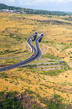
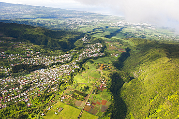
Aerial view over the 'Route des Tamarins' and the tunnel, the highway N1 on the west coast near Saint-Paul, Reunion island, overseas departement of France,Indian Ocean
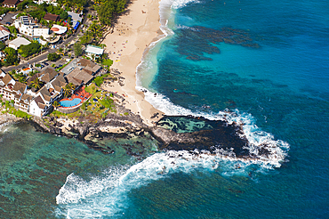
Boucan Canot hotel,aerial view of lagoon west coast , Saint-Gilles-les-Bains. Reunion island,overseas departement of France,Indian Ocean
Boucan Canot hotel,aerial view of lagoon west coast , Saint-Gilles-les-Bains. Reunion island,overseas departement of France,Indian Ocean
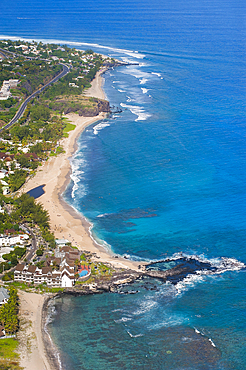
Aerial view of lagoon west coast , Saint-Leu. Reunion island,overseas departement of France,Indian Ocean
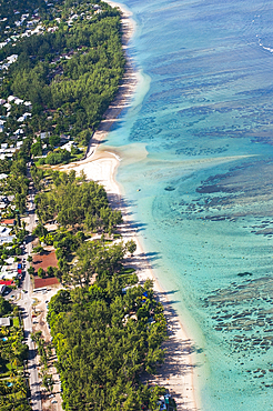
Aerial view of the lagoon on the west coast at Saint-Gilles les Bains, Reunion island,overseas departement of France,Indian Ocean
Aerial view over the West Coast,Reunion island,overseas departement of France,Indian Ocean
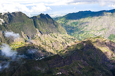
Aerial view, Cilaos Cirque, Reunion island, overseas departement of France, Indian Ocean
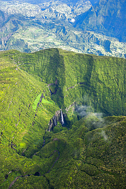
Aerial view of falls in the canyon Trou de Fer, Reunion island, overseas departement of France, Indian Ocean
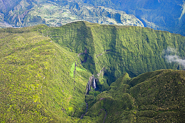
Aerial view of falls in the canyon Trou de Fer, Reunion island, overseas departement of France, Indian Ocean
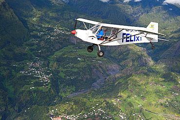
Aerial view of an ULM (Ultralight aviation) flying above the northwestern coast, Reunion island, overseas departement of France, Indian Ocean
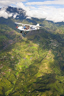
Aerial view of an ULM (Ultralight aviation) flying above the northwestern coast, Reunion island, overseas departement of France, Indian Ocean
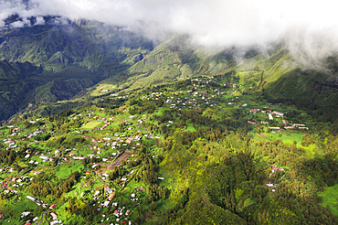
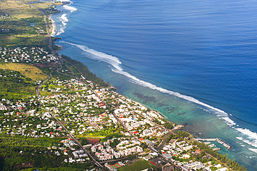
Aerial view over the northwestern coast,Reunion island,overseas departement of France,Indian Ocean
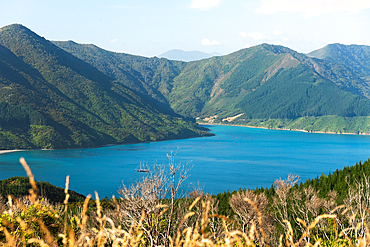
Aerial View of Serene Inlet Surrounded by Lush Green Hills in Queen Charlotte Sound, Marlborough Sounds, New Zealand
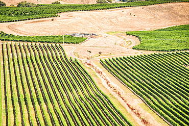
Aerial View of Vineyard Rows and Central Irrigation Circle Surrounded by Hills Near Blenheim, Marlborough, New Zealand
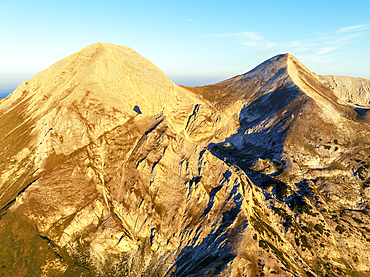
Vihren Peak, 2914m, Bansko, Pirin National Park, UNESCO World Heritage Site, Bulgaria, Europe
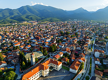
Old Town, Bansko, near the Pirin National Park, Bulgaria, Europe
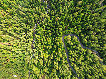
Aerial view of forest near Bansko, Pirin National Park, UNESCO World Heritage Site, Bulgaria, Europe
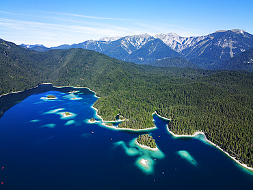
Aerial drone view of Eibsee lake, Garmisch Partenkirchen, Bavaria, Germany, Europe
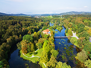
Aerial drone view of Otocec Castle, 13th to 17th century construction, Slovenia, Europe
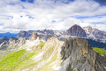
Aerial view of Giau Pass, Ra Gusela, Nuvolau, Averau and Tofane mountains, Dolomites, Belluno province, Veneto, Italy, Europe
Aerial view of 'Pointe Allegre' (the northest headland of Basse-Terre), Grand Cul-de-sac Marin, Sainte-Rose, Basse-Terre, Guadeloupe, overseas region of France,Leewards Islands, Lesser Antilles, Caribbean
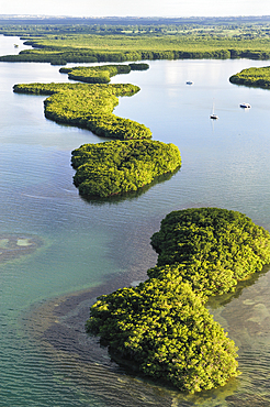
Aerial view of mangrove swamp, Grand Cul-de-sac Marin, Sainte-Rose, Basse-Terre, Guadeloupe, overseas region of France,Leewards Islands, Lesser Antilles, Caribbean
Aerial view of the coast at Sainte-Rose, Grand Cul-de-sac Marin, Sainte-Rose, Basse-Terre, Guadeloupe, overseas region of France,Leewards Islands, Lesser Antilles, Caribbean
Aerial view of 'Pointe Nogent', Grand Cul-de-sac Marin, Sainte-Rose, Basse-Terre, Guadeloupe, overseas region of France,Leewards Islands, Lesser Antilles, Caribbean
Aerial view of the coast between Plessis-Nogent and Sainte-Rose, Grand Cul-de-sac Marin, Sainte-Rose, Basse-Terre, Guadeloupe, overseas region of France,Leewards Islands, Lesser Antilles, Caribbean
Aerial view of Caret Islet, Grand Cul-de-sac Marin, off the coast of Sainte-Rose, Basse-Terre, Guadeloupe, overseas region of France,Leewards Islands, Lesser Antilles, Caribbean
Aerial view of mangrove swamp, Grand Cul-de-sac Marin, Sainte-Rose, Basse-Terre, Guadeloupe, overseas region of France,Leewards Islands, Lesser Antilles, Caribbean
Aerial view of mangrove swamp, Grand Cul-de-sac Marin, Sainte-Rose, Basse-Terre, Guadeloupe, overseas region of France,Leewards Islands, Lesser Antilles, Caribbean
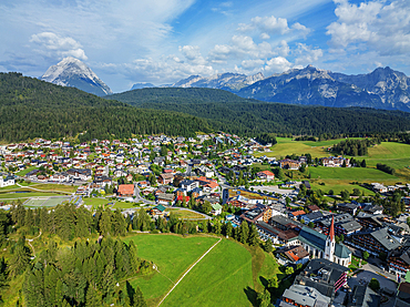
Aerial drone view, Seefeld, Tyrol, Austrian Alps, Austria, Europe
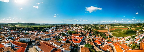
Aerial drone panoramic view of Obidos, a town in the Oeste region, historical province of Estremadura and Leiria district, Portugal, Europe

Aerial view of tourist admiring the colorful starfish snorkeling in the turquoise lagoon, Zanzibar, Tanzania, East Africa, Africa
Aerial view of tourists at the historic Sao Miguel Arcanjo lighthouse overlooking Nazare's stunning coastline with giant waves, enjoying spectacular views, Nazare, Oeste, Estremadura, Portugal, Europe
Aerial view of tourists at the historic Sao Miguel Arcanjo lighthouse overlooking Nazare's stunning coastline with giant waves, enjoying spectacular views, Nazare, Oeste, Estremadura, Portugal, Europe
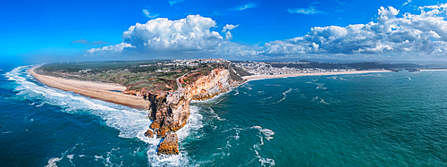
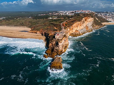
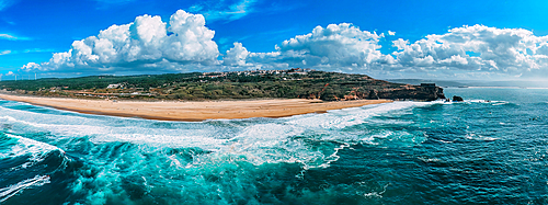
A breathtaking aerial drone panoramic view of Nazare's coastline with towering cliffs meeting the ocean, and waves crashing onto the sandy beach, Nazare, Oeste, Estremadura, Portugal, Europe
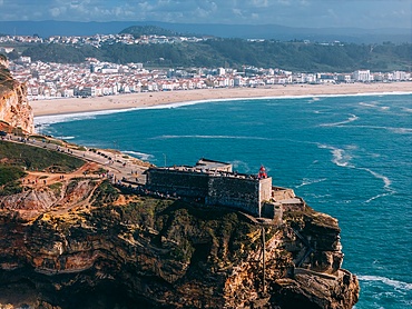
Aerial view of tourists at the historic Sao Miguel Arcanjo lighthouse overlooking Nazare's stunning coastline with giant waves, enjoying spectacular views, Nazare, Oeste, Estremadura, Portugal, Europe
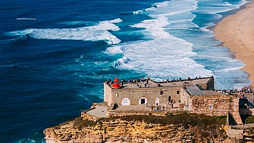
Aerial view of tourists at the historic Sao Miguel Arcanjo lighthouse overlooking Nazare's stunning coastline with giant waves, enjoying spectacular views, Nazare, Oeste, Estremadura, Portugal, Europe
Aerial view of tourists at the historic Sao Miguel Arcanjo lighthouse overlooking Nazare's stunning coastline with giant waves, enjoying spectacular views, Nazare, Oeste, Estremadura, Portugal, Europe
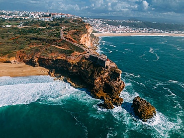
Aerial drone panoramic view of Nazare coastline showcasing beautiful beach, vibrant surf and rocky pier, Nazare, Oeste, Estremadura, Portugal, Europe
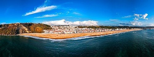
Aerial drone panoramic view of Nazare beach and Nazare city on a sunny day, Nazare, Oeste, Estremadura, Portugal, Europe
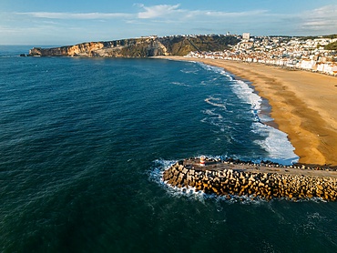
Aerial drone view of Nazare coastline showcasing beautiful beach, vibrant surf and rocky pier, Nazare, Oeste, Estremadura, Portugal, Europe
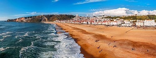
Aerial drone panoramic view of North Beach, with the iconic Sao Miguel Arcanjo lighthouse on the right, as well as the city of Nazare, Oeste, Estremadura, Portugal, Europe
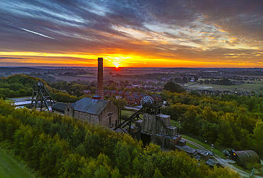
Aerial view of pit headstocks at Pleasley Country Park during sunset, Pleasley, Bolsover, Derbyshire, England, United Kingdom, Europe

Aerial view of Victoria Quays and Sheffield city skyline at dusk, Sheffield, South Yorkshire, England, United Kingdom, Europe
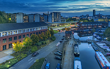
Aerial view of Victoria Quays and Sheffield city skyline at dusk, Sheffield, South Yorkshire, England, United Kingdom, Europe
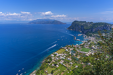
View of Grande Marina from Anacapri panorama view point, Anacapri, Isle of Capri, Bay of Naples, Campania, Italy, Mediterranean, Europe
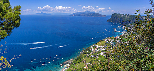
View of Grande Marina from Anacapri panorama view point, Anacapri, Isle of Capri, Bay of Naples, Campania, Italy, Mediterranean, Europe
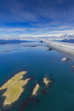
Aerial View of the Beagle Channel and the town of Ushuaia, Argentina, South America
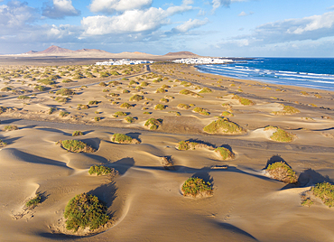
Aerial view of a tourist and sand dunes of Famara Beach at sunrise, Caleta de Famara, Las Palmas, Lanzarote, Canary Islands, Spain, Atlantic, Europe
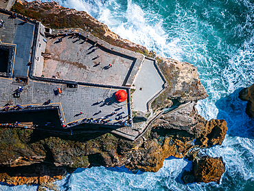
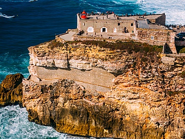
Aerial drone top down view of Nazare lighthouse with waves crashing on rocks beneath, Nazare, Oeste, Estremadura, Portugal, Europe
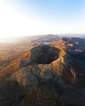
Aerial view of the crater of Volcan de la Corona at sunrise, Haria, Las Palmas, Lanzarote, Canary Islands, Spain, Atlantic, Europe
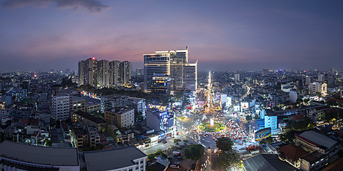
Aerial view of Saigon at dusk, Ho Chi Minh City, Vietnam
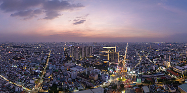
Aerial view of Saigon at dusk, Ho Chi Minh City, Vietnam
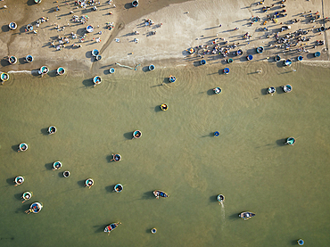
Aerial view of fishing boats, Mũi Né, Bình Thuận Province, Vietnam
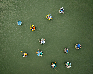
Aerial view of fishing boats, Mũi Né, Bình Thuận Province, Vietnam
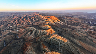
Aerial view of desert mountains and volcanic landscape at sunset from Sicasumbre viewpoint, Fuerteventura, Canary Islands, Spain
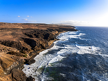
Aerial view of volcanic landscape surrounding La Pared beach washed by waves at sunset, Fuerteventura, Canary Islands, Spain
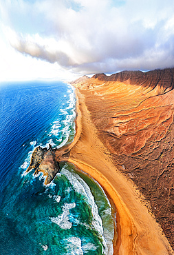
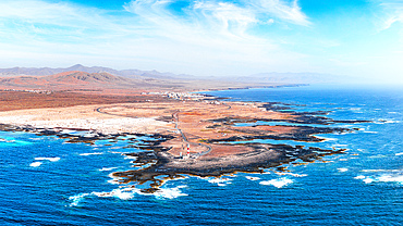
Aerial view of volcanic cliffs overlooking Cofete beach washed by waves, Jandia Nature Park, Fuerteventura, Canary Islands, Spain
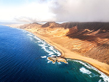
Aerial view of the wild Cofete beach in between volcanic mountains and sea, Jandia Natural Park, Fuerteventura, Canary Islands
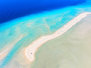
Blue and turquoise shades of sea washing the white sand of Sotavento beach, aerial view, Fuerteventura, Canary Islands, Spain
Aerial view of El Toston Lighthouse on volcanic coastline, El Cotillo, Fuerteventura, Canary Islands, Spain
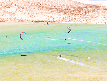
Aerial view of kitesurfers surrounded by volcanic cliffs, Sotavento beach, Jandia, Fuerteventura, Canary Islands, Spain
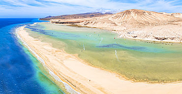
Aerial view of kite surfers having fun at Sotavento beach, Jandia Natural Park, Fuerteventura, Canary Islands, Spain
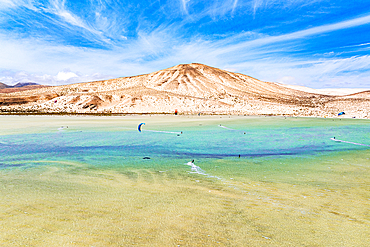
Aerial view of kiteboarders framed by volcanic peaks, Sotavento beach, Jandia, Fuerteventura, Canary Islands, Spain
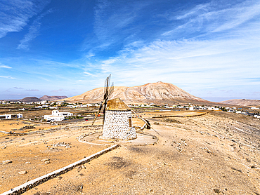
Aerial view of the traditional whitewashed windmill Molinos De Villaverde, Fuerteventura, Canary Islands, Spain
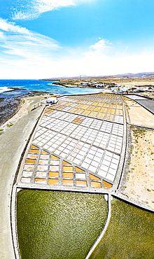
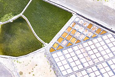
Panoramic aerial view of salt flats overlooking the ocean, Las Salinas Del Carmen, Fuerteventura, Canary Islands, Spain
Panoramic aerial view of salt flats overlooking the ocean, Las Salinas Del Carmen, Fuerteventura, Canary Islands, Spain
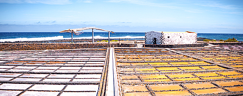
Salt flats and traditional village, aerial view, Las Salinas del Carmen, Fuerteventura, Canary Islands, Spain
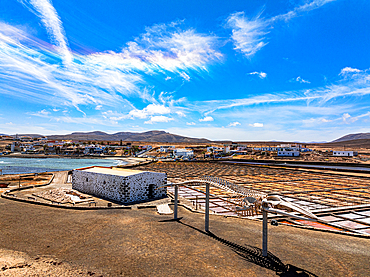
Aerial view of Las Salinas del Carmen salt flats, Fuerteventura, Canary Islands, Spain
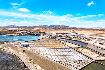
Aerial view of Las Salinas del Carmen salt flats, Fuerteventura, Canary Islands, Spain
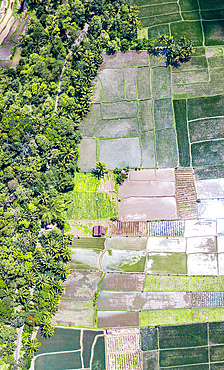
Aerial view of colorful patterned rice terraces and palm trees, Bali, Indonesia
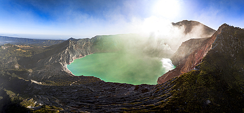
Aerial view of smoke above the turquoise lake on crater of Kawah Ijen volcano, Banyuwangi, East Java, Indonesia
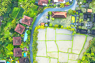
Aerial view of a winding road through paddy fields and traditional rural houses, Ubud, Bali, Indonesia
Pizzo Scalino peak covered with snow at dawn in autumn, aerial view, Valmalenco, Sondrio province, Valtellina, Lombardy, Italy
Aerial view of the snowy Bernina Range, Campo Moro dam and reservoir at sunrise in autumn, Valmalenco, Lombardy, Italy

Aerial view of Grignetta (Grigna Meridionale) emerging from autumn fog, Lake Como, Lombardy, Italy
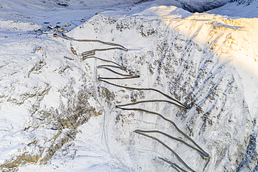
Narrow bends of the Stelvio Pass road on steep snowy mountain ridge, aerial view by drone, Bolzano province, South Tyrol side, Italy, Europe
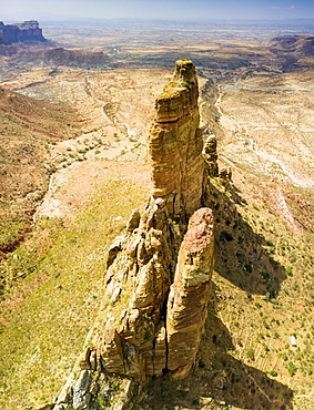
Aerial view of Gheralta Mountains pinnacles and access trail to the old Abuna Yemata Guh church, Tigray Region, Ethiopia, Africa

Aerial drone panoramic view of Largo do Intendente Pina Manique in Lisbon, Portugal, Europe

Aerial drone panoramic view of Largo do Intendente Pina Manique in Lisbon, Portugal, Europe
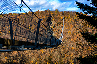
Geierlay suspension bridge in an autumn landscape with trees, Rhineland-Palatinate, Germany, Europe
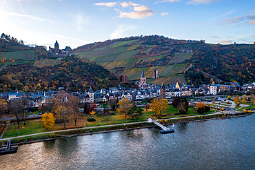
Aerial drone view of Bacharach, a traditional German village with the River Rhine, Rhineland-Palatinate, Germany, Euyrope
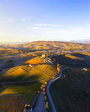
Aerial view of Grinzane Cavour at sunrise during autumn, Cuneo, Langhe and Roero, Piedmont, Italy, Europe
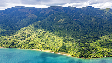
Aerial of Gombe Stream National Park, Lake Tanganyika, Tanzania, East Africa, Africa