Results
« Previous 1 … 12 13 14 15 16 … 22 Next »
2105 results found
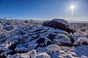
Snow covered landscape, Chino Valley, Arizona, USA
Snow covered landscape, Chino Valley, Arizona, USA
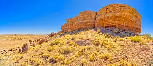
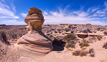
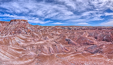
A butte of Bentonite clay, The Painted Desert, USA

Pink and red balloons in front of Eiffel tower, Paris, France

An Indian dwelling in Petrified Forest National Park called the Agate House, built between 1030AD and 1300AD, Arizona, United States of America, North America
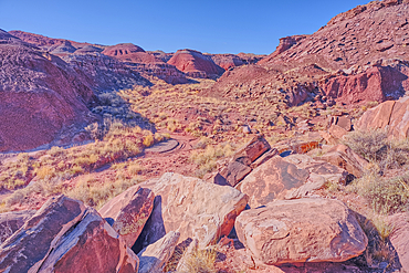
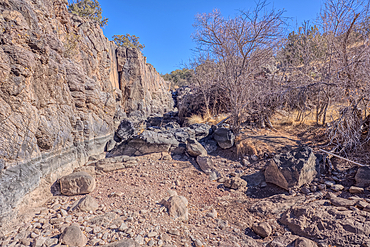
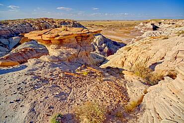
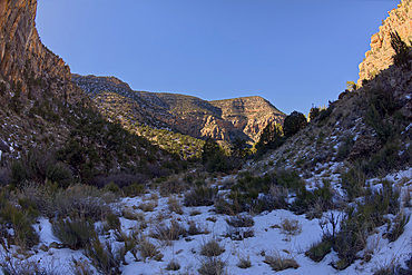
An unnamed canyon that leads to Dead Wash in Petrified Forest National Park, Arizona, United States of America
An island of rock in an unnamed canyon that leads to Dead Wash in Petrified Forest National Park, Arizona, United States of America
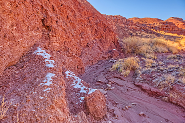
Patches of snow in the shade of a hill in Dead Wash at Petrified Forest National Park, Arizona, United States of America
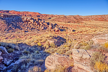
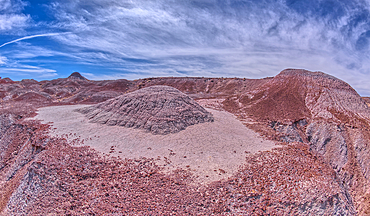
Boulder pile in a valley leading to Dead Wash, Petrified Forest National Park, Arizona, United States of America
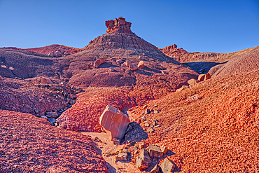
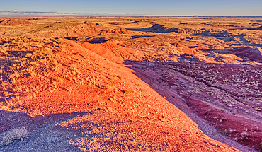
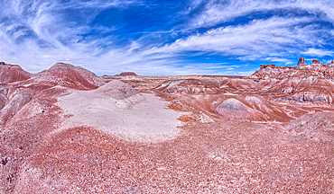
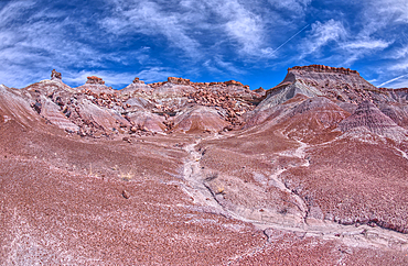
Red hills of bentonite clay overlooking Dead Wash in Petrified Forest National Park, Arizona, United States of America
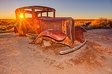
An old Model-T placed as a marker for the Route 66 Road Alignment in Petrified Forest National Park, Arizona, United States of America
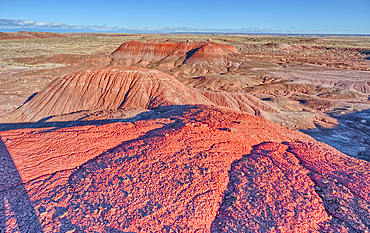
Cliff view of Dead Wash Valley in Petrified Forest National Park, at sundown, Arizona, United States of America
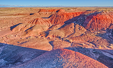
Red hills of bentonite clay overlooking Dead Wash in Petrified Forest National Park, Arizona, United States of America

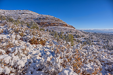
Wet Beaver Creek Canyon viewed from the south end of White Mesa in Coconino National Forest, Arizona, United States of America
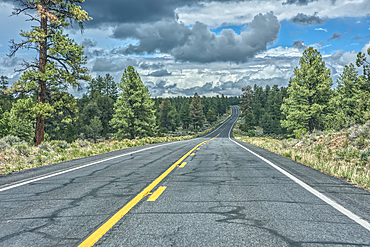
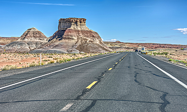
State Route 64 heading north to Grand Canyon South Rim, Arizona, USA
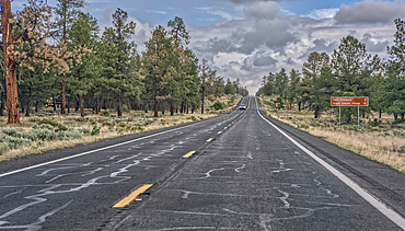
A sign along State Route 64 in Arizona marking 5 miles to Grand Canyon National Park, Arizona, USA
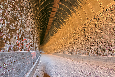
Interior view of the Johnson Canyon Railroad Tunnel, Kaibab National Forest of Arizona, USA

Holy Quran with Muslim prayer beads and Bible with rosary, Interfaith symbols between Christianity and Islam, Ho Chi Minh City, Vietnam
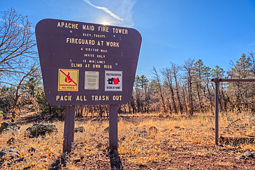
An information sign on the summit of Apache Maid Mountai, Coconino National Forest, Arizona, United States of America
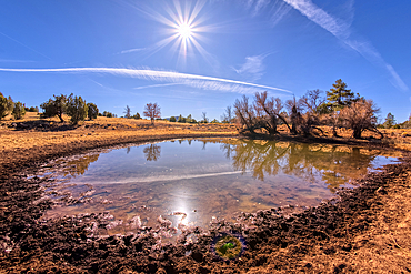
A cattle pond, Rarick Tank, Coconino National Forest, Arizona, United States of America
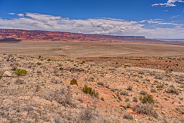
View of Vermilion Cliffs Arizona from US89A from and overlook above House Rock Valley.
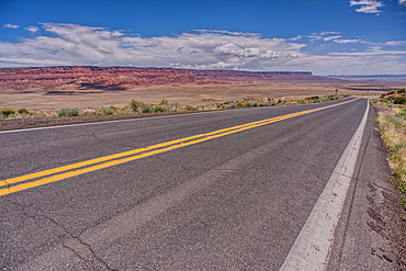
View of Vermilion Cliffs Arizona from US89A ascending to the Kaibab Plateau.
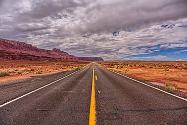
View of Echo Cliffs near Marble Canyon Arizona from US89A on a mostly cloudy day. This section of the cliffs is near the little town of Bitter Springs on the Navajo Reservation adjacent to the Vermilion Cliffs National Monument.
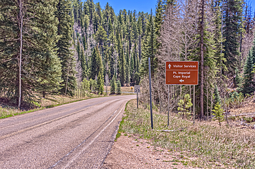
Directional sign pointing the way to Point Imperial and Cape Royal, Grand Canyon National Park, Arizona, USA
The junction where the Transept Trail meets the Bright Angel Point Trail on the North Rim of Grand Canyon, Grand Canyon National Park, UNESCO World Heritage Site, Arizona, United States of America, North America

An overlook along the Transept Trail with Oza Butte just right of center at Grand Canyon North Rim, Grand Canyon National Park, UNESCO World Heritage Site, Arizona, United States of America, North America
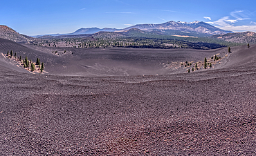
Volcanic cinder rim in Coconino National Forest, Arizona, USA
Basalt boulders and cliffs, Johnson Canyon between Bainbridge Steel and Stone Dams, Kaibab National Forest, Arizona, United States of America

Bouquet on bench, United Kingdom, Europe

Wedding images, United Kingdom, Europe
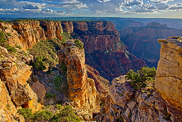
Pillars of rock standing just away from the cliff of the Grand Canyon south of Zuni Point with Moran Point in the distance, Grand Canyon National Park, UNESCO World Heritage Site, Arizona, United States of America, North America
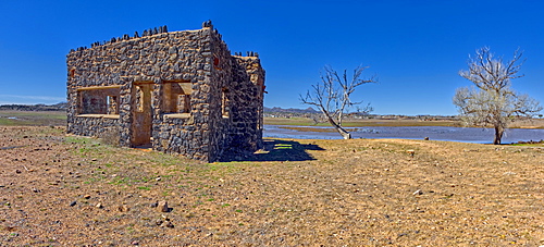
The ruins of a stone house built in the 1930s as part of a WPA Project in Paulden, abandoned at the start of WWII, Arizona, United States of America, North America
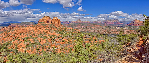
Panorama view of Cathedral Rock and Sedona from the HiLine Trail Vista, Arizona, United States of America, North America
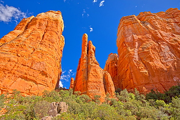
The Central Spires of Cathedral Rock viewed from the west side of the formation, Sedona, Arizona, United States of America, North America
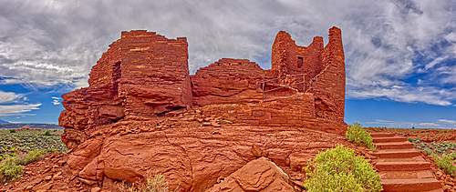
A low angle exterior closeup view of the Wukoki Pueblo at the Wupatki National Monument, Arizona, United States of America, North America
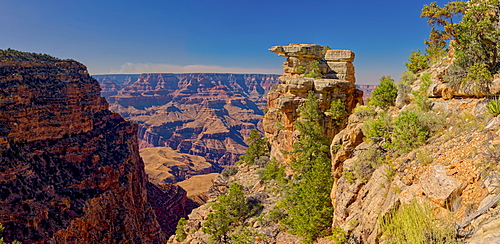
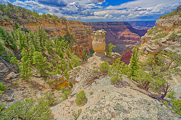
Stone pillars overlooking Papago Creek Canyon on the south rim of the Grand Canyon, Grand Canyon National Park, UNESCO World Heritage Site, Arizona, United States of America, North America
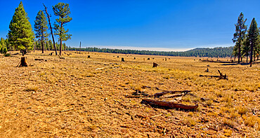
Meadow near Williams known as Sunflower Flat Wildlife Preserve, normally a wetland now dry due to Arizona's drought, Arizona, United States of America, North America
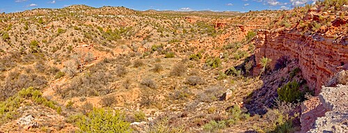
A canyon in Dead Horse Ranch State Park along the historic Lime Kiln Trail, Cottonwood, Arizona, United States of America, North America
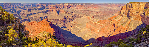
Grand Canyon viewed from the vista of Mohave Point along the Hermit Road, Grand Canyon National Park, UNESCO World Heritage Site, Arizona, United States of America, North America
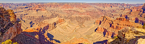
Panorama of Grand Canyon viewed from Powell Point along the Hermit Road, Grand Canyon National Park, UNESCO World Heritage Site, Arizona, United States of America, North America
A rock formation called Agate Mesa, Petrified Forest National Park, Arizona, United States of America, North America
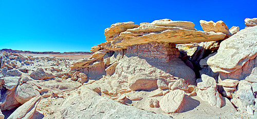
A hoodoo shaped like a table top, on a cliff along the Blue Mesa in Petrified Forest National Park, Arizona, United States of America, North America

Icelandic horses near Vik, Iceland, Polar Regions
A hoodoo ridge in Devil's Playground at Petrified Forest National Park, Arizona, United States of America, North America
A rock bridge in Devil's Playground where Trolls could hide, Petrified Forest National Park, Arizona, United States of America, North America
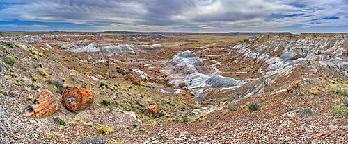
View of Jasper Forest in Petrified Forest National Park Arizona from the southern side of Agate Plateau.
Loki's Rock at Grand Canyon east of Thor's Hammer Overlook, Grand Canyon National Park, UNESCO World Heritage Site, Arizona, United States of America, North America

The overhang of a sandstone mesa, a fossilized sand dune, at Ferry Swale in the Glen Canyon Recreation Area near Page, Arizona, United States of America, North America
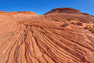
View from the top of a wavy sandstone mesa, a fossilized sand dune, at Ferry Swale in the Glen Canyon Recreation Area near Page, Arizona, United States of America, North America
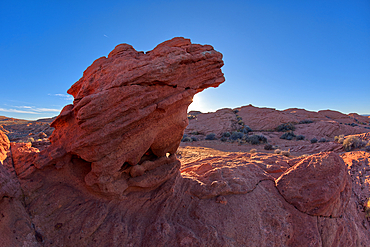
A sandstone hoodoo at Ferry Swale in the Glen Canyon Recreation Area near Page, Arizona, United States of America, North America
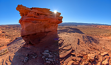
Sandstone hoodoo formation north of the Horseshoe Bend Overlook along the Colorado River in Page, Arizona, United States of America, North America
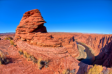
Hoodoos on top of a ridge of sandstone near the Spur Canyon at Horseshoe Bend, Arizona, United States of America, North America
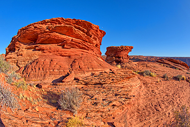
A hoodoo shaped like a vulture's head, at Horseshoe Bend in the Glen Canyon Recreation Area, near Page, Arizona, United States of America, North America
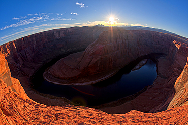
Horseshoe Bend in the Glen Canyon Recreation Area at sundown, near Page, Arizona, United States of America, North America
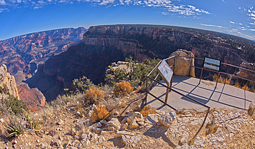
The Trailview Overlook East Vista at Grand Canyon South Rim, just off Hermit Road, Grand Canyon, UNESCO World Heritage Site, Arizona, United States of America, North America
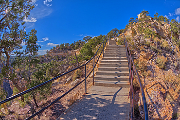
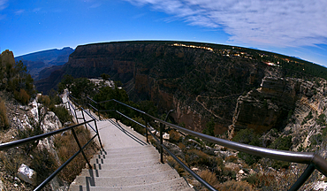
Stairway leading down to the Trailview Overlook East Vista at Grand Canyon South Rim, off Hermit Road, Grand Canyon, Arizona, United States of America, North America
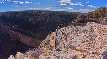
The Trailview Overlook East Vista at Grand Canyon South Rim, just off Hermit Road, Grand Canyon, UNESCO World Heritage Site, Arizona, United States of America, North America
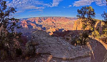
Grand Canyon view from a cliff between Hopi Point and Mohave Point, Grand Canyon, UNESCO World Heritage Site, Arizona, United States of America, North America
View of Grand Canyon Arizona from the west side of Mohave Point near sundown, UNESCO World Heritage Site, Arizona, United States of America, North America
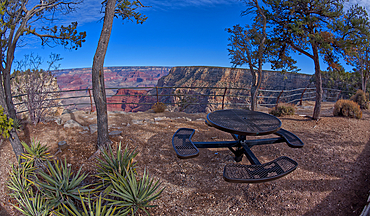
Steel picnic table along the rim trail overlooking Grand Canyon South Rim off Hermit Road halfway between Monument Creek Vista and The Abyss, Grand Canyon, Arizona, United States of America, North America
A warning sign at the start of the Hermit Canyon Trail stating that getting to the bottom is optional, but getting back to the top is mandatory, Grand Canyon, Arizona, United States of America, North America
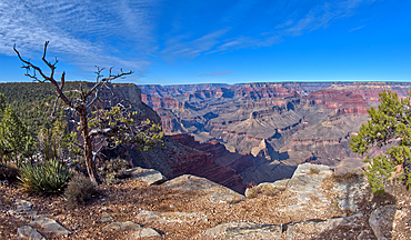
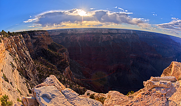
The cliffs of Grand Canyon west of Monument Creek Vista, Grand Canyon National Park, UNESCO World Heritage Site, Arizona, United States of America, North America
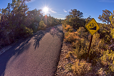
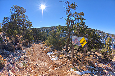
The paved Greenway trail west of Monument Creek Vista with a sign warning cyclists of a steep gradient ahead, Grand Canyon, Arizona, United States of America, North America
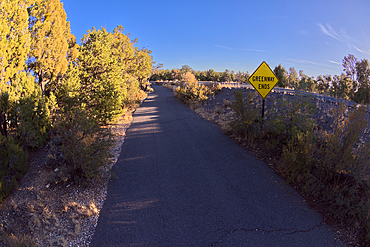
Sign marking the end of the paved Greenway Trail that runs between Monument Creek Vista and Pima Point, Grand Canyon, Arizona, United States of America, North America
Steps leading down to Trailview Overlook under moonlight, Grand Canyon, Arizona, United States of America, North America
Waldron Canyon viewed from near its end, southwest of Hermit Canyon in winter, Grand Canyon, Arizona, United States of America, North America
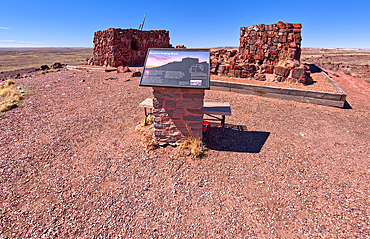
An information sign detailing the history of Agate House in Petrified Forest National Park, Arizona, United States of America, North America
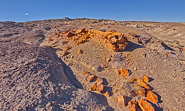
A petrified tree log that has shattered over time, located on a mesa near Hamilili Point on the south end of Petrified Forest National Park, Arizona, United States of America, North America
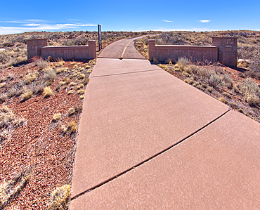
The gateway to the Long Logs Trail and Agate House in Petrified Forest National Park, Arizona, United States of America, North America
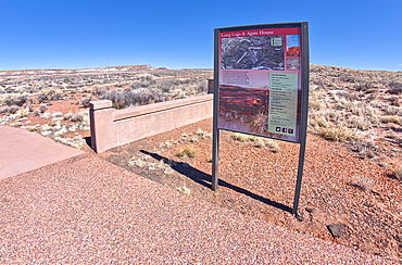
The map sign at the gateway for the Long Logs Trail and Agate House in Petrified Forest National Park, Arizona, United States of America, North America
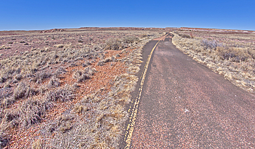
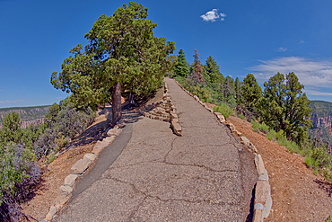
The paved path, that used to be an old road, leading to the Long Logs Trail and Agate House in Petrified Forest National Park, Arizona, United States of America, North America
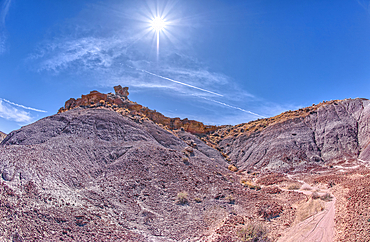
Crumbling islands of rock near Hamilili Point in Petrified Forest, Arizona, United States of America, North America
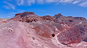
View from below a ridge that overlooks the Jim Camp Wash on the south end of Petrified Forest National Park, Arizona, United States of America, North America
A hoodoo called the Zuni Warrior on the edge of a cliff near Hamilili Point, Hamilili is Zuni meaning petrified wood, Petrified Forest National Park, Arizona, United States of America, North America
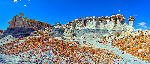
A small hill of gray bentonite clay that appears to be melting into the purple bentonite of Hamilili Valley on the south end of Petrified Forest National Park, Arizona, United States of America, North America
Crumbling cliffs of a mesa near Hamilili Point in Petrified Forest, Arizona, United States of America, North America
A small hill of gray bentonite clay that appears to be melting into the purple bentonite of Hamilili Valley on the south end of Petrified Forest National Park, Arizona, United States of America, North America
Purple hills of volcanic bentonite near Hamilili Point on the south end of Petrified Forest National Park, Arizona, United States of America, North America

Yellow cab in a street in San Francisco area, Panama City, Republic of Panama, Central America
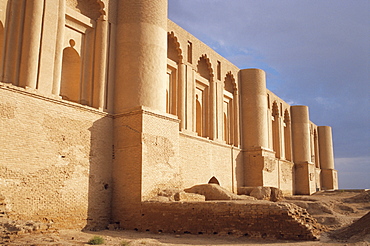
Palace of Love, Samarra, Iraq, Middle East
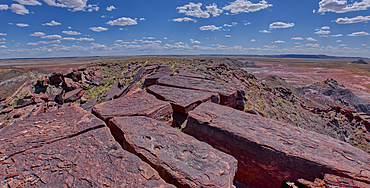
The summit of Haystack Mesa in Petrified Forest National Park, Arizona, United States of America, North America
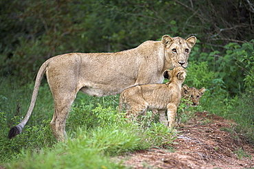
Lioness (Panthera leo), with cubs, Kruger National Park, South Africa, Africa
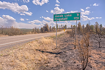
Road sign along US89A north of Jacob Lake Arizona that has been partially damaged by the White Sage Fire.
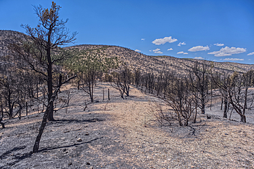
Scorched Earth and burned trees from the White Sage Wildfire near Jacob Lake Arizona in the Kaibab National Forest.
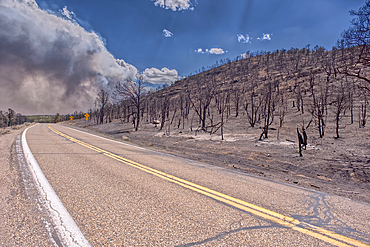
Scorched Earth and burned trees from the White Sage Wildfire near Jacob Lake Arizona in the Kaibab National Forest.
Scorched Earth and burned trees from the White Sage Wildfire near Jacob Lake Arizona in the Kaibab National Forest.
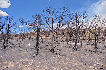
Scorched Earth and burned trees from the White Sage Wildfire near Jacob Lake Arizona in the Kaibab National Forest.
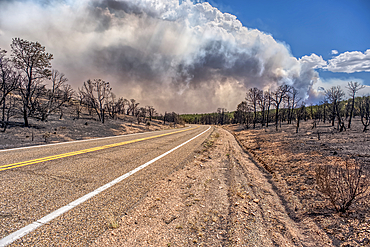
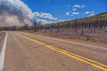
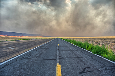
Smoke from the Dragon Bravo Wildfire burning on Grand Canyon North Rim billowing off the Kaibab Plateau. Viewed north of US89A across from Vermilion Cliffs.
Scorched Earth and burned trees from the White Sage Wildfire near Jacob Lake Arizona in the Kaibab National Forest.
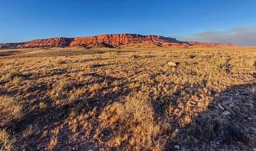
Vermilion Cliffs National Monument Arizona near sunset with smoke in the sky from the Dragon Bravo Wildfire burning on North Rim in the background.
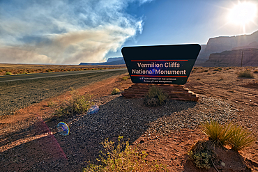
Sign for Vermilion Cliffs National Monument Arizona near sunset with smoke in the sky from the Dragon Bravo Wildfire burning on North Rim.
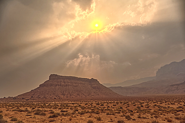
Sun shining thru dense smoke from the Dragon Bravo Wildfire enshrouding Vermilion Cliffs National Monument Arizona. Viewed from US89A.
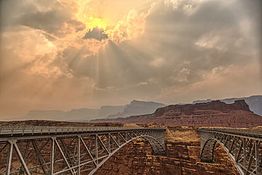
Sun shining thru dense smoke from the Dragon Bravo Wildfire enshrouding Vermilion Cliffs National Monument Arizona. Viewed from US89A at Navajo Bridge.
Sun shining thru dense smoke from the Dragon Bravo Wildfire enshrouding Vermilion Cliffs National Monument Arizona. Viewed from US89A.
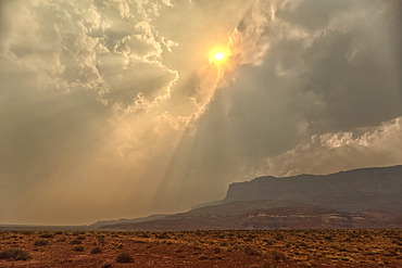
Smoke from the Dragon Bravo Wildfire enshrouding Vermilion Cliffs National Monument Arizona. Viewed from US89A.
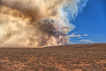
Smoke from the Dragon Bravo Wildfire burning on Grand Canyon North Rim billowing off the Kaibab Plateau. Viewed from US89A across from Vermilion Cliffs.
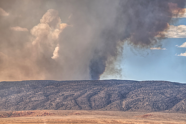
Smoke from the Dragon Bravo Wildfire burning on Grand Canyon North Rim billowing off the Kaibab Plateau. Viewed from US89A across from Vermilion Cliffs.
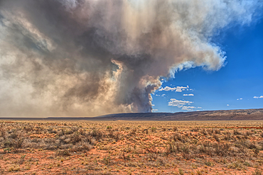
Smoke from the Dragon Bravo Wildfire burning on Grand Canyon North Rim billowing off the Kaibab Plateau. Viewed from US89A across from Vermilion Cliffs.
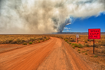
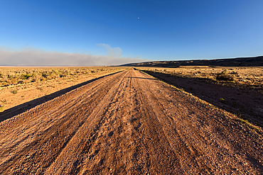
Smoke from the Dragon Bravo Wildfire burning on Grand Canyon North Rim billowing off the Kaibab Plateau. Viewed from House Rock Road across from Vermilion Cliffs.
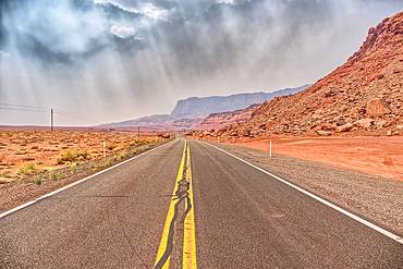
Vermilion Cliffs at Marble Canyon Arizona enshrouded with smoke from the Dragon Bravo Wildfire burning on Grand Canyon North Rim. Viewed from US89A.