Results
« Previous 1 … 12 13 14 15 16 … 215 Next »
21471 results found

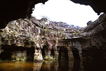
Cave entrance, Mount Autana (Cerro Autana), Tepuis, Amazonas territory, Venezuela, South America
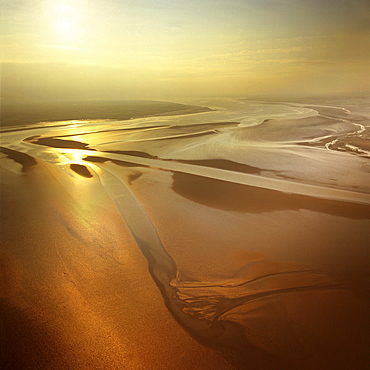
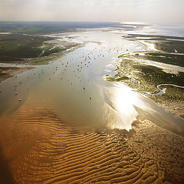
Aerial image of mudflats at sunset, Solway Firth, border between Cumbria in England and Dumfries and Galloway in Scotland, United Kingdom, Europe
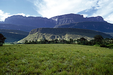
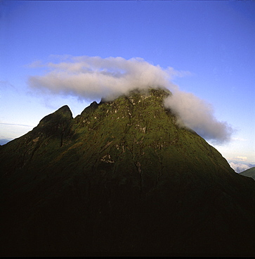
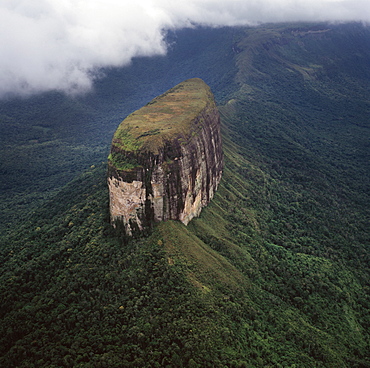
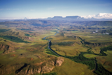
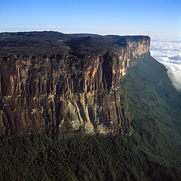
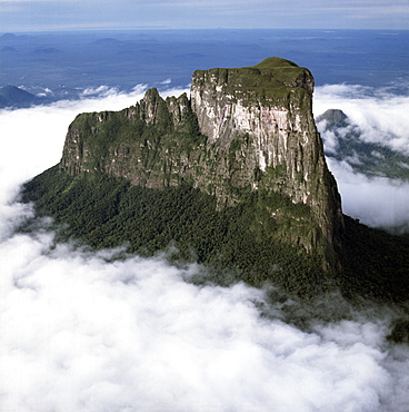
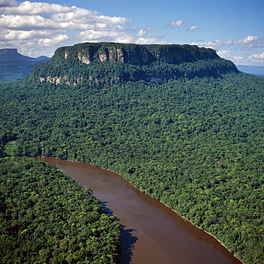
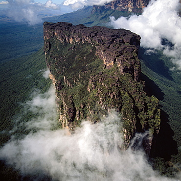
Tepuis showing south side of Auyantepui (Auyantepuy) (Devil's Mountain) from Uruyen valley, Canaima National Park, UNESCO World Heritage Site, Venezuela, South America
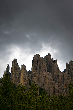
Needles Highway, Black Hills, South Dakota, United States of America, North America
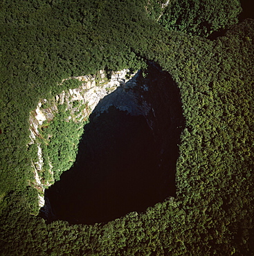
Fosso Sinkhole, summit of Mount Roraima (Cerro Roraima), Tepuis, Venezuela, South America
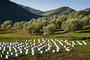
Beehives in the olive grove, Rif mountains, Chefchaouen, Morocco, North Africa, Africa
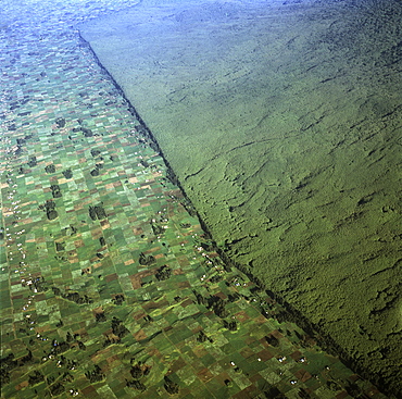
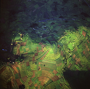
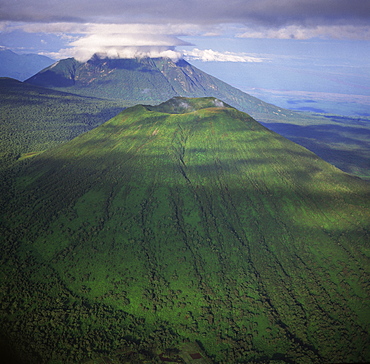
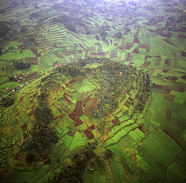
Aerial view of of Virunga National Park (Parc National des Volcans) showing the boundary of the park and agricultural land, Virunga Volcanoes, Rwanda, Africa
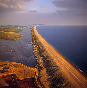
Aerial image of Chesil Beach (Chesil Bank), 29 km long shingle beach, a tombolo connecting mainland to the Isle of Portland, Jurassic Coast, UNESCO World Heritage Site, Dorset, England, United Kingdom, Europe
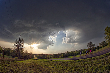
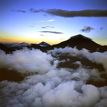
Dramatic cloud formations at the edge of an evening thunderstorm in rural Oklahoma, United States of America, North America
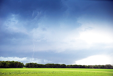
Cloud to ground lightning flash or strike, Oklahoma, United States of America, North America
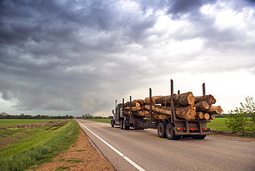
Logging truck in Mississippi driving into the heart of a thunderstorm with an extreme tornado watch, United States of America, North America

Merzouga and Erg Chebbi desert, Tafilalt, Morocco, North Africa, Africa

Peaceful mountain scenery, Chiang Mai, Thailand, Southeast Asia, Asia
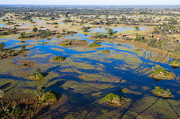
Aerial view of Okavango Delta, Botswana, Africa
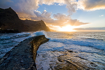
Sunset at coast of San Antao, Ponta do Sol, Cape Verde Islands, Atlantic, Africa
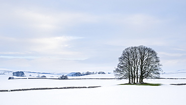
A small copse of trees in the winter snow near Malham, Yorkshire Dales, Yorkshire, England, United Kingdom, Europe
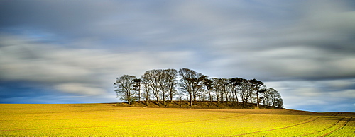
Copse atop drumlin near Boroughbridge on a showery spring evening, North Yorkshire, Yorkshire, England, United Kingdom, Europe
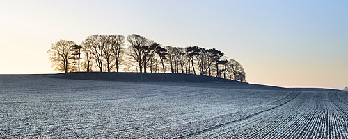
A small copse of trees growing on a drumlin in frosty dawn light, Boroughbridge, North Yorkshire, Yorkshire, England, United Kingdom, Europe
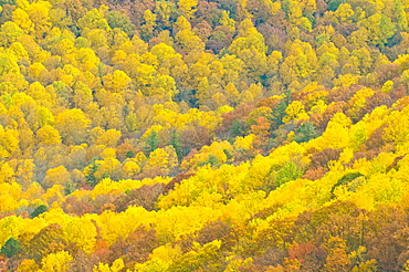
Beautiful foliage in the Indian summer, Blue Ridge Mountain Parkway, North Carolina, United States of America, North America
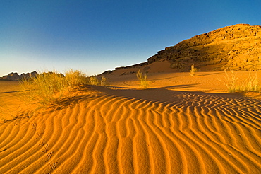
The stunning desert scenery of Wadi Rum, Jordan, Middle East
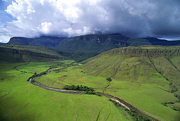
Aerial image of tepuis showing south side of Auyantepui (Auyantepuy) (Devil's Mountain) from Uruyen valley, Canaima National Park, UNESCO World Heritage Site, Venezuela, South America
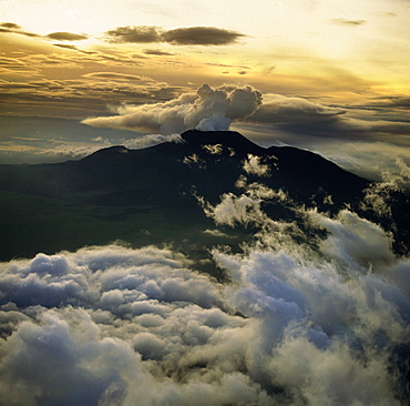
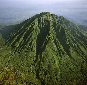
Aerial view of Mount Mikeno, Virunga Volcanoes, Rwanda, Great Rift Valley, Africa
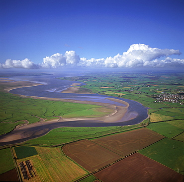
Aerial image of the River Esk flowing into Solway Firth, near Gretna Green, border between Cumbria in England and Dumfries and Galloway in Scotland, United Kingdom, Europe
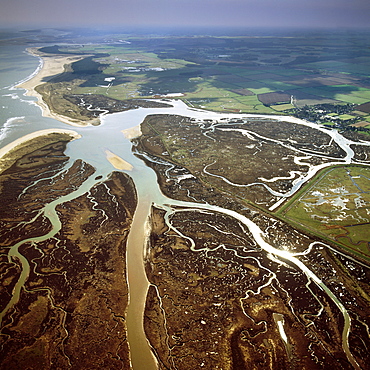
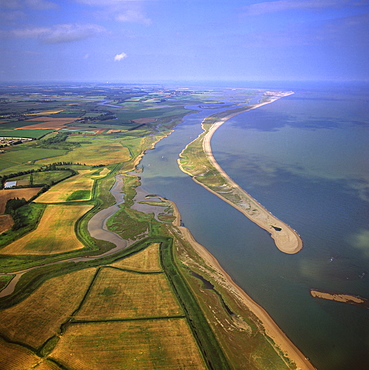
Aerial image of Blakeney Point, Norfolk, England, United Kingdom, Europe
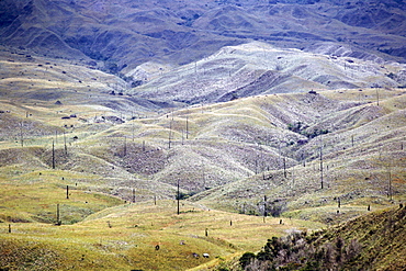
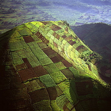
Aerial view of intensive agriculture in Rwanda, Africa
Aerial image of skeleton forest, damaged by forest fire, on La Gran Sabana, Canaima National Park, UNESCO World Heritage Site, Bolivar State, Venezuela, South America
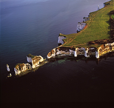
Aerial image of Old Harry Rocks, chalk stacks located directly east of Studland, north of Swanage, Dorset, England, United Kingdom, Europe
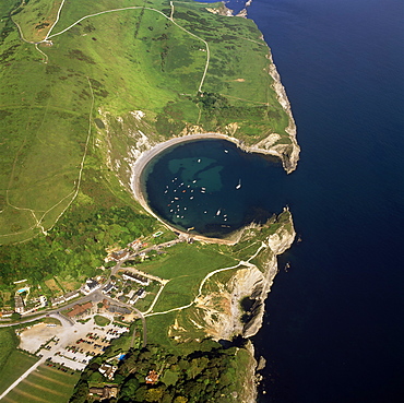
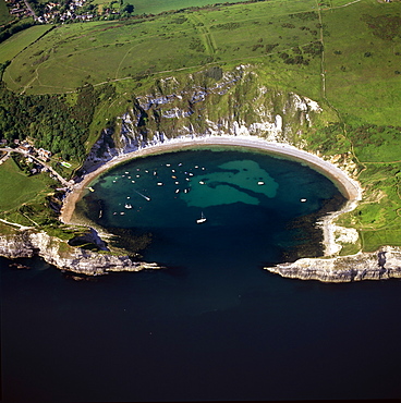
Aerial image of Lulworth Cove, a natural landform harbour, near West Lulworth, on the Jurassic Coast, UNESCO World Heritage Site, Dorset, England, United Kingdom, Europe
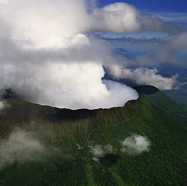
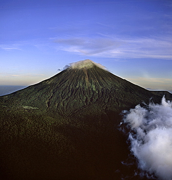
Aerial view of Mount Nyiragongo, an active volcano in the Virunga Mountains in Virunga National Park, near the border with Rwanda, known for its recent devastating eruptions, Democratic Republic of the Congo, Great Rift Valley, Africa
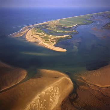
Aerial view of Blakeney Point, Norfolk, England, United Kingdom, Europe
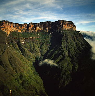
Aerial image of tepuis showing Mount Auyantepui (Auyantepuy) (Devil's Mountain), Venezuela, South America
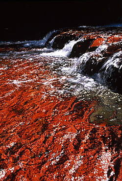
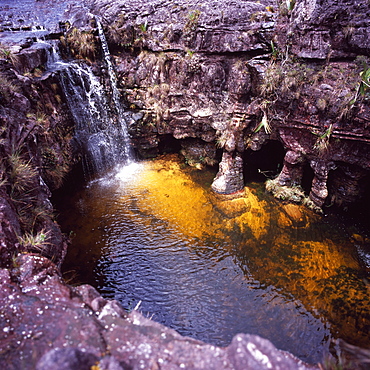
Quebrada de Jaspe, Jasper Rock Waterfall, Gran Sabana, Venezuela, South America
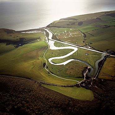
Aerial image of the Cuckmere River at Cuckmere Haven, Seven Sisters Country Park, East Sussex, England, United Kingdom, Europe
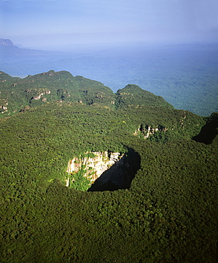
Aerial image of tepuis and Sarisarinama Sinkhole, Jaua-Sarisarinama National Park, Bolivar State, Venezuela, South America
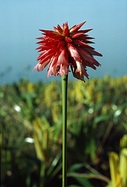
Cerro Autana, Kunhardtia rhodantha (Rapataceae), Amazonas territory, Venezuela, South America
Aerial image of tepuis showing Akopantepui, Gran Sabana, Estado Bolivar, Venezuela, South America
Aerial image of Lulworth Cove, a natural landform harbour, near West Lulworth, on the Jurassic Coast, UNESCO World Heritage Site, Dorset, England, United Kingdom, Europe
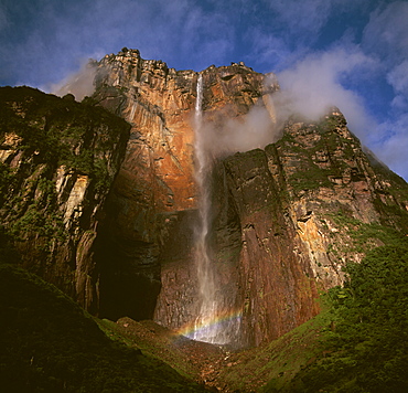
Angel Falls and Mount Auyantepui (Auyantepuy) (Devil's Mountain), Tepuis, Venezuela, South America
Aerial view of Mount Nyiragongo, an active volcano in the Virunga Mountains in Virunga National Park, near the border with Rwanda, known for its recent devastating eruptions, Democratic Republic of the Congo, Great Rift Valley, Africa
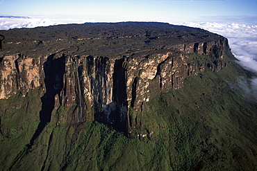
Aerial image of Tepuis showing summit of Mount Roraima (Cerro Roraima), Venezuela, South America
The shore of Lake Baikal, Siberia, Russia, Europe
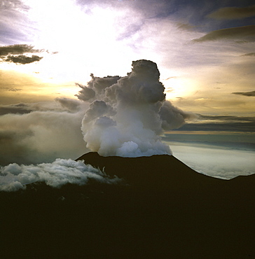
Aerial view of Mount Nyiragongo, an active volcano in the Virunga Mountains in Virunga National Park, near the border with Rwanda, known for its recent devastating eruptions, Democratic Republic of the Congo, Great Rift Valley, Africa
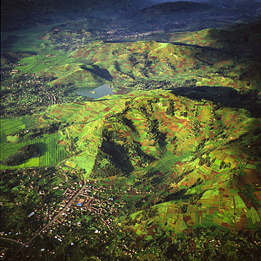
Aerial view of intensive agriculture in Rwanda, Africa
Aerial image of Sarisarinama Sinkhole, Jaua-Sarisarinama National Park, Tepuis, Bolivar State, Venezuela, South America
Aerial image of Angel Falls and Mount Auyantepui (Auyantepuy) (Devil's Mountain), Tepuis, Venezuela, South America
Aerial view of Mount Karisimbi, a dormant volcano in the Virunga Mountains on the border between Rwanda and the Democratic Republic of Congo (DRC), flanked by Mount Mikeno to the north, Mount Bisoke to the east and Mount Nyiragongo to the west, Great Rift Valley, Africa
Aerial image of River Kukenan looking north to tepuis of Mount Kukenaam (Kukenan) (Cuguenan) and Mount Roraima, Gran Sababa, Venezuela, South America

Didiereaceae plant (Alluaudiopsis sp.), Spiny Forest, Hazofotsy, Southern Madagascar, Africa
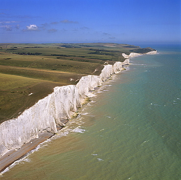
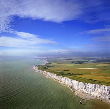
Aerial image of the chalk cliffs of the Seven Sisters, with Belle Tout lighthouse and Beachy Head in the distance, East Sussex, England, United Kingdom, Europe
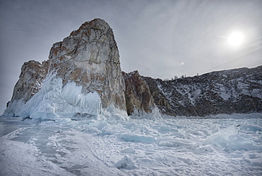
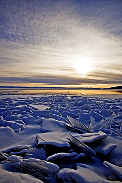
Rough ice formed at Shaman Rock, Olkhon Island as the waves freeze at the beginning of winter, Lake Baikal, Irkutsk Oblast, Siberia, Russia, Eurasia
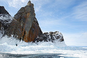
Rough ice formed at Olkhon Island as the waves freeze at the beginning of winter, Lake Baikal, Irkutsk Oblast, Siberia, Russia, Eurasia
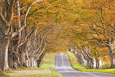
The beech avenue at Kingston Lacy in full autumn colour, Dorset, England, United Kingdom, Europe
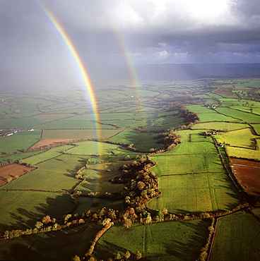
Aerial image of a double rainbow over the Somerset Levels, Somerset, England, United Kingdom, Europe
Aerial view of Mount Karisimbi, a dormant volcano in the Virunga Mountains on the border between Rwanda and the Democratic Republic of Congo (DRC), at 4507m the highest of the mountain range, Great Rift Valley, Africa
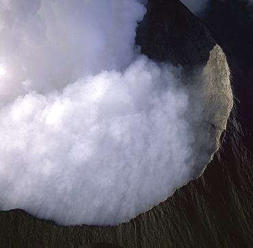
Aerial view of Mount Nyiragongo, an active volcano in the Virunga Mountains in Virunga National Park, near the border with Rwanda, known for its recent devastating eruptions, Democratic Republic of the Congo, Great Rift Valley, Africa
Aerial view of Mount Visoke (Mount Bisoke), an extinct volcano, straddling border of Rwanda and the Democratic Republic of the Congo. with Mount Mikeno in background, Virunga Volcanoes, Great Rift Valley, Africa
Aerial image of tepuis showing eastern cliff looking towards Brazil and Guyana, Mount Roraima, Venezuela, South America
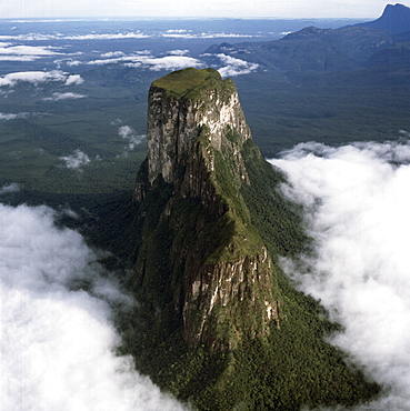
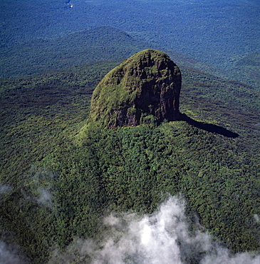
Aerial image of tepuis showing Mount Autana (Cerro Autana), Amazonas territory, Venezuela, South America
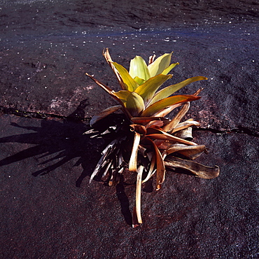
Brocchinia tatei (Bromeliaceae), Mount Roraima summit, Venezuela, South America
Aerial view of Mount Sabyinyo, an extinct volcano and oldest of the Virunga Mountains, the summit at 3645ï¾ metres marks the intersection of the borders of Democratic Republic of the Congo (DRC), Rwanda, and Uganda, Virunga Volcanoes, Africa
Aerial image of tepuis showing Mount Autana (Cerro Autana), Amazonas territory, Venezuela, South America
Aerial view of intensive agriculture on Virunga foothills, Rwanda, Africa
Aerial view of salt marsh at Burnham Overy Staithe, Norfolk, England, United Kingdom, Europe
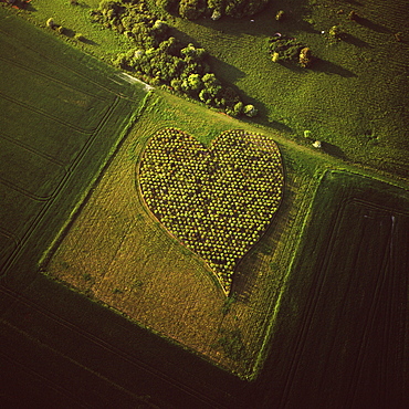
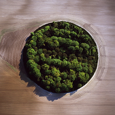
Aerial image of heart shape orchard, near Huish Hill earthwork, Oare, Wiltshire, England, United Kingdom, Europe
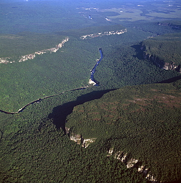
Aerial image of the Upper Mazaruni River, downstream from Kamarang, Guyana, South America
Aerial view of intensive agriculture on Virunga foothills, Democratic Republic of Congo, Africa
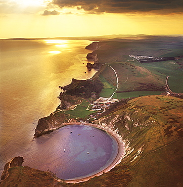
Aerial image of Lulworth Cove, a natural landform harbour, near West Lulworth, on the Jurassic Coast, UNESCO World Heritage Site, Dorset, England, United Kingdom, Europe
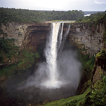
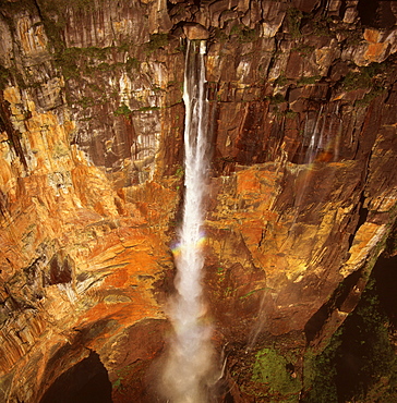
Kaieteur Falls, Potaro River, dry season, Guyana, South Amrica
Aerial image of chalk cliffs and lighthouse at Beachy Head, near Eastbourne, East Sussex, England, United Kingdom, Europe
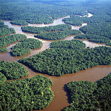
Aerial image of the Lower Mazaruni River with islands of tropical rain forest, Hororabo, near Bartica, Guyana, South America
Fosso Sinkhole, summit of Mount Roraima (Cerro Roraima), Tepuis, Venezuela, South America
Aerial image of Wadakapiapetepui, Eastern chain of tepuis, Estado Bolivar, Venezuela, South America
Aerial view of Orford Ness (Orfordness), a cuspate foreland shingle spit, Suffolk, England, United Kingdom, Europe
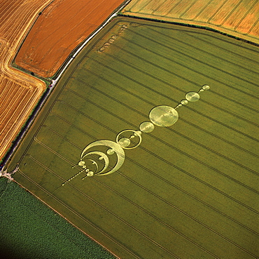
Aerial image of crop circle, Wiltshire, England, united Kingdom, Europe
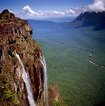
Angel Falls and Mount Auyantepui (Auyantepuy) (Devil's Mountain), looking out to Churun Gorge and Churun River, Tepuis, Venezuela, South America
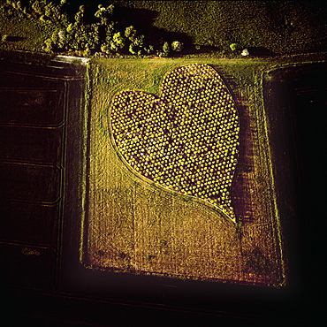
Aerial image of heart shape orchard, near Huish Hill earthwork, Oare, Wiltshire, England, United Kingdom, Europe
Aerial image of Weiassipu, Eastern chain of tepuis, Estado Bolivar, Venezuela, South America
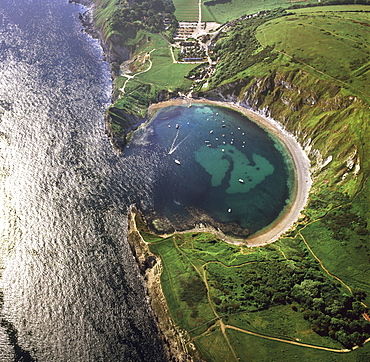
Aerial image of Lulworth Cove, a natural landform harbour, near West Lulworth, on the Jurassic Coast, UNESCO World Heritage Site, Dorset, England, United Kingdom, Europe
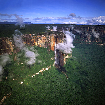
Aerial image of tepuis showing Angel Falls and Mount Auyantepui (Auyantepuy) (Devil's Mountain), Venezuela, South America
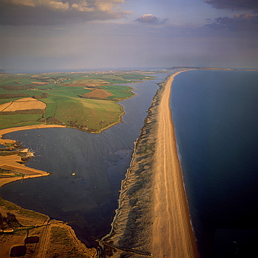
Aerial image of Chesil Beach (Chesil Bank), 29 km long shingle beach, a tombolo connecting mainland to the Isle of Portland, Jurassic Coast, UNESCO World Heritage Site, Dorset, England, United Kingdom, Europe

Didiereaceae plant (Alluaudia sp.), Spiny Forest, Hazofotsy, Southern Madagascar, Africa
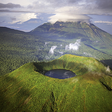
Aerial view of Mount Visoke (Mount Bisoke), an extinct volcano straddling the border of Rwanda and Democratic Republic of the Congo (DRC) showing crater lake, with Mount Mikeno in background, Virunga Volcanoes, Great Rift Valley, Africa
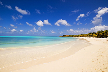
An empty beach in Antigua, Leeward Islands, West Indies, Caribbean, Central America
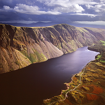
Aerial image of Wastwater Screes and Wast Water (Wastwater), the deepest lake in England, a good example of a glacially over-deepened valley, Wasdale Valley, Lake District National Park, Cumbria, England, United Kingdom, Europe
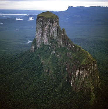
Aerial image of tepuis showing Mount Autana (Cerro Autana), Amazonas territory, Venezuela, South America
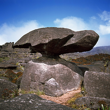
Turtle Rock, Mount Roraima summit, Estado Bolivar, Venezuela, South America
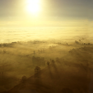
Aerial image of fog over the Somerset Levels, near Glastonbury, Somerset, England, United Kingdom, Europe
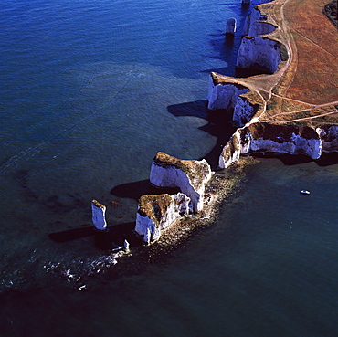
Aerial image of Old Harry Rocks, chalk stacks located directly east of Studland, north of Swanage, Dorset, England, United Kingdom, Europe
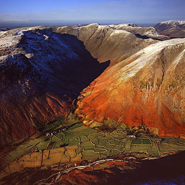
Aerial image of Wasdale Head, with St. Olaf's church, the smallest church in England, Brackenclose, Wasdale Fell, Kirk Fell, High Fell and Mosedale, Lake District National Park, Cumbria, England, United Kingdom, Europe
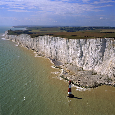
Aerial image of chalk cliffs and lighthouse, Beachy Head, near Eastbourne, East Sussex, England, United Kingdom, Europe
Aerial view of Meggs Hill (Gog Magog Downs) (Gog Magog Hills) (the Gogs), a range of low chalk hills, Cambridgeshire, England, United Kingdom, Europe
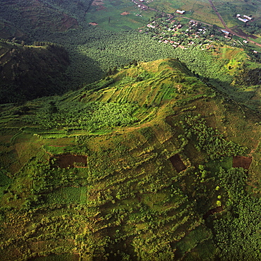
Aerial view of intensive agriculture on Virunga foothills, Rwanda, Africa
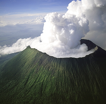
Aerial view of Mount Nyiragongo, an active volcano in the Virunga Mountains in Virunga National Park, near the border with Rwanda, known for its recent devastating eruptions, Democratic Republic of the Congo, Great Rift Valley, Africa
Aerial image of Chi-Chi Gorge, downstream from Chi-Chi Falls, Upper Mazaruni River, Upper Mazaruni District, Guyana, South America
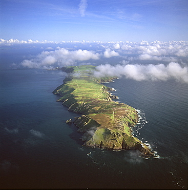
Aerial image of Lundy Island looking from north to south, Bristol Channel, Devon, England, United Kingdom, Europe
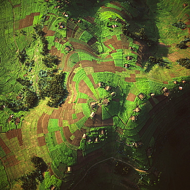
Aerial view of intensive agriculture in Rwanda, Africa
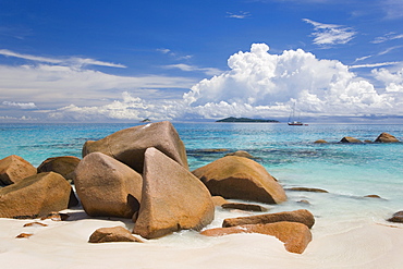
Granite boulders on the shore at Anse Lazio, island of Aride visible on horizon, Baie Sainte Anne district, Island of Praslin, Seychelles, Indian Ocean, Africa
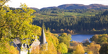
Autumn view to Loch Achray from wooded hillside above the former Trossachs Hotel, near Aberfoyle, Loch Lomond and the Trossachs National Park, Stirling, Scotland, United Kingdom, Europe
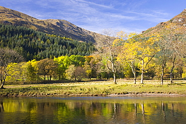
Autumn view across Loch Lubnaig to the slopes of Ben Ledi, near Callander, Loch Lomond and the Trossachs National Park, Stirling, Scotland, United Kingdom, Europe
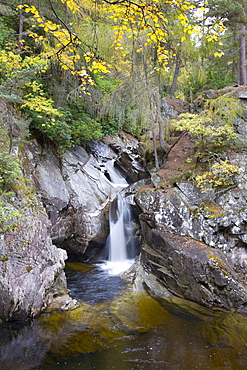
The Falls of Bruar in autumn, near Blair Atholl, Perth and Kinross, Scotland, United Kingdom, Europe