Results
« Previous 1 … 13 14 15 16 17 … 24 Next »
2370 results found
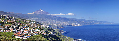
View over Orotava Valley to the north coast and Puerto de la Cruz and Pico del Teide, Tenerife, Canary Islands, Spain, Europe
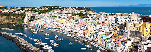
Panoramic view of town, colourful houses and sea, Corricella, Procida island, Phlegraean Islands, Bay of Naples, Campania, Italy
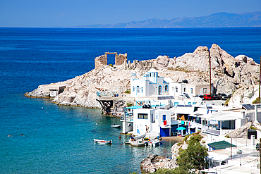
Firopotamos, traditional Cycladic style Greek village by the sea, with sirmata (fishermen's houses), Milos island, Cyclades, Greek Islands, Greece
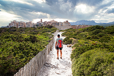
Old town of Bonifacio, Island of Corsica, France
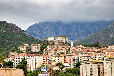
Beautiful little town of Corte on a summer morning, Island of Corsica, France
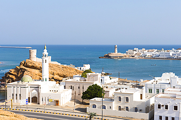
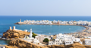
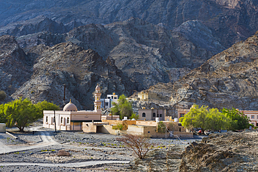
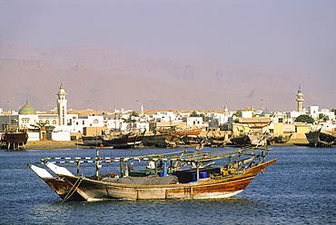
Al Ayjah village, Sur Township, port-city, capital of Ash Sharqiyah Region, Sultanate of Oman, Arabian Peninsula
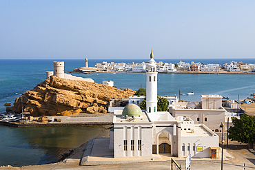
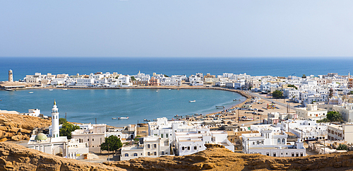
Al Ayjah village, Sur Township, port-city, capital of Ash Sharqiyah Region, Sultanate of Oman, Arabian Peninsula
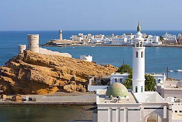
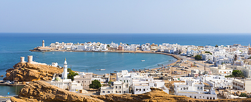
Al Ayjah village, Sur Township, port-city, capital of Ash Sharqiyah Region, Sultanate of Oman, Arabian Peninsula
Al Ayjah village, Sur Township, port-city, capital of Ash Sharqiyah Region, Sultanate of Oman, Arabian Peninsula
Al Ayjah village, Sur Township, port-city, capital of Ash Sharqiyah Region, Sultanate of Oman, Arabian Peninsula
Al Ayjah village, Sur Township, port-city, capital of Ash Sharqiyah Region, Sultanate of Oman, Arabian Peninsula

Bridge connecting Sur Township to Al Ayjah village, port-city, capital of Ash Sharqiyah Region, Sultanate of Oman, Arabian Peninsula
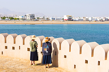
Two female tourists by crenelated wall of lighthouse, Al Ayjah village, Sur, capital of Ash Sharqiyah Region, Sultanate of Oman, Arabian Peninsula
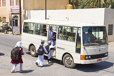
School children taking the school bus, Birkat Al Mouz in the Al Dakhliya region, foothills of Jebel Akhdar, Sultanate of Oman, Arabian Peninsula
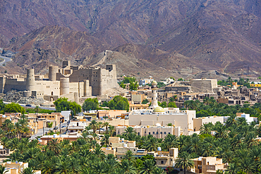
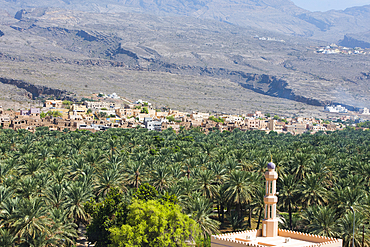
Bahla fort, UNESCO, situated at the foot of the Jebel Akhdar, Sultanate of Oman, Arabian Peninsula
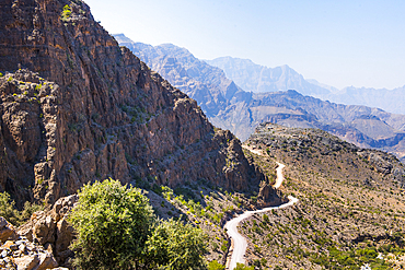
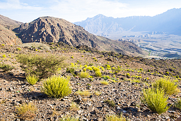
Track (Al Barida Road) on western slope of Djebel Ahkdar from Sharaf al Alamayn Pass, 2036m, to Bilad Sayt and Rustaq road, Oman, Arabian Peninsula
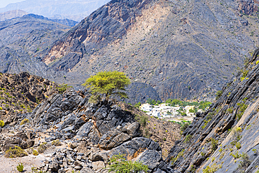
Al Hajir seen from track (Al Barida Road) on western slope of Djebel Ahkdar below Sharaf al Alamayn Pass, 2036m, Oman, Arabian Peninsula
Al Hajir seen from track (Al Barida Road) on western slope of Djebel Ahkdar below Sharaf al Alamayn Pass, 2036m, Oman, Arabian Peninsula
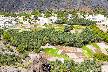
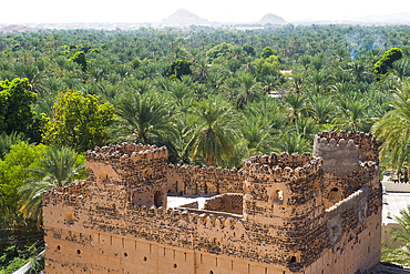
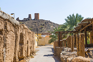
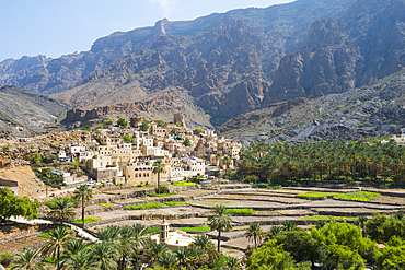
Al-Hamra village and the palm grove, a 400-year-old town in the region Ad Dakhiliyah, Akhdar Mountains, Sultanate of Oman, Arabian Peninsula
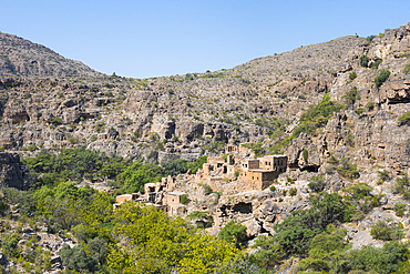
Old adobe village in ruins of Al Ain, perched villages of Jabal Al Akhdar (Green Mountains), Sayq Plateau, Sultanate of Oman, Arabian Peninsula
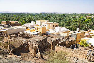
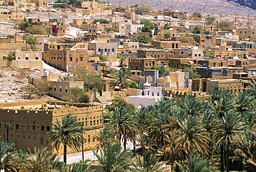
Al Mudhaireb Village, Al Sharqiyah region, Sultanate of Oman, Arabian Peninsula
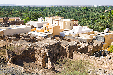
Al Mudhaireb Village, Al Sharqiyah region, Sultanate of Oman, Arabian Peninsula
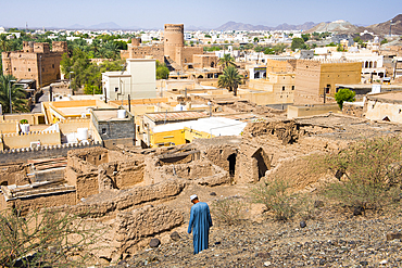
Al Mudhaireb Village, Al Sharqiyah region, Sultanate of Oman, Arabian Peninsula
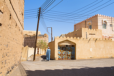
Al Mudhaireb Village, Al Sharqiyah region, Sultanate of Oman, Arabian Peninsula
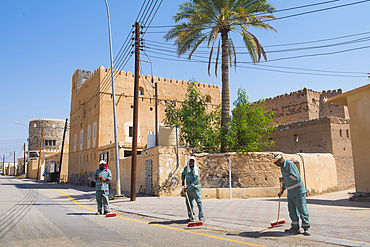
Al Mudhaireb Village, Al Sharqiyah region, Sultanate of Oman, Arabian Peninsula
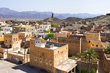
Al Mudhaireb Village, Al Sharqiyah region, Sultanate of Oman, Arabian Peninsula
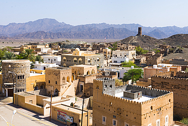
Al Mudhaireb Village, Al Sharqiyah region, Sultanate of Oman, Arabian Peninsula
Al Mudhaireb Village, Al Sharqiyah region, Sultanate of Oman, Arabian Peninsula
Al Mudhaireb Village, Al Sharqiyah region, Sultanate of Oman, Arabian Peninsula
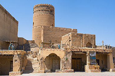
Al Mudhaireb Village, Al Sharqiyah region, Sultanate of Oman, Arabian Peninsula
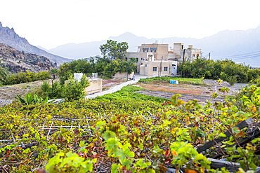
Wakan village in the Western Hajar Mountains, border South Batinah and Al Dakhiliyah Governorates, Sultanate of Oman, Arabian Peninsula
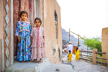
Two little girls, Mosque, Wakan village, Western Hajar Mountains, border South Batinah and Al Dakhiliyah Governorates, Oman, Arabian Peninsula
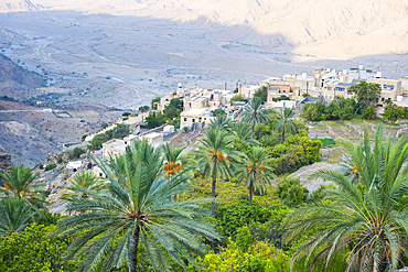
Bilad Sayt village, edge of Wadi Bani Awf, north east slope of Jebel Akhdar, Western Hajar Mountains, Al-Dakhiliyah region, Oman, Arabian Peninsula
Al Bardah, village on edge of Wadi Bani Awf, NE slope of Jebel Akhdar, Western Hajar Mountains, Al-Dakhiliyah region, Oman, Arabian Peninsula
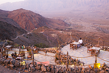
Sama Wakan Heritage hotel terrace, Wakan village, Western Hajar Mountains, South Batinah and Al Dakhiliyah Governorates, Oman, Arabian Peninsula
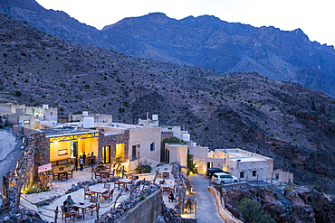
Sama Wakan Heritage hotel by night, Wakan village, Western Hajar Mountains, South Batinah and Al Dakhiliyah Governorates, Oman, Arabian Peninsula
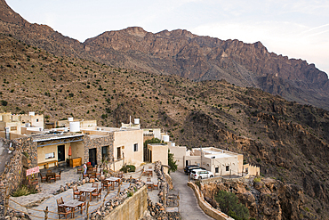
Sama Wakan Heritage hotel, Wakan village, Western Hajar Mountains, South Batinah and Al Dakhiliyah Governorates, Oman, Arabian Peninsula
Wakan village, Western Hajar Mountains, border South Batinah Governorate and Al Dakhiliyah Governorates, Sultanate of Oman, Arabian Peninsula
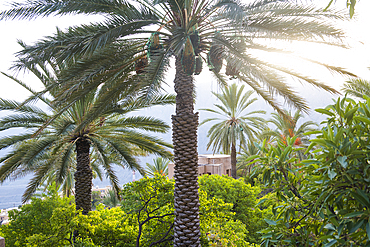
Palm trees, Wakan village, Western Hajar Mountains, border South Batinah Governorate and Al Dakhiliyah Governorates, Oman, Arabian Peninsula
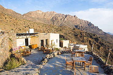
Sama Wakan Heritage hotel, Wakan village, Western Hajar Mountains, South Batinah and Al Dakhiliyah Governorates, Oman, Arabian Peninsula
Landscape around Wakan village, Western Al Hajar Mountains, border South Batinah and Al Dakhiliyah Governorates, Oman, Arabian Peninsula
Fishing dhow at Sur, Sultanate of Oman, Arabian Peninsula
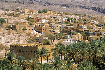
Al-Hamra village, Akhdar Jebel, Sultanate of Oman, Arabian Peninsula
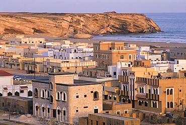
Taqah, Dhofar, Sultanate of Oman, Arabian Peninsula
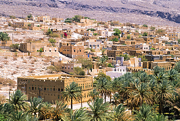
Al-Hamra village, Akhdar Jebel, Sultanate of Oman, Arabian Peninsula
Al-Hamra village, Akhdar Jebel, Sultanate of Oman, Arabian Peninsula
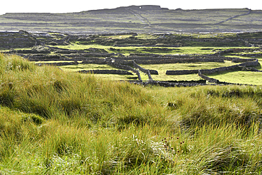
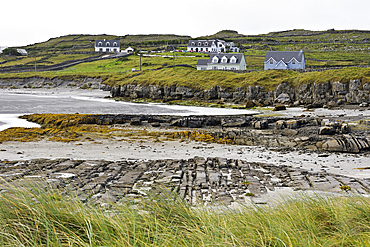
Grassy dunes of Cil Mhuirbhigh (Kilmurvey Village), Inishmore, largest of the Aran Islands, Galway Bay, County Galway, Connacht, Republic of Ireland
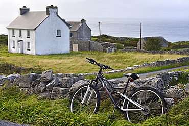
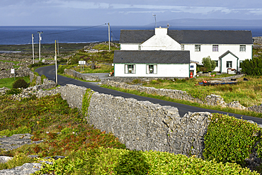
Inishmore, largest of the Aran Islands, Galway Bay, County Galway, Connacht, Republic of Ireland
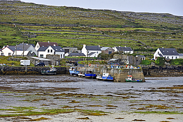
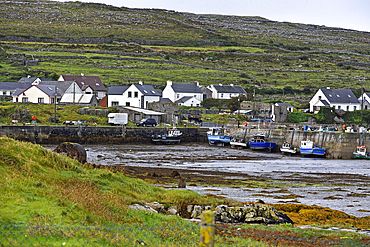
Kilronan village, Inishmore, largest of the Aran Islands, Galway Bay, County Galway, Connacht, Republic of Ireland
Small harbour of Rossaveel Lower, Inishmore, the largest of the Aran Islands, Galway Bay, Count Galway, Connacht, Republic of Irelan
Small harbour of Rossaveel Lower, Inishmore, largest Aran Island, Galway Bay, County Galway, Connacht, Republic of Ireland
Hamlet near Aeer Arann Air field on the east end of Inishmore, largest of the Aran Islands, Galway Bay, County Galway, Connacht, Republic of Ireland
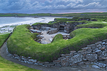
Stormy sky over Skara Brae, UNESSCO World Heritage Site, a Neolithic village on the Mainland of Orkney, Scotland, United Kingdom, Europe

Vineyards line the Cinque Terre trail above the seaside town of Monterosso al Mare, Cinque Terre, UNESCO World Heritage Site, Liguria, Italy, Europe
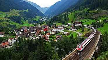
Wassen, Gotthard, Canton of Uri, Swirtzerland, Europe

Blue dusk on the snowy alpine village surrounded by ski lifts, Bettmeralp, district of Raron, canton of Valais, Switzerland, Europe
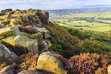
Baslow Edge, early autumn heather, view to Baslow village, Peak District National Park, Derbyshire, England, United Kingdom, Europe

Visitors walk across a bridge as water cascades over the Caban-coch dam, at Elan Valley village near Rhayader in Powys, Wales, United Kingdom, Europe

Water cascades over the Caban-coch dam, at Elan Valley village near Rhayader in Powys, Wales, United Kingdom, Europe
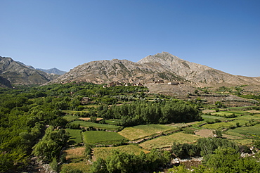
A village and terraced fields of wheat and potatoes in the Panjshir valley in Afghanistan, Asia
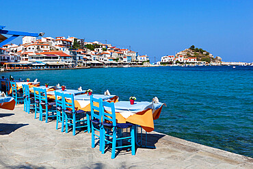
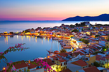
Restaurants on harbour, Kokkari, Samos, Aegean Islands, Greece
Harbour at dusk, Pythagorion, Samos, Aegean Islands, Greece
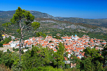
View over mountain village, Pagondas, Samos, Aegean Islands, Greece
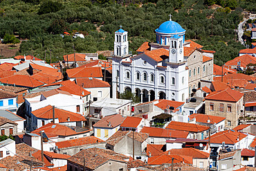
Church of the Holy Trinity, Pagondas, Samos, Aegean Islands, Greece
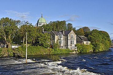
Corrib River with the dome of the Cathedral in the background, Galway, Connemara, County Galway, Connacht, Republic of Ireland
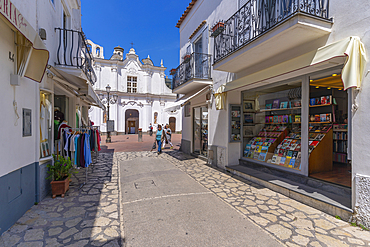
View of shops and Church of Saint Sophia, Anacapri, Isle of Capri, Campania, Italy, Mediterranean, Europe

Inlet and River Solva, Solva, St. Bride's Bay, Pembrokeshire, Wales, United Kingdom, Europe

Tourists and skiers enjoying the snowy landscape, Bettmeralp, district of Raron, canton of Valais, Switzerland, Europe

Boat Hire, Walchensee Village, Walchensee Lake, Bavarian Alps, Upper Bavaria, Bavaria, Germany, Europe
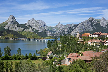
Riano and reservoir, Picos de Europa, Leon, Spain, Europe

Barpak, the biggest settlement during the Manaslu circuit trek, Nepal, Himalayas, Asia
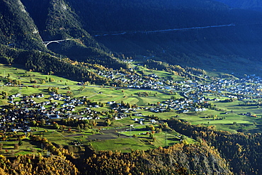
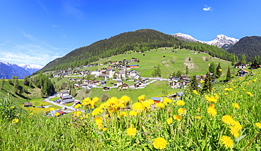
Village of Termen near Brig, Valais, Swiss Alps, Switzerland, Europe
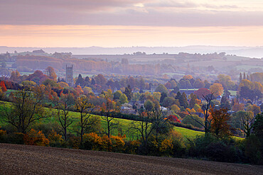
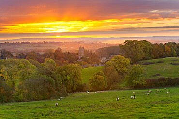
View over Chipping Campden in autumn, Chipping Campden, Cotswolds, Gloucestershire, England, United Kingdom, Europe
Cotswold countryside and St. James Church at dawn, Chipping Campden, Cotswolds, Gloucestershire, England, United Kingdom, Europe
Panoramic of the alpine village of Davos Wiesen in spring, Canton of Graubunden, Prettigovia Davos Region, Switzerland, Europe
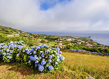
Ponta Delgada, elevated view, Flores Island, Azores, Portugal, Atlantic, Europe
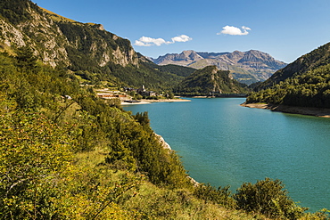
Lanuza village and resevoir, with Sierra Tendenera range beyond, Tena Valley, Sallent de Gallego, Pyrenees, Huesca Province, Spain, Europe
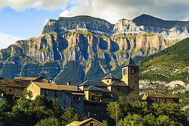
Torla village and church and Mount Mondarruego (Red Mountain) in Ordesa National Park beyond, Torla, Pyrenees, Huesca, Aragon, Spain, Europe
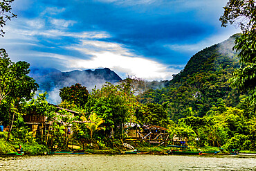
Scenics in Gunung Mulu National Park in Borneo, Malaysia, Southeast Asia, Asia
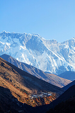
Village of Dingboche, Sagarmatha National Park, UNESCO World Heritage Site, Khumbu Valley, Nepal, Himalayas, Asia
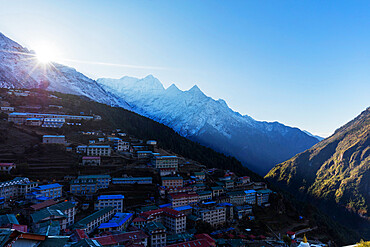
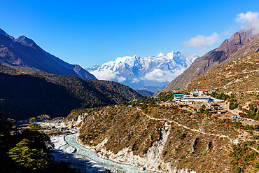
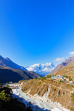
Namche Bazaar, Sagarmatha National Park, UNESCO World Heritage Site, Khumbu Valley, Nepal, Himalayas, Asia
Village of Pangboche, 4000m, Sagarmatha National Park, UNESCO World Heritage Site, Khumbu Valley, Nepal, Himalayas, Asia
Village of Pangboche, 4000m, Sagarmatha National Park, UNESCO World Heritage Site, Khumbu Valley, Nepal, Himalayas, Asia
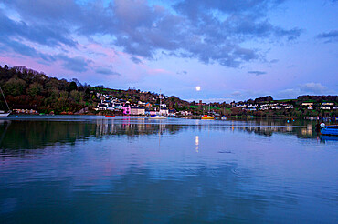
Moon reflected in the River Dart, Dittisham, South Devon, England, United Kingdom, Europe

Les Houches village below Mont Blanc, Chamonix, Haute Savoie, Rhone Alpes, France, Europe
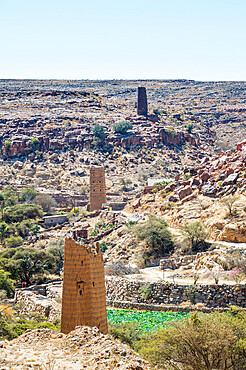
Fortified village near Abha, Saudi Arabia, Middle East
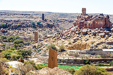
Fortified village near Abha, Saudi Arabia, Middle East
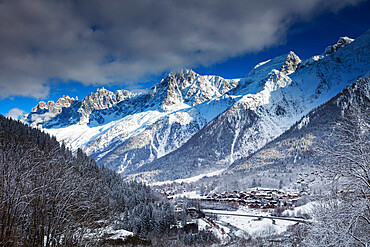
Les Houches village below Mont Blanc, Chamonix, Haute Savoie, Rhone Alpes, France, Europe
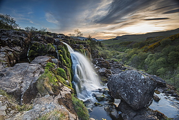
Sunset at the Loup o Fintry waterfall near the village of Fintry, Stirlingshire, Scotland, United Kingdom, Europe
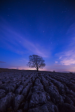
A lone tree on the limestone pavement on the hills above the village of Malham in the Yorkshire Dales, Yorkshire, England, United Kingdom, Europe
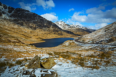
Scottish Highland road near Arrochar village in winter in the Loch Lomond and The Trossachs National Park, Stirling, Scotland, United Kingdom, Europe
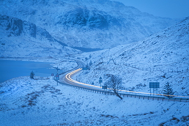
Scottish Highland road near Arrochar village in winter in the Loch Lomond and the Trossachs National Park, Stirling, Scotland, United Kingdom, Europe
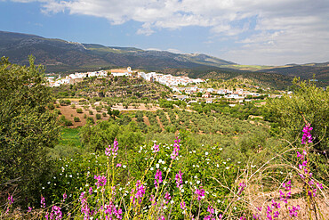
View in spring over the white Andalucian village of El Burgo, Malaga Province, Andalucia, Spain, Europe
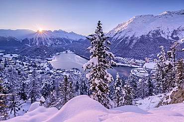
Sunrise over village and Lake of St. Moritz covered with snow, Engadine, Canton of Graubunden, Switzerland, Europe
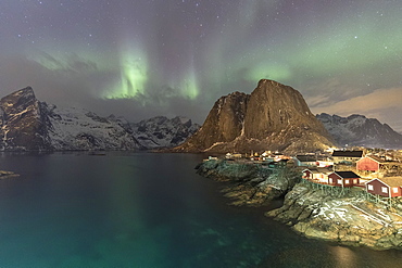
Northern Lights (Aurora borealis), Hamnoy, Lofoten Islands, Nordland, Norway, Europe
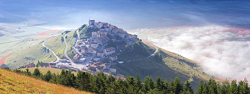
Sunrise in Castelluccio di Norcia, Umbria, Italy, Europe

The ancient Incan citadel of Pisac in the Sacred Valley, Peru, South America
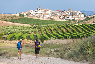
Pilgrims walking the Camino de Santiago (The Way of St. James) towards little village of Cirauqui, Navarre, Spain, Europe
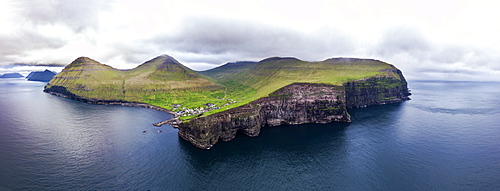
Panoramic aerial view of cliffs and village of Gjogv, Eysturoy island, Faroe Islands, Denmark, Europe
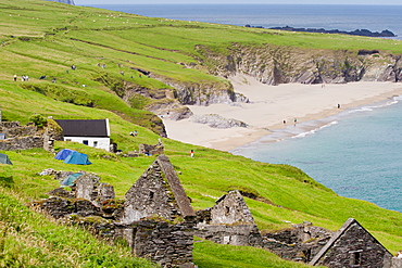
Ruined village and beach, Great Blasket Island, County Kerry, Munster, Republic of Ireland, Europe