Results
« Previous 1 … 15 16 17 18 19 … 83 Next »
8206 results found

Off road vehicle crossing desert towards salt mines of Dallol, aerial view, Danakil Depression, Afar Region, Ethiopia, Africa
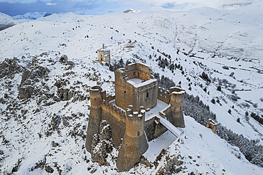
Close-up aerial view of the snow covered medieval castle of Rocca Calascio and the church of Santa Maria della Pieta� at dusk, Rocca Calascio, Gran Sasso e Monti della Laga National Park, Campo Imperatore, L'Aquila province, Abruzzo region, Italy, Europe

Aerial view of great white pelicans (Pelecanus onocrotalus), Okavango Delta, Botswana, Africa
Beach 91, Calamian Islands, Coron, Palawan, Philippines, Southeast Asia, Asia
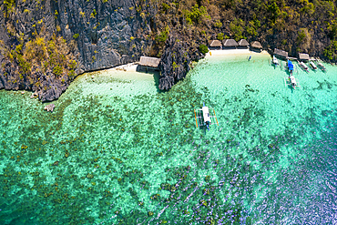
Bangka (boat) over coral, Chindonan Island, Calamian Islands, Coron, Palawan, Philippines, Southeast Asia, Asia
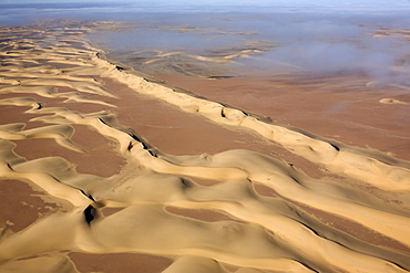
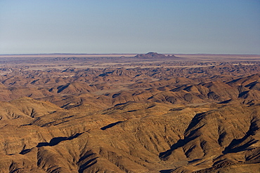
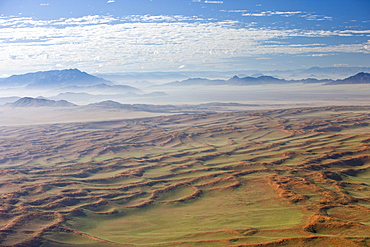
Aerial photo, Skeleton Coast Park, Namibia, Africa
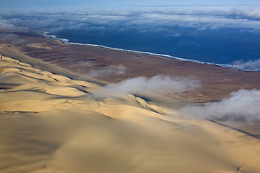
Aerial photo of sand dunes, Skeleton Coast Park, Namibia, Africa
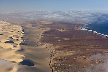
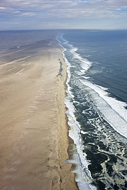
Aerial of Atlantic Ocean coastline, Skeleton Coast Park, Namibia, Africa
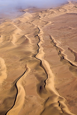
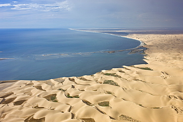
Aerial of sand dunes, Skeleton Coast Park, Namibia, Africa
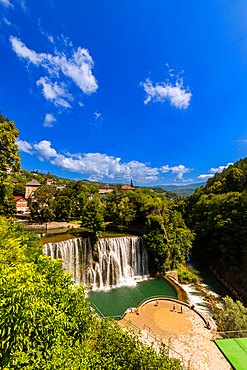
Aerial view of Pliva Waterfall and circular viewing platform in Jajce, Federation of Bosnia and Herzegovina, Bosnia and Herzegovina. The urban waterfall sits below the historic town and is surrounded by lush greenery and summer skies.
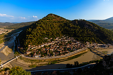
Panoramic aerial view of the Gorica neighborhood wrapped around the bend of the Osum River in Berat, Berat County, Albania, with tree-covered hills and connecting bridges seen from Kala Castle.
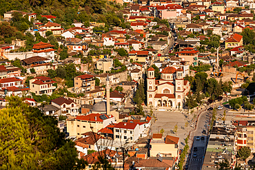
Aerial view of Berat, Albania, featuring the Orthodox Church of Saint Demetrius in the city center. The historic town, a UNESCO World Heritage site, is known for its red-tiled roofs, Ottoman-era architecture, and surrounding mountain scenery.
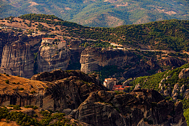
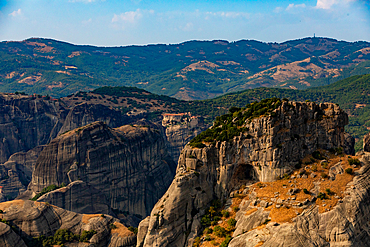
Aerial view in landscape orientation of Meteora’s monasteries perched atop towering rock pillars, surrounded by rugged cliffs and green hills, Thessaly, Greece.
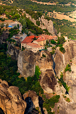
Aerial view in vertical orientation of a Meteora monastery perched on a high rock formation, surrounded by dramatic cliffs and greenery, Thessaly, Greece.
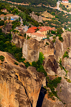
Aerial view in vertical orientation of a Meteora monastery built on a steep rock formation, surrounded by cliffs, greenery, and distant buildings, Thessaly, Greece.
Aerial view in landscape orientation of a Meteora monastery perched on a towering rock pillar, with rugged cliffs and forested hills in the background, Thessaly, Greece.
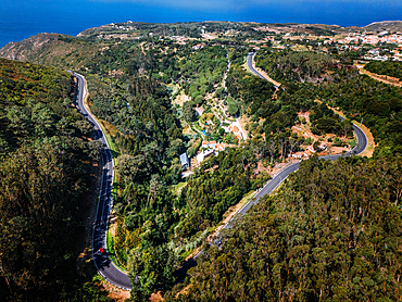
Aerial drone view of N247 highway near Cabo da Roca, Portugal
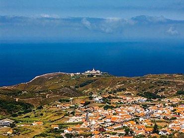
Aerial drone view of lighthouse at Cabo da Roca, Portugal - continental Europe's western-most point

Aerial by drone of Polihale State Park beach, Kauai Island, Hawaii, United States of America, North America

Aerial view by drone of Hanalei Bay, Kauai Island, Hawaii, United States of America, North America
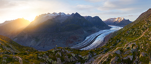
Panoramic and aerial view of trekker at Aletsch Glacier during sunset in summer, Riederalp, Oriental Raron, Valais, Switzerland, Europe
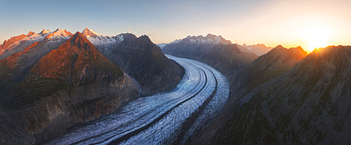
Panoramic and aerial view of Aletsch Glacier during sunrise in summer, Riederalp, Oriental Raron, Valais, Switzerland, Europe
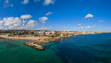
Aerial drone panoramic view of Tamariz beach in Estoril, Lisbon Region, Portugal
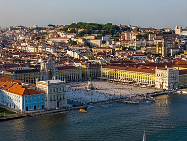
Aerial drone view of Praca do Comercio in Lisbon, Portugal with major landmarks visible such as Castelo Sao Jorge and Se Cathedral
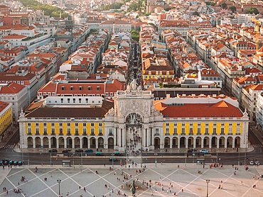
Aerial drone view of Praca do Comercio in Lisbon, Portugal leading to Augusta street in the Baixa district
Aerial, Skeleton Coast Park, Namibia, Africa
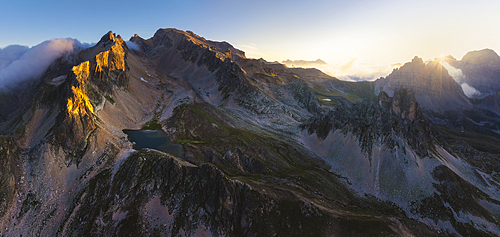
Aerial and panoramic view of Grand Serù and Mont Thabor at sunrise during summer, Provence Alps Cote d’Azur, Haute Alps, Vallee Etroite, France, Europe
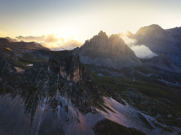
Aerial view of Grand Serù and Grand Adret at sunrise during summer, Provence Alps Cote d’Azur, Haute Alps, Vallee Etroite, France, Europe
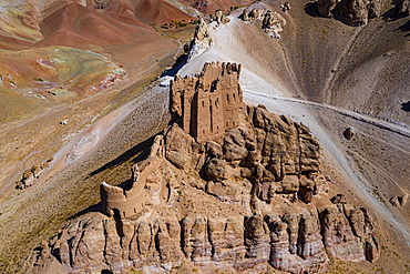
Aerial by drone of Gohargeen fort, Yakawlang province, Bamyan, Afghanistan, Asia
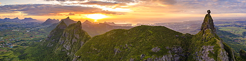
Aerial panoramic of sunset over Le Pouce and Pieter Both mountains, Moka Range, Port Louis, Mauritius, Africa
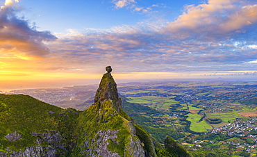
Panoramic of Le Pouce mountain and Pieter Both towards the Indian Ocean sunset, aerial view, Moka Range, Port Louis, Mauritius, Africa
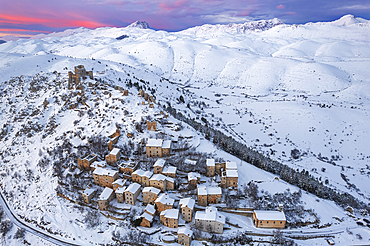
Aerial winter view of the snow covered medieval village of Rocca Calascio with the castle and pink sky at sunset, Rocca Calascio, Gran Sasso e Monti della Laga National Park, Campo Imperatore, L'Aquila province, Abruzzo region, Italy, Europe
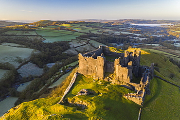
Aerial vista by drone of Carreg Cennen Castle, Brecon Beacons National Park, Carmarthenshire, Wales, United Kingdom, Europe
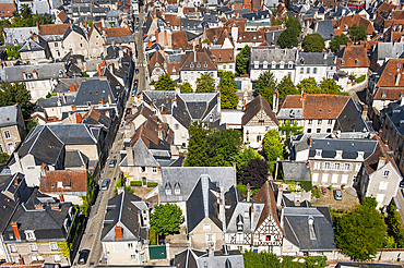
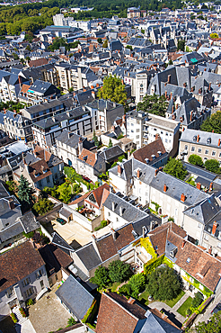
Aerial view over the historical centre of Bourges, from the top of the tower bell of the Cathedral Saint Stephen,Cher department,Berry province,region of Centre,France,Europe
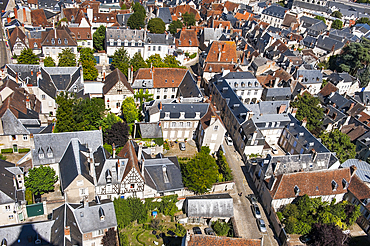
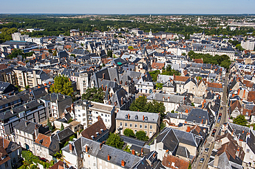
Aerial view over the historical centre of Bourges, from the top of the tower bell of the Cathedral Saint Stephen,Cher department,Berry province,region of Centre,France,Europe
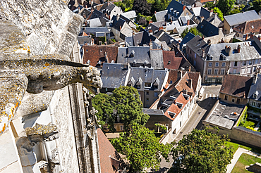
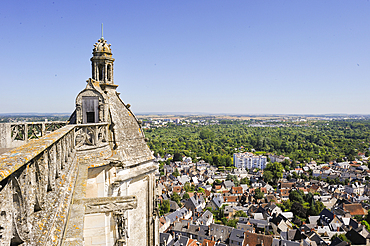
Aerial view over the historical centre of Bourges, from the top of the tower bell of the Cathedral Saint Stephen,Cher department,Berry province,region of Centre,France,Europe
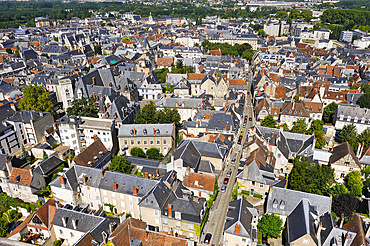
Aerial view over the historical centre of Bourges, from the top of the tower bell of the Cathedral Saint Stephen,Cher department,Berry province,region of Centre,France,Europe
Aerial view over the historical centre of Bourges, from the top of the tower bell of the Cathedral Saint Stephen,Cher department,Berry province,region of Centre,France,Europe
Aerial view over the historical centre of Bourges, from the top of the tower bell of the Cathedral Saint Stephen,Cher department,Berry province,region of Centre,France,Europe
Aerial view over the historical centre of Bourges, from the top of the tower bell of the Cathedral Saint Stephen,Cher department,Berry province,region of Centre,France,Europe
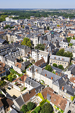
Aerial view over the historical centre of Bourges, from the top of the tower bell of the Cathedral Saint Stephen,Cher department,Berry province,region of Centre,France,Europe
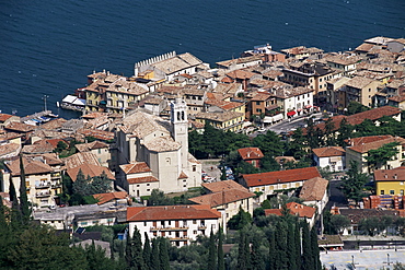
Malcesine, Lake Garda, Veneto, Italy, Europe
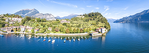
Panoramic aerial view of sailboats in Lake Como around the village of Pescallo, Bellagio, Province of Como, Lombardy, Italian Lakes, Italy, Europe (Drone)
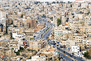
View over city, Amman, Jordan, Middle East
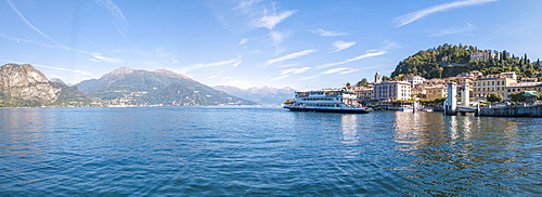
Panoramic aerial view of ferry boat at Bellagio on the shore of Lake Como, Province of Como, Lombardy, Italian Lakes, Italy, Europe (Drone)
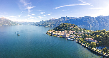
Panoramic aerial view of Lake Como and the village of Bellagio, Province of Como, Lombardy, Italian Lakes, Italy, Europe (Drone)
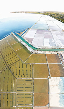
Aerial view of Saline dello Stagnone at dawn, Marsala, province of Trapani, Sicily, Italy, Mediterranean, Europe
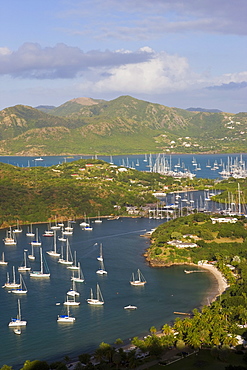
Elevated view of English Harbour from Shirley Heights looking towards Nelson's Dockyard, Antigua, Leeward Islands, West Indies, Caribbean, Central America
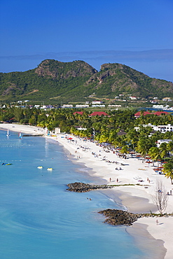
Elevated view over Jolly Harbour and Jolly Beach, Antigua, Leeward Islands, West Indies, Caribbean, Central America
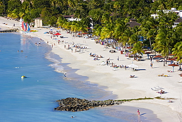
Elevated view over Jolly Harbour and Jolly Beach, Antigua, Leeward Islands, West Indies, Caribbean, Central America
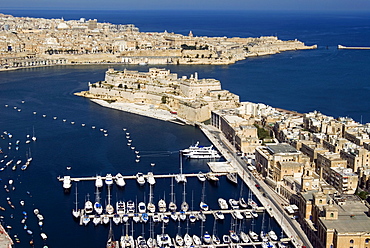
Aerial view of St. Angelo Fort in Vittoriosa (Birgu) in front of Valletta, Malta, Mediterranean, Europe
Aerial view of Valletta, Grand Harbour and St. Angel Fort in Vittoriosa or Birgu, Malta, Mediterranean, Europe
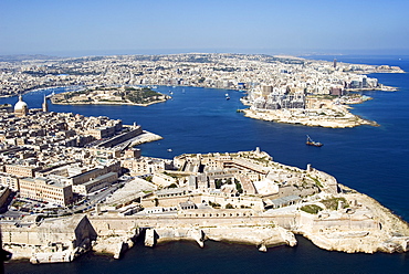
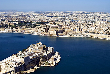
Aerial view of Valletta and St. Elmo Fort, Manoel Island, and Dragutt Point on the right, Malta, Mediterranean, Europe

Aerial view of Mgarr, Gozo Island, Malta, Mediterranean, Europe
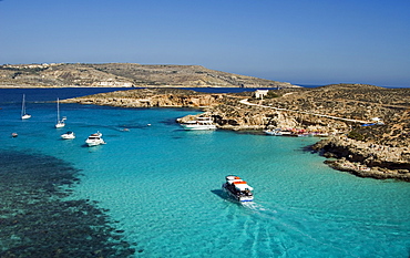
Aerial view of the Blue Lagoon, Comino Island, Malta, Mediterranean, Europe
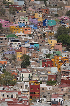
Colourful buildings, Guanajuato, Guanajuato State, Mexico, North America

Aerial view of town and Paralia Sidari Beach, Sidari, Ionian Islands, Greek Islands, Greece, Europe
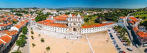
Aerial drone panoramic view of the Alcobaca Monastery (Alcobasa Monastery), UNESCO World Heritage Site, a Catholic monastic complex, Alcobaca, central Portugal, Eurpe
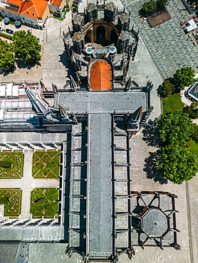
Aerial view of the Monastery of the Dominicans of Batalha, built to commemorate the Portuguese victory over the Castilians at the battle of Aljubarrota in 1385, UNESCO World Heritage Site, Batalha, Centro, Portugal, Europe
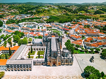
Aerial of the Monastery of the Dominicans of Batalha, built to commemorate the Portuguese victory over the Castilians at the battle of Aljubarrota in 1385, UNESCO World Heritage Site, Batalha, Centro, Portugal, Europe
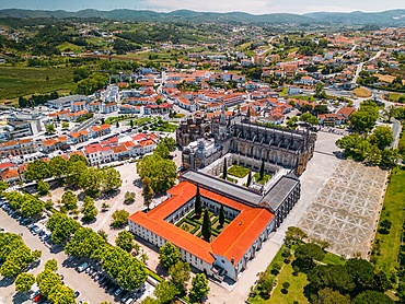
Aerial of the Monastery of the Dominicans of Batalha, built to commemorate the Portuguese victory over the Castilians at the battle of Aljubarrota in 1385, UNESCO World Heritage Site, Batalha, Centro, Portugal, Europe
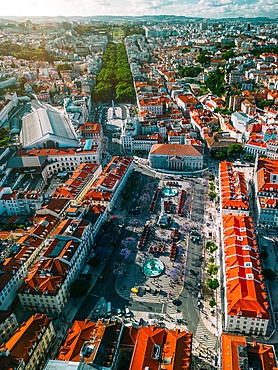
An aerial vertical drone perspective of city center with Rossio Square leading to Restauradores and the tree-lined Avenida da Liberdade boulevard towards Marques de Pombal Square and Eduardo VII Park, Lisbon, Portugal, Europe
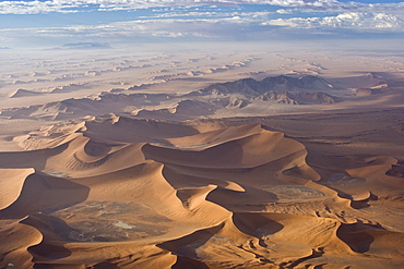
Aerial view, Sossusvlei, Namib Naukluft Park, Namib Desert, Namibia, Africa
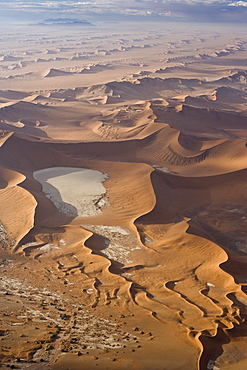
Aerial view, Dead Vlei, Sossusvlei, Namib Naukluft National Park, Namibia, Africa
Aerial photo, Sossusvlei, Namib Naukluft Park, Namibia, Africa
Aerial photo, Sossusvlei, Namib Naukluft National Park, Namibia, Africa
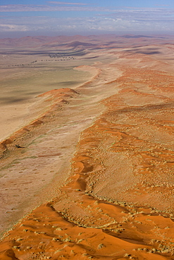
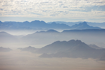
Aerial photo, Namib Naukluft National Park, Namibia, Africa
Aerial photo of the Skeleton Coast, Namibia, Africa
Aerial photo of Sandwich Harbour on the coast, Namibia, Africa
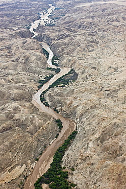
Aerial photo of the Omaruru River, Namibia, Africa
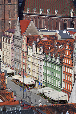
Old Town view from Marlii Magdaleny Church, Wroclaw, Silesia, Poland, Europe
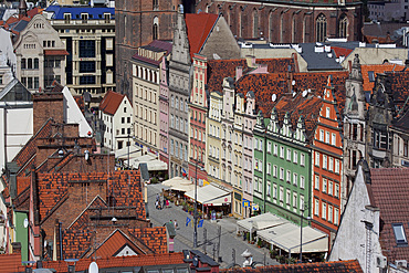
Old Town view from Marlii Magdaleny Church, Wroclaw, Silesia, Poland, Europe
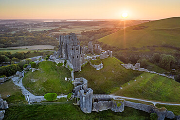
Aerial view of the abandoned ruins of Corfe Castle at sunrise, Dorset, England, United Kingdom, Europe

Jacques-Cartier River, Jacques-Cartier National Park, Province of Quebec, Canada, North America

Aerial view of the Grand Jorasses at sunrise, Mont Blanc massif, Courmayeur, Aosta Valley, Italy, Europe
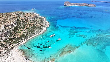
Aerial view of Balos Lagoon, Balos Beach and Cape Tigani, Gramvousa Peninsula, Chania Region, Crete, Greek Islands, Greece, Europe
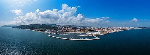
Aerial drone panoramic view of Setubal, Portugal
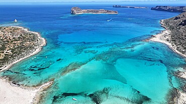
Aerial view of Balos Lagoon, Balos Beach and Cape Tigani, Gramvousa Peninsula, Chania Region, Crete, Greek Islands, Greece, Europe
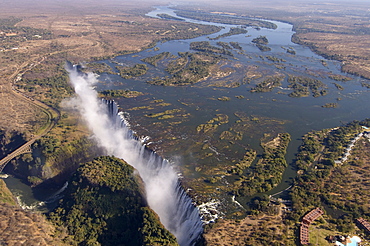
Victoria Falls, UNESCO World Heritage Site, Zambesi River, on the border of Zambia and Zimbabwe, Africa
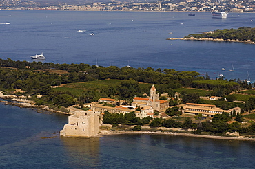
View from helicopter of Lerins Abbey, Ile Saint-Honorat, Iles de Lerins, Provence, Cote d'Azur, French Riviera, France, Mediterranean, Europe
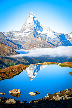
Aerial view of Stellisee lake and Matterhorn at sunrise, Zermatt, Valais Canton, Swiss Alps, Switzerland, Europe
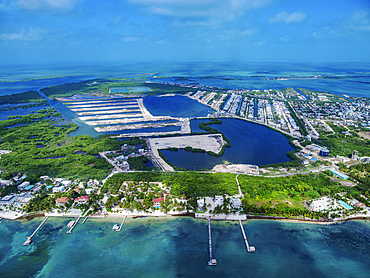
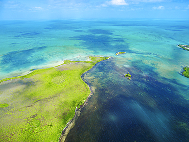
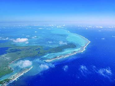
Ambergris Caye, aerial view, Belize District, Belize
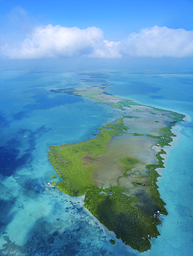
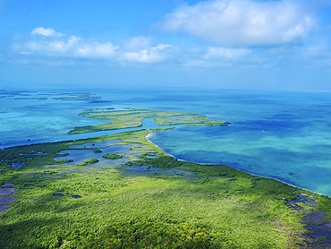
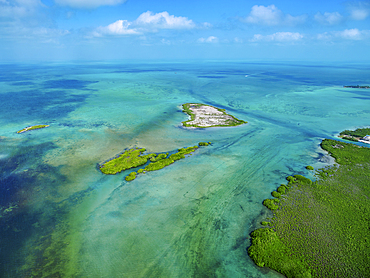
Hick's Cayes, aerial view, Belize District, Belize
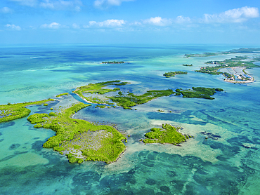
Ambergris Caye, aerial view, Belize District, Belize
Ambergris Caye, aerial view, Belize District, Belize
Ambergris Caye, aerial view, Belize District, Belize
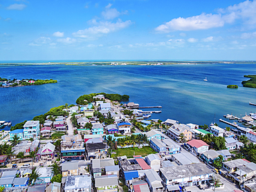
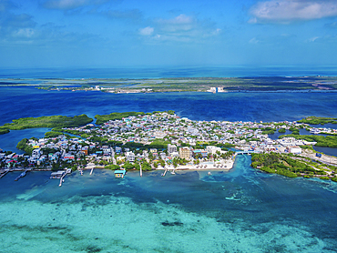
San Pedro Town, Ambergris Caye, aerial view, Belize District, Belize
Ambergris Caye, aerial view, Belize District, Belize
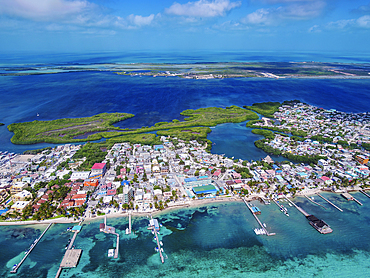
San Pedro Town, Ambergris Caye, aerial view, Belize District, Belize
San Pedro Town, Ambergris Caye, aerial view, Belize District, Belize
Ambergris Caye, aerial view, Belize District, Belize
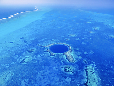
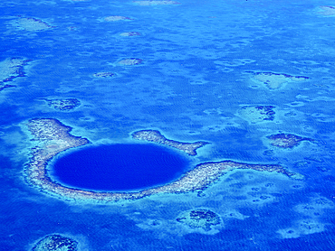
The Great Blue Hole, Lighthouse Reef, aerial view, Belize District, Belize
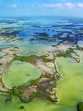
Turneffe Atoll, aerial view, Belize District, Belize
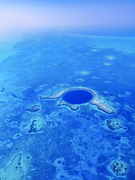
The Great Blue Hole, Lighthouse Reef, aerial view, Belize District, Belize
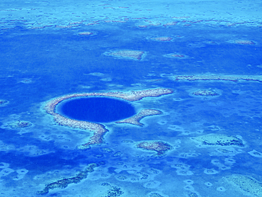
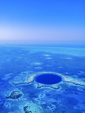
The Great Blue Hole, Lighthouse Reef, aerial view, Belize District, Belize
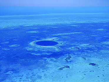
The Great Blue Hole, Lighthouse Reef, aerial view, Belize District, Belize
The Great Blue Hole, Lighthouse Reef, aerial view, Belize District, Belize
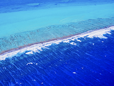
Lighthouse Reef, aerial view, Belize District, Belize
The Great Blue Hole, Lighthouse Reef, aerial view, Belize District, Belize
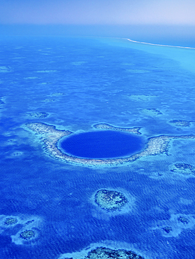
The Great Blue Hole, Lighthouse Reef, aerial view, Belize District, Belize