Results
« Previous 1 2
155 results found
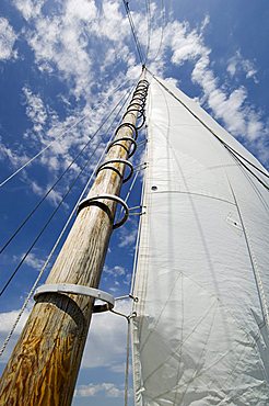
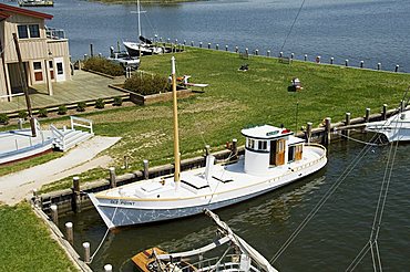
Rebecca T. Ruark, a famous historic Skipjack, the oldest in the U.S.A., Dogwood Harbour, Tilghman Island, Talbot County, Chesapeake Bay area, Maryland, United States of America, North America
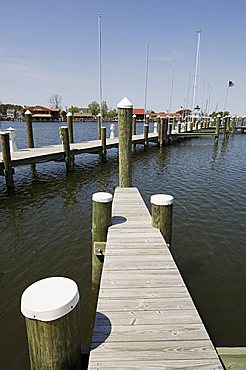
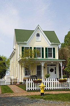
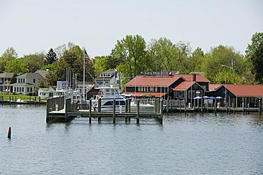
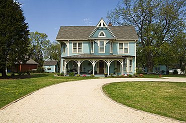
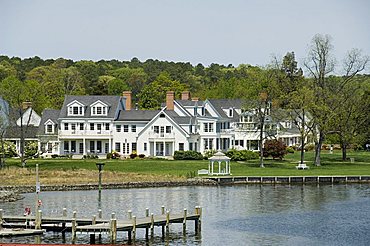
St. Michaels, Miles River, Chesapeake Bay area, Maryland, United States of America, North America
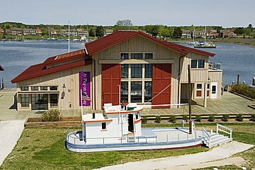
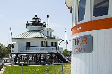
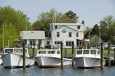
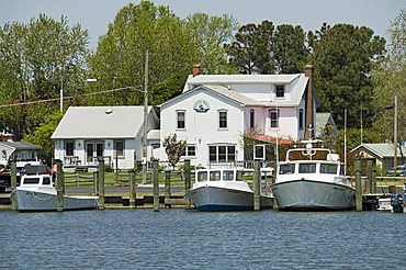
Chesapeake Bay Maritime Museum, St. Michaels, Talbot County, Miles River, Chesapeake Bay area, Maryland, United States of America, North America
Luskentyre Bay, tidal area at low tide, North Harris Hills in background, South Harris, Outer Hebrides, Scotland, United Kingdom, Europe
Clew Bay peninsula, Wesport area, County Mayo, Connacht, Eire (Ireland), Europe
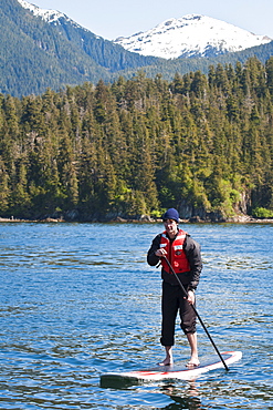
Paddleboarding in Windham Bay in the Chuck River Wilderness Area, Southeast Alaska, United States of America, North America
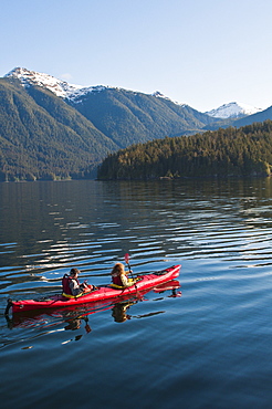
Kayaking in Windham Bay in the Chuck River Wilderness Area, Southeast Alaska, United States of America, North America
Chesapeake Bay Maritime Museum, St. Michaels, Talbot County, Miles River, Chesapeake Bay area, Maryland, United States of America, North America
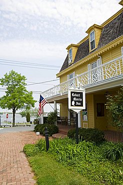
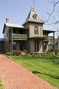
Famous historic Robert Morris Inn, Oxford, Talbot County, Chesapeake Bay area, Maryland, United States of America, North America
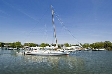
Rebecca T. Ruark, a famous historic Skipjack, the oldest in the U.S.A., Dogwood Harbour, Tilghman Island, Talbot County, Chesapeake Bay area, Maryland, United States of America, North America

Famous historic Robert Morris Inn, Oxford, Talbot County, Chesapeake Bay area, Maryland, United States of America, North America
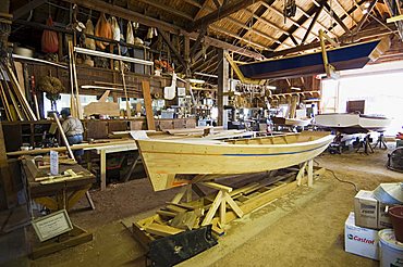
Chesapeake Bay Maritime Museum, St. Michaels, Talbot County, Miles River, Chesapeake Bay area, Maryland, United States of America, North America

Chesapeake Bay Maritime Museum, St. Michaels, Talbot County, Miles River, Chesapeake Bay area, Maryland, United States of America, North America
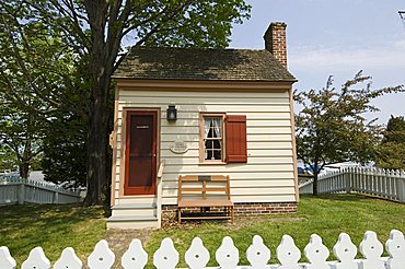
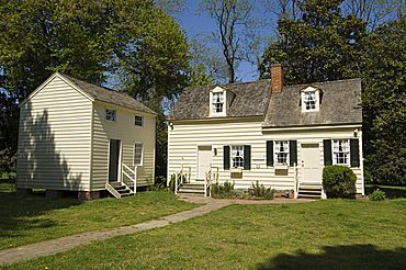
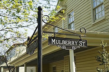
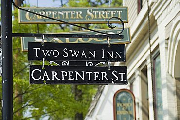
Oxford, Talbot County, Chesapeake Bay area, Maryland, United States of America, North America
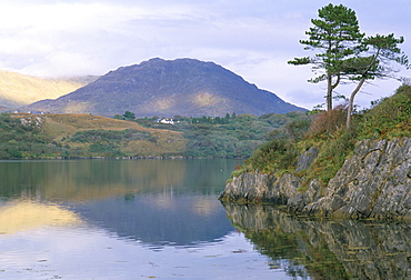
Clew Bay peninsula, Wesport area, County Mayo, Connacht, Eire (Ireland), Europe
The old Customs House, Oxford, Talbot County, Tred Avon River, Chesapeake Bay area, Maryland, United States of America, North America
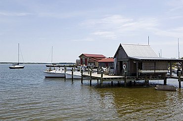
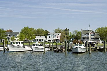
Knapps Narrows, Tilghman Island, Talbot County, Chesapeake Bay area, Maryland, United States of America, North America
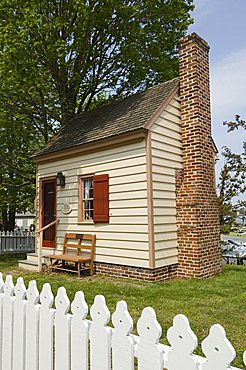
St. Michaels Museum, St. Mary's Square, St. Michaels, Talbot County, Chesapeake Bay area, Maryland, United States of America, North America
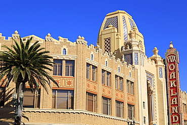
Historic Fox Theatre, Oakland, California, United States of America, North America
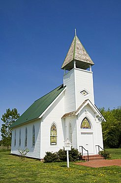
Church, Tilghman Island, Talbot County, Chesapeake Bay area, Maryland, United States of America, North America
Chesapeake Bay Maritime Museum, St. Michaels, Talbot County, Miles River, Chesapeake Bay area, Maryland, United States of America, North America

Historic Paramount Theatre, Oakland, California, United States of America, North America

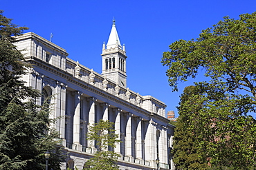
University of California, Berkeley, California, United States of America, North America
St. Michaels, Miles River, Chesapeake Bay area, Maryland, United States of America, North America
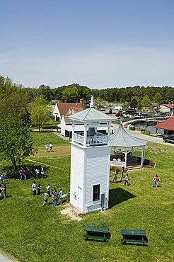
Typical historic lighthouse rescued and brought to the Chesapeake Bay Maritime Museum, St. Michaels, Talbot County, Miles River, Chesapeake Bay area, Maryland, United States of America, North America

Dogwood Harbour, Tilghman Island, Talbot County, Chesapeake Bay area, Maryland, United States of America, North America
Chesapeake Bay Maritime Museum, St. Michaels, Talbot County, Miles River, Chesapeake Bay area, Maryland, United States of America, North America
Chesapeake Bay Maritime Museum, St. Michaels, Talbot County, Miles River, Chesapeake Bay area, Maryland, United States of America, North America
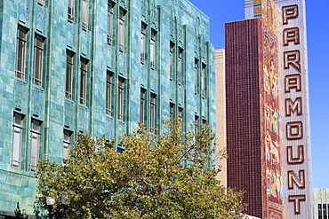
Historic Paramount Theatre, Oakland, California, United States of America, North America
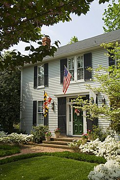
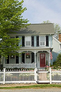
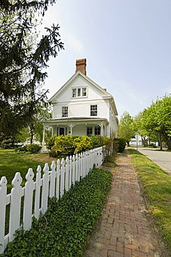
St. Michaels, Talbot County, Chesapeake Bay area, Maryland, United States of America, North America
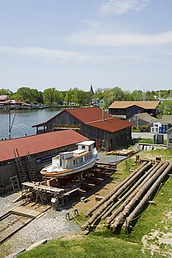
Chesapeake Bay Maritime Museum, St. Michaels, Talbot County, Miles River, Chesapeake Bay area, Maryland, United States of America, North America
Oxford, Talbot County, Chesapeake Bay area, Maryland, United States of America, North America
Oxford, Talbot County, Chesapeake Bay area, Maryland, United States of America, North America
St. Michaels, Talbot County, Chesapeake Bay area, Maryland, United States of America, North America
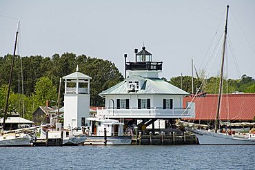
Typical historic lighthouse rescued and brought to the Chesapeake Bay Maritime Museum, St. Michaels, Talbot County, Miles River, Chesapeake Bay area, Maryland, United States of America, North America

St. Michaels, Talbot County, Chesapeake Bay area, Maryland, United States of America, North America
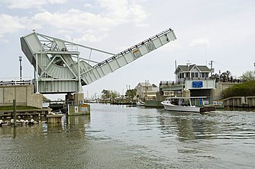
Knapps Narrows, Tilghman Island, Talbot County, Chesapeake Bay area, Maryland, United States of America, North America
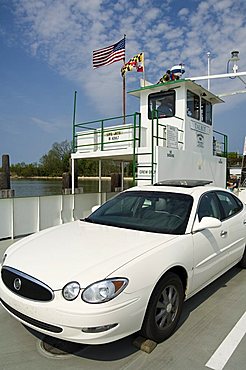
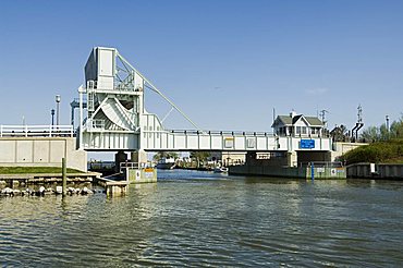
Oxford Bellevue Ferry, Oxford, Talbot County, Tred Avon River, Chesapeake Bay area, Maryland, United States of America, North America

Dogwood Harbour, Tilghman Island, Talbot County, Chesapeake Bay area, Maryland, United States of America, North America

Oxford, Talbot County, Chesapeake Bay area, Maryland, United States of America, North America

Easton, Talbot County, Chesapeake Bay area, Maryland, United States of America, North America
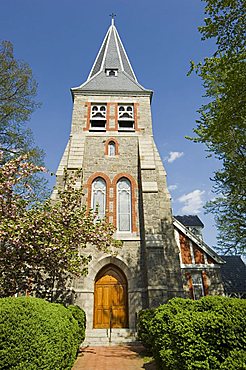
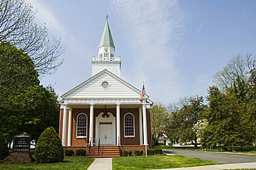
Christ Church, St. Michaels, Talbot County, Chesapeake Bay area, Maryland, United States of America, North America
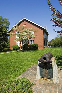
Masonic Lodge with old cannon, St. Michaels, Chesapeake Bay area, Maryland, United States of America, North America
University of California, Berkeley, California, United States of America, North America
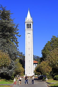
Campanile in the University of California, Berkeley, California, United States of America, North America
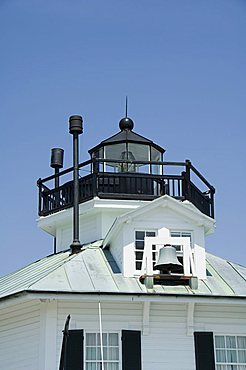
Typical historic lighthouse rescued and brought to the Chesapeake Bay Maritime Museum, St. Michaels, Talbot County, Miles River, Chesapeake Bay area, Maryland, United States of America, North America
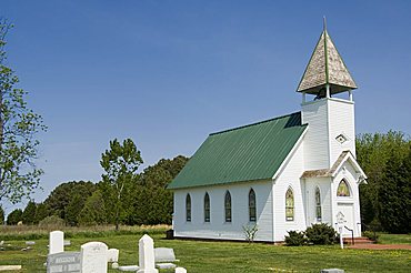
Church, Tilghman Island, Talbot County, Chesapeake Bay area, Maryland, United States of America, North America

Chesapeake Bay Maritime Museum, St. Michaels, Talbot County, Miles River, Chesapeake Bay area, Maryland, United States of America, North America
Oxford, Talbot County, Chesapeake Bay area, Maryland, United States of America, North America
Dogwood Harbour, Tilghman Island, Talbot County, Chesapeake Bay area, Maryland, United States of America, North America
St. Michaels, Talbot County, Chesapeake Bay area, Maryland, United States of America, North America
Oxford, Talbot County, Chesapeake Bay area, Maryland, United States of America, North America
Oxford, Talbot County, Chesapeake Bay area, Maryland, United States of America, North America
The old Customs House, Oxford, Talbot County, Tred Avon River, Chesapeake Bay area, Maryland, United States of America, North America

University of California, Berkeley, California, United States of America, North America
Dogwood Harbour, Tilghman Island, Talbot County, Chesapeake Bay area, Maryland, United States of America, North America
Dogwood Harbour, Tilghman Island, Talbot County, Chesapeake Bay area, Maryland, United States of America, North America

St. Michaels, Talbot County, Chesapeake Bay area, Maryland, United States of America, North America
Dogwood Harbour, Tilghman Island, Talbot County, Chesapeake Bay area, Maryland, United States of America, North America
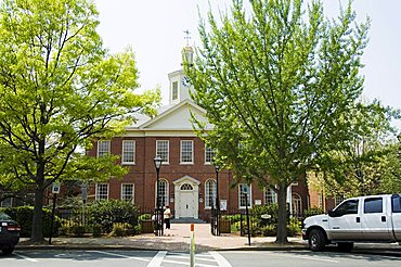
Easton, Talbot County, Chesapeake Bay area, Maryland, United States of America, North America
St. Michaels, Talbot County, Chesapeake Bay area, Maryland, United States of America, North America

View of the landscape in the Eastern Cape Province of South Africa. This is an area along the Coffee Bay road in a region formerly known as the Transkei.

A group of Xhosa women pose for a photo in the Eastern Cape Province of South Africa. This is an area along the Coffee Bay road in a region formerly known as the Transkei,
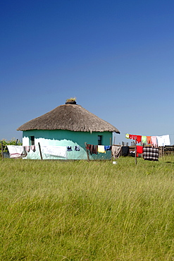
Washing hanging out to dry in the Eastern Cape Province of South Africa. This is an area along the Coffee Bay road in a region formerly known as the Transkei,
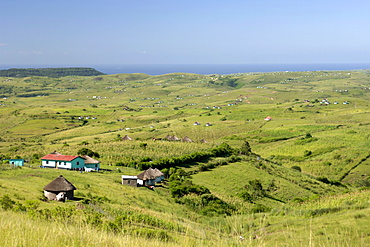
View of the landscape in the Eastern Cape Province of South Africa. This is an area along the Coffee Bay road in a region formerly known as the Transkei.

View of the landscape in the Eastern Cape Province of South Africa. This is an area along the Coffee Bay road in a region formerly known as the Transkei.
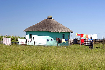
A Xhosa woman hangs out her washing to dry in the Eastern Cape Province of South Africa. This is an area along the Coffee Bay road in a region formerly known as the Transkei,
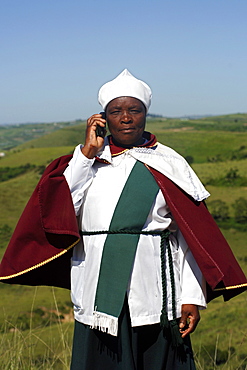
A Xhosa woman talks on her mobile/cell phone in the Eastern Cape Province of South Africa. This is an area along the Coffee Bay road in a region formerly known as the Transkei.
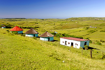
View of the landscape in the Eastern Cape Province of South Africa. This is an area along the Coffee Bay road in a region formerly known as the Transkei,
Carna Bay, Connemara area, County Galway, Connacht, Republic of Ireland, Europe

Pond intended for shrimp farm although non-productive in vast area of devastated mangroves, Balikpapan Bay, East Kalimantan, Borneo, Indonesia, Southeast Asia, Asia
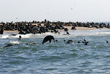
Colonies of sea lions on the beaches in the area of Walvis Bay, near Swakopmund, Skeleton coast, Namibia, Africa

Pond intended for shrimp farm although non-productive in vast area of devastated mangroves, Balikpapan Bay, East Kalimantan, Borneo, Indonesia, Southeast Asia, Asia

Pond intended for shrimp farm although non-productive in vast area of devastated mangroves, Balikpapan Bay, East Kalimanta, Borneo, Indonesia, Southeast Asia, Asia

Pond intended for shrimp farm although non-productive in vast area of devastated mangroves, Balikpapan Bay, East Kalimantan, Borneo, Indonesia, Southeast Asia, Asia
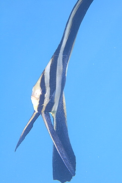
tallfin batfish (platax teira), juvenile, wild, day, marine protected area, diving off Coral Bay, Ningaloo reef, Western Australia, Indian Ocean. MORE INFO: with 3 dark bars, very long dorsal, anal and pelvic fins, feed on plankton from water column.
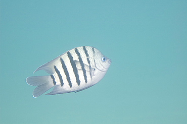
bengal sergeant (abudefduf bengalensis) wild, day, marine protected area, diving off Coral Bay, Ningaloo reef, Western Australia, Indian Ocean. MORE INFO: has rounded, white-edged tail lobes.
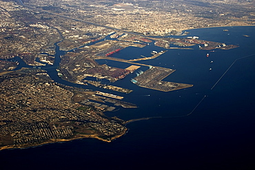
Aerial view of Long Beach area, California, United States of America, North America
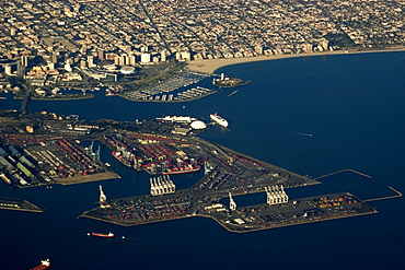
Aerial view of Long Beach area, California, United States of America, North America
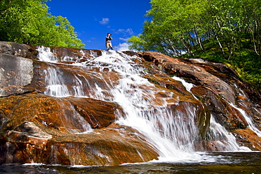
A beautiful waterfall just outside the small Norwegian summer area in Sandvika Bay on the south side of Svesfjord, Norway.
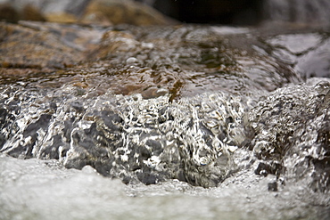
Detail from a waterfall in the small Norwegian summer area in Sandvika Bay on the south side of Svesfjord, Norway.
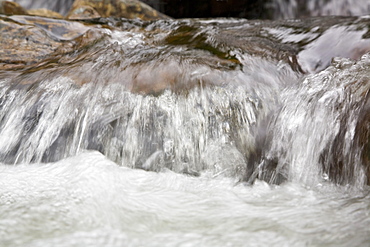
Detail from a waterfall in the small Norwegian summer area in Sandvika Bay on the south side of Svesfjord, Norway.

A beautiful waterfall just outside the small Norwegian summer area in Sandvika Bay on the south side of Svesfjord, Norway.
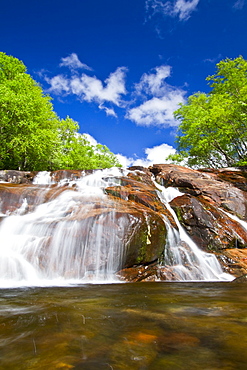
A beautiful waterfall just outside the small Norwegian summer area in Sandvika Bay on the south side of Svesfjord, Norway.
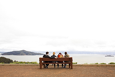
Friends sitting on bench admiring scenic view of ocean
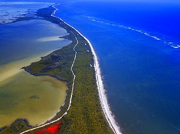
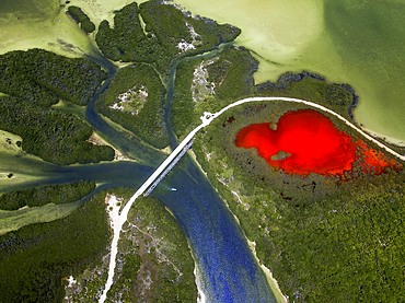
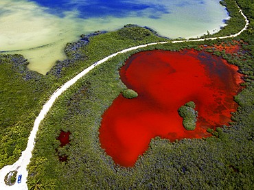
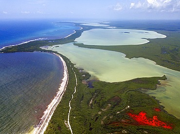
Aerial view of Punta Allen Sian Ka'an Reserve, Yucatan Peninsula, Mexico. Red lagoon near Boca Paila Bridge.
In the language of the Mayan peoples who once inhabited this region, Sian Ka'an means Origin of the Sky. Located on the east coast of the Yucatán peninsula, this biosphere reserve contains tropical forests, mangroves and marshes, as well as a large marine section intersected by a barrier reef. It provides a habitat for a remarkably rich flora and a fauna comprising more than 300 species of birds, as well as a large number of the region's characteristic terrestrial vertebrates, which cohabit in the diverse environment formed by its complex hydrological system.
Along its roughly 120 kilometres of coastline, the property covers over 400,000 hectares of land ranging from sea level to only ten m.a.s.l. The property boasts diverse tropical forests, palm savannah, one of the most pristine wetlands in the region, lagoons, extensive mangrove stands, as well as sandy beaches and dunes. The 120,000 hectares of marine area protect a valuable part of the Mesoamerican Barrier Reef and seagrass beds in the shallow bays. The lush green of the forests and the many shades of blue of the lagoons and the Caribbean Sea under a wide sky offer fascinating visual impressions.

Palms and old pier in Punta Allen Sian Ka'an Reserve, Yucatan Peninsula, Mexico.
In the language of the Mayan peoples who once inhabited this region, Sian Ka'an means Origin of the Sky. Located on the east coast of the Yucatán peninsula, this biosphere reserve contains tropical forests, mangroves and marshes, as well as a large marine section intersected by a barrier reef. It provides a habitat for a remarkably rich flora and a fauna comprising more than 300 species of birds, as well as a large number of the region's characteristic terrestrial vertebrates, which cohabit in the diverse environment formed by its complex hydrological system.
Along its roughly 120 kilometres of coastline, the property covers over 400,000 hectares of land ranging from sea level to only ten m.a.s.l. The property boasts diverse tropical forests, palm savannah, one of the most pristine wetlands in the region, lagoons, extensive mangrove stands, as well as sandy beaches and dunes. The 120,000 hectares of marine area protect a valuable part of the Mesoamerican Barrier Reef and seagrass beds in the shallow bays. The lush green of the forests and the many shades of blue of the lagoons and the Caribbean Sea under a wide sky offer fascinating visual impressions.
Pia bay or Pia Fjord, in Beagle Channel (northwest branch), PN Alberto de Agostini, Tierra del Fuego, Patagonia, Chile
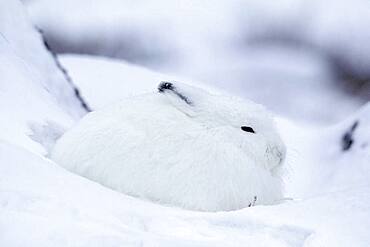
Adult Arctic Hare (Lepus arcticus) camouflage hiding in snow near Hudson Bay, Churchill area, Manitoba, Northern Canada
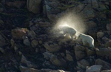
Mother Polar Bear (ursus maritimus) with cub shaking off water halo on rocky cliff in sub-arctic Wager Bay near Hudson Bay, Churchill area, Manitoba, Northern Canada
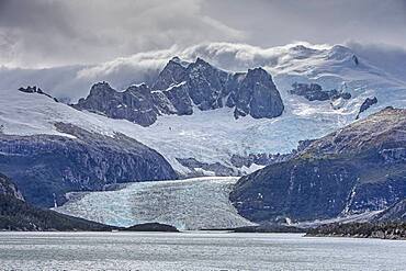
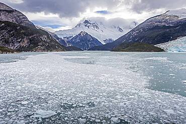
Pia Glacier, from Pia bay, in Beagle Channel (northwest branch), PN Alberto de Agostini, Tierra del Fuego, Patagonia, Chile
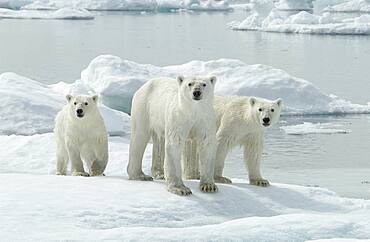
Mother Polar Bear (ursus maritimus) with cubs dripping on ice in sub-arctic Wager Bay near Hudson Bay, Churchill area, Manitoba, Northern Canada
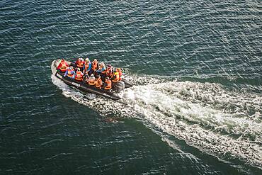
Explorers riding a zodiac, in Seno Almirantazgo, PN Alberto de Agostini, Tierra del Fuego, Patagonia, Chile
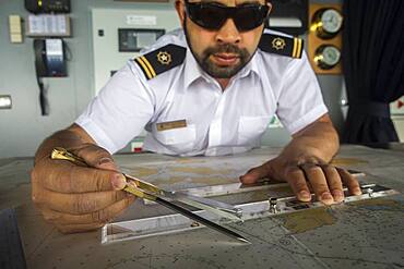
Officer calculating the course of the ship, ship's bridge, Ventus cruise ship, Nassau bay, near Cape Horn, Tierra de Fuego, Patagonia, Chile
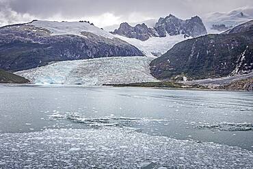
Pia Glacier, from Pia bay, in Beagle Channel (northwest branch), PN Alberto de Agostini, Tierra del Fuego, Patagonia, Chile

Guam, Micronesia: outrigger canoe paddlers at sunset at Tumon Bay resort area.
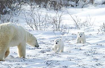
Mother Polar Bear (ursus maritimus) with cubs COY near snow den at Wapusk National Park, Hudson Bay, Churchill area, Manitoba, Northern Canada