Results
« Previous 1 2
118 results found
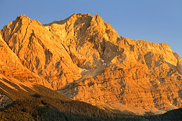
Wettersteingebirge and Zugspitze Mountains at sunset, near Grainau, Werdenfelser Land range, Upper Bavaria, Bavaria, Germany, Europe
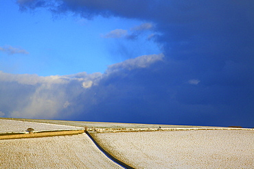
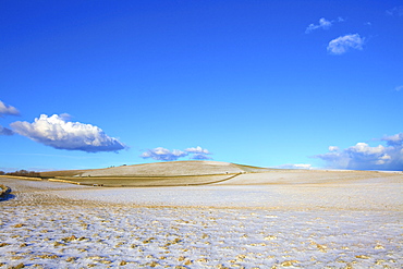
Snow covered South Downs farm land, East Dean, East Sussex, England, United Kingdom, Europe
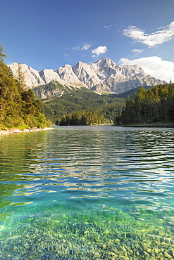
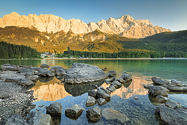
Eibsee Lake and Zugspitze Mountain, near Grainau, Werdenfelser Land range, Upper Bavaria, Bavaria, Germany, Europe
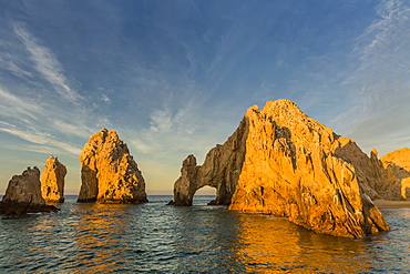
Sunrise at Land's End, Cabo San Lucas, Baja California Sur, Gulf of California, Mexico, North America
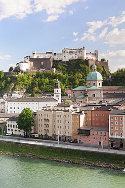
The Old Town, UNESCO World Heritage Site, with Hohensalzburg Fortress, Dom Cathedral and Neue Residenz Palace, Salzburg, Salzburger Land, Austria, Europe
Eibsee Lake, Eibsee Hotel and Wettersteingebirge Mountains, near Grainau, Werdenfelser Land range, Upper Bavaria, Bavaria, Germany, Europe
Snow covered South Downs farm land, East Dean, East Sussex, England, United Kingdom, Europe
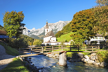
Parish Church, Reiteralpe Mountain, Ramsauer Ache River, Ramsau, Berchtesgadener Land, Upper Bavaria, Bavaria, Germany, Europe

High angle view of the old town with Hohensalzburg Fortress, Dom Cathedral and Kappuzinerkirche Church, UNESCO World Heritage Site, Salzburg, Salzburger Land, Austria, Europe
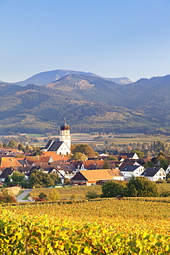
Vineyards in autumn, Ehrenkirchen, District Ehrenstetten, Markgrafler Land, Black Forest, Baden Wurttemberg, Germany, Europe

High angle view of the old town with Hohensalzburg Fortress, Dom Cathedral and Kappuzinerkirche Church, UNESCO World Heritage Site, Salzburg, Salzburger Land, Austria, Europe
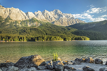
Eibsee Lake and Zugspitze Mountain, near Grainau, Werdenfelser Land range, Upper Bavaria, Bavaria, Germany, Europe
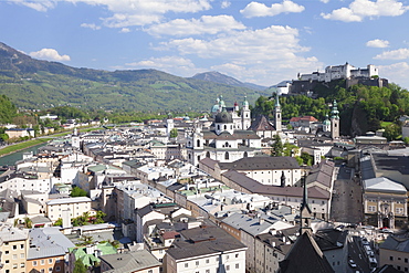
High angle view of the old town with Hohensalzburg Fortress, Dom Cathedral and Kappuzinerkirche Church, UNESCO World Heritage Site, Salzburg, Salzburger Land, Austria, Europe
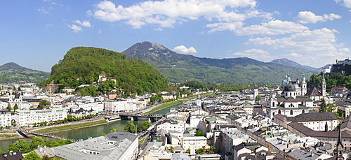
High angle view from Monchsberg mountain over the old town of Salzburg, UNESCO World Heritage Site, Salzburger Land, Austria, Europe

High angle view of the old town with Hohensalzburg Fortress, Dom Cathedral and Kappuzinerkirche Church, UNESCO World Heritage Site, Salzburg, Salzburger Land, Austria, Europe
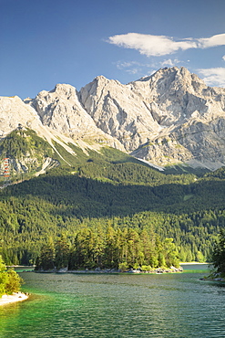
Eibsee Lake and Zugspitze Mountain, near Grainau, Werdenfelser Land range, Upper Bavaria, Bavaria, Germany, Europe
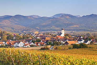
Vineyards in autumn, Ehrenkirchen, District Ehrenstetten, Markgrafler Land, Black Forest, Baden Wurttemberg, Germany, Europe
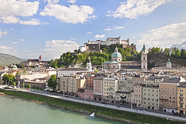
High angle view of the old town with Hohensalzburg Fortress, Dom Cathedral and Kappuzinerkirche Church, UNESCO World Heritage Site, Salzburg, Salzburger Land, Austria, Europe
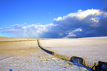
Snow covered South Downs farm land, East Dean, East Sussex, England, United Kingdom, Europe

High angle view of the old town with Hohensalzburg Fortress, Dom Cathedral and Kappuzinerkirche Church at dusk, UNESCO World Heritage Site, Salzburg, Salzburger Land, Austria, Europe
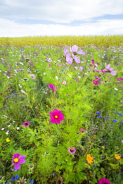
Wildflower border by maize crop in a field in rural Normandy, France
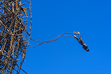
Man jumping from a bamboo tower, Pentecost land diving, Pentecost, Vanuatu, Pacific

Man jumping from a bamboo tower, Pentecost land diving, Pentecost, Vanuatu, Pacific
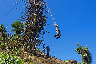
Man jumping from a bamboo tower, Pentecost land diving, Pentecost, Vanuatu, Pacific

Man jumping from a bamboo tower, Pentecost land diving, Pentecost, Vanuatu, Pacific
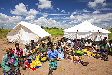
In mid January 2015, a three day period of excessive rain brought unprecedented floods to the small poor African country of Malawi. It displaced nearly quarter of a million people, devastated 64,000 hectares of land, and killed several hundred people. This shot shows displaced people in Baani refugee camp near Phalombe, preparing pumpkin flowers to eat.

Grubbed out Olive trees that no longer have water to irrigate them near Bakersfield, California, USA. Following an unprecedented four year long drought, Bakersfield is now the driest city in the USA. Most of California is in exceptional drought, the highest level of drought classification. 428,000 acres of agricultural land have been taken out of production due to lack of water, thousands of agricultural workers have lost their jobs and one third of all children in California go to bed hungry.

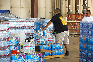
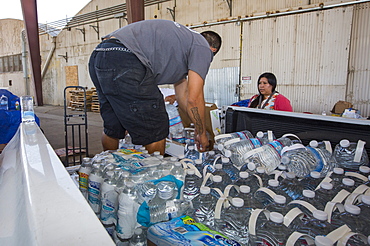
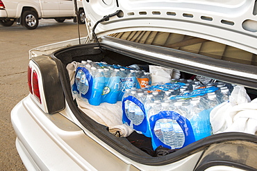
A water charity in Porterville supplying bottled water to houses who have had no running water for over five months, near Bakersfield, California, USA. Hoses in the East of Porterville, many of which are on private wells, have run completely out of water as the water table has dropped catastrophically. Following an unprecedented four year long drought, Bakersfield is now the driest city in the USA. Most of California is in exceptional drought, the highest level of drought classification. 428,000 acres of agricultural land have been taken out of production due to lack of water, thousands of agricultural workers have lost their jobs and one third of all children in California go to bed hungry.

Dying Olive trees that no longer have water to irrigate them near Bakersfield, California, USA. Following an unprecedented four year long drought, Bakersfield is now the driest city in the USA. Most of California is in exceptional drought, the highest level of drought classification. 428,000 acres of agricultural land have been taken out of production due to lack of water, thousands of agricultural workers have lost their jobs and one third of all children in California go to bed hungry.
A water charity in Porterville supplying bottled water to houses who have had no running water for over five months, near Bakersfield, California, USA. Hoses in the East of Porterville, many of which are on private wells, have run completely out of water as the water table has dropped catastrophically. Following an unprecedented four year long drought, Bakersfield is now the driest city in the USA. Most of California is in exceptional drought, the highest level of drought classification. 428,000 acres of agricultural land have been taken out of production due to lack of water, thousands of agricultural workers have lost their jobs and one third of all children in California go to bed hungry.

Abandoned dead and dying Orange trees that no longer have water to irrigate them near Bakersfield, California, USA. Following an unprecedented four year long drought, Bakersfield is now the driest city in the USA. Most of California is in exceptional drought, the highest level of drought classification. 428,000 acres of agricultural land have been taken out of production due to lack of water, thousands of agricultural workers have lost their jobs and one third of all children in California go to bed hungry.
A water charity in Porterville supplying bottled water to houses who have had no running water for over five months, near Bakersfield, California, USA. Hoses in the East of Porterville, many of which are on private wells, have run completely out of water as the water table has dropped catastrophically. Following an unprecedented four year long drought, Bakersfield is now the driest city in the USA. Most of California is in exceptional drought, the highest level of drought classification. 428,000 acres of agricultural land have been taken out of production due to lack of water, thousands of agricultural workers have lost their jobs and one third of all children in California go to bed hungry.
A water charity in Porterville supplying bottled water to houses who have had no running water for over five months, near Bakersfield, California, USA. Hoses in the East of Porterville, many of which are on private wells, have run completely out of water as the water table has dropped catastrophically. Following an unprecedented four year long drought, Bakersfield is now the driest city in the USA. Most of California is in exceptional drought, the highest level of drought classification. 428,000 acres of agricultural land have been taken out of production due to lack of water, thousands of agricultural workers have lost their jobs and one third of all children in California go to bed hungry.

A water charity in Porterville supplying bottled water to houses who have had no running water for over five months, near Bakersfield, California, USA. Hoses in the East of Porterville, many of which are on private wells, have run completely out of water as the water table has dropped catastrophically. Following an unprecedented four year long drought, Bakersfield is now the driest city in the USA. Most of California is in exceptional drought, the highest level of drought classification. 428,000 acres of agricultural land have been taken out of production due to lack of water, thousands of agricultural workers have lost their jobs and one third of all children in California go to bed hungry.

Abandoned dead and dying Orange trees that no longer have water to irrigate them near Bakersfield, California, USA. Following an unprecedented four year long drought, Bakersfield is now the driest city in the USA. Most of California is in exceptional drought, the highest level of drought classification. 428,000 acres of agricultural land have been taken out of production due to lack of water, thousands of agricultural workers have lost their jobs and one third of all children in California go to bed hungry.

Burnt ground from a wildfire near Bakersfield, California, USA. Following an unprecedented four year long drought, Bakersfield is now the driest city in the USA. Most of California is in exceptional drought, the highest level of drought classification. Wild fires are much more common due to the drought. 428,000 acres of agricultural land have been taken out of production due to lack of water, thousands of agricultural workers have lost their jobs and one third of all children in California go to bed hungry.
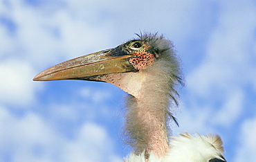
marabou stork: leptoptilos crumeniferus juvenile kent, eng land
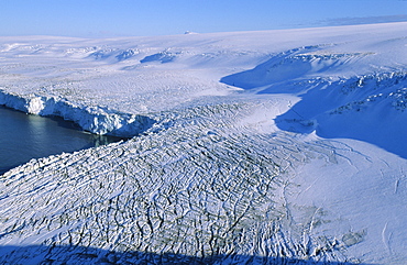
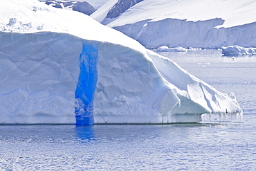
View of a land-based glacier calving into the sea. Hannah Point, Livingston Island, ntarctic Peninsula, Antarctica.
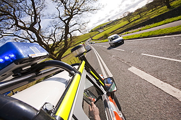
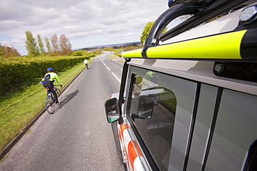
A Land Rover belonging to the Langdale Ambleside Mountain Rescue Team driving under blue lights in an emergency situation, Cumbria, England, United Kingdom, Europe
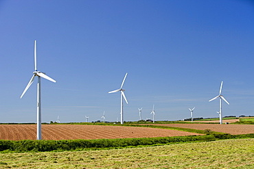
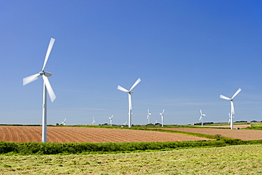
A wind farm on agricultural land in West Cornwall near St Ives, Cornwall, England, United Kingdom, Europe
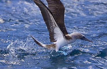
Blue-footed booby (Sula nebouxii) in the Galapagos Island Group, Ecuador. The Galapagos are a nesting and breeding area for blue-footed boobies.
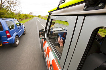
A Land Rover belonging to the Langdale Ambleside Mountain Rescue Team driving under blue lights in an emergency situation, Cumbria, England, United Kingdom, Europe
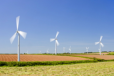
A wind farm on agricultural land in West Cornwall near St Ives, Cornwall, England, United Kingdom, Europe
A Land Rover belonging to the Langdale Ambleside Mountain Rescue Team driving under blue lights in an emergency situation, Cumbria, England, United Kingdom, Europe
A wind farm on agricultural land in West Cornwall near St Ives, Cornwall, England, United Kingdom, Europe
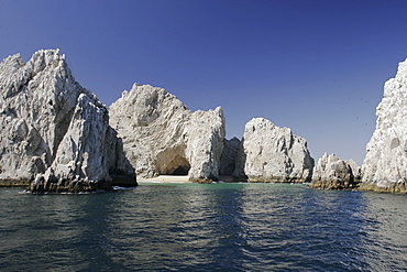
Honeymoon beach at land's end in Cabo San Lucas at the end of the Baja California penninsula, Mexico.
Views of Bourgeois Fjord, Pourquoi Pas Island and Blaiklock Island and the west coast of Graham Land
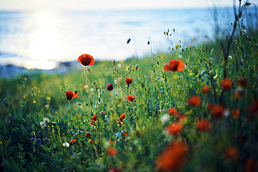
Close up of poppy field
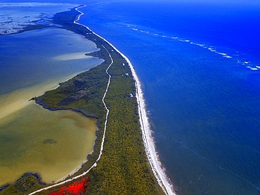
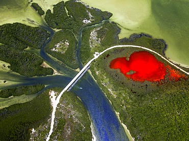
Aerial view of Punta Allen Sian Ka'an Reserve, Yucatan Peninsula, Mexico. Red lagoon near Boca Paila Bridge.
In the language of the Mayan peoples who once inhabited this region, Sian Ka'an means Origin of the Sky. Located on the east coast of the Yucatán peninsula, this biosphere reserve contains tropical forests, mangroves and marshes, as well as a large marine section intersected by a barrier reef. It provides a habitat for a remarkably rich flora and a fauna comprising more than 300 species of birds, as well as a large number of the region's characteristic terrestrial vertebrates, which cohabit in the diverse environment formed by its complex hydrological system.
Along its roughly 120 kilometres of coastline, the property covers over 400,000 hectares of land ranging from sea level to only ten m.a.s.l. The property boasts diverse tropical forests, palm savannah, one of the most pristine wetlands in the region, lagoons, extensive mangrove stands, as well as sandy beaches and dunes. The 120,000 hectares of marine area protect a valuable part of the Mesoamerican Barrier Reef and seagrass beds in the shallow bays. The lush green of the forests and the many shades of blue of the lagoons and the Caribbean Sea under a wide sky offer fascinating visual impressions.
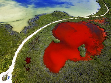
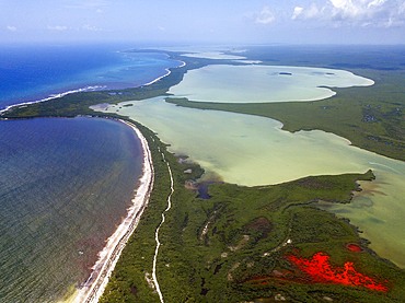

Palms and old pier in Punta Allen Sian Ka'an Reserve, Yucatan Peninsula, Mexico.
In the language of the Mayan peoples who once inhabited this region, Sian Ka'an means Origin of the Sky. Located on the east coast of the Yucatán peninsula, this biosphere reserve contains tropical forests, mangroves and marshes, as well as a large marine section intersected by a barrier reef. It provides a habitat for a remarkably rich flora and a fauna comprising more than 300 species of birds, as well as a large number of the region's characteristic terrestrial vertebrates, which cohabit in the diverse environment formed by its complex hydrological system.
Along its roughly 120 kilometres of coastline, the property covers over 400,000 hectares of land ranging from sea level to only ten m.a.s.l. The property boasts diverse tropical forests, palm savannah, one of the most pristine wetlands in the region, lagoons, extensive mangrove stands, as well as sandy beaches and dunes. The 120,000 hectares of marine area protect a valuable part of the Mesoamerican Barrier Reef and seagrass beds in the shallow bays. The lush green of the forests and the many shades of blue of the lagoons and the Caribbean Sea under a wide sky offer fascinating visual impressions.
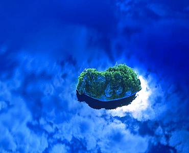
Bora Bora, Tahiti

Yokoyama Observatory, Mie Prefecture
Lake Mashu, Hokkaido
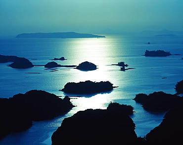
99 Islands, Nagasaki Prefecture
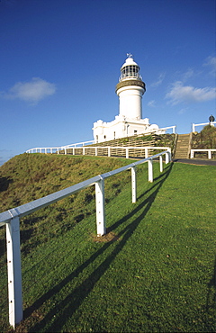
Lighthouse, Byron Bay, Qeensland, Australien
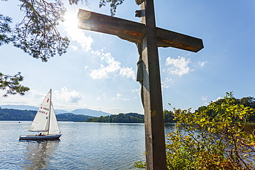
Cross on the Jakob island, Staffelsee, with sailing boat, near Murnau, Blue Land, district Garmisch-Partenkirchen, Bavarian alpine foreland, Upper Bavaria, Bavaria, Germany, Europe
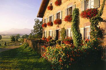
Farmhouse in Hofheim, Blue Land, Upper Bavaria, Bavaria, Germany
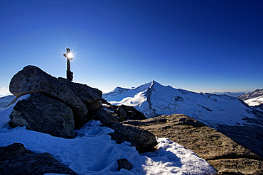
Summit cross on the top of the Keeskogel: in the south of the Großvenediger, Obersulzbachtal, Salzburger Land, Hohe Tauern National Park, Austria
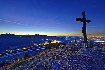
Night mood on the Heuberg with summit cross and deep view of the Inn Valley and illuminated places of the Rosenheimer Land, Heuberg, Chiemgau Alps, Upper Bavaria, Bavaria, Germany

People on the beach on a tongue of land under blue sky, Golden Horn, Brac island, Croatian Adriatic Sea, Dalmatia, Croatia, Europe

People on the beach on a tongue of land under blue sky, Golden Horn, Brac island, Croatian Adriatic Sea, Dalmatia, Croatia, Europe

Boy sitting on the lake shore with his feet in the water, Lake Staffelsee, Upper Bavaria, Bavaria, Germany
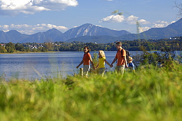
Family at Lake Staffelsee, Upper Bavaria, Bavaria, Germany
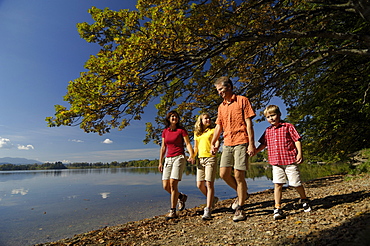
Family walking along the lake shore of Lake Saffelsee, Upper Bavaria, Bavaria, Germany
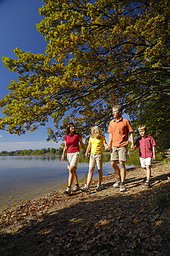
Family walking along the lake shore of Lake Saffelsee, Upper bavaria, Bavaria, Germany

Coastline, heather blossom on the Atlantic coast, view on the South West Coast Path, blue sky in summer, headland Land's End, Lands End, Penzance, Penwith Peninsula, Cornwall, England, Great Britain
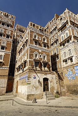
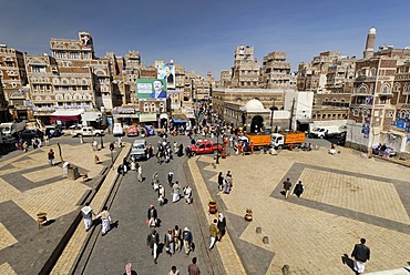
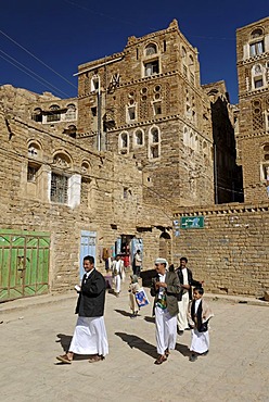
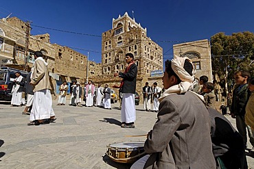
Decorated house in the old town of Sanaa, Sana´a, Yemen
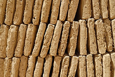
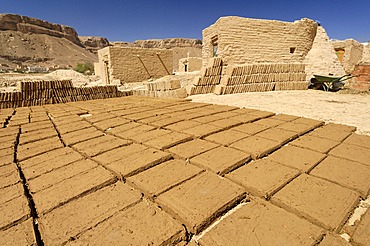
Mud brick production at Al Hajjaryn, Wadi Doan, Yemen
Bab al Jemen, Bab al Yemen, Sanaa, Sana´a, Yemen
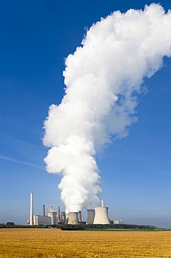
Kraftwerk Neurath power plant with a huge cloud of steam, Grevenbroich, North Rhine-Westphalia, Germany, Europe
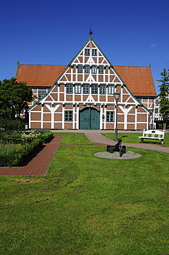
Half-timbered house, Town Hall, Jork, Altes Land, Lower Saxony, Germany, Europe, PublicGround
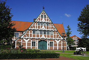
Half-timbered house, Town Hall, Jork, Altes Land, Lower Saxony, Germany, Europe, PublicGround
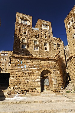
Decorated stone houses in the old town of Thula, Yemen
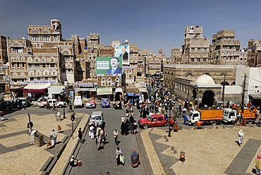
Bab al Jemen, Bab al Yemen, Sanaa, Sana´a, Yemen
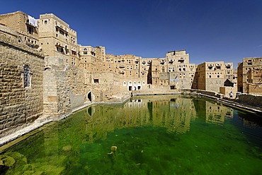
Cisterne of Habbaba, Yemen

Socotra Desert Rose or Bottle Tree, adenium obesum sokotranum, Socotra island, UNESCO World Heritage Site, Yemen
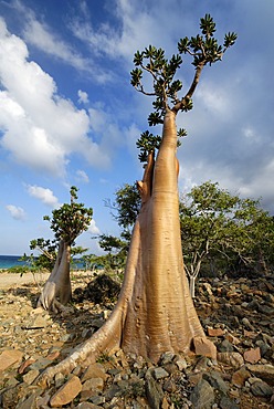
Socotra Desert Rose or Bottle Tree, adenium obesum sokotranum, Socotra island, UNESCO World Heritage Site, Yemen
Mud brick production at Al Hajjaryn, Wadi Doan, Yemen
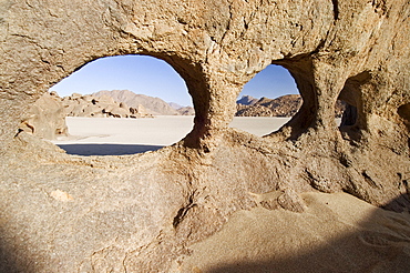
Hole in the rock, Jebel Uweinat, Jabal al Awaynat
Decorated stone houses in the old town of Thula, Yemen
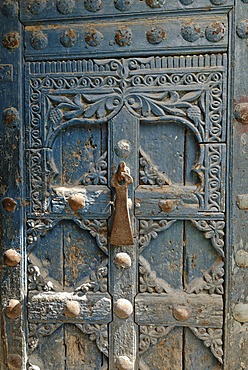
Historic door in the old town of Al Mukalla, Mukalla, Yemen
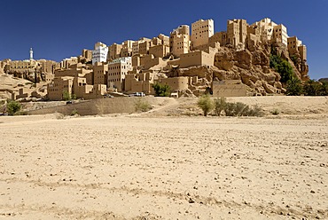
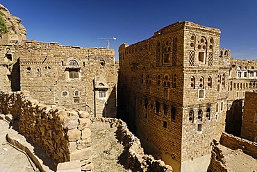
Old town of Al Hajjaryn, Wadi Doan, Hadramaut, Yemen

Socotra Desert Rose or Bottle Tree, adenium obesum sokotranum, Socotra island, UNESCO World Heritage Site, Yemen

Bavarian flag with King Ludwig II of Bavaria
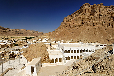
Grave site of the prophet Hud, pilgrimage site of Gabr Hud, Qabr Hud, Wadi Hadramaut, Yemen
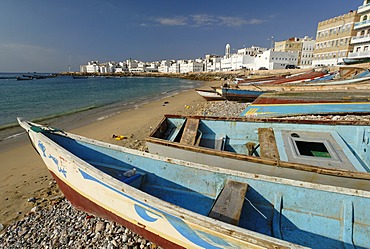
Harbor of Al Mukalla, Mukalla, Yemen
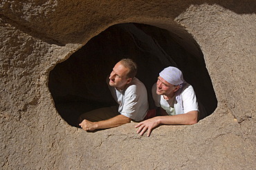
Man looking through a hole in the rock, Jebel Uweinat, Jabal al Awaynat, Libya

Blue sky, Pilbara Region, Western Australia, Australia, Oceania
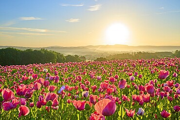
Opium poppy (Papaver somniferum), pink poppies at dawn with fresh blue sky, summer, Germerode, Geo nature park Park Frau-Holle-Land, Hoher Meissner, Hesse, Germany
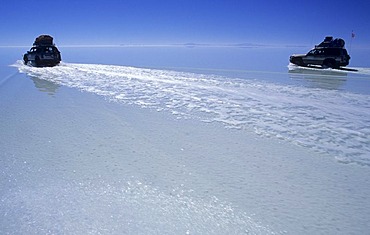
Fourwheeldrive vehicle driving over Salar de Uyuni, Bolivia
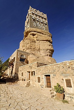
Dar al Hadschar, palace of iman Yachya at Wadi Darr, Dhar, Yemen
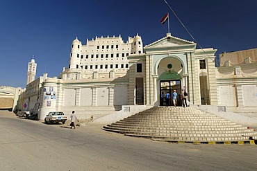
Palace of the sultan, Sayun, Wadi Hadramaut, Yemen

Al-Kaff Palace Isch Schaa, holy city of Tarim, Wadi Hadramaut, Yemen
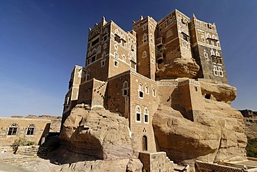
Dar al Hadschar, palace of iman Yachya at Wadi Darr, Dhar, Yemen
Old town of Thula, Yemen
Wedding day in Thula, Yemen
Altocumulus clouds in a blue sky and mountain panorama, Manndlwand, Salzburger Land, Austria, Europe