Results
« Previous 1 2 3 Next »
299 results found
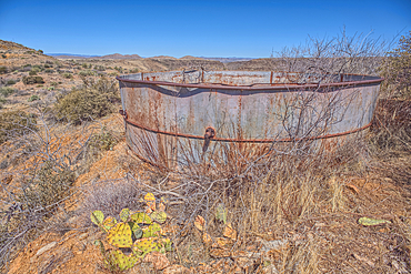
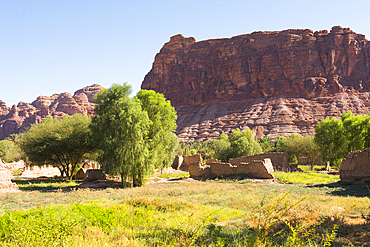
Remnants of the Richinbar Mine within the Agua Fria National Monument, Black Canyon City, Arizona, USA
Remnants of the Richinbar Mine within the Agua Fria National Monument, Black Canyon City, Arizona, USA
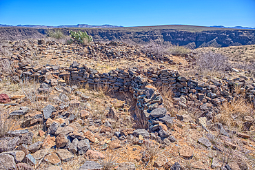
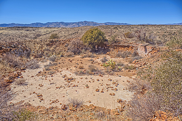
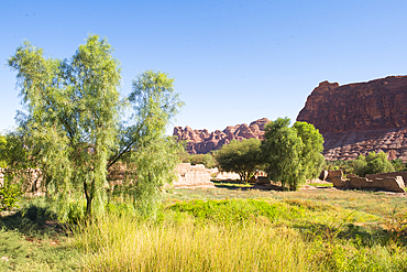
Ancient Indian Ruins near the historic Richinbar Mine in the Agua Fria National Monument, Black Canyon City, Arizona, USA
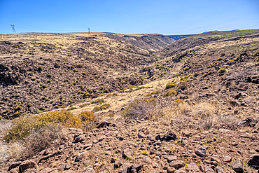
An unnamed tributary canyon near the Sunset Point Rest Stop, Arizona, USA
O'Leary Peak, Coconino National Forest, Arizona, USA
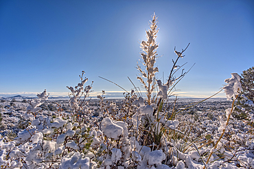
Snow covered landscape, Chino Valley, Arizona, USA
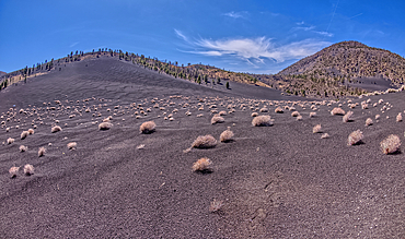
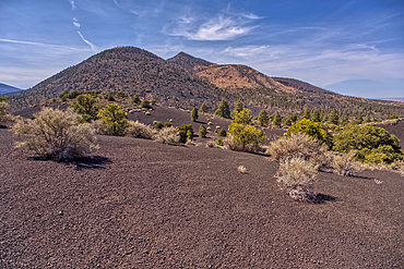
Volcanic cinder hills in Coconino National Forest, Arizona, USA
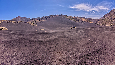
Volcanic cinder hills in Coconino National Forest, Arizona, USA
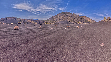
Volcanic cinder hills in Coconino National Forest, Arizona, USA
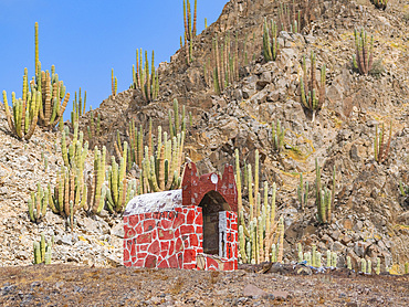
Small shrine in Puerto Refugio on the northern end of Angel de la Guarda Island, Baja California, Sea of Cortez, Mexico, North America
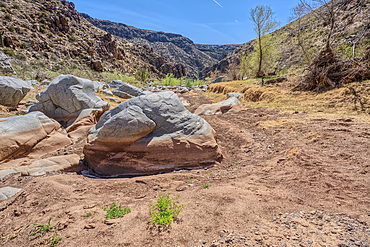
The granite riverbed of the Agua Fria River Canyon in the Agua Fria National Monument of Arizona.
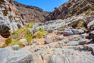
The granite riverbed of the Agua Fria River Canyon in the Agua Fria National Monument of Arizona.
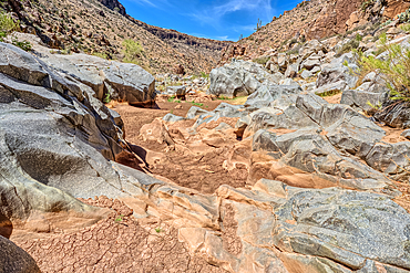
The granite riverbed of the Agua Fria River Canyon in the Agua Fria National Monument of Arizona.
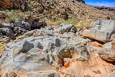
The granite riverbed of the Agua Fria River Canyon in the Agua Fria National Monument of Arizona.
The granite riverbed of the Agua Fria River Canyon in the Agua Fria National Monument of Arizona.
The granite riverbed of the Agua Fria River Canyon in the Agua Fria National Monument of Arizona.
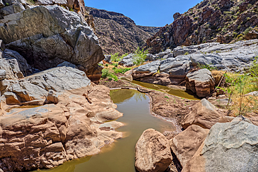
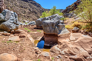
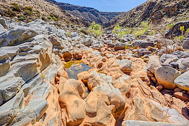
An ephemeral pool of water in the granite riverbed of the Agua Fria River Canyon in the Agua Fria National Monument of Arizona.
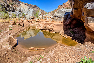
An ephemeral pool of water in the granite riverbed of the Agua Fria River Canyon in the Agua Fria National Monument of Arizona.
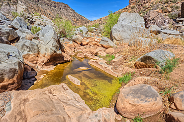
An ephemeral pool of water in the granite riverbed of the Agua Fria River Canyon in the Agua Fria National Monument of Arizona.
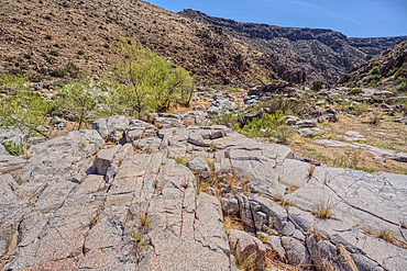
The granite riverbed of the Agua Fria River Canyon in the Agua Fria National Monument of Arizona.
The granite riverbed of the Agua Fria River Canyon in the Agua Fria National Monument of Arizona.
The granite riverbed of the Agua Fria River Canyon in the Agua Fria National Monument of Arizona.
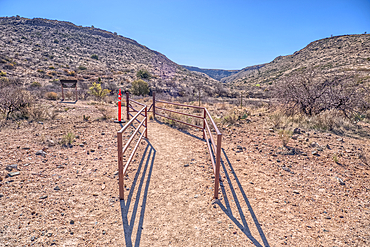
Entrance to the Badger Springs Trailhead in the Agua Fria National Monument of Arizona.
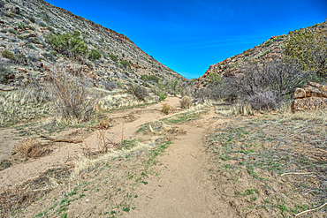
Badger Springs Creek Canyon in the Agua Fria National Monument of Arizona.
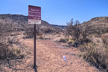
Sign marking the Badger Springs Trail in the Agua Fria National Monument of Arizona.
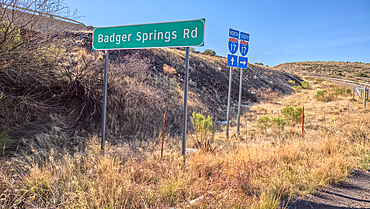
Sign marking Badger Springs Road off of I-17 Arizona. This road leads to a hiking trail in the Agua Fria National Monument.
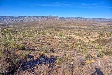
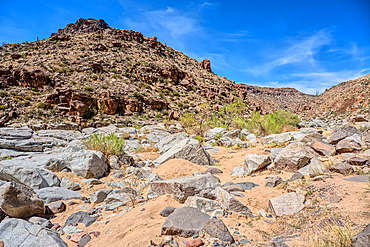
View of Black Canyon on the west side of the Agua Fria National Monument of Arizona with the Bradshaw Mountains in the distance.

View of cruise boat and gardens at dawn at Al Daba 'Eya near Luxor, Luxor, Egypt, Africa
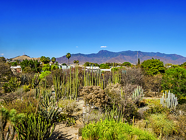
Oaxaca Ethnobotanical Garden by The Church and Convent of Santo Domingo de Guzman, Oaxaca de Juarez, Oaxaca State, Mexico
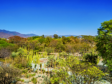
Oaxaca Ethnobotanical Garden by The Church and Convent of Santo Domingo de Guzman, Oaxaca de Juarez, Oaxaca State, Mexico
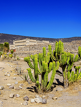
Mitla Archaeological Site, San Pablo Villa de Mitla, Oaxaca State, Mexico
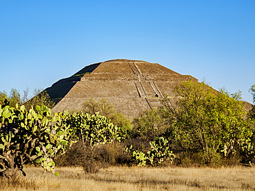
Pyramid of the Sun, Teotihuacan, Mexico State, Mexico
Pyramid of the Sun at sunset, Teotihuacan, Mexico State, Mexico
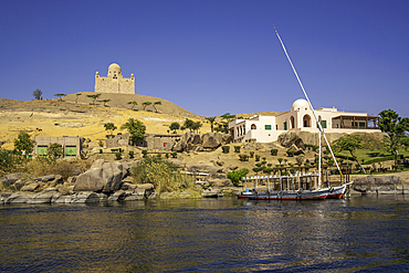
View of the Nile river and Aga Khan Mausoleum from small boat in Aswan, Aswan, Nubia, Egypt, North Africa, Africa
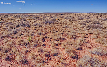
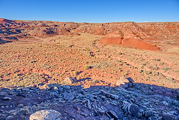
The grassland prairie near Dead Wash in Petrified Forest, Arizona, United States of America
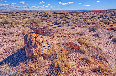
Pieces of petrified wood on hills overlooking Dead Wash, Petrified Forest National Park, Arizona, United States of America
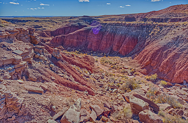
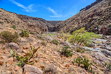
A canyon that drains into Dead Wash, Petrified Forest National Park, Arizona, United States of America
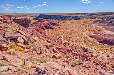
An unnamed canyon that leads into Dead Wash at Petrified Forest National Park, Arizona, United States of America
An unnamed canyon that leads to Dead Wash in Petrified Forest National Park, Arizona, United States of America
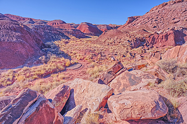
Boulder pile in a valley leading to Dead Wash in Petrified Forest National Park, Arizona, United States of America
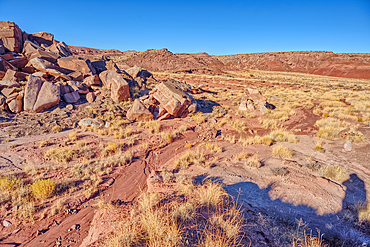
Dead Wash Valley in Petrified Forest National Park, Arizona, United States of America
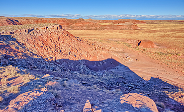
Dead Wash Valley in Petrified Forest National Park, Arizona, United States of America
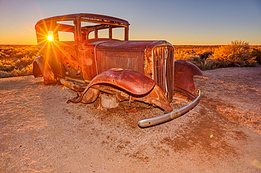
An old Model-T placed as a marker for the Route 66 Road Alignment in Petrified Forest National Park, Arizona, United States of America
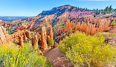
Fairyland Point and hoodoos, Bryce Canyon National Park, Utah, United States of America
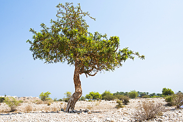
Boswellia sacra (frankincense) (olibanum) tree, Sultanate of Oman, Arabian Peninsula
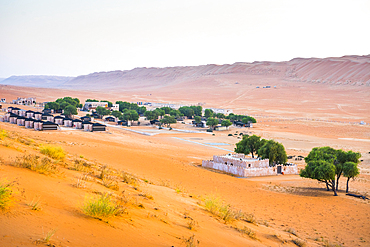
The Thousand Nights Camp in the Sharqiya Sands, formerly Wahiba Sands, desert region, Sultanate of Oman, Arabian Peninsula
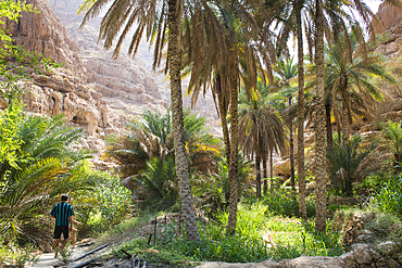
Wadi Shab, canyon near Tiwi, Sultanate of Oman, Arabian Peninsula
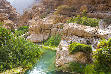
Wadi Shab, canyon near Tiwi, Sultanate of Oman, Arabian Peninsula
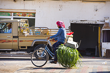
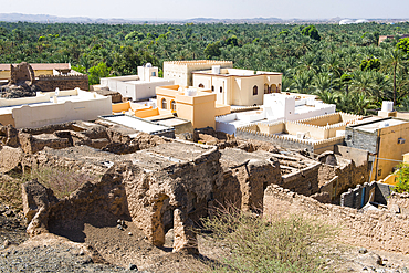
Street in Al Mintarib, village on the edge of The Sharqiya Sands, formerly Wahiba Sands, desert region, Sultanate of Oman, Arabian Peninsula
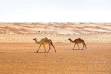
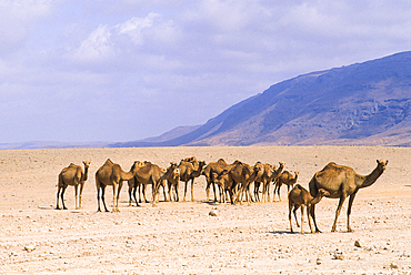
Dunes and camels in the Sharqiya Sands, formerly Wahiba Sands, desert region, Sultanate of Oman, Arabian Peninsula
Camels in the Sharqiya Sands, formerly Wahiba Sands, desert region, Sultanate of Oman, Arabian Peninsula
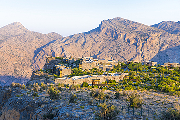
Alila Jabal Akhdar hotel, nestled 2000 metres above sea level, surrounded by Al Hajar Mountains, Sultanate of Oman, Arabian Peninsula

Alila Jabal Akhdar hotel, nestled 2000 metres above sea level, surrounded by Al Hajar Mountains, Sultanate of Oman, Arabian Peninsula
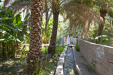
Irrigation canal in palm grove. Birkat Al Mouz, Al Dakhliya region, Falaj irrigation system (Falaj Al-Khatmeen), UNESCO, Oman, Arabian Peninsula
Al-Hamra village and the palm grove, a 400-year-old town in the region Ad Dakhiliyah, Akhdar Mountains, Sultanate of Oman, Arabian Peninsula
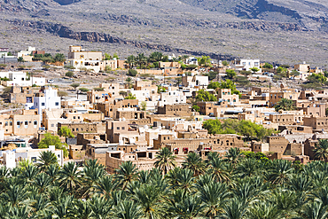
Al Mudhaireb Village, Al Sharqiyah region, Sultanate of Oman, Arabian Peninsula
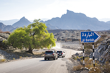
View from track on west slope of Djebel (Al Barida Road) from Sharaf al Alamayn Pass, 2036m, to Bilad Sayt and Rustaq road, Oman, Arabian Peninsula
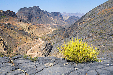
Wadi Bani Awf, North Eastern slope of Jebel Akhdar, Western Hajar Mountains, Al-Dakhiliyah region, Sultanate of Oman, Arabian Peninsula
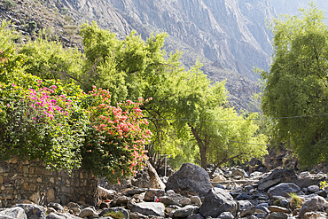
Beautiful tree (sedar), on edge of Wadi Bani Awf, NE slope of Jebel Akhdar, Western Hajar Mountains, Al-Dakhiliyah region, Oman, Arabian Peninsula
Palm trees, Wakan village, Western Hajar Mountains, border South Batinah Governorate and Al Dakhiliyah Governorates, Oman, Arabian Peninsula
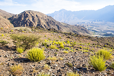
Landscape around Wakan village, Western Al Hajar Mountains, border South Batinah and Al Dakhiliyah Governorates, Oman, Arabian Peninsula
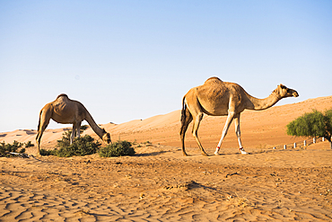
Camels, Dhofar, Sultanate of Oman, Arabian Peninsula
Camel in Djebel Akhdar, Sultanate of Oman, Arabian Peninsula
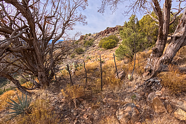
Boundary gate and cattle-proof fence between Coconino National Forest and Wet Beaver Creek Wilderness, Arizona, United States of America
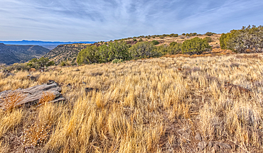
The grassland prairie on the summit of White Mesa in Coconino National Forest, Arizona, United States of America
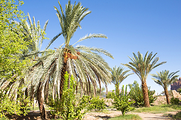
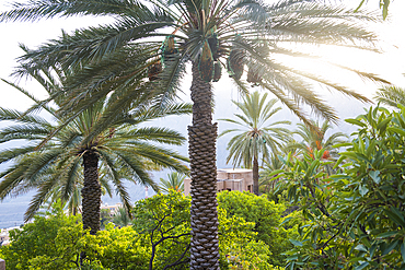
Date palm grove in the oasis of AlUla, Medina Province, Saudi Arabia
Gardens in the Oasis of AlUla, Medina Province, Saudi Arabia
Gardens in the Oasis of AlUla, Medina Province, Saudi Arabia
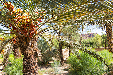
Date bunches in a palm grove of the oasis of AlUla, Medina Province, Saudi Arabia
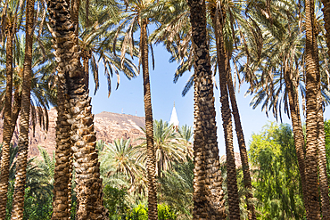
Date palm grove in the oasis of AlUla, Medina Province, Saudi Arabia

Aerial view from hot air balloon over Hegra site and around, AlUla, Medina Province, Saudi Arabia
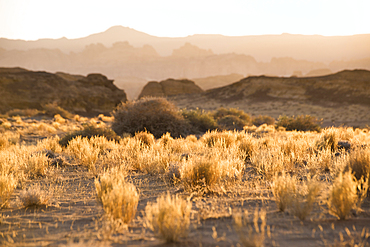
Sandstone rock formations in the desert canyons of the Ashar Valley, Medina Province, Saudi Arabia
Isolated tree among sandstone rock formation in the desert canyons of the Ashar Valley, Medina Province, Saudi Arabia
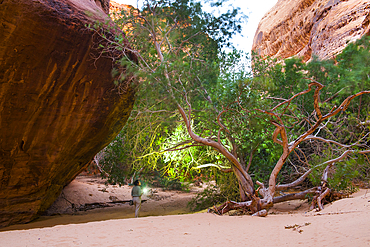
Woman walking with headlamp at the bottom of canyon with sandstone walls in the Sharaan Nature Reserve, AlUla, Medina Province, Saudi Arabia
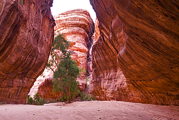
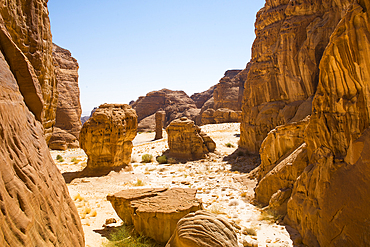
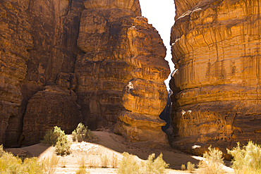
Canyon with sandstone walls in the Sharaan Nature Reserve, AlUla, Medina Province, Saudi Arabia
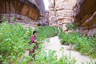
Woman walking at the bottom of a canyon with sandstone walls in the Sharaan Nature Reserve, AlUla, Medina Province, Saudi Arabia
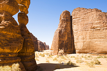
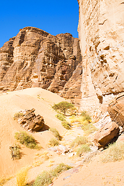
Magnificent sandstone rock structure in the Sharaan Nature Reserve, AlUla, Medina Province, Saudi Arabia
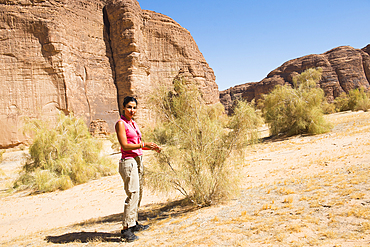
Rana El Zein, Deputy Director at AFALULA, and White saxaul (Haloxylon persicum), Sharaan Nature Reserve, AlUla, Medina Province, Saudi Arabia
Rana El Zein, Deputy Director at AFALULA, and White saxaul (Haloxylon persicum), Sharaan Nature Reserve, AlUla, Medina Province, Saudi Arabia
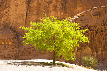
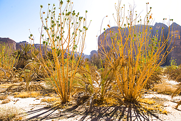
White saxaul (Haloxylon persicum), Sharaan Nature Reserve, AlUla, Medina Province, Saudi Arabia
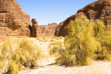
Sharaan Nature Reserve, AlUla, Medina Province, Saudi Arabia
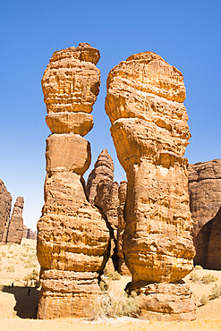
Extraordinary sandstone rock structure called Dancing Rocks in the Sharaan Nature Reserve, AlUla, Medina Province, Saudi Arabia
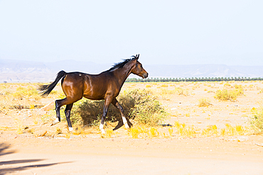
Young horse free-roaming near the Alqaleebah Gate of Sharaan Nature Reserve, AlUla, Medina Province, Saudi Arabia
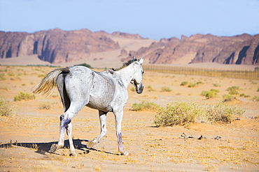
Horse free-roaming near the Alqaleebah Gate of Sharaan Nature Reserve, AlUla, Medina Province, Saudi Arabia
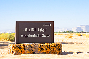
Alqaleebah Gate's sign of Sharaan Nature Reserve, AlUla, Medina Province, Saudi Arabia
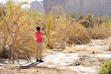
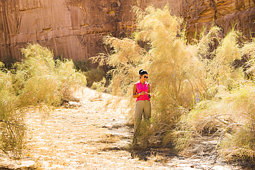
Woman photographing Palm plantation colonized by invasive Sodom apple (Calotropis procera), Sharaan Nature Reserve, Medina Province, Saudi Arabia
Palm plantation colonized by invasive Sodom apple plant (Calotropis procera), Sharaan Nature Reserve, AlUla, Medina Province, Saudi Arabia
Sharaan Nature Reserve, AlUla, Medina Province, Saudi Arabia
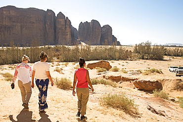
Three women visiting Sharaan Nature Reserve, AlUla, Medina Province, Saudi Arabia
The Thirteen Mile Cattle Tank off of Corva Road in the Kaibab National Forest near Ash Fork Arizona, USA
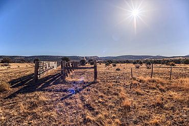
A livestock corral for the Thirteen Mile Cattle Tank off of Corva Road, Kaibab National Forest, Arizona, USA

The old abandoned homestead of Rods Winter Camp in the Kaibab National Forest of Arizona, USA

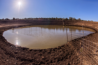
A water leak from a crack in Stone Dam in the Kaibab National Forest, Arizona, USA
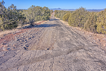
The crumbling remains of Arizona Route 66 in the Kaibab National Forest, USA
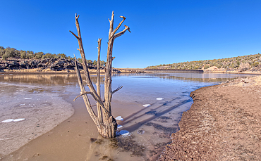
View from the shore of Stone Dam Lake in the Kaibab National Forest, Arizona, USA
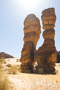
Extraordinary sandstone rock structure called Dancing Rocks in the Sharaan Nature Reserve, AlUla, Medina Province, Saudi Arabia
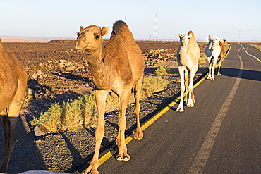
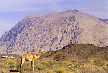
Encounter with dromedaries on the road that crosses the Harrat volcanic plateau, AlUla, Medina Province, Saudi Arabia
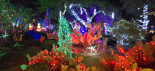
Christmas Illuminations, Ethel M Cactus Gardens, United States of America
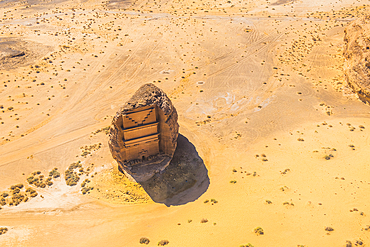
Aerial view of Qasr al-Farid, the largest tomb within Site of Hegra (Madain Salih), UNESCO, in the area of AlUla, Medina Province, Saudi Arabia
Site of Hegra (Madain Salih), UNESCO, AlUla, Medina Province, Saudi Arabia