Results
« Previous 1 2
140 results found

The peak of Cerro Miniques at 5910m, Los Flamencos National Reserve, Atacama Desert, Antofagasta Region, Norte Grande, Chile, South America
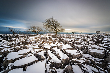
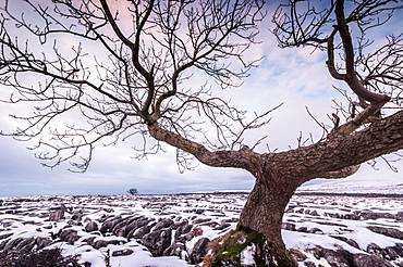
Twistleton Scar End in snow, Ingleton, Yorkshire Dales, Yorkshire, England, United Kingdom, Europe
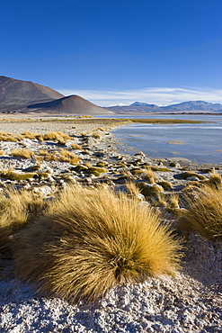
The altiplano at an altitude of over 4000m looking over the salt lake Laguna de Tuyajto, Los Flamencos National Reserve, Atacama Desert, Antofagasta Region, Norte Grande, Chile, South America
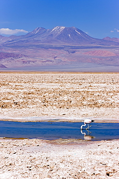
Flamingo breeding site, Laguna Chaxa, Salar de Atacama, Atacama Desert, Norte Grande, Chile, South America
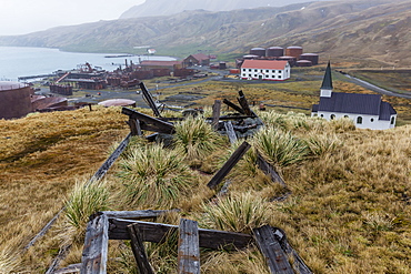
Overview of the abandoned whaling station in Grytviken Harbor, South Georgia, Polar Regions
Twistleton Scar End in snow, Ingleton, Yorkshire Dales, Yorkshire, England, United Kingdom, Europe
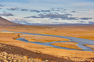
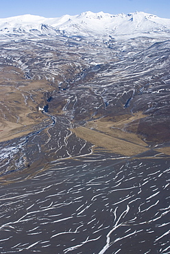
The wilderness of Iceland's desolate interior, The Kjolur valley, in the south of the Highlands region, central Iceland, Polar Regions
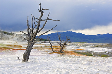
Dead trees at the top of Canary Spring, Main Terrace, Mammoth Hot Springs, Yellowstone National Park, UNESCO World Heritage Site, Wyoming, United States of America, North America
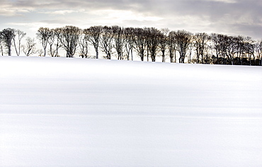
Row of trees in silhouette on edge of snow-covered field, Rock, near Alnwick, Northumberland, England, United Kingdom, Europe
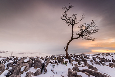
Twistleton Scar End in snow, Ingleton, Yorkshire Dales, Yorkshire, England, United Kingdom, Europe
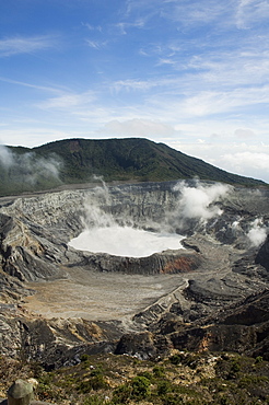
Poas Volcano, Poas National Park, Costa Rica

The altiplano at an altitude of over 4000m looking over the salt lake Laguna de Tuyajto, Los Flamencos National Reserve, Atacama Desert, Antofagasta Region, Norte Grande, Chile, South America
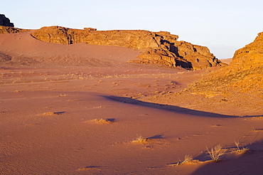
Desert, Wadi Rum, Jordan, Middle East
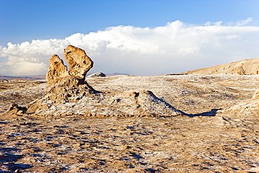
Eroded rock pinnacles, Valle de la Luna (Valley of the Moon), Atacama Desert, Norte Grande, Chile, South America
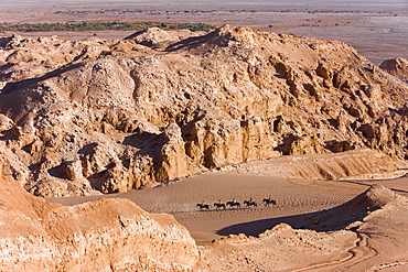
Tourists horse trekking, Valle de la Luna (Valley of the Moon), Atacama Desert, Norte Grande, Chile, South America
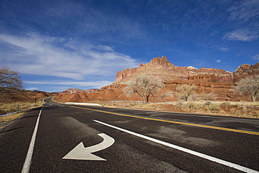
Highway 24 by the Castle, Capitol Reef National Park, Utah, United States of America, North America
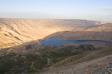
Wadi Mujib (Jordan Grand Canyon), Jordan, Middle East
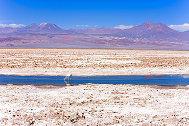
Flamingo breeding site, Laguna Chaxa, Salar de Atacama, Atacama Desert, Norte Grande, Chile, South America

Valle de la Luna (Valley of the Moon), Atacama Desert, Norte Grande, Chile, South America
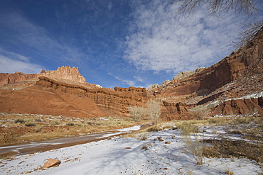
The Castle and Fremont River, Capitol Reef National Park, Utah, United States of America, North America
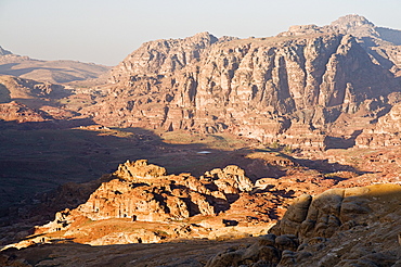
View of Wadi Sha'ab Qais, Petra, Jordan, Middle East
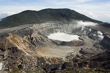
Poas Volcano, Poas National Park, Costa Rica

River leading to Eyjafjallajokull glacier, Mount Hekla behind, South Iceland, Iceland, Polar Regions
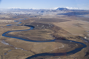
River leading to Eyjafjallajokull Glacier, South Iceland, Iceland, Polar Regions
Path of retreating Eyjafjallajokull glacier, South Iceland, Iceland, Polar Regions

Desert, Wadi Rum, Jordan, Middle East
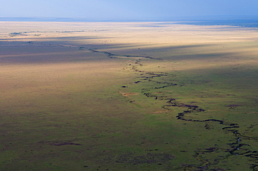
Aerial view, Masai Mara, Kenya, East Africa, Africa
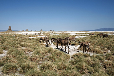
The desolate landscape of Lac Abbe, dotted with limestone chimneys and livestock belonging to local nomads, Djibouti, Africa
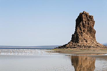
The desolate landscape of Lac Abbe, dotted with limestone chimneys, Djibouti, Africa

The desolate landscape of Lac Abbe, dotted with limestone chimneys, Djibouti, Africa

The desolate landscape of Lac Abbe, dotted with limestone chimneys, Djibouti, Africa

The desolate landscape of Lac Abbe, dotted with limestone chimneys, Djibouti, Africa

The desolate landscape of Lac Abbe, dotted with limestone chimneys, Djibouti, Africa
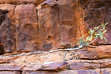
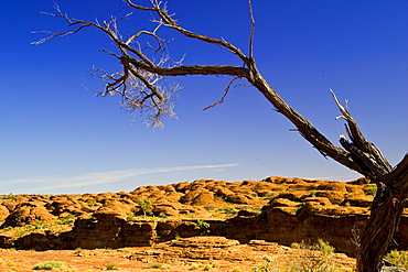
Vegetation grows roots in cracks of Mereenie sandstone at King's Canyon, Red Centre, Australia
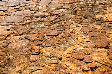
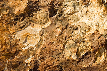
Cracked Mereenie sandstone at King's Canyon, Northern Territory, Australia
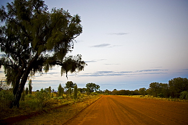
Mereenie Loop Road, Red Centre, Australia
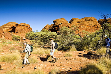
Tourists visit King's Canyon, Northern Territory, Australia
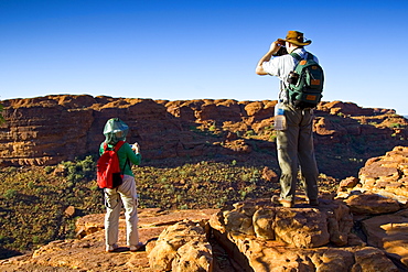
Tourists on the rim of King's Canyon, Red Centre, Northern Territory, Australia
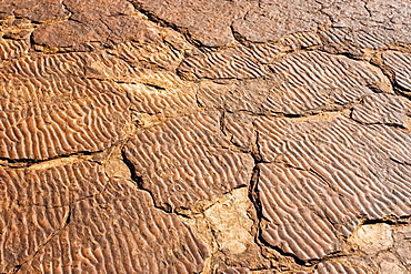
Ripple marks preserved in the Mereenie sandstone at King's Canyon, Northern Territory, Australia

Sandstone domes at King's Canyon, Northern Territory, Red Centre, Australia
Sandstone domes in shape of beehives at King's Canyon, Red Centre, Australia
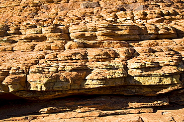
Multi-coloured layers of Mereenie sandstone at King's Canyon, Northern Territory, Australia

Mereenie Loop Road, Red Centre, Australia

King's Canyon, Northern Territory, Australia
Tourists on the rim of King's Canyon, Red Centre, Northern Territory, Australia
Trees at King's Canyon, Northern Territory, Australia
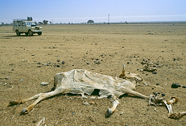
Drought in Burkina Faso (formerly Upper Volta). A white Land Rover 4-wheel drive vehicle drives past a dried out carcass.
Drought scene - two men walking past the dried out carcasses of dead cattle in Burkina Faso (formerly Upper Volta)
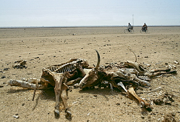
Locals on bicycles ride past carcasses of the bones of dead animals in the drought areas of Burkina Faso (formerly Upper Volta)
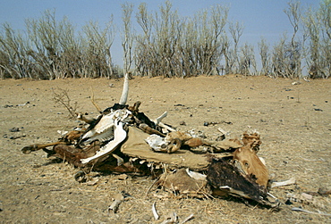
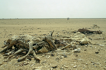
Ccarcasses of the bones of dead animals in the drought areas of Burkina Faso (formerly Upper Volta)
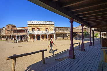
Fort Bravo (Texas Hollywood), Tabernas, Almeria, Andalusia, Spain

The desolate landscape of Lac Abbe, dotted with limestone chimneys, Djibouti, Africa
Tree at King's Canyon, Northern Territory, Australia
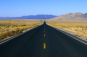
Highway 50 - 'The Loneliest Road in America' that crosses Nevada's desert landscape west to east from California to Utah, The Great Basin, Nevada, USA
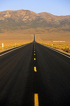
Highway 50 - 'The Loneliest Road in America' that crosses Nevada's desert landscape west to east from California to Utah, The Great Basin, Nevada, USA
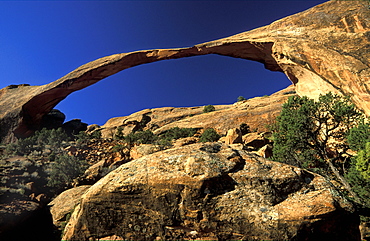
306ft 'Landscape Arch', Arches National Park, Utah, Usa306ft 'Landscape Arch', the longest such landform in this spectacular park of eroded formations, including over 2000 arches
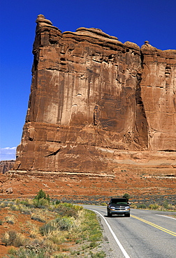
'The Tower of Babel', Arches National Park, Utah, Usa'The Tower of Babel' by Park Drive in this spectacular park of eroded formations, including over 2000 arches
Storm approaching the 'Fiery Furnace' area of the Arches National Park, Utah, UsaStorm approaching the 'Fiery Furnace' area in this spectacular park of eroded formations, including over 2000 arches
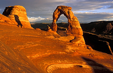
'Delicate Arch', Arches National Park, Utah, Usa'Delicate Arch', one of the best known landforms in this spectacular park of eroded formations, including over 2000 arches
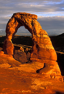
'Delicate Arch', Arches National Park, Utah, Usa'Delicate Arch', one of the best known landforms in this spectacular park of eroded formations, including over 2000 arches

Storm approaching the 'Fiery Furnace' area of the Arches National Park, Utah, UsaStorm approaching the 'Fiery Furnace' area in this spectacular park of eroded formations, including over 2000 arches
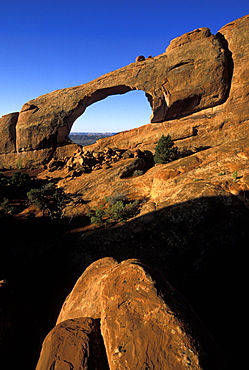
'Tunnel Arch', Arches National Park, Utah, Usa'Tunnel Arch', one of the landforms in this spectacular park of eroded formations, including over 2000 arches
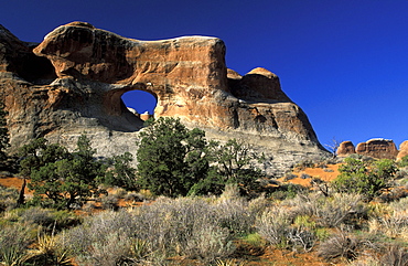
Skyline Arch, Arches National Park, Utah, Usa
'Skyline Arch', one of the sandstone landforms in this spectacular park of eroded formations, including over 2000 arches

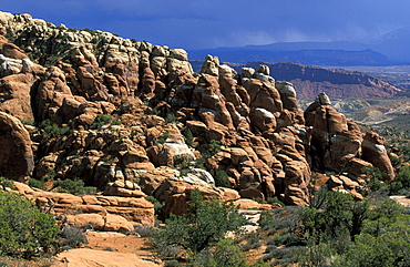
The 'Fiery Furnace', Arches National Park, Utah, UsaThe 'Fiery Furnace' area in this spectacular park of eroded formations, including over 2000 arches
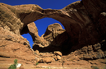
'Double Arch', Arches National Park, Utah, Usa'Double Arch', one of the landforms in this spectacular park of eroded formations, including over 2000 arches

Storm approaching the 'Fiery Furnace' area of the Arches National Park, Utah, UsaStorm approaching the 'Fiery Furnace' area in this spectacular park of eroded formations, including over 2000 arches
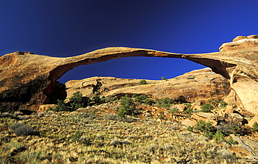
306ft 'Landscape Arch', Arches National Park, Utah, Usa306ft 'Landscape Arch', the longest such landform in this spectacular park of eroded formations, including over 2000 arches
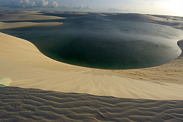
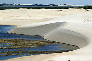
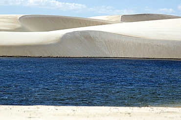
Sand dunes around Gaivota Lake at Lencois Maranhenses National Park, Santo Amaro, Maranhao, Brazil, South America
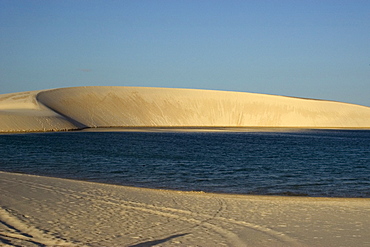
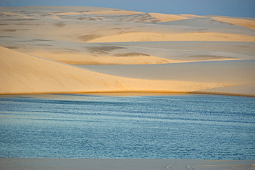
Sand dunes and lake of Lencois Maranhenses National Park, Santo Amaro, Maranhao, Brazil, South America
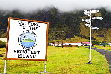
View of Tristan da Cunha, "the most remote inhabited location on Earth", South Atlantic Ocean
View of the volcanic shoreline on Tristan da Cunha, "the most remote inhabited location on Earth", South Atlantic Ocean
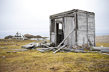
Trapers Cabin. fuglehuken (bird), Svalbard, Norway
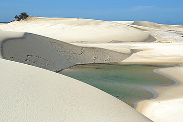
Sand dunes and lake of Lencois Maranhenses National Park, Santo Amaro, Maranhao, Brazil, South America
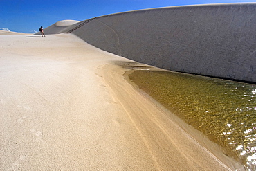
Sand dunes and lake of Lencois Maranhenses National Park, Santo Amaro, Maranhao, Brazil, South America
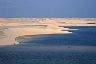
Sand dunes around Gaivota Lake at Lencois Maranhenses National Park, Santo Amaro, Maranhao, Brazil, South America
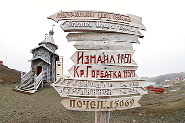
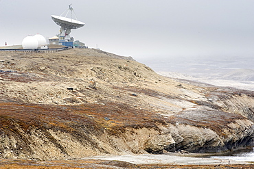
Views of the Trinity Church at Belingshausen Russian Research Station, Antarctica, Southern Ocean
Sand dunes and lake of Lencois Maranhenses National Park, Santo Amaro, Maranhao, Brazil, South America
Sand dunes and lake of Lencois Maranhenses National Park, Santo Amaro, Maranhao, Brazil, South America
Sand dunes around Gaivota Lake at Lencois Maranhenses National Park, Santo Amaro, Maranhao, Brazil, South America
Sand dunes around Gaivota Lake at Lencois Maranhenses National Park, Santo Amaro, Maranhao, Brazil, South America
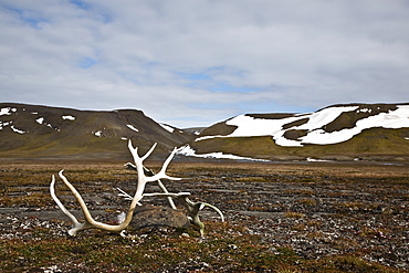
Svalbard reindeer antlers (Rangifer tarandus platyrhynchus) on the gentle plains of Talaveraflya on the south shore of Borentsoya, Svalbard Archipelago, Norway
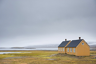
Most Northern permenant settlement. Ny-Alesund, Svalbard, Norway
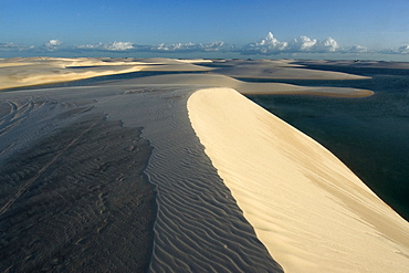
Sand dunes around Gaivota Lake at Lencois Maranhenses National Park, Santo Amaro, Maranhao, Brazil, South America
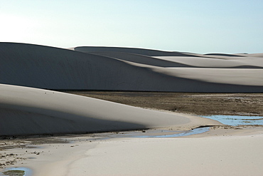
Sand dunes and lake of Lencois Maranhenses National Park, Santo Amaro, Maranhao, Brazil, South America

Most Northern permenant settlement. Ny-Alesund, Town center, Svalbard, Norway
Sand dunes and lake of Lencois Maranhenses National Park, Santo Amaro, Maranhao, Brazil, South America
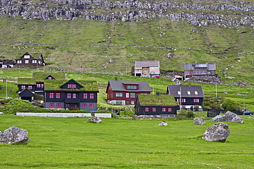
Views of the town of Kirkjubur on Streymoy in the Faroe Islands
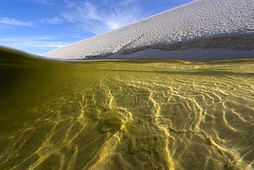
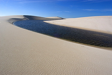
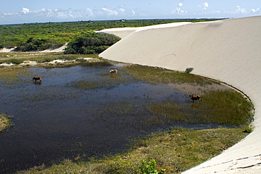
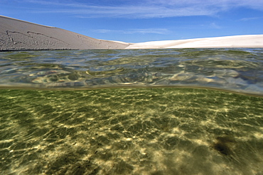
View from inside one of the lakes of Lencois Maranhenses National Park, Santo Amaro, Maranhao, Brazil, South America
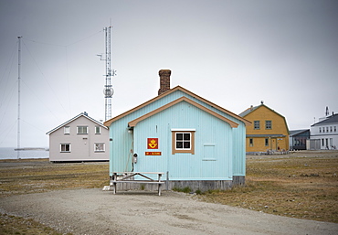
Most Northern permenant settlement/Most Northern Post Office in world. Ny-Alesund, Town center, Svalbard, Norway
Sand dunes and lake of Lencois Maranhenses National Park, Santo Amaro, Maranhao, Brazil, South America
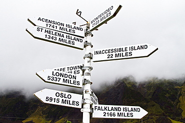
View of Tristan da Cunha, "the most remote inhabited location on Earth", South Atlantic Ocean
Most Northern permenant settlement. Ny-Alesund, Svalbard, Norway

Rock formations in desert landscape, Monument Valley, Arizona, United States
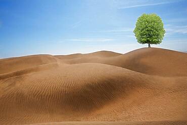
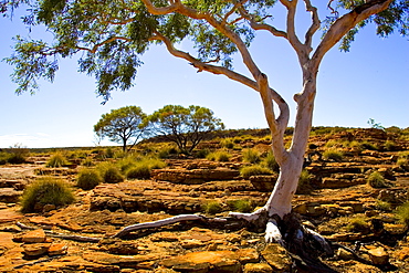
Tree growing in desert sand dunes

Layered rock formations under blue sky, Badlands National Park, South Dakota, United States
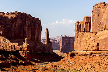
Rock formations in desert landscape, Arches National Park, Utah, United States
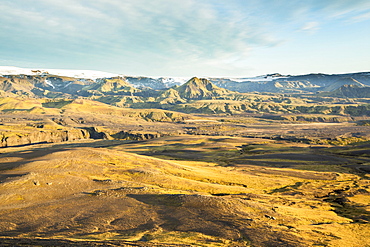
Distant hills and rock formations in remote landscape
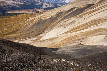
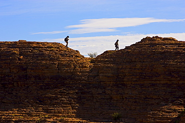
Distant view of hikers walking on remote hillside
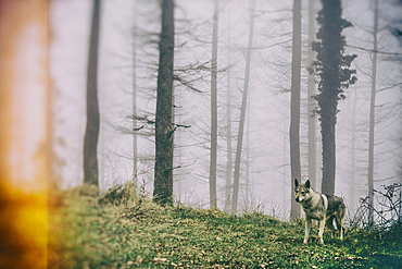
Wolf dog in a beechwood. Señorio de Bertiz Natural Park. Navarre, Spain, Europe
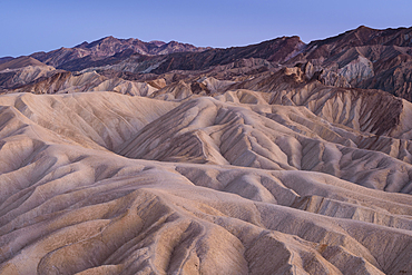
Eroded mudstone at Zabriskie Point, Death Valley National Park, California.