Results
« Previous 1 2 3 Next »
269 results found
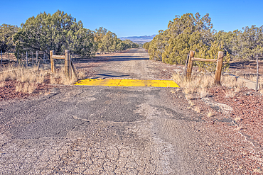
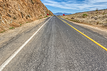
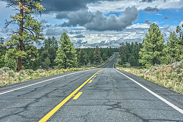
The crumbling remains of Arizona Route 66 in the Kaibab National Forest, USA
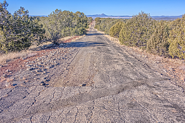
The crumbling remains of Arizona Route 66 in the Kaibab National Forest, USA
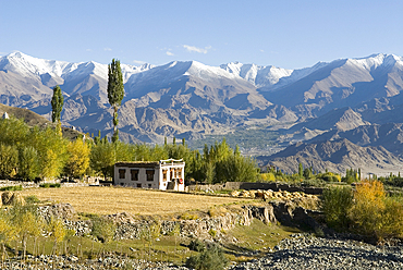
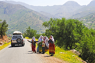
House of the Indus River valley seen from the village of Stok, around Leh, Ladakh region, state of Jammu and Kashmir, India, Asia
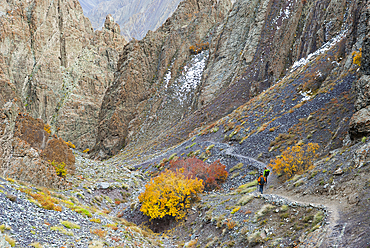
Trekker on the way down from Stokla pass (4900) to the village of Stok, Hemis National Park, Ladakh region, state of Jammu and Kashmir, India, Asia
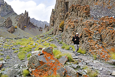
Trekker on the way down from Stokla pass (4900) to the village of Stok, Hemis National Park, Ladakh region, state of Jammu and Kashmir, India, Asia
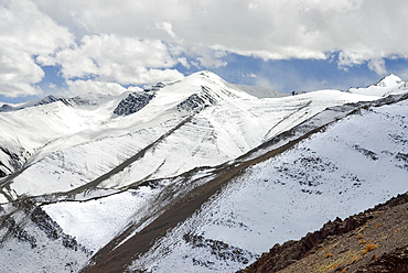
View on the way down from Stokla pass (4900) to the village of Stok, Hemis National Park, Ladakh region, state of Jammu and Kashmir, India, Asia
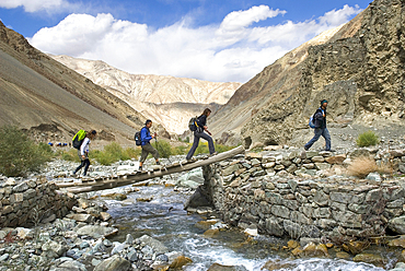
Hikers crossing a torrent on a footbridge in Zingchen gorge, Hemis National Park, Ladakh region, state of Jammu and Kashmir, India, Asia

Horse-drawn carriage in front Arch of Izamal, Yucatan State, Mexico
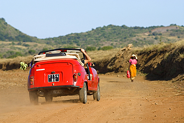
4L Renault car on the north road, Nosy Be island, Republic of Madagascar, Indian Ocean
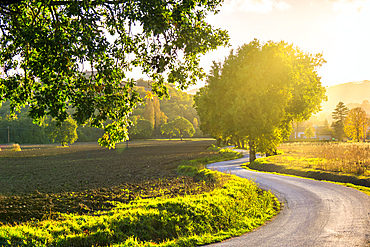
Apennines at sunset, Gubbio, Umbria, Italy
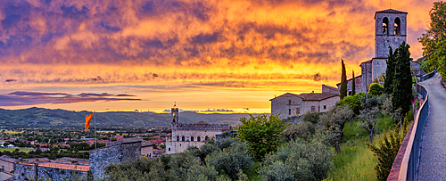
Palazzo dei Consoli (Palace of the Consuls) and Cathedral at sunset, Gubbio, Umbria, Italy
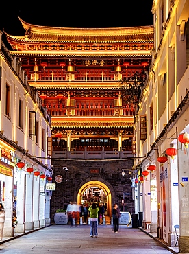
Guangji Gate Tower at night, built in 1370, the gate leads into Chaozhou ancient city, Paifang street, Chaozhou City, Guangdong Province, China
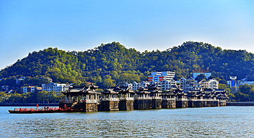
Guangji Bridge, built in 1170, one of China's four famous ancient bridges, Chaozhou City, Guangdong province, China
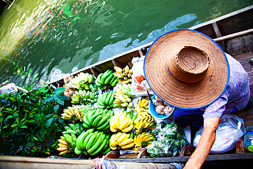
Top view of boat full of fresh fruits on sale, Floating Market, Bangkok, Thailand
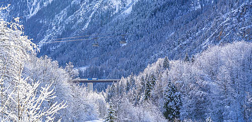
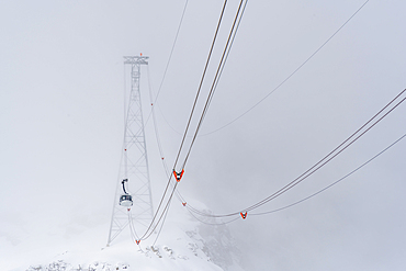
Snow covered trees, mountains and Courmayeur to Plan Checrouit cable car, from Courmayeur in winter, Courmayeur, Aosta Valley, Italian Alps, Italy
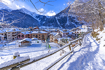
View of snow covered mountains and rooftops in Courmayeur in winter, Courmayeur, Aosta Valley, Italian Alps, Italy
Port City, Colombo, Sri Lanka
Berber women walking to a village of palm grove Targa N'touchka, Chtouka Ait Baha province, Anti-Atlas, Morocco

Landscape viewed from Kerdous Pass, on the road from Tafraoute to Tiznit, Anti-Atlas, Morocco
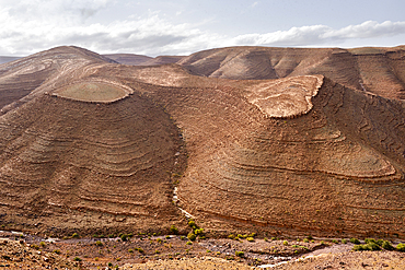
Semi-arid landscape near Tazert, Al Haouz province, Morocco
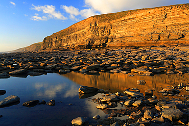
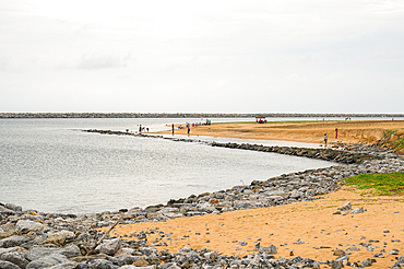
Dunraven Bay, Southerndown, South Wales, United Kingdom
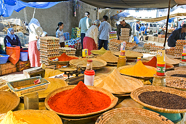
Display of spices at the Large Market at Chefchaouen, Rif region, Morocco
View of snow covered Aosta Valley, mountains and Skyway Monte Bianco cable car in winter, Courmayeur, Aosta Valley, Italian Alps, Italy

Desert landscape in the far southwest of Saint Anthony, Cape Verde
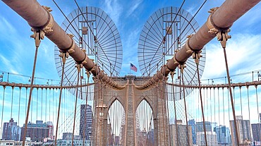
Brooklyn Bridge, New York City, spanning the East River between Manhattan and Brooklyn. When built in 1883 it was the longest suspension bridge in the world.
Djebel Saghro, on the road from Ouarzazate to Agdz, Draa-Tafilet region, Morocco
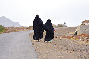
Women dressed in black abaya walking along the road, Draa River valley, Province of Zagora, Region Draa-Tafilalet, Morocco
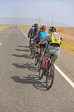
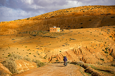
Electric mountain bikers on road from Tamegroute toward the South (N 9), Draa River valley, Province of Zagora, Region Draa-Tafilalet, Morocco

People passing sign indicating direction of Timbuktu at 52 days by camel, Zagora, Draa River valley, Province of Zagora, Draa-Tafilalet region, Morocco

Landscape viewed from Tizi'n-Tinififft mountain Pass, on the road from Ouarzazate to Agdz, Draa-Tafilet region, Morocco
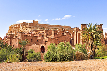
Ksar of Ait-Ben-Haddou, UNESCO, Ounila River valley, Ouarzazate Province, region of Draa-Tafilalet, Morocco
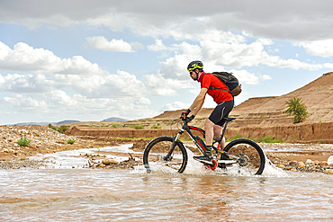
Electric mountain bike rider crossing river ford on track between Ouarzazate and Ait Ben Haddou, Ounila River valley, Ouarzazate Province, Draa-Tafilalet, Morocco
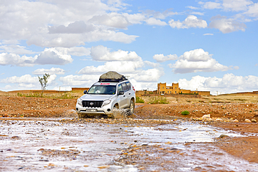
Four-wheel drive crossing a river ford between Ouarzazate and Ait Ben Haddou, Ounila River valley, Ouarzazate Province, Draa-Tafilalet region, Morocco
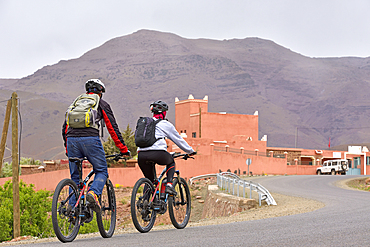
Cyclists with mountain pedelec on road connecting Tizi n'Tichka Pass to Telouet village, Ouarzazate Province, region of Draa-Tafilalet, Morocco
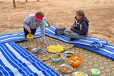
Lunch break, group of bikers, road from Telouet to Tighza, Ouarzazate Province, region of Draa-Tafilalet, Morocco
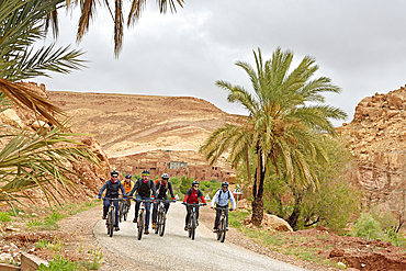
Riders on mountain bike with electric assistance, Ounila River valley, Ouarzazate Province, region of Draa-Tafilalet, Morocco

Tourists visiting by bike the Wat Visoun temple, Luang Prabang, Laos
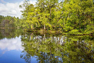
Perfect reflections in the still waters at High Dam Tarn, Lake District National Park, United Kingdom

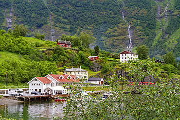
A ferry at the dock in the city of Flam, Vestland, Norway
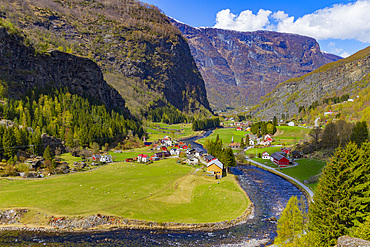
View from the Bergen Railway route from Myrdal to the town of Flam, Vestland, Norway
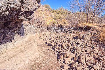
Basalt boulders and cliffs in a section of Johnson Canyon halfway between the Bainbridge Steel Dam and Stone Dam near Ash Fork Arizona in the Kaibab National Forest.
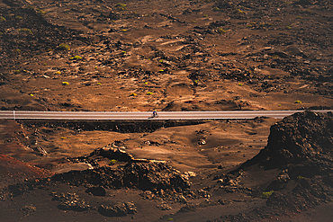
A cyclist cycling on a road in the Timanfaya national park in Lanzarote in the Canary Islands, Spain
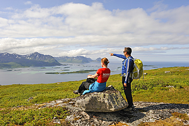
Trekkers having a break with view over the fjord Bergsfjorden from Husfjellet mountain, Senja island, County of Troms, Norway, Northern Europe
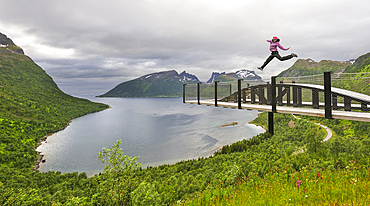
Young woman jumping over the fjord Bergsfjorden, Landscaping of the National Tourist Route on west coast of Senja Island, Selected as one of the most spectacular landscapes in Norway, County of Troms, Norway, Northern Europe
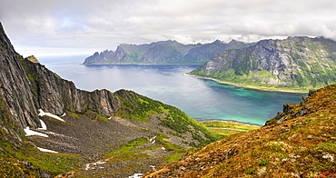
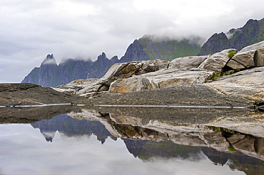
View over the fjords Steinfjorden and Ersfjorden from Husfjellet mountain.Senja island.County of Troms, Norway, Northern Europe
Christian pilgrims walking the Camino de Santiago (St. James' Way) route in Spain, Europe

Christian pilgrims on the Camino de Santiago (St. James' Way) route in France on their way to Spain, France, Europe
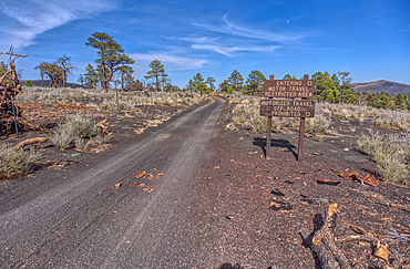
Fire Road 546 where it branches off from Sunset Crater National Monument into Coconino National Forest of Arizona, USA
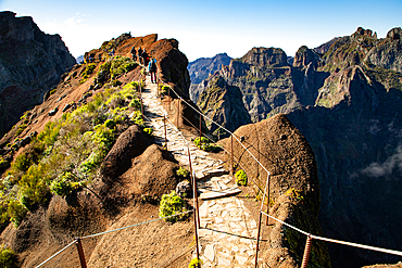
View of the mountains and rocks near Arieiro peak, Madeira, Portugal
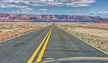
Vermilion Cliffs National Monument, Arizona, USA
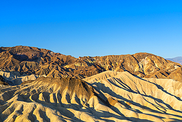
Natural rock formations at Zabriskie Point, Death Valley National Park, Eastern California, California, United States of America, North America
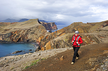
Young woman walking along Abra Bay, Sao Lourenco peninsula, Madeira island, Atlantic Ocean, Portugal
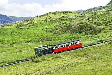
Snowdon Mountain Railway, Llanberis, Gwynedd, Wales, United Kingdom
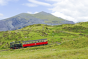
Snowdon Mountain Railway, Llanberis, Gwynedd, Wales, United Kingdom

Snowdon Mountain Railway, Llanberis, Gwynedd, Wales, United Kingdom
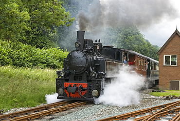
Llanfair Light Railway, Llanfair Caereinion, Welshpool, Powis, Wales, United Kingdom
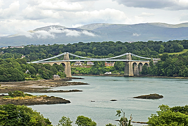
Thomas Telford's Menai Suspension Bridge crossing the Strait, Anglesey island, Wales, United Kingdom
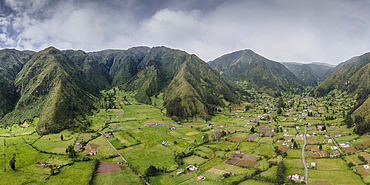
Landscape in Angochagua Parochia, Imbabura Province, Ecuador
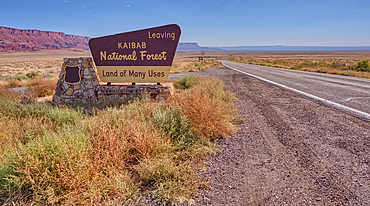
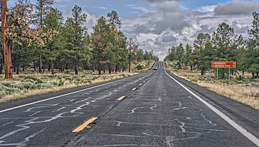
Highway US89A looking east to Vermilion Cliffs National Monument with Kaibab National Forest boundary sign, Arizona, United States of America
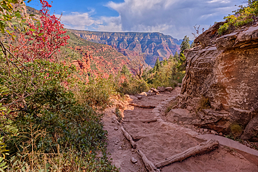
Looking back up the first leg of the North Kaibab Trail at Grand Canyon North Rim, UNESCO, Arizona, United States of America
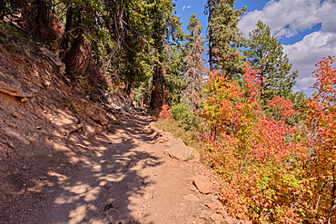
A curve in the North Kaibab Trail between Coconino Overlook and the Supai Tunnel Rest Area, Grand Canyon, Arizona, United States of America
Look back up the freeway exit ramp for Bloody Basin Road in the Agua Fria National Monument of Arizona, Black Canyon City, USA

View of vintage yellow No28 tram on a sunny day in the Alfama District, Lisbon, Portugal, Europe
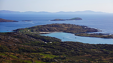
Derrynane, Co Kerry, Ireland

Traditional dressed Evenki hunter before a traditional Evenki Yurt in Tura, Krasnoyarsk Krai, Evenki state, Russia
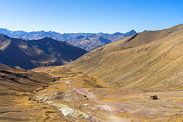
Trail leading through valley to Rainbow Mountain, Uchullujllo, Pitumarca District, Canchis Province, Cuzco Region, Peru, South America

View of scenery and cruise boat from cruise boat near Armant on the Nile River, Luxor, Egypt, Africa
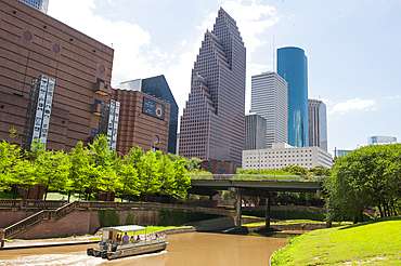
Buffalo Bayou River, Downtown Houston, Texas, United States of America
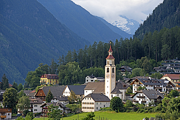
Dietenheim, outskirts of Brunico (Bruneck), South Tyrol (Alto Adige), Italy
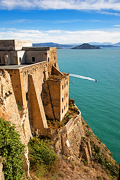
Palazzo d'Avalos, Terra Murata, Procida Island, Phlegraean Islands, Bay of Naples, Campania, Italy

An old Model-T placed as a marker for the Route 66 Road Alignment in Petrified Forest National Park, Arizona, United States of America
State Route 64 heading north to Grand Canyon South Rim, Arizona, USA
A sign along State Route 64 in Arizona marking 5 miles to Grand Canyon National Park, Arizona, USA

Drone view of camper van on a mountain road on the coast, Greece
Wardour Castle, a 14th Century castle at Wardour, near Tisbury, Wiltshire, England, United Kingdom

Passengers at Maya Train / Tren Maya new rail route connecting Mayan archaeological sites over Yucatan and Quintana Roo states in southern Mexico
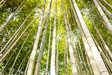
Towering bamboo trees forming a natural canopy in the Arashiyama Bamboo Forest, Kyoto, Honshu, Japan
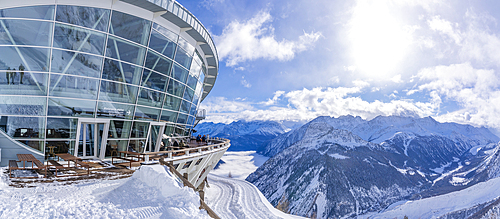
View of Skyway Monte Bianco cable car station at Pavillon du Mont Frety and Aosta Valley in winter, Courmayeur, Aosta Valley, Italian Alps, Italy
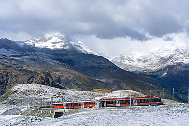
Zermatt, Canton Valais, Switzerland
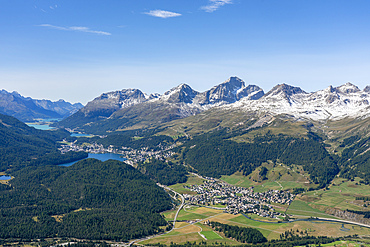
View of St. Moritz, Celerina and the Engadin lakes from top of Muottas Muragl, Canton of Grisons, Switzerland
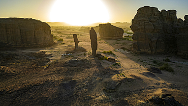
Aerial of beautiful rock formations at sunset around Zouar, Tibesti Mountains, Chad
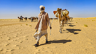
Camel caravan in the Tibesti Mountains, Chad
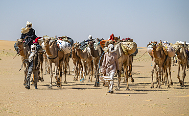
Camel caravan in the Tibesti Mountains, Chad
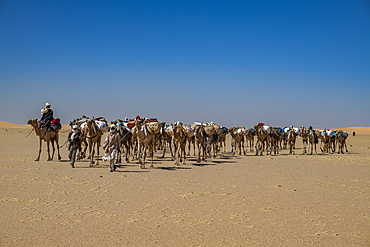
Camel caravan in the Tibesti Mountains, Chad
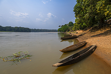
Anchoring boats, Sangha River, Dzanga Sangha National Park, UNESCO, Central African Republic

Cable car on Lagazuoi mountain, Dolomites, Italy

The dramatic scenery in the volcanic highlands of northern Saint Anthony, Cape Verde
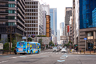
Streets of Osaka, Japan. a blue bus amidst skyscraper in the Nakanoshima area.
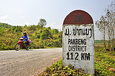
Kilometre-marker on the 2W road leading to Pakbeng, Laos
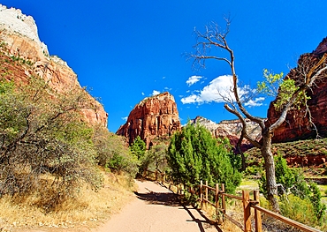
Angels Landing, a rock formation 1488 feet high, Zion National Park, Utah, United States of America

View at night of the city of Bergen, Vestland, Norway
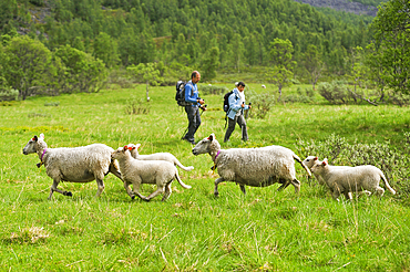
Trekkers and sheep on the way up to the Steindalsbreen glacier, Lyngen Alps, region of Lyngen, County of Troms, Norway, Northern Europe
View point along the National tourist route on the west coast.Senja island.County of Troms, Norway, Northern Europe
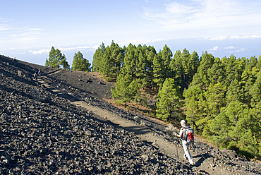
The Volcano Route, La Palma, Canary Islands, Spain, Atlantic Ocean, Europe

The Volcano Route, La Palma, Canary Islands, Spain, Atlantic Ocean, Europe
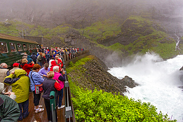
View of a waterfall on the Bergen Railway route from Myrdal to the town of Flam, Norway, Scandinavia, Europe
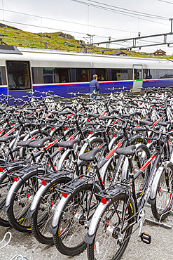
Views of rental bicycles on the Bergen Railway route from Myrdal to the town of Flam, Norway, Scandinavia, Europe
Views from the Bergen Railway route from Myrdal to the town of Flam, Norway, Scandinavia, Europe
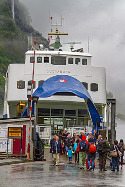
Ferry service on the Aurlandsfjord, an arm of the Sognefjord, the largest fjord in all of Norway, Vestland, Norway, Scandinavia, Europe
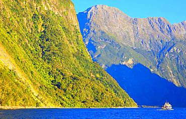
Milford Sound, South Island, New Zealand