Results
« Previous 1 2
159 results found
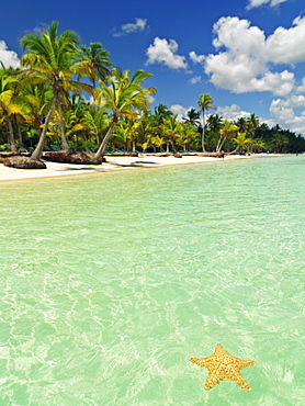
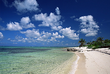
Starfish floating on placid water with blue sky and palm fringed beach, Bavaro Beach, Punta Cana, Dominican Republic, West Indies, Caribbean, Central America
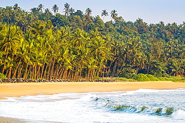
Beautiful palm fringed Kizhunna Beach, south of Kannur on the Kerala north coast, Kannur, Kerala, India, Asia
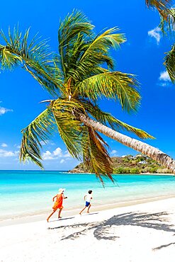
Woman and cute little boy having fun running on a palm fringed beach, Antigua, Caribbean, West Indies
Cheerful little boy with mother walking on idyllic palm fringed beach, Antigua, Leeward Islands, Caribbean, West Indies

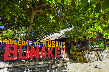
The colourful jetty at this popular coral fringed holiday island and scuba diving destination, Bunaken Island, Sulawesi, Indonesia, Southeast Asia, Asia
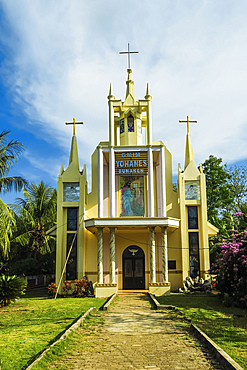
Yohanes Church on this Christian coral fringed holiday island and scuba diving destination, Bunaken Island, Sulawesi, Indonesia, Southeast Asia, Asia
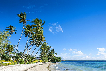
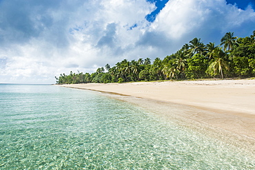
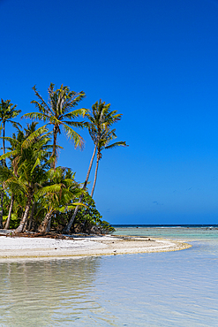
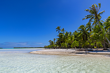
Palm fringed white sand beach on an islet of Vavau, Vavau Islands, Tonga, South Pacific, Pacific
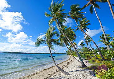
Palm fringed white sand beach on an islet of Vavau, Vavau Islands, Tonga, South Pacific, Pacific
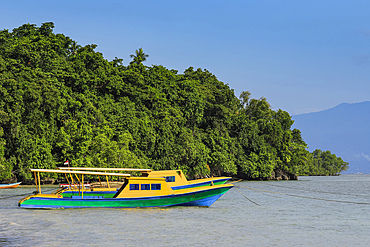
Beach entrance to a resort on the east coast of this coral fringed holiday and diving island, Bunaken Island, North Sulawesi, Indonesia, Southeast Asia, Asia
Palm fringed white sand beach on Palm Island, The Grenadines, St. Vincent and the Grenadines, Windward Islands, West Indies, Caribbean, Central America
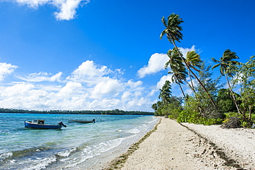
Palm fringed white sand beach on an islet of Vavau, Vavau Islands, Tonga, South Pacific, Pacific
One tourist walking on empty palm fringed beach, overhead view, Rendezvous Beach, Antigua, West Indies, Caribbean, Central America
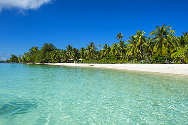
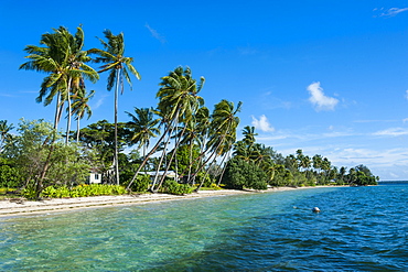
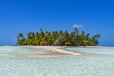
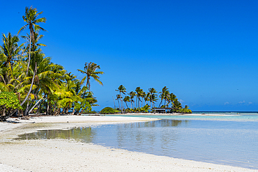
Beautiful palm fringed white sand beach in the turquoise waters of Tikehau, Tuamotus, French Polynesia, Pacific
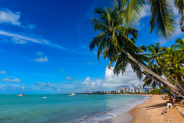
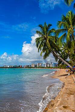
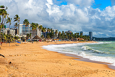
Palm fringed beach, Maceio, Alagoas, Brazil, South America
Palm fringed beach, Maceio, Alagoas, Brazil, South America
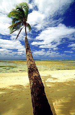
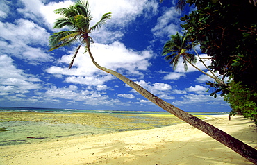
Palm tree fringed beach, Englishmans Bay, Tobago, Trinidad and Tobago, West Indies, Caribbean, Central America
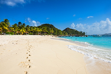
Aerial panoramicby drone of palm-fringed beach, St. James Bay, Antigua, Leeward Islands, West Indies, Caribbean, Central America
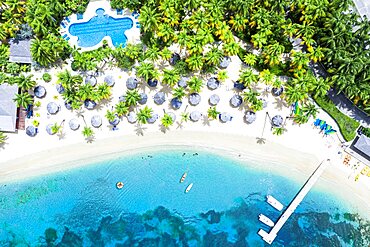
Canoes floating in the tropical lagoon of luxury resort with swimming pool on palm fringed beach, Antigua, Caribbean, West Indies
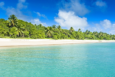
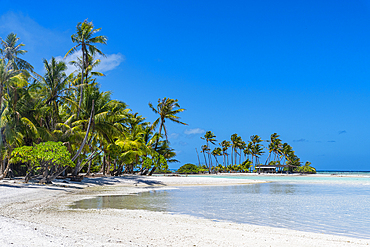
Palm fringed white sand beach in Haapai, Haapai Islands, Tonga, South Pacific, Pacific
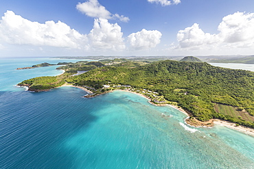
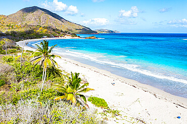
Aerial view of the rugged coast of Antigua full of bays and beaches fringed by dense tropical vegetation, Antigua, Leeward Islands, West Indies, Caribbean, Central America
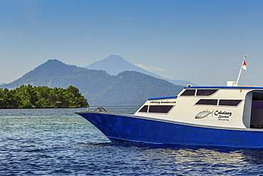
Dive boat with mainland and Manadotua Island beyond, off this coral fringed holiday and scuba island, Bunaken, North Sulawesi, Indonesia, Southeast Asia, Asia
Palm fringed white sand beach in Haapai, Haapai Islands, Tonga, South Pacific, Pacific

A view of the palm fringed beach at Vai in Eastern Crete, Greek Islands, Greece, Europe
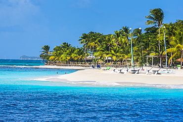
Catamarans on a beautiful palm fringed white sand beach on Palm Island, The Grenadines, St. Vincent and the Grenadines, Windward Islands, West Indies, Caribbean, Central America
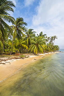
Beautiful palm fringed beach, Achutupu, San Blas Islands, Kuna Yala, Panama, Central America
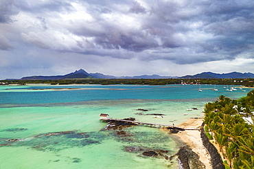
Clouds over lagoon and pier by a palm fringed beach, aerial view, Trou d'Eau Douce, Flacq, East coast, Mauritius, Indian Ocean, Africa
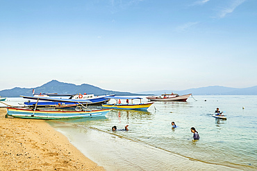
Locals swimming at the town beach with mainland beyond on this coral fringed holiday island, Bunaken Island, Sulawesi, Indonesia, Southeast Asia, Asia
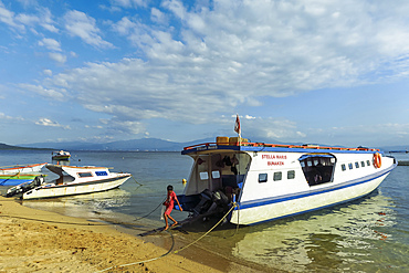
Ferry boats moored on the central bay of this coral fringed holiday and scuba dive destination, Bunaken Island, North Sulawesi, Indonesia, Southeast Asia, Asia
Palm fringed white sand beach on an islet of Vavau, Vavau Islands, Tonga, South Pacific, Pacific
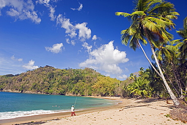
Fisherman on a palm-fringed beach, Englishmans Bay, Tobago, Trinidad and Tobago, West Indies, Caribbean, Central America
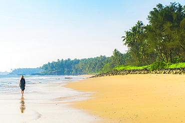
Lone traveller on lovely palm-fringed Kizhunna Beach, south of Kannur on Kerala's north coast, Kizhunna, Kannur, Kerala, India, Asia
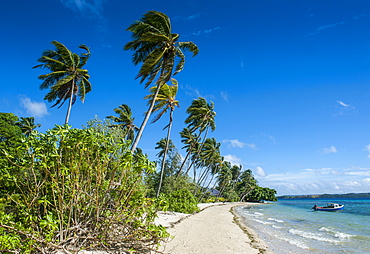
Palm fringed white sand beach on an islet of Vavau, Vavau Islands, Tonga, South Pacific, Pacific
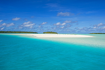
White sand beach and palm fringed beach in Aitutaki lagoon, Rarotonga and the Cook Islands, South Pacific, Pacific
View of palm tree fringed Worthing Beach, Barbados, West Indies, Caribbean, Central America
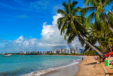
Palm fringed beach, Maceio, Alagoas, Brazil, South America
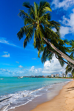
Palm fringed beach, Maceio, Alagoas, Brazil, South America
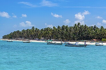
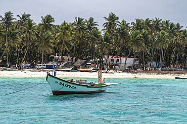
Little boats before a palm fringed white sand beach, Agatti Island, Lakshadweep archipelago, Union territory of India, Indian Ocean, Asia
Palm fringed beach, Maceio, Alagoas, Brazil, South America
A view of the palm fringed beach at Vai in Eastern Crete, Greek Islands, Greece, Europe
Palm fringed motu in the Blue Lagoon, Rangiroa atoll, Tuamotus, French Polynesia, South Pacific, Pacific
Palm fringed white sand beach, Agatti Island, Lakshadweep archipelago, Union territory of India, Indian Ocean, Asia
Palm fringed Coral beach, Taveuni, Fiji, South Pacific, Pacific
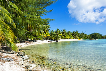
Beautiful palm fringed white sand beach in the turquoise waters of Tikehau, Tuamotus, French Polynesia, Pacific
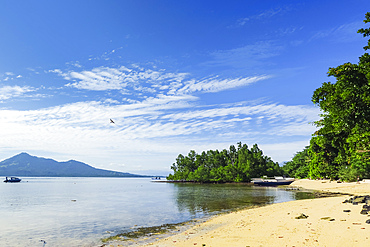
View to mainland and Gunung Tumpa at an eastern beach on this coral fringed holiday island, Bunaken, North Sulawesi, Indonesia, Southeast Asia, Asia

Beautiful palm fringed white sand beach in the turquoise waters of Tikehau, Tuamotus, French Polynesia, Pacific

Beautiful palm fringed white sand beach in the turquoise waters of Tikehau, Tuamotus, French Polynesia, Pacific
Palm fringed motu in the Blue Lagoon, Rangiroa atoll, Tuamotus, French Polynesia, South Pacific, Pacific
Palm fringed motu in the Blue Lagoon, Rangiroa atoll, Tuamotus, French Polynesia, South Pacific, Pacific
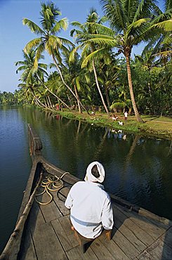
Boat on a typical backwater, fringed with palm trees, where house boats used for tourists, Kerala, India, Asia
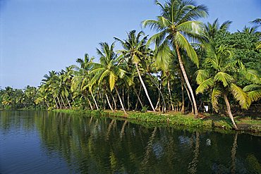
Typical backwater scene, waterway fringed by palm trees, canals and rivers are used as roadways, Kerala, India, Asia

People on a palm fringed beach at Palm Cove with Double Island beyond, north of Cairns, Queensland, Australia, Pacific
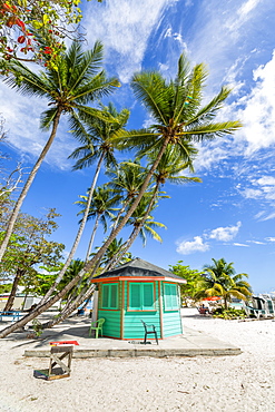
Palm-fringed beach, Cayman Kai, Grand Cayman, Cayman Islands, West Indies, Central America

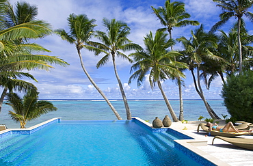
A palm fringed swimming pool within the Royal Savoy Resort at Sharm el-Sheikh, Egypt, North Africa, Africa
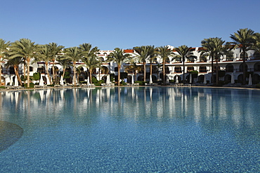
Rooms with verandas overlook a palm fringed swimming pool within the Royal Savoy Resort at Sharm el-Sheikh, Egypt, North Africa, Africa
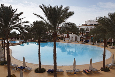
A palm fringed swimming pool within the Royal Savoy Resort at Sharm el-Sheikh, Egypt, North Africa, Africa
Boy walks off ferry at this popular coral fringed holiday island and scuba diving destination. Bunaken, North Sulawesi, Indonesia, Southeast Asia, Asia
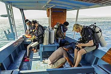
Divers prepare on boat off this popular coral fringed island and scuba and snorkel destination, Bunaken, North Sulawesi, Indonesia, Southeast Asia, Asia
Anakena beach, the Island's white sand beach fringed by palm trees, Rapa Nui (Easter Island), Chile, South America
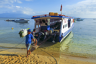
Men unload cargo from ferry at this coral fringed holiday island and scuba diving destination. Bunaken, North Sulawesi, Indonesia, Southeast Asia, Asia
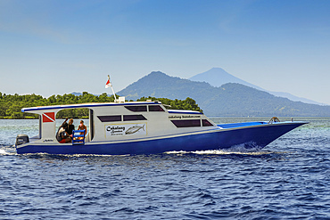
Dive boat with mainland and Manadotua Island beyond, off this coral fringed holiday and scuba island. Bunaken, North Sulawesi, Indonesia, Southeast Asia, Asia
Palm fringed beaches, Cook Islands, South Pacific, Pacific
Palm-fringed beach at Lavena Villlage, start of the famous Lavena Coastal Walk in this national park on the south coast of Taveuni - the 'Garden Island, Bouma National Park, Taveuni, Fiji
Palm-fringed beach at Lavena Villlage, start of the famous Lavena Coastal Walk in this national park on the south coast of Taveuni - the 'Garden Island, Bouma National Park, Taveuni, Fiji

Fringed waterlily (Villarsia nymphoides) and Parrots feather (Myriophyllium quaticum pettata). Bucks, UK.
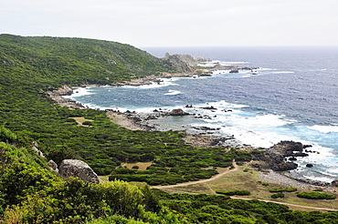
Rocky granitic coastline on a stormy day fringed by coastal maquis scrub, Campomoro Point, near Propriano, Corsica, France.
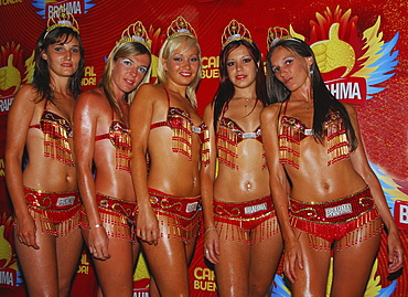
Female dancers at Gualeguaychú carnival, Entre RÃos province, Argentina
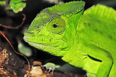
Crested or Fringed Chameleon (Chamaeleo cristatus, Trioceros cristatus), portrait, species from Africa, captive, Bergkamen, North Rhine-Westphalia, Germany, Europe
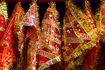
Coloured towels in Kamakhya Temple, a Hindu temple, Guwahati, Assam, North East India, India, Asia
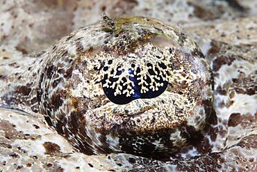
Eye, Tentacled flathead (Papilloculiceps longiceps), fish eye, Red Sea, Aqaba, Jordan, Asia
Little boats before a palm fringed white sand beach, Agatti Island, Lakshadweep archipelago, Union territory of India
Little boats before a palm fringed white sand beach, Agatti Island, Lakshadweep archipelago, Union territory of India
The Louisiade Archipelago is a string of ten larger volcanic islands frequently fringed by coral reefs, and 90 smaller coral islands located 200 km southeast of New Guinea, stretching over more than 160 km and spread over an ocean area of 26,000 km? between the Solomon Sea to the north and the Coral Sea to the south. The aggregate land area of the islands is about 1,790 km? (690 square miles), with Vanatinai (formerly Sudest or Tagula as named by European claimants on Western maps) being the largest.Sideia Island and Basilaki Island lie closest to New Guinea, while Misima, Vanatinai, and Rossel islands lie further east. The archipelago is divided into the Local Level Government (LLG) areas Louisiade Rural (western part, with Misima), and Yaleyamba (western part, with Rossell and Tagula islands. The LLG areas are part of Samarai-Murua District district of Milne Bay. The seat of the Louisiade Rural LLG is Bwagaoia on Misima Island, the population center of the archipelago.
The Louisiade Archipelago is a string of ten larger volcanic islands frequently fringed by coral reefs, and 90 smaller coral islands located 200 km southeast of New Guinea, stretching over more than 160 km and spread over an ocean area of 26,000 km? between the Solomon Sea to the north and the Coral Sea to the south. The aggregate land area of the islands is about 1,790 km? (690 square miles), with Vanatinai (formerly Sudest or Tagula as named by European claimants on Western maps) being the largest. Sideia Island and Basilaki Island lie closest to New Guinea, while Misima, Vanatinai, and Rossel islands lie further east. The archipelago is divided into the Local Level Government (LLG) areas Louisiade Rural (western part, with Misima), and Yaleyamba (western part, with Rossell and Tagula islands. The LLG areas are part of Samarai-Murua District district of Milne Bay. The seat of the Louisiade Rural LLG is Bwagaoia on Misima Island, the population center of the archipelago.

Nimoa Island - here the island mission will impress. The five-sided church features murals of island life and all mission buildings are surrounded by well maintained paths and gardens filled with flowering plants. Edged by jungle-covered mountains, postcard beaches and crystal clear waters - an island paradise indeed! The Louisiade Archipelago is a string of ten larger volcanic islands frequently fringed by coral reefs, and 90 smaller coral islands located 200 km southeast of New Guinea, stretching over more than 160 km and spread over an ocean area of 26,000 km? between the Solomon Sea to the north and the Coral Sea to the south. The aggregate land area of the islands is about 1,790 km? (690 square miles), with Vanatinai (formerly Sudest or Tagula as named by European claimants on Western maps) being the largest. Sideia Island and Basilaki Island lie closest to New Guinea, while Misima, Vanatinai, and Rossel islands lie further east. The archipelago is divided into the Local Level Government (LLG) areas Loui!

Nimoa Island - here the island mission will impress. The five-sided church features murals of island life and all mission buildings are surrounded by well maintained paths and gardens filled with flowering plants. Edged by jungle-covered mountains, postcard beaches and crystal clear waters - an island paradise indeed! The Louisiade Archipelago is a string of ten larger volcanic islands frequently fringed by coral reefs, and 90 smaller coral islands located 200 km southeast of New Guinea, stretching over more than 160 km and spread over an ocean area of 26,000 km? between the Solomon Sea to the north and the Coral Sea to the south. The aggregate land area of the islands is about 1,790 km? (690 square miles), with Vanatinai (formerly Sudest or Tagula as named by European claimants on Western maps) being the largest. Sideia Island and Basilaki Island lie closest to New Guinea, while Misima, Vanatinai, and Rossel islands lie further east. The archipelago is divided into the Local Level Government (LLG) areas Loui!

Nimoa Island - here the island mission will impress. The five-sided church features murals of island life and all mission buildings are surrounded by well maintained paths and gardens filled with flowering plants. Edged by jungle-covered mountains, postcard beaches and crystal clear waters - an island paradise indeed! The Louisiade Archipelago is a string of ten larger volcanic islands frequently fringed by coral reefs, and 90 smaller coral islands located 200 km southeast of New Guinea, stretching over more than 160 km and spread over an ocean area of 26,000 km? between the Solomon Sea to the north and the Coral Sea to the south. The aggregate land area of the islands is about 1,790 km? (690 square miles), with Vanatinai (formerly Sudest or Tagula as named by European claimants on Western maps) being the largest. Sideia Island and Basilaki Island lie closest to New Guinea, while Misima, Vanatinai, and Rossel islands lie further east. The archipelago is divided into the Local Level Government (LLG) areas Louisiade Rural (western part, with Misima), and Yaleyamba (western part, with Rossell and Tagula islands. The LLG areas are part of Samarai-Murua District district of Milne Bay. The seat of the Louisiade Rural LLG is Bwagaoia on Misima Island, the population center of the archipelago.
Nimoa Island - here the island mission will impress. The five-sided church features murals of island life and all mission buildings are surrounded by well maintained paths and gardens filled with flowering plants. Edged by jungle-covered mountains, postcard beaches and crystal clear waters - an island paradise indeed! The Louisiade Archipelago is a string of ten larger volcanic islands frequently fringed by coral reefs, and 90 smaller coral islands located 200 km southeast of New Guinea, stretching over more than 160 km and spread over an ocean area of 26,000 km? between the Solomon Sea to the north and the Coral Sea to the south. The aggregate land area of the islands is about 1,790 km? (690 square miles), with Vanatinai (formerly Sudest or Tagula as named by European claimants on Western maps) being the largest. Sideia Island and Basilaki Island lie closest to New Guinea, while Misima, Vanatinai, and Rossel islands lie further east.
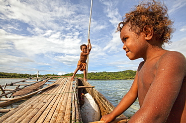
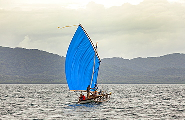
Children playing with a outrigger canoe in the village of Hessessai Bay at PanaTinai (Panatinane)island in the Louisiade Archipelago in Milne Bay Province, Papua New Guinea. The island has an area of 78 km2. The Louisiade Archipelago is a string of ten larger volcanic islands frequently fringed by coral reefs, and 90 smaller coral islands located 200 km southeast of New Guinea, stretching over more than 160 km and spread over an ocean area of 26,000 km? between the Solomon Sea to the north and the Coral Sea to the south. The aggregate land area of the islands is about 1,790 km? (690 square miles), with Vanatinai (formerly Sudest or Tagula as named by European claimants on Western maps) being the largest. Sideia Island and Basilaki Island lie closest to New Guinea, while Misima, Vanatinai, and Rossel islands lie further east. The archipelago is divided into the Local Level Government (LLG) areas Louisiade Rural (western part, with Misima), and Yaleyamba (western part, with Rossell and Tagula islands. The LLG areas are part of Samarai-Murua District district of Milne Bay. The seat of the Louisiade Rural LLG is Bwagaoia on Misima Island, the population center of the archipelago.PanaTinai (Panatinane) is an island in the Louisiade Archipelago in Milne Bay Province, Papua New Guinea.

Nimoa Island - here the island mission will impress. The five-sided church features murals of island life and all mission buildings are surrounded by well maintained paths and gardens filled with flowering plants. Edged by jungle-covered mountains, postcard beaches and crystal clear waters - an island paradise indeed! The Louisiade Archipelago is a string of ten larger volcanic islands frequently fringed by coral reefs, and 90 smaller coral islands located 200 km southeast of New Guinea, stretching over more than 160 km and spread over an ocean area of 26,000 km? between the Solomon Sea to the north and the Coral Sea to the south. The aggregate land area of the islands is about 1,790 km? (690 square miles), with Vanatinai (formerly Sudest or Tagula as named by European claimants on Western maps) being the largest. Sideia Island and Basilaki Island lie closest to New Guinea, while Misima, Vanatinai, and Rossel islands lie further east. The archipelago is divided into the Local Level Government (LLG) areas Louisiade Rural (western part, with Misima), and Yaleyamba (western part, with Rossell and Tagula islands. The LLG areas are part of Samarai-Murua District district of Milne Bay. The seat of the Louisiade Rural LLG is Bwagaoia on Misima Island, the population center of the archipelago.

Nimoa Island - here the island mission will impress. The five-sided church features murals of island life and all mission buildings are surrounded by well maintained paths and gardens filled with flowering plants. Edged by jungle-covered mountains, postcard beaches and crystal clear waters - an island paradise indeed! The Louisiade Archipelago is a string of ten larger volcanic islands frequently fringed by coral reefs, and 90 smaller coral islands located 200 km southeast of New Guinea, stretching over more than 160 km and spread over an ocean area of 26,000 km? between the Solomon Sea to the north and the Coral Sea to the south. The aggregate land area of the islands is about 1,790 km? (690 square miles), with Vanatinai (formerly Sudest or Tagula as named by European claimants on Western maps) being the largest. Sideia Island and Basilaki Island lie closest to New Guinea, while Misima, Vanatinai, and Rossel islands lie further east. The archipelago is divided into the Local Level Government (LLG) areas Louisiade Rural (western part, with Misima), and Yaleyamba (western part, with Rossell and Tagula islands. The LLG areas are part of Samarai-Murua District district of Milne Bay. The seat of the Louisiade Rural LLG is Bwagaoia on Misima Island, the population center of the archipelago.

Nimoa Island - here the island mission will impress. The five-sided church features murals of island life and all mission buildings are surrounded by well maintained paths and gardens filled with flowering plants. Edged by jungle-covered mountains, postcard beaches and crystal clear waters - an island paradise indeed! The Louisiade Archipelago is a string of ten larger volcanic islands frequently fringed by coral reefs, and 90 smaller coral islands located 200 km southeast of New Guinea, stretching over more than 160 km and spread over an ocean area of 26,000 km? between the Solomon Sea to the north and the Coral Sea to the south. The aggregate land area of the islands is about 1,790 km? (690 square miles), with Vanatinai (formerly Sudest or Tagula as named by European claimants on Western maps) being the largest. Sideia Island and Basilaki Island lie closest to New Guinea, while Misima, Vanatinai, and Rossel islands lie further east. The archipelago is divided into the Local Level Government (LLG) areas Loui!
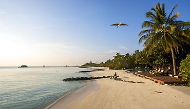
Palm Fringed, White Sand Beach With Heron Flying Overhead

WEST INDIES Jamaica Negril Sunfish dingies with sails up on coconut palm tree fringed beach
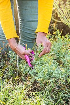
Woman harvesting Fringed rue (Ruta chalepensis) for maceration