Results
« Previous 1 2
195 results found
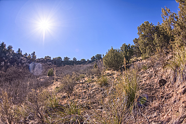
View from below the rim of the giant sinkhole known as Johnson Crater in the Kaibab National Forest near Ash Fork Arizona, USA
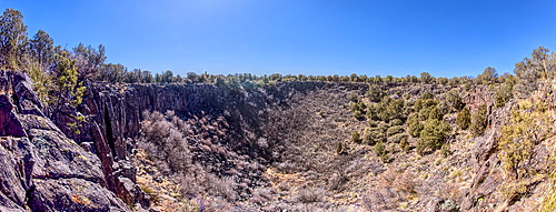
Super Panorama of the giant sinkhole known as Johnson Crater in the Kaibab National Forest near Ash Fork Arizona, USA
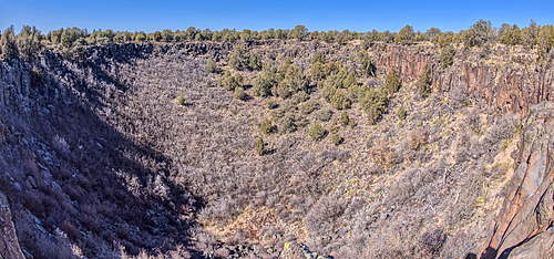
The giant sinkhole known as Johnson Crater in the Kaibab National Forest near Ash Fork Arizona, USA

Sport Utility Vehicle traveling on Forest Service Road 709 in the Kaibab National Forest of Arizona, USA

Sport Utility Vehicle traveling on Forest Service Road 709 in the Kaibab National Forest of Arizona, USA
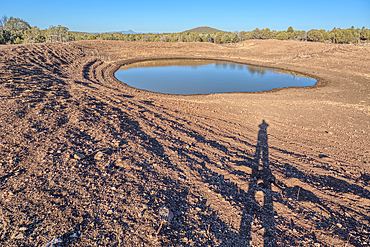
The Thirteen Mile Cattle Tank off of Corva Road in the Kaibab National Forest near Ash Fork Arizona, USA
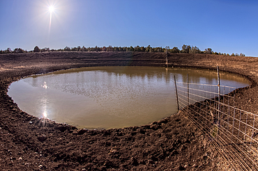
The Thirteen Mile Cattle Tank off of Corva Road in the Kaibab National Forest near Ash Fork Arizona, USA
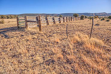
A livestock corral for the Thirteen Mile Cattle Tank off of Corva Road, Kaibab National Forest, Arizona, USA
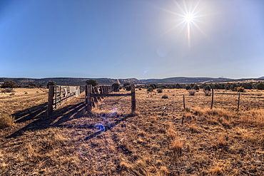
A livestock corral for the Thirteen Mile Cattle Tank off of Corva Road, Kaibab National Forest, Arizona, USA

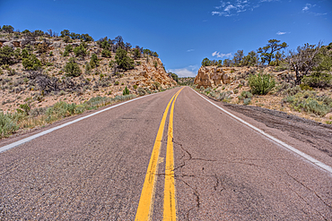
Forest Service Road 709 in the Kaibab National Forest of Arizona, USA

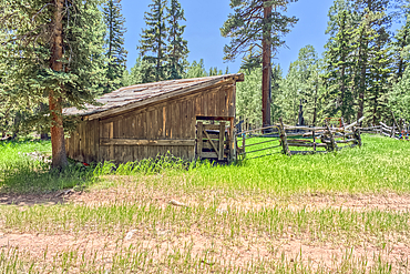
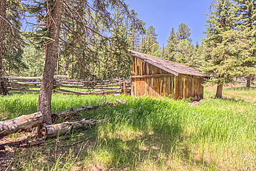
The old abandoned homestead of Rods Winter Camp in the Kaibab National Forest of Arizona, USA
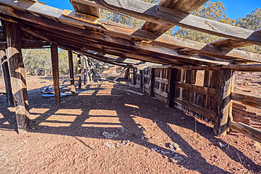
The old abandoned homestead of Rods Winter Camp in the Kaibab National Forest of Arizona, USA
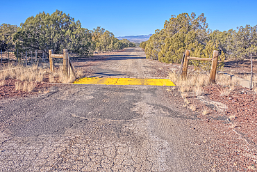
The crumbling remains of Arizona Route 66 in the Kaibab National Forest, USA

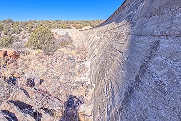
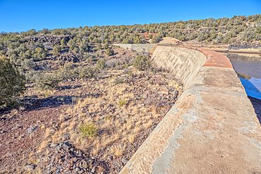
A water leak from a crack in Stone Dam in the Kaibab National Forest, Arizona, USA

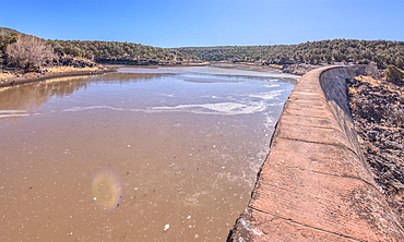
View from below the Stone Dam in the Kaibab National Forest, Arizona, USA
View from below the Stone Dam in the Kaibab National Forest, Arizona, USA
View from below the Stone Dam in the Kaibab National Forest, Arizona, USA
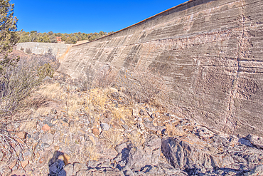
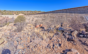
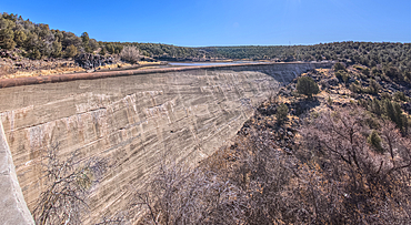
Johnson Canyon face of the Stone Dam in the Kaibab National Forest, Arizona, USA

Johnson Canyon face of the Stone Dam in the Kaibab National Forest, Arizona, USA
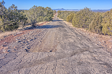
The crumbling remains of Arizona Route 66 in the Kaibab National Forest, USA
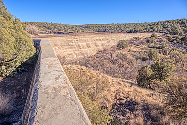
Top view from the Stone Dam in the Kaibab National Forest, Arizona, USA
Top view of the Stone Dam in the Kaibab National Forest, Arizona, USA
View from below the Stone Dam in the Kaibab National Forest, Arizona, USA
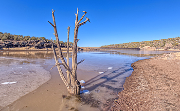
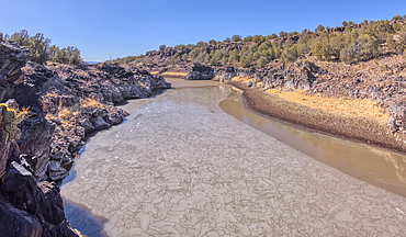
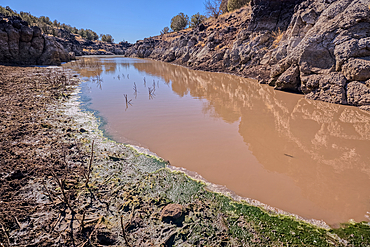
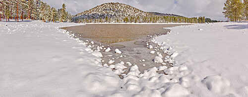
View from the shore of Stone Dam Lake in the Kaibab National Forest, Arizona, USA
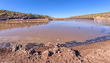
View from the shore of Stone Dam Lake in the Kaibab National Forest, Arizona, USA
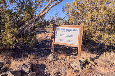
Historical information sign at Stone Dam Lake in the Kaibab National Forest, Arizona, USA
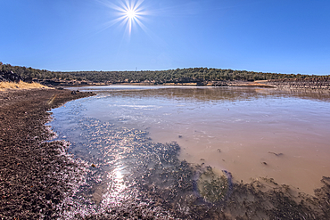
View from the shore of Stone Dam Lake in the Kaibab National Forest, Arizona, USA
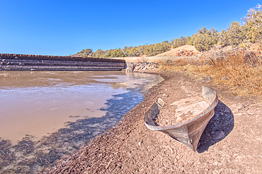
An abandoned boat along the shore of Stone Dam Lake in the Kaibab National Forest, Arizona, USA
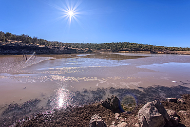
View from the shore of Stone Dam Lake in the Kaibab National Forest, Arizona, USA
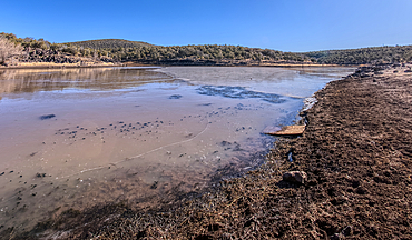
View from the shore of Stone Dam Lake in the Kaibab National Forest, Arizona, USA
View from the shore of Stone Dam Lake in the Kaibab National Forest, Arizona, USA
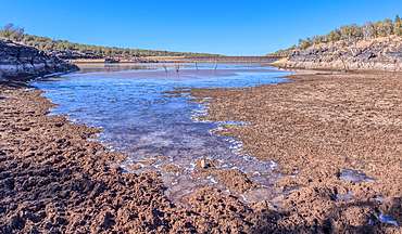
View from the shore of Stone Dam Lake in the Kaibab National Forest, Arizona, USA
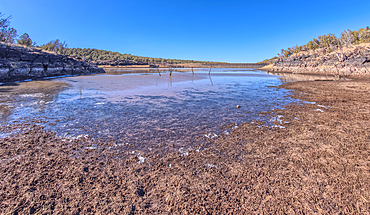
View from the shore of Stone Dam Lake in the Kaibab National Forest, Arizona, USA
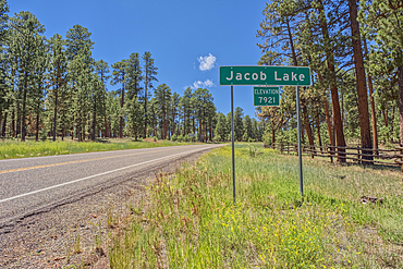
A sign marking the boundary of Jacob Lake, a settlement within the Kaibab National Forest in northern Arizona.
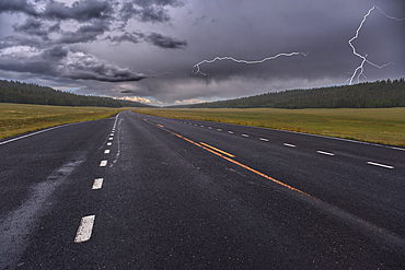
Lightning storm over Pleasant Valley in Kaibab National Forest Arizona, north of Grand Canyon North Rim.
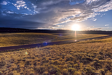
Highway 67 facing south in Pleasant Valley of Kaibab National Forest Arizona near sundown after a rain. North of Grand Canyon North Rim.
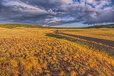
Rolling Hills in Pleasant Valley in the Kaibab National Forest north of Grand Canyon North Rim Arizona near sundown.
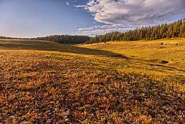
Rolling Hills in Pleasant Valley in the Kaibab National Forest north of Grand Canyon North Rim Arizona near sundown.
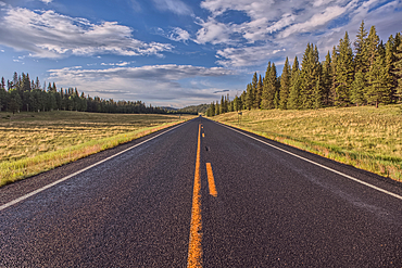
Highway 67 facing north in Pleasant Valley of Kaibab National Forest Arizona near sundown after a rain. North of Grand Canyon North Rim.
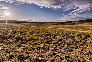
The rolling hills of Pleasant Valley in the Kaibab National Forest north of Grand Canyon North Rim Arizona near sundown.
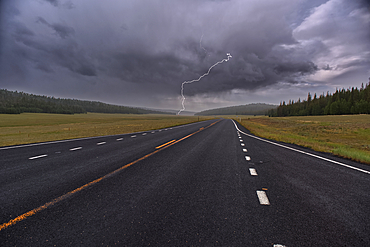
Lightning storm over Pleasant Valley in Kaibab National Forest Arizona, north of Grand Canyon North Rim.
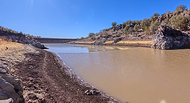
Shoreline view of the historic Bainbridge Steel Dam near Ash Fork, Kaibab National Forest, Arizona, United States of America
View of the lake created by the historic Bainbridge Steel Dam near Ash Fork, Kaibab National Forest, Arizona, United States of America
View from below the historic Bainbridge Steel Dam near Ash Fork, Kaibab National Forest, Arizona, United States of America
View of the lake created by the historic Bainbridge Steel Dam near Ash Fork, Kaibab National Forest, Arizona, United States of America
View of the lake created by the historic Bainbridge Steel Dam near Ash Fork, Kaibab National Forest, Arizona, United States of America
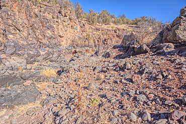
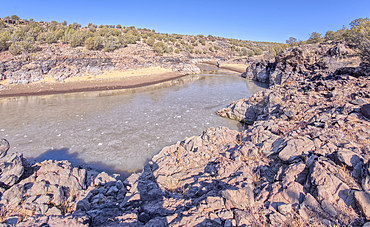
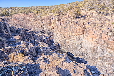
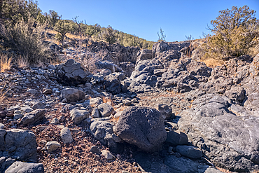
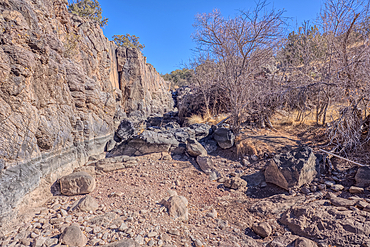
Basalt boulders and cliffs, Johnson Canyon east of Bainbridge Steel Dam Lake near Ash Fork, Kaibab National Forest, Arizona, United States of America
Basalt boulders and cliffs, Johnson Canyon east of Bainbridge Steel Dam Lake near Ash Fork, Kaibab National Forest, Arizona, United States of America
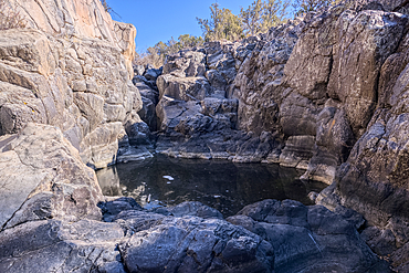
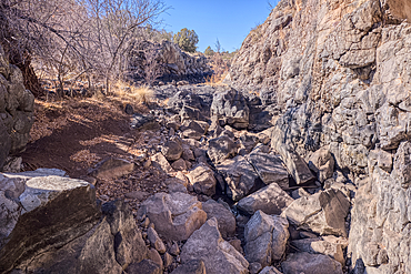
Dry waterfall cliffs, Johnson Canyon between Bainbridge Steel and Stone Dams near Ash Fork, Kaibab National Forest, Arizona, United States of America
Dry waterfall cliffs, Johnson Canyon between Bainbridge Steel and Stone Dams near Ash Fork, Kaibab National Forest, Arizona, United States of America
Dry waterfall cliffs, Johnson Canyon between Bainbridge Steel and Stone Dams near Ash Fork, Kaibab National Forest, Arizona, United States of America
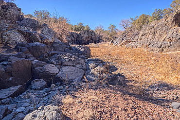
Basalt boulders and cliffs in a section of Johnson Canyon halfway between the Bainbridge Steel Dam and Stone Dam near Ash Fork Arizona in the Kaibab National Forest.
Basalt boulders and cliffs in a section of Johnson Canyon halfway between the Bainbridge Steel Dam and Stone Dam near Ash Fork Arizona in the Kaibab National Forest.

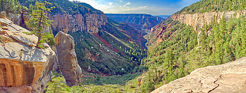
Sycamore Canyon viewed from the west side of Sycamore Point near sundown, located in Kaibab National Forest, Williams, Arizona, United States of America, North America

A twisted Juniper Tree near Sycamore Canyon in the Kaibab National Forest south of Williams, Arizona, United States of America, North America
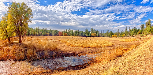
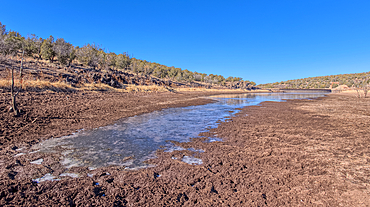
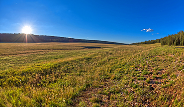
Grassland that used to be the J D Dam Lake, dry due to a drought in Arizona, Kaibab National Forest, south of Williams, Arizona, United States of America, North America
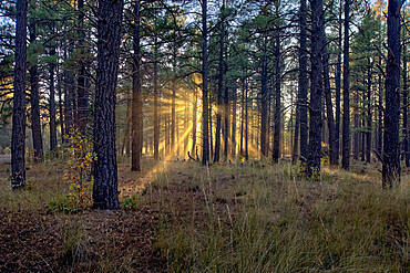
HDR composite of the late day sun shining through the trees of the Kaibab Forest near Williams, Arizona, United States of America, North America
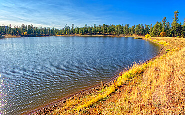
Panorama of Kaibab Lake from its south side, Kaibab National Forest near Williams, Arizona, United States of America, North America
Panorama view from above Sand Hill Spring at Vermilion Cliffs National Monument, with snow covered land in the distance of the Kaibab Plateau, location of the Grand Canyon, Arizona, United States of America, North America
View from the Saddle Mountain Overlook on the northeast edge of Grand Canyon North Rim and the Kaibab National Forest, Arizona, United States of America, North America
View from below the historic Bainbridge Steel Dam near Ash Fork Arizona in the Kaibab National Forest. It was originally constructed in the late 1800s and is now a historic landmark that is open to the public.
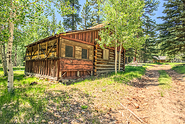
An abandoned homestead in the Kaibab National Forest off of Highway 67 north of Grand Canyon North Rim Arizona. Public land. No property release needed. Preserved by Forest Service as a historical landmark.
An abandoned homestead in the Kaibab National Forest off of Highway 67 north of Grand Canyon North Rim Arizona. Public land. No property release needed. Preserved by Forest Service as a historical landmark.
An abandoned homestead in the Kaibab National Forest off of Highway 67 north of Grand Canyon North Rim Arizona. Public land. No property release needed. Preserved by Forest Service as a historical landmark.
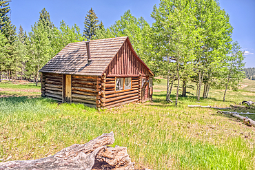
An abandoned homestead in the Kaibab National Forest off of Highway 67 north of Grand Canyon North Rim Arizona. Public land. No property release needed. Preserved by Forest Service as a historical landmark.
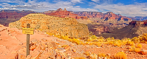
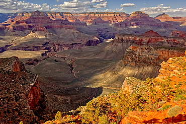
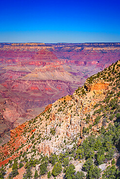
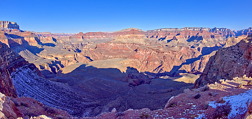
Grand Canyon view from Skeleton Point along the South Kaibab Trail on the south rim, Grand Canyon National Park, UNESCO World Heritage Site, Arizona, United States of America, North America
Top view of the Stone Dam in the Kaibab National Forest, USA

Overhead view of the Icy shore of Stone Dam Lake in the Kaibab National Forest, Arizona, USA
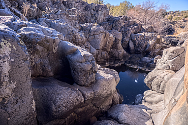
Basalt boulders and cliffs, Johnson Canyon between Bainbridge Steel and Stone Dams, Kaibab National Forest, Arizona, United States of America
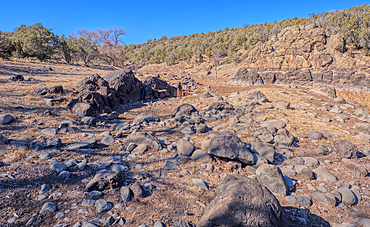
Basalt formation in Johnson Canyon east of the Bainbridge Steel Dam Lake near Ash Fork, Kaibab National Forest, Arizona, United States of America
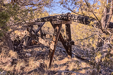
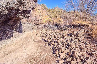
Old water pipe, Johnson Canyon between Bainbridge Steel and Stone Dams near Ash Fork, Kaibab National Forest, Arizona, United States of America
An abandoned homestead in the Kaibab National Forest off of Highway 67 north of Grand Canyon North Rim Arizona. Public land. No property release needed. Preserved by Forest Service as a historical landmark.
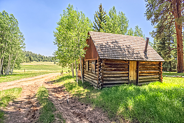
An abandoned homestead in the Kaibab National Forest off of Highway 67 north of Grand Canyon North Rim Arizona. Public land. No property release needed. Preserved by Forest Service as a historical landmark.
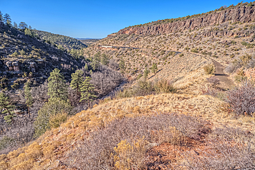
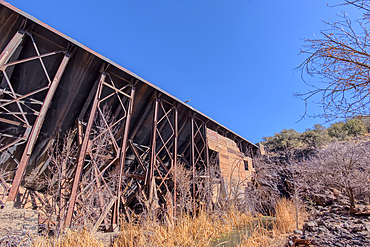
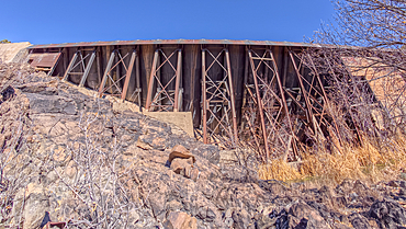
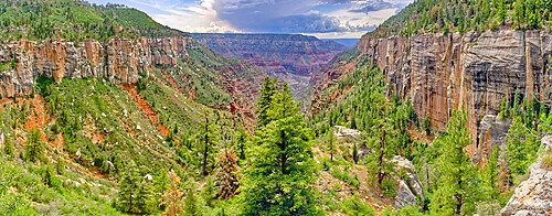
View of Johnson Canyon from above the abandoned Johnson Canyon Railroad Tunnel in the Kaibab National Forest of Arizona, USA
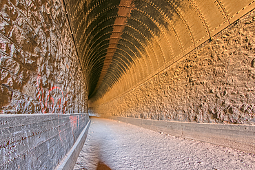
Interior view of the Johnson Canyon Railroad Tunnel, Kaibab National Forest of Arizona, USA
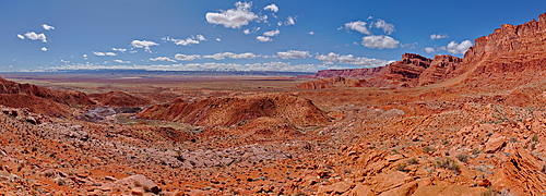
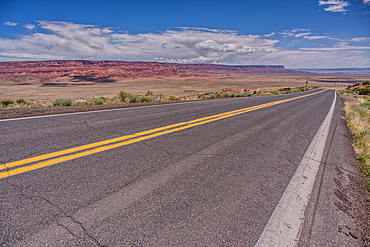
US89A ascending to the Kaibab Plateau in Arizona north of the Vermilion Cliffs National Monument.
View of Vermilion Cliffs Arizona from US89A ascending to the Kaibab Plateau.
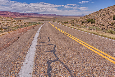
View of Vermilion Cliffs Arizona from US89A ascending to the Kaibab Plateau.
Basalt boulders and cliffs, Johnson Canyon between Bainbridge Steel and Stone Dams, Kaibab National Forest, Arizona, United States of America
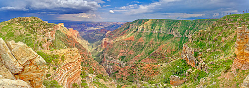
Bright Angel Canyon viewed from Coconino Overlook along North Kaibab Trail on Grand Canyon North Rim, Arizona, United States of America, North America

Cliffs of Sycamore Falls with dry inactive waterfalls, Kaibab National Forest near Williams, Arizona, United States of America, North America

White Horse Lake in the Kaibab National Forest of northern Arizona viewed from its northwest lagoon, Arizona, United States of America, North America

Grand Canyon view from the east side of Skeleton Point along the South Kaibab Trail, Grand Canyon National Park, UNESCO World Heritage Site, Arizona, United States of America, North America
The road leading to Kaibab Lake in the Kaibab National Forest near Williams, Arizona, United States of America, North America
Grand Canyon South Rim viewed from Cedar Ridge along the South Kaibab Trail, UNESCO World Heritage Site, Arizona, United States of America, North America
Pleasant Valley near sunset in the Kaibab National Forest just north of Grand Canyon North Rim, Arizona, United States of America, North America
Bright Angel Canyon viewed from Coconino Overlook along North Kaibab Trail on Grand Canyon North Rim, Arizona, United States of America, North America
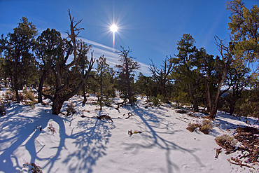
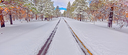
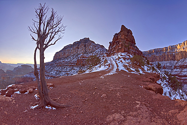
The Kaibab Forest in winter near Waldron Canyon west of Hermits Rest, Grand Canyon, Arizona, United States of America, North America
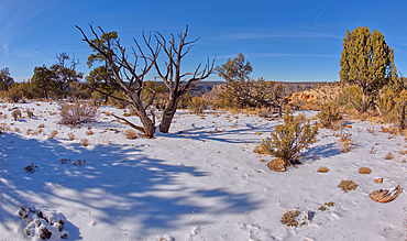
The Kaibab Forest in winter near Waldron Canyon west of Hermits Rest, Grand Canyon, Arizona, United States of America, North America
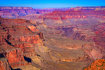
Scenic view of Grand Canyon from Ooh Aah Point on South Kaibab Trail, Grand Canyon National Park, Arizona, USA
Northeast Shoreline view of White Horse Lake near Williams, located within the Kaibab National Forest, Arizona, United States of America, North America
View of O'Neill Butte from its north side along the South Kaibab Trail at Grand Canyon Arizona just after sunrise.
Scenic view of Grand Canyon from South Kaibab Trail, Grand Canyon National Park, Arizona, USA
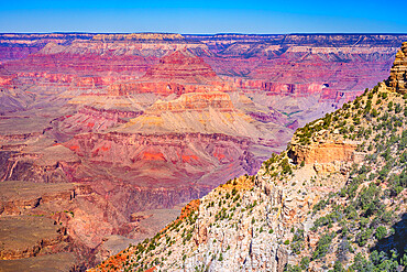
Scenic view of Grand Canyon from South Kaibab Trail, Grand Canyon National Park, Arizona, USA
View of Pipe Creek from the west cliff of Skeleton Point at Grand Canyon Arizona along the South Kaibab Trail.
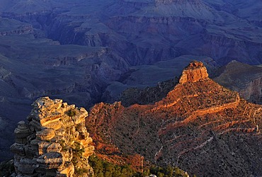
View of O'Neill Butte from Yaki Point at first morning light, South Kaibab Trail, Bright Angel Canyon and Trail, Grand Canyon National Park, South Rim, Arizona, United States of America, USA
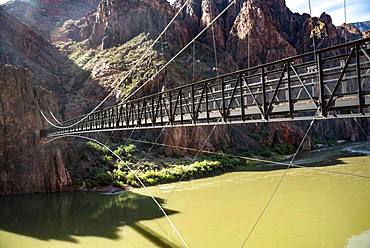
Suspension Bridge Kaibab Suspension Bridge over Colorado River, South Kaibab Trail, Grand Canyon National Park, Arizona, USA, North America
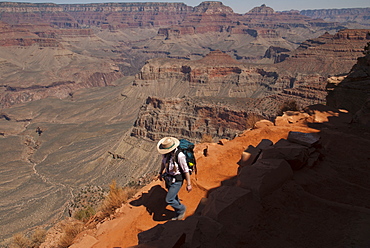
Hiking the Grand Canyon's Kaibab Trail, South Rim. Grand Canyon National Park, Arizona.
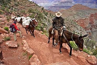
Female hiker waits for pack horses to pass on the South Kaibab Trail in Grand Canyon National Park north of Williams, Arizona May 2011. The South Kaibab Trail starts on the south rim of the Colorado Plateau and follows a ridge out to Skeleton Point allowing for 360-degree views of the canyon then down to the Colorado River. At the Colorado River the trail connects with the North Kaibab trail as part of the Arizona Trail system, that crosses the state of Arizona from Mexico to Utah.

Overlooking the Grand Canyon's Kaibab Trail, South Rim. Grand Canyon National Park, Arizona.