Results
« Previous 1 2 3 4 … 15 Next »
1467 results found
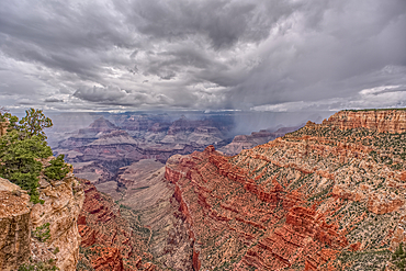
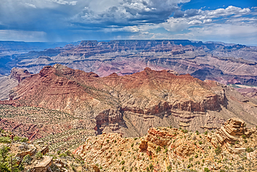
A rain storm over the North Rim of Grand Canyon National Park, Arizona, USA
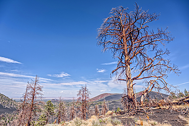
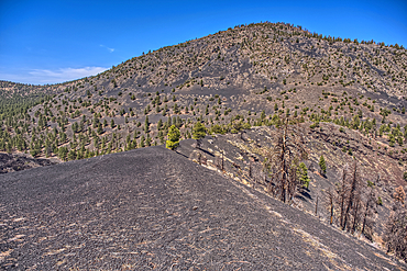
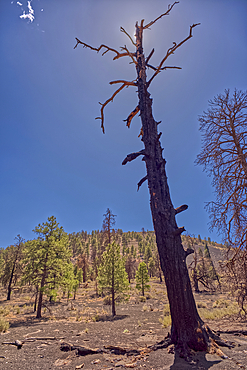
Burned trees on a Volcanic cinder rim in Coconino National Forest, Arizona, USA
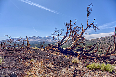
Burned trees on a Volcanic cinder rim in Coconino National Forest, Arizona, USA
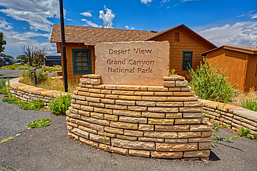
The welcome sign for Desert View Point on the east side of Grand Canyon South Rim, UNESCO World Heritage Site, Arizona, United States of America, North America
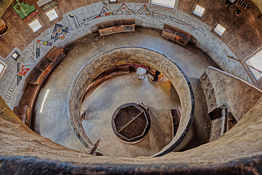
Downward view from the third floor in the historic Desert View Watchtower at Grand Canyon South Rim, artwork created by Fred Kobotie in 1933, now owned by the National Park Service, UNESCO World Heritage Site, Arizona, United States of America, North America
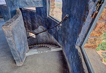
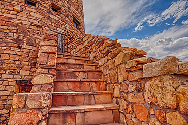
Stairs going down from the fourth floor in the historic Desert View Watchtower at Grand Canyon South Rim, UNESCO World Heritage Site, Arizona, United States of America, North America
Southwest view of Grand Canyon South Rim Arizona from the top floor of the historic Watchtower, taken through glass window, Grand Canyon, UNESCO World Heritage Site, Arizona, United States of America, North America
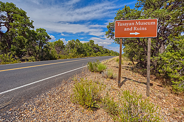
The direction sign for the Tusayan Museum and ruins at Grand Canyon South Rim, Arizona, United States of America, North America
Northwest view of Grand Canyon South Rim Arizona from the top floor of the historic Watchtower, taken through glass window, Grand Canyon, UNESCO World Heritage Site, Arizona, United States of America, North America
Steps to a platform above the observation deck of the Desert View Watchtower at Grand Canyon South Rim, HDR enhanced, Arizona, United States of America, North America
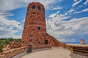
The upper half of the Desert View Watchtower viewed from the observation deck at Grand Canyon South Rim, UNESCO World Heritage Site, Arizona, United States of America, North America
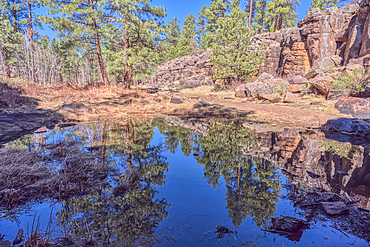
A still pond in Keyhole Sink in the Kaibab National Forest near Williams, Arizona, USA
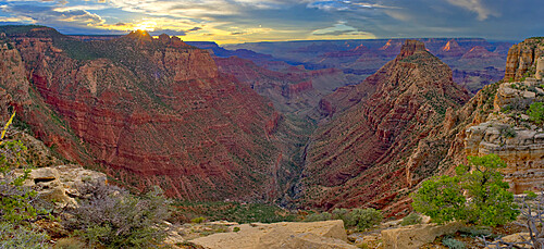
Hance Creek at sunset with Sinking Ship on the left and Coronado Butte right of center right, Grand Canyon, Grand Canyon National Park, UNESCO World Heritage Site, Arizona, United States of America, North America
A storm rolling across Grand Canyon near the Sinking Ship formation, viewed from Coronado Ridge, Grand Canyon National Park, UNESCO World Heritage Site, Arizona, United States of America, North America
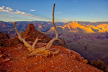
View of O'Neill Butte on the left and Grand Canyon on the right from the edge of Cedar Ridge along the South Kaibab Trail, Grand Canyon National Park, UNESCO World Heritage Site, Arizona, United States of America, North America
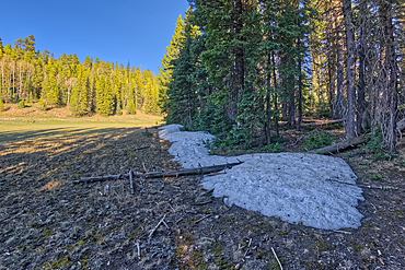
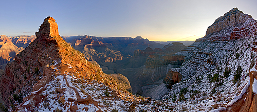
Taken near the end of May 2024, the last remnants of winter snow on the North Rim of Grand Canyon National Park, Arizona, United States of America, North America
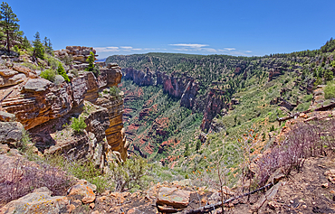
Cliff views south of Naji Point on the North Rim of Grand Canyon National Park, UNESCO World Heritage Site, Arizona, United States of America, North America
Cliff views just south of Naji Point on the North Rim of Grand Canyon National Park, UNESCO World Heritage Site, Arizona, United States of America, North America
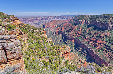
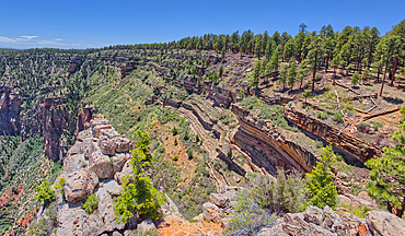
Cliff views from the edge of Naji Point on the North Rim of Grand Canyon, with Cape Final in the distance, Grand Canyon National Park, UNESCO World Heritage Site, Arizona, United States of America, North America
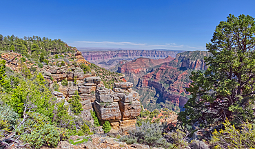
Cliff views from the edge of Naji Point on the North Rim of Grand Canyon National Park, UNESCO World Heritage Site, Arizona, United States of America, North America
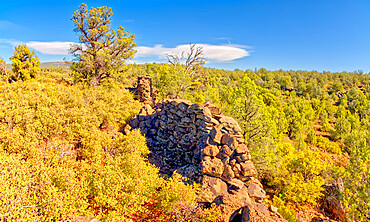
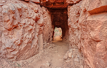
The crumbling walls of ancient Indian Ruins along the south rim of Rattlesnake Canyon near the historic Chavez Trail, Arizona, United States of America, North America
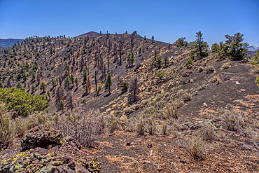
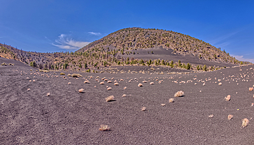
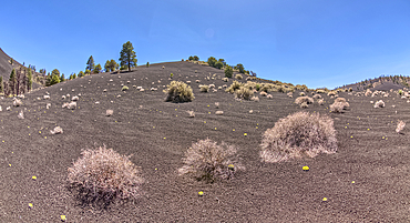
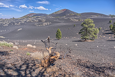
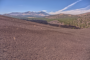
Volcanic cinder hills in Coconino National Forest, Arizona, USA
Volcanic cinder hills in Coconino National Forest, Arizona, USA
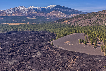
Humphrey's Peak, Coconino National Forest, Arizona, USA
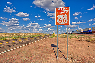
Road sign marking Historic Route 66 just east of Seligman, the birthplace of the famous road, Arizona, United States of America, North America
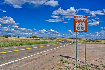
A road sign marking the Historic Route 66 just west of Ash Fork, Arizona, United States of America, North America
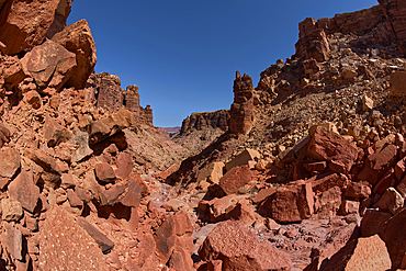
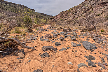
Giant boulders from a rock slide in a narrow section of the south fork of Soap Creek Canyon at Marble Canyon, Arizona, United States of America, North America
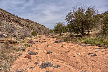
Silver Creek Canyon in the Agua Fria National Monument, Black Canyon City Arizona, USA
An entry gate to Silver Creek Canyon in Agua Fria National Monument Arizona, USA
Silver Creek Canyon in the Agua Fria National Monument, Black Canyon City Arizona, USA
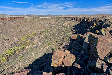
Silver Creek Canyon in the Agua Fria National Monument. Located north of Black Canyon City Arizona
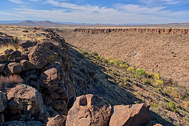
Silver Creek Canyon in the Agua Fria National Monument. Located north of Black Canyon City Arizona
The southeast summit of O'Leary Peak, Coconino National Forest, Arizona, USA
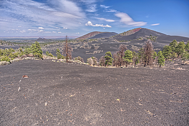
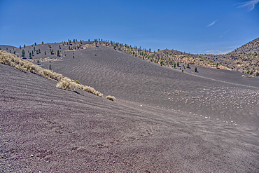
Volcanic cinder hills in Coconino National Forest, Arizona, USA
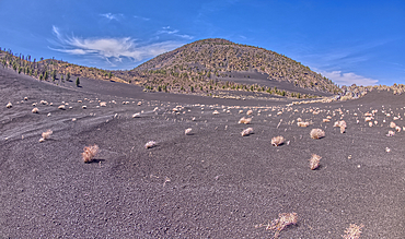
Volcanic cinder hills in Coconino National Forest, Arizona, USA
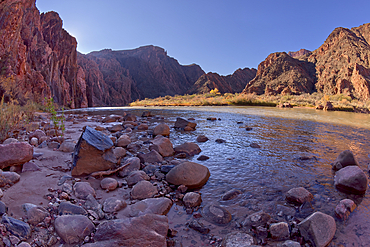
The Colorado River from its south shoreline near Phantom Ranch at Grand Canyon Arizona.
Sunrise view from Cedar Ridge along the South Kaibab Trail at Grand Canyon Arizona in winter. O'Neill Butte is on the left and Cremation Creek is below in the center. Ooh Aah Point in on the upper right.

The South Kaibab Trail winding down to the Black Bridge that spans the Colorado River at Grand Canyon Arizona. Phantom Ranch is just left of center.
Vermilion Cliffs National Monument, Arizona, USA
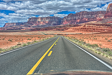
Vermilion Cliffs National Monument, Arizona, USA
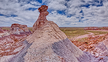
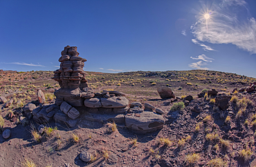
A hoodoo spire shaped like a Horse Head, in the valley below Blue Mesa of Petrified Forest National Park, Arizona, United States of America, North America
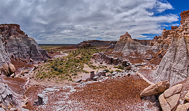
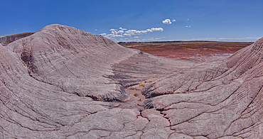
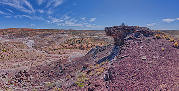
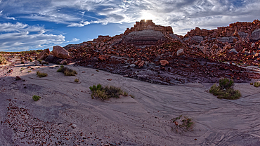
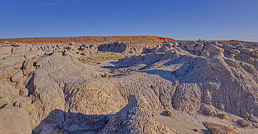
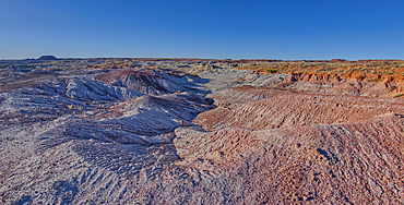
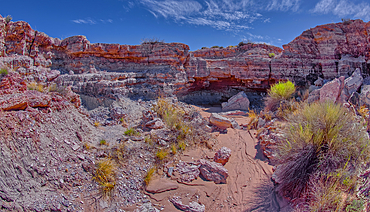
A valley below the east cliffs of Blue Mesa in Petrified Forest National Park, Arizona, United States of America, North America
The Billings Gap Overlook on the east side of Blue Mesa in Petrified Forest National Park, Arizona, United States of America, North America
The Billings Gap Overlook on the east side of Blue Mesa in Petrified Forest National Park, Arizona, United States of America, North America
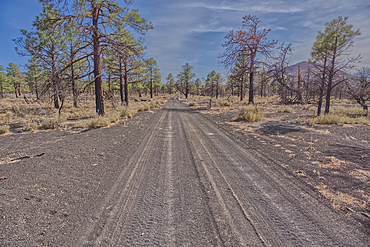
Fire Road 546 where it branches off from Sunset Crater National Monument into Coconino National Forest of Arizona, USA
A burned tree below a volcanic cinder hill in the Coconino National Forest, Arizona, USA
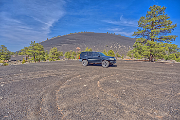
An SUV traveling near Volcanic cinder hills in Coconino National Forest, Arizona, USA
Volcanic cinder hills in Coconino National Forest, Arizona, USA
Volcanic cinder hills in Coconino National Forest, Arizona, USA
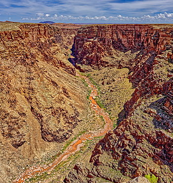
An area of the Little Colorado River Gorge east of the Grand Canyon, Arizona, Uninted States of America, North America

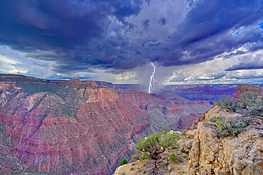
View of the Grand Canyon west of Navajo Point with a storm rolling in from the west, Arizona, United States of America, North America
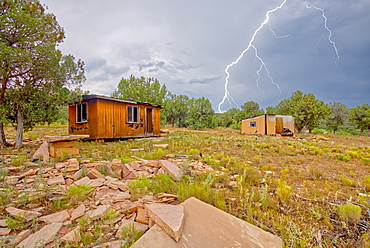
Lightning striking from a monsoon storm building up over the abandoned Mexican Quarry near Perkinsville, Arizona, United States of America, North America
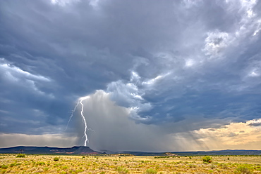
A massive monsoon storm moving over Matterhorn Mesa north of Drake, viewed from Forest Service Road 492, Arizona, United States of America, North America
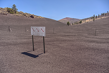
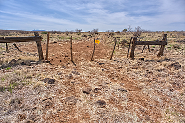
The boundary fence between Coconino National Forest and Sunset Crater National Monument of Arizona, USA
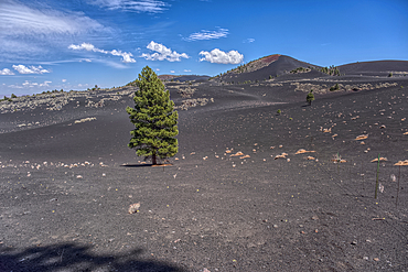
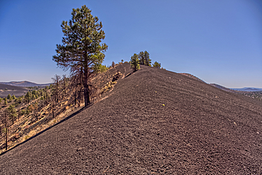
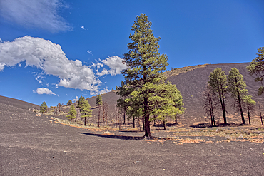
Lone Pine Tree in a volcanic valley in Coconino National Forest, Arizona, USA
Volcanic cinder hills in Coconino National Forest, Arizona, USA
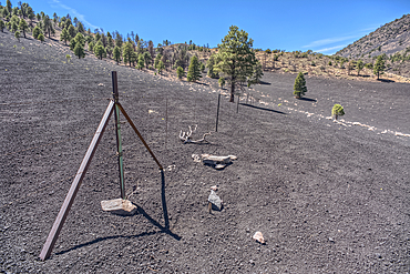
The boundary fence between Coconino National Forest and Sunset Crater National Monument of Arizona.
Volcanic cinder hills in Coconino National Forest, Arizona, USA
Volcanic cinder hill in Coconino National Forest, Arizona, USA
Volcanic cinder hills in Coconino National Forest, Arizona, USA
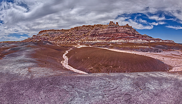
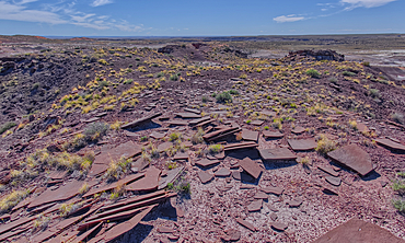
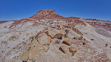
East slopes of Haystack Mesa in Petrified Forest National Park, Arizona, United States of America, North America
Slabs of brown sandstone on the summit of Crystal Mesa west of Hamilili Point in Petrified Forest National Park, Arizona, United States of America, North America
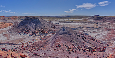
View from the summit of Crystal Mesa west of Hamilili Point in Petrified Forest National Park, Arizona, United States of America, North America
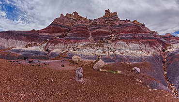
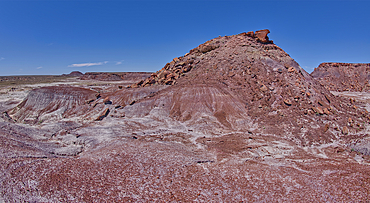
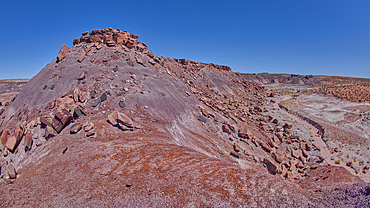
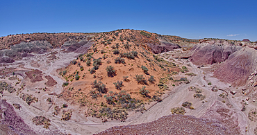
The south Haystack Hill in Petrified Forest National Park, Arizona, United States of America, North America
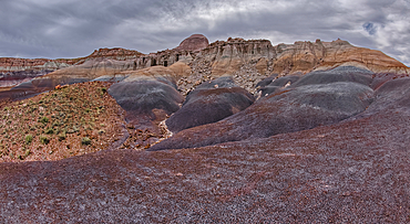
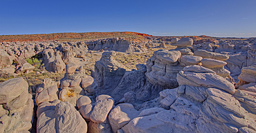
Hoodoo filled cliffs on the north side of Blue Mesa in Petrified Forest National Park, Arizona, United States of America, North America
The east cliffs of Blue Mesa near sunset, Petrified Forest National Park, Arizona, United States of America, North America
Billings Gap Overlook on Blue Mesa towards sunset, Petrified Forest National Park, Arizona, United States of America, North America
View of Anvil Hill and Crystal Butte from the summit of Crystal Mesa west of Hamilili Point in Petrified Forest National Park, Arizona, United States of America, North America
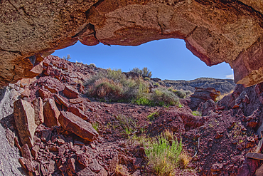
A cliff cave below Crystal Mesa west of Hamilili Point in Petrified Forest National Park, Arizona, United States of America, North America
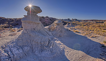
A rock spire sculpted by the wind on Crystal Mesa west of Hamilili Point in Petrified Forest National Park, Arizona, United States of America, North America
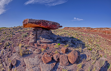
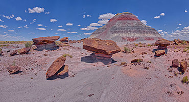
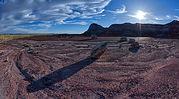
A rock table sculpted by the wind on Crystal Mesa west of Hamilili Point in Petrified Forest National Park, Arizona, United States of America, North America
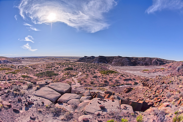
View of Crystal Mesa west of Hamilili Point in Petrified Forest National Park, Arizona, United States of America, North America
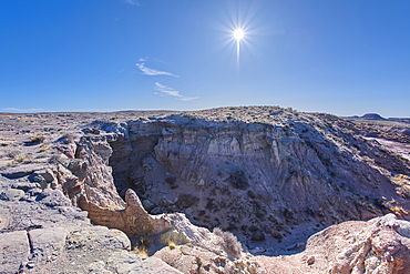
A dry waterfall west of Hamilili Point in Petrified Forest National Park, Arizona, United States of America, North America
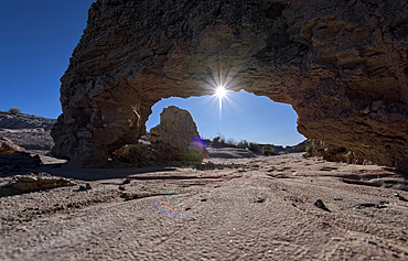
A small bentonite arch in Goblin Garden west of Hamilili Point in Petrified Forest National Park, Arizona, United States of America, North America
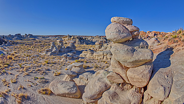
Goblin Garden west of Hamilili Point in Petrified Forest National Park, Arizona, United States of America, North America
Goblin Garden west of Hamilili Point in Petrified Forest National Park, Arizona, United States of America, North America
Goblin Garden west of Hamilili Point in Petrified Forest National Park, Arizona, United States of America, North America
Goblin Garden west of Hamilili Point in Petrified Forest National Park, Arizona, United States of America, North America
Goblin Garden west of Hamilili Point in Petrified Forest National Park, Arizona, United States of America, North America
Anvil Hill west of Hamilili Point in Petrified Forest National Park, Arizona, United States of America, North America
Gray clay flats below Anvil Hill west of Hamilili Point in Petrified Forest National Park, Arizona, United States of America, North America
Crystal Mesa above Crystal Creek west of Hamilili Point in Petrified Forest National Park, Arizona, United States of America, North America
A dry waterfall in Crystal Creek below Crystal Mesa west of Hamilili Point in Petrified Forest National Park, Arizona, United States of America, North America
A sloping red sand dune above Hamilili Wash in Petrified Forest National Park, Arizona, United States of America, North America
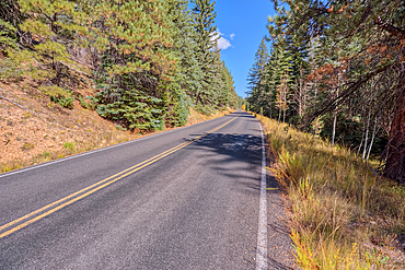
Cape Royal Road winding through Fuller Canyon at Grand Canyon North Rim, UNESCO, Arizona, United States of America
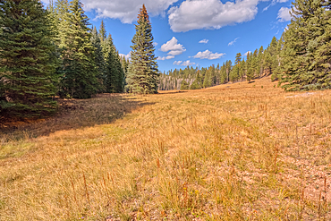
A meadow in Fuller Canyon off Cape Royal Road at Grand Canyon North Rim, Arizona, United States of America
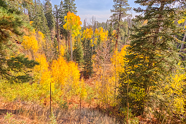
Autumn colored Aspen trees off Cape Royal Road in Grand Canyon North Rim, UNESCO, Arizona, United States of America
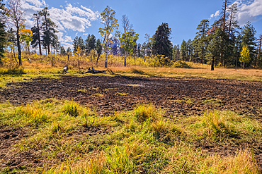
Greenland Lake reduced to a mud hole, Grand Canyon North Rim, UNESCO, Arizona, United States of America
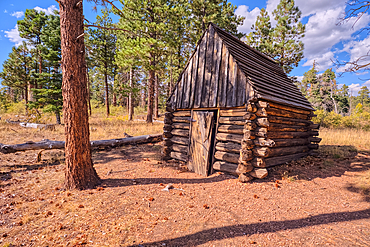
The historic Salt Cabin dating back to 1870s near Greenland Lake at Grand Canyon North Rim, UNESCO, Arizona, United States of America
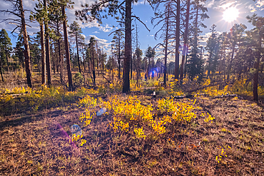
Burned forest area taken over by young Aspen trees in fall colors east of Greenland Lake, Grand Canyon North Rim, Arizona, United States of America

Aspen trees in autumn colors east of Greenland Lake, Grand Canyon North Rim, Arizona, United States of America
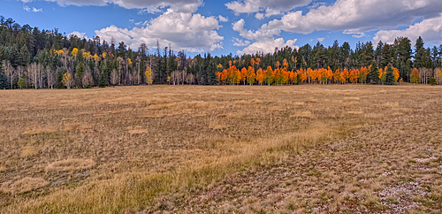
Deciduous trees with yellow and orange fall colors mixed with green Pine Trees, Kaibab National Forest, Arizona, United States of America
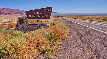
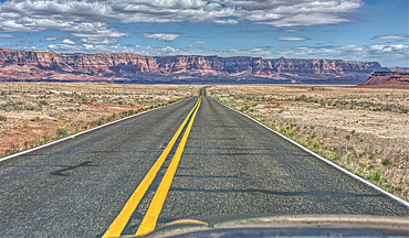
Highway US89A looking east to Vermilion Cliffs National Monument with Kaibab National Forest boundary sign, Arizona, United States of America
The west entrance of Supai Tunnel on North Kaibab Trail, Grand Canyon North Rim, UNESCO, Arizona, United States of America
The Red Wall of sandstone east of Supai Tunnel on North Kaibab Trail, Grand Canyon North Rim, UNESCO, Arizona, United States of America
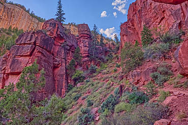
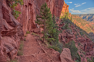
Red Wall cliffs of Roaring Springs Canyon on North Kaibab Trail, Grand Canyon North Rim, UNESCO, Arizona, United States of America
Ephemeral Spring on Red Wall of Roaring Springs Canyon, North Kaibab Trail, Grand Canyon North Rim, UNESCO, Arizona, United States of America
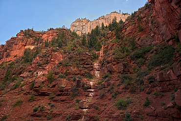
The sheer cliff of the Red Wall along the North Kaibab Trail, Grand Canyon North Rim, UNESCO, Arizona, United States of America
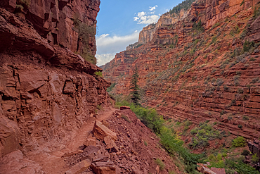
View above Red Wall Bridge crossing Roaring Springs Canyon, North Kaibab Trail, Grand Canyon North Rim, UNESCO, Arizona, United States of America
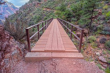
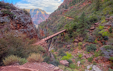
Red Wall Bridge crossing Roaring Springs Canyon on North Kaibab Trail, Grand Canyon North Rim, UNESCO, Arizona, United States of America