Results
« Previous 1 2
147 results found
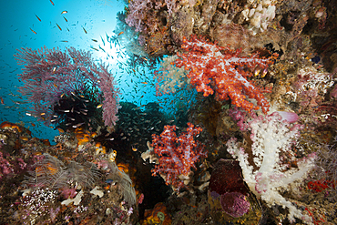
Soft Corals in Coral Reef, Triton Bay, West Papua, Indonesia
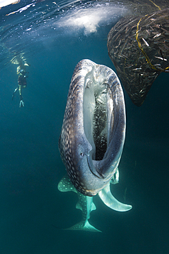
Feeding Whale Shark, Rhincodon typus, Triton Bay, West Papua, Indonesia
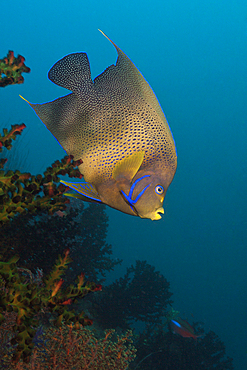
Semicircle Angelfish, Pomacanthus semicirculatus, Triton Bay, West Papua, Indonesia

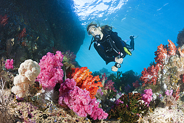
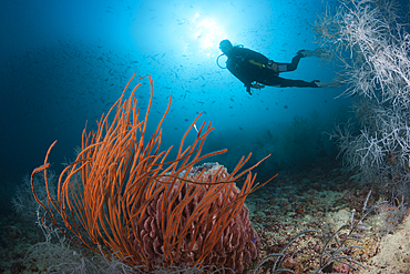
Scuba Diver and colored Coral Reef, Triton Bay, West Papua, Indonesia
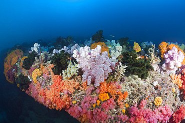
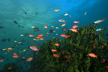
Colored Coral Reef, Triton Bay, West Papua, Indonesia
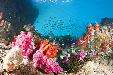
Colored Coral Reef, Triton Bay, West Papua, Indonesia
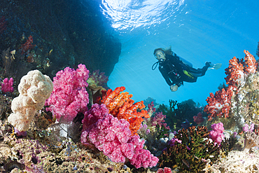
Scuba Diver and colored Coral Reef, Triton Bay, West Papua, Indonesia
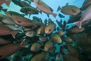
Shoal of Elongate Surgeonfish, Acanthurus mata, Triton Bay, West Papua, Indonesia
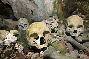
Old Skulls hidden in Rock Islands near Malwawa, Triton Bay, West Papua, Indonesia
Scuba Diver and colored Coral Reef, Triton Bay, West Papua, Indonesia
Celebes Sweetlips, Plectorhinchus chrysotaenia, Triton Bay, West Papua, Indonesia
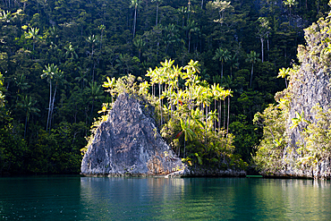
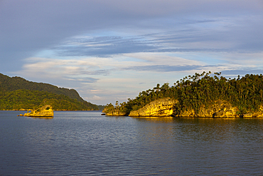
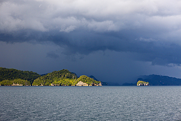
Rock Islands at Strait of Iris, Triton Bay, West Papua, Indonesia
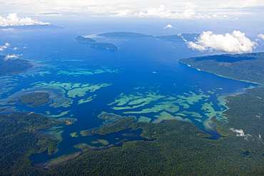
Islands near Kaimana, Triton Bay, West Papua, Indonesia
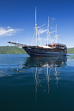
Amira Liveaboard, Triton Bay, West Papua, Indonesia
Scuba Diver and Red Whip Coral, Ellisella ceratophyta, Triton Bay, West Papua, Indonesia
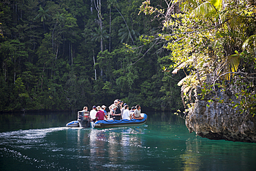
Zodiac Trip to Rock Islands at Strait of Iris, Triton Bay, West Papua, Indonesia

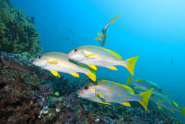
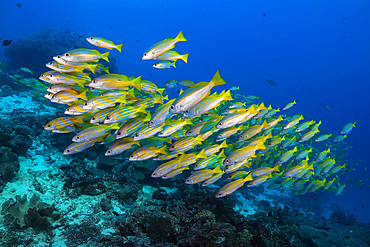
Shoal of Bigeye Snapper, Lutjanus lutjanus, Triton Bay, West Papua, Indonesia
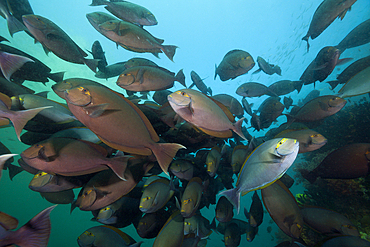
Shoal of Elongate Surgeonfish, Acanthurus mata, Triton Bay, West Papua, Indonesia
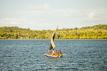
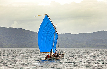
Impressions of Triton Bay, West Papua, Indonesia

Shoal of Elongate Surgeonfish, Acanthurus mata, Triton Bay, West Papua, Indonesia

Shoal of Elongate Surgeonfish, Acanthurus mata, Triton Bay, West Papua, Indonesia
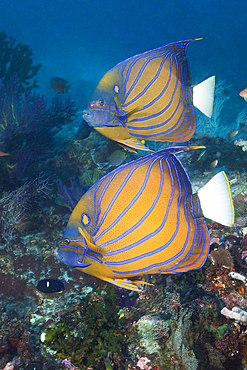
Pair of Blue-ringed Angelfish, Pomacanthus annularis, Triton Bay, West Papua, Indonesia
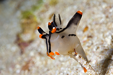
Neon Sea Slug, Thecacera picta, Triton Bay, West Papua, Indonesia
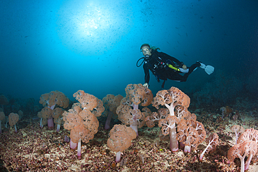
Scuba Diver and Soft corals, Umbellulifera sp., Triton Bay, West Papua, Indonesia
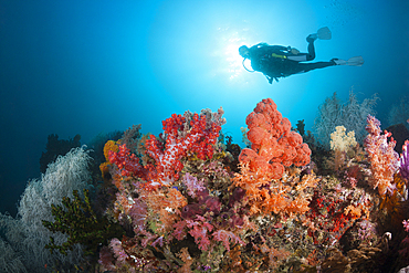
Scuba Diver and colored Coral Reef, Triton Bay, West Papua, Indonesia
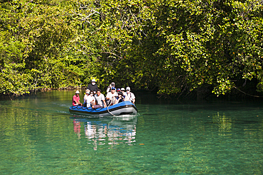
Zodiac Trip to Rock Islands at Strait of Iris, Triton Bay, West Papua, Indonesia
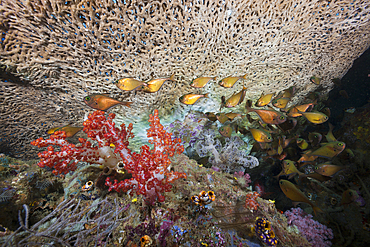
Copper Sweeper, Pempheris oualensis, Triton Bay, West Papua, Indonesia
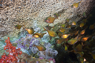
Copper Sweeper, Pempheris oualensis, Triton Bay, West Papua, Indonesia
Lyretail Anthias, Pseudanthias squamipinnis, Triton Bay, West Papua, Indonesia
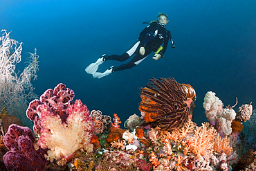
Scuba Diver and colored Coral Reef, Triton Bay, West Papua, Indonesia
Impressions of Triton Bay, West Papua, Indonesia
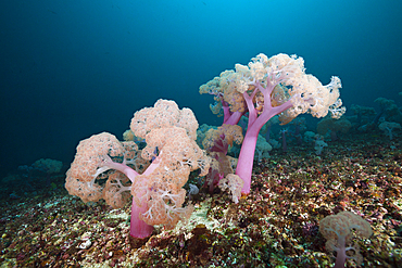
Soft Coral, Umbellulifera sp., Triton Bay, West Papua, Indonesia
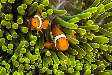
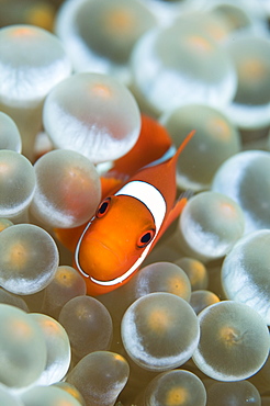
False clown anemonefish hide in their anemone in West Papua, Indonesia.
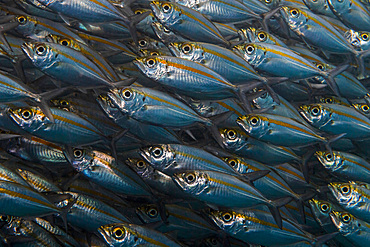
Oxeye scad in Raja Ampat, Indonesia.
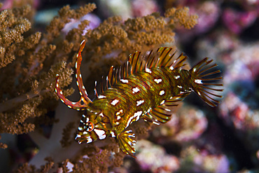
Rockmover wrasse in Raja Ampat, Indonesia.
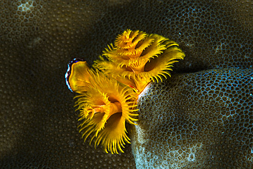
Christmas tree worm in Raja Ampat, Indonesia.
Golden-lined snapper in Raja Ampat, Indonesia.
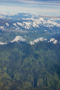
Aerial of the western highlands of Papua New Guinea, Pacific
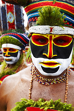
Sing Sing of Mount Hagen, a cultural show with ethnic groups, Mount Hagen, Western Highlands, Papua New Guinea, Pacific
Sing Sing of Mount Hagen, a cultural show with ethnic groups, Mount Hagen, Western Highlands, Papua New Guinea, Pacific
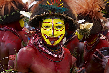
Sing Sing of Mount Hagen, a cultural show with ethnic groups, Mount Hagen, Western Highlands, Papua New Guinea, Pacific
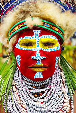
Sing Sing of Mount Hagen, a cultural show with ethnic groups, Mount Hagen, Western Highlands, Papua New Guinea, Pacific
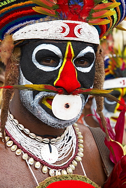
Sing Sing of Mount Hagen, a cultural show with ethnic groups, Mount Hagen, Western Highlands, Papua New Guinea, Pacific
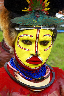
Sing Sing of Mount Hagen, a cultural show with ethnic groups, Mount Hagen, Western Highlands, Papua New Guinea, Pacific
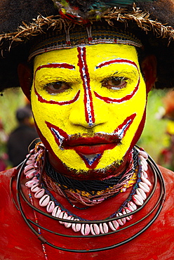
Sing Sing of Mount Hagen, a cultural show with ethnic groups, Mount Hagen, Western Highlands, Papua New Guinea, Pacific
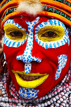
Sing Sing of Mount Hagen, a cultural show with ethnic groups, Mount Hagen, Western Highlands, Papua New Guinea, Pacific
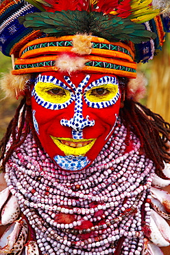
Sing Sing of Mount Hagen, a cultural show with ethnic groups, Mount Hagen, Western Highlands, Papua New Guinea, Pacific
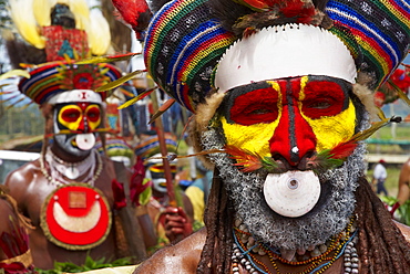
Sing Sing of Mount Hagen, a cultural show with ethnic groups, Mount Hagen, Western Highlands, Papua New Guinea, Pacific
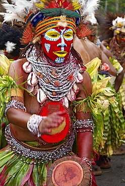
Sing Sing of Mount Hagen, a cultural show with ethnic groups, Mount Hagen, Western Highlands, Papua New Guinea, Pacific
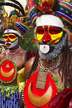
Sing Sing of Mount Hagen, a cultural show with ethnic groups, Mount Hagen, Western Highlands, Papua New Guinea, Pacific
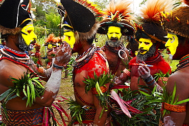
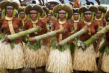
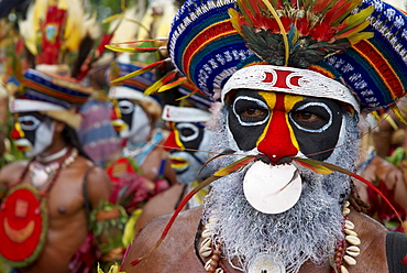
Cultural show with ethnic groups, Sing sing of Mount Hagen, Western Highlands, Papua New Guinea, Pacific
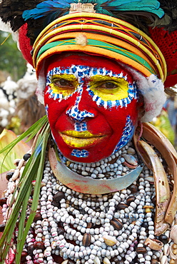
Sing Sing of Mount Hagen, a cultural show with ethnic groups, Mount Hagen, Western Highlands, Papua New Guinea, Pacific
Sing Sing of Mount Hagen, a cultural show with ethnic groups, Mount Hagen, Western Highlands, Papua New Guinea, Pacific
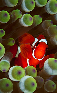
Clark's anemonefish (Amphiprion clarkii) in bubble-tip anemone (Entacmaea quadricolor), Raja Ampat archipelago, Papua Barat, Western New Guinea, Pacific Ocean, Indonesia, Asia

Clarks anemonefish (Amphiprion clarkii) in bladder anemone (Entacmaea quadricolor), Raja Ampat Archipelago, Papua Barat, Western New Guinea, Pacific Ocean, Indonesia, Asia

Coconut tree (Cocos nucifera) with fruits, village Yenbuba, Mansuar, Raja-Ampat, Western New Guinea, Indonesia, Asia

Forested limestone cliffs, Gam, Dampier Strait, Raja Ampat, Western New Guinea, Indonesia, Asia

Papua Diving Resort, Raja-Ampat, Kri, Dampier Strait, Western New Guinea, Indonesia, Asia
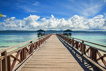
Landing stage, Arborek Island, Raja-Ampat, Western New Guinea, Indonesia, Asia

View of city with harbor, Sorong, West Papua, Western New Guinea, Indonesia, Asia

Bungalows, Papua Diving Resort, Kri Island in the Dampier Strait, West Papua, Indonesia, Asia

Coconut trees (Cocos nucifera), Arborek Island, Raja-Ampat, Western New Guinea, Indonesia, Asia
The Louisiade Archipelago is a string of ten larger volcanic islands frequently fringed by coral reefs, and 90 smaller coral islands located 200 km southeast of New Guinea, stretching over more than 160 km and spread over an ocean area of 26,000 km? between the Solomon Sea to the north and the Coral Sea to the south. The aggregate land area of the islands is about 1,790 km? (690 square miles), with Vanatinai (formerly Sudest or Tagula as named by European claimants on Western maps) being the largest.Sideia Island and Basilaki Island lie closest to New Guinea, while Misima, Vanatinai, and Rossel islands lie further east. The archipelago is divided into the Local Level Government (LLG) areas Louisiade Rural (western part, with Misima), and Yaleyamba (western part, with Rossell and Tagula islands. The LLG areas are part of Samarai-Murua District district of Milne Bay. The seat of the Louisiade Rural LLG is Bwagaoia on Misima Island, the population center of the archipelago.
The Louisiade Archipelago is a string of ten larger volcanic islands frequently fringed by coral reefs, and 90 smaller coral islands located 200 km southeast of New Guinea, stretching over more than 160 km and spread over an ocean area of 26,000 km? between the Solomon Sea to the north and the Coral Sea to the south. The aggregate land area of the islands is about 1,790 km? (690 square miles), with Vanatinai (formerly Sudest or Tagula as named by European claimants on Western maps) being the largest. Sideia Island and Basilaki Island lie closest to New Guinea, while Misima, Vanatinai, and Rossel islands lie further east. The archipelago is divided into the Local Level Government (LLG) areas Louisiade Rural (western part, with Misima), and Yaleyamba (western part, with Rossell and Tagula islands. The LLG areas are part of Samarai-Murua District district of Milne Bay. The seat of the Louisiade Rural LLG is Bwagaoia on Misima Island, the population center of the archipelago.

Nimoa Island - here the island mission will impress. The five-sided church features murals of island life and all mission buildings are surrounded by well maintained paths and gardens filled with flowering plants. Edged by jungle-covered mountains, postcard beaches and crystal clear waters - an island paradise indeed! The Louisiade Archipelago is a string of ten larger volcanic islands frequently fringed by coral reefs, and 90 smaller coral islands located 200 km southeast of New Guinea, stretching over more than 160 km and spread over an ocean area of 26,000 km? between the Solomon Sea to the north and the Coral Sea to the south. The aggregate land area of the islands is about 1,790 km? (690 square miles), with Vanatinai (formerly Sudest or Tagula as named by European claimants on Western maps) being the largest. Sideia Island and Basilaki Island lie closest to New Guinea, while Misima, Vanatinai, and Rossel islands lie further east. The archipelago is divided into the Local Level Government (LLG) areas Loui!

Nimoa Island - here the island mission will impress. The five-sided church features murals of island life and all mission buildings are surrounded by well maintained paths and gardens filled with flowering plants. Edged by jungle-covered mountains, postcard beaches and crystal clear waters - an island paradise indeed! The Louisiade Archipelago is a string of ten larger volcanic islands frequently fringed by coral reefs, and 90 smaller coral islands located 200 km southeast of New Guinea, stretching over more than 160 km and spread over an ocean area of 26,000 km? between the Solomon Sea to the north and the Coral Sea to the south. The aggregate land area of the islands is about 1,790 km? (690 square miles), with Vanatinai (formerly Sudest or Tagula as named by European claimants on Western maps) being the largest. Sideia Island and Basilaki Island lie closest to New Guinea, while Misima, Vanatinai, and Rossel islands lie further east. The archipelago is divided into the Local Level Government (LLG) areas Loui!

Nimoa Island - here the island mission will impress. The five-sided church features murals of island life and all mission buildings are surrounded by well maintained paths and gardens filled with flowering plants. Edged by jungle-covered mountains, postcard beaches and crystal clear waters - an island paradise indeed! The Louisiade Archipelago is a string of ten larger volcanic islands frequently fringed by coral reefs, and 90 smaller coral islands located 200 km southeast of New Guinea, stretching over more than 160 km and spread over an ocean area of 26,000 km? between the Solomon Sea to the north and the Coral Sea to the south. The aggregate land area of the islands is about 1,790 km? (690 square miles), with Vanatinai (formerly Sudest or Tagula as named by European claimants on Western maps) being the largest. Sideia Island and Basilaki Island lie closest to New Guinea, while Misima, Vanatinai, and Rossel islands lie further east. The archipelago is divided into the Local Level Government (LLG) areas Louisiade Rural (western part, with Misima), and Yaleyamba (western part, with Rossell and Tagula islands. The LLG areas are part of Samarai-Murua District district of Milne Bay. The seat of the Louisiade Rural LLG is Bwagaoia on Misima Island, the population center of the archipelago.
Nimoa Island - here the island mission will impress. The five-sided church features murals of island life and all mission buildings are surrounded by well maintained paths and gardens filled with flowering plants. Edged by jungle-covered mountains, postcard beaches and crystal clear waters - an island paradise indeed! The Louisiade Archipelago is a string of ten larger volcanic islands frequently fringed by coral reefs, and 90 smaller coral islands located 200 km southeast of New Guinea, stretching over more than 160 km and spread over an ocean area of 26,000 km? between the Solomon Sea to the north and the Coral Sea to the south. The aggregate land area of the islands is about 1,790 km? (690 square miles), with Vanatinai (formerly Sudest or Tagula as named by European claimants on Western maps) being the largest. Sideia Island and Basilaki Island lie closest to New Guinea, while Misima, Vanatinai, and Rossel islands lie further east.
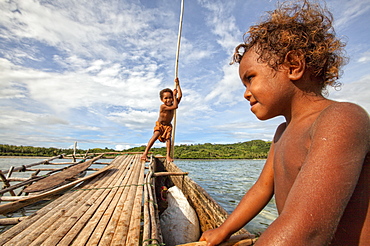
Children playing with a outrigger canoe in the village of Hessessai Bay at PanaTinai (Panatinane)island in the Louisiade Archipelago in Milne Bay Province, Papua New Guinea. The island has an area of 78 km2. The Louisiade Archipelago is a string of ten larger volcanic islands frequently fringed by coral reefs, and 90 smaller coral islands located 200 km southeast of New Guinea, stretching over more than 160 km and spread over an ocean area of 26,000 km? between the Solomon Sea to the north and the Coral Sea to the south. The aggregate land area of the islands is about 1,790 km? (690 square miles), with Vanatinai (formerly Sudest or Tagula as named by European claimants on Western maps) being the largest. Sideia Island and Basilaki Island lie closest to New Guinea, while Misima, Vanatinai, and Rossel islands lie further east. The archipelago is divided into the Local Level Government (LLG) areas Louisiade Rural (western part, with Misima), and Yaleyamba (western part, with Rossell and Tagula islands. The LLG areas are part of Samarai-Murua District district of Milne Bay. The seat of the Louisiade Rural LLG is Bwagaoia on Misima Island, the population center of the archipelago.PanaTinai (Panatinane) is an island in the Louisiade Archipelago in Milne Bay Province, Papua New Guinea.

Nimoa Island - here the island mission will impress. The five-sided church features murals of island life and all mission buildings are surrounded by well maintained paths and gardens filled with flowering plants. Edged by jungle-covered mountains, postcard beaches and crystal clear waters - an island paradise indeed! The Louisiade Archipelago is a string of ten larger volcanic islands frequently fringed by coral reefs, and 90 smaller coral islands located 200 km southeast of New Guinea, stretching over more than 160 km and spread over an ocean area of 26,000 km? between the Solomon Sea to the north and the Coral Sea to the south. The aggregate land area of the islands is about 1,790 km? (690 square miles), with Vanatinai (formerly Sudest or Tagula as named by European claimants on Western maps) being the largest. Sideia Island and Basilaki Island lie closest to New Guinea, while Misima, Vanatinai, and Rossel islands lie further east. The archipelago is divided into the Local Level Government (LLG) areas Louisiade Rural (western part, with Misima), and Yaleyamba (western part, with Rossell and Tagula islands. The LLG areas are part of Samarai-Murua District district of Milne Bay. The seat of the Louisiade Rural LLG is Bwagaoia on Misima Island, the population center of the archipelago.

Nimoa Island - here the island mission will impress. The five-sided church features murals of island life and all mission buildings are surrounded by well maintained paths and gardens filled with flowering plants. Edged by jungle-covered mountains, postcard beaches and crystal clear waters - an island paradise indeed! The Louisiade Archipelago is a string of ten larger volcanic islands frequently fringed by coral reefs, and 90 smaller coral islands located 200 km southeast of New Guinea, stretching over more than 160 km and spread over an ocean area of 26,000 km? between the Solomon Sea to the north and the Coral Sea to the south. The aggregate land area of the islands is about 1,790 km? (690 square miles), with Vanatinai (formerly Sudest or Tagula as named by European claimants on Western maps) being the largest. Sideia Island and Basilaki Island lie closest to New Guinea, while Misima, Vanatinai, and Rossel islands lie further east. The archipelago is divided into the Local Level Government (LLG) areas Louisiade Rural (western part, with Misima), and Yaleyamba (western part, with Rossell and Tagula islands. The LLG areas are part of Samarai-Murua District district of Milne Bay. The seat of the Louisiade Rural LLG is Bwagaoia on Misima Island, the population center of the archipelago.

Nimoa Island - here the island mission will impress. The five-sided church features murals of island life and all mission buildings are surrounded by well maintained paths and gardens filled with flowering plants. Edged by jungle-covered mountains, postcard beaches and crystal clear waters - an island paradise indeed! The Louisiade Archipelago is a string of ten larger volcanic islands frequently fringed by coral reefs, and 90 smaller coral islands located 200 km southeast of New Guinea, stretching over more than 160 km and spread over an ocean area of 26,000 km? between the Solomon Sea to the north and the Coral Sea to the south. The aggregate land area of the islands is about 1,790 km? (690 square miles), with Vanatinai (formerly Sudest or Tagula as named by European claimants on Western maps) being the largest. Sideia Island and Basilaki Island lie closest to New Guinea, while Misima, Vanatinai, and Rossel islands lie further east. The archipelago is divided into the Local Level Government (LLG) areas Loui!

Dani men engaged in a mock battle with long spears, in a display of prowess and opulence of dress and decoration, Obia Village, Baliem Valley, Central Highlands of Western New Guinea, Papua, Indonesia

Dani man engaged in a mock battle with a long spear, in a display of prowess and opulence of dress and decoration, Obia Village, Baliem Valley, Central Highlands of Western New Guinea, Papua, Indonesia

Dani man engaged in a mock battle with a long spear, in a display of prowess and opulence of dress and decoration, Obia Village, Baliem Valley, Central Highlands of Western New Guinea, Papua, Indonesia

Dani men wearing an elaborate headdress of bird of paradise or cassowary feathers lighting a fire, Obia Village, Baliem Valley, Central Highlands of Western New Guinea, Papua, Indonesia

Dani man wearing bones on his nose and an elaborate headdress of bird of paradise or cassowary feathers, Obia Village, Baliem Valley, Central Highlands of Western New Guinea, Papua, Indonesia

Dani man wearing an elaborate headdress of bird of paradise or cassowary feathers, Obia Village, Baliem Valley, Central Highlands of Western New Guinea, Papua, Indonesia
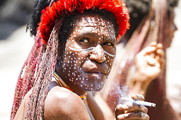
Dani woman smoking a cigarette, Obia Village, Baliem Valley, Central Highlands of Western New Guinea, Papua, Indonesia

Dani men engaged in a mock battle with long spears, in a display of prowess and opulence of dress and decoration, Obia Village, Baliem Valley, Central Highlands of Western New Guinea, Papua, Indonesia

Schooling longfin batfish, Raja Ampat Indonesia

Tassled wobbegong shark and Manta Ray-Raja Ampat Indonesia
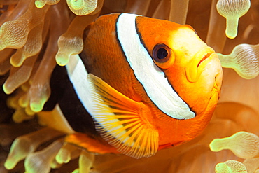
Spinecheek anemonefish, Raja Ampat Indonesia

Black Manta Ray, Dampier Strait Raja Ampat Indonesia
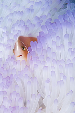
Pink anemonefish in bleached Anemone, Raja Ampat Indonesia

Soft corals on a tropical reef, Raja Ampat Indonesia

Gorgonian Seafan and Bigeye Snappers, Raja Ampat Indonesia

Crinoids and a small gorgonian fan, Raja Ampat Indonesia

Giant barrel sponge and Unicornfish, Raja Ampat Indonesia

School of Bigeye Snappers, Raja Ampat Indonesia
Spinecheek anemonefish, Raja Ampat Indonesia

Schooling Ribbon Sweetlips, Raja Ampat Indonesia

Porcelain Crab on Soft Coral, Raja Ampat Indonesia

Lionfish and Soft Corals, Raja Ampat Indonesia
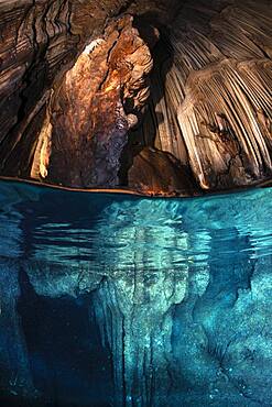
Underwater cave from Misool, Raja Ampat, Indon?sie

Staghorn Coral (Acropora sp) on reef, Raja Ampat, Indonesia
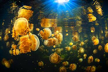
Black water and Jellyfish (Mastigias papua) of Lenmakana lake. This lake is isolated from the rest of the ocean by ramparts several tens of meters high. It is connected to the ocean by terrestrial channels but it prevents the entry and exit of living organisms. These jellyfish have therefore found refuge in what is for them a haven of peace. They have proliferated to reach millions of people. Misool, Rajat Ampat, Indonesia
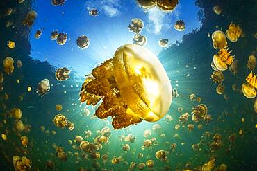
Jellyfish (Mastigias papua) of Lenmakana lake. This lake is isolated from the rest of the ocean by ramparts several tens of meters high. It is connected to the ocean by terrestrial channels but it prevents the entry and exit of living organisms. These jellyfish have therefore found refuge in what is for them a haven of peace. They have proliferated to reach millions of people. Misool, Rajat Ampat, Indonesia
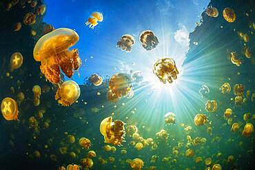
Flying Jellyfish (Mastigias papua) of Lenmakana lake. This lake is isolated from the rest of the ocean by ramparts several tens of meters high. It is connected to the ocean by terrestrial channels but it prevents the entry and exit of living organisms. These jellyfish have therefore found refuge in what is for them a haven of peace. They have proliferated to reach millions of people. Misool, Rajat Ampat, Indonesia
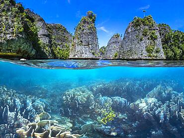
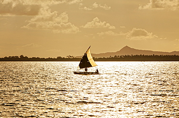
Split level panorama to Raja Ampat, Indonesia