Results
« Previous 1 … 20 21 22 23 24 … 47 Next »
4659 results found
The Humming Bird Geoglyph, aerial view, Nazca, UNESCO World Heritage Site, Ica Region, Peru, South America
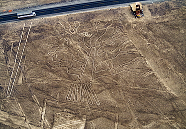
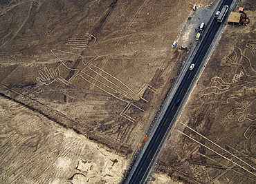
The Tree Geoglyph, aerial view, Nazca, UNESCO World Heritage Site, Ica Region, Peru, South America
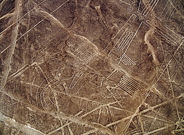
The Bird Geoglyph, aerial view, Nazca, UNESCO World Heritage Site, Ica Region, Peru, South America
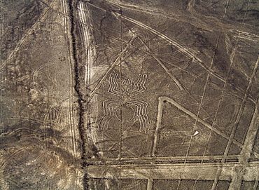
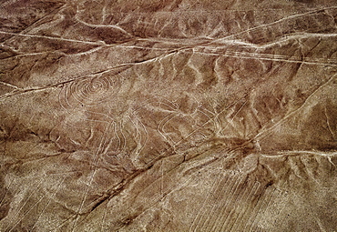
The Spider Geoglyph, aerial view, Nazca, UNESCO World Heritage Site, Ica Region, Peru, South America
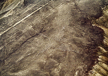
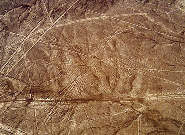
The Heron Geoglyph, aerial view, Nazca, UNESCO World Heritage Site, Ica Region, Peru, South America
The Monkey Geoglyph, aerial view, Nazca, UNESCO World Heritage Site, Ica Region, Peru, South America
The Condor Geoglyph, aerial view, Nazca, UNESCO World Heritage Site, Ica Region, Peru, South America
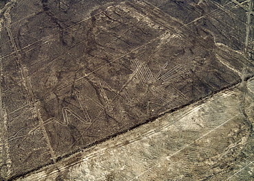
The Lizard Geoglyph, aerial view, Nazca, UNESCO World Heritage Site, Ica Region, Peru, South America
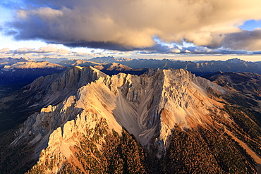
Aerial view of the rocky peaks of Latemar at sunset, Dolomites, South Tyrol, Italy, Europe
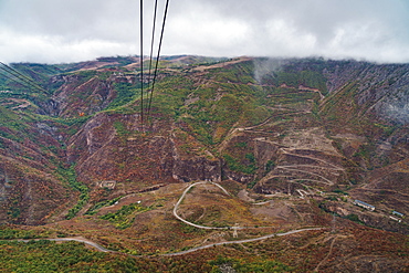
Aerial view from one of the world's longest (6 km) aerial tramways, Tatev, Armenia, Central Asia, Asia
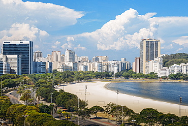
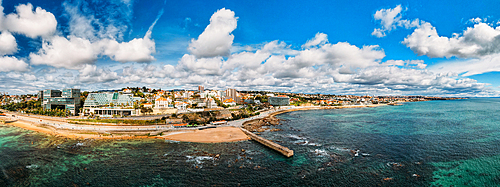
Aerial view of Botafogo Beach, Rio de Janeiro, Brazil, South America

Aerial view of old town and Monti Sion church, Pollenca, Majorca, Balearic Islands, Spain, Europe
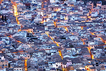
Aerial view of old town, Pollenca, Majorca, Balearic Islands, Spain, Mediterranean, Europe

Aerial panoramic view of Lake Sils and Plaun da Lej during winter, Maloja Region, Canton of Graubunden, Engadine, Switzerland, Europe (Drone)
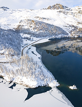
Aerial panoramic view of road around frozen Lake Sils, Plaun da Lej, Maloja Region, Canton of Graubunden, Engadine, Switzerland, Europe (Drone)
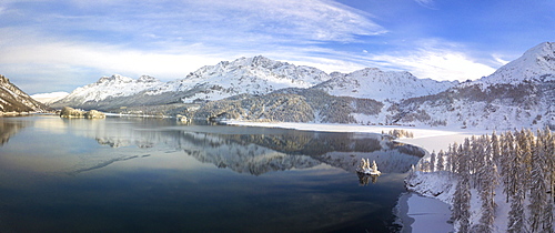
Aerial panoramic view of Lake Sils and Plaun da Lej during winter, Maloja Region, Canton of Graubunden, Engadine, Switzerland, Europe (Drone)
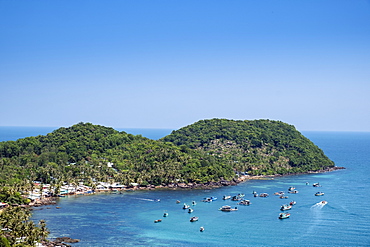
Aerial view of an island in the Phu Quoc archipelago in southern Vietnam, Indochina, Southeast Asia, Asia
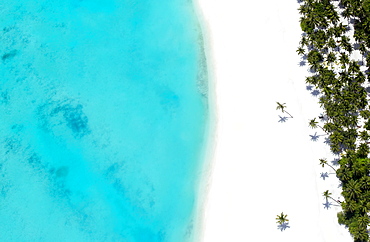
Aerial view of tropical beach and lagoon, The Maldives, Indian Ocean, Asia
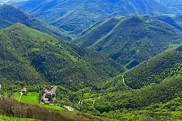
Aerial view of Fonte Avellana Monastery, Mount Catria, Umbria, Italy, Europe
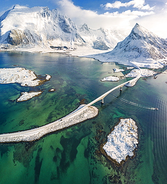
Aerial panoramic view of snowy peak of Volanstinden and Fredvang bridge, Lofoten Islands, Nordland, Norway, Europe
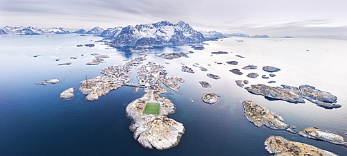
Panoramic aerial view of soccer pitch and islets, Henningsvaer, Vagan municipality, Lofoten Islands, Nordland, Norway, Europe

Aerial view of Monte Disgrazia at sunset, Valmalenco, Val Masino, Valtellina, Lombardy, province of Sondrio, Italy, Europe
Aerial view of Rio Tinto, by drone, Huelva District, Andalucia, Spain, Europe
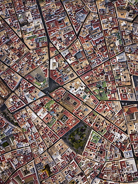
Aerial view of Cadiz, by drone, Andalucia, Spain, Europe
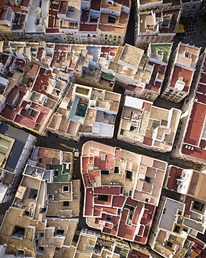
Aerial view by drone of Cadiz, Andalucia, Spain, Europe
Aerial view of Rio Tinto, by drone, Huelva District, Andalucia, Spain, Europe
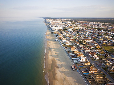
Aerial view of Matalascanas, by drone, Huelva District, Andalucia, Spain, Europe
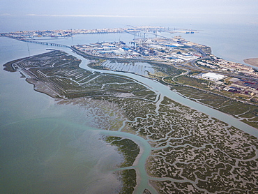
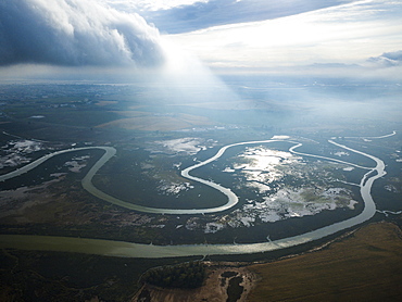
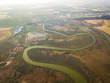
Aerial view, by drone, of San Fernando marshes, Bahia de Cadiz, Cadiz, Andalucia, Spain, Europe
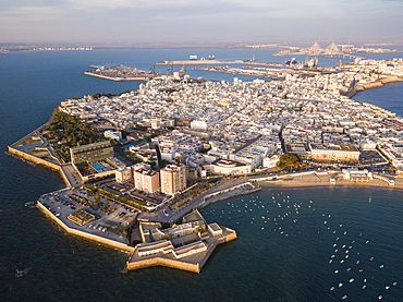
Aerial view, by drone, of Cadiz, Andalucia, Spain, Europe
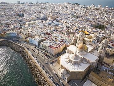
Aerial view of Cadiz Cathedral, by drone, Cadiz, Andalucia, Spain, Europe
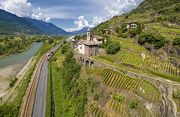
Aerial view of Torre della Sassella and vineyards, Sondrio province, Lombardy, Italy, Europe
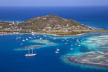
Aerial view of Union Island, looking towards Clifton and the airport, The Grenadines, St. Vincent and The Grenadines, West Indies, Caribbean, Central America
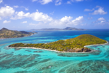
Aerial view of Petit St. Vincent, with Petite Martinique to the left and Carriacou, Grenada in the distance, The Grenadines, St. Vincent and The Grenadines, West Indies, Caribbean, Central America
Aerial view of Mopian, The Grenadines, St. Vincent and The Grenadines, West Indies, Caribbean, Central America
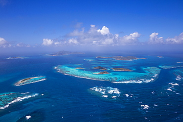
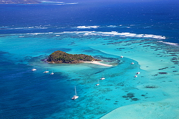
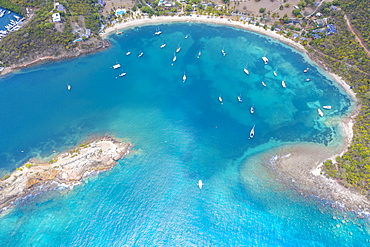
Aerial view of the Tobago Cays, The Grenadines, St. Vincent and The Grenadines, West Indies, Caribbean, Central America
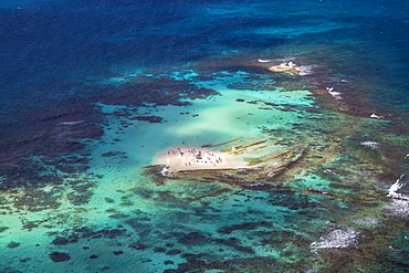
Aerial view of Baradal, Tobago Cays, The Grenadines, St. Vincent and The Grenadines, West Indies, Caribbean, Central America
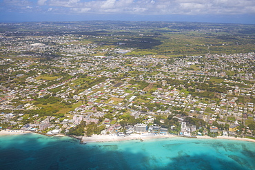
Aerial view of Barbados, Barbados, West Indies, Caribbean, Central America
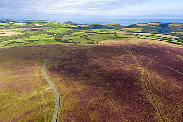
Aerial view over the moors, Exmoor National Park, Devon, England, United Kingdom, Europe
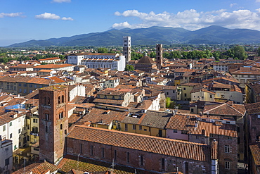
Aerial view of Lucca, Tuscany, Italy, Europe
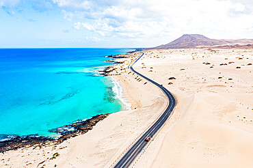
Aerial view of road crossing the desert overlooking the crystal sea, Corralejo Natural Park, Fuerteventura, Canary Islands, Spain, Atlantic, Europe
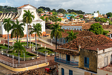
Aerial view of Cathedral and main square, with horsedrawn carriages, Trinidad, Cuba
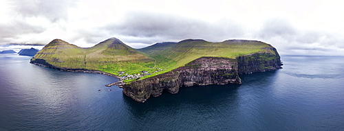
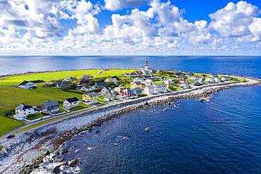
Panoramic aerial view of cliffs and village of Gjogv, Eysturoy island, Faroe Islands, Denmark, Europe
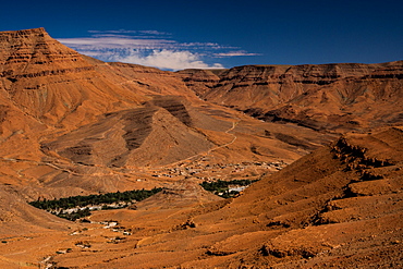
Aerial view of Ziz valley on the boundary of the High Atlas, Morocco, North Africa, Africa
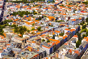
Aerial view of Berlin, Germany, Europe
Aerial drone panoramic view of promenade in Cascais, on the Portuguese Riveira 30km west of Lisbon, with Estoril visible on the far right, Cascais, Portugal, Europe
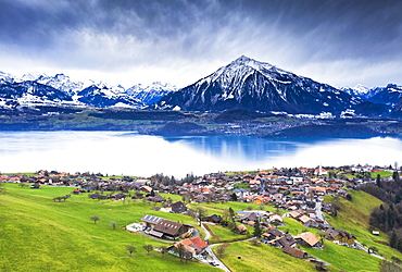
Aerial view of Sigriswil with Thun Lake, Canton of Bern, Switzerland, Europe

Landscape of Wadi Rum, aerial view from a balloon, Aqaba Governorate, Jordan, Middle East
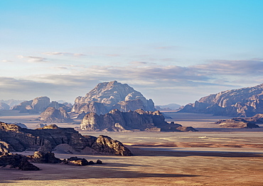
Landscape of Wadi Rum, aerial view from a balloon, Aqaba Governorate, Jordan, Middle East
Landscape of Wadi Rum at sunrise, aerial view from a balloon, Aqaba Governorate, Jordan, Middle East

An aerial view of the Banzaan night market in Patong, Phuket, Thailand, Southeast Asia, Asia

An aerial view of the Banzaan night market in Patong, Phuket, Thailand, Southeast Asia, Asia
Aerial view of traditional huts in winter, Val Federia, Livigno, Valtellina, Lombardy, Italy, Europe
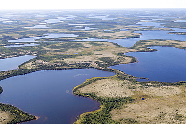
Aerial view of lakes and an esker, a ridge formed by sediment deposited during the last Ice Age, in northern Manitoba, Canada, North America

Aerial view of Alexander Nevsky Orthodox Cathedral in winter, Sofia, Bulgaria, Europe
Europe, Bulgaria, aerial view of Church of the Nativity of the Virgin Mother at Rila Monastery, UNESCO World Heritage Site, Bulgaria, Europe

Aerial view of Alexander Nevsky Orthodox Cathedral in winter, Sofia, Bulgaria, Europe
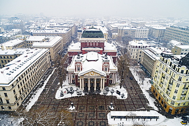
Aerial view of Ivan Vazov National Theatre in a snow storm, Sofia, Bulgaria, Europe

Aerial view of NDK National Cultural Center, Sofia, Bulgaria, Europe
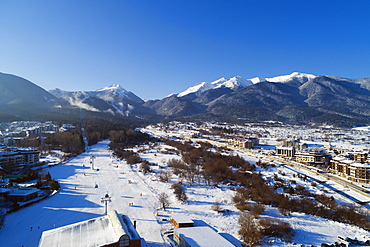
Aerial view of home run winter ski slope, Pirin National Park, UNESCO World Heritage Site, Bansko, Bulgaria, Europe

Aerial view of Sofia city center at night, Sofia, Bulgaria, Europe
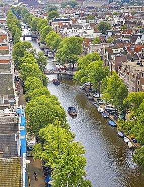
An aerial view of Prinsengracht Canal, Amsterdam, North Holland, The Netherlands, Europe
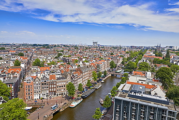
An aerial view of the Jordaan and Prinsengracht, Amsterdam, North Holland, The Netherlands, Europe
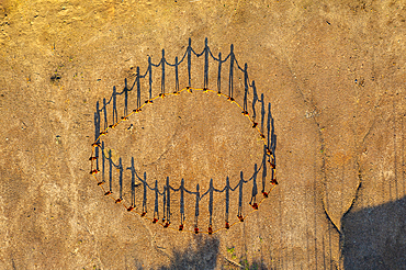
Aerial view of Yanomami tribe, in a circle, and shadows, southern Venezuela, South America

The gargoyles of Notre Dame Cathedral (Our Lady of Paris) and aerial view over the Paris skyline, Paris, France, Europe
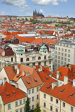
Aerial view over the red roofs of Prague, the Castle and the Cathedral, UNESCO World Heritage Site, Prague, Bohemia, Czech Republic (Czechia), Europe

Sunset over Trou d'Eau Douce bay, aerial view, Flacq district, East coast, Mauritius, Indian Ocean, Africa

Aerial view from the top of Sun Island across deep blue Lake Titicaca to the mainland, Bolivia, South America

Aerial view the Gran Teatro de La Habana and El Capitolio at dusk, UNESCO World Heritage Site, Havana, Cuba, West Indies, Caribbean, Central America
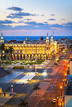
Aerial view the Gran Teatro de La Habana and El Capitolio at dusk, UNESCO World Heritage Site, Havana, Cuba, West Indies, Caribbean, Central America
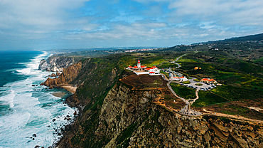
Aerial view of Cabo da Roca, Continental Europe's western-most point, near Sintra, Portugal, Europe
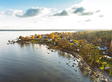
Aerial view of Altja and the Baltic Sea, Laane-Viru, Estonia, Europe

Aerial view from Tanah Lot Temple, Bali, Indonesia, Southeast Asia, Asia
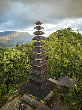
Aerial view of Pura Bukit Sangkan Gunung, Sidemen, Bali, Indonesia, Southeast Asia, Asia
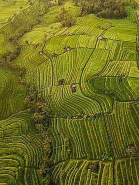
Aerial view of Jatiluwih Rice Terraces, Tabanan, Bali, Indonesia, Southeast Asia, Asia

Aerial view from Tanah Lot Temple, Bali, Indonesia, Southeast Asia, Asia
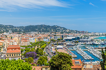
An aerial view over Cannes, Alpes Maritimes, Cote d'Azur, Provence, French Riviera, France, Mediterranean, Europe

Aerial view by drone of man and woman running on white sand beach, Antilles, West Indies, Caribbean, Central America

White limestone cliffs Pillar of Hercules washed by Caribbean Sea, aerial view by drone, English Harbour, Antigua, Leeward Islands, West Indies, Caribbean, Central America
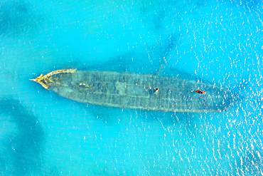
Aerial view by drone of a shipwreck in the shallow water of blue Caribbean Sea, Antilles, West Indies, Caribbean, Central America
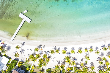
Aerial view by drone of beach umbrellas on tropical palm-fringed beach washed by Caribbean Sea, Antilles, West Indies, Caribbean, Central America
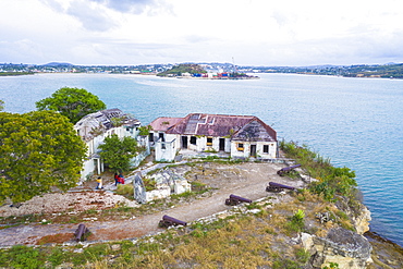
Aerial view of ruins of buildings at Fort James, St. John's, Antigua and Barbuda, Leeward Islands, West Indies, Caribbean, Central America

Aerial view by drone of sailboats and catamarans moored in the Caribbean Sea, Antilles, West Indies, Caribbean, Central America

Aerial view by drone of Hermitage Bay and Caribbean Sea, Antigua, Antigua and Barbuda, Leeward Islands, West Indies, Caribbean, Central America
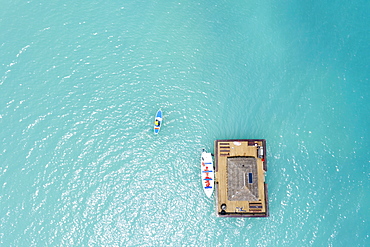
Aerial view by drone of man on paddleboard approaching the floating Ocean Bar, Caribbean, Antilles, West Indies, Caribbean, Central America
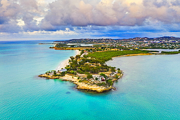
Aerial view by drone of Fort James surrounded by Caribbean Sea, St. John's, Antigua, Leeward Islands, West Indies, Caribbean, Central America
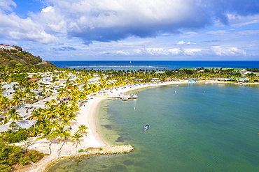
Aerial view by drone of St. James Bay, Antigua, Antigua and Barbuda, Leeward Islands, West Indies, Caribbean, Central America
Aerial view of boats in the blue Caribbean Sea next to Galleon beach, Antigua, Antigua and Barbuda, Leeward Islands, West Indies, Central America
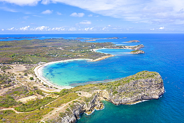
Aerial view by drone of cliffs surrounding Half Moon Bay washed by Caribbean Sea, Antigua, Leeward Islands, West Indies, Caribbean, Central America
White limestone cliffs Pillar of Hercules washed by Caribbean Sea, aerial view by drone, English Harbour, Antigua, Leeward Islands, West Indies, Caribbean, Central America

Aerial view by drone of the crystal Caribbean Sea, Urlings, Antigua, Antigua and Barbuda, Leeward Islands, West Indies, Caribbean, Central America
Man and woman relaxing on palm-fringed beach, aerial view by drone, Caribbean Sea, Antilles, West Indies, Caribbean, Central America

Aerial view of woman bathing in the transparent sea in the scenic sandbanks, Nungwi, Zanzibar, Tanzania, East Africa, Africa
Aerial view of Rauma river and green valley from Romsdalseggen ridge, Andalsnes, More og Romsdal county, Norway, Scandinavia, Europe
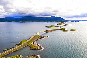
Aerial view of Storseisundet Bridge surrounded by sea and islets, Atlantic Road, More og Romsdal county, Norway, Scandinavia, Europe
Aerial view by drone of the coastal village of Alnes, Godoya Island, Alesund, More og Romsdal County, Norway, Scandinavia, Europe
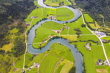
Aerial view of the winding course of Stryneelva river, Stryn, Nordfjorden, Sogn og Fjordane county, Norway, Scandinavia, Europe

Rhone Glacier and glacial lake at its base in summer, aerial view, Gletsch, Canton of Valais, Switzerland, Europe

Aerial view of man lying down along the bends of historic Vindhellavegen road, Borgund, Laerdal, Sogn og Fjordane county, Norway, Scandinavia, Europe
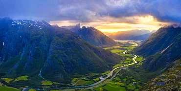
Aerial view of clouds at sunset over Romsdalen valley from Romsdalseggen ridge, Andalsnes, More og Romsdal county, Norway, Scandinavia, Europe

Aerial view of sun rays at sunset lighting up the clouds over Romsdalen valley, Andalsnes, More og Romsdal county, Norway, Scandinavia, Europe