Results
« Previous 1 … 20 21 22 23 24 … 28 Next »
2731 results found

Aerial photo of M23 flyover M25, near Redhill, Surrey, England, United Kingdom, Europe
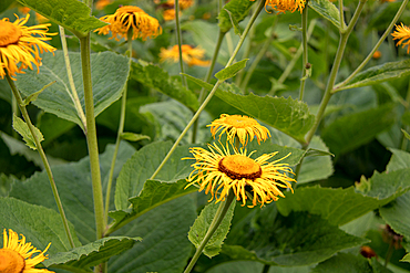
Photo of yellow inula flowers at Kew Gardens, London, England, United Kingdom, Europe

Taking photo of cliffs from Dun Aengus, prehistoric hill fort, Inishmore, largest Aran Island, Galway Bay, County Galway, Connacht, Republic of Ireland
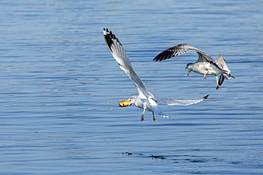
Two seagulls fight over a doughnut in midflight. Photo taken at the Raritan Bay in Keyport, New Jersey.
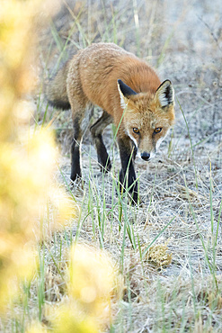
A red fox walks through the sand in the coastal area of Sandy Hook, New Jersey. He appears to gaze directly at the camera as he moves. The warm colors of fall foliage are blurred to the left. Photo taken shortly before sunset.
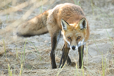
A red fox walks through the sand in the coastal area of Sandy Hook, New Jersey. He appears to gaze directly at the camera as he moves. Photo taken shortly before sunset.
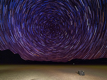
Night photo of stars, the Racetrack, a playa or dried up lakebed, in Death Valley National Park, California, United States of America, North America

Uk. Chinese new year celebrations in trafalgar sq, london
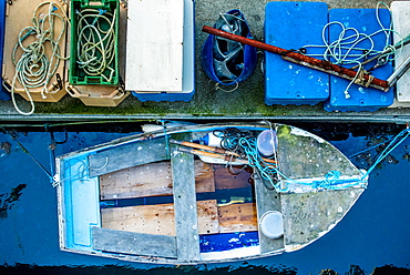
Docked fishing boat, Guernsey, Channel Islands, United Kingdom, Europe

Seal on Rathlin Island, County Antrim, Ulster, Northern Ireland, United Kingdom, Europe
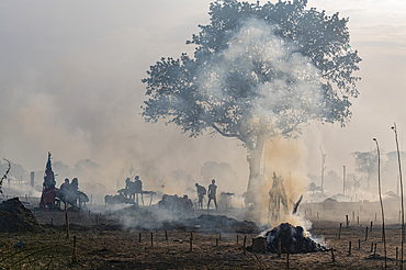
Backlit photo of a Mundari cattle camp, Mundari tribe, South Sudan, Africa
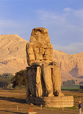
The Colossus of Memnon, Luxor, Egypt, North Africa
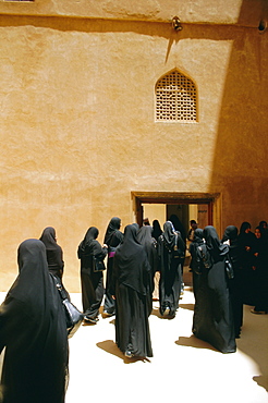
Jabrin, Niswa, Oman, Middle East
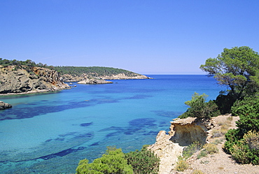
View near Cala Portinatx, Ibiza, Balearic Islands, Spain, Europe
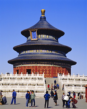
The Temple of Heaven, Beijing, China
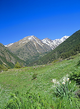
View north west across the Arinsal Valley to Pic de Coma Pedrosa in early summer, Percanela, Arinsal, Andorra
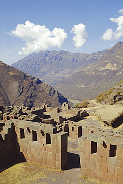
Pisac, Hitching Post of the Sun, Inca site in the Urubamba Valley, Peru, South America
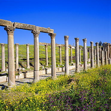
Cardo (main street) of the Roman Decapolis city, 1st century AD, Jerash, Jordan, Middle East
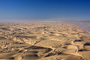
Aerial photo of sand dunes, Skeleton Coast Park, Namibia, Africa
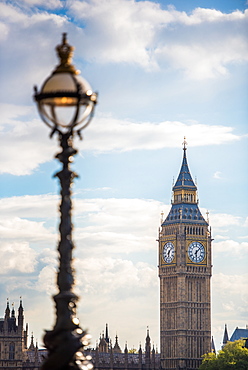
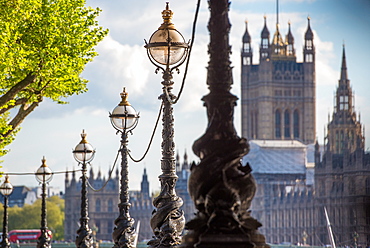
Lampposts on South Bank with The Houses of Parliament, London, England, United Kingdom, Europe
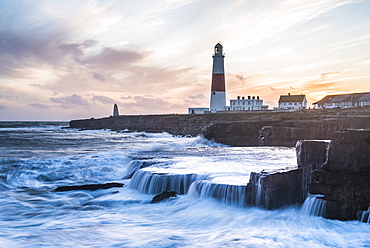
Lighthouse at Portland Bill, Isle of Portland, UNESCO World Heritage Site, Dorset, England, United Kingdom, Europe
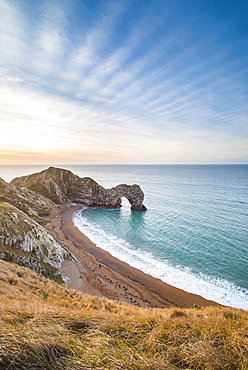
Durdle Door at sunrise, Lulworth Cove, Jurassic Coast, UNESCO World Heritage Site, Dorset, England, United Kingdom, Europe

A photo of a bird, Kyrgyzstan, Central Asia, Asia

India. Muslim reading outside a mosque, mumbai

A purely accidental photo of a rainbow intersecting Coffee Pot Rock in Sedona, Arizona, United States of America, North America
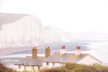
Cuckmere Haven and the Seven Sisters chalk cliffs on a misty day, South Downs National Park, East Sussex, England, United Kingdom, Europe

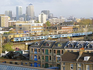
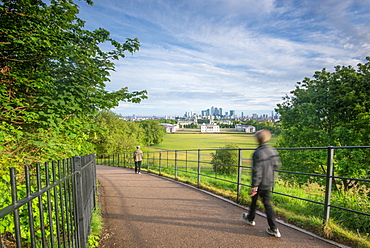
Tourist walking in Greenwich Park with Canary Wharf in the background, London, England, United Kingdom, Europe
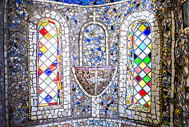
Little Chapel, Guernsey, Channel Islands, United Kingdom, Europe
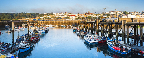
Boats in St. Peter Port Harbour at sunrise, Guernsey, Channel Islands, United Kingdom, Europe
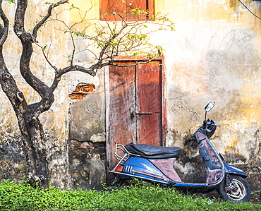
Moped street scene, Fort Kochi (Cochin), Kerala, India, Asia
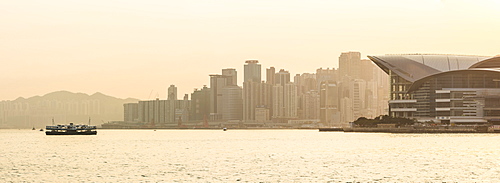
Star Ferry in front of Hong Kong Island at sunset, Hong Kong, China, Asia

Centre of Hong Kong Island at night, Hong Kong, China, Asia
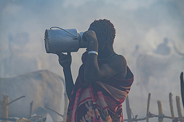
Backlight photo of a man in a Mundari cattle camp drinking milk, Mundari tribe, South Sudan, Africa

Furano farmer, Hokkaido, Japan

Marian Column, Telc, South Moravia, Czech Republic, Europe
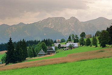
Typical Polish landscape near Zacopane, Tatra Mountains, Poland, Europe
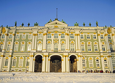
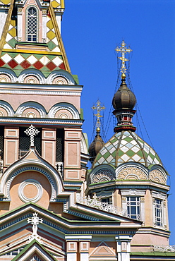
The Hermitage, St. Petersburg, Russia
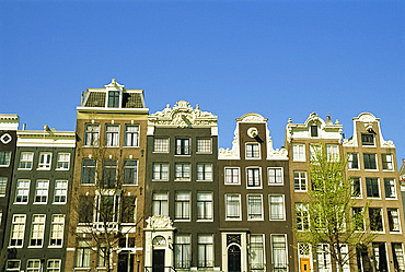
Old merchant houses on the canal in Amsterdam, Holland, The Netherlands
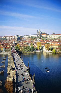
Charles Bridge, Prague, Czech Republic, Europe
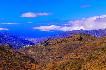
View of coast with Mount Teide in Tenerife in the background, Gran Canaria, Canary Islands, Spain
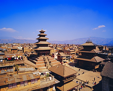
View of Taumadi Tole, Nyatapola Buddist Temple, Bhaktapur,Nepal, Asia
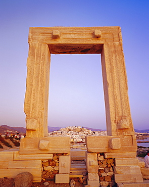
Temple of Apollo and Naxos, Naxos, Cyclades Islands, Greece, Europe
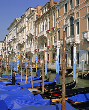
Moored gondolas on the Grand Canal, Venice, Veneto, Italy
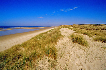
Dunes at Hardelot Plage, near Boulogne, Pas-de-Calais, France, Europe
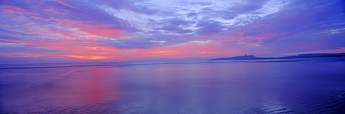
Dunstanburgh Castle and Embleton Bay, Northumberland, England, UK

Pelican at Playa Buena Vista Beach at sunrise, Guanacaste Province, Costa Rica, Central America
Uk views of canary wharf from studios in hackney, east london

India. Delivering bottled domestic in mumbai. Photo julio etchart

India. Spice stand in colaba market, mumbai

France, traditional basque cultural in bayonne, french basque country
Cyprus. Abandoned houses along th Green Line in Nicosia dividing the Republic of Cyprus and Turkish controlled northern part.
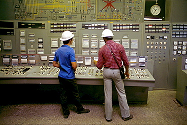
Cuba, control room of a thermo-nuclear power station. Matanzas.
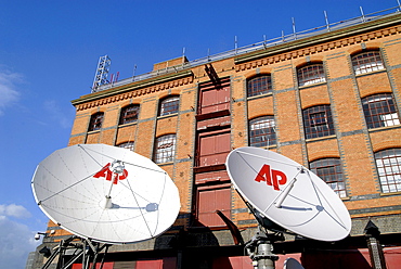
Uk satellite dishes at the ap hq in camden, london
Houses of Parliament from South Bank, London, England, United Kingdom, Europe

Fort Grey (Cup and Saucer) at sunset, Guernsey, Channel Islands, United Kingdom, Europe
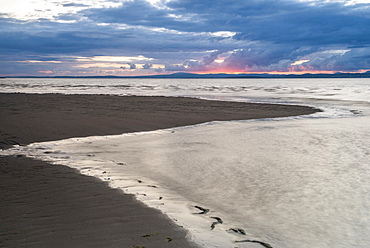
Morecambe Bay at sunset, Lancashire, England, United Kingdom, Europe
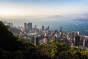
View over Victoria Harbour at sunset, seen from Victoria Peak, Hong Kong Island, Hong Kong, China, Asia
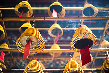
Man Mo Temple, Sheung Wan, Hong Kong Island, Hong Kong, China, Asia
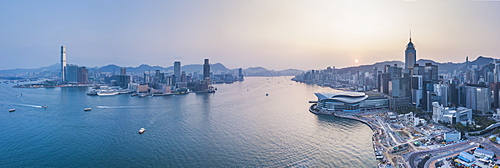
View over Victoria Harbour and Hong Kong at sunset, China, Asia
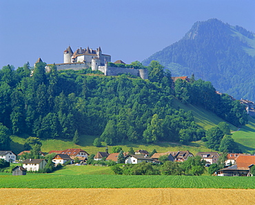
Chateau de Gruyeres, Gruyeres, Fribourg Canton, Switzerland
Sunset over lake created by dam, Deogarh, Rajasthan, India
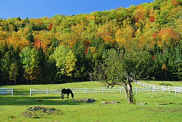
Horse grazing in paddock, near Jackson, New Hampshire, USA
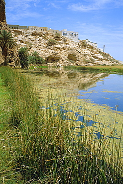
Wadi Shaab Oasis, Oman, Middle East
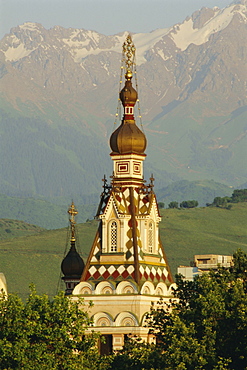
The Zenkov Cathedral built with wood, but no nails, in 1904, at Almaty, Kazakhstan, Central Asia
Zenkov Cathedral, 1904, made of wood with no nails, Alamty, Kazakhstan, Central Asia
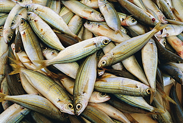
Close up of fish in market, Mykonos, Cyclades Islands, Greece, Europe
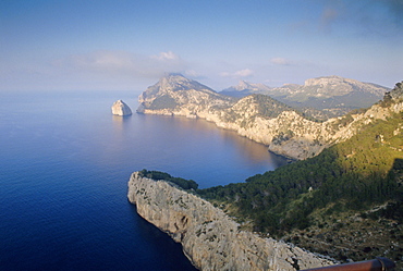
Cabo Formentor, Mallorca, Balearic Islands, Spain, Europe
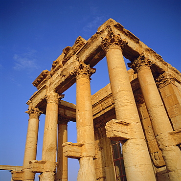
Roman Temple of Baal-Shamine, 23 AD, Palmyra, Syria, Middle East

Valldemossa, Mallorca, Balearic Islands, Spain
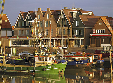
Volendam, Netherlands

Photographer on a Tor in Dartmoor National Park, Devon, England, United Kingdom, Europe
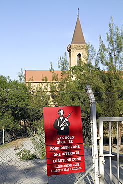
Cyprus. Varosha ghost town in Famagusta, Turkish occupied North Cyprus.

Gravestones of Sufi Dervish tombs in the Turkish occupied section of Nicosia in Cyprus
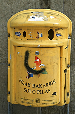
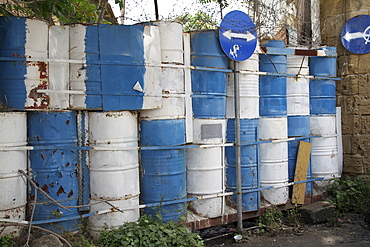
Spain, battery recyling bin in bilbao in the basque country

Uk, rally in london

Western sahara. Woman covered in henna for ceremony at polisario central camp.
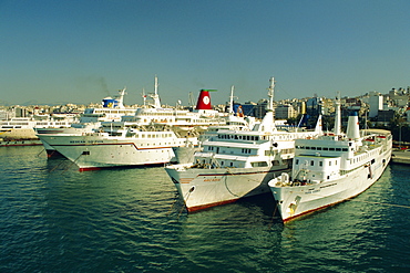
Piraeus harbour and port, inter-island ferries, Athens, Greece, Europe

Ksiaz Castle, Sudeten Mountains, Silesia, Poland, Europe
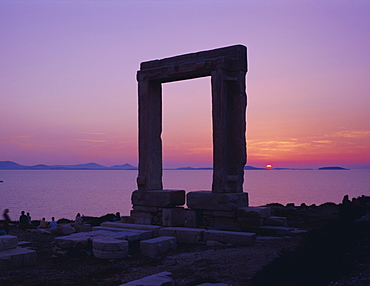
Greek Temple of Apollo, Naxos, Cyclades Islands, Greece, Europe
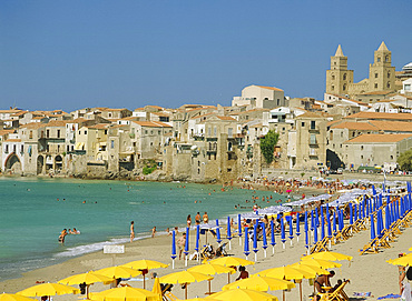
Cefalu, Sicily, Italy
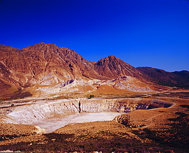
View of Stefanos Crater and mountains,Nisyros, Dodecanese, Greece, Europe
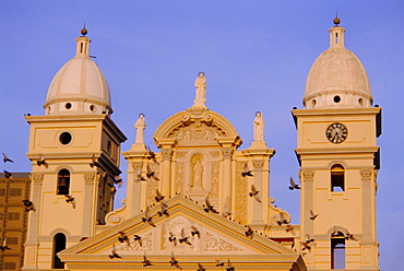
Basilica de la Chiquinquiria, Maracaibo, Venezuela, South America

St. Vitus Cathedral and Prague Castle across the River Vltava, Prague, Czech Republic, Europe

Playa Buena Vista Beach at sunrise, Guanacaste Province, Costa Rica, Central America
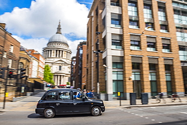
Rush hour in The City of London, England, United Kingdom, Europe

Urban fox at the London Barrier, London, England, United Kingdom, Europe
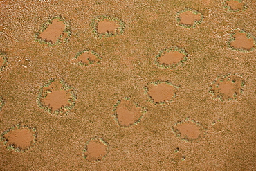
Aerial photo of Magic Circles, Namib Naukluft National Park, Namibia, Africa
London and Canary Wharf taken from Greenwich Observatory, London, England, United Kingdom, Europe
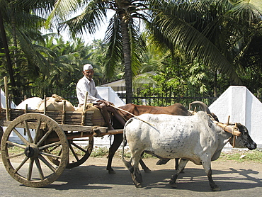
India. Oxen drawn cart in maharahstra state
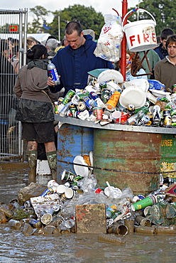
Uk rubbish accumulated at glastonbury. 2007 england

Cuba classic cars before a rally havana
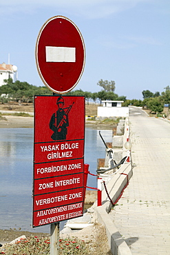
Cyprus. Abandoned houses along th Green Line in Nicosia dividing the Republic of Cyprus and Turkish controlled northern part. The United Nations Buffer Zone in Cyprus runs for more than 180.5?kilometres (112.2?mi) along what is known as the Green Line and has an area of 346?square kilometres (134?sq?mi). The zone partitions the island of Cyprus into a southern area effectively controlled by the government of the Republic of Cyprus (which is the de jure government for the entire island save for the British Sovereign Base Areas), and the northern area controlled by the Turkish army

India. Dhobi ghat municipal laundry in mumbai
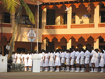
India. Children attending a catholic school in agondo,photo julio etchart
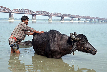
Bangladesh, washing bull in chittagong.
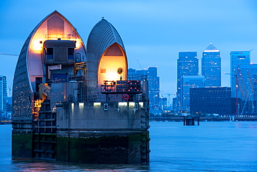
Thames Barrier on River Thames at dusk, Woolwich, London, England, United Kingdom, Europe
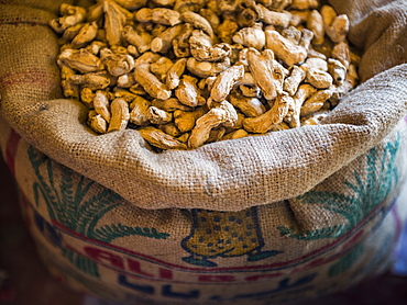
Ginger for sale at a spice market in Fort Kochi (Cochin), Kerala, India, Asia
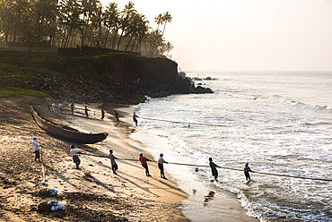
Fishermen at Kappil Beach, Varkala, Kerala, India, Asia
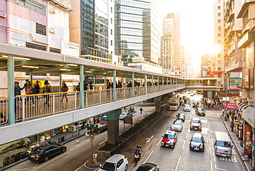
Kowloon street scene, by Fa Yuen Street Market, Kowloon, Hong Kong, China, Asia
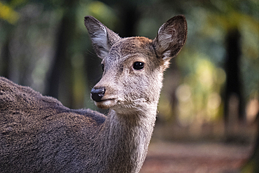
A photo capturing a deer up close in the forest of Nara, Honshu, Japan, Asia