Results
« Previous 1 … 21 22 23 24 25 … 28 Next »
2717 results found

Urban fox at the London Barrier, London, England, United Kingdom, Europe
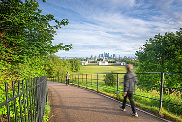
London and Canary Wharf taken from Greenwich Observatory, London, England, United Kingdom, Europe
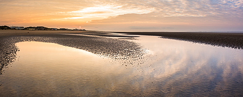
Camber Sands Beach at sunrise, East Sussex, England, United Kingdom, Europe
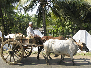
India. Oxen drawn cart in maharahstra state

Indonesia. Javanese woman in malang, east java.

India. Spice stand in colaba market, mumbai
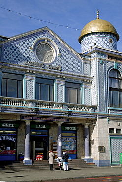
Uk aspect of the aziziye mosque in stoke newington, east london

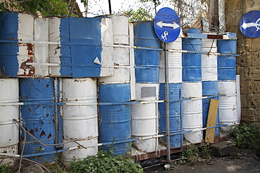
Uk. Used tyres piling up at a recycling centre in tower hamlets, london, england.

Uk recycling bins by the leigh canal in clapton, london
Cyprus. Abandoned houses along th Green Line in Nicosia dividing the Republic of Cyprus and Turkish controlled northern part. The United Nations Buffer Zone in Cyprus runs for more than 180.5?kilometres (112.2?mi) along what is known as the Green Line and has an area of 346?square kilometres (134?sq?mi). The zone partitions the island of Cyprus into a southern area effectively controlled by the government of the Republic of Cyprus (which is the de jure government for the entire island save for the British Sovereign Base Areas), and the northern area controlled by the Turkish army
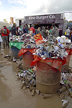
Uk rubbish accumulated at glastonbury. 2007 england

Uk, cavity wall insulation being fitted in a house in london
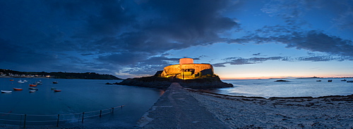
Fort Grey in Guernsey, Channel Islands, United Kingdom, Europe

German Observation Tower from World War Two, Guernsey, Channel Islands, United Kingdom, Europe
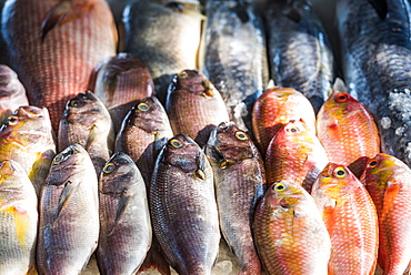
Fish for sale at a food market in Fort Kochi (Cochin), Kerala, India, Asia
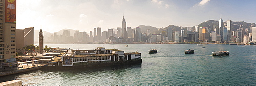
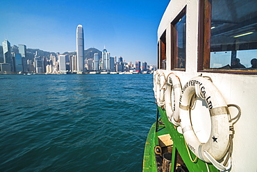
Star Ferry with Hong Kong Island behind, seen from Kowloon, Hong Kong, China, Asia
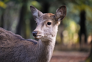
A photo capturing a deer up close in the forest of Nara, Honshu, Japan, Asia
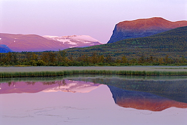
Laponia World Heritage Site, Lappland, Sweden, Scandinavia, Europe
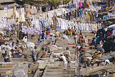
Laundry, Bombay, India
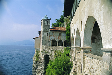
Santa Caterina del Sasso, Lake Maggiore, Piemonte, Italy
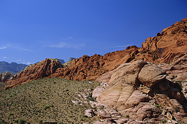
Red Rock Canyon, Spring Mountains, Mojave Desert, near Las Vegas, Nevada, USA
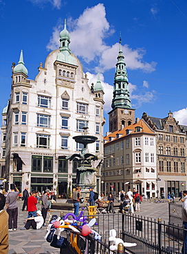
Stroget, Copenhagen, Denmark, Europe

Nenbutsu dera (temple), Arashiyama, Kyoto, Japan

View along the hiking trails of Mt. Hakuba, Northern Alps, Japan

Aerial photo showing Tower Bridge, River Thames and Canary Wharf at dusk, London, England, United Kingdom, Europe

Tower Bridge at night, Southwark, London, England, United Kingdom, Europe
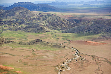
Aerial photo of Namib Naukluft National Park, Namibia, Africa

Playa Buena Vista Beach at sunrise, Guanacaste Province, Costa Rica, Central America
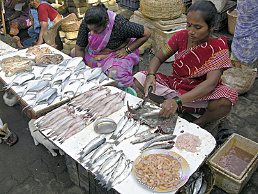
India. Fishmongers in mumbai.
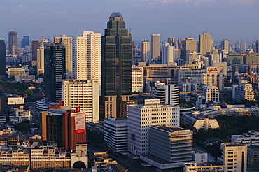
Central Bangkok, Thailand, Asia
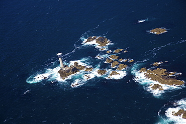
Aerial photo of Longships Lighthouse and Lands End Peninsula, West Penwith, Cornwall, England, United Kingdom, Europe
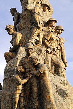
Monument to the Turkish victims of war in Famagusta,Turkish controlled northern part of Cyprus
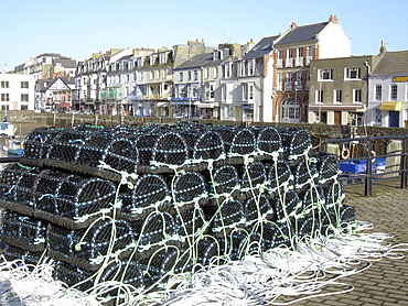
Uk fish cages in the harbour at ilfracombe, devon
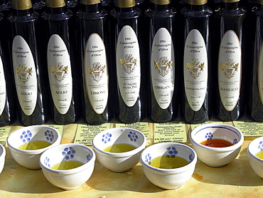
Uk olive oil and balsamic vinegar for sale at a stall at broadway market in east london

India. Dhobi ghat municipal laundry in mumbai
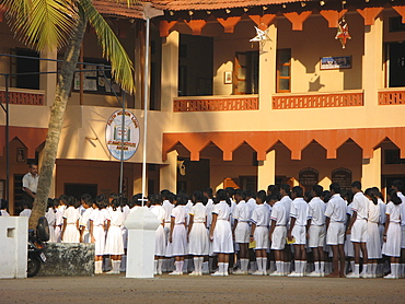
India. Children attending a catholic school in agondo,photo julio etchart
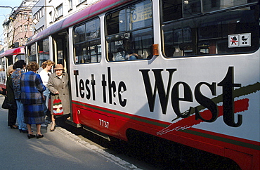
Slovakia. Tram in the streets of bratislava.
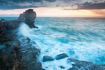
Pulpit Rock, Portland Bill, Isle of Portland, Jurassic Coast, UNESCO World Heritage Site, Dorset, England, United Kingdom, Europe

Civita di Bagnoregio at sunset, Province of Viterbo, Lazio, Italy, Europe

Tea plantations, Munnar in the Western Ghats Mountains, Kerala, India, Asia
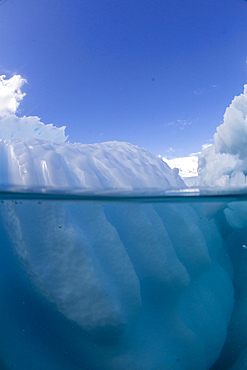
Half above and half below photo of an iceberg off Danco Island, Antarctica, Polar Regions
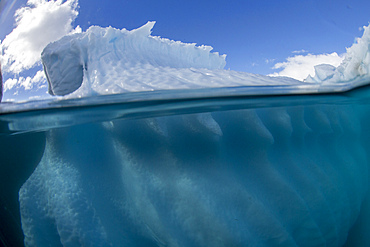
Half above and half below photo of an iceberg off Danco Island, Antarctica, Polar Regions

Matsumoto Castle, Japan

Moskenesoya, fishing village on Sakrisoya Island, Lofoten Islands, Nordland, Norway, Scandinavia
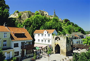
Castle ruins overlooking the town, Valkenburg, Netherlands, Europe
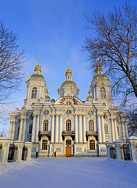
St. Nicholas Cathedral, St. Petersburg, Russia
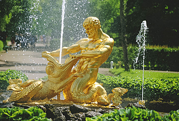
Triton Fountain, Summer Palace, Petrodvorets (Peterhof), near St. Petersburg, Russia
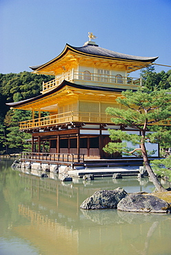
Temple of the Golden Pavilion, Kyoto, Japan
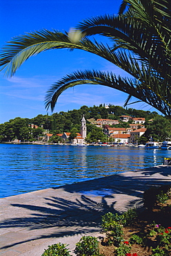
Promenade and harbour, Cavtat, Croatia, Europe

Lake Issyk-Kul at Balikchi, Kyrgyzstan, Central Asia

Ste lucie de Tallano, near Sarlene, Corsica, France

Playa Buena Vista Beach at sunrise, Guanacaste Province, Costa Rica, Central America
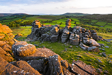
Tor at sunrise, Dartmoor National Park, Devon, England, United Kingdom, Europe

Playa Buena Vista Beach at sunrise, Guanacaste Province, Costa Rica, Central America

Cuba, tobacco packing plant, havana.
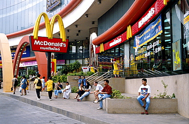
Thailand, macdonalds in a shopping mall in bangkok.
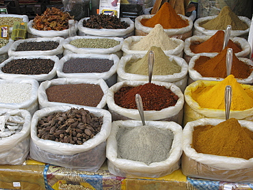
India. Spice stand in colaba market, mumbai
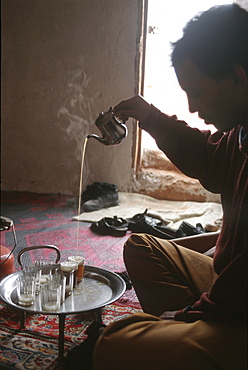
Western sahara. Man making tea in polisario smara camp.
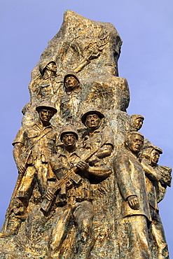
Monument to the Turkish victims of war in Famagusta,Turkish controlled northern part of Cyprus

Haiti. Young boy in a cemetery in port-au-prince

India. Indian family with luxury hotel in background, mumbai. Photo julio etchart
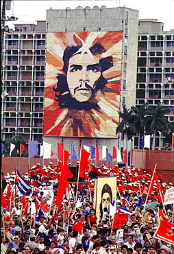
Cuba, rally in revolution square. Havana.
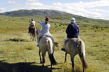
Uruguay. Ecotourism in a ranch in maldonado.
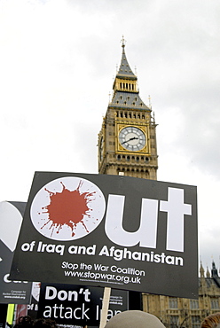
Uk rally against the war at the fifth anniversary of the invasion of iraq in london photo by julio etchart
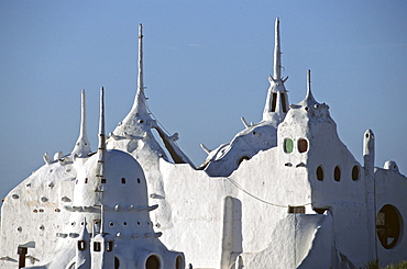
Uruguay. The casa pueblo by artist paez vilaro near punta del este
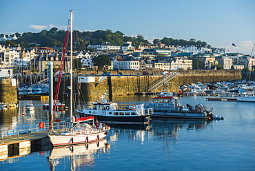
Boats in St. Peter Port Harbour at sunrise, Guernsey, Channel Islands, United Kingdom, Europe
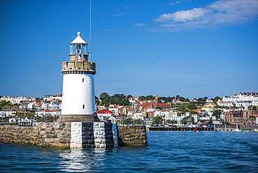
Lighthouse in St. Peter Port Harbour, Guernsey, Channel Islands, United Kingdom, Europe
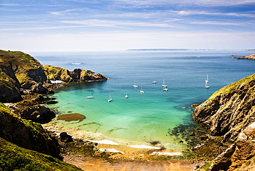
Sailing boats seen from La Coupee, Sark Island, Channel Islands, United Kingdom, Europe

Traditional Chinese fishing nets at dawn, Fort Kochi (Cochin), Kerala, India, Asia

Mosque at Kappil Beach, Varkala, Kerala, India, Asia
Star Ferry between Hong Kong Island and Kowloon, Hong Kong, China, Asia
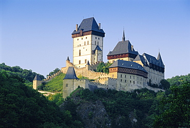
Karlstejn Castle, Central Bohemia, Czech Republic, Europe
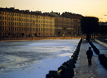
Fontanka Canal at dusk, St. Petersburg, Russia
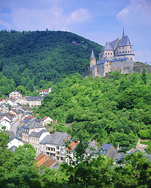
Vianden Castle, Vianden, Luxembourg
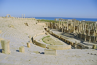
The Theater, Leptis Magna, Libya, North Africa
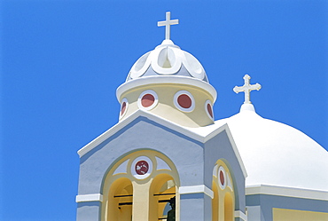
Colorful church, Firostephani, Santorini, Cyclades Islands, Greece, Europe
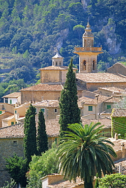
Valldemosa, Mallorca, Balearic Islands, Spain, Europe

Roman Temple of Bel, 45 AD, Palmyra, Syria, Middle East
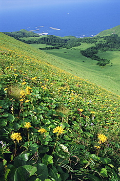
Rebun Island coastline and mountain flowers, Hokkaido, Japan
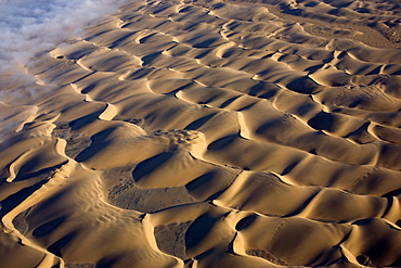
Aerial photo of sand dunes, Skeleton Coast Park, Namibia, Africa
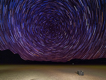
Night photo of stars, the Racetrack, a playa or dried up lakebed, in Death Valley National Park, California, United States of America, North America
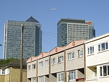
Uk. New office developments and old council houses in canary wharf in east london
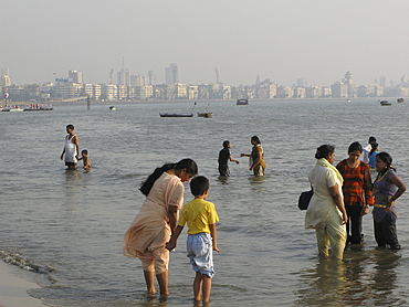
India. People bathing in chowpatty beach, mumbai
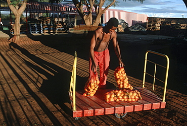
South africa packing oranges. Northern province
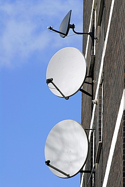
Uk council estate with satellite dishes in clapton, near the olympic park construction site in east london
Tree in Costa Rica, Central America
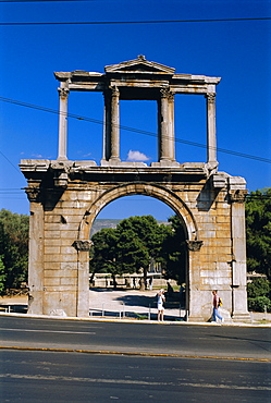
Hadrian's Arch, Athens, Greece, Europe
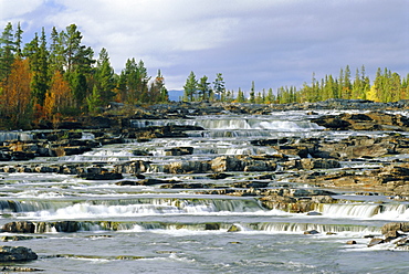
Trappstegforsarna Waterfalls, Fatmomakke region, Lappland, Sweden, Scandinavia, Europe
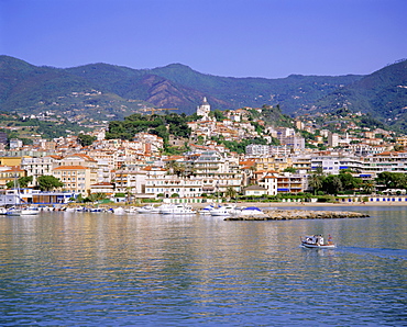
San Remo, Italian Riviera, Liguria, Italy
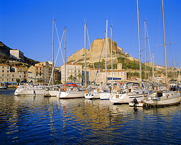
Bonifacio harbour, Corsica, France
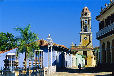
Santa Ana church, Trinidad, Sancti Spiritus, Cuba
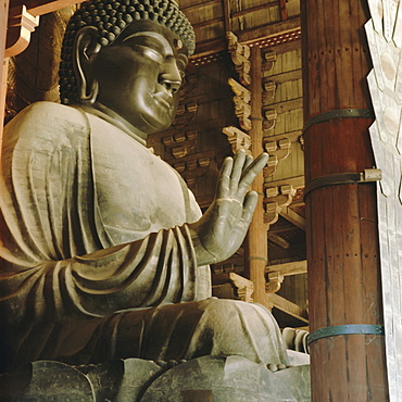
Buddha, Todaiji Temple, Japan
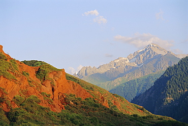
Near Kara-Kol, Dzhety-Oguz, Kyrgyzstan, Central Asia
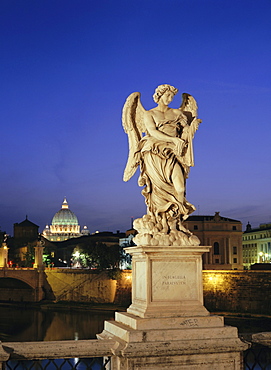
Angelic statue on Ponte Sant Angelo, St. Peter's, Vatican, Rome, Italy
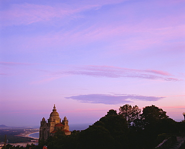
Viano do Castello, Costa Verde, Portugal
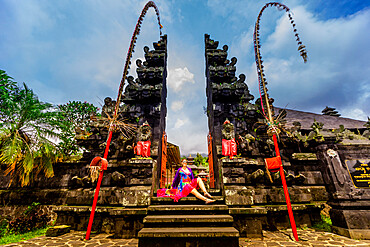
Woman posing for photo at the Besakih Temple, the largest and holiest temple of Hindu religion in Bali, Indonesia, Southeast Asia, Asia
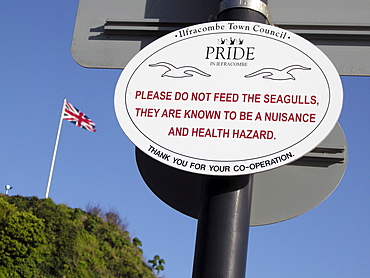
Uk signs in the harbour at ilfracombe, devon
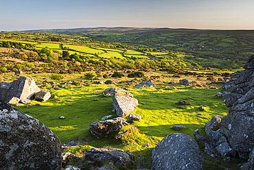
Dartmoor, Devon, England, United Kingdom, Europe
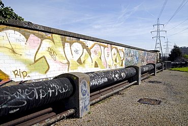
Uk. Grafiitti along the greenway pathway by the olympic park construction site in east london

India. Barber in streets of colaba, mumbai