Results
« Previous 1 … 23 24 25 26 27 … 83 Next »
8206 results found
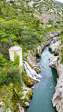
Aerial of an old watchtower in the Herault gorge, UNESCO World Heritage Site, Causses and Cevennes, Herault, Occitanie, France, Europe
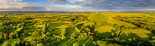
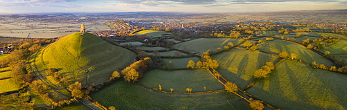
Aerial panorama of Glastonbury Tor and surrounding rolling countryside, Somerset, England, United Kingdom, Europe
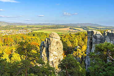
Sandstone rock formation named Orloj (astronomical clock), Marianska vyhlidka, Hruba Skala, Semily District, Liberec Region, Bohemia, Czech Republic (Czechia), Europe
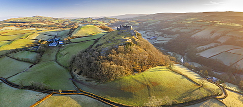
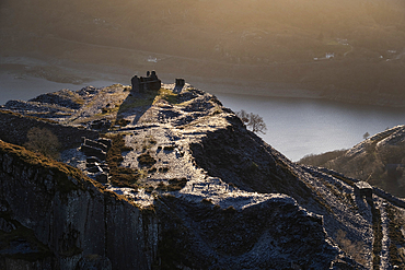
Aerial vista by drone of Carreg Cennen Castle, Brecon Beacons National Park, Carmarthenshire, Wales, United Kingdom, Europe
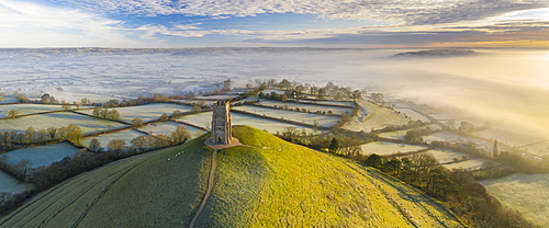
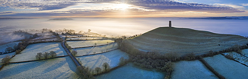
Aerial view by drone of frosty winter morning at Glastonbury Tor, Somerset, England, United Kingdom, Europe
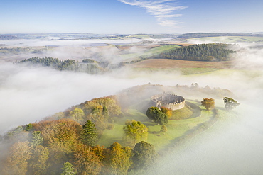
Aerial view by drone of Restormel Castle on a misty autumn morning, Lostwithiel, Cornwall, England, United Kingdom, Europe
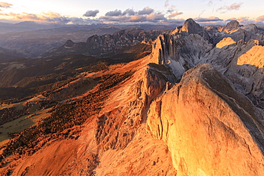
Aerial view of Roda Di Vael at sunset, Catinaccio Group (Rosengarten), Dolomites, South Tyrol, Italy, Europe
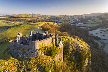
Aerial vista by drone of Carreg Cennen Castle, Brecon Beacons National Park, Carmarthenshire, Wales, United Kingdom, Europe
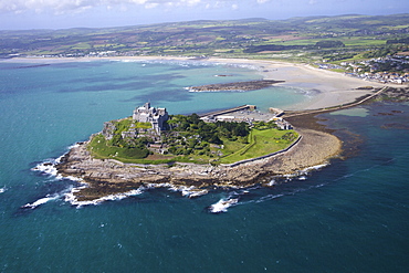
Aerial view of St. Michael's Mount, Penzance, Lands End Peninsula, West Penwith, Cornwall, England, United Kingdom, Europe
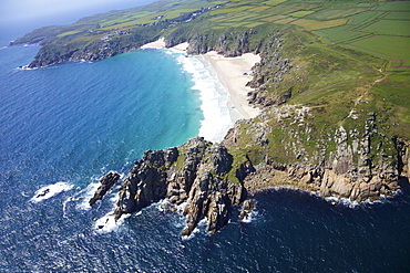
Aerial photo of Treen Cliff and Porthcurno beach looking west to the Minnack Theatre, West Penwith, Cornwall, England, United Kingdom, Europe
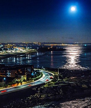
Aerial view of the super full moon over the Tagus River in Lisbon, Portugal, Europe

Aerial view from hot air balloon over Hegra site and around, AlUla, Medina Province, Saudi Arabia
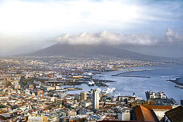
A view of the Bay of Naples with the cruise liner port in the foreground and Mount Vesuvius in the background, Campania, Italy
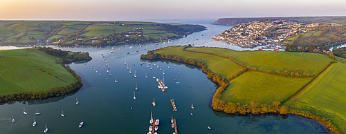
Aerial panorama by drone of Kingsbridge Estuary and Salcombe, South Hams, Devon, England, United Kingdom, Europe
Aerial view by drone of frosty winter sunrise over Glastonbury Tor, Somerset, England, United Kingdom, Europe
Aerial view by drone of frosty winter morning at Glastonbury Tor, Somerset, England, United Kingdom, Europe
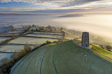
Aerial view by drone of Glastonbury Tor on a frosty morning on the Somerset Levels, Somerset, England, United Kingdom, Europe
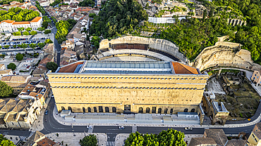
Aerial of the Roman Amphitheatre, UNESCO World Heritage Site, Orange, Vaucluse, Provence-Alpes-Cote d'Azur, France, Europe

Aerial of the Roman Amphitheatre, UNESCO World Heritage Site, Orange, Vaucluse, Provence-Alpes-Cote d'Azur, France, Europe
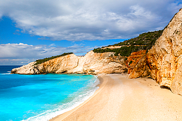
Porto Katsiki drone aerial view on Lefkada island, Ionian Islands, Greek Islands, Greece
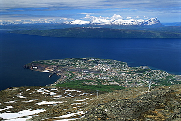
Narvik, The Arctic Highway, Norway, Scandinavia, Europe
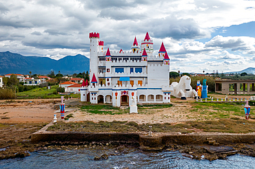
Drone view of abandoned Fairytale Castle, by the sea, Agrilis Messinia, Peloponnese, Greece
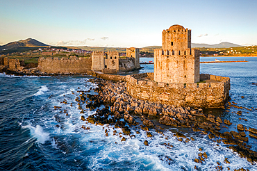
Bourtzi of Methoni castle, drone aerial view, in the sea, Methoni, Peloponnnese, Greece
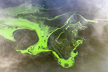
Aerial view by drone of swirls of green algae in a freshwater lake, Roadford Lake, Devon, England, United Kingdom, Europe
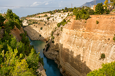
Corinth Canal connecting the Gulf of Corinth in the Ionian Sea with the Saronic Gulf in the Aegean Sea, Greece
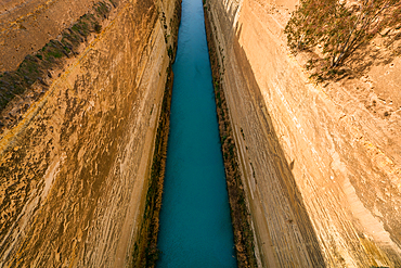
Corinth Canal connecting the Gulf of Corinth in the Ionian Sea with the Saronic Gulf in the Aegean Sea, Greece
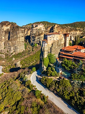
Drone aerial view of Meteora with ancient holy Monastery of Varlaam, UNESCO, Kalabaka, Greece
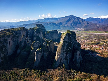
Drone aerial view of Meteora and ancient holy monastery, UNESCO, Kalabaka, Greece
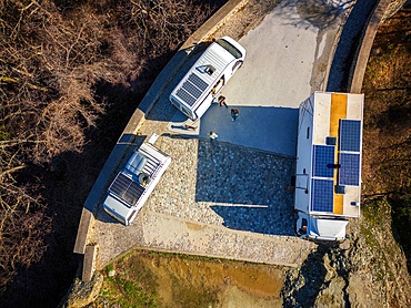
Drone aerial view of camper vans with solar panels on the roof, parked on a wild spot on the mountains in autumn, Kalabaka, Greece
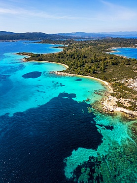
Diaporos island with wild beaches with turquoise water, drone aerial view, Chalkidiki, Greece
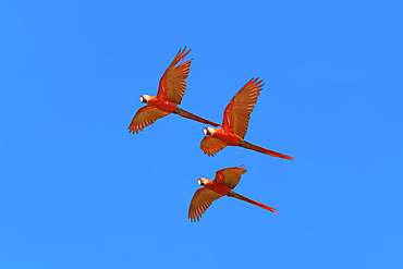
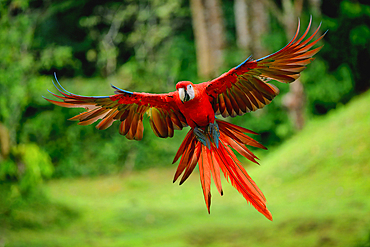
Scarlet Macaws (Ara macao) in flight, Osa Peninsula, Corcovado N.P, Costa Rica
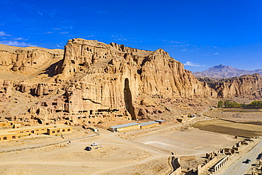
Aerial by drone of the site of the great Buddhas in Bamyan (Bamiyan), taken in 2019, post destruction, Afghanistan, Asia

Aerial view of Shibuya crossing, Tokyo, Honshu, Japan, Asia
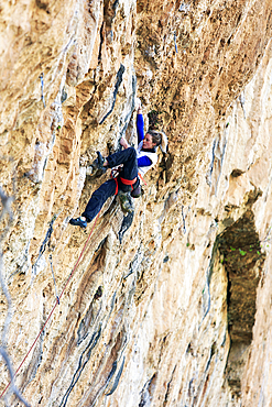
Rock climber in action on the world-famous limestone cliffs of Chulilla, Valencia region, Spain
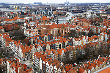
Aerial view of Gdansk, a city on the Baltic coast, Poland
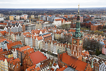
Aerial view of Gdansk, a city on the Baltic coast, Poland
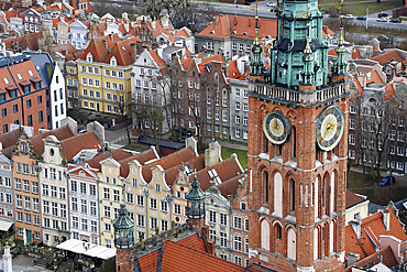
Aerial view of Gdansk, a city on the Baltic coast, Poland
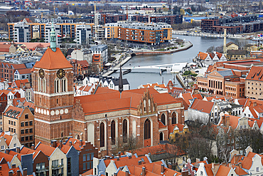
Aerial view of Gdansk, a city on the Baltic coast, Poland
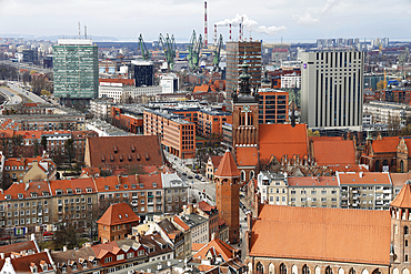
Aerial view of Gdansk, a city on the Baltic coast, Poland
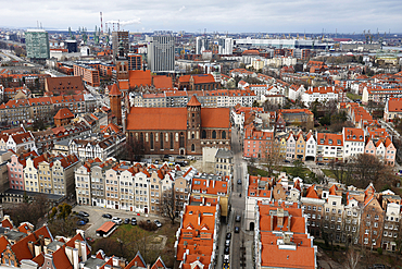
Aerial view of Gdansk, a city on the Baltic coast, Poland
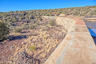
Top view of the Stone Dam in the Kaibab National Forest, USA
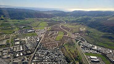
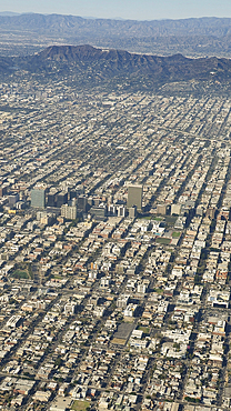
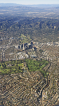
Southern California aerial view, United States of America
Aerial views, United States of America
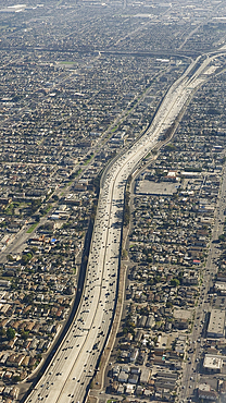
Freeway aerial view, United States of America

Freeway aerial view, United States of America
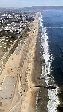
Coastline aerial view, United States of America
Aerial views, United States of America

Aerial drone view of historic tower with Porto Giunco beach with white sand and turquoise water, Sardinia, Italy, Mediterranean, Europe
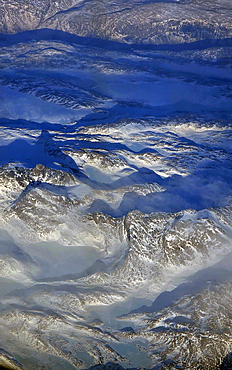
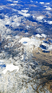
Aerial view of Mountain Range, Greenland, Denmark
Aerial view of the Rockies, United States of America

Kyoto skyline at sunset with a vibrant orange sky, Kyoto Tower, Kyoto, Honshu, Japan, Asia
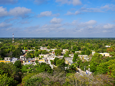
Izamal, elevated view, Yucatan State, Mexico
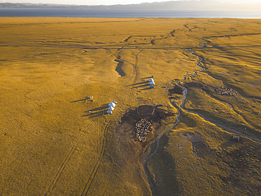
An aerial view of the Song Kol lake area at sunrise, Kyrgyzstan
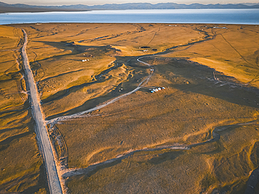
An aerial view of the Song Kol lake area at sunrise, Kyrgyzstan
default
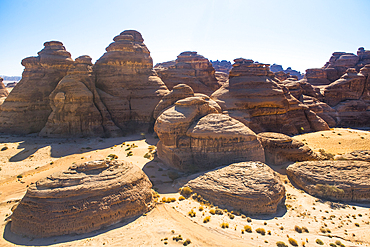
Aerial view of Jabal Ithlib area within Site of Hegra (Madain Salih), UNESCO, in the area of AlUla, Medina Province, Saudi Arabia
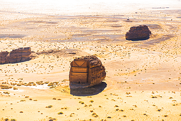
Aerial view of Qasr al-Farid, the largest tomb within Site of Hegra (Madain Salih), UNESCO, in the area of AlUla, Medina Province, Saudi Arabia
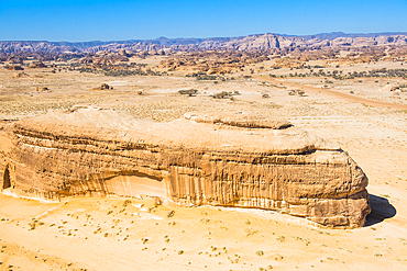
Aerial of tombs carved in sandstone rock of Jabal Banat (Qasr al-Bint), Hegra (Madain Salih), UNESCO, AlUla area, Medina Province, Saudi Arabia
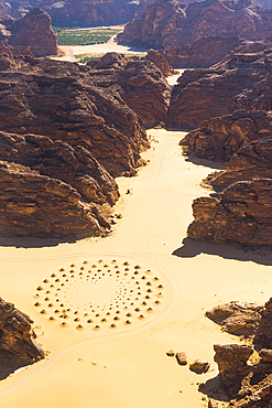
Aerial view of a work of land art in the middle of red sandstone formation, in the area of AlUla, Medina Province, Saudi Arabia
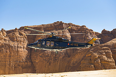
Helicopter approaching the landing area near the Maraya Theatre, in AlUla's Ashar Valley, Medina Province, Saudi Arabia
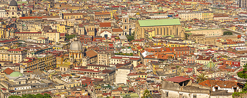
Elevated view of Naples skyline from Castel Sant'Elmo, Naples, Campania, Italy, Europe
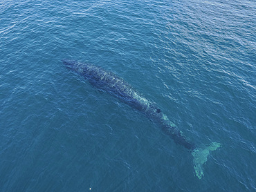
Dolphin, Sea of Cortez, the Gulf of California, Mexico, North America
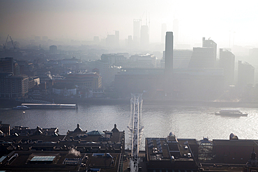
Rooftop view over River Thames and Millennium Bridge on a foggy day from St. Paul's Cathedral, London, England, United Kingdom
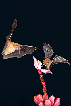
Two Orange nectar bats (Lonchophylla robusta) hovering and drinking nectar from wild red banana flower (Musa velutina) in rain forest, Costa Rica
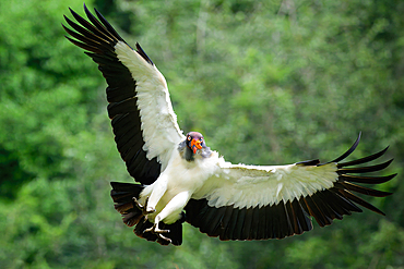
Flying King vulture (Sarcoramphus papa), Costa Rica
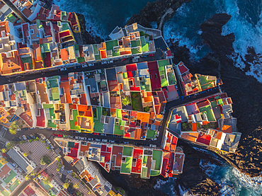
Overhead view of colorful houses in Punta Brava at sunrise, Puerto de La Cruz, Tenerife, Canary Islands, Macaronesia, Atlantic, Spain
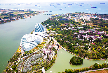
Aerial view over Gardens by the Bay and supertree grove, Singapore

Aerial view over Gardens by the Bay and supertree grove, Singapore
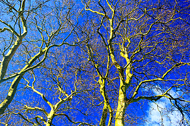
Tree details, Sao Miguel, Azores Islands, Atlantic, Portugal
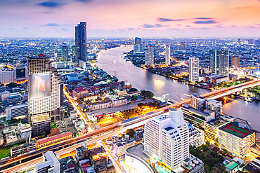
Aerial night view of Bangkok City skyscrapers, Bangkok, Thailand

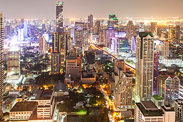
Aerial view of Bangkok City skyscrapers with King Power Mahanakhon building, Bangkok, Thailand

Aerial night view of Bangkok City skyscrapers, Bangkok, Thailand
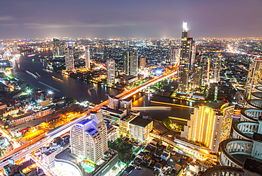
Aerial night view of Bangkok City skyscrapers, Bangkok, Thailand
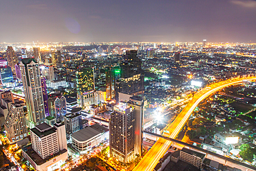
Aerial night view of Bangkok City skyscrapers, Bangkok, Thailand
Aerial night view of Bangkok City skyscrapers, Bangkok, Thailand

Traffic on a busy intersection on Sheikh Zayed highway, Dubai, United Arab Emirates

Night traffic on a busy intersection on Sheikh Zayed highway, Dubai, United Arab Emirates

Aerial Drone shot showing the wave breaks on the golden coloured sand beach
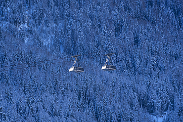
Snow covered trees and cable cars from Courmayeur to Plan Checrouit viewed from Courmayeur in winter, Courmayeur, Aosta Valley, Italian Alps, Italy
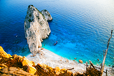
Viewpoint of Keri and famous Mizithres rocks with turquoise sea, Zakynthos island, Greek Islands, Greece
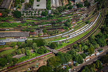
View of trains from the Lotus Tower, Colombo, Sri Lanka
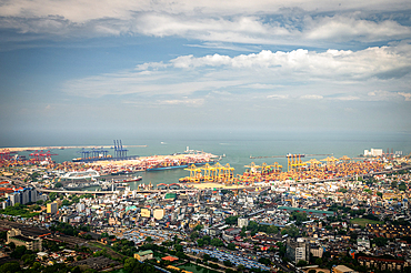
View over Colombo from the Lotus Tower, Colombo, Sri Lanka
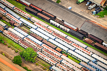
View of trains from the Lotus Tower, Colombo, Sri Lanka
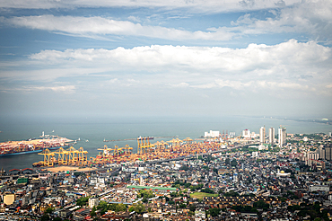
View over Colombo Port from the Lotus Tower, Colombo, Sri Lanka
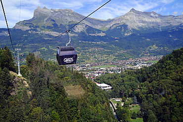
The new Valleen lift (cable car) in the alpine village of Saint Gervais les Bains, Haute-Savoie, France
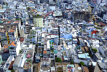
Ho Chi Minh city (Saigon) skyline with colorful house, Ho Chi Minh City, Vietnam
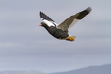
Adult female kelp goose (Chloephaga hybrida) in the Falkland Islands
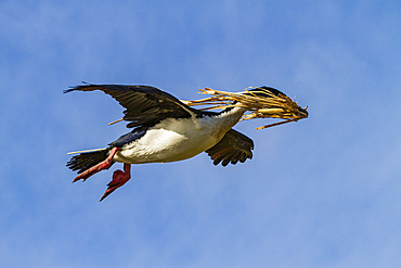
Adult Imperial Shag (Phalacrocorax (atriceps) atriceps) returning to the colony with nesting material, Falkland Islands
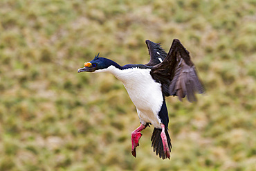
Adult Imperial Shag (Phalacrocorax (atriceps) atriceps) exhibiting intense breeding plumage, New Island, Falkland Islands
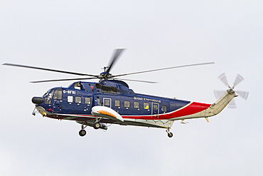
British International helicopter flying over the outer harbor of Stanley on East Island, Falkland Islands
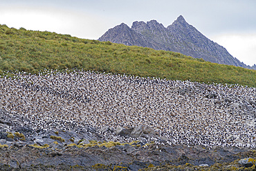
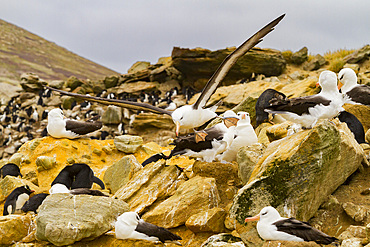
Black-browed albatross (Thalassarche melanophrys) breeding colony on Steeple Jason Island in the Falkland Islands
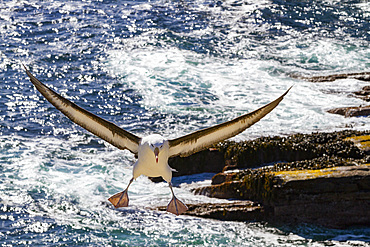
Black-browed albatross (Thalassarche melanophrys) in flight on New Island in the Falkland Islands
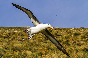
Black-browed albatross (Thalassarche melanophrys) in flight on New Island in the Falkland Islands
Black-browed albatross (Thalassarche melanophrys) in flight on New Island in the Falkland Islands
Flying Hybrid Scarlet x Great Green Macaw (Ara macao x militaris), Costa Rica
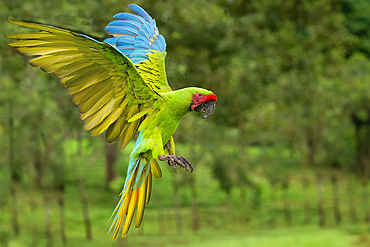
Flying Great Green Macaw (Grand Military Macaw) (Ara ambiguus), Costa Rica

Aerial of the seaside town of Menton, Alpes Maritimes, Provence-Alpes-Cote d'Azur, French Riviera, France, Europe
Mine working and spoil tip remains, Dinorwig Quarry (Dinorwic Quarry), Llyn Peris behind, Eryri (Snowdonia National Park), North Wales, United Kingdom
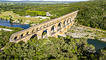
The Pont du Gard, a Roman aqueduct, UNESCO World Heritage Site, Vers-Pont-du-Guard, Occitanie, France, Europe
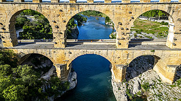
The Pont du Gard, a Roman aqueduct, UNESCO World Heritage Site, Vers-Pont-du-Guard, Occitanie, France, Europe