Results
« Previous 1 … 26 27 28 29 30 … 83 Next »
8206 results found
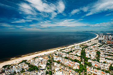
Aerial panoramic view of Gavea Beach in Sao Conrado, an upper-class neighbourhood in the west of Rio, Rio de Janeiro, Brazil, South America
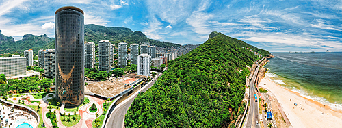
Aerial panoramic view of Sao Conrado neighbourhood with iconic Hotel Nacional on the left designed by Oscar Niemeyer, Rio de Janeiro, Brazil, South America
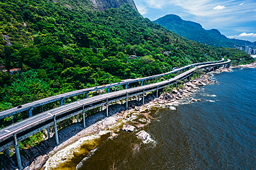
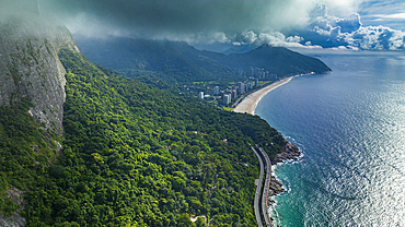
Aerial panoramic view of Elevado do Joa, a complex of tunnels, bridges and viaducts that connects the south and west zones of the city of Rio de Janeiro on the Atlantic coast, Rio de Janeiro, Brazil, South America
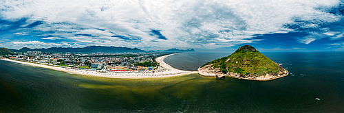
Aerial panoramic view of Pedra do Pontal, which divides Praia de Sernambetiba and Praia do Recreio, Rio de Janeiro, Brazil, South America
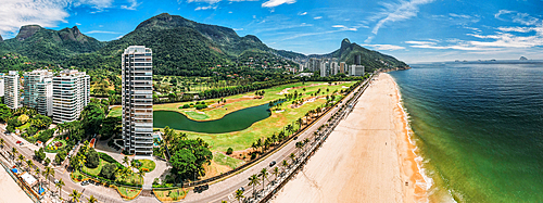
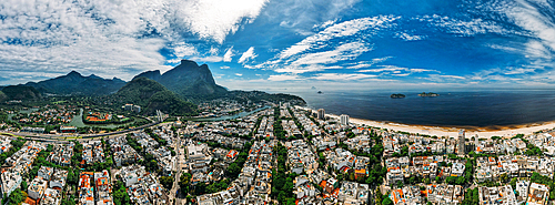
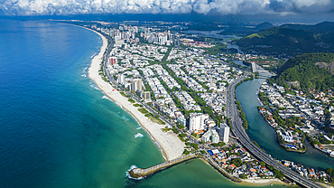
Aerial panoramic view of Barra da Tijuca district, and long sandy beach, a western neighborhood, Rio de Janeiro, Brazil, South America

Aerial view of Pepe Beach and Pedra da Gavea in Barra da Tijuca district, a western neighborhood in Rio de Janeiro, Brazil, South America
Aerial panoramic view of Pepe Beach and Pedra da Gavea in Barra da Tijuca district, an upscale neighborhood on the west side of Rio de Janeiro, Brazil, South Amereica

Dramatic sky at sunset over Pieter Both and Le Pouce mountain, aerial view, Moka Range, Port Louis, Mauritius, Africa
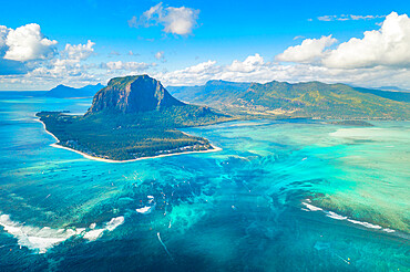
Aerial view of Le Morne Brabant and the Underwater Waterfall optical illusion and natural phenomena, Mauritius, Indian Ocean, Africa

Tourists riding horses on palm-fringed beach, aerial view, Le Morne Brabant peninsula, Black River, Mauritius, Indian Ocean, Africa

Aerial view by drone of State Opera House, Varna, Bulgaria, Europe

Aerial view by drone of Ivan Vazov National Theatre, Sofia, Bulgaria, Europe
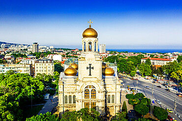
Aerial view by drone of Mother of God Cathedral, Varna, Bulgaria, Europe
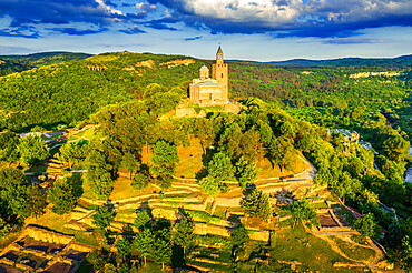
Aerial view by drone of Tsarevets fortress, Veliko Tarnovo, Bulgaria, Europe

Aerial view by drone of Ivan Vazov National Theatre, Sofia, Bulgaria, Europe

Aerial view by drone of Kaleto Rock Fortress rock formations, Belogradchik, Bulgaria, Europe
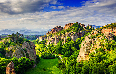
Aerial view by drone of rock formations and forest, Belogradchik, Bulgaria, Europe
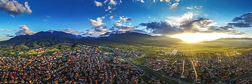
Aerial view by drone of Bansko and Pirin National Park, UNESCO World Heritage Site, Bankso, Bulgaria, Europe
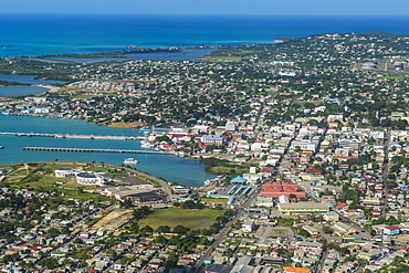
Aerial view of a corner of Barbuda, the Frigate Bird Sanctuary touches a thin strip of sand that separates the Caribbean Sea, Barbuda, Antigua and Barbuda, Leeward Islands, West Indies, Caribbean, Central America
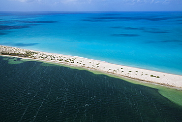
Aerial view of the color contrasts of Barbuda, tones change according to the current and the difference of seafloor, Barbuda, Antigua and Barbuda, Leeward Islands, West Indies, Caribbean, Central America

Aerial view of a lagoon on the Caribbean island of Antigua a thin line of sand divides the small salt basin from the sea, Antigua, Leeward Islands, West Indies, Caribbean, Central America
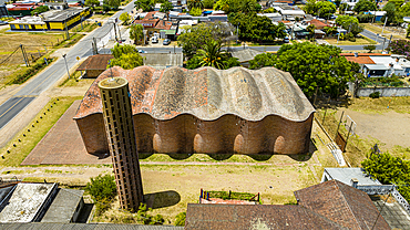
Aerial of the Church of Atlantida (Church of Christ the Worker and Our Lady of Lourdes), the work of engineer Eladio Dieste, UNESCO World Heritage Site, Canelones department, Uruguay, South America

Aerial of Leblon beach, with Two Brothers Peak, Rio de Janeiro, Brazil, South America
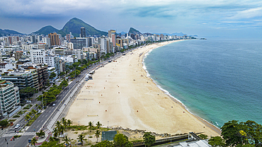
Aerial of Leblon beach, Rio de Janeiro, Brazil, South America

Aerial of Leblon beach, Rio de Janeiro, Brazil, South America

Aerial of Two Brothers Peak, Rio de Janeiro, Brazil, South America
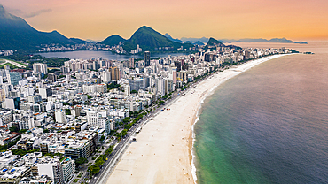
Aerial of Leblon beach, Rio de Janeiro, Brazil, South America
Aerial of Barra de Tijuca, Rio de Janeiro, Brazil, South America
Aerial, Rio de Janeiro, Brazil, South America
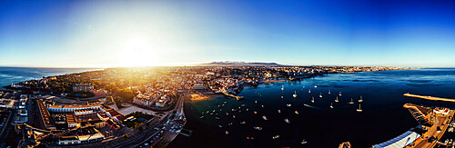
Aerial drone panoramic view of sunset at Cascais Bay, in the Lisbon region of the Portuguese Riveira, Europe
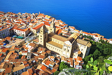
Aerial view of Cefalu from La Rocca, Cefalu, Sicily, Italy, Mediterranean, Europe

Luxury resort with swimming pool on a palm fringed beach, aerial view, Zanzibar, Tanzania, East Africa, Africa
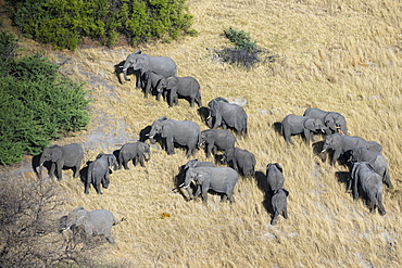
Aerial view of African elephants (Loxodonta africana), Okavango Delta, Botswana, Africa

Aerial view of the Okavango Delta, Botswana, Africa
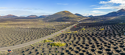
Aerial view of wine growing district of La Geria, Timanfaya National Park, Lanzarote, Las Palmas, Canary Islands, Spain, Atlantic, Europe
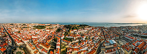
Aerial drone view of Baixa District, facing south towards the Tagus River with the major landmarks visible including St. George Castle, Pantheon, Figueira, Rossio Square, Martim Moniz Squares, Lisbon, Portugal, Europe

Cheerful man and woman having fun chasing each others on a tropical beach, aerial view, Zanzibar, Tanzania, East Africa, Africa
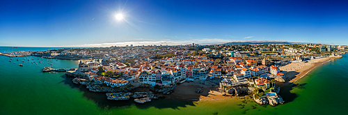
Aerial drone panoramic view of Cascais, on the Portuguese Riviera, in region known as the Green Coast due to the colour of the water, with beaches inclding Rainha, Duquesa and Conceicao, Portugal, Europe

Aerial view of anchored boats in the exotic blue lagoon, Zanzibar, Tanzania, East Africa, Africa
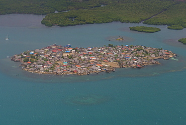
Aerial of a densely populated island, San Blas Islands, Kuna Yala, Panama, Central America
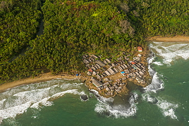
Aerial of a tiny village, San Blas Islands, Kuna Yala, Panama, Central America
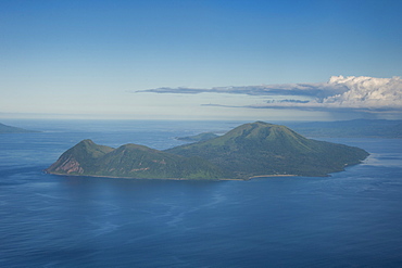
Aerial of Tongoa island, Shepherd Islands, Vanuatu, Pacific
Aerial of Ouvea, Loyalty Islands, New Caledonia, Pacific
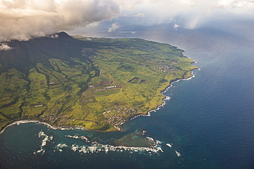
Aerial of St. Kitts, St. Kitts and Nevis, West Indies, Caribbean, Central America
Aerial of St. Kitts, St. Kitts and Nevis, West Indies, Caribbean, Central America
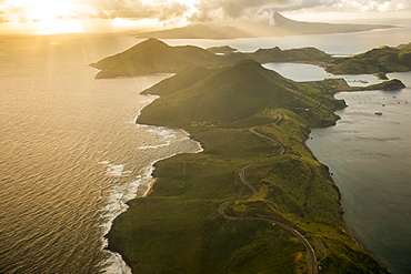
Aerial of Antigua, West Indies, Caribbean, Central America
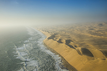
Aerials of sand dunes of the Namib Desert meeting the Atlantic Ocean, Namibia, Africa
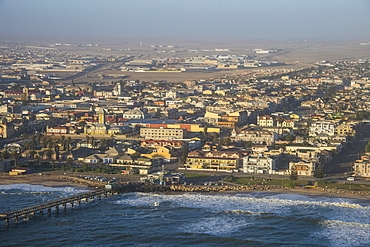
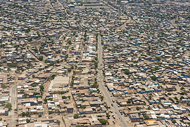
Aerial of Swakopmund, Namibia, Africa

Aerial view, Chateau-d'Oex, Vaud, Swiss Alps, Switzerland, Europe
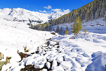
Aerial view of larches and mountains covered with snow in autumn, Vamlera, Spluga Valley, Valtellina, Lombardy, Italy, Europe
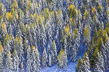
Aerial view of larches in the woods covered with snow during the fall season, Chiavenna Valley, Valtellina, Lombardy, Italy, Europe

Aerial panoramic of Tofane, Monte Cristallo, Sorapiss and Antelao, Ampezzo Dolomites, Belluno province, Veneto, Italy, Europe
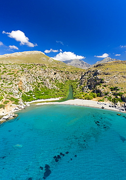
Aerial photo by drone of Preveli beach, Retymno, Crete Island, Greek Islands, Greece, Europe
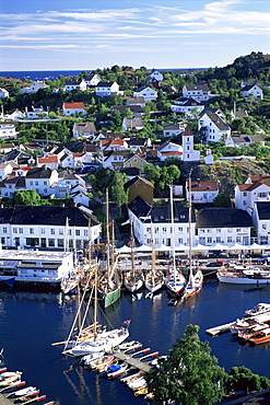
Risor, the White Town on the Skagerrak, south coast, Norway, Scandinavia, Europe
Aerial of Djibouti on the Horn of Africa, Africa
Aerial of Djibouti on the Horn of Africa, Africa
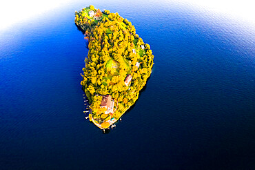
Aerial view of Comacina Island during autumn, Lake Como, Lombardy, Italian Lakes, Italy, Europe
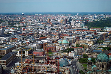
Aerial view, Berlin, Germany, Europe

Aerial view of Villefranche, Alpes Maritimes, Cote d'Azur, French Riviera, Provence, France, Europe

Aerial view of tropical beach and palm trees, The Maldives, Indian Ocean, Asia (Drone)

Aerial view of Brisbane city after dark, Brisbane, Queensland, Australia, Pacific
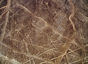
The Humming Bird Geoglyph, aerial view, Nazca, UNESCO World Heritage Site, Ica Region, Peru, South America
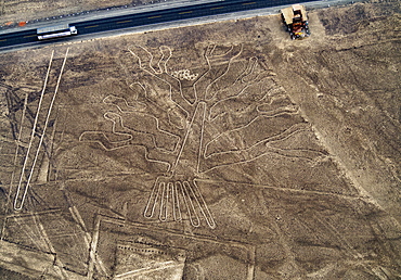
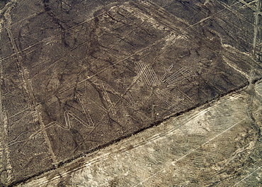
The Tree Geoglyph, aerial view, Nazca, UNESCO World Heritage Site, Ica Region, Peru, South America
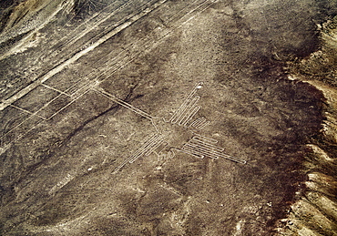
The Bird Geoglyph, aerial view, Nazca, UNESCO World Heritage Site, Ica Region, Peru, South America
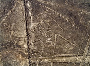
The Spider Geoglyph, aerial view, Nazca, UNESCO World Heritage Site, Ica Region, Peru, South America
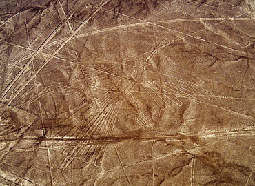
The Heron Geoglyph, aerial view, Nazca, UNESCO World Heritage Site, Ica Region, Peru, South America
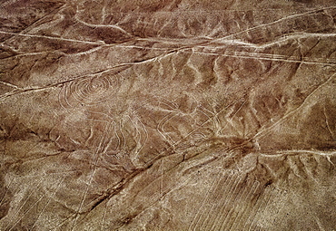
The Monkey Geoglyph, aerial view, Nazca, UNESCO World Heritage Site, Ica Region, Peru, South America
The Condor Geoglyph, aerial view, Nazca, UNESCO World Heritage Site, Ica Region, Peru, South America
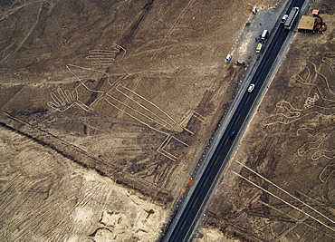
The Lizard Geoglyph, aerial view, Nazca, UNESCO World Heritage Site, Ica Region, Peru, South America
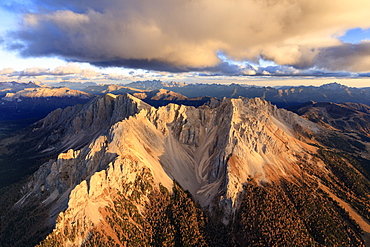
Aerial view of the rocky peaks of Latemar at sunset, Dolomites, South Tyrol, Italy, Europe
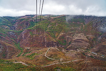
Aerial view from one of the world's longest (6 km) aerial tramways, Tatev, Armenia, Central Asia, Asia
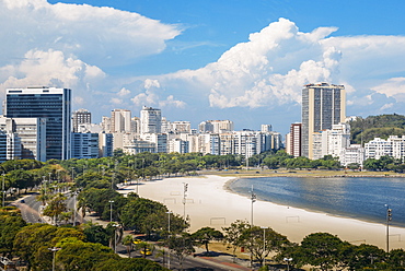
Aerial view of Botafogo Beach, Rio de Janeiro, Brazil, South America
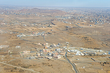
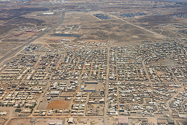
Aerial of Abha, Saudi Arabia, Middle East
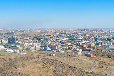
Aerial of Abha, Saudi Arabia, Middle East
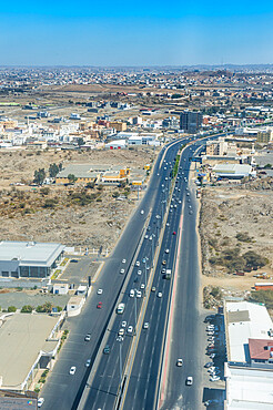
Aerial of Abha, Saudi Arabia, Middle East
Aerial view of old town and Monti Sion church, Pollenca, Majorca, Balearic Islands, Spain, Europe
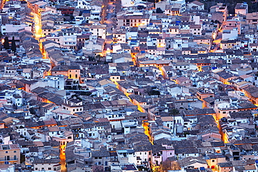
Aerial view of old town, Pollenca, Majorca, Balearic Islands, Spain, Mediterranean, Europe

Aerial panoramic view of Lake Sils and Plaun da Lej during winter, Maloja Region, Canton of Graubunden, Engadine, Switzerland, Europe (Drone)
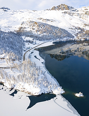
Aerial panoramic view of road around frozen Lake Sils, Plaun da Lej, Maloja Region, Canton of Graubunden, Engadine, Switzerland, Europe (Drone)
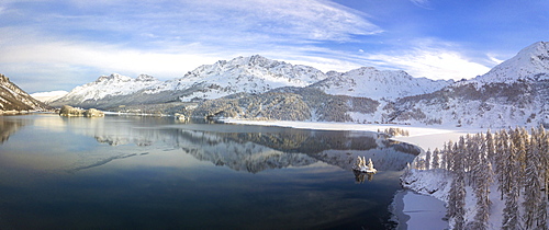
Aerial panoramic view of Lake Sils and Plaun da Lej during winter, Maloja Region, Canton of Graubunden, Engadine, Switzerland, Europe (Drone)
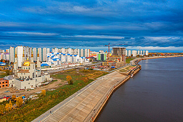
Aerial of Nizhnevartovsk, Khanty-Mansi Autonomous Okrug, Russia, Eurasia
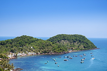
Aerial view of an island in the Phu Quoc archipelago in southern Vietnam, Indochina, Southeast Asia, Asia
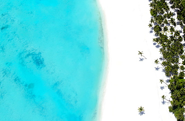
Aerial view of tropical beach and lagoon, The Maldives, Indian Ocean, Asia
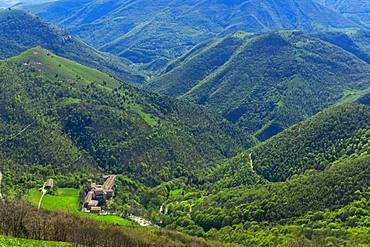
Aerial view of Fonte Avellana Monastery, Mount Catria, Umbria, Italy, Europe
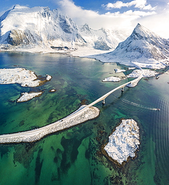
Aerial panoramic view of snowy peak of Volanstinden and Fredvang bridge, Lofoten Islands, Nordland, Norway, Europe
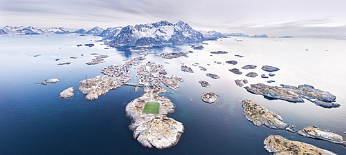
Panoramic aerial view of soccer pitch and islets, Henningsvaer, Vagan municipality, Lofoten Islands, Nordland, Norway, Europe

Aerial view of Monte Disgrazia at sunset, Valmalenco, Val Masino, Valtellina, Lombardy, province of Sondrio, Italy, Europe
Aerial view of Rio Tinto, by drone, Huelva District, Andalucia, Spain, Europe
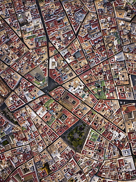
Aerial view of Cadiz, by drone, Andalucia, Spain, Europe
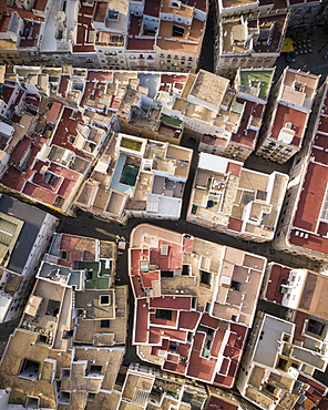
Aerial view by drone of Cadiz, Andalucia, Spain, Europe
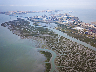
Aerial view of Rio Tinto, by drone, Huelva District, Andalucia, Spain, Europe
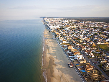
Aerial view of Matalascanas, by drone, Huelva District, Andalucia, Spain, Europe
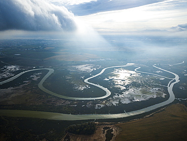
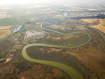
Aerial view, by drone, of San Fernando marshes, Bahia de Cadiz, Cadiz, Andalucia, Spain, Europe
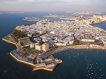
Aerial view, by drone, of Cadiz, Andalucia, Spain, Europe
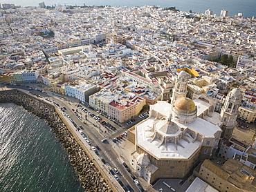
Aerial view of Cadiz Cathedral, by drone, Cadiz, Andalucia, Spain, Europe
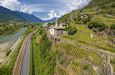
Aerial view of Torre della Sassella and vineyards, Sondrio province, Lombardy, Italy, Europe
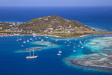
Aerial view of Union Island, looking towards Clifton and the airport, The Grenadines, St. Vincent and The Grenadines, West Indies, Caribbean, Central America
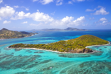
Aerial view of Petit St. Vincent, with Petite Martinique to the left and Carriacou, Grenada in the distance, The Grenadines, St. Vincent and The Grenadines, West Indies, Caribbean, Central America
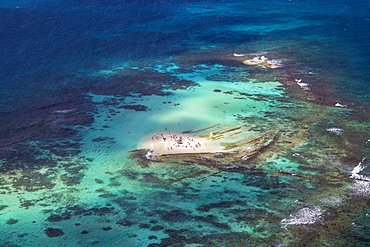
Aerial view of Mopian, The Grenadines, St. Vincent and The Grenadines, West Indies, Caribbean, Central America
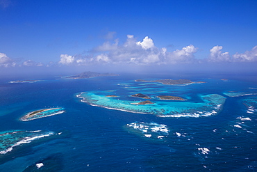
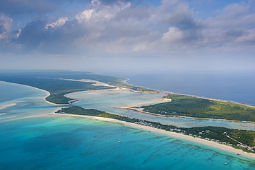
Aerial view of the Tobago Cays, The Grenadines, St. Vincent and The Grenadines, West Indies, Caribbean, Central America