Results
« Previous 1 2 3 4 5 Next »
406 results found

Restaurant and cafe scene in Paphos, Cyprus, Europe
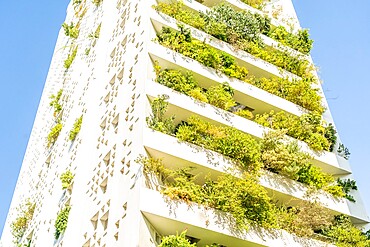
Modern architecture of the EY building in Nicosia, Cyprus, Europe
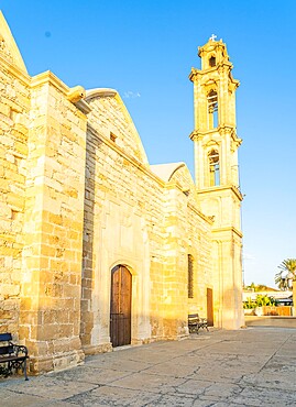
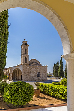
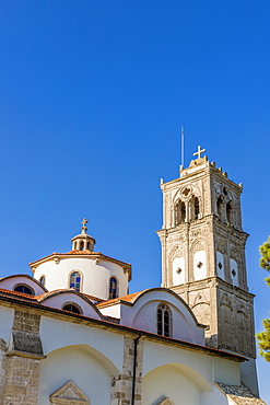
St. George Church in Athienou, Larnaca disrict, Cyprus, Europe

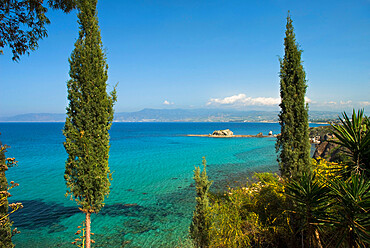
Coastal seascape at sunset in Paphos, Cyprus, Europe

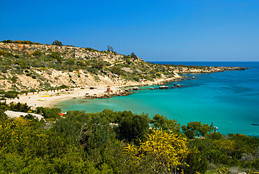
Cape Greco in Ayia Napa, Famagusta district, Cyprus, Mediterranean, Europe

Cape Greco at sunset in Ayia Napa, Famagusta District, Cyprus, Mediterranean, Europe
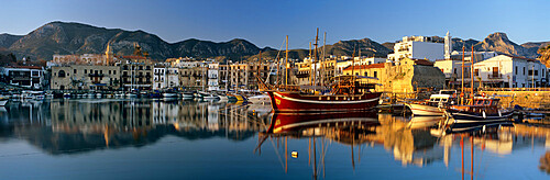
The boat filled harbour and mountains with mirror reflection, Kyrenia (Girne), Northern Cyprus, Cyprus, Mediterranean, Europe
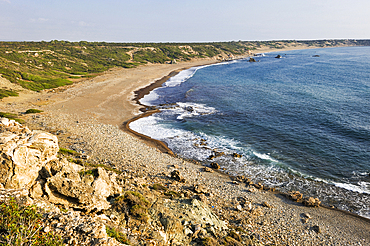
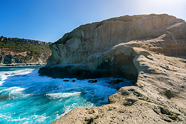
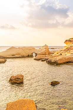
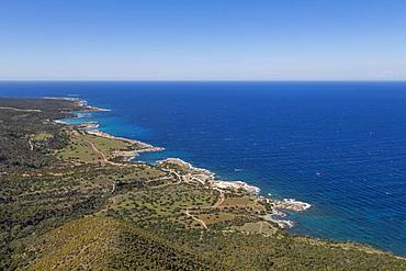
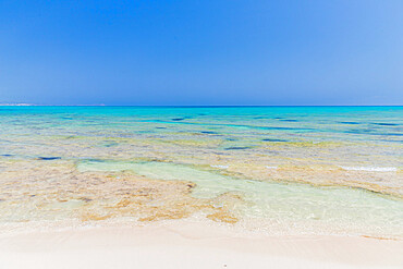
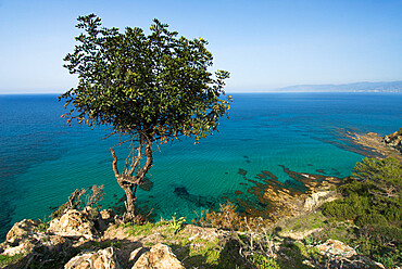
Lara Bay, Akamas peninsula, Cyprus, Eastern Mediterranean Sea, Europe
Cane Malu cave with sea waves crashing on the rocks, Sardinia, Italy, Mediterranean, Europe

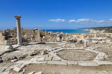
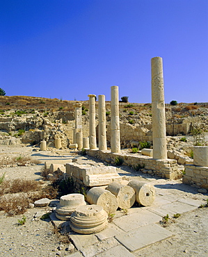
Roman ruins, southwest Cyprus
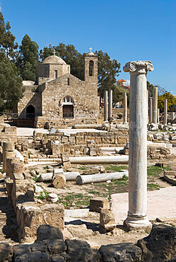
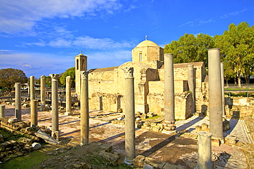
Agia Kyriaki (columns of early Christian Basilica) and the church of Panagia Chrysopolitissa, Paphos, UNESCO World Heritage Site, Cyprus, Europe
Agios Sozomenos, an abandoned village in Nicosia District, Cyprus, Europe
Coastal seascape at sunset in Paphos, Cyprus, Europe
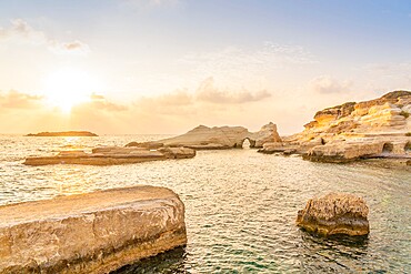
Coastal seascape at sunset in Paphos, Cyprus, Europe
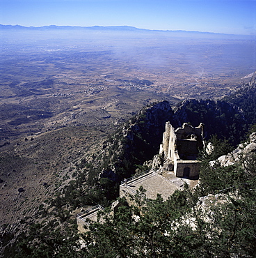
Buffavento, Byzantine watch tower rebuilt as a castle by Lusignans in the 12th century, highest of Kyrenian hill castles, North Cyprus, Cyprus, Europe
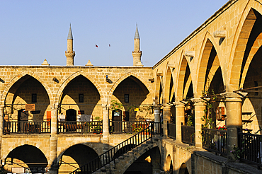
Buyuk Han, ancient Ottoman caravansary, Nicosia, Northern Cyprus, Eastern Mediterranean Sea, Europe

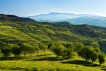
Vineyards around Omodos, Troodos Mountains, Cyprus, Eastern Mediterranean Sea, Europe
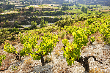
Vineyards around Omodos, Troodos Mountains, Cyprus, Eastern Mediterranean Sea, Europe
Roman ruins, southwest Cyprus

St. Hilarion view to the west over Karaman village and Mediterranean, Cyprus, Mediterranean, Europe
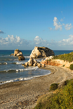
Aphrodite's Rock, Paphos, UNESCO World Heritage Site, South Cyprus, Cyprus, Mediterranean, Europe
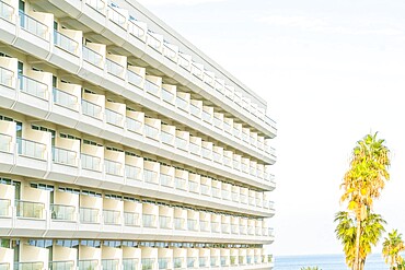
Hotel in Protaras, Famagusta District, Cyprus, Europe
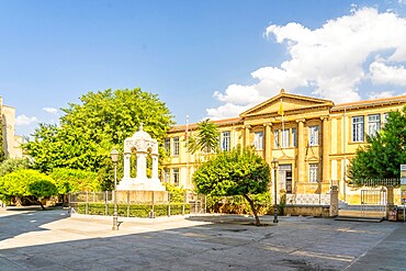
Phaneromeni Square in Nicosia, Cyprus, Europe
The Monastery in the centre of the historic village of Omodos in the Troodos mountains, Cyprus, Mediterranean, Europe
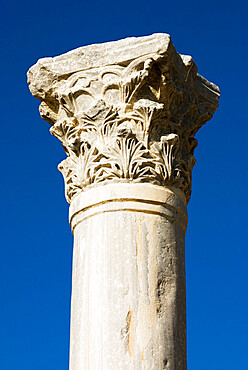
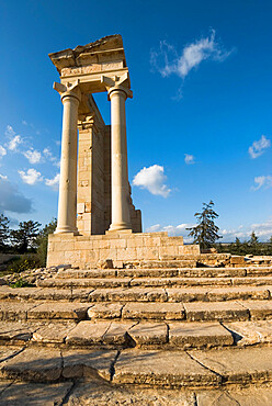
Classical column, Kourion (Curium), Limassol, Cyprus, Europe
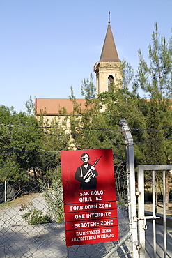
Cyprus. Varosha ghost town in Famagusta, Turkish occupied North Cyprus.

Konnos Beach, Protaras, Cyprus, Mediterranean, Europe

Gravestones of Sufi Dervish tombs in the Turkish occupied section of Nicosia in Cyprus
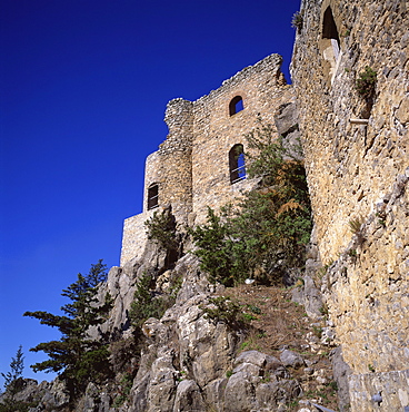
Byzantine watchtower rebuilt as a castle by Lusignans in the 12th century, Buffavento, Northern Cyprus, Cyprus, Europe
Cyprus. Abandoned houses along th Green Line in Nicosia dividing the Republic of Cyprus and Turkish controlled northern part.
The Roman Nymphaeum in Kourion Archaeological Site in southern Cyprus, Mediterranean, Europe
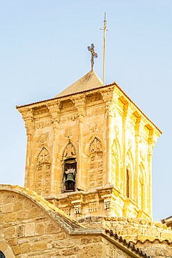
Church of Saint Lazarus, late 9th century, in Larnaca, Cyprus, Europe

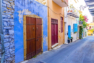
Street and rooftops of Turkish Cypriot North Nicosia with Kyrenia mountains in distance, taken from Saray Hotel, Nicosia, North Cyprus, Europe
Lala Mustafa Pasa Mosque, Famagusta, Turkish part of Cyprus, Cyprus, Europe
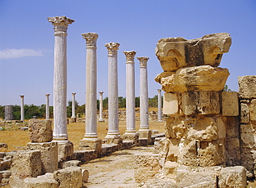
Roman Ruins, Salamis, North Cyprus, Europe
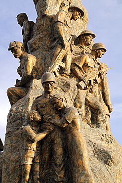
Monument to the Turkish victims of war in Famagusta,Turkish controlled northern part of Cyprus
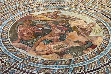
Roman mosaic, Archaeological Park, Paphos, UNESCO World Heritage Site, Cyprus, Europe
Cyprus. Abandoned houses along th Green Line in Nicosia dividing the Republic of Cyprus and Turkish controlled northern part. The United Nations Buffer Zone in Cyprus runs for more than 180.5?kilometres (112.2?mi) along what is known as the Green Line and has an area of 346?square kilometres (134?sq?mi). The zone partitions the island of Cyprus into a southern area effectively controlled by the government of the Republic of Cyprus (which is the de jure government for the entire island save for the British Sovereign Base Areas), and the northern area controlled by the Turkish army
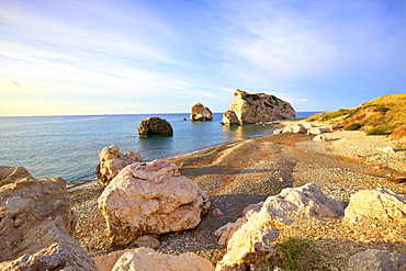
Aphrodites Rock, Paphos, Cyprus, Eastern Mediterranean Sea, Europe
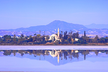
Hala Sultan Tekke, Larnaka, Cyprus, Eastern Mediterranean Sea, Europe
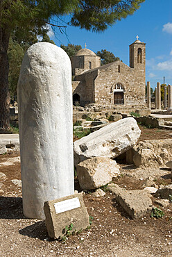
St. Paul`s Pillar and Agia Kyriaki, Paphos, UNESCO World Heritage Site, Cyprus, Europe
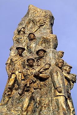
Monument to the Turkish victims of war in Famagusta,Turkish controlled northern part of Cyprus

Pottery souvenirs, Paphos, Cyprus, Europe

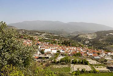
Spring view, Pedoulas, High Troodos Mountains, Cyprus, Europe
View along Chrysochou Bay on North West coast, near Latsi, Cyprus, Mediterranean, Europe

Aphrodite's Rock at sunrise, Paphos, UNESCO World Heritage Site, South Cyprus, Cyprus, Mediterranean, Europe
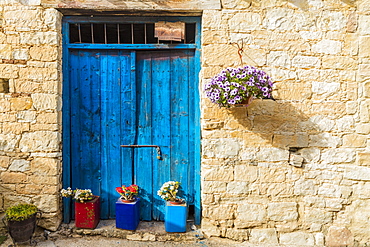
A typical view of a building in the traditional village of Omodos in Cyprus, Europe
The traditional village of Lefkara, Cyprus, Europe

Aphrodites Rock, Paphos, Cyprus, Eastern Mediterranean Sea, Europe
Fontana Amoroza and Blue Lagoon near Latchi, Cyprus, Mediterranean, Europe
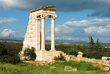
Temple of Apollo, Sanctuary of Apollo Ylatis, Limassol, Cyprus, Europe
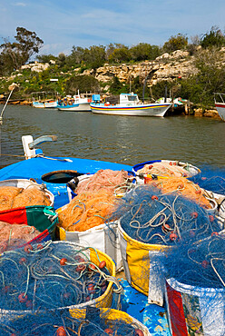
Fishing boats and nets, Potamos Tou Liopetri, Cyprus, Mediterranean, Europe
Cyprus. Abandoned houses along th Green Line in Nicosia dividing the Republic of Cyprus and Turkish controlled northern part. The United Nations Buffer Zone in Cyprus runs for more than 180.5?kilometres (112.2?mi) along what is known as the Green Line and has an area of 346?square kilometres (134?sq?mi). The zone partitions the island of Cyprus into a southern area effectively controlled by the government of the Republic of Cyprus (which is the de jure government for the entire island save for the British Sovereign Base Areas), and the northern area controlled by the Turkish army
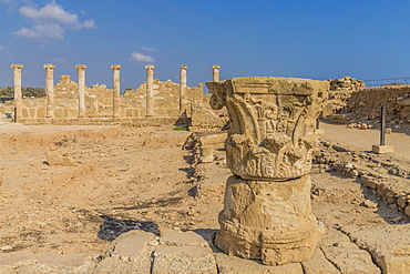
The House of Theseus in Paphos Archaeological Park, UNESCO World Heritage Site, Paphos, Cyprus, Europe
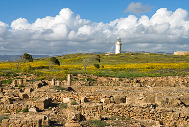
View over ruined Roman town to the lighthouse, The Agora, Archaeological Park, Paphos, UNESCO World Heritage Site, Cyprus, Europe
Cyprus. Abandoned houses along th Green Line in Nicosia dividing the Republic of Cyprus and Turkish controlled northern part. The United Nations Buffer Zone in Cyprus runs for more than 180.5?kilometres (112.2?mi) along what is known as the Green Line and has an area of 346?square kilometres (134?sq?mi). The zone partitions the island of Cyprus into a southern area effectively controlled by the government of the Republic of Cyprus (which is the de jure government for the entire island save for the British Sovereign Base Areas), and the northern area controlled by the Turkish army
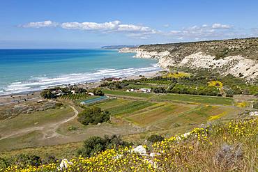
Kourion Beach and cliffs at Episkopi Bay in southern Cyprus, Mediterranean, Europe
View along fishing creek, Potamos Tou Liopetri, Cyprus, Mediterranean, Europe

Aphrodite's Rock, Paphos, UNESCO World Heritage Site, South Cyprus, Cyprus, Mediterranean, Europe
Konnos Beach, Protaras, Cyprus, Mediterranean, Europe
St. Georges old church in Paralimni, Cyprus, Europe
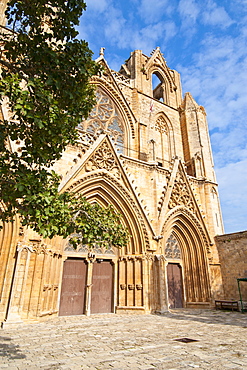
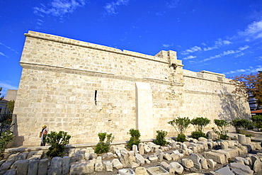
The historic walled city of Famagusta, in Turkish occupied North Cyprus
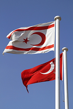
Cyprus. Flags of the Turkish controlled northern part of Cyprus along the Turkish national flag
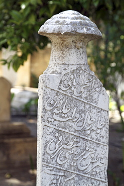
Gravestones of Sufi Dervish tombs in the Turkish occupied section of Nicosia in Cyprus
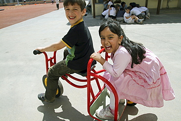
Cyprus.Children play at school near Green Line in Nicosia dividing the Republic of Cyprus and Turkish controlled north
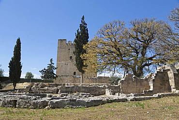
Archaeological site of Amathous, Cyprus
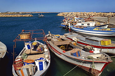
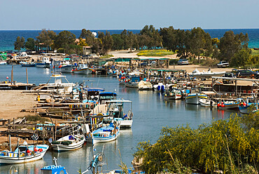
Fishing boats in the tiny harbour at Bogaz, north Cyprus, Cyprus, Mediterranean, Europe
Beach at Potamos, Liopetri, Cyprus, Mediterranean, Europe
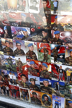
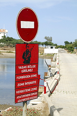
Photos of Turkish conscript soldiers at a shop in occupied North Cyprus, along the Green Line in Nicosia

Governor`s Beach, Limassol, Cyprus, Mediterranean, Europe
View over High Troodos Mountains to Mount Olympos, Troodos Mountains, Cyprus, Europe

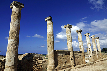
Detail of columns of Agia Kyriaki, Paphos, Cyprus, Europe
Cyprus. Varosha ghost town in Famagusta, Turkish occupied North Cyprus.

Church, Kornos, Cyprus, Eastern Mediterranean Sea, Europe
View along Chrysochou Bay on North West coast, near Latsi, Cyprus, Mediterranean, Europe

Roman mosaic, Archaeological Park, Paphos, Cyprus, Europe
Temple of Apollo, Sanctuary of Apollo Ylatis, Limassol, Cyprus, Europe

Aphrodite's Rock, Paphos, UNESCO World Heritage Site, South Cyprus, Cyprus, Mediterranean, Europe
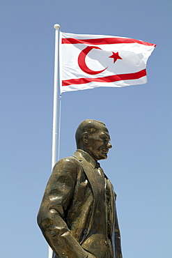
Statue of Ataturk with the flag of the Turkish occupied north Cyprus in Kyrenia
Kolossi Castle in southern Cyprus, Mediterranean, Europe
Entrance to Othello's tower in Famagusta, Turkish occupied North Cyprus, where Shakespeare's play was was based
Cyprus. Abandoned houses along th Green Line in Nicosia dividing the Republic of Cyprus and Turkish controlled northern part.
Saranda Kolones, Archaeological Park, Paphos, Cyprus, Europe
Cyprus. Abandoned houses along the Green Line in Nicosia dividing the Republic of Cyprus and Turkish controlled northern part
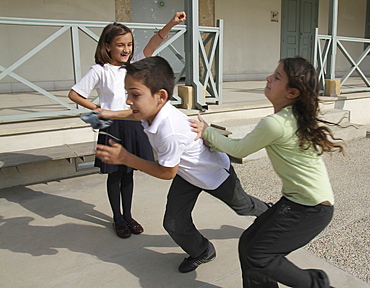
Cyprus.Children play at school near Green Line in Nicosia dividing the Republic of Cyprus and Turkish controlled north
The port of Latchi, Cyprus, Mediterranean, Europe
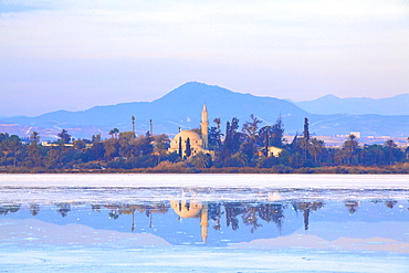
Hala Sultan Tekke, Larnaka, Cyprus, Eastern Mediterranean Sea, Europe
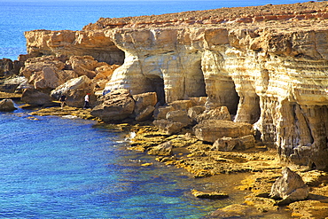
Cape Grekko, Cyprus, Eastern Mediterranean Sea, Europe
Cyprus. Varosha ghost town in Famagusta, Turkish occupied North Cyprus.
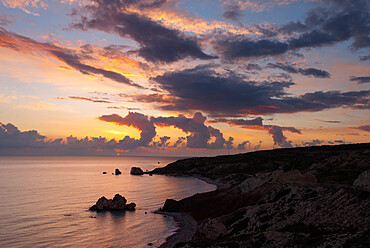
Aphrodite's Rock at sunset, Paphos, UNESCO World Heritage Site, South Cyprus, Cyprus, Mediterranean, Europe
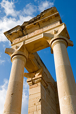
Temple of Apollo, Sanctuary of Apollo Ylatis, Limassol, Cyprus, Europe
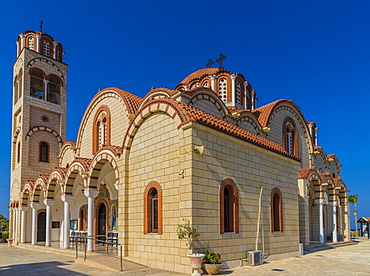
Church of St. Barbara in Paralimni, Cyprus, Europe
The Holy Cross church in the village of Lefkara, Cyprus, Europe
The 12th century stone Church of Agia Kyriaki, Pathos, Cyprus, Eastern Mediterranean Sea, Europe

The historic walled city of Famagusta, in Turkish occupied North Cyprus
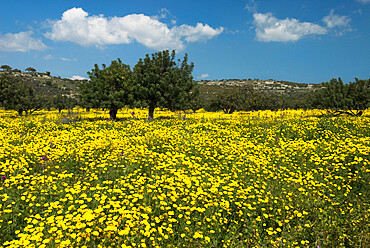
Spring meadow, near Limassol, Cyprus, Europe

Aphrodite's Rock, Paphos, UNESCO World Heritage Site, South Cyprus, Cyprus, Mediterranean, Europe
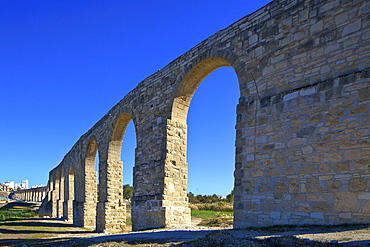
The 18th century Aqueduct, Larnaka, Cyprus, Eastern Mediterranean Sea, Europe
Limassol Castle, Limassol, Cyprus, Eastern Mediterranean Sea, Europe
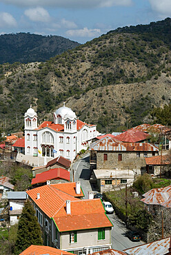
Village view, Pedoulas, High Troodos Mountains, Cyprus, Europe