Results
« Previous 1 2 3
215 results found
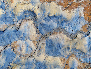
Aerial abstract view taken by drone of desert area near to Big Water during a sunny summer day, Utah, United States of America, North America

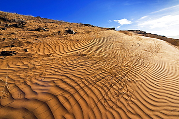
A red sand dune below a sandstone mesa, at Ferry Swale in the Glen Canyon Recreation Area near Page, Arizona, United States of America, North America
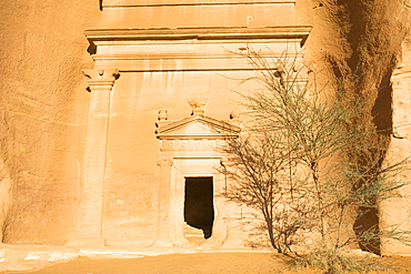
Tombs carved into sandstone rock of Jabal Banat (Qasr Al-Bint) area in site of Hegra (Madain Salih), UNESCO, AlUla, Medina Province, Saudi Arabia
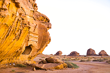
Tombs carved into the sandstone rock of Jabal Banat (Qasr al-Bint) area within site of Hegra, UNESCO, AlUla, Medina Province, Saudi Arabia
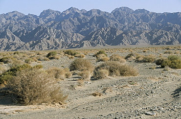
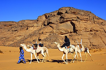
Uan Kaza area, Southwest desert, Libya, North Africa, Africa
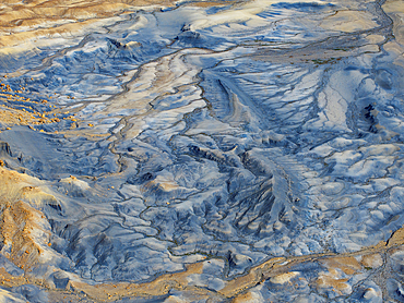
Aerial abstract view taken by drone of desert area near to Big Water during a sunny summer day, Utah, United States of America, North America
Huab River Valley area, Damaraland, Kunene Region, Namibia, Africa
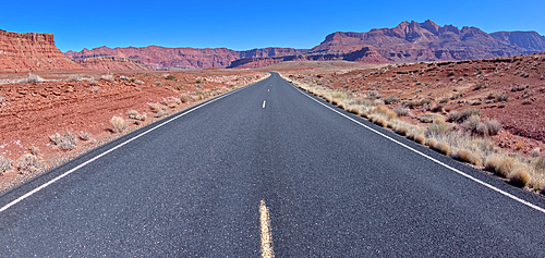
View of Glen Canyon Recreation Area from the middle of Lees Ferry Road at Marble Canyon, Arizona, United States of America, North America
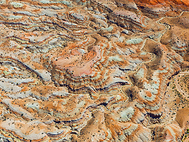
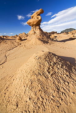
Aerial abstract view taken by drone of desert area near to Goblin Valley National Park during a sunny summer day, Utah, United States of America, North America
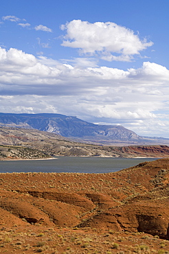
Bighorn Lake, Bighorn Canyon National Recreation Area, Wyoming, United States of America, North America
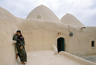
Jinar, 15 year old girl in front of a 200 year old beehive house in the desert, Ebla area, Syria, Middle East
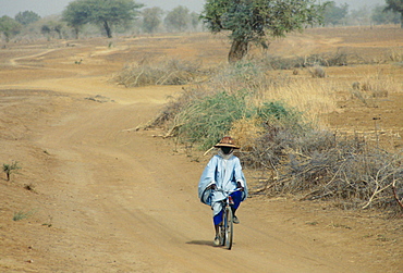
A local man wearing a sunhat rides a bicycle on the road to Sebba through the desert drought areas of Burkina Faso (formerly Upper Volta)
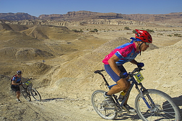
Competitiors in the Mount Sodom International Mountain Bike Race, Dead Sea area, Israel, Middle East
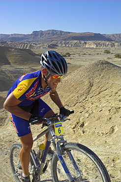
Competitior in the Mount Sodom International Mountain Bike Race, Dead Sea area, Israel, Middle East
Landscape in the Isluga area of the Atacama Desert, Chile, South America
Southeast area of the Taklamakan desert, Xinjiang, China, Asia
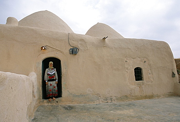
Woman in doorway of a 200 year old beehive house in the desert, Ebla area, Syria, Middle East

Desert flora beneath Camelback Mountain, Echo Canyon Recreation Area, Paradise Valley, Phoenix, Arizona, United States of America, North America
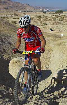
Teenage competitior in the Mount Sodom International Mountain Bike Race, Dead Sea area, Israel, Middle East
Bolan area, Baluchistan, Pakistan, Asia
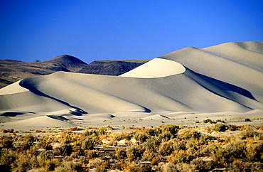
Sand Mountain Recreation Area, a 600ft sand dune popular with off-roaders, east of Fallon, by Highway 50 -'The loneliest road in America', The Great Basin, Nevada, United States of America (USA), North America

Pool area at the Bab Al Shams Desert Resort and Spa. Dubai, United Arab Emirates, Middle East
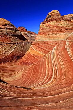
Coyote buttes north, the wave, sandstone formed by wind and water, paria wilderness area, arizona, usa
Coyote buttes north, juniper tree, juniperus, wacholder baum, sandstone formed by wind and water, paria wilderness area, arizona, usa

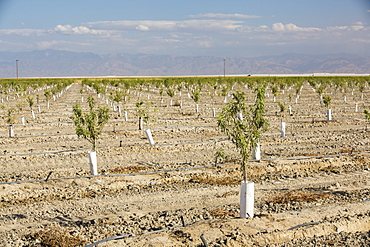
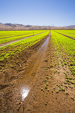
Cotton growing in California's Central Valley, which is in the grip of a four year long drought. The catastrophic drought means that no crops will grow without increasingly scarce irrigation water. Many areas of farmland have been abandoned due to the drought.
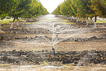
Almod trees being irrigated in California's Central Valley, which is in the grip of a four year long drought. The catastrophic drought means that no crops will grow without increasingly scarce irrigation water. Many areas of farmland have been abandoned due to the drought. 80% of the world's almonds grow in California, each Almond takes 1 gallon of water to produce, water that is increasingly unavailable.
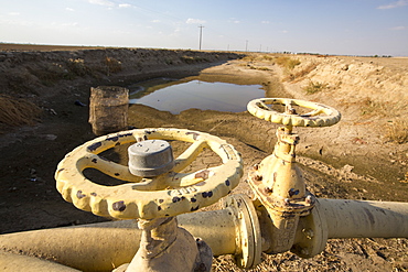
A virtually empty farmers water hole in California's Central Valley, which is in the grip of a four year long drought. The catastrophic drought means that no crops will grow without increasingly scarce irrigation water. Many areas of farmland have been abandoned due to the drought.
Almond trees being irrigated in California's Central Valley, which is in the grip of a four year long drought. The catastrophic drought means that no crops will grow without increasingly scarce irrigation water. Many areas of farmland have been abandoned due to the drought. 80% of the world's almonds grow in California, each Almond takes 1 gallon of water to produce, water that is increasingly unavailable.
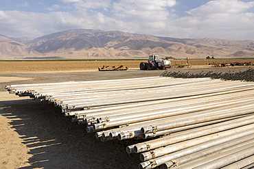
Irrigation pipes in California's Central Valley, which is in the grip of a four year long drought. The catastrophic drought means that no crops will grow without increasingly scarce irrigation water. Many areas of farmland have been abandoned due to the drought.

Part of the Tehachapi Pass wind farm, the first large scale wind farm area developed in the US, California, USA.
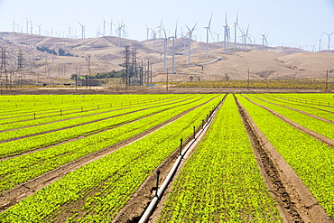
Crops being irrigated below the Tehachapi Pass wind farm, the first large scale wind farm area developed in the US, California, USA.
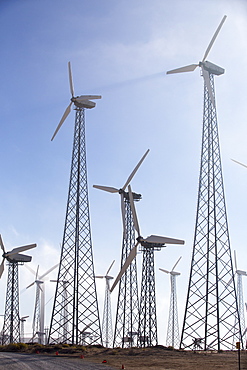
Part of the Tehachapi Pass wind farm, the first large scale wind farm area developed in the US, California, USA.
Part of the Tehachapi Pass wind farm, the first large scale wind farm area developed in the US, California, USA.
Crops being irrigated below the Tehachapi Pass wind farm, the first large scale wind farm area developed in the US, California, USA.
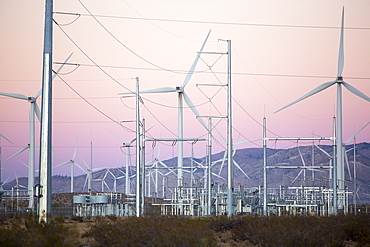
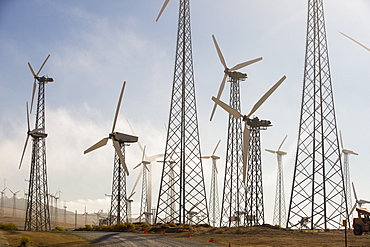
Part of the Tehachapi Pass wind farm, the first large scale wind farm area developed in the US, California, USA, at sunrise.
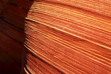
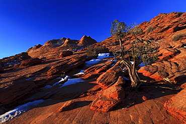
Coyote buttes north, fragile sandstone formed by wind and water, paria wilderness area, arizona, usa
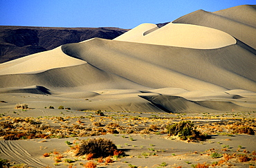
Sand Mountain Recreation Area, a 600ft sand dune popular with off-roaders, east of Fallon, by Highway 50 -'The Loneliest Road in America', The Great Basin, Nevada, United States of America (USA), North America
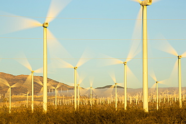
Part of the Tehachapi Pass wind farm, the first large scale wind farm area developed in the US, California, USA, at sunrise.
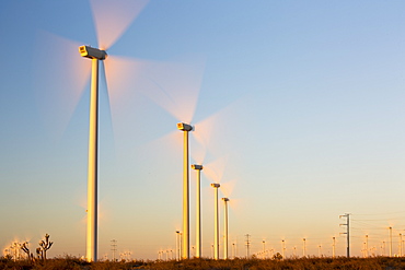
Part of the Tehachapi Pass wind farm, the first large scale wind farm area developed in the US, California, USA, at sunrise.
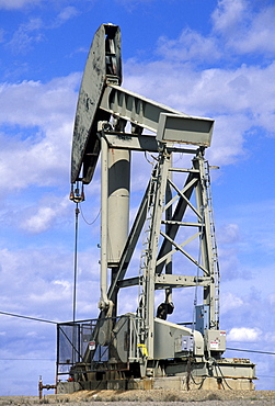
Working pumpjack near Rangely in the desert plateau oilfields of the Rio Blanco area in the far north west. War needs stimulated drilling here in the 1940s, north west, Colorado, Utah, United States of America (USA), North America
Coyote buttes north, fragile sandstone formed by wind and water, paria wilderness area, arizona, usa
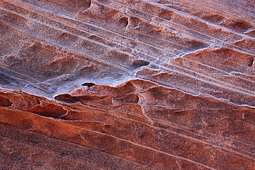
Coyote buttes north, fragile sandstone formed by wind and water, paria wilderness area, arizona, usa
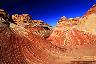
Coyote buttes north, the wave, sandstone formed by wind and water, paria wilderness area, arizona, usa
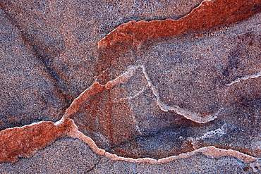
Coyote buttes north, fragile sandstone formed by wind and water, paria wilderness area, arizona, usa

Coyote buttes north, sandstone formed by wind and water, paria wilderness area, arizona, usa
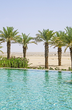
Pool area at the Bab Al Shams Desert Resort and Spa, Dubai, United Arab Emirates, Middle East
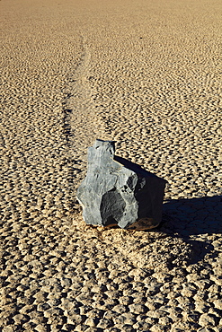
Sliding rock, race track, desert area, death valley national park, california, usa
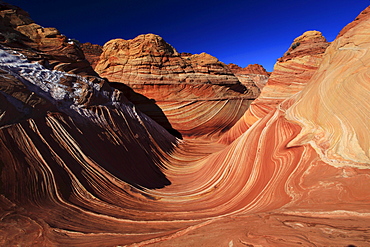
Coyote buttes north, the wave, sandstone formed by wind and water, paria wilderness area, arizona, usa

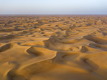
Imperial Sand Dunes State Recreation Area, California, United States of America, North America

Aerial view of a mountainous area surrounded by crop fields in the desert of California, United States of America, North America
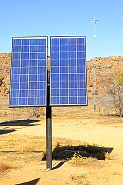
Solar panel in a dry area.
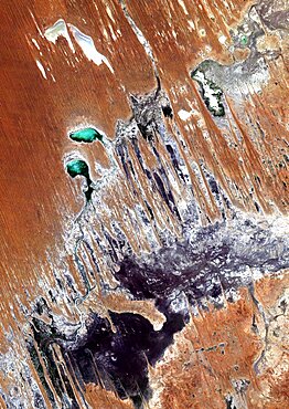
Desert Erg Iguidi, Algeria, True Colour Satellite Image. True colour satellite image of Erg Iguidi, a sand desert between Algeria and Mauritania. The 250m wide dunes lay in the South on a sand plain, and in the North on a blakek sandstone area. The light blue areas are calcareous and salt crusts left out from the evaporation of the oueds' water. Image taken on 29 March 1987 using LANDSAT data.
Simpson Desert , Australia, True Colour Satellite Image. True colour satellite image of the Simpson Desert in the Australian Outback. The sand dunes are coloured in red because of iron oxyd. The green areas are lakes and oueds. East is a calcareous plateau. Image taken on 29 July 1992 using LANDSAT data.
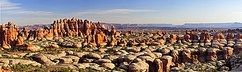
Panorama of rock spires in Chesler Park, Needles Area, Canyonlands National Park, Moab, Utah, Southwest, USA, America
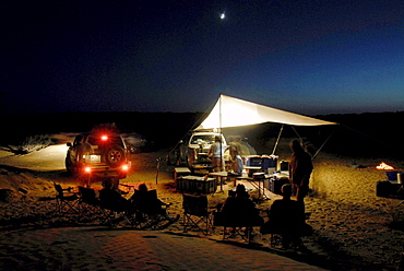
A group of people camping in the desert, Offroad 4x4 Sahara Desert Tour, Bebel Tembain area, Sahara, Tunisia, Africa, mr
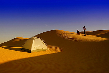
Two people camping in the desert, Sahara Desert Tour, Bebel Tembain area, Sahara, Tunisia, Africa, mr
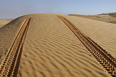
Car tracks in the sand, Offroad 4x4 Sahara Desert Tour, Bebel Tembain area, Sahara, Tunisia, Africa

Camels runs along road through the desert, near Arabian Nights Village, Razeen Area of Al Khatim, Abu Dhabi, United Arab Emirates, Middle East

Laziness on porch of bungalow at Eagles Nest, Gondwana restricted area Rand Park. Succulent Karoo Desert, Namibia
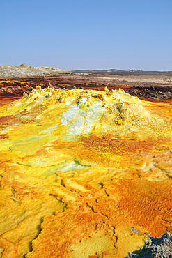
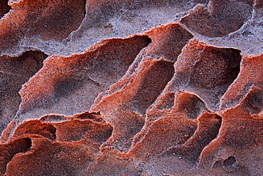
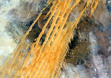
Ethiopia; Afar region; Danakil Desert; Danakil Depression; Dallol geothermal area; hot sulfur springs; cone-like formation in intense yellow, red and green tones
Three camels run on sand dune in the desert, near Arabian Nights Village, Razeen Area of Al Khatim, Abu Dhabi, United Arab Emirates, Middle East

Camels runs along road through the desert, near Arabian Nights Village, Razeen Area of Al Khatim, Abu Dhabi, United Arab Emirates, Middle East
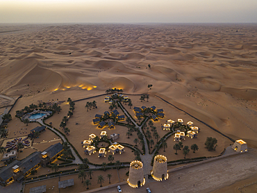
Aerial view of Arabian Nights Village desert resort amid dunes at sunset, Arabian Nights Village, Razeen Area of Al Khatim, Abu Dhabi, United Arab Emirates, Middle East
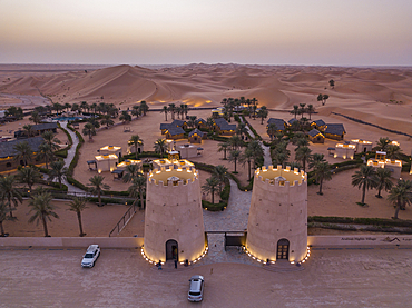
Aerial view from entrance to Arabian Nights Village desert resort amidst dunes at sunset, Arabian Nights Village, Razeen Area of Al Khatim, Abu Dhabi, United Arab Emirates, Middle East

Aerial view of the Oasis swimming pool at the Arabian Nights Village Desert Resort, Arabian Nights Village, Razeen Area of Al Khatim, Abu Dhabi, United Arab Emirates, Middle East
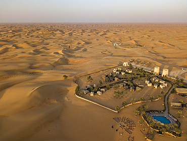
Aerial view of Arabian Nights Village desert resort amidst dunes, Arabian Nights Village, Razeen Area of Al Khatim, Abu Dhabi, United Arab Emirates, Middle East
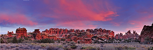
Panorama of rock spires in Chesler Park in the evening, Needles Area, Canyonlands National Park, Moab, Utah, Southwest, USA, America
Aerial view of a four-wheel drive vehicle in dunes during a "dune bashing" excursion in the desert, Arabian Nights Village, Razeen Area of Al Khatim, Abu Dhabi, United Arab Emirates, Middle East
Silhouette of people on sand dune outside Arabian Nights Village desert resort at sunset, Arabian Nights Village, Razeen Area of Al Khatim, Abu Dhabi, United Arab Emirates, Emirates, Middle East
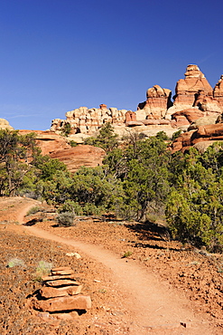
Trail leading towards rock spires in Chesler Park, Needles Area, Canyonlands National Park, Moab, Utah, Southwest, USA, America
The Rimrock, landscape, Utah, USA, America

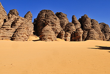
Stone desert, Tassili Maridet, Libyan Desert, Libya, Sahara, North Africa, Africa

Tuareg with white Mehari riding dromedary, Acacus Mountains, Libya
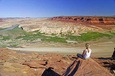
Woman looking over the Glen Canyon National Recreation Area from the Hite viewpoint, Colorado Plateau, Utah, USA
Tuareg with white Mehari riding dromedary, Acacus Mountains, Libya
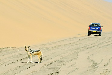
Off-road vehicle and a Black-backed jackal (Canis mesomelas) near Sandwich Harbour, Namib Naukluft National Park, part of the Namibian Skeleton Coast National Park, Skeleton Coast, Namib Desert, Namibia, Africa
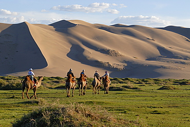
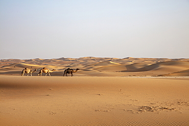
Tourists on camel riding through a lush green grass landscape towards the great Khorgoryn Els sand dunes in the Gobi Desert, Gurvan Saikhan National Park, Oemnoegov Aimak, Mongolia, Asia
Sandstone rock formation at Tikobaouine, Tassili n'Ajjer National Park, Unesco World Heritage Site, Wilaya Illizi, Algeria, Sahara, North Africa
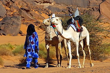
Tuareg with white Mehari riding dromedary, Acacus Mountains, Libya
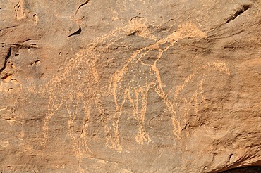
Giraffe engraving, neolithic rock art of the Tadrart, Tassili n'Ajjer National Park, Unesco World Heritage Site, Algeria, Sahara, North Africa
Dirt road with a volcano, Desierto, Uyuni, Bolivia, South America
Bedouins at a camel race in the desert, Wadi Rum, Jordan, Middle East
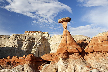
Sandstone formations in Goblin Valley State Park, Utah, USA
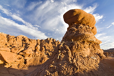
Sandstone formations in Goblin Valley State Park, Utah, USA
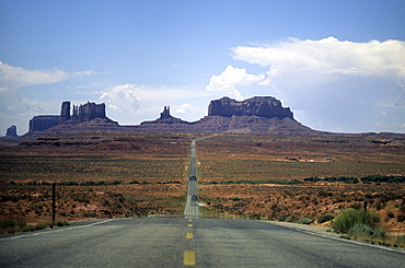
Highway going through Monument Valley, Southwest USA

USA, United States of America, Arizona: Petrified Forest National Park. Park with bizarre erosion landscape, Painted Desert area and petrified trees.. Navajo Indian Reservation.
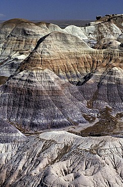
USA, United States of America, Arizona: Petrified Forest National Park. Park with bizarre erosion landscape, Painted Desert area and petrified trees.. Navajo Indian Reservation.
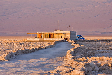
CONAF (Corporacion Nacional Forestal or National Forest Service) office at Reserva Nacional los Flamencos at the Salar de Atacama salt flats, Region de Antofagasta, Chile, South America
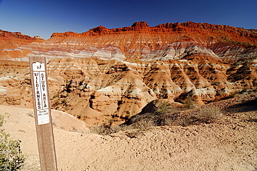
Sign marking a wilderness research area in the desert in front of sandstone mountains, eroded landscape along the Paria River, setting of many classic westerns, Grand Staircase Escalante National Monument, Utah, USA, North America

View from the Hite lookout point over the Glen Canyon National Recreation Area , Colorado Plateau, Utah, USA
Jeep-Safari in the dunes, Saddle Hill, Diamond area, Namibia
Jeeps in the dunes at Conception Bay, Diamond Area, Namibia

Land Rover in stony desert landscape, Brandberg Mountain backdrop, near Uis, Namibia, Africa
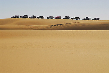
Jeeps in the dunes near Sylvia Hill, Diamond Area, Namibia

Rock arch in Tin Akachaker, Tassili du Hoggar, Wilaya Tamanrasset, Algeria, Sahara Desert, North Africa, Africa

Man standing underneath the rock arch of Youf Ahakit, Tassili du Hoggar, Wilaya Tamanrasset, Algeria, Sahara Desert, North Africa, Africa

Group of Tuareg men, Youf Ahakit, Tassili du Hoggar, Wilaya Tamanrasset, Algeria, Sahara Desert, North Africa, Africa
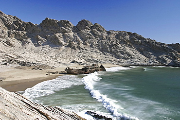
Ship wrack Otavi, diamonds prohibited area, Saddlehill, Atlantic ocean, Namibia, Africa

Mojave Desert in bloom with Parish's Gold Poppy (Eschscholzia parishii), Joshua Tree National Park, California, USA
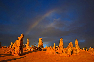
Pinnacles rock formation with rainbow, Pinnacles National Park, Western Australia, Australia