Results
« Previous 1 2 3
231 results found
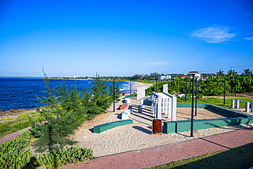
Beach park, Pemba, Punta Delgado, Northern Mozambique, Africa
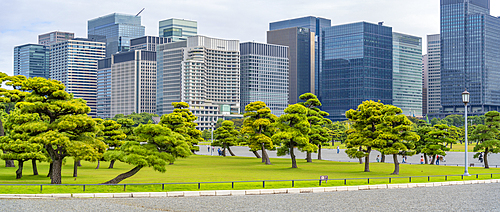
View of contrasting city skyline and Japanese Red Pine trees near the Imperial Palace of Tokyo, Tokyo, Honshu, Japan

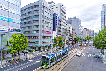
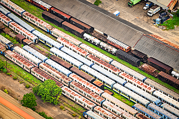
Central Hiroshima, Japan, Vintage street car on the tracks
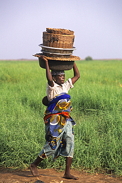
Woman walking carrying basket on her head, Mono River bank in Grand-Popo area, Benin,Gulf of Guinea,West Africa
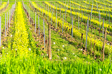
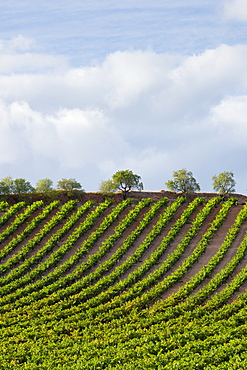
Spring season in Franciacorta district area, Brescia province in Lombardy district, Italy.
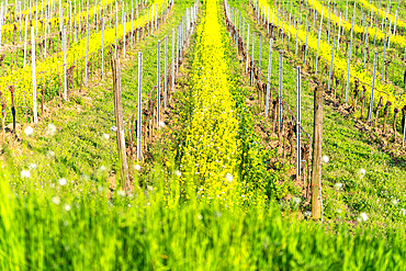
Spring season in Franciacorta district area, Brescia province in Lombardy district, Italy.
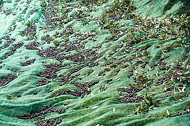
Harvesting of Olives in Franciacorta district area, Brescia province in Lombardy, Italy.
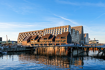
Copenhagen, Denmark ��� View of Papirv?en from Inderhavnsbroen ('The Inner Harbour Bridge'), showing the former warehouse island now redeveloped into a vibrant urban area.
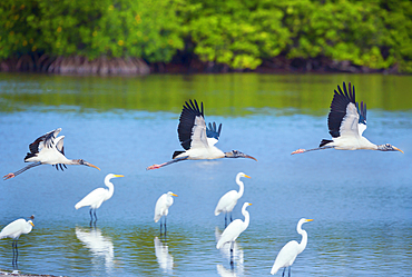
Wood Storks (Mycteria Americana) in flight, Sanibel Island, J.N. Ding Darling National Wildlife Refuge, Florida, USA
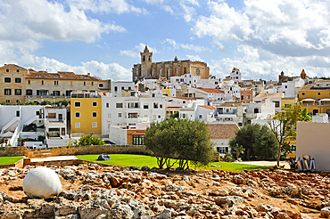
Ciutadella de Menorca, Menorca, Balearic Islands, Spain, Mediterranean, Europe
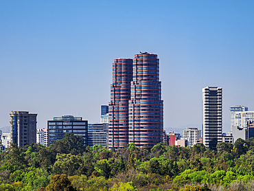
View towards Polanco, Mexico City, Mexico
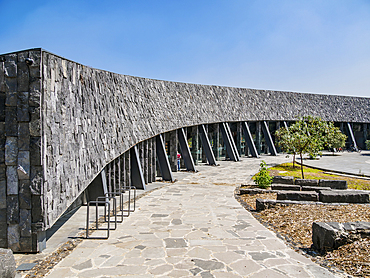
Environmental Culture Center, Bosque de Chapultepec Park, Mexico City, Mexico

New Basilica of Guadalupe, elevated view, Villa de Guadalupe, Mexico City, Mexico
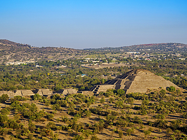
Avenue of the Dead and Pyramid of the Moon at sunrise, aerial view, Teotihuacan, Mexico State, Mexico
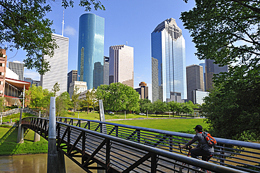
Hobby Center pedestrian bridge in the Buffalo Bayou Park, Houston, Texas, United States of America
Elevated view of traffic and tram on major street during daytime, Hondori, Naka Ward, Hiroshima, Honshu, Japan
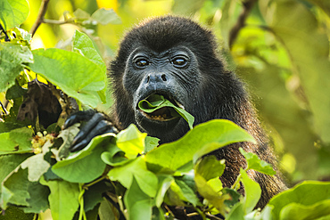
Female mantled howler monkey (Alouatta palliata) eating tree leaves in a north Pacific coast forest, Esperanza, Nosara, Guanacaste, Costa Rica
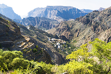
Perched villages of Jabal Al Akhdar (Green Mountains) around the Sayq plateau, Sultanate of Oman, Arabian Peninsula
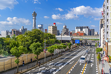
View of Tsutenkaku Tower and city skyline on a sunny day in the Shinsekai area, Osaka, Honshu, Japan

Wild flowers blooming, Cattolica Eraclea, Agrigento district, Sicily, Italy
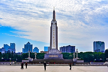
Bayi Square, the second largest square in China after Tiananmen Square, Nanchang, Jiangxi Province, China
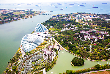
Aerial view over Gardens by the Bay and supertree grove, Singapore
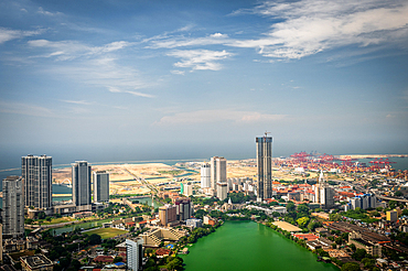
View over Colombo from the Lotus Tower, Colombo, Sri Lanka
View of trains from the Lotus Tower, Colombo, Sri Lanka

Traditional barn-fortress for crop harvesting, Tallate, Anti-Atlas, Morocco
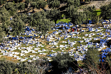
Graveyard in Moulay Idriss Zerhoun, Morocco
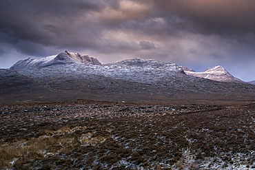
Ben Mor Coigach and Beinn an Eoin in winter, Assynt Mountains, Assynt-Coigach National Scenic Area, Sutherland, Scottish Highlands, Scotland, United Kingdom, Europe

Aerial drone panoramic view of Bo-Kaap, formerly known as the Malay Quarter, formerly a racially segregated area, on the slopes of Signal Hill above the city centre, Cape Town, Western Cape, South Africa, Africa
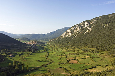
Green fields of Serra del Cadi (Sierra del Cadi) area, Catalonia (Catalunya) (Cataluna), Spain, Europe

Statue on bridge leading to Valdstejn Castle, Hruba Skala, Bohemian Paradise Protected Landscape Area, Semily District, Liberec Region, Bohemia, Czech Republic (Czechia), Europe
Cyprus. Abandoned houses along th Green Line in Nicosia dividing the Republic of Cyprus and Turkish controlled northern part. The United Nations Buffer Zone in Cyprus runs for more than 180.5?kilometres (112.2?mi) along what is known as the Green Line and has an area of 346?square kilometres (134?sq?mi). The zone partitions the island of Cyprus into a southern area effectively controlled by the government of the Republic of Cyprus (which is the de jure government for the entire island save for the British Sovereign Base Areas), and the northern area controlled by the Turkish army
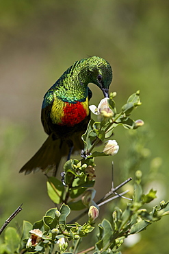
Beautiful sunbird (Cinnyris pulchella), female, Ngorongoro Conservation Area, UNESCO World Heritage Site, Serengeti, Tanzania, East Africa, Africa
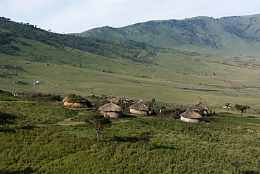
A Masai village in the Ngorongoro Conservation Area, Serengeti, Tanzania, East Africa, Africa
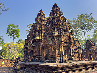
Banteay Srei Temple, a miniature temple complex built entirely of red sandstone in the area of Angkor, UNESCO World Heritage Site, Cambodia, Indochina, Southeast Asia, Asia
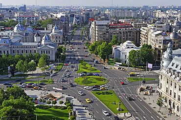
University Square viewed from the Intercontinental Hotel, Bucharest, Romania

View of Victoria Terrasse and Turid Angell Eng sculpture in Johan Svendsens Plass, Oslo, Norway, Scandinavia, Europe
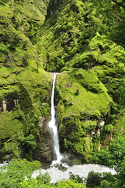
Chyamche Falls, Marsyangdi River Valley, Annapurna Conservation Area, Gandaki, Western Region (Pashchimanchal), Nepal, Asia
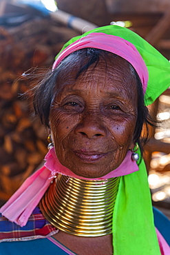
Portrait of a Padaung woman (Giraffe woman) (Long-necked woman), Loikaw area, Panpet, Kayah state, Myanmar (Burma), Asia
Cyprus. Abandoned houses along th Green Line in Nicosia dividing the Republic of Cyprus and Turkish controlled northern part. The United Nations Buffer Zone in Cyprus runs for more than 180.5?kilometres (112.2?mi) along what is known as the Green Line and has an area of 346?square kilometres (134?sq?mi). The zone partitions the island of Cyprus into a southern area effectively controlled by the government of the Republic of Cyprus (which is the de jure government for the entire island save for the British Sovereign Base Areas), and the northern area controlled by the Turkish army
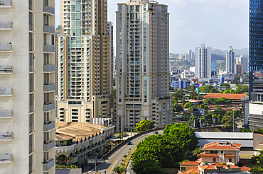
View toward the Marbella area from the Trump Ocean Club International Hotel and Tower Panama, Punta Pacifica area, Panama City, Republic of Panama, Central America
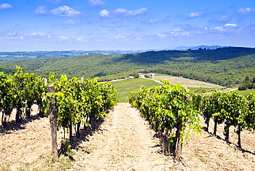
Vineyard, Strada in Chianti, Chianti area, Firenze province, Tuscany, Italy, Europe
Cyprus. Abandoned houses along th Green Line in Nicosia dividing the Republic of Cyprus and Turkish controlled northern part. The United Nations Buffer Zone in Cyprus runs for more than 180.5?kilometres (112.2?mi) along what is known as the Green Line and has an area of 346?square kilometres (134?sq?mi). The zone partitions the island of Cyprus into a southern area effectively controlled by the government of the Republic of Cyprus (which is the de jure government for the entire island save for the British Sovereign Base Areas), and the northern area controlled by the Turkish army
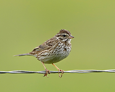
Lincoln's sparrow (Melospiza lincolnii), San Jacinto Wildlife Area, California, United States of America, North America

Green meadows and alpine lake framed by the high peaks in the Adamello Ski Area, Tonale Pass, Valcamonica, Lombardy, Italy, Europe
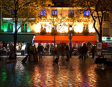
Restaurants and cafes lit at night in the Montmartre area of Paris, France, Europe
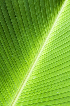
Leaf, Arenal area, Costa Rica

Area near Loft Mountain, Shenandoah National Park, Virginia, United States of America (U.S.A.), North America

Broad leaved plants and ferns grow at base of dipterocarp rainforest, Danum Valley Conservation Area, Danum Valley, Sabah, Malaysia, island of Borneo, Southeast Asia, Asia

Traditional wooden buildings along Storgata in the quaint area of Tromso, in the Arctic Circle in Northern Norway
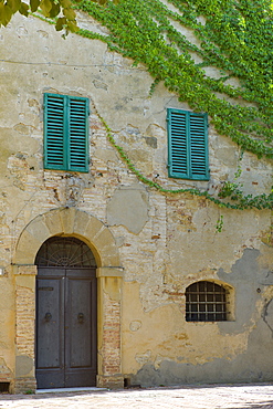
Traditional house with green window shutters and covered in Virginia Creeper, in hill town of Monticcheillo, Val D'Orcia area of Tuscany, Italy
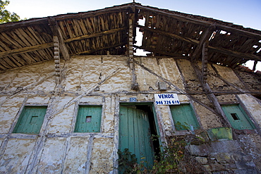
Traditional Basque house for sale in the Biskaia Basque region of Northern Spain
Rioja Vineyard on Ruta Del Vino wine route near Marques de Riscal in La Rioja-Alavesa area of Northern Spain
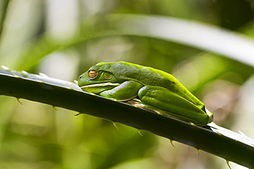
White-Lipped Green Tree Frog on palm leaf in Daintree Rainforest, Queenland, Australia

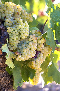
White grapes growing on a vine at Chinon Vineyard, Chinon in the Loire Valley, France.
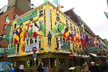
Flags outside colourful yellow Oliver St. John Gogarty pub in Temple Bar area, Dublin city centre, Republic of Ireland, Europe
Viura green grapes for Rioja white wine in vineyard in Rioja-Alavesa area of Basque country, Euskadi, Spain, Europe
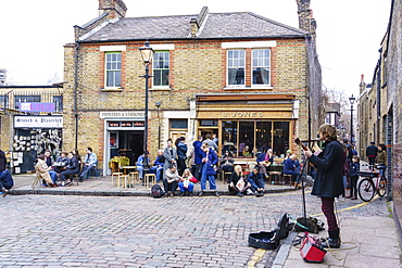
Busker entertains in Columbia Road area, a very popular Sunday market between Hoxton and Bethnal Green in East London, London, England, United Kingdom, Europe
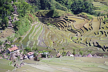
Spectacular amphitheatre of rice terraces around the mountain province village of Batad, northern area of the island of Luzon, Philippines, Southeast Asia, Asia
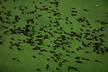
Tadpoles in pond in Zhangjiajie Forest Park, Wulingyuan Scenic Area, Hunan, China, Asia
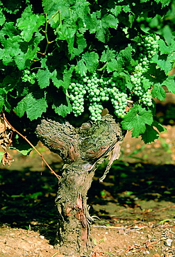
White grapes growing on a vine at Chinon Vineyard, Chinon in the Loire Valley, France.
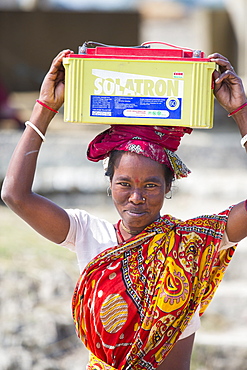
A WWF project to supply electricity to a remote island in the Sunderbans, a low lying area of the Ganges Delta in Eastern India, that is very vulnerable to sea level rise. Prior to this project the subsistence farmers had no access to electricity. The project involves charging large batteries from solar panels. Each villager collects a battery to run household lighting, and returns to the recharging station once a week to recharge their battery. This shot shows women carrying the heavy batteries (20Kg) from the charging station.
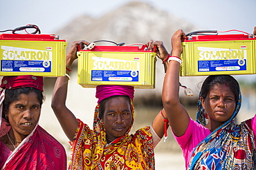
A WWF project to supply electricity to a remote island in the Sunderbans, a low lying area of the Ganges Delta in Eastern India, that is very vulnerable to sea level rise. Prior to this project the subsistence farmers had no access to electricity. The project involves charging large batteries from solar panels. Each villager collects a battery to run household lighting, and returns to the recharging station once a week to recharge their battery. This shot shows women carrying the heavy batteries (20Kg) from the charging station.

Part of the Tehachapi Pass wind farm, the first large scale wind farm area developed in the US, California, USA.
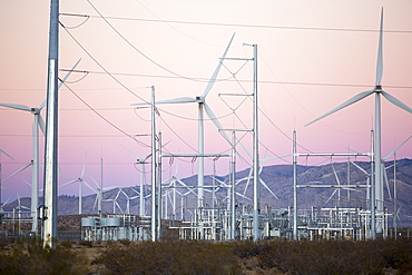
Part of the Tehachapi Pass wind farm, the first large scale wind farm area developed in the US, California, USA, at sunrise.
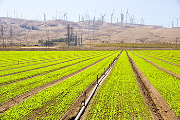
Crops being irrigated below the Tehachapi Pass wind farm, the first large scale wind farm area developed in the US, California, USA.
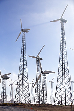
Part of the Tehachapi Pass wind farm, the first large scale wind farm area developed in the US, California, USA.
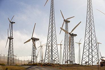
Part of the Tehachapi Pass wind farm, the first large scale wind farm area developed in the US, California, USA.
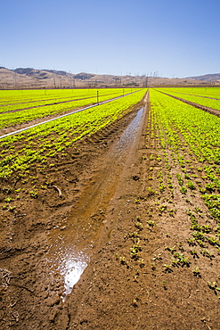
Crops being irrigated below the Tehachapi Pass wind farm, the first large scale wind farm area developed in the US, California, USA.
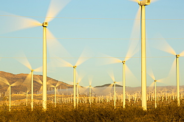
Part of the Tehachapi Pass wind farm, the first large scale wind farm area developed in the US, California, USA, at sunrise.
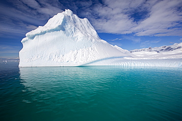
An iceberg in the Gerlache Strait separating the Palmer Archipelago from the Antarctic Peninsular off Anvers Island. The Antartic Peninsular is one of the fastest warming areas of the planet.
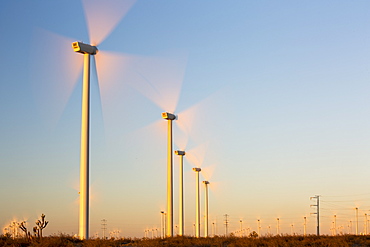
Part of the Tehachapi Pass wind farm, the first large scale wind farm area developed in the US, California, USA, at sunrise.

Fir trees in the south west of Lassen Volcanic National Park, an area of volcanic activities and features, Lassen Volcanic National Park, Northern California, California, United States of America (USA), North America

Grass in boggy area

western king wrasse (coris auricularis), male, dark pink colour with reddish-brown band running around boby and blue-green colouration over the head, wild, day, marine protected area, diving off Rottnest Island, reef edges, sand, seagrass, Western Australia, Indian Ocean. MORE INFO: social structure where dominant male, usually the biggest in the area, will have a harem of females. When the male dies or is absent for any length of time the largest female will change sex and dominate the group.
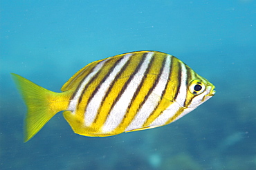
footballer sweep (neatypus obliquus) diagonal yellow bands are edged in black and stand out against the silvery-blue body, wild, day, marine protected area, reef, in small schools diving off Rottnest Island, Western Australia, Indian Ocean. MORE INFO: other name stripey, eating green algae as they sweep over the reef.
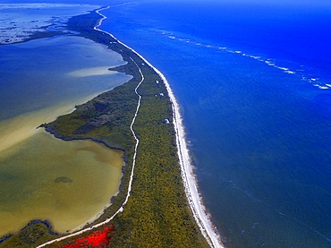
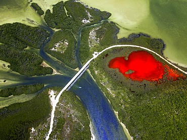
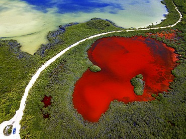
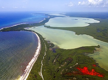
Aerial view of Punta Allen Sian Ka'an Reserve, Yucatan Peninsula, Mexico. Red lagoon near Boca Paila Bridge.
In the language of the Mayan peoples who once inhabited this region, Sian Ka'an means Origin of the Sky. Located on the east coast of the Yucatán peninsula, this biosphere reserve contains tropical forests, mangroves and marshes, as well as a large marine section intersected by a barrier reef. It provides a habitat for a remarkably rich flora and a fauna comprising more than 300 species of birds, as well as a large number of the region's characteristic terrestrial vertebrates, which cohabit in the diverse environment formed by its complex hydrological system.
Along its roughly 120 kilometres of coastline, the property covers over 400,000 hectares of land ranging from sea level to only ten m.a.s.l. The property boasts diverse tropical forests, palm savannah, one of the most pristine wetlands in the region, lagoons, extensive mangrove stands, as well as sandy beaches and dunes. The 120,000 hectares of marine area protect a valuable part of the Mesoamerican Barrier Reef and seagrass beds in the shallow bays. The lush green of the forests and the many shades of blue of the lagoons and the Caribbean Sea under a wide sky offer fascinating visual impressions.

Palms and old pier in Punta Allen Sian Ka'an Reserve, Yucatan Peninsula, Mexico.
In the language of the Mayan peoples who once inhabited this region, Sian Ka'an means Origin of the Sky. Located on the east coast of the Yucatán peninsula, this biosphere reserve contains tropical forests, mangroves and marshes, as well as a large marine section intersected by a barrier reef. It provides a habitat for a remarkably rich flora and a fauna comprising more than 300 species of birds, as well as a large number of the region's characteristic terrestrial vertebrates, which cohabit in the diverse environment formed by its complex hydrological system.
Along its roughly 120 kilometres of coastline, the property covers over 400,000 hectares of land ranging from sea level to only ten m.a.s.l. The property boasts diverse tropical forests, palm savannah, one of the most pristine wetlands in the region, lagoons, extensive mangrove stands, as well as sandy beaches and dunes. The 120,000 hectares of marine area protect a valuable part of the Mesoamerican Barrier Reef and seagrass beds in the shallow bays. The lush green of the forests and the many shades of blue of the lagoons and the Caribbean Sea under a wide sky offer fascinating visual impressions.

Strawberry Poison Frog (Dendrobates pumilio), adult, Bastimentos National Park, Bocas del Toro, Panama. The strawberry poison frog or strawberry poison-dart frog (Oophaga pumilio or Dendrobates pumilio) is a species of small amphibian poison dart frog found in Central America. It is common throughout its range, which extends from eastern central Nicaragua through Costa Rica and northwestern Panama. The species is often found in humid lowlands and premontane forest, but large populations are also found in disturbed areas such as plantations. The strawberry poison frog is perhaps most famous for its widespread variation in coloration, comprising approximately 15���30 color morphs, most of which are presumed to be true-breeding. O. pumilio, while not the most poisonous of the dendrobatids, is the most toxic member of its genus. The species is most diverse in Panama with varieties in vivid shades of all red, orange, blue, yellow or green, green and yellow, white with red, orange or black and spotted varieties. The most colorful mix is found in Isla Bastimentos Marine National Park though not all in one place. Colors vary by location. A beach on the north side of the island is named after the species. Two of Southern Explorations' Panama tours visit red frog habitat. Both the eight-day Panama Adventure trip and eleven-day Panama Highlights trip spend time in Isla Bastimentos Marine National Park and the former also goes to Red Frog Beach.
The red frog is not as poisonous as some of its cousins and is not a threat to humans. It subsists on a diet of ants that dine on poisonous plants, providing the red frog its protective skin toxin. Males attract females with a loud quick chirp. To hear the distinctive sound before you depart on your Panama tours, go to the University of Michigan Museum's biodiversity website (www.animaldiversity.ummz.umich.edu.) After birth, the tadpoles climb aboard the mother who deposits them in different protected areas where she retu
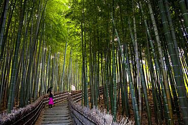
Bamboo forest, in Adashino Nembutsu ji temple , Arashiyama, Kyoto

Agricultural aerial landscape, Tierra Estella, Navarre, Spain, Europe
Green area near to the mosque at Takwa on Manda Island near Lamu Kenya
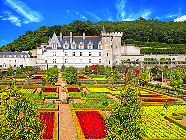
The castle and the gardens of Villandry, Loire Valley, France. The beautiful castle and gardens at Villandry, UNESCO World Heritage Site, Indre et Loire, Centre, France, Europe These gardens are divided into different areas; an ornamental next to the castle (dedicated to the tender love, passionate love, the unfaithful love and tragic love); a water garden around the pond; and a garden of medicinal herbs; aromatic; and horticulture.

Agricultural aerial landscape, Tierra Estella, Navarre, Spain, Europe
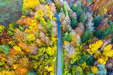
Aerial view of a decidual forest and road in autumn. Close to Irati area. Navarre, Spain, Europe.
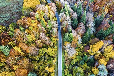
Aerial view of a decidual forest and road in autumn. Close to Irati area. Navarre, Spain, Europe.
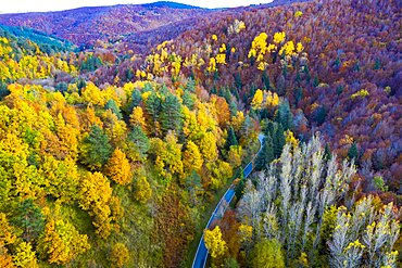
Aerial view of a decidual forest and road in autumn. Close to Irati area. Navarre, Spain, Europe.
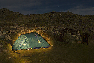
"El Rincon" Campsite at Night, Perito Moreno National Park, Southern Andean Patagonia, Santa Cruz, Argentina

Agricultural aerial landscape, Tierra Estella, Navarre, Spain, Europe

The Northern Lights over the end of Prosperous Lake, on the Ingraham Trail near Yellowknife, NWT, a popular spot for aurora watching in the area. This is looking west on the night of September 5-6, 2019 during a brighter outburst this night.
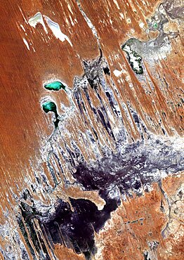
Simpson Desert , Australia, True Colour Satellite Image. True colour satellite image of the Simpson Desert in the Australian Outback. The sand dunes are coloured in red because of iron oxyd. The green areas are lakes and oueds. East is a calcareous plateau. Image taken on 29 July 1992 using LANDSAT data.
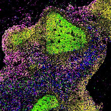
Lymph node of person with untreated hiv
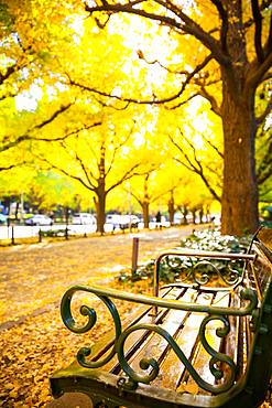
Autumn colors in Tokyo, Japan
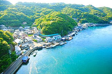
Tokushima Prefecture, Japan
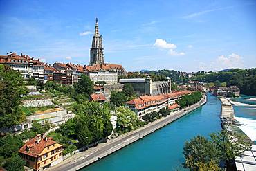
Switzerland, Canton Bern, Bern, UNESCO World Heritage Site
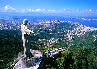
Brazil, South America

Hiroshima Prefecture, Japan

Myanmar