Results
« Previous 1 2 3 4 5 6 … 88 Next »
8762 results found
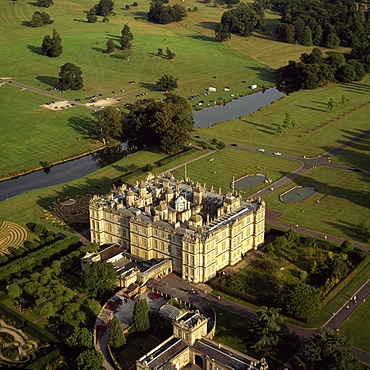
Aerial image of Longleat, an English country house, Horningsham, near Warminster, Wiltshire, England, United Kingdom, Europe
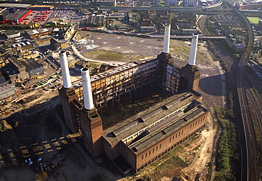
Aerial image of Battersea Power Station, an unused coal-fired power station on the south bank of the River Thames, Battersea, London, England, United Kingdom, Europe
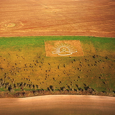
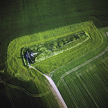
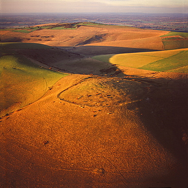
Aerial image of Lamb Down Military Badge, the badge of the Australian Commonwealth Military Forces, cut on a steep slope by the A36, Lamb Down, Wiltshire, England, United Kingdom, Europe
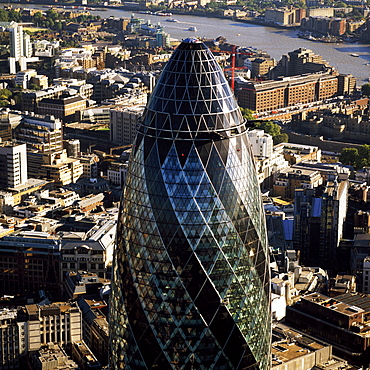
Aerial image of the Swiss Re Building (30 St. Mary Axe) (Gherkin), City of London, London, England, United Kingdom, Europe
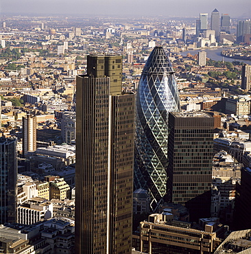
Aerial view of Tower 42, Gherkin (30 St. Mary Axe) (Swiss Re Building) and St. Helen's (Aviva Tower), City of London, London, England, United Kingdom, Europe
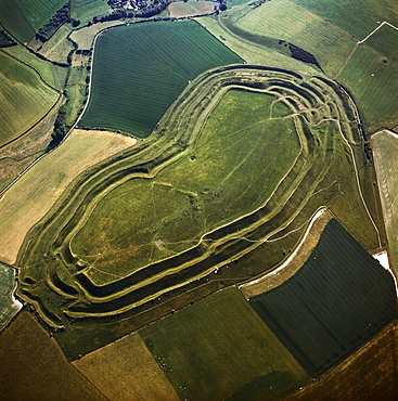
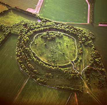
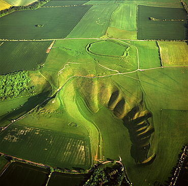
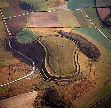
Aerial image of Maiden Castle, an Iron Age hill fort, Winterborne Monkton, near Dorchester, Dorset, England, United Kingdom, Europe
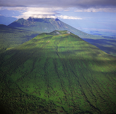
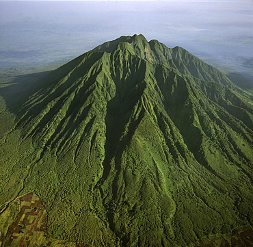
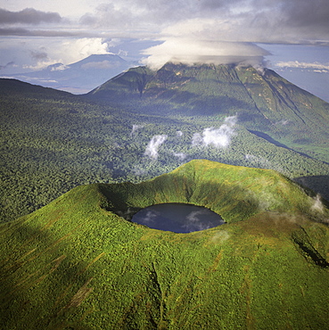
Aerial view of Mount Visoke (Mount Bisoke), an extinct volcano, straddling border of Rwanda and the Democratic Republic of the Congo. with Mount Mikeno in background, Virunga Volcanoes, Great Rift Valley, Africa
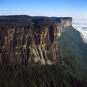
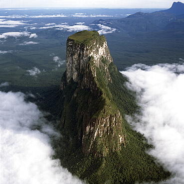
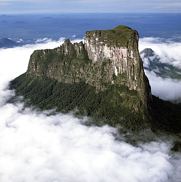
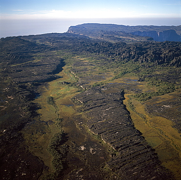
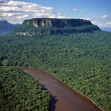
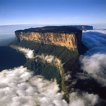
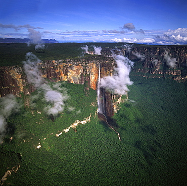
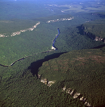
Aerial image of tepuis showing eastern cliff looking towards Brazil and Guyana, Mount Roraima, Venezuela, South America
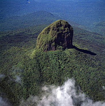
Aerial image of tepuis showing Mount Autana (Cerro Autana), Amazonas territory, Venezuela, South America
Aerial view of Mount Sabyinyo, an extinct volcano and oldest of the Virunga Mountains, the summit at 3645ï¾ metres marks the intersection of the borders of Democratic Republic of the Congo (DRC), Rwanda, and Uganda, Virunga Volcanoes, Africa
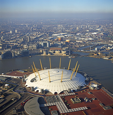
Aerial image of the Millennium Dome and the River Thames, Greenwich Peninsula, South East London, London, England, United Kingdom, Europe
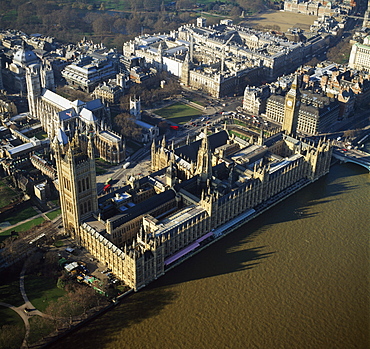
Aerial image of the Houses of Parliament (Palace of Westminster) and Big Ben, UNESCO World Heritage Site, Westminster, London, England, United Kingdom, Europe
Aerial image of tepuis showing Mount Autana (Cerro Autana), Amazonas territory, Venezuela, South America
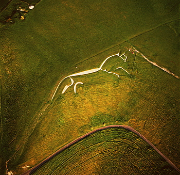
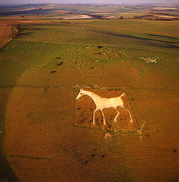
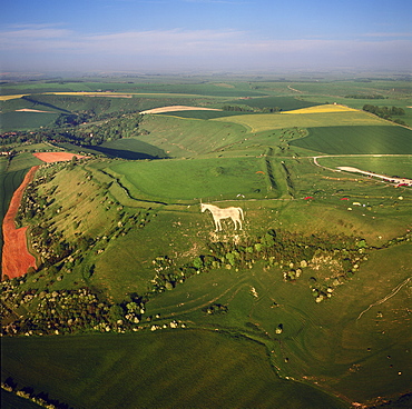
Aerial image of the Uffington White Horse, Berkshire Downs, Vale of White Horse, Oxfordshire, England, United Kingdom, Europe
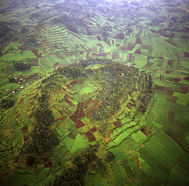
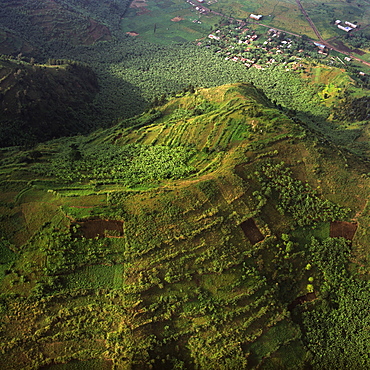
Aerial view of intensive agriculture on Virunga foothills, Rwanda, Africa
Aerial view of the River Ant, Norfolk Broads, near How Hill, Norfolk, England, United Kingdom, Europe

Aerial image of the Long Man of Wilmington, Wilmington, South Downs, East Sussex, England, United Kingdom, Europe
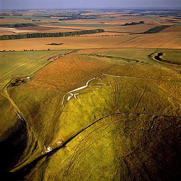
Aerial image of Uffington White Horse with Uffington Castle hill fort, Berkshire Downs, Vale of White Horse, Oxfordshire, England, United Kingdom, Europe
Aerial image of tepuis showing swamps and rock labyrinths on summit plateau in Brazilian and Guyanese sectors, Mount Roraima, Venezuela, South America
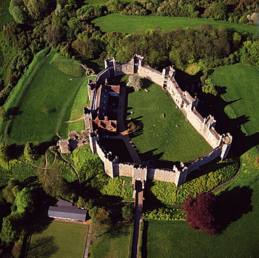
Aerial view of Framlingham Castle, Framlingham, Suffolk, England, United Kingdom, Europe
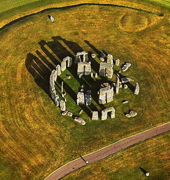
Aerial image of Stonehenge, prehistoric monument and stone circle, UNESCO World Heritage Site, Salisbury Plain, Wiltshire, England, United Kingdom, Europe
Aerial view of Alton Barnes White Horse, Alton Barnes, Wiltshire, England, United Kingdom, Europe
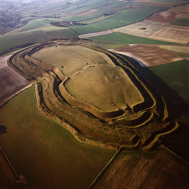
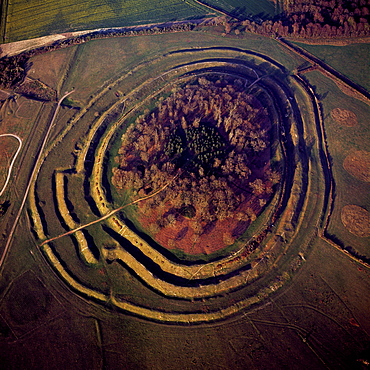
Aerial image of Danebury Ring, an Iron Age hill fort, Wiltshire, England, United Kingdom, Europe

Aerial image of Bodiam Castle, late medieval moated castle, Robertsbridge, East Sussex, England, United Kingdom, Europe
Aerial view of salt marsh at Burnham Overy Staithe, Norfolk, England, United Kingdom, Europe
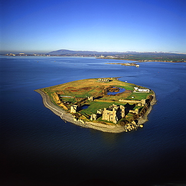
Aerial image of Piel Castle (Fouldry Castle) (Fouldrey Castle), a concentric medieval fortification with a keep and three towers, Piel Island, Furness Peninsula, Barrow in Furness, Cumbria, England, United Kingdom, Europe
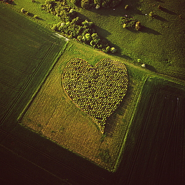
Aerial image of heart shape orchard, near Huish Hill earthwork, Oare, Wiltshire, England, United Kingdom, Europe
Aerial image of West Kennet Long Barrow, a Neolithic tomb or barrow, on a prominent chalk ridge, near Silbury Hill, Avebury, Wiltshire, England, United Kingdom, Europe
Aerial image of the Upper Mazaruni River, downstream from Kamarang, Guyana, South America
Aerial image of tepuis showing northern prow in the Guyanese sector of Mount Roraima (Cerro Roraima), Venezuela, South America
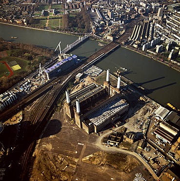
Aerial image of Battersea Power Station, an unused coal-fired power station on the south bank of the River Thames, Battersea, London, England, United Kingdom, Europe
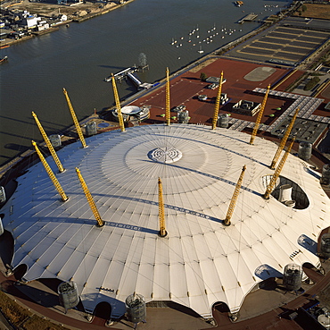
Aerial image of the Millennium Dome and the River Thames, Greenwich Peninsula, South East London, London, England, United Kingdom, Europe
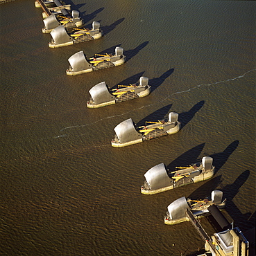
Aerial image of the Thames Flood Barrier across the River Thames, Woolwich Reach, Woolwich, London, England, United Kingdom, Europe

Aerial image of Salisbury Cathedral and city in snow, Salisbury, Wiltshire, England, United Kingdom, Europe
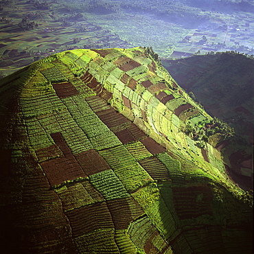
Aerial view of intensive agriculture on Virunga foothills, Democratic Republic of Congo, Africa
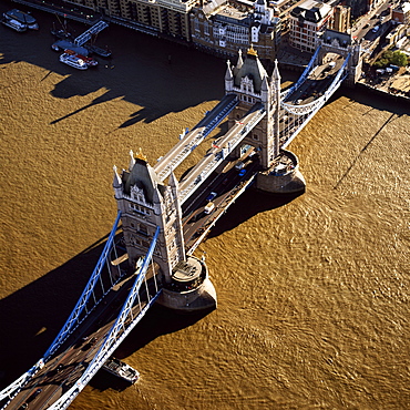
Aerial image of Tower Bridge, a combined bascule and suspension bridge, over the River Thames, London, England, United Kingdom, Europe
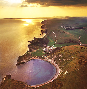
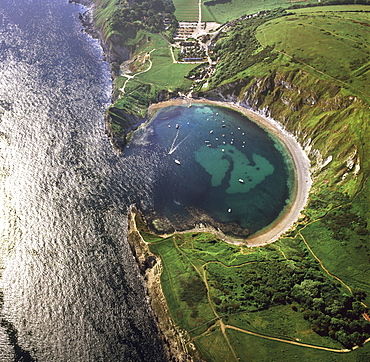
Aerial image of Lulworth Cove, a natural landform harbour, near West Lulworth, on the Jurassic Coast, UNESCO World Heritage Site, Dorset, England, United Kingdom, Europe
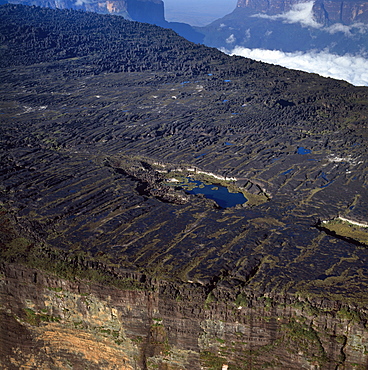
Aerial image of tepuis showing the summit of Mount Roraima (Cerro Roraima) with Lake Gladys, Venezuela, South America
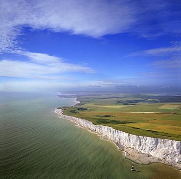
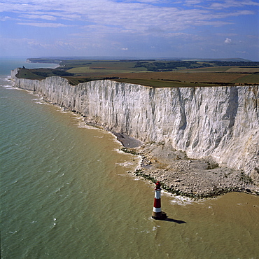
Aerial image of chalk cliffs and lighthouse at Beachy Head, near Eastbourne, East Sussex, England, United Kingdom, Europe
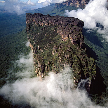
Aerial image of tepuis showing Mount Roraima (Cerro Roraima) from the north, Venezuela, South America
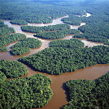
Aerial image of the Lower Mazaruni River with islands of tropical rain forest, Hororabo, near Bartica, Guyana, South America
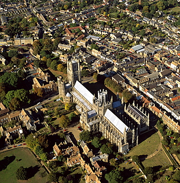
Aerial view of Ely Cathedral, (Cathedral Church of the Holy and Undivided Trinity), known as the Ship of the Fens, Ely, Cambridgeshire, England, United Kingdom, Europe
Aerial image of Wadakapiapetepui, Eastern chain of tepuis, Estado Bolivar, Venezuela, South America
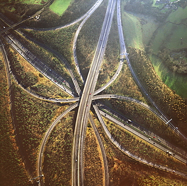
Aerial image of M25 and M23 Motorway Junction, Surrey, England, United Kingdom, Europe
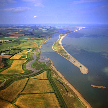
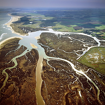
Aerial view of Orford Ness (Orfordness), a cuspate foreland shingle spit, Suffolk, England, United Kingdom, Europe
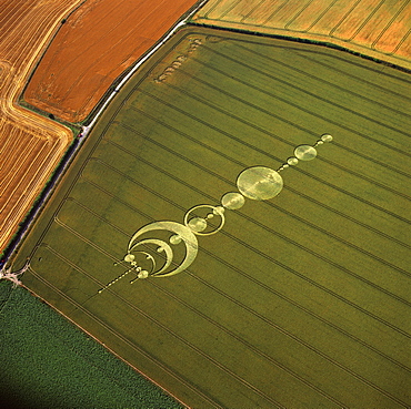
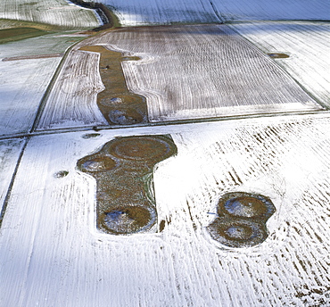
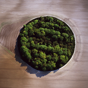
Aerial image of crop circle, Wiltshire, England, united Kingdom, Europe
Aerial view of the Westbury White Horse and the Iron Age Bratton Camp Hill Fort, Wiltshire, England, United Kingdom, Europe
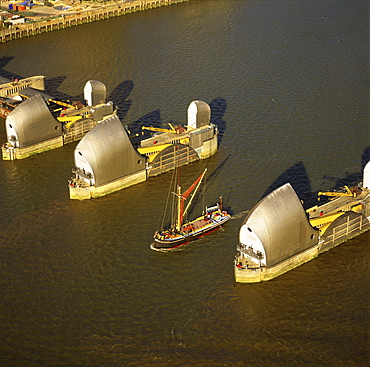
Aerial image of Thames sailing barge and Thames Flood Barrier across the River Thames, Woolwich Reach, Woolwich, London, England, United Kingdom, Europe
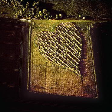
Aerial image of heart shape orchard, near Huish Hill earthwork, Oare, Wiltshire, England, United Kingdom, Europe
Aerial image of the Uffington White Horse with Uffington Castle hill fort, Berkshire Downs, Vale of White Horse, Oxfordshire, England, United Kingdom, Europe

Aerial image of city including Durham Castle, a Medieval castle, Norman Cathedral, and the River Wear, Durham, England, United Kingdom, Europe
Aerial image of Weiassipu, Eastern chain of tepuis, Estado Bolivar, Venezuela, South America
Aerial image of Lulworth Cove, a natural landform harbour, near West Lulworth, on the Jurassic Coast, UNESCO World Heritage Site, Dorset, England, United Kingdom, Europe
Aerial image of Normanton Down Barrows in snow, consisting of a Neolithic long barrow and Bronze Age round barrows, Wiltshire, England, United Kingdom, Europe
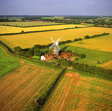
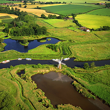
Aerial view of Bircham Windmill, Great Bircham, King's Lynn, Norfolk, England, United Kingdom, Europe
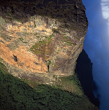
Aerial image of tepuis showing Angel Falls and Mount Auyantepui (Auyantepuy) (Devil's Mountain), Venezuela, South America
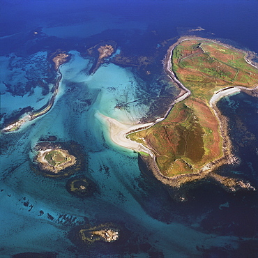
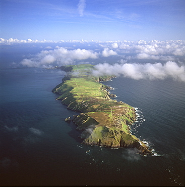
Aerial image of Samson, Isles of Scilly, off Cornwall, England, United Kingdom, Europe
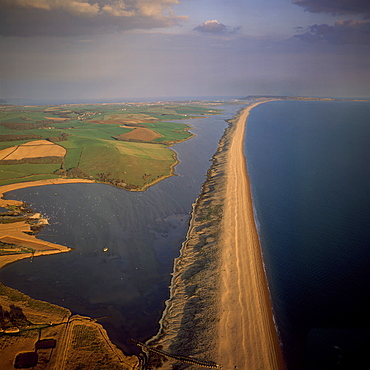
Aerial image of Chesil Beach (Chesil Bank), 29 km long shingle beach, a tombolo connecting mainland to the Isle of Portland, Jurassic Coast, UNESCO World Heritage Site, Dorset, England, United Kingdom, Europe
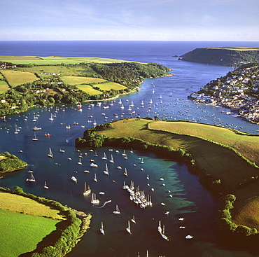
Aerial image of Salcombe and East Portlemouth, Kingsbridge Estuary, Devon, England, United Kingdom, Europe

Aerial view of the Norfolk Broads at Ludham Bridge, Norfolk, England, United Kingdom, Europe
Aerial view of Mount Visoke (Mount Bisoke), an extinct volcano straddling the border of Rwanda and Democratic Republic of the Congo (DRC) showing crater lake, with Mount Mikeno in background, Virunga Volcanoes, Great Rift Valley, Africa
Aerial image of Battlesbury Camp, an Iron Age Hill fort, Warminster, Wiltshire, England, United Kingdom, Europe
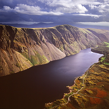
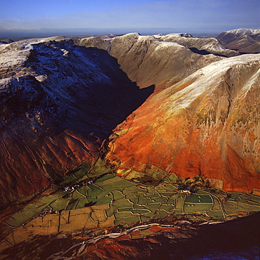
Aerial image of Wastwater Screes and Wast Water (Wastwater), the deepest lake in England, a good example of a glacially over-deepened valley, Wasdale Valley, Lake District National Park, Cumbria, England, United Kingdom, Europe
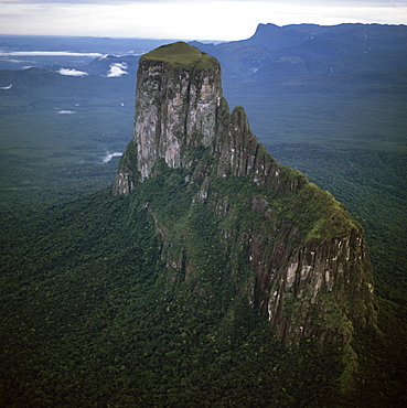
Aerial image of tepuis showing Mount Autana (Cerro Autana), Amazonas territory, Venezuela, South America
Aerial image of Maiden Castle, an Iron Age hill fort, Winterborne Monkton, near Dorchester, Dorset, England, United Kingdom, Europe
Aerial image of Mount Caburn with the remains of an Iron Age hill fort, east of Lewes, East Sussex, England, United Kingdom, Europe
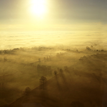
Aerial image of fog over the Somerset Levels, near Glastonbury, Somerset, England, United Kingdom, Europe
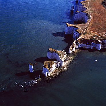
Aerial image of Old Harry Rocks, chalk stacks located directly east of Studland, north of Swanage, Dorset, England, United Kingdom, Europe
Aerial image of Wasdale Head, with St. Olaf's church, the smallest church in England, Brackenclose, Wasdale Fell, Kirk Fell, High Fell and Mosedale, Lake District National Park, Cumbria, England, United Kingdom, Europe
Aerial image of chalk cliffs and lighthouse, Beachy Head, near Eastbourne, East Sussex, England, United Kingdom, Europe
Aerial view of Meggs Hill (Gog Magog Downs) (Gog Magog Hills) (the Gogs), a range of low chalk hills, Cambridgeshire, England, United Kingdom, Europe
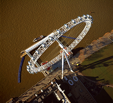
Aerial image of the London Eye (Millennium Wheel), South Bank of the River Thames, London, England, United Kingdom, Europe
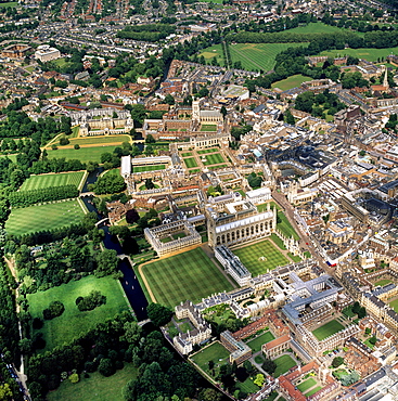
Aerial view of Cambridge including The Backs where several University of Cambridge colleges back on to the River Cam, Cambridge, Cambridgeshire, England, United Kingdom, Europe
Aerial view of intensive agriculture on Virunga foothills, Rwanda, Africa
Aerial image of Badbury Rings, an Iron Age hill fort, Dorset, England, United Kingdom, Europe
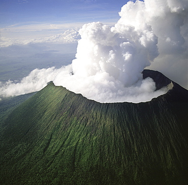
Aerial view of Mount Nyiragongo, an active volcano in the Virunga Mountains in Virunga National Park, near the border with Rwanda, known for its recent devastating eruptions, Democratic Republic of the Congo, Great Rift Valley, Africa
Aerial image of Chi-Chi Gorge, downstream from Chi-Chi Falls, Upper Mazaruni River, Upper Mazaruni District, Guyana, South America
Aerial image of Lundy Island looking from north to south, Bristol Channel, Devon, England, United Kingdom, Europe
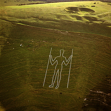
Aerial image of the Long Man of Wilmington, Wilmington, East Sussex, England, United Kingdom, Europe
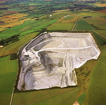
Aerial image of Westbury chalk quarry, with Westbury White Horse and Bratton Camp Hill Fort in background, Wiltshire, England, United Kingdom, Europe
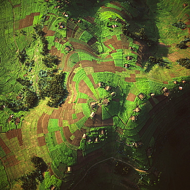
Aerial view of intensive agriculture in Rwanda, Africa
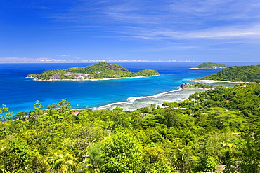
View across Anse l'Islette to the offshore islands of Therese and Conception from hillside above Port Glaud, Port Glaud district, Island of Mahe, Seychelles, Indian Ocean, Africa
Aerial view of island, Maldives, Indian Ocean, Asia
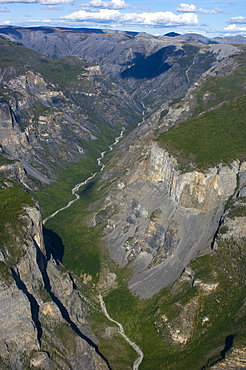
South Nahanni River, Nahanni National Park Reserve, Northwest Territories, Canada, North America
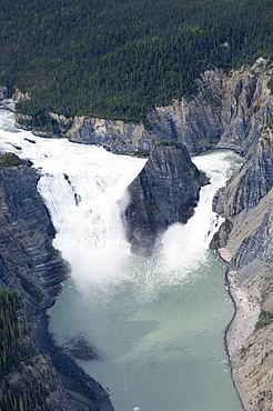
Virginia Falls, Nahanni National Park Reserve, Northwest Territories, Canada, North America
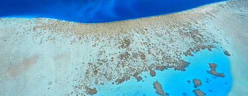
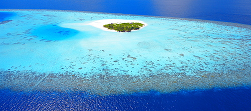
Aerial view of lagoon, Maldives, Indian Ocean, Asia
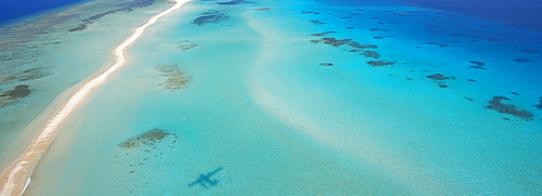
Aerial view of an sandbank and lagoon, Maldives, Indian Ocean, Asia
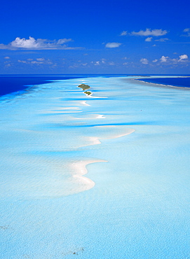
Aerial view of tropical island with lagoon, Maldives, Indian Ocean, Asia
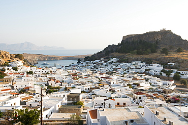
View over Lindos town, Rhodes, Dodecanese, Greek Islands, Greece, Europe
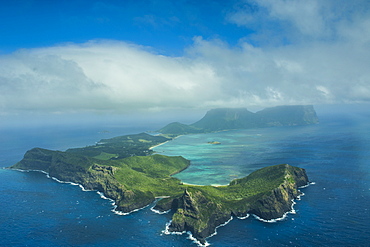
Aerial of Lord Howe Island, UNESCO World Heritage Site, Australia, Tasman Sea, Pacific
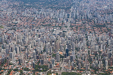
Aerial of Sao Paulo, Brazil, South America
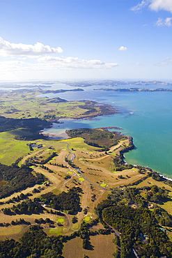
Aerial view over the Bay of Islands, Northland, North Island, New Zealand, Pacific
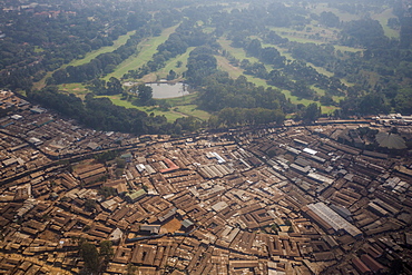
Aerial view of a slum on the outskirts of Nairobi, Kenya, East Africa, Africa
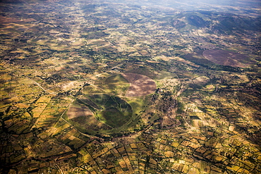
Aerial landscape, Kenya, East Africa, Africa
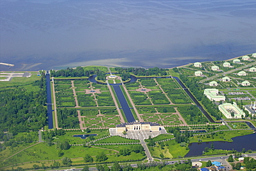
Aerial view of Constantine Palace, Strelna, near St. Petersburg, Russia, Europe
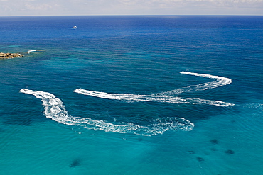
Aerial view of people on jet skis, Coral Bay, Paphos, Cyprus, Mediterranean, Europe
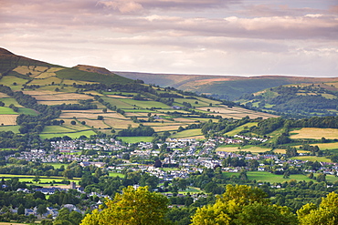
Aerial view of the towns of Crickhowell (Crug Hywel) and Llangattock (Llangatwg) in the Usk Valley, Brecon Beacons National Park, Powys, Wales, United Kingdom, Europe
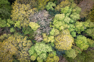
Broadleaves woodland canopy in spring, Edenbridge, Kent, England, United Kingdom, Europe
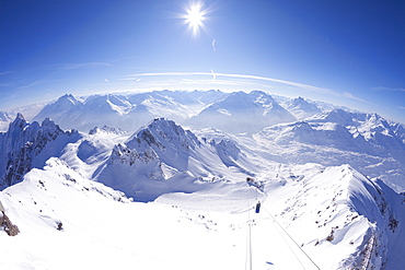
View from summit of Valluga in St. Anton am Arlberg in winter snow, Austrian Alps, Austria, Europe

Black and green dart frog (Dendrobates auratus), Costa Rica, Central America