Results
« Previous 1 2 3 4
350 results found
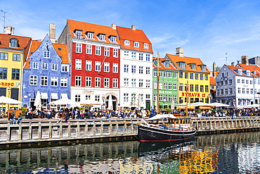
Nyhavn harbour with colourful houses reflected in the waters channel, daytime, Copenhagen, Denmark, Scandinavia, Europe

Elevated view of harbour and colourful houses in Assos, Assos, Kefalonia, Ionian Islands, Greek Islands, Greece, Europe
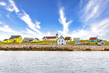
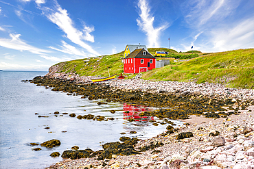
Old fishing houses, Ile aux Marins, fishermen's island, Territorial Collectivity of Saint-Pierre and Miquelon, Overseas Collectivity of France, North America
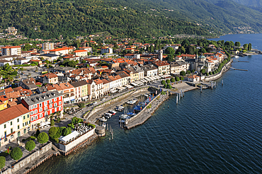
Cannobio, Lago Maggiore, Piedmont, Italian Lakes, Italy, Europe
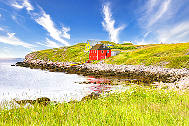
Lonely house above the basalt cliff near the harbour, Arnarstapi, Snaefellsjokull National Park, Snaefellsness peninsula, Vesturland, Western Iceland, Iceland, Polar Regions

The sun sets over a new home atop Mount Victoria in Wellington, North Island, New Zealand, Pacific
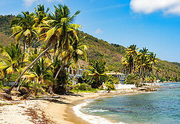
Patillas, south coast of Puerto Rico, Caribbean, Central America

Harbour of the little fishing village of Nusfjord, Lofoten, Nordland, Norway, Scandinavia, Europe
Joe Batt's Arm, Fogo Island, Newfoundland, Canada, North America
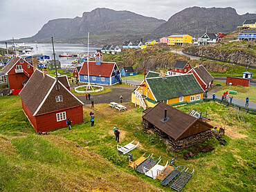
A view of the Bethel Church, blue building built in 1775, in the Town centre in the city of Sisimiut, Greenland, Denmark, Polar Regions
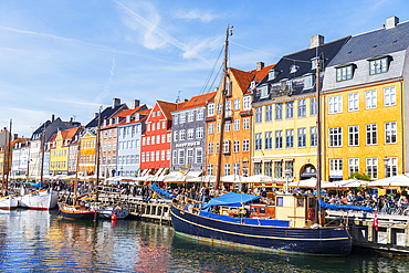
Colourful houses and wooden boats in Nyhavn harbour, Copenhagen, Denmark, Scandinavia, Europe
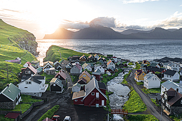
Aerial view of the coastal village of Gjogv and Kalsoy island at dawn, Eysturoy Island, Faroe Islands, Denmark, Europe
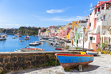
Multi-coloured houses and boats at Marina Corricella, Procida island, Naples Bay, Naples province, Phlegraean islands, Campania region, Italy, Europe
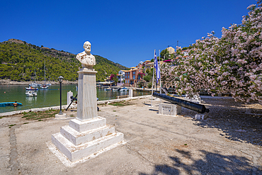
View of statue and colourful houses in Assos, Assos, Kefalonia, Ionian Islands, Greek Islands, Greece, Europe
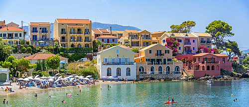
View of harbour and colourful houses in Assos, Assos, Kefalonia, Ionian Islands, Greek Islands, Greece, Europe
Moken, sea gypsy village on a white sand beach on Dome Island, Mergui (Myeik) Archipelago, Myanmar (Burma), Asia

The harbour at Mousehole, an historic and archetypal Cornish fishing village, seen at low tide, near Penzance, west Cornwall, England, United Kingdom, Europe

Old fishing houses, Ile aux Marins, fishermen's island, Territorial Collectivity of Saint-Pierre and Miquelon, Overseas Collectivity of France, North America
View of coastal path in Agia Effimia, Kefalonia, Ionian Islands, Greek Islands, Greece, Europe
Mountain refelcted in the water, Kystriksveien Coastal Road, Norway, Scandinavia, Europe

View of Skiathos Town from St. Nicholas Church, Skiathos Island, Sporades Islands, Greek Islands, Greece, Europe
View of Dalt Vila and harbour from defensive walls, UNESCO World Heritage Site, Ibiza Town, Eivissa, Balearic Islands, Spain, Mediterranean, Europe
Zapallar beach at sunset, Zapallar, Petorca Province, Valparaiso Region, Chile, South America
Mesa Pigadia Beach, Santorini, Cyclades, Greek Islands, Greece, Europe
Long sandy beach of Ramsberg, Lofoten, Nordland, Norway, Scandinavia, Europe
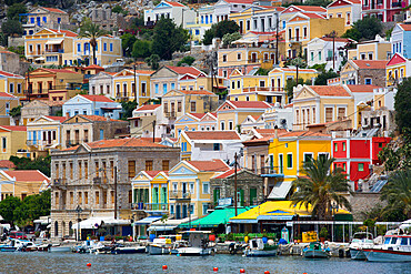
Gialos Harbor, Symi (Simi) Island, Dodecanese Island Group, Greek Islands, Greece, Europe
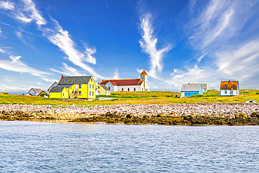
Old fishing houses, Ile aux Marins, fishermen's island, Territorial Collectivity of Saint-Pierre and Miquelon, Overseas Collectivity of France, North America
Luskentyre beach, Harris, Outer Hebrides, Scotland, United Kingdom, Europe
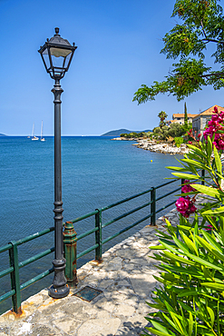
Lamp post on coastal path in Agia Effimia, Kefalonia, Ionian Islands, Greek Islands, Greece, Europe

Colorful houses of Valparaiso with harbor in background, Valparaiso, Valparaiso Province, Valparaiso Region, Chile, South America

View of beach front houses and Worthing Beach from the pier, Worthing, West Sussex, England, United Kingdom, Europe
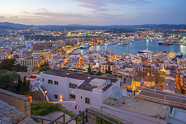
Elevated view of Dalt Vila district at dusk, UNESCO World Heritage Site, Ibiza Town, Eivissa, Balearic Islands, Spain, Mediterranean, Europe
Old fishing houses, Ile aux Marins, fishermen's island, Territorial Collectivity of Saint-Pierre and Miquelon, Overseas Collectivity of France, North America
Old fishing houses, Ile aux Marins, fishermen's island, Territorial Collectivity of Saint-Pierre and Miquelon, Overseas Collectivity of France, North America

Zapallar beach, Zapallar, Petorca Province, Valparaiso Region, Chile, South America
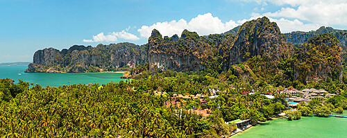
Railay Peninsula with West Rai Leh Beach and East Rai Leh Beach, Krabi, Thailand, Southeast Asia, Asia
A view of the village of Bjornsund, abandoned in 1968 to full time residents, Hustadvika Municipality, More og Romsdal, Norway, Scandinavia, Europe
Porto Faro beach, Palau, Sassari Province, Sardinia, Italy, Mediterranean, Europe
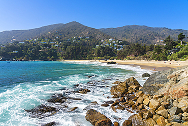
Zapallar beach, Zapallar, Petorca Province, Valparaiso Region, Chile, South America

Zapallar beach, Zapallar, Petorca Province, Valparaiso Region, Chile, South America
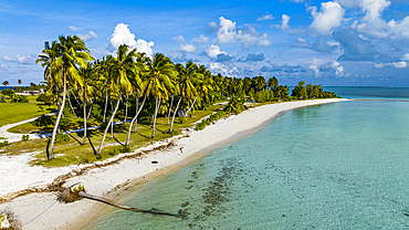
Aerial of white sand beach on Home Island, Cocos (Keeling) Islands, Australian Indian Ocean Territory, Australia, Indian Ocean
Old fishing houses, Ile aux Marins, fishermen's island, Territorial Collectivity of Saint-Pierre and Miquelon, Overseas Collectivity of France, North America
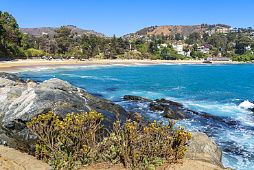
Zapallar beach, Zapallar, Petorca Province, Valparaiso Region, Chile, South America
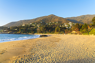
Zapallar beach at sunset, Zapallar, Petorca Province, Valparaiso Region, Chile, South America
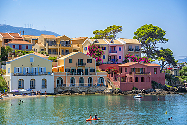
View of harbour and colourful houses in Assos, Assos, Kefalonia, Ionian Islands, Greek Islands, Greece, Europe
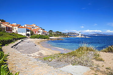
Porto Faro beach and lighthouse, Palau, Sassari Province, Sardinia, Italy, Mediterranean, Europe
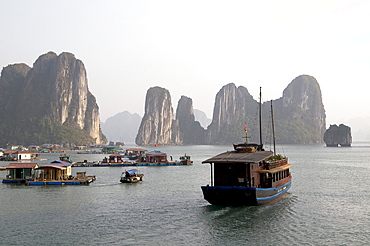
Vietnam, tourist and fishing boats in halong bay
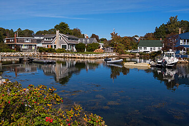
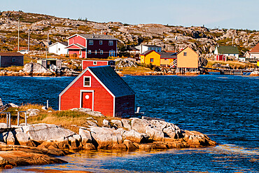
Harbour, Chester, Nova Scotia, Canada, North America
Zapallar beach, Zapallar, Petorca Province, Valparaiso Region, Chile, South America

Aerial of a little island at the Avatoru Pass, Rangiroa atoll, Tuamotus, French Polynesia, South Pacific, Pacific
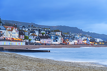
View from the beach of the colouful village of Lyme Regis at dusk, Jurassic Coast, UNESCO World Heritage Site, Dorset, England, United Kingdom, Europe
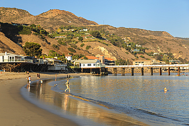
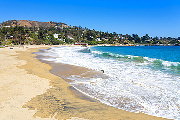
Malibu Surfrider Beach, Malibu, California, United States of America, North America
Sunrise in Sommaroy, Troms og Finnmark, north west Norway, Scandinavia, Europe
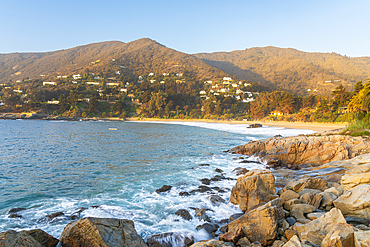
Zapallar beach at sunset, Zapallar, Petorca Province, Valparaiso Region, Chile, South America
Pablo Neruda beach house and garden, Pablo Neruda Museum, Isla Negra, Chile, South America
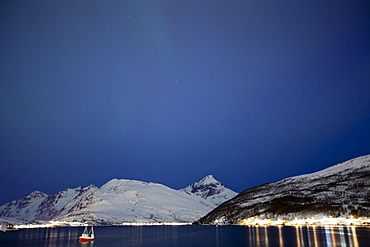
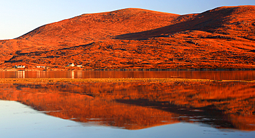
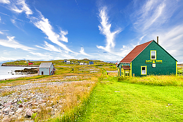
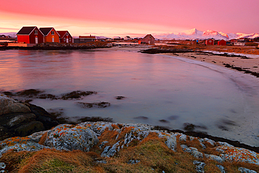
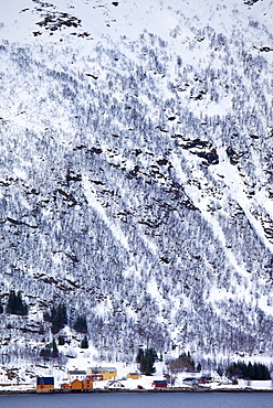
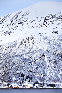
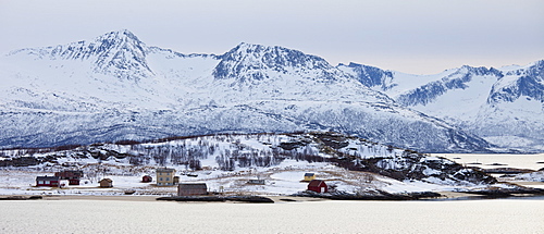
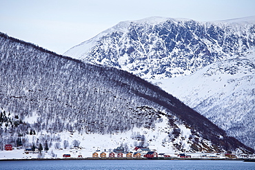
Hamlet on Kvaloya Island near Tromso in Arctic Circle Northern Norway
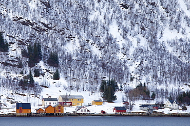
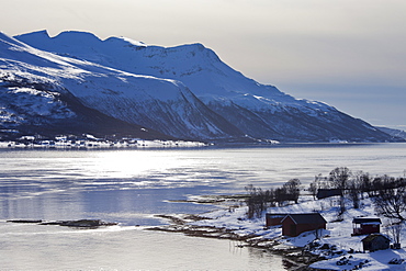
Homes and fishing huts in hamlet across fjord from Sandneshamnvegen 862 on Kvaloya Island, Tromso, Arctic Circle, Northern Norway
Homes and fishing huts in hamlet across fjord from Sandneshamnvegen 862 on Kvaloya Island, Tromso, Arctic Circle, Northern Norway
Homes and fishing huts in hamlet across fjord from Sandneshamnvegen 862 on Kvaloya Island, Tromso, Arctic Circle, Northern Norway
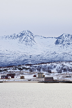
Hamlet on Kvaloya Island near Sommeroy in Arctic Circle Northern Norway
Hamlet on Kvaloya Island near Sommeroy in Arctic Circle Northern Norway
Hamlet on Kvaloya Island near Sommeroy in Arctic Circle Northern Norway

Hamlet on Kvaloya Island near Sommeroy in Arctic Circle Northern Norway
Homes and fishing huts in hamlet across fjord from Sandneshamnvegen 862 on Kvaloya Island, Tromso, Arctic Circle, Northern Norway
Homes and fishing huts in hamlet across fjord from Sandneshamnvegen 862 on Kvaloya Island, Tromso, Arctic Circle, Northern Norway

Housing in coastal town of Teignmouth, Devon, UK
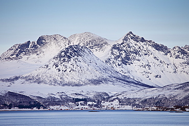
View across Tromso Sound to Tromso and the Lyngen Alps from Kvaloya Island in Arctic Circle Northern Norway
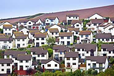
Housing in coastal town of Teignmouth, Devon, UK
Baracoa Beach, Guantanamo Province, Cuba, West Indies, Caribbean, Central America

Guardalavaca Beach at sunset, Holguin Province, Cuba, West Indies, Caribbean, Central America

Hardest hit was a 650 kilometers stretch of the somali coastline between garacad (mudung region) and xaafuun (bari region), which forms part of the puntland province near the horn of africa. The tsunami resulted in the death of some 300 people and extensive destruction of shelters, houses and water sources as well as fishing gear. The livelihoods of many people residing in towns and small villages along the somali indian ocean coastline, particularly in the northern regions, were devastated
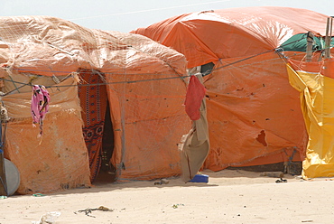
Hardest hit was a 650 kilometers stretch of the somali coastline between garacad (mudung region) and xaafuun (bari region), which forms part of the puntland province near the horn of africa. The tsunami resulted in the death of some 300 people and extensive destruction of shelters, houses and water sources as well as fishing gear. The livelihoods of many people residing in towns and small villages along the somali indian ocean coastline, particularly in the northern regions, were devastated
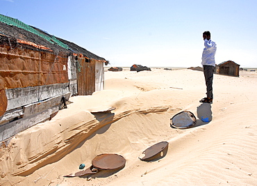
Hardest hit was a 650 kilometers stretch of the somali coastline between garacad (mudung region) and xaafuun (bari region), which forms part of the puntland province near the horn of africa. The tsunami resulted in the death of some 300 people and extensive destruction of shelters, houses and water sources as well as fishing gear. The livelihoods of many people residing in towns and small villages along the somali indian ocean coastline, particularly in the northern regions, were devastated
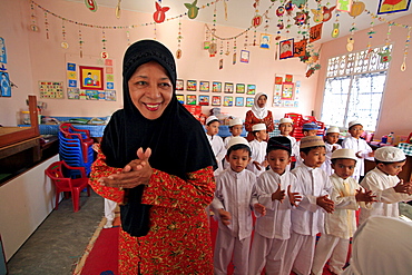
Indonesia a kindergarten in banda aceh which lost many of children to tsunami, been rebuilt. schools director halimah anwar bustam (seen here in foreground) describes horrors suffered: area kids came from completely flattened by waves. On that fateful sunday children were in their homes, or many were already on beach having. So many died that morning. It devastating. Only we getting things back together, very grateful to helping with reconstruction of damaged building. staff give up a portion of their (already) salaries to sponsor poor children from outlying villages to come to school. structure includes offices staff, a library, prayer room wheelchair accessible classroom.__ Photograph taken in banda aceh, -december 2006, 2 years after tsunami of december 26th 2004 devasted much of coastal region. Taken to illustrate reconstruction work projects of (catholic relief services) of sponsored photo tour
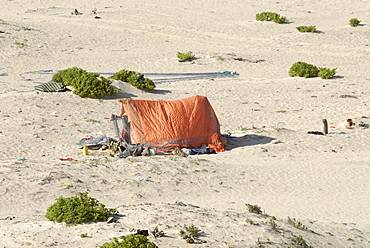
Hardest hit was a 650 kilometers stretch of the somali coastline between garacad (mudung region) and xaafuun (bari region), which forms part of the puntland province near the horn of africa. The tsunami resulted in the death of some 300 people and extensive destruction of shelters, houses and water sources as well as fishing gear. The livelihoods of many people residing in towns and small villages along the somali indian ocean coastline, particularly in the northern regions, were devastated
Hardest hit was a 650 kilometers stretch of the somali coastline between garacad (mudung region) and xaafuun (bari region), which forms part of the puntland province near the horn of africa. The tsunami resulted in the death of some 300 people and extensive destruction of shelters, houses and water sources as well as fishing gear. The livelihoods of many people residing in towns and small villages along the somali indian ocean coastline, particularly in the northern regions, were devastated

Hardest hit was a 650 kilometers stretch of the somali coastline between garacad (mudung region) and xaafuun (bari region), which forms part of the puntland province near the horn of africa. The tsunami resulted in the death of some 300 people and extensive destruction of shelters, houses and water sources as well as fishing gear. The livelihoods of many people residing in towns and small villages along the somali indian ocean coastline, particularly in the northern regions, were devastated

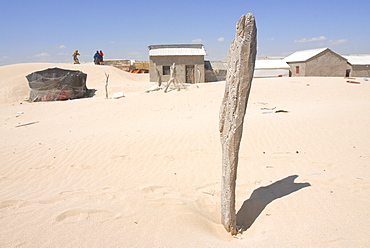
Eyl is a town in somalias puntland state. The prominent clan in eyl district are yonis idiris, a sub-clan of isse mahamud, which in turn is a sub-clan of majeerteen. Eyl is near the hafun peninsula, the location of most of somalias casualties from the 2004 indian ocean tsunami., the tsunami resulted in the death of some 300 people and extensive destruction of shelters, houses and water sources as well as fishing gear. The livelihoods of many people residing in towns and small villages along the somali indian ocean coastline, particularly in the northern regions, were devastated
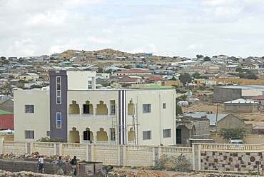
Somaliland, hargeissa, somaliland (officially soomaaliland in the somali language) is a de facto independent located in the horn of africa within the internationally recognized borders of somalia. On may 18, 1991, the people of somaliland declared independence from somalia however it was not recognised by any other country or international organisaion. The of somaliland consists of five administrative regions with governor as highest ranking leader of each region.Eletrical System

Eyl is a town in somalias puntland state. The prominent clan in eyl district are yonis idiris, a sub-clan of isse mahamud, which in turn is a sub-clan of majeerteen. Eyl is near the hafun peninsula, the location of most of somalias casualties from the 2004 indian ocean tsunami., the tsunami resulted in the death of some 300 people and extensive destruction of shelters, houses and water sources as well as fishing gear. The livelihoods of many people residing in towns and small villages along the somali indian ocean coastline, particularly in the northern regions, were devastated

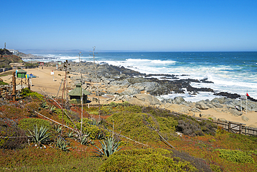
A holiday chalet in the sand dunes at low Newton by the Sea on Northumberland's coast stands precarioulsy close to the edge following a severe storm surge in December 2013 that caused considerable erosion to the sand dunes.

Hardest hit was a 650 kilometers stretch of the somali coastline between garacad (mudung region) and xaafuun (bari region), which forms part of the puntland province near the horn of africa. The tsunami resulted in the death of some 300 people and extensive destruction of shelters, houses and water sources as well as fishing gear. The livelihoods of many people residing in towns and small villages along the somali indian ocean coastline, particularly in the northern regions, were devastated

Hardest hit was a 650 kilometers stretch of the somali coastline between garacad (mudung region) and xaafuun (bari region), which forms part of the puntland province near the horn of africa. The tsunami resulted in the death of some 300 people and extensive destruction of shelters, houses and water sources as well as fishing gear. The livelihoods of many people residing in towns and small villages along the somali indian ocean coastline, particularly in the northern regions, were devastated
Somaliland, hargeissa., somaliland (officially soomaaliland in the somali language) is a de facto independent located in the horn of africa within the internationally recognized borders of somalia. On may 18, 1991, the people of somaliland declared independence from somalia however it was not recognised by any other country or international organisaion. The of somaliland consists of five administrative regions with governor as highest ranking leader of each region

Large Swimming Pool and Deck in Coastal Mansion

Palm trees on stone patio at sunset
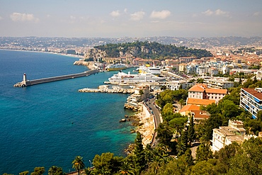
Overlooking Nice harbour and town, Nice, France
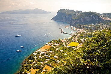
View of Isle of Capri coastline and Marina Grande, from Villa San Michele, Capri, Italy
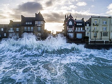
Storm Ciara in Saint-Malo.
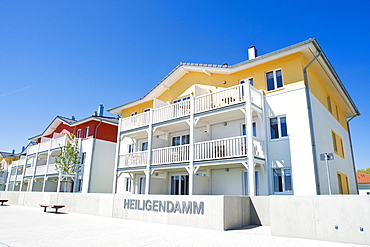
TUI Hotel Resort Marina Boltenhagen, Boltenhagen, Mecklenburg-Western Pomerania, Germany, Europe
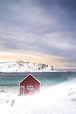
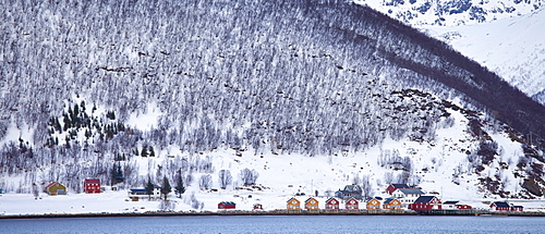
Red Rorbuer fishing hut on the beach in the snow, Ramberg, Flakstadoya, Lofoten, Norway, Europe
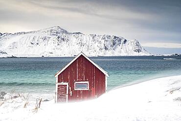
Red Rorbuer fishing hut on the beach in the snow, Ramberg, Flakstadoya, Lofoten, Norway, Europe
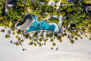
Helicopter view, Six Senses Kanuhura Island Resort, with beaches and water bungalows, Lhaviyani Atoll, Maldives, Indian Ocean, Asia

Mediterranean old town with old alleys and houses in the morning, Baska, Island Krk, Croatia, Europe
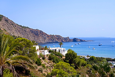
Finca above the bay of Cala des Jondal, Ibiza, Balearic Islands, Spain, Europe
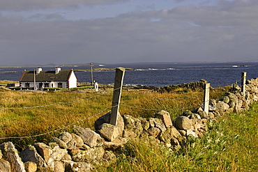
Cottage on coastal landscape, Cleggan, Connemara, Republic of Ireland, Europe
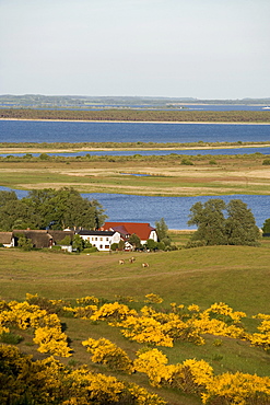
View of the village Grieben from the Dornbusch, hill, Hiddensee Island, Baltic Sea, Mecklenburg-Western Pomerania, Germany, Europe
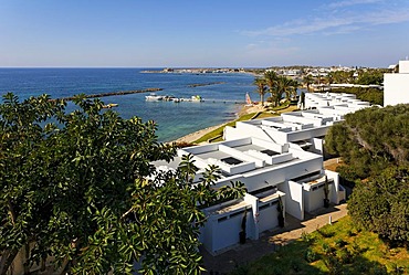
Bungalows in a row, beach, bay, fort, historc centre, Almyra Hotel, Paphos, Cyprus, Asia

Mediterranean old town with old streets and houses in the morning, restaurant, Baska, island Krk, Croatia, Europe
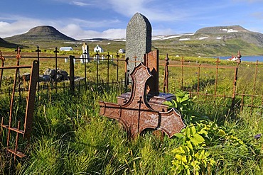
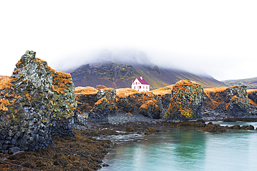
Old cemetery, Hesteyri, Hesteyrarfjoerur or Joekulfirir, Hornstrandir hiking paradise, Westfjords, Iceland, Europe