Results
« Previous 1 2 3 4 5 6 … 9 Next »
822 results found
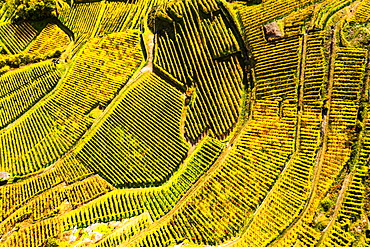
View by drone of top-down high angle view of vineyards, Valtellina, Lombardy, Italy, Europe

View from Cerro Monserrate, Bogota, Cundinamarca, Colombia, South America
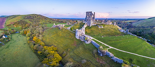
View by drone of Corfe Castle, Dorset, England, United Kingdom, Europe
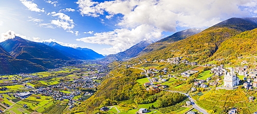
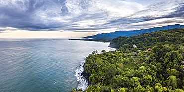
Aerial view by drone of Valtellina in autumn, Lombardy, Italy, Europe

View by drone of Southwold Lighthouse, Southwold, Suffolk, England, United Kingdom, Europe

Aerial view by drone of jeeps and camping tents in the desert, Semera, Afar Region, Ethiopia, Africa
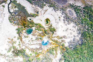
Aerial view by drone of Ala Lobet (Alol Bet) geyser erupting, Semera, Afar Region, Ethiopia, Africa

Aerial view of skyscrapers and traffic, Seoul, South Korea, Asia
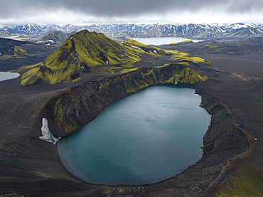
Aerial view taken by drone of Landmannalaugar mountain on a cloudy summer day, Iceland, Polar Regions

Aerial view taken by drone of Landmannalaugar area on a summer day, Iceland, Polar Regions
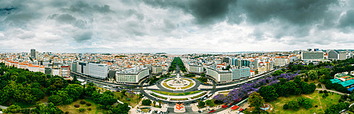
Aerial drone panoramic view of Parque Eduardo XII and Marques the Pombal looking south with Avenida da Liberdade in Lisbon, Portugal, Europe
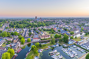
Drone view of Ely Cathedral with Ely Marina and Great Ouse River in foreground, Ely, Cambridgeshire, England, United Kingdom, Europe
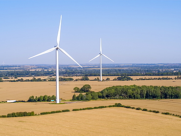
Drone view of Cotton Farm Wind Farm, Cambridgeshire, England, United Kingdom, Europe
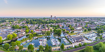
Drone view of Ely Cathedral with Ely Marina and Great Ouse River in foreground, Ely, Cambridgeshire, England, United Kingdom, Europe
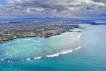
Dramatic sky over coral reef and inland, aerial view by drone Grand Baie (Pereybere), north-west coast, Mauritius, Indian Ocean, Africa
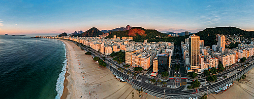
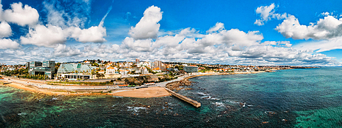
Aerial drone view of Copacabana Beach and urban setting at sunrise, UNESCO World Heritage Site, Rio de Janeiro, Brazil, South America
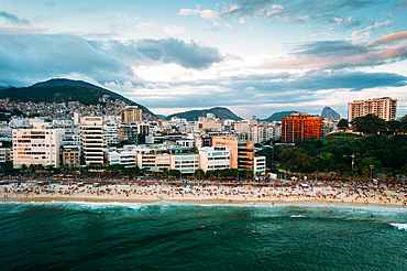
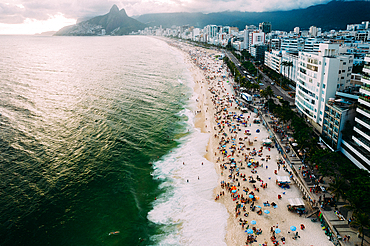
Aerial drone view of Ipanema Beach and neighbourhood, Rio de Janeiro, Brazil, South America
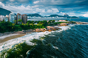
Aerial drone view of Arpoador section of Ipanema Beach with Copacabana and Sugarloaf Mountain visible in the background, Rio de Janeiro, Brazil, South America
Aerial drone view of Ipanema and Leblon beaches, Rio de Janeiro, Brazil, South America
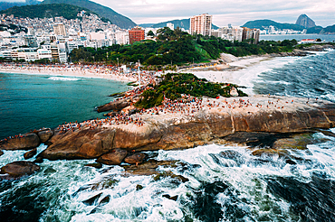
Aerial drone view of Arpoador Rock in Ipanema Beach, with Praia Vermelha visible on right, Rio de Janeiro, Brazil, South America

Aerial view by drone of mist over Restormel Castle in Cornwall, England, United Kingdom, Europe

Aerial view by drone of Kingsbridge Estuary and Salcombe in Devon, England, United Kingdom, Europe

Aerial view by drone of State Opera House, Varna, Bulgaria, Europe

Aerial view by drone of ruins of Eumolpias, a Thracian settlement in 5000 BC, Plovdiv, Bulgaria, Europe

Aerial view by drone of Ivan Vazov National Theatre, Sofia, Bulgaria, Europe
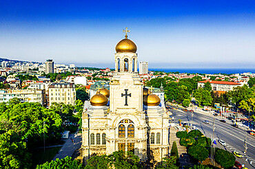
Aerial view by drone of Mother of God Cathedral, Varna, Bulgaria, Europe
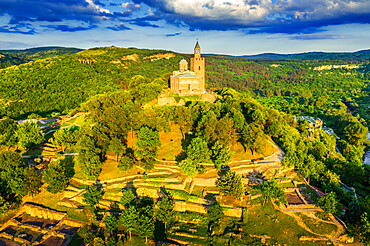
Aerial view by drone of Tsarevets fortress, Veliko Tarnovo, Bulgaria, Europe

Aerial view by drone of Ivan Vazov National Theatre, Sofia, Bulgaria, Europe

Aerial view by drone of Kaleto Rock Fortress rock formations, Belogradchik, Bulgaria, Europe
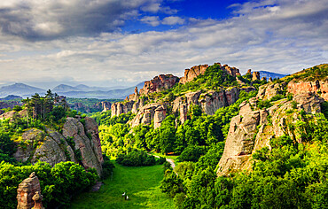
Aerial view by drone of rock formations and forest, Belogradchik, Bulgaria, Europe
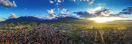
Aerial view by drone of Bansko and Pirin National Park, UNESCO World Heritage Site, Bankso, Bulgaria, Europe

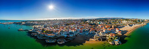
Aerial drone panoramic view of sunset at Cascais Bay, in the Lisbon region of the Portuguese Riveira, Europe
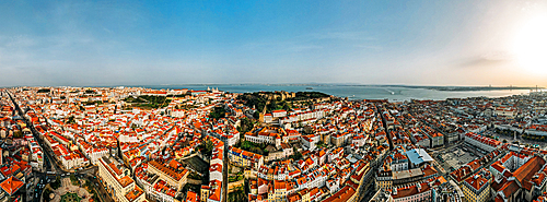
Aerial drone view of Baixa District, facing south towards the Tagus River with the major landmarks visible including St. George Castle, Pantheon, Figueira, Rossio Square, Martim Moniz Squares, Lisbon, Portugal, Europe
Aerial drone panoramic view of Cascais, on the Portuguese Riviera, in region known as the Green Coast due to the colour of the water, with beaches inclding Rainha, Duquesa and Conceicao, Portugal, Europe

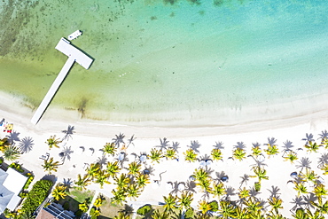
Aerial view of tropical beach and palm trees, The Maldives, Indian Ocean, Asia (Drone)

Aerial panoramic view of Lake Sils and Plaun da Lej during winter, Maloja Region, Canton of Graubunden, Engadine, Switzerland, Europe (Drone)
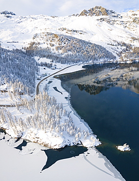
Aerial panoramic view of road around frozen Lake Sils, Plaun da Lej, Maloja Region, Canton of Graubunden, Engadine, Switzerland, Europe (Drone)
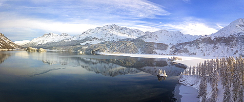
Aerial panoramic view of Lake Sils and Plaun da Lej during winter, Maloja Region, Canton of Graubunden, Engadine, Switzerland, Europe (Drone)
Aerial view of Rio Tinto, by drone, Huelva District, Andalucia, Spain, Europe
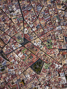
Aerial view of Cadiz, by drone, Andalucia, Spain, Europe
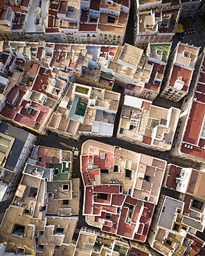
Aerial view by drone of Cadiz, Andalucia, Spain, Europe
Aerial view of Rio Tinto, by drone, Huelva District, Andalucia, Spain, Europe
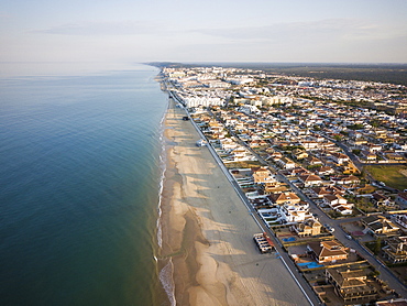
Aerial view of Matalascanas, by drone, Huelva District, Andalucia, Spain, Europe
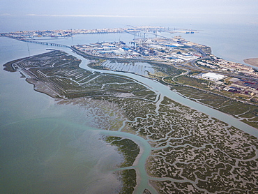
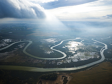
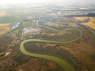
Aerial view, by drone, of San Fernando marshes, Bahia de Cadiz, Cadiz, Andalucia, Spain, Europe
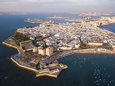
Aerial view, by drone, of Cadiz, Andalucia, Spain, Europe
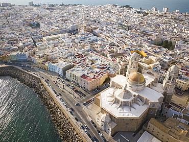
Aerial view of Cadiz Cathedral, by drone, Cadiz, Andalucia, Spain, Europe
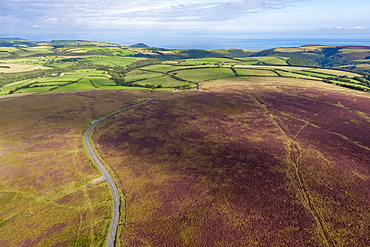
Aerial view over the moors, Exmoor National Park, Devon, England, United Kingdom, Europe
Aerial drone panoramic view of promenade in Cascais, on the Portuguese Riveira 30km west of Lisbon, with Estoril visible on the far right, Cascais, Portugal, Europe
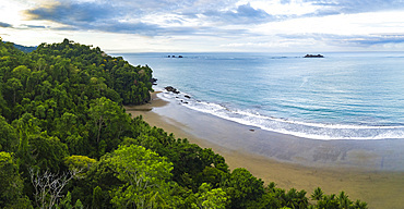
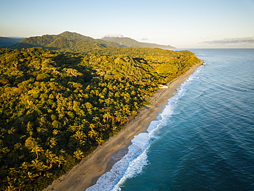
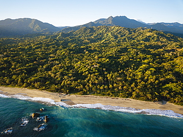
Drone view of Arco Beach and rainforest at sunrise, Uvita, Puntarenas Province, Pacific Coast of Costa Rica, Central America

Drone view of Punta Leona Beach, Puntarenas Province, Pacific Coast of Costa Rica, Central America
Drone view of Arco Beach and rainforest at sunrise, Uvita, Puntarenas Province, Pacific Coast of Costa Rica, Central America
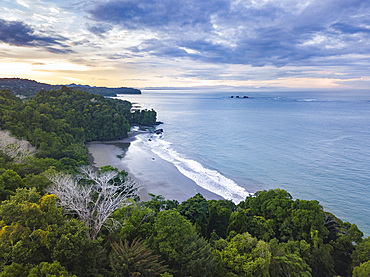
Drone view of Arco Beach and rainforest at sunrise, Uvita, Puntarenas Province, Pacific Coast of Costa Rica, Central America
Drone view of Arco Beach and rainforest at sunrise, Uvita, Puntarenas Province, Pacific Coast of Costa Rica, Central America

Aerial view by drone of man and woman running on white sand beach, Antilles, West Indies, Caribbean, Central America

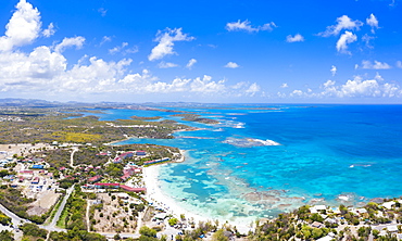
Aerial panoramic by drone of Fort James, St. John's, Antigua, Leeward Islands, West Indies, Caribbean, Central America

White limestone cliffs Pillar of Hercules washed by Caribbean Sea, aerial view by drone, English Harbour, Antigua, Leeward Islands, West Indies, Caribbean, Central America

Aerial view by drone of a shipwreck in the shallow water of blue Caribbean Sea, Antilles, West Indies, Caribbean, Central America

Aerial panoramic by drone of the coral reef around Long Bay, Antigua, Antigua and Barbuda, Leeward Islands, West Indies, Caribbean, Central America
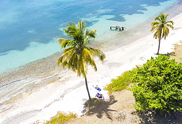
Aerial view by drone of beach umbrellas on tropical palm-fringed beach washed by Caribbean Sea, Antilles, West Indies, Caribbean, Central America

Aerial view by drone of sailboats and catamarans moored in the Caribbean Sea, Antilles, West Indies, Caribbean, Central America

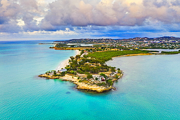
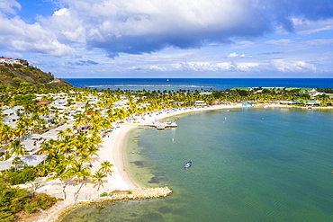
Aerial view by drone of Hermitage Bay and Caribbean Sea, Antigua, Antigua and Barbuda, Leeward Islands, West Indies, Caribbean, Central America
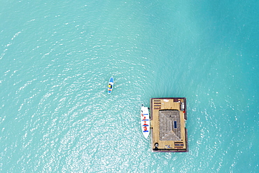
Aerial view by drone of man on paddleboard approaching the floating Ocean Bar, Caribbean, Antilles, West Indies, Caribbean, Central America
Aerial view by drone of Fort James surrounded by Caribbean Sea, St. John's, Antigua, Leeward Islands, West Indies, Caribbean, Central America
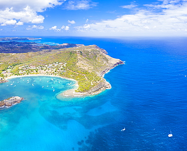
Aerial view by drone of St. James Bay, Antigua, Antigua and Barbuda, Leeward Islands, West Indies, Caribbean, Central America
Aerial panoramic by drone of Galleon Beach and Pillar of Hercules limestone cliffs, Antigua, Antigua and Barbuda, Leeward Islands, West Indies, Caribbean, Central America
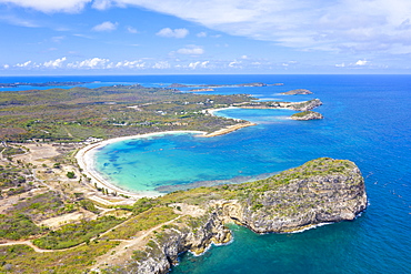
Aerial view by drone of cliffs surrounding Half Moon Bay washed by Caribbean Sea, Antigua, Leeward Islands, West Indies, Caribbean, Central America
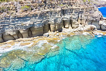
White limestone cliffs Pillar of Hercules washed by Caribbean Sea, aerial view by drone, English Harbour, Antigua, Leeward Islands, West Indies, Caribbean, Central America
Aerial panoramic by drone of coral reef along Long Bay beach, Antigua, Antigua and Barbuda, Leeward Islands, West Indies, Caribbean, Central America

Aerial view by drone of the crystal Caribbean Sea, Urlings, Antigua, Antigua and Barbuda, Leeward Islands, West Indies, Caribbean, Central America
Man and woman relaxing on palm-fringed beach, aerial view by drone, Caribbean Sea, Antilles, West Indies, Caribbean, Central America
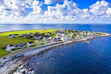
Aerial view by drone of the coastal village of Alnes, Godoya Island, Alesund, More og Romsdal County, Norway, Scandinavia, Europe
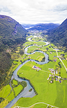
Aerial panoramic of serpentine shape of Stryneelva river, Stryn, Nordfjorden, Sogn og Fjordane county, Norway, Scandinavia, Europe
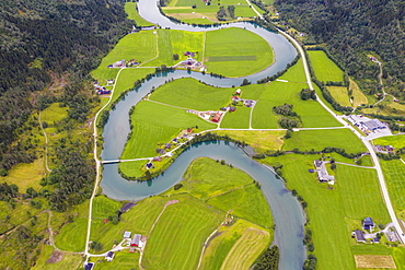
Aerial view of the winding course of Stryneelva river, Stryn, Nordfjorden, Sogn og Fjordane county, Norway, Scandinavia, Europe

Aerial view by drone of Varenna, Lake Como, Lombardy, Italian Lakes, Italy, Europe
Aerial view by drone of Playa los Angeles, Magdalena Department, Caribbean, Colombia, South America

Aerial view by drone of Basketball Court, Cartagena, Bolivar Department, Colombia, South America
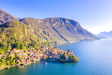
Aerial view by drone of Varenna, Lake Como, Lombardy, Italian Lakes, Italy, Europe

Aerial view by drone of foggy sky at sunset over Ra Gusela and Giau Pass in autumn, Dolomites, Belluno, Veneto, Italy, Europe
Aerial view by drone of Playa los Angeles, Magdalena Department, Caribbean, Colombia, South America

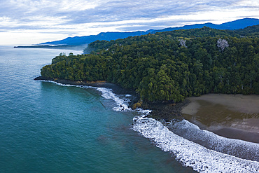
Aerial view by drone of Tayrona National Park, Magdalena Department, Caribbean, Colombia, South America

Aerial view by drone of Tayrona National Park, Magdalena Department, Caribbean, Colombia, South America

Aerial view by drone of Cartagena, Bolivar Department, Colombia, South America
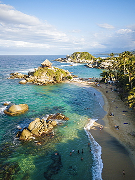
Aerial view by drone of Tayrona National Park, Magdalena Department, Caribbean, Colombia, South America

Aerial view by drone of Playa los Angeles, Magdalena Department, Caribbean, Colombia, South America
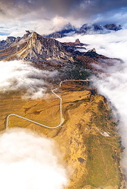
Aerial view by drone of Giau Pass, Ra Gusela and Cinque Torri in the mist of autumn, Dolomites, Belluno province, Veneto, Italy, Europe

Aerial view by drone of Tayrona National Park, Magdalena Department, Caribbean, Colombia, South America
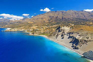
Aerial view of Agios Pavlos Beach on the island of Crete, Greek Islands, Greece, Europe

Aerial view by drone of snow capped Piz Da La Margna and Lake Sils at sunrise, Engadine, canton of Graubunden, Switzerland, Europe

Aerial view by drone of Bernina Group and Biancograt mountain, Engadine, canton of Graubunden, Switzerland, Europe

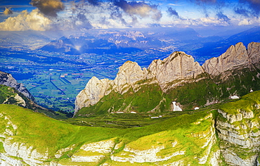
Aerial view by drone of the majestic ridge and peak of Piz Nair in summer, Engadine, canton of Graubunden, Switzerland, Europe

Aerial view of the old Vezio Castle on hills above Varenna at sunset, Lake Como, Lecco province, Lombardy, Italian Lakes, Italy, Europe
Sunset on Saxer Lucke with the town of Buchs in St. Gallen canton in the background, aerial view, Appenzell Canton, Switzerland, Europe

Aerial view of sunset over Santis and Saxer Lucke mountain peaks, Appenzell Canton, Alpstein Range, Switzerland, Europe
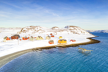
Aerial view of the fishing village of Veines in winter, Kongsfjord, Varanger Peninsula, Finnmark, Norway, Scandinavia, Europe
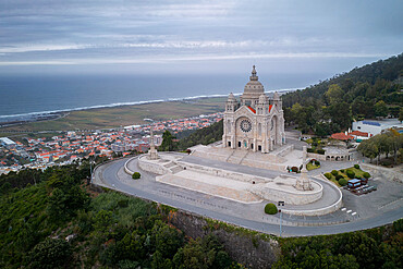
Santa Luzia Church sanctuary, drone aerial view, Viana do Castelo, with Atlantic Ocean in the background, Norte, Portugal, Europe
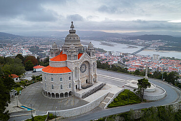
Santa Luzia Church sanctuary, drone aerial view, Viana do Castelo, with city and River Lima in the background, Norte, Portugal, Europe

City drone aerial view at sunset with iconic Palace, Mafra, Portugal, Europe
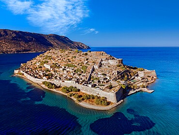
Drone view of Spinalonga, former leper colony fortress, Crete, Greek Islands, Greece, Europe
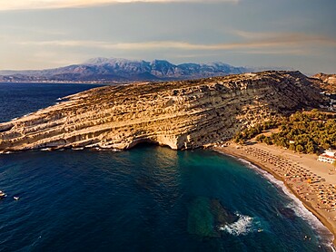
Drone view of Matala artificial caves on the rock by the beach at Crete, Greek Islands, Greece, Europe
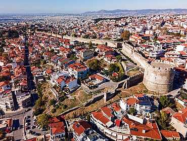
Drone view of Trigonion Chain defensive Tower and fortifications at upper town of Ano Poli in Thessaloniki, Greece, Europe