Results
« Previous 1 2 3 4
334 results found
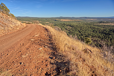
Road to the summit of Apache Maid Mountain, Coconino National Forest, Arizona, United States of America
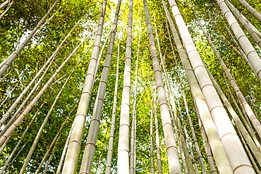
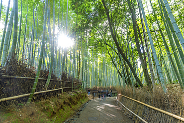
Towering bamboo trees forming a natural canopy in the Arashiyama Bamboo Forest, Kyoto, Honshu, Japan
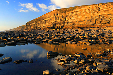
Dunraven Bay, Southerndown, South Wales, United Kingdom
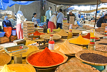
Display of spices at the Large Market at Chefchaouen, Rif region, Morocco
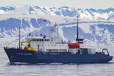
A view of the expedition ship Akademik Shokalskiy operating in the Svalbard Archipelago, Norway

Desert landscape in the far southwest of Saint Anthony, Cape Verde

The spectacular scenery of the north coast and volcanic highlands of Saint Anthony, Cape Verde

The dramatic scenery in the volcanic highlands of northern Saint Anthony, Cape Verde

Streets of Osaka, Japan. a blue bus amidst skyscraper in the Nakanoshima area.
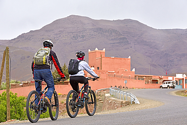
Cyclists with mountain pedelec on road connecting Tizi n'Tichka Pass to Telouet village, Ouarzazate Province, region of Draa-Tafilalet, Morocco
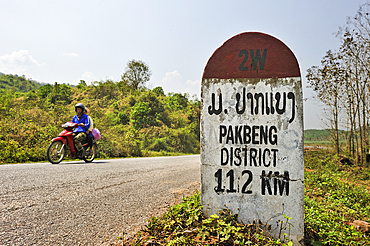
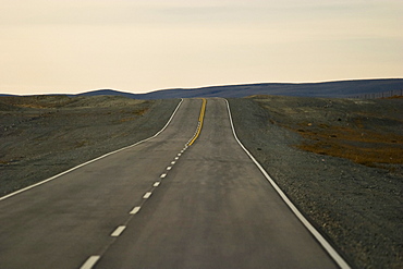
Kilometre-marker on the 2W road leading to Pakbeng, Laos
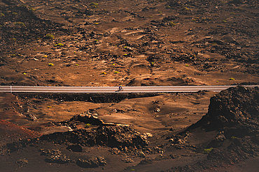
A cyclist cycling on a road in the Timanfaya national park in Lanzarote in the Canary Islands, Spain
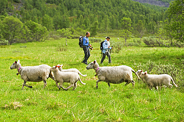
Trekkers and sheep on the way up to the Steindalsbreen glacier, Lyngen Alps, region of Lyngen, County of Troms, Norway, Northern Europe
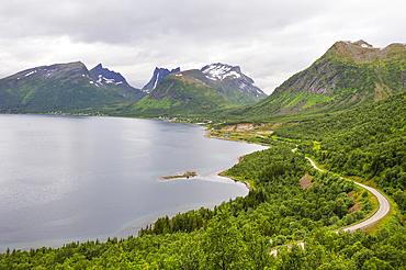
Panorama over the fjord Bergsfjorden on National Tourist Route on the west coast of Senja Island, Selected as one of the most spectacular landscapes in Norway, County of Troms, Norway, Northern Europe
View point along the National tourist route on the west coast.Senja island.County of Troms, Norway, Northern Europe
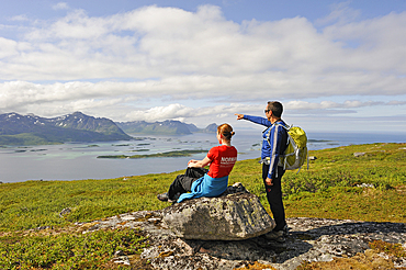
Trekkers having a break with view over the fjord Bergsfjorden from Husfjellet mountain, Senja island, County of Troms, Norway, Northern Europe
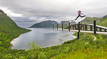
Young woman jumping over the fjord Bergsfjorden, Landscaping of the National Tourist Route on west coast of Senja Island, Selected as one of the most spectacular landscapes in Norway, County of Troms, Norway, Northern Europe
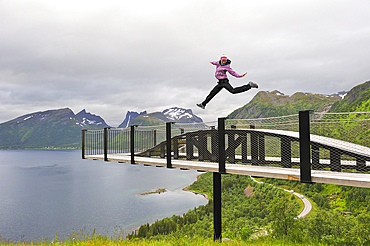
Young woman jumping over the fjord Bergsfjorden, Landscaping of the National Tourist Route on west coast of Senja Island, Selected as one of the most spectacular landscapes in Norway, County of Troms, Norway, Northern Europe
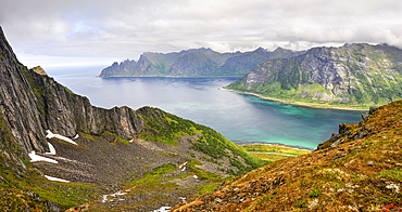
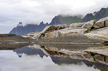
View over the fjords Steinfjorden and Ersfjorden from Husfjellet mountain.Senja island.County of Troms, Norway, Northern Europe
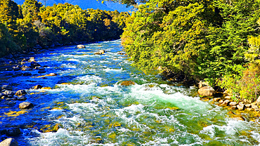
River valley, South Island, New Zealand
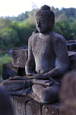
Stone Buddha statue, Borobudur, 9th-century Mahayana Buddhist temple, UNESCO, Java, Indonesia
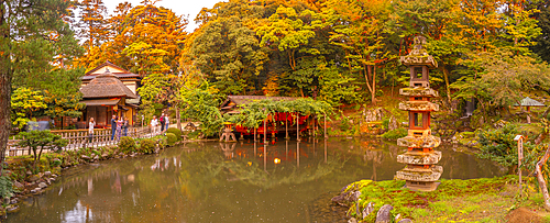
View of Hisago-ike Pond and Kaiseki Pagoda in Kenrokumachi Japanese Garden, Kanazawa City, Ishikawa Prefecture, Honshu, Japan
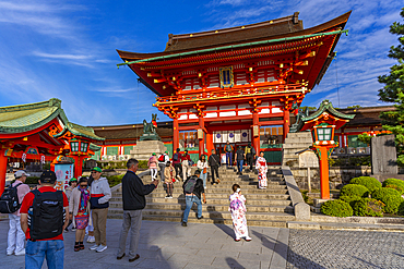
View of Fushimi Inari Shrine at dusk, Fukakusa Yabunouchicho, Fushimi Ward, Kyoto, Honshu, Japan
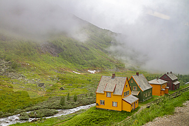
Views from the Bergen Railway route from Myrdal to the town of Flam, Norway, Scandinavia, Europe
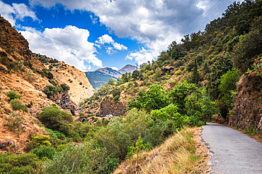
Hiking trail along rugged arid mountain valley of the Sierra Nevada, Andalusia, Spain, Europe
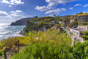
View of coastline from elevated position in Sant'Angelo, Sant'Angelo, Island of Ischia, Campania, Italy, Europe
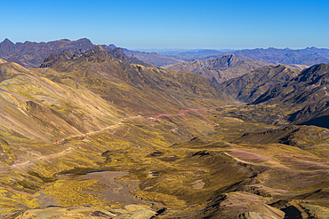
Trail leading through valley to Rainbow Mountain, Uchullujllo, Pitumarca District, Canchis Province, Cuzco Region, Peru, South America
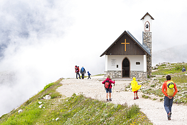
Cappella degli Alpini in the fog, Three Peaks Nature Park, Dolomites, South Tyrol (Alto Adige), Italy
View of Bamboo walkway, Sagatenryuji Tateishicho, Ukyo Ward, Kyoto, Honshu, Japan
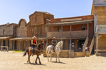
Fort Bravo (Texas Hollywood), Tabernas, Almeria, Andalusia, Spain
Cathedral of Santiago de Compostela (Cathedral of Saint James of Compostela), UNESCO, Santiago de Compostela, Galicia, Spain
Cathedral of Santiago de Compostela (Cathedral of Saint James of Compostela), UNESCO, Santiago de Compostela, Galicia, Spain
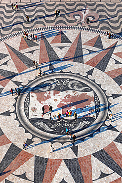
Pavement map showing routes of Portugese explorers below Monument to the Discoveries, Belem, Lisbon, Portugal, Europe
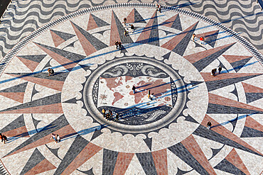
Pavement map showing routes of Portugese explorers below Monument to the Discoveries, Belem, Lisbon, Portugal, Europe
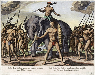
llustration of the King of Cochin, from the Itinerario of Jan Huygen van Linschoten, the 16th century Dutch traveller credited with stealing the Portuguese navigation secret and opening the Eastern route to Dutch and British ships, India, Asia
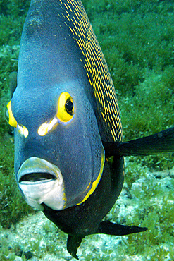
French angelfish, Pomacanthus paru, Ilha rata, Fernando de Noronha national marine sanctuary, Pernambuco, Brazil (S. Atlantic)

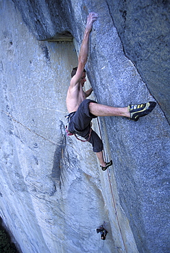
Kevin Jorgeson climbing "Fantasia" at Lover's Leap, a popular granite climbing destination near Lake Tahoe in California's Sierra Nevada mountains. The cliff is known for its distinct horizontal quartz dikes which make interesting climbing. This route is considered a risky mental test piece because of its lack of good cracks for protection. It was first climbed in 1973 by Royal Robbins and Ken Wilson.
Tommy Caldwell free climbing on the crux pitch, 5.14, of the Dihedral Wall during his first ascent of the route on El Capitan in Yosemite National Park in the Sierra Nevada Mountains, California.
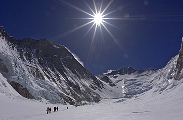
Climbers make their way to Advanced Basecamp (ABC) through the massive Western Cwm (glacial valley) on the Southeast Ridge route on Mt. Everest, Nepal. Everest's Southwest Face rises to the left with Lhotse and the Lhotse Face in the distance. Jake Norton, 4, 20, 2002, Western Cwm, Everest, Nepal.
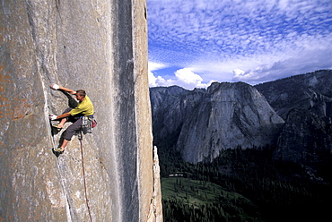
Tommy Caldwell on the head wall of the Dihedral Wall during his first ascent of the route on El Capitan in Yosemite National Park in the Sierra Nevada Mountains, California. He is crack climbing a 5.13 pitch. Half Dome is visible in the distance.
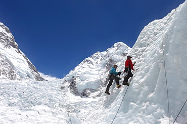
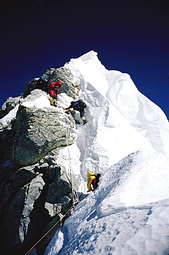
Mountaineers climbing up the Khumbu Icefall on the route up Everest, Everest Base Camp, Khumbu, Nepal
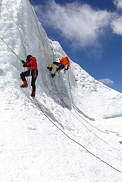
Mountaineers climbing up the Khumbu Icefall on the route up Everest, Everest Base Camp, Khumbu, Nepal
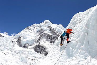
Mountaineers climbing up the Khumbu Icefall on the route up Everest, Everest Base Camp, Khumbu, Nepal
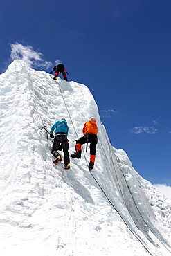
Mountaineers climbing up the Khumbu Icefall on the route up Everest, Everest Base Camp, Khumbu, Nepal
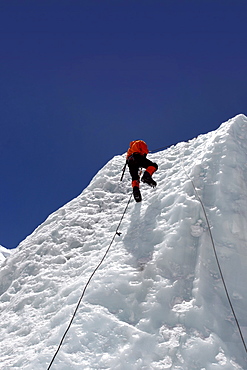
Mountaineers climbing up the Khumbu Icefall on the route up Everest, Everest Base Camp, Khumbu, Nepal
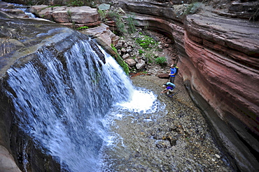
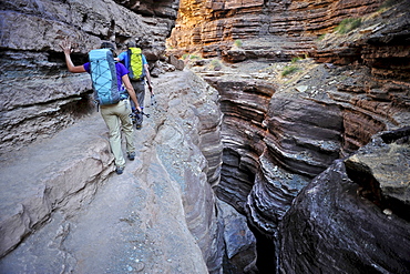
Hikers past small waterfalls along Deer Creek Narrows in the Grand Canyon outside of Fredonia, Arizona November 2011. The 21.4-mile loop starts at the Bill Hall trailhead on the North Rim and descends 2000-feet in 2.5-miles through Coconino Sandstone to the level Esplanada then descends further into the lower canyon through a break in the 400-foot-tall Redwall to access Surprise Valley. Hikers connect Thunder River and Tapeats Creek to a route along the Colorado River and climb out Deer Creek.
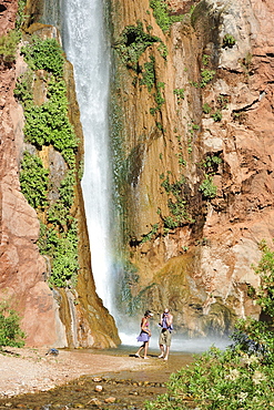
Hikers swim in the pool below 180-foot Deer Creek Falls in the Grand Canyon outside of Fredonia, Arizona November 2011. The 21.4-mile loop starts at the Bill Hall trailhead on the North Rim and descends 2000-feet in 2.5-miles through Coconino Sandstone to the level Esplanada then descends further into the lower canyon through a break in the 400-foot-tall Redwall to access Surprise Valley. Hikers connect Thunder River and Tapeats Creek to a route along the Colorado River and climb out Deer Creek.
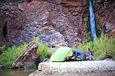
Hikers setup camp on a beach along the Colorado River near the plumeting 180-foot Deer Creek Falls in the Grand Canyon outside of Fredonia, Arizona November 2011. The 21.4-mile loop starts at the Bill Hall trailhead on the North Rim and descends 2000-feet in 2.5-miles through Coconino Sandstone to the level Esplanada then descends further into the lower canyon through a break in the 400-foot-tall Redwall to access Surprise Valley. Hikers connect Thunder River and Tapeats Creek to a route along the Colorado River and climb out Deer Creek.
Mountaineers navigating through the Hillary Step on Mount Everest. The Hillary Step is a nearly vertical part (height around 40 ft) of upper Mount Everest. It lies almost at the top of the mountain, halfway from the "south summit" to the summit top, and is the last real challenge before the summit. It is reached by climbing the South East route. It was named after Sir Edmund Hillary, who was the first person, along with Tenzing Norgay, who passed it to reach the summit, Nepal

Climbers Trace Ghostly Shapes Through The Starry Night On Mount Kilimanjaro's Rongai Route

Three backpackers hike over snow in the Coast Mountain Range en route Joffre Peak in British Columbia, Canada, Pemberton, British Columbia, Canada
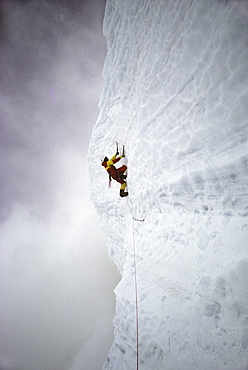
Rob Raker ascends a vertical pitch of glacial ice high on the Cassin Ridge route of Denali (Mt. McKinley), Alaska in May 1990. This pitch is the technical crux of the route which ascends the South Face to the summit at 20,320 feet, the highest point in North America. (Photo by Kevin Steele, Aurora)
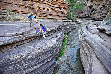
Hikers walk along Deer Creek Narrows in the Grand Canyon outside of Fredonia, Arizona November 2011. The 21.4-mile loop starts at the Bill Hall trailhead on the North Rim and descends 2000-feet in 2.5-miles through Coconino Sandstone to the level Esplanada then descends further into the lower canyon through a break in the 400-foot-tall Redwall to access Surprise Valley. Hikers connect Thunder River and Tapeats Creek to a route along the Colorado River and climb out Deer Creek.
Hikers walk along Deer Creek Narrows in the Grand Canyon outside of Fredonia, Arizona November 2011. The 21.4-mile loop starts at the Bill Hall trailhead on the North Rim and descends 2000-feet in 2.5-miles through Coconino Sandstone to the level Esplanada then descends further into the lower canyon through a break in the 400-foot-tall Redwall to access Surprise Valley. Hikers connect Thunder River and Tapeats Creek to a route along the Colorado River and climb out Deer Creek.

Climber talking on a phone while hiking to a nearby climbing route, north Iceland.
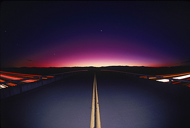
A highway converging at a silhouette of some mountains, California, USA, United States
Route 40, Patagonia, Glacier National Park, El Chalten, Santa Cruz Province Argentina