Results
« Previous 1 … 3 4 5
406 results found
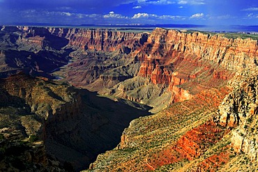
The Grand Canyon seen from the North Rim, UNESCO World Heritage Site, Arizona, United States of America, North America
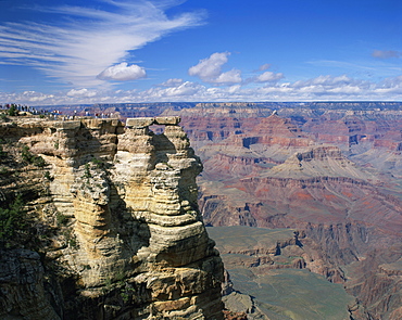
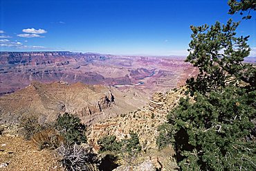
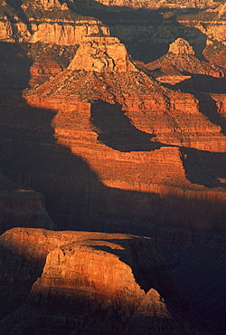
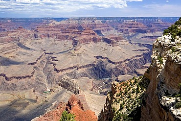
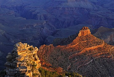
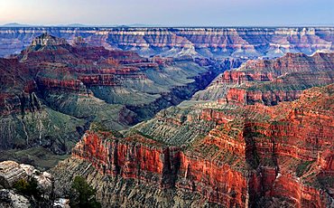
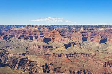
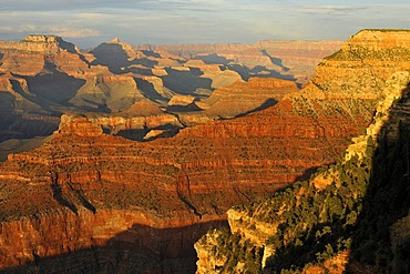
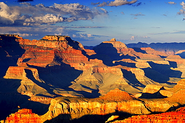
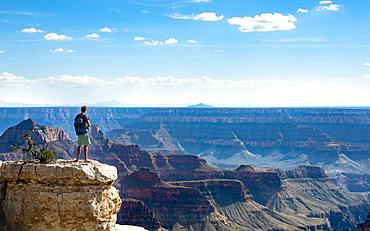
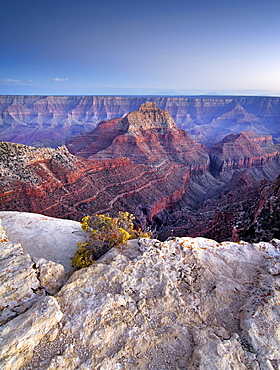
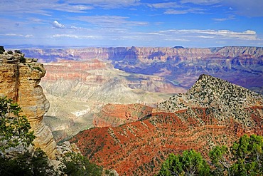
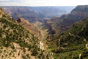
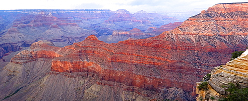
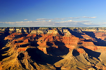
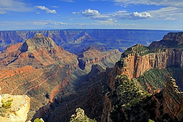
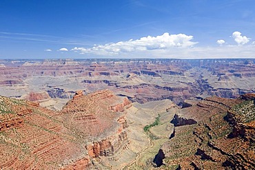
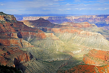
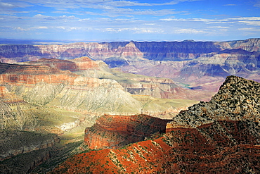
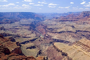
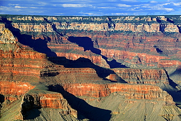
South Rim, Grand Canyon, UNESCO World Heritage Site, Arizona, United States of America, North America
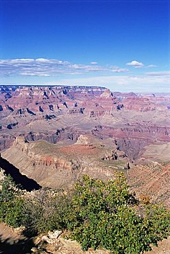
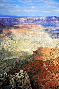
South Rim, Grand Canyon, UNESCO World Heritage Site, Arizona, United States of America, North America
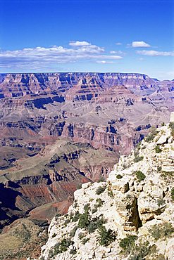
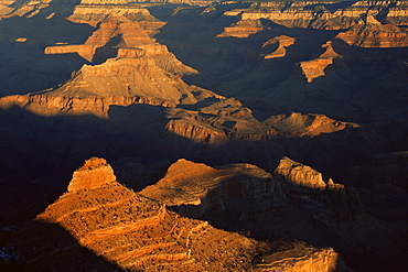
South Rim, Grand Canyon, UNESCO World Heritage Site, Arizona, United States of America, North America
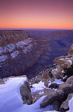
South Rim, Grand Canyon, UNESCO World Heritage Site, Arizona, United States of America, North America
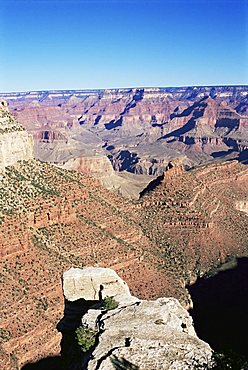
South Rim, Grand Canyon, UNESCO World Heritage Site, Arizona, United States of America, North America
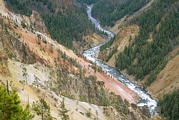
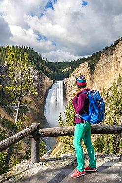
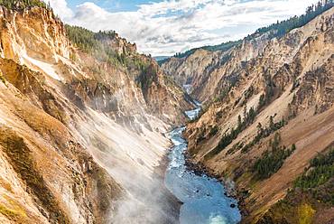
View from the Rim, Grand Canyon of the Yellowstone River, Yellowstone National Park, UNESCO World Heritage Site, Wyoming, United States of America (U.S.A.), North America
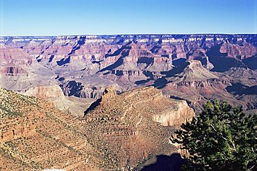
South Rim, Grand Canyon, UNESCO World Heritage Site, Arizona, United States of America, North America
South Rim, Grand Canyon, UNESCO World Heritage Site, Arizona, United States of America, North America
South Rim, Grand Canyon, UNESCO World Heritage Site, Arizona, United States of America, North America
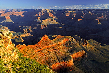
Dawn at Yaki Point Overlook, South Rim, Grand Canyon, UNESCO World Heritage Site, Arizona, United States of America, North America
Dawn at Yaki Point, South Rim, Grand Canyon, UNESCO World Heritage Site, Arizona, United States of America, North America
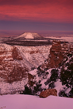
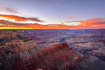
Sunset, Desert View Overlook, South Rim, Grand Canyon, UNESCO World Heritage Site, Arizona, United States of America, North America
Powell Point, South Rim, Grand Canyon, UNESCO World Heritage Site, Arizona, United States of America, North America
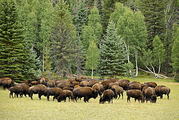
Beefalos or Cattalos, a crossbreed between North American Bison (Bison bison) and Domestic Cattle (Bos taurus), Grand Canyon National Park, North Rim, Arizona, United States of America, USA
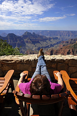
Holidaymaker enjoying the view from the terrace of the Grand Canyon Lodge towards Deva Temple, Brahma Temple, Grand Canyon National Park, North Rim, Arizona, United States of America, USA
Hermits Rest Route, South Rim Grand Canyon National Park, Arizona, USA
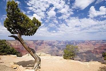
Old pine on the Hermits Rest Route, South Rim, Grand Canyon National Park, Arizona, USA

Mather Point, South Rim, Grand Canyon National Park, Arizona, USA
Morning Mood, Grand Canyon North Rim, Toroweap Point, Arizona, USA, America
View of the Grand Canyon, viewing point Mather Point, South Rim, Grand Canyon, at Tusayan, Arizona, USA, North America
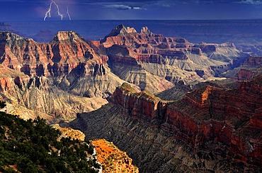
Thunderstorm with a lightning strike, view from Bright Angel Point towards Deva Temple, Brahma Temple, Zoroaster Temple, Transept Canyon, Bright Angel Canyon, sunset, evening mood, Grand Canyon National Park, North Rim, Arizona, United States of America,
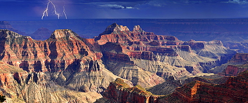
Panoramic image, thunderstorm with lightning, view from Bright Angel Point towards Deva Temple, Brahma Temple, Zoroaster Temple, Transept Canyon, Bright Angel Canyon, evening mood at sunset, Grand Canyon National Park, North Rim, Arizona, United States of

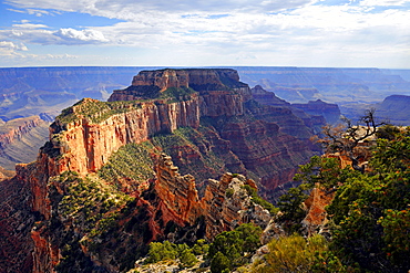
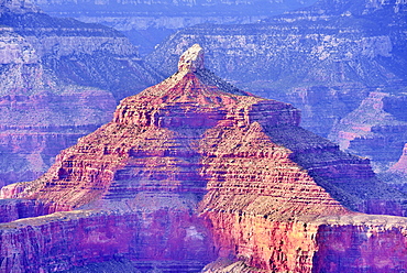
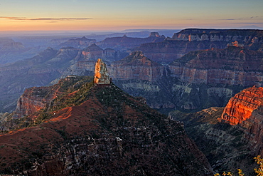
View from Point Imperial towards Mount Hayden, Coconimo Rim, Palisades of the Desert, Cedar Mountain, evening light, Grand Canyon National Park, North Rim, Arizona, United States of America, USA

View of Vishnu Temple at sunset from Yavapai Point, Desert Palisades, Wotan's Throne, Comanche Point, evening light, Grand Canyon National Park, South Rim, Arizona, USA
View at sunset from Yavapai Point lookout towards Pattie's Butte, Bright Angel Canyon, evening light, Grand Canyon National Park, South Rim, Arizona, United States of America, USA
Thunderstorm brewing, view of Vishnu Temple Desert Palisades, Zoroaster Temple, Brahma Temple, Pattie's Butte at sunset from Yavapai Point, evening light, Grand Canyon National Park, South Rim, Arizona, United States of America, USA
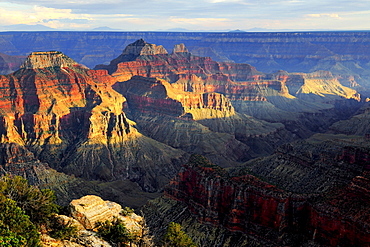
View of O'Neill Butte from Yaki Point at first morning light, South Kaibab Trail, Bright Angel Canyon and Trail, Grand Canyon National Park, South Rim, Arizona, United States of America, USA
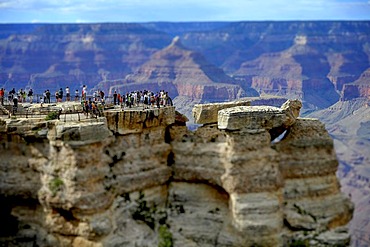
Miniature view, toy view, tilt-shift-effect, tourists on the lookout at Mather Point, Isis Temple at back Grand Canyon National Park, South Rim, Arizona, United States of America, USA
Bright Angel Point, Grand Canyon Lodge, North Rim, Grand Canyon National Park, Arizona, USA, North America
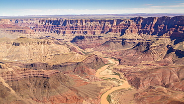
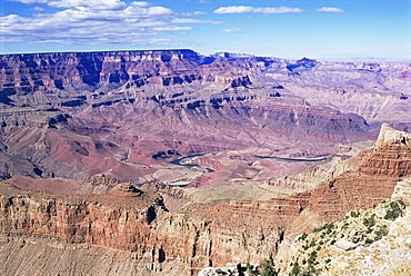
Landscape, panorama, rock, canyon, Colorado River, aerial view, South Rim, Grand Canyon National Park, Arizona, USA, North America
Canyon landscape, eroded rocky landscape of the Grand Canyon, South Rim, Grand Canyon National Park, Arizona, USA, North America
Hiker at Red Rock Viewpoint, Lower Falls, Waterfall in a gorge, Grand Canyon of the Yellowstone River, View from North Rim, Yellowstone National Park, Wyoming, USA, North America
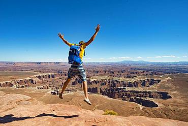
Young man jumping with outstretched arms, view from Grand Viewpoint, rugged gorges of the Green River, canyon landscape, erosion landscape, rock formations, Monument Basin, White Rim, Island in the Sky, Canyonlands National Park, Utah, USA, North America

Gorge of the Grand Canyon at sunset, view from Hopi Point, eroded rock landscape, South Rim, Grand Canyon National Park, near Tusayan, Arizona, USA, North America
Gorge of the Grand Canyon at sunset, Colorado River, view from Hopi Point, eroded rock landscape, South Rim, Grand Canyon National Park, near Tusayan, Arizona, USA, North America
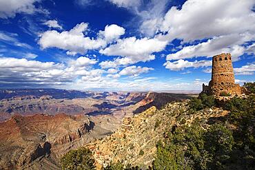
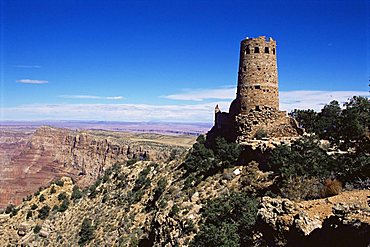
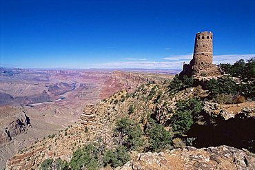
Desert View Observation Tower, South Rim, Grand Canyon National Park, Arizona, USA, North America
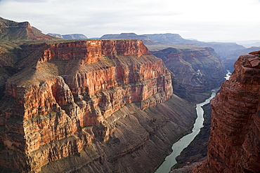
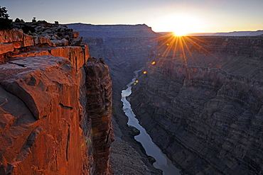
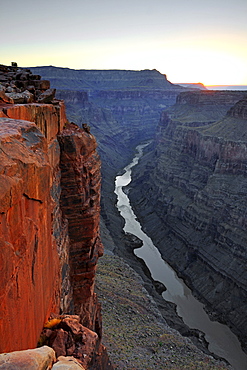
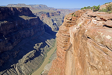
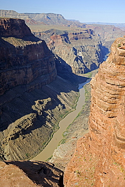
Grand Canyon and Colorado River seen from Toroweap Point, Tuweep Area, North Rim, Arizona, USA

View from South Rim, Grand Canyon National Park, Arizona, USA, North America
Yellowstone River flows through Gorge, Grand Canyon of the Yellowstone, View from North Rim, Brink of the Lower Falls, Yellowstone National Park, Wyoming, USA, North America

Morning at Lipan Point, Colorado River, Grand Canyon South Rim, Arizona, United States, America
View of Vishnu Temple at sunset from Yavapai Point, Desert Palisades, Wotan's Throne, Comanche Point, evening light, Grand Canyon National Park, South Rim, Arizona, USA

Sunset at Bright Angel Point, Grand Canyon, North Rim, Arizona, USA
Morning Mood, Grand Canyon North Rim, Toroweap Point, Arizona, USA, America
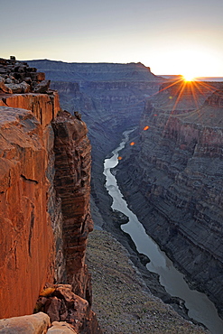
Sunrise at Grand Canyon North Rim, Toroweap Point, Arizona, USA

Evening mood, Grand Canyon North Rim, Bright Angel Point, Arizona, USA, America

Morning at Lipan Point, Colorado River, Grand Canyon South Rim, South Rim, Arizona, USA, America
Sunset, Grand Canyon National Park, South Rim, last light of the day near Yavapai Point, Arizona, USA
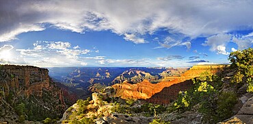
Evening mood, Grand Canyon North Rim, Cape Royal, Arizona, USA, America
Man standing on rock, view of canyon landscape from Bright Angel Viewpoint, North Rim, Grand Canyon National Park, Arizona, USA, North America

View of Vishnu Temple at sunset from Yavapai Point, Desert Palisades, Wotan's Throne, Comanche Point, evening light, Grand Canyon National Park, South Rim, Arizona, USA
Cape Royal, North Rim, Grand Canyon National Park, Arizona, USA
Morning at Yaki Point, Grand Canyon South Rim, South Rim, Arizona, United States, America
Grand Canyon North Rim at sunset, Arizona, USA
Bright Angel Trail, South Rim, Grand Canyon National Park, Arizona, USA, North America
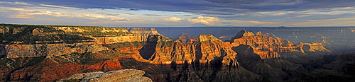
Panorama, Grand Canyon North Rim in the evening light, Bright Angel Point, Arizona, USA
View of eroded rock formation Bright Angel, Colorado River Canyon, Grand Canyon National Park, South Rim, Arizona, USA, North America
Sunset at Grand Canyon North Rim, Bright Angel Point, Arizona, USA
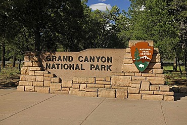
Entrance sign at the south rim of the Grand Canyon, Grand Canyon National Park, Arizona, American Southwest, USA

Evening at Bright Angel Point, Grand Canyon North Rim, Arizona, USA, America
Grand Canyon North Rim, Toroweap Point, Colorado River, Arizona, USA, America
Sunrise at Point Imperial, Mount Hayden, Grand Canyon North Rim, Arizona, USA
Grand Canyon North Rim at sunset, Arizona, USA

Yavapai Point in the evening light, Grand Canyon South Rim, Arizona, USA
Navajo Point at sunset, South Rim, Grand Canyon National Park, Arizona, USA
Sunset at Mather Point, South Rim, Grand Canyon National Park, Arizona, USA
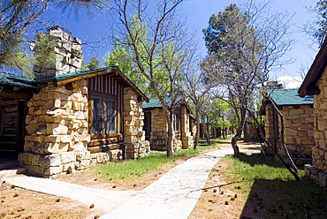
Lodges at the North Rim, Grand Canyon National Park, Arizona, USA
Sunset at Grand Canyon North Rim, Cape Royal, Arizona, USA

Visitors lodging at the Grand Canyon Lodge watching the sunset, Grand Canyon North Rim, Arizona, USA

Evening mood, Grand Canyon North Rim, Arizona, USA, America
Evening at Yavapai Point, Grand Canyon South Rim, South Rim, Arizona, USA, America
Grand Canyon North Rim in the evening light, Cape Royal, Arizona, USA
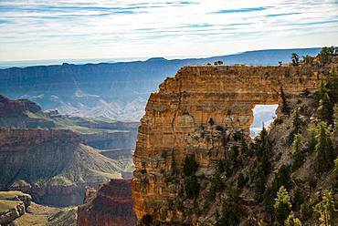
Rock formation Angels Window, Cape Royal, North Rim, Grand Canyon National Park, Arizona, USA, North America
Rim Trail, South Rim, Grand Canyon National Park, Arizona, USA
Evening mood, Grand Canyon North Rim, Cape Royal, Arizona, USA, America

Toroweap Point, Grand Canyon North Rim, Colorado River, Arizona, USA
Sunset at Grand Canyon North Rim, Cape Royal, Arizona, USA
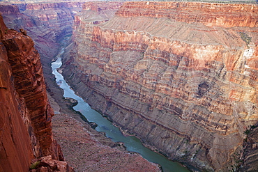
Grand Canyon and Colorado River seen from Toroweap Point, Tuweep Area, North Rim, Arizona, USA
Grand Canyon North Rim, Toroweap Point, Colorado River, Arizona, USA
Navajo Point, South Rim, Grand Canyon National Park, Arizona, USA
Evening at Yavapai Point, Grand Canyon South Rim, South Rim, Arizona, USA, America
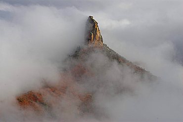
Mount Hayden on the North Rim of the Grand Canyon in fog, Grand Canyon, Arizona, United States
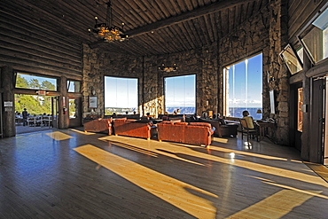
Panorama room of the hotel Grand Canyon Lodge, Grand Canyon North Rim, Arizona, USA, America
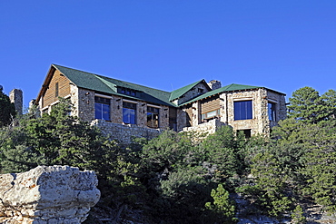
Hotel Grand Canyon Lodge, Grand Canyon North Rim, Arizona, USA, America
Hikers descend into Surprise Valley to access the lower canyon through a break in the 400-foot-tall Redwall on the Thunder River Trail in the Grand Canyon outside of Fredonia, Arizona November 2011. The 21.4-mile loop starts at the Bill Hall trailhead on the North Rim and descends 2000-feet in 2.5-miles through Coconino Sandstone to the level Esplanada then descends further into the lower canyon to access Thunder River, Tapeats Creek and Deer Creek.
Hikers walk along Deer Creek Narrows in the Grand Canyon outside of Fredonia, Arizona November 2011. The 21.4-mile loop starts at the Bill Hall trailhead on the North Rim and descends 2000-feet in 2.5-miles through Coconino Sandstone to the level Esplanada then descends further into the lower canyon through a break in the 400-foot-tall Redwall to access Surprise Valley. Hikers connect Thunder River and Tapeats Creek to a route along the Colorado River and climb out Deer Creek.

Male hiker filters water on a cliff-pinched patio near Deer Creek Falls in the Grand Canyon outside of Fredonia, Arizona November 2011. The 21.4-mile loop starts at the Bill Hall trailhead on the North Rim and descends 2000-feet in 2.5-miles through Coconino Sandstone to the level Esplanada then descends further into the lower canyon through a break in the 400-foot-tall Redwall to access Surprise Valley. Hikers connect Thunder River and Tapeats Creek to a route along the Colorado River and climb out Deer Creek.
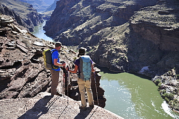
Hikers overlook the Colorado River as they exit the Deer Creek Narrows in the Grand Canyon outside of Fredonia, Arizona November 2011. The 21.4-mile loop starts at the Bill Hall trailhead on the North Rim and descends 2000-feet in 2.5-miles through Coconino Sandstone to the level Esplanada then descends further into the lower canyon through a break in the 400-foot-tall Redwall to access Surprise Valley. Hikers connect Thunder River and Tapeats Creek to a route along the Colorado River and climb out Deer Creek.
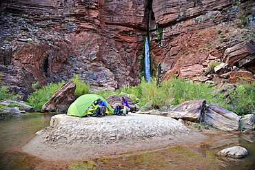
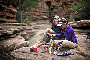
Hikers setup camp on a beach along the Colorado River near the plumeting 180-foot Deer Creek Falls in the Grand Canyon outside of Fredonia, Arizona November 2011. The 21.4-mile loop starts at the Bill Hall trailhead on the North Rim and descends 2000-feet in 2.5-miles through Coconino Sandstone to the level Esplanada then descends further into the lower canyon through a break in the 400-foot-tall Redwall to access Surprise Valley. Hikers connect Thunder River and Tapeats Creek to a route along the Colorado River and climb out Deer Creek.
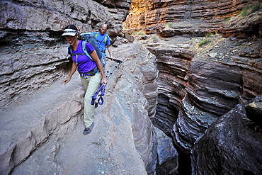
Hikers walk along Deer Creek Narrows in the Grand Canyon outside of Fredonia, Arizona November 2011. The 21.4-mile loop starts at the Bill Hall trailhead on the North Rim and descends 2000-feet in 2.5-miles through Coconino Sandstone to the level Esplanada then descends further into the lower canyon through a break in the 400-foot-tall Redwall to access Surprise Valley. Hikers connect Thunder River and Tapeats Creek to a route along the Colorado River and climb out Deer Creek.
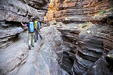
Hikers walk along Deer Creek Narrows in the Grand Canyon outside of Fredonia, Arizona November 2011. The 21.4-mile loop starts at the Bill Hall trailhead on the North Rim and descends 2000-feet in 2.5-miles through Coconino Sandstone to the level Esplanada then descends further into the lower canyon through a break in the 400-foot-tall Redwall to access Surprise Valley. Hikers connect Thunder River and Tapeats Creek to a route along the Colorado River and climb out Deer Creek.
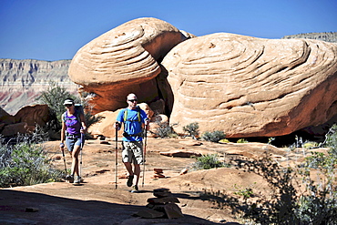
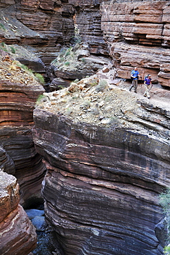
Hikers on the sandstone Esplanade of the Thunder River Trail below the North Rim of the Grand Canyon outside Fredonia, Arizona November 2011. The 21.4-mile loop descends 2000-feet in 2.5-miles through Coconino Sandstone from the Bill Hall trailhead to connect the Thunder River and Deer Creeks trails. Hikers descend into the lower canyon through a break in the 400-foot-tall Redwall to access Surprise Valley, Deer Creek, Tapeats Creek via Thunder River and even the Colorado River.

Hikers follow a route along the Colorado River that connect Tapeats Creek and Thunder River to Deer Creek in the Grand Canyon outside of Fredonia, Arizona November 2011. The 21.4-mile loop starts at the Bill Hall trailhead on the North Rim and descends 2000-feet in 2.5-miles through Coconino Sandstone to the level Esplanada then descends further into the lower canyon through a break in the 400-foot-tall Redwall to access Surprise Valley. Hikers connect Thunder River and Tapeats Creek to a route along the Colorado River and climb out Deer Creek.
Hikers cook dinner along Deer Creek Narrows in the Grand Canyon outside of Fredonia, Arizona November 2011. The 21.4-mile loop starts at the Bill Hall trailhead on the North Rim and descends 2000-feet in 2.5-miles through Coconino Sandstone to the level Esplanada then descends further into the lower canyon through a break in the 400-foot-tall Redwall to access Surprise Valley. Hikers connect Thunder River and Tapeats Creek to a route along the Colorado River and climb out Deer Creek.
Hikers climb out of Surprise Valley to the North Rim of the Grand Canyon outside of Fredonia, Arizona November 2011. The 21.4-mile loop starts at the Bill Hall trailhead on the North Rim and descends 2000-feet in 2.5-miles through Coconino Sandstone to the level Esplanada then descends further into the lower canyon through a break in the 400-foot-tall Redwall to access Surprise Valley. Hikers connect Thunder River and Tapeats Creek to a route along the Colorado River and climb out Deer Creek.
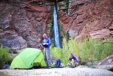
Hikers setup camp on a beach along the Colorado River near the plumeting 180-foot Deer Creek Falls in the Grand Canyon outside of Fredonia, Arizona November 2011. The 21.4-mile loop starts at the Bill Hall trailhead on the North Rim and descends 2000-feet in 2.5-miles through Coconino Sandstone to the level Esplanada then descends further into the lower canyon through a break in the 400-foot-tall Redwall to access Surprise Valley. Hikers connect Thunder River and Tapeats Creek to a route along the Colorado River and climb out Deer Creek.
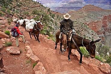
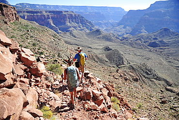
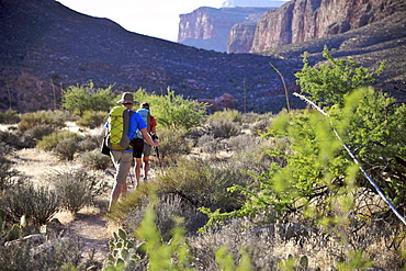
Female hiker waits for pack horses to pass on the South Kaibab Trail in Grand Canyon National Park north of Williams, Arizona May 2011. The South Kaibab Trail starts on the south rim of the Colorado Plateau and follows a ridge out to Skeleton Point allowing for 360-degree views of the canyon then down to the Colorado River. At the Colorado River the trail connects with the North Kaibab trail as part of the Arizona Trail system, that crosses the state of Arizona from Mexico to Utah.
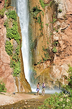
Hikers swim in the pool below 180-foot Deer Creek Falls in the Grand Canyon outside of Fredonia, Arizona November 2011. The 21.4-mile loop starts at the Bill Hall trailhead on the North Rim and descends 2000-feet in 2.5-miles through Coconino Sandstone to the level Esplanada then descends further into the lower canyon through a break in the 400-foot-tall Redwall to access Surprise Valley. Hikers connect Thunder River and Tapeats Creek to a route along the Colorado River and climb out Deer Creek.
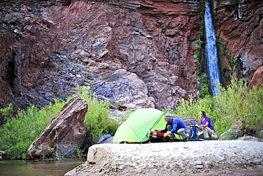
Hikers setup camp on a beach along the Colorado River near the plumeting 180-foot Deer Creek Falls in the Grand Canyon outside of Fredonia, Arizona November 2011. The 21.4-mile loop starts at the Bill Hall trailhead on the North Rim and descends 2000-feet in 2.5-miles through Coconino Sandstone to the level Esplanada then descends further into the lower canyon through a break in the 400-foot-tall Redwall to access Surprise Valley. Hikers connect Thunder River and Tapeats Creek to a route along the Colorado River and climb out Deer Creek.
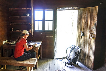
A thru hiker takes a break at Theodore Roosevelts Cabin on the Muav Saddle, far out on the North Rim of the Grand Canyon, and signs a storied trail register, Arizona, USA