Results
« Previous 1 … 3 4 5 6 7 … 19 Next »
1839 results found

A twisted Juniper Tree near Sycamore Canyon in the Kaibab National Forest south of Williams, Arizona, United States of America, North America

Heart shaped box of soft candy hearts for Valentine's Day

The main house of the ancient Tusayan Ruins at Grand Canyon South Rim, UNESCO World Heritage Site, Arizona, United States of America, North America
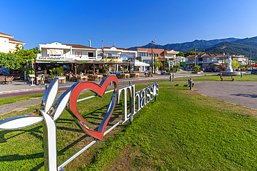
View of tavervas and I Love Thassos sign in the port of Thassos Town, Thassos, Aegean Sea, Greek Islands, Greece, Europe
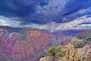
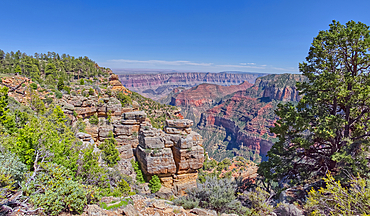
A storm rolling across Grand Canyon near the Sinking Ship formation, viewed from Coronado Ridge, Grand Canyon National Park, UNESCO World Heritage Site, Arizona, United States of America, North America
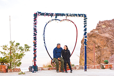
Couple sitting on a heart-shaped swing, Jordan, Middle East
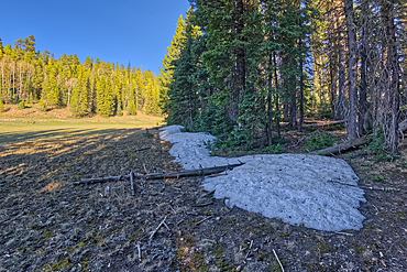
Taken near the end of May 2024, the last remnants of winter snow on the North Rim of Grand Canyon National Park, Arizona, United States of America, North America
Cliff views from the edge of Naji Point on the North Rim of Grand Canyon National Park, UNESCO World Heritage Site, Arizona, United States of America, North America
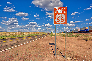
Road sign marking Historic Route 66 just east of Seligman, the birthplace of the famous road, Arizona, United States of America, North America
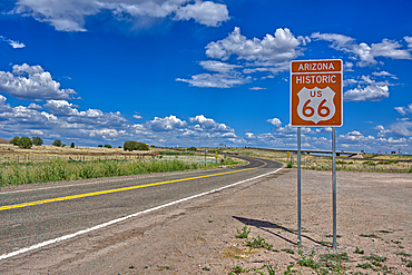
A road sign marking the Historic Route 66 just west of Ash Fork, Arizona, United States of America, North America
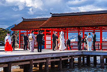
Japanese wedding at Itsukushima Shrine, Shinto temple, Miyajima Island, UNESCO World Heritage Site, Hiroshima Prefecture, Honshu, Japan, Asia
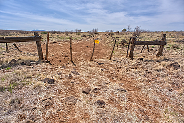
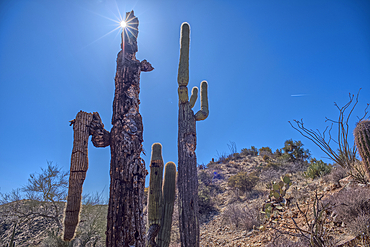
An entry gate to Silver Creek Canyon in Agua Fria National Monument Arizona. The gate is to keep cattle from wandering down into the canyon.
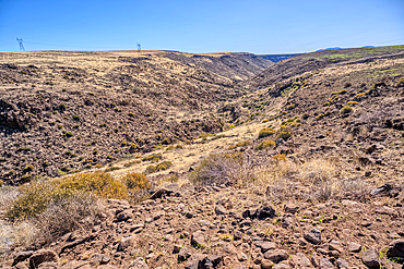
Silver Creek Canyon in the Agua Fria National Monument. Located north of Black Canyon City Arizona.
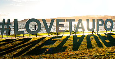
Love Taupo sign on the shore of lake Taupo in sunset light. A scenic point of North Island of New Zealand

AI generated image of Two cute French Bulldog pups playing and running together in the grass

AI generated image of Two cute Maltese pups sitting in a wicker basket

View of the Grand Canyon west of Navajo Point with a storm rolling in from the west, Arizona, United States of America, North America
Lightning striking from a monsoon storm building up over the abandoned Mexican Quarry near Perkinsville, Arizona, United States of America, North America

AI generated image of Puppies dogs and cats in a colorful flower setting
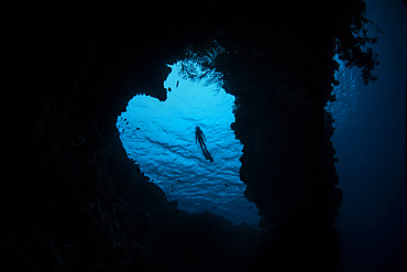
Snorkeler exploring heart-shaped reef in Banda Sea, Indonesia.
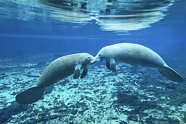
A pair of manatees appear to be greeting each other as they meet in the clear freshwater of the Fanning Spring inlet to the Suwannee River in Fanning Springs, Florida.
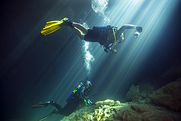
A young married couple celebrate their ten year anniversary by scuba diving in the clear freshwaters of Devil's Den Springs, a sinkhole in Williston, Florida, as the afternoon sun filters down into the cavern.

Quartier General de la Delegation Francaise at Ingreja de Santos-O-Velho, Lisbon, Portugal

World Youth Day 2023, Pope Francis welcoming Mass at Tagus Park, Lisbon, Portugal

World Youth Day 2023, Pope Francis welcoming Mass at Tagus Park, Lisbon, Portugal
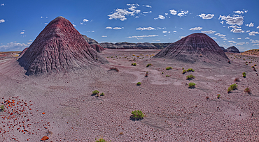
The Little Teepees on the north side of Haystack Mesa in Petrified Forest National Park, Arizona, United States of America, North America

Christianity, Islam and Judaism symbols, three monotheistic religions, Jewish Star of David, Christian Cross and Muslim Crescent, Indonesia

Mass in St. Anthony's Catholic Church, Hanoukope, Lome, Togo

Sex shop, Rue Saint-Denis, Paris, France

Couple kissing, Paris Plage, Paris, France
The east cliffs of Blue Mesa near sunset, Petrified Forest National Park, Arizona, United States of America, North America
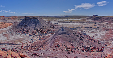
View of Anvil Hill and Crystal Butte from the summit of Crystal Mesa west of Hamilili Point in Petrified Forest National Park, Arizona, United States of America, North America
View of Crystal Mesa west of Hamilili Point in Petrified Forest National Park, Arizona, United States of America, North America
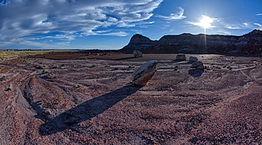
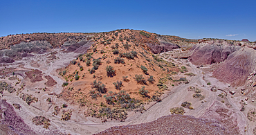
Goblin Garden west of Hamilili Point in Petrified Forest National Park, Arizona, United States of America, North America
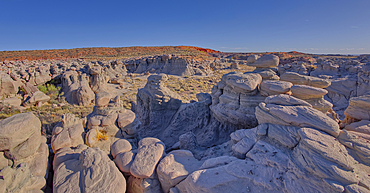
Goblin Garden west of Hamilili Point in Petrified Forest National Park, Arizona, United States of America, North America
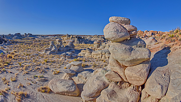
Goblin Garden west of Hamilili Point in Petrified Forest National Park, Arizona, United States of America, North America
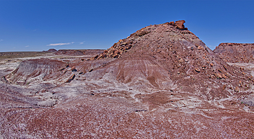
Anvil Hill west of Hamilili Point in Petrified Forest National Park, Arizona, United States of America, North America
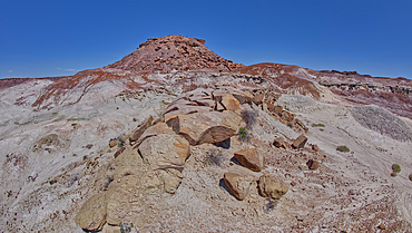
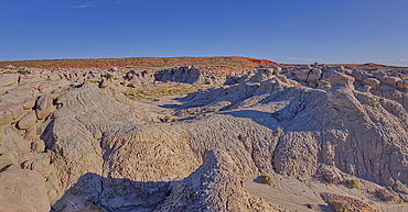
Gray clay flats below Anvil Hill west of Hamilili Point in Petrified Forest National Park, Arizona, United States of America, North America
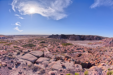
A sloping red sand dune above Hamilili Wash in Petrified Forest National Park, Arizona, United States of America, North America
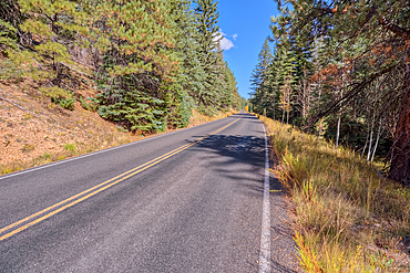
Cape Royal Road winding through Fuller Canyon at Grand Canyon North Rim, UNESCO, Arizona, United States of America
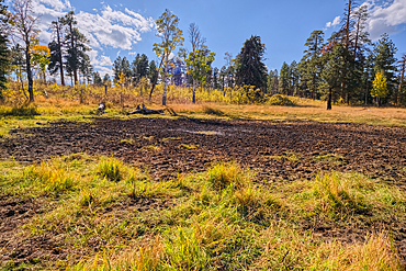
Greenland Lake reduced to a mud hole, Grand Canyon North Rim, UNESCO, Arizona, United States of America
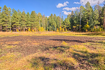
Greenland Lake reduced to a mud hole, Grand Canyon North Rim, UNESCO, Arizona, United States of America
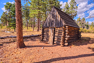
The historic Salt Cabin dating back to 1870s near Greenland Lake at Grand Canyon North Rim, UNESCO, Arizona, United States of America
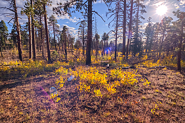
Burned forest area taken over by young Aspen trees in fall colors east of Greenland Lake, Grand Canyon North Rim, Arizona, United States of America
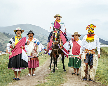
Festival of Light (Inti Raymi festival) Cochas Community, Angochagua Parochia, Imbabura Province, Ecuador
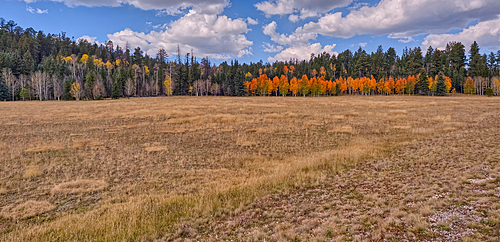
Deciduous trees with yellow and orange fall colors mixed with green Pine Trees, Kaibab National Forest, Arizona, United States of America
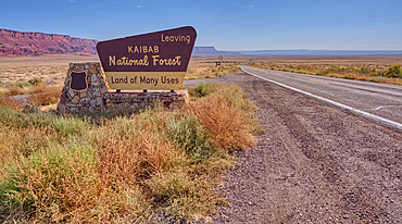
Highway US89A looking east to Vermilion Cliffs National Monument with Kaibab National Forest boundary sign, Arizona, United States of America
The west entrance of Supai Tunnel on North Kaibab Trail, Grand Canyon North Rim, UNESCO, Arizona, United States of America
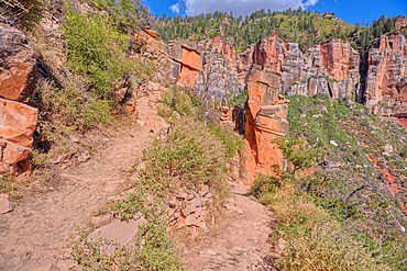
The Red Wall of sandstone east of Supai Tunnel on North Kaibab Trail, Grand Canyon North Rim, UNESCO, Arizona, United States of America
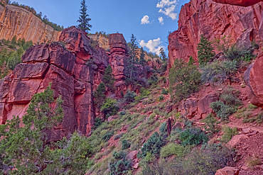
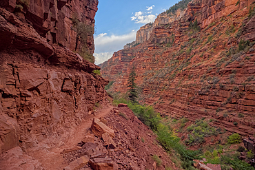
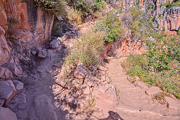
Red Wall cliffs of Roaring Springs Canyon on North Kaibab Trail, Grand Canyon North Rim, UNESCO, Arizona, United States of America
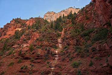
Ephemeral Spring on Red Wall of Roaring Springs Canyon, North Kaibab Trail, Grand Canyon North Rim, UNESCO, Arizona, United States of America
The sheer cliff of the Red Wall along the North Kaibab Trail, Grand Canyon North Rim, UNESCO, Arizona, United States of America
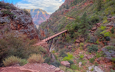
View above Red Wall Bridge crossing Roaring Springs Canyon, North Kaibab Trail, Grand Canyon North Rim, UNESCO, Arizona, United States of America
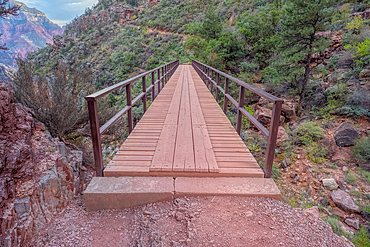
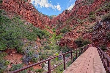
Red Wall Bridge crossing Roaring Springs Canyon on North Kaibab Trail, Grand Canyon North Rim, UNESCO, Arizona, United States of America
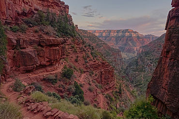
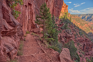
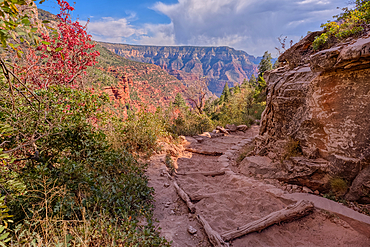
View of Roaring Springs Canyon along the North Kaibab Trail at Grand Canyon North Rim, UNESCO, Arizona, United States of America
View of the Roaring Springs Canyon cliffs from the Red Wall Bridge, Grand Canyon North Rim, UNESCO, Arizona, United States of America
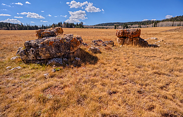
Lonely Boulders and exposed rock in Pleasant Valley, Kaibab National Forest just north of Grand Canyon North Rim, Arizona, United States of America
Looking back up the first leg of the North Kaibab Trail at Grand Canyon North Rim, UNESCO, Arizona, United States of America

The Coconino Overlook along the North Kaibab Trail at Grand Canyon North Rim, UNESCO, Arizona, United States of America
The 11th switchback along the North Kaibab Trail at Grand Canyon North Rim, UNESCO, Arizona, United States of America
The 17th switchback along the North Kaibab Trail at Grand Canyon North Rim, UNESCO, Arizona, United States of America
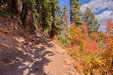
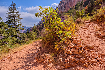
A curve in the North Kaibab Trail between Coconino Overlook and the Supai Tunnel Rest Area, Grand Canyon, Arizona, United States of America
The 20th switchback along the North Kaibab Trail at Grand Canyon North Rim, UNESCO, Arizona, United States of America
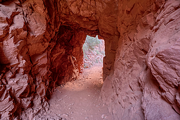
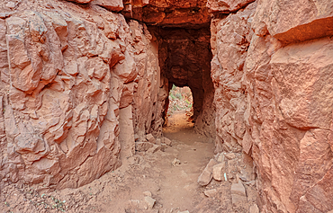
The interior of the Supai Tunnel along the North Kaibab Trail, Grand Canyon North Rim, UNESCO, Arizona, United States of America
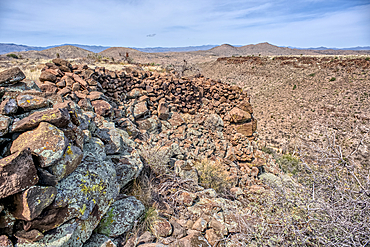
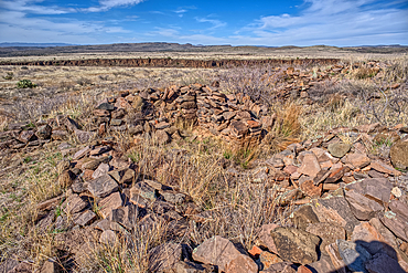
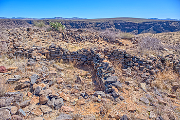
Ancient wall of the Fort Silver Indian Ruins overlooking Silver Creek Canyon in Agua Fria National Monument of Arizona. Located near the Pueblo La Plata ruins.
The Pueblo La Plata Indian Ruins near Silver Creek Canyon in the Agua Fria National Monument of Arizona. Located north of Black Canyon City.
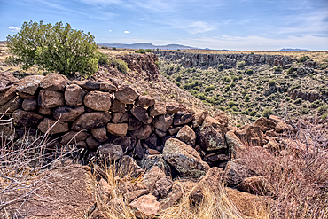
Ancient wall of the Fort Silver Indian Ruins overlooking Silver Creek Canyon in Agua Fria National Monument of Arizona. Located near the Pueblo La Plata ruins.
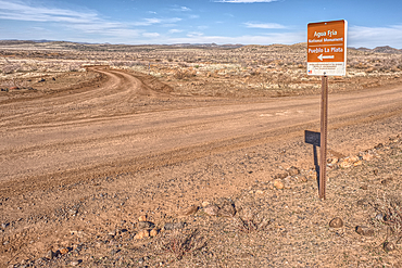
Road sign along Bloody Basin Road in the Agua Fria National Monument of Arizona directing the way to the Pueblo La Plata Indian Ruins.
The primitive Bloody Basin Road winding thru the Agua Fria National Monument north of Black Canyon City Arizona.
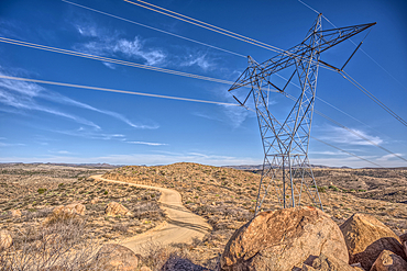
High Tension Power Lines stretching across Bloody Basin in Agua Fria National Monument north of Black Canyon City Arizona.
Look back up the freeway exit ramp for Bloody Basin Road in the Agua Fria National Monument of Arizona. Located north of Black Canyon City.
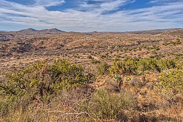
A Saguaro covered scenic ridge overlooking the Agua Fria River in the Agua Fria National Monument of Arizona.
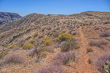
Path leading to a scenic overlook in the Agua Fria National Monument near the abandoned Richinbar Mine.
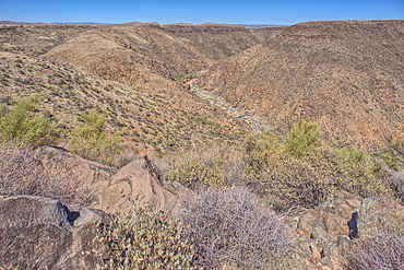
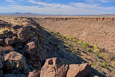
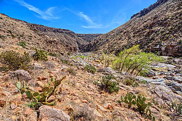
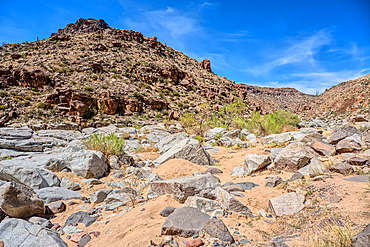
The Agua Fria River Canyon in the Agua Fria National Monument north of Black Canyon City Arizona.
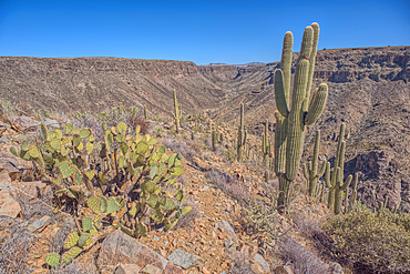
A Saguaro covered scenic ridge overlooking the Agua Fria River in the Agua Fria National Monument of Arizona.
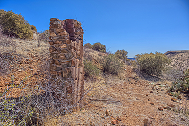
Remnants of the Richinbar Mine within the Agua Fria National Monument north of Black Canyon City Arizona. Mine was established in 1905 but was abandoned in 1940 when the company that owned it went bankrupt.
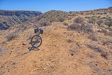
A bicycle parked near the abandoned Richinbar Mine in the Agua Fria National Monument.
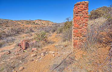
Remnants of the Richinbar Mine within the Agua Fria National Monument north of Black Canyon City Arizona. Mine was established in 1905 but was abandoned in 1940 when the company that owned it went bankrupt.
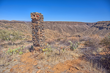
Remnants of the Richinbar Mine within the Agua Fria National Monument north of Black Canyon City Arizona. Mine was established in 1905 but was abandoned in 1940 when the company that owned it went bankrupt.
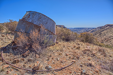
Remnants of the Richinbar Mine within the Agua Fria National Monument north of Black Canyon City Arizona. Mine was established in 1905 but was abandoned in 1940 when the company that owned it went bankrupt.
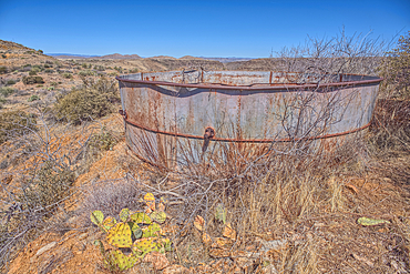
Remnants of the Richinbar Mine within the Agua Fria National Monument north of Black Canyon City Arizona. Mine was established in 1905 but was abandoned in 1940 when the company that owned it went bankrupt.
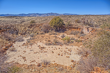
Remnants of the Richinbar Mine within the Agua Fria National Monument north of Black Canyon City Arizona. Mine was established in 1905 but was abandoned in 1940 when the company that owned it went bankrupt.
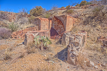
Remnants of the Richinbar Mine within the Agua Fria National Monument north of Black Canyon City Arizona. Mine was established in 1905 but was abandoned in 1940 when the company that owned it went bankrupt.
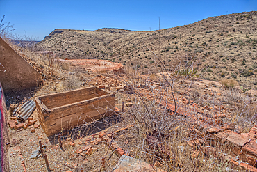
Remnants of the Richinbar Mine within the Agua Fria National Monument north of Black Canyon City Arizona. Mine was established in 1905 but was abandoned in 1940 when the company that owned it went bankrupt.
Ancient Indian Ruins near the historic Richinbar Mine in the Agua Fria National Monument north of Black Canyon City Arizona.
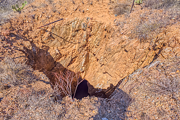
Open mine shaft at the Richinbar Mine within the Agua Fria National Monument north of Black Canyon City Arizona. Mine was established in 1905 but was abandoned in 1940 when the company that owned it went bankrupt.
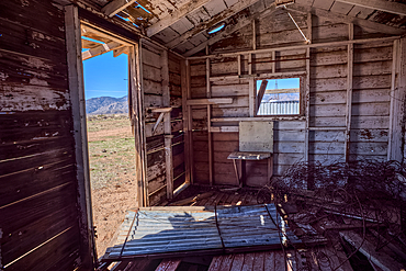
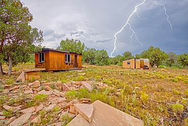
An abandoned cabin next to an active cattle corral in the Agua Fria National Monument north of Black Canyon City Arizona. Public land. No property release needed.
An unnamed tributary canyon that feeds into the Agua Fria River near the Sunset Point Rest Stop off of I-17 north of Black Canyon City AZ.
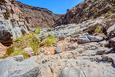
The granite riverbed of the Agua Fria River Canyon in the Agua Fria National Monument of Arizona.
The granite riverbed of the Agua Fria River Canyon in the Agua Fria National Monument of Arizona.
The granite riverbed of the Agua Fria River Canyon in the Agua Fria National Monument of Arizona.
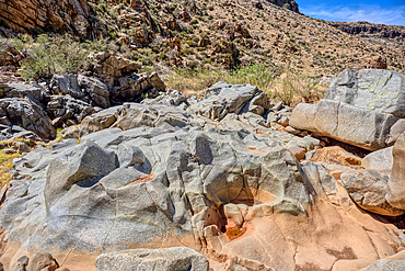
The granite riverbed of the Agua Fria River Canyon in the Agua Fria National Monument of Arizona.
The granite riverbed of the Agua Fria River Canyon in the Agua Fria National Monument of Arizona.
The granite riverbed of the Agua Fria River Canyon in the Agua Fria National Monument of Arizona.
The granite riverbed of the Agua Fria River Canyon in the Agua Fria National Monument of Arizona.
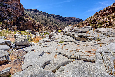
The granite riverbed of the Agua Fria River Canyon in the Agua Fria National Monument of Arizona.
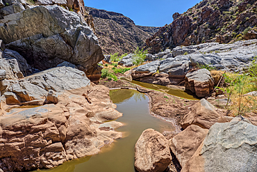
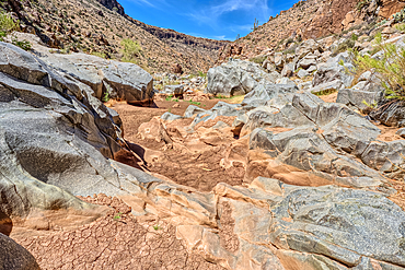
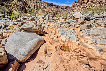
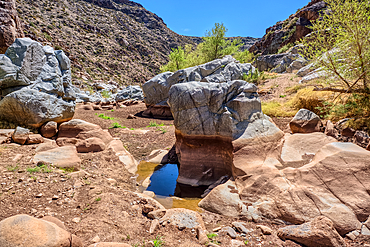
An ephemeral pool of water in the granite riverbed of the Agua Fria River Canyon in the Agua Fria National Monument of Arizona.
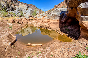
An ephemeral pool of water in the granite riverbed of the Agua Fria River Canyon in the Agua Fria National Monument of Arizona.
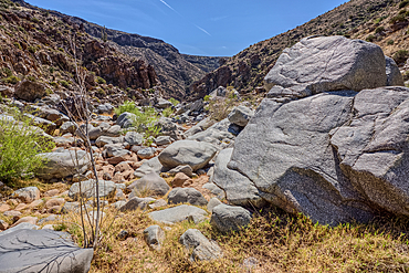
The granite riverbed of the Agua Fria River Canyon in the Agua Fria National Monument of Arizona.
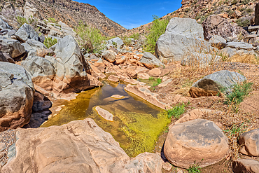
An ephemeral pool of water in the granite riverbed of the Agua Fria River Canyon in the Agua Fria National Monument of Arizona.