Results
« Previous 1 … 4 5 6 7 8 … 28 Next »
2773 results found
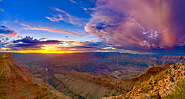
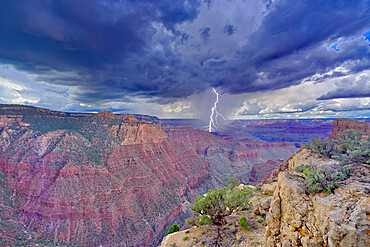
A dying storm at twilight viewed from Lipan Point, Grand Canyon, with Spider Lightning visible, Grand Canyon National Park, UNESCO World Heritage Site, Arizona, United States of America, North America
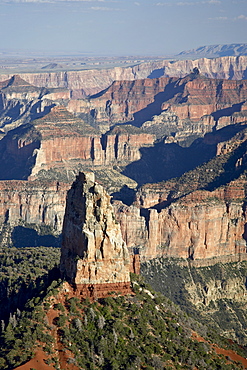
Mount Hayden from Point Imperial, Grand Canyon National Park, UNESCO World Heritage Site, Arizona, United States of America, North America
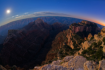
Point Sublime, North Rim, Grand Canyon National Park, UNESCO World Heritage Site, Arizona, United States of America, North America
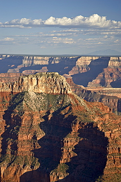
View from Cape Royal, below is Vishnu Creek running between Vishnu Temple on the left with Wotans Throne on the right at twilight with the Moon rising, Grand Canyon National Park, UNESCO World Heritage Site, Arizona, United States of America, North America
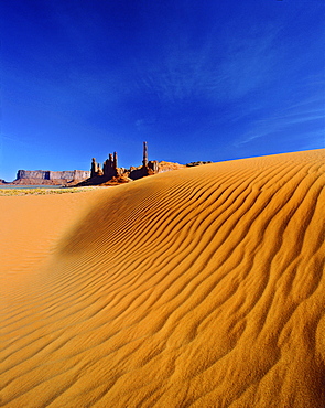
Totem Pole and Yei Bi Chei rock formations and sand dunes, Monument Valley, Arizona, United States of America, North America
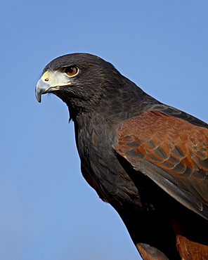
Harris's Hawk (Parabuteo unicinctus) in captivity, Arizona Sonora Desert Museum, Tucson, Arizona, United States of America, North America
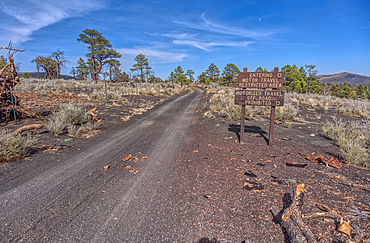
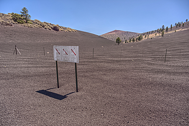
Fire Road 546 where it branches off from Sunset Crater National Monument into Coconino National Forest of Arizona.
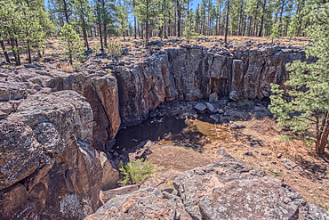
The cliff rim of Keyhole Sink in the Kaibab National Forest near Williams Arizona. This sink is an open ended sinkhole where water can flow out of it.
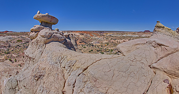
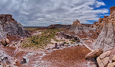
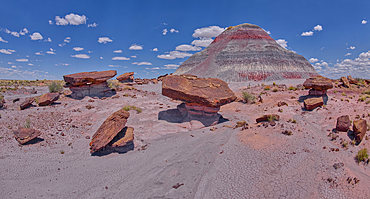
Mushroom shaped sandstone spire on an eroded ridge west of Hamilili Point in Petrified Forest National Park, Arizona, United States of America, North America
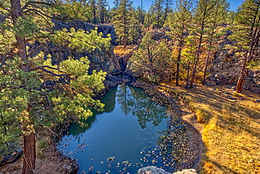
One of several natural ponds near Sycamore Falls known as the Pomeroy Tanks, Kaibab National Forest near Williams, Arizona, United States of America, North America

A twisted Juniper Tree near Sycamore Canyon in the Kaibab National Forest south of Williams, Arizona, United States of America, North America
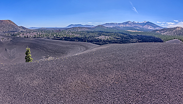
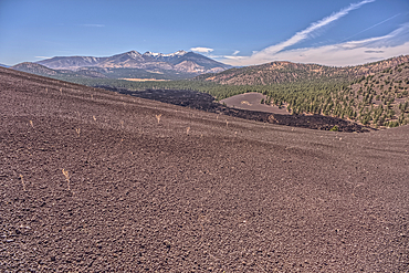
Volcanic cinder rim in Coconino National Forest near Sunset Crater National Monument of Arizona. Humphrey's Peak is in the background.
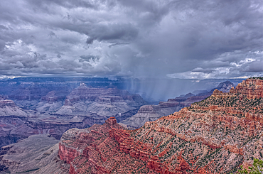
A rain storm over the North Rim of Grand Canyon National Park Arizona. Viewed from the Pipe Creek Vista on the South Rim.
A rain storm over the North Rim of Grand Canyon National Park Arizona. Viewed from the Pipe Creek Vista on the South Rim.
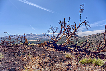
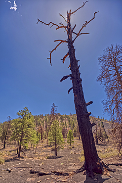
Burned trees on a Volcanic cinder rim in Coconino National Forest near Sunset Crater National Monument of Arizona. Humphrey's Peak is in the background.
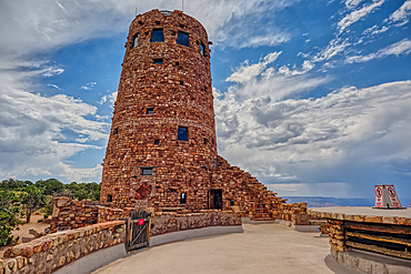
The upper half of the Desert View Watchtower viewed from the observation deck at Grand Canyon South Rim, UNESCO World Heritage Site, Arizona, United States of America, North America
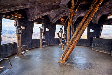
The top floor of the historic Watchtower at Grand Canyon South Rim, UNESCO World Heritage Site, Arizona, United States of America, North America
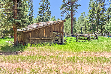
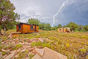
An abandoned homestead in the Kaibab National Forest off of Highway 67 north of Grand Canyon North Rim Arizona. Public land. No property release needed. Preserved by Forest Service as a historical landmark.
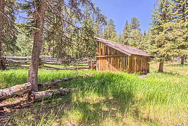
An abandoned homestead in the Kaibab National Forest off of Highway 67 north of Grand Canyon North Rim Arizona. Public land. No property release needed. Preserved by Forest Service as a historical landmark.
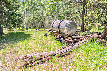
An abandoned homestead in the Kaibab National Forest off of Highway 67 north of Grand Canyon North Rim Arizona. Public land. No property release needed. Preserved by Forest Service as a historical landmark.
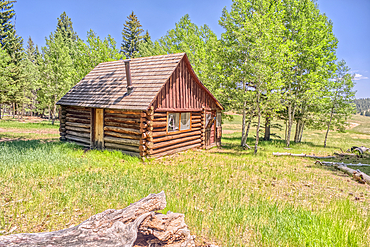
An abandoned homestead in the Kaibab National Forest off of Highway 67 north of Grand Canyon North Rim Arizona. Public land. No property release needed. Preserved by Forest Service as a historical landmark.
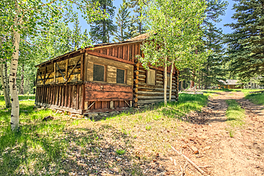
An abandoned homestead in the Kaibab National Forest off of Highway 67 north of Grand Canyon North Rim Arizona. Public land. No property release needed. Preserved by Forest Service as a historical landmark.
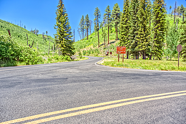
The point where Fuller Canyon Road divides in Grand Canyon North Rim Arizona. Left fork leads to Point Imperial. Right fork leads to Cape Royal.
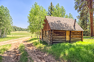
An abandoned homestead in the Kaibab National Forest off of Highway 67 north of Grand Canyon North Rim Arizona. Public land. No property release needed. Preserved by Forest Service as a historical landmark.
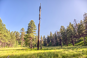
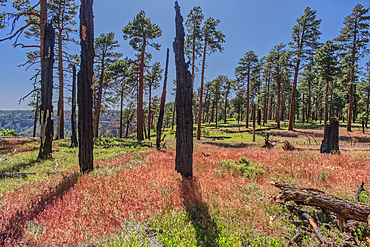
A burned tree in a grassy meadow in a valley near Clear Creek Canyon at Grand Canyon North Rim Arizona.
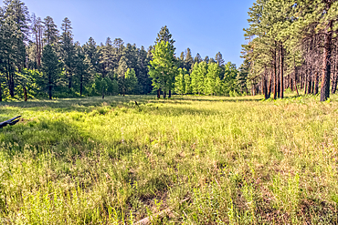
A grassy meadow in a valley near Clear Creek Canyon at Grand Canyon North Rim Arizona.
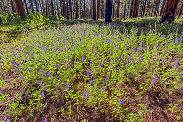
A field of purple wildflowers called Lupine at Grand Canyon North Rim Arizona near Clear Creek Canyon. Species Lupinus in the family Fabaceae.
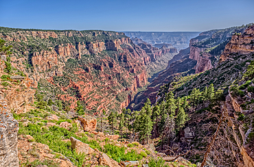
View of Clear Creek Canyon from its north cliffs at Grand Canyon North Rim Arizona.
Dry Waterfall on the north end of Clear Creek Canyon at Grand Canyon North Rim Arizona.
View of Clear Creek Canyon from its north cliffs at Grand Canyon North Rim Arizona.
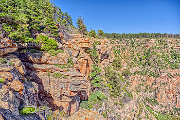
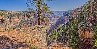
The jagged north cliffs of Clear Creek Canyon at Grand Canyon North Rim Arizona.
Dry Waterfall on the north end of Clear Creek Canyon at Grand Canyon North Rim Arizona.
Dry Waterfall on the north end of Clear Creek Canyon at Grand Canyon North Rim Arizona.
Dry Waterfall on the north end of Clear Creek Canyon at Grand Canyon North Rim Arizona.
Burned trees at the north edge of Clear Creek Canyon at Grand Canyon North Rim Arizona.
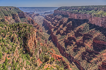
View of Clear Creek Canyon from its east rim at Grand Canyon North Rim Arizona.
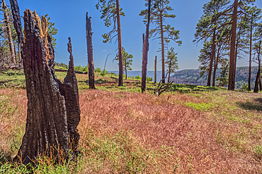
Burned trees on the north end of Clear Creek Canyon at Grand Canyon North Rim Arizona.
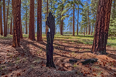
Burned tree in the forest of Grand Canyon North Rim Arizona near the edge of Clear Creek Canyon.
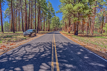
An SUV parked along Cape Royal Road at Grand Canyon North Rim Arizona.
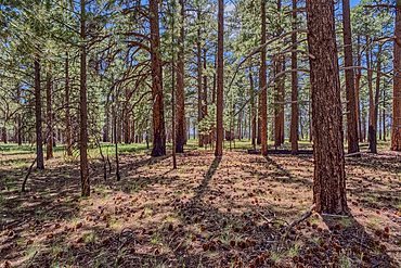
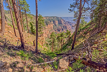
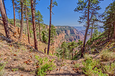
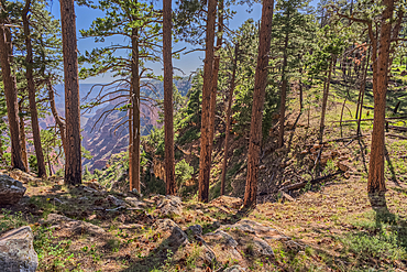
The forest of Grand Canyon North Rim Arizona near the edge of Clear Creek Canyon.
A storm rolling across Grand Canyon near the Sinking Ship formation, viewed from Coronado Ridge, Grand Canyon National Park, UNESCO World Heritage Site, Arizona, United States of America, North America
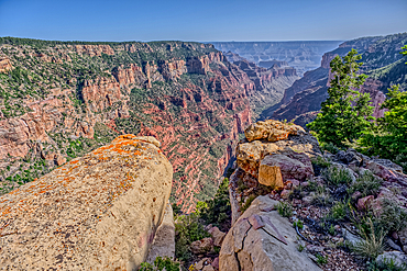
Naji Ravine just south of Naji Point on the North Rim of Grand Canyon National Park, UNESCO World Heritage Site, Arizona, United States of America, North America
Cliff views from the edge of Naji Point on the North Rim of Grand Canyon National Park, UNESCO World Heritage Site, Arizona, United States of America, North America
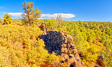
The crumbling walls of ancient Indian Ruins along the south rim of Rattlesnake Canyon near the historic Chavez Trail, Arizona, United States of America, North America
Volcanic cinder hills in Coconino National Forest near Sunset Crater National Monument of Arizona.
Volcanic cinder hills in Coconino National Forest near Sunset Crater National Monument of Arizona.
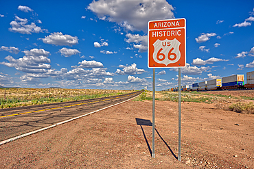
Road sign marking Historic Route 66 just east of Seligman, the birthplace of the famous road, Arizona, United States of America, North America
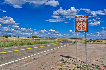
A road sign marking the Historic Route 66 just west of Ash Fork, Arizona, United States of America, North America
Volcanic cinder hills in Coconino National Forest near Sunset Crater National Monument of Arizona.
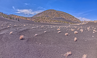
Volcanic cinder hills in Coconino National Forest near Sunset Crater National Monument of Arizona.
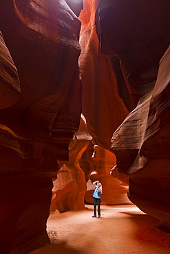
Upper Antelope Canyon, Tse' bighanilini, LeChee Chapter, Navajo Nation, Arizona, United States of America, North America
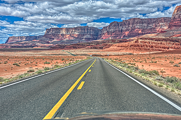
Vermilion Cliffs National Monument Arizona viewed thru the windshield of a moving vehicle traveling on highway US89A.
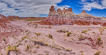
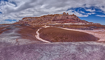
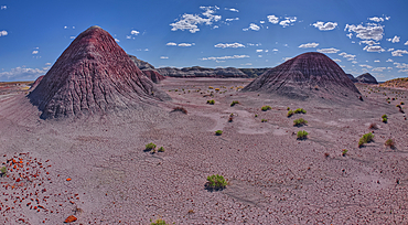
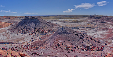
Tall hoodoo towers in the valley below Blue Mesa in Petrified Forest National Park, Arizona, United States of America, North America
A valley below the east cliffs of Blue Mesa in Petrified Forest National Park, Arizona, United States of America, North America
The Billings Gap Overlook on the east side of Blue Mesa in Petrified Forest National Park, Arizona, United States of America, North America
The Billings Gap Overlook on the east side of Blue Mesa in Petrified Forest National Park, Arizona, United States of America, North America
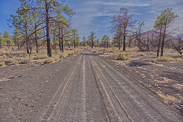
Fire Road 546 where it branches off from Sunset Crater National Monument into Coconino National Forest of Arizona.
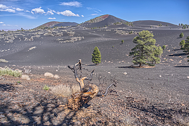
A burned tree below a volcanic cinder hill in the Coconino National Forest near Sunset Crater National Monument Arizona.
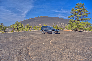
An SUV traveling near Volcanic cinder hills in Coconino National Forest near Sunset Crater National Monument of Arizona.
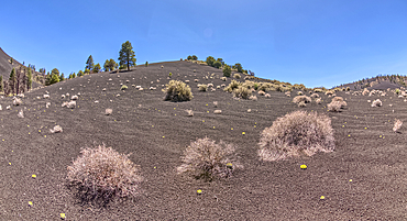
Volcanic cinder hills in Coconino National Forest near Sunset Crater National Monument of Arizona.

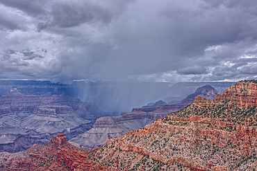
View of the Grand Canyon west of Navajo Point with a storm rolling in from the west, Arizona, United States of America, North America
Lightning striking from a monsoon storm building up over the abandoned Mexican Quarry near Perkinsville, Arizona, United States of America, North America
The boundary fence between Coconino National Forest and Sunset Crater National Monument of Arizona.
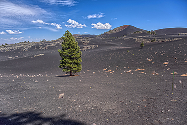
Lone Pine Tree in a volcanic valley in Coconino National Forest near Sunset Crater National Monument of Arizona.
Volcanic cinder hills in Coconino National Forest near Sunset Crater National Monument of Arizona.
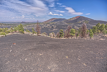
Volcanic cinder hills in Coconino National Forest near Sunset Crater National Monument of Arizona.
Volcanic cinder hill in Coconino National Forest near Sunset Crater National Monument of Arizona with snow capped Humphrey's Peak in the background.
The Little Teepees on the north side of Haystack Mesa in Petrified Forest National Park, Arizona, United States of America, North America
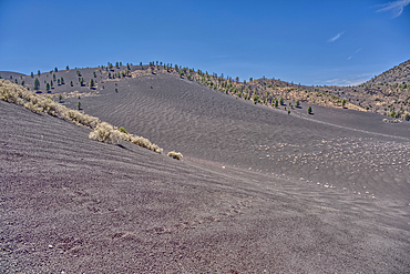
Volcanic cinder hills in Coconino National Forest near Sunset Crater National Monument of Arizona.
East slopes of Haystack Mesa in Petrified Forest National Park, Arizona, United States of America, North America
The south Haystack Hill in Petrified Forest National Park, Arizona, United States of America, North America
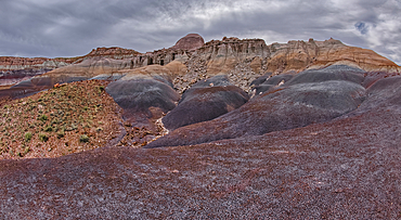
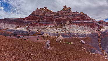
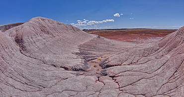
Hoodoo filled cliffs on the north side of Blue Mesa in Petrified Forest National Park, Arizona, United States of America, North America
The east cliffs of Blue Mesa near sunset, Petrified Forest National Park, Arizona, United States of America, North America
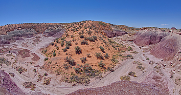
View of Anvil Hill and Crystal Butte from the summit of Crystal Mesa west of Hamilili Point in Petrified Forest National Park, Arizona, United States of America, North America
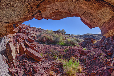
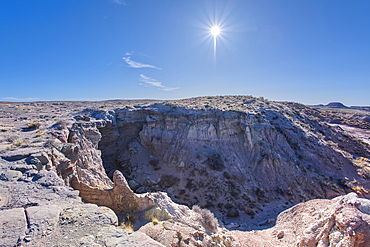
A cliff cave below Crystal Mesa west of Hamilili Point in Petrified Forest National Park, Arizona, United States of America, North America
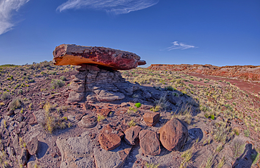
A rock table sculpted by the wind on Crystal Mesa west of Hamilili Point in Petrified Forest National Park, Arizona, United States of America, North America
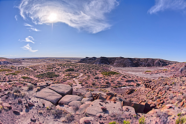
View of Crystal Mesa west of Hamilili Point in Petrified Forest National Park, Arizona, United States of America, North America
A dry waterfall west of Hamilili Point in Petrified Forest National Park, Arizona, United States of America, North America
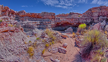
Goblin Garden west of Hamilili Point in Petrified Forest National Park, Arizona, United States of America, North America
Goblin Garden west of Hamilili Point in Petrified Forest National Park, Arizona, United States of America, North America
Goblin Garden west of Hamilili Point in Petrified Forest National Park, Arizona, United States of America, North America
Anvil Hill west of Hamilili Point in Petrified Forest National Park, Arizona, United States of America, North America
A dry waterfall in Crystal Creek below Crystal Mesa west of Hamilili Point in Petrified Forest National Park, Arizona, United States of America, North America
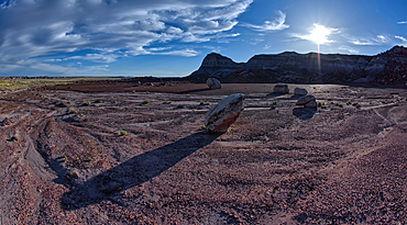
A sloping red sand dune above Hamilili Wash in Petrified Forest National Park, Arizona, United States of America, North America
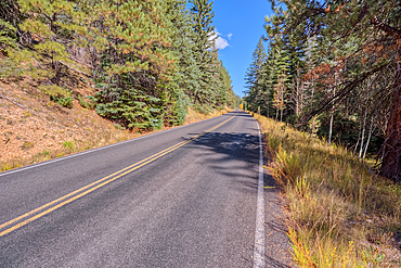
Cape Royal Road winding through Fuller Canyon at Grand Canyon North Rim, UNESCO, Arizona, United States of America
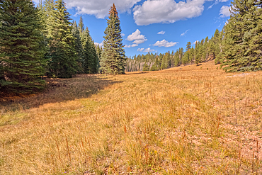
A meadow in Fuller Canyon off Cape Royal Road at Grand Canyon North Rim, Arizona, United States of America
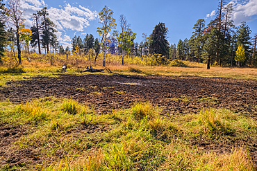
Greenland Lake reduced to a mud hole, Grand Canyon North Rim, UNESCO, Arizona, United States of America
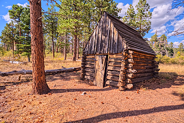
The historic Salt Cabin dating back to 1870s near Greenland Lake at Grand Canyon North Rim, UNESCO, Arizona, United States of America

Aspen trees in autumn colors east of Greenland Lake, Grand Canyon North Rim, Arizona, United States of America
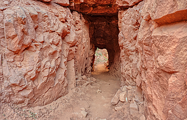
The west entrance of Supai Tunnel on North Kaibab Trail, Grand Canyon North Rim, UNESCO, Arizona, United States of America
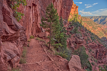
The Red Wall of sandstone east of Supai Tunnel on North Kaibab Trail, Grand Canyon North Rim, UNESCO, Arizona, United States of America
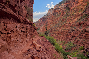
The sheer cliff of the Red Wall along the North Kaibab Trail, Grand Canyon North Rim, UNESCO, Arizona, United States of America
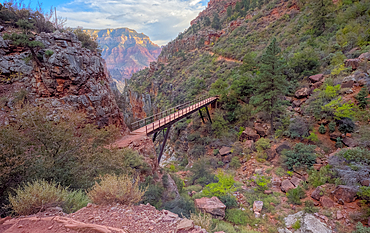
View above Red Wall Bridge crossing Roaring Springs Canyon, North Kaibab Trail, Grand Canyon North Rim, UNESCO, Arizona, United States of America
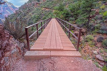
Red Wall Bridge crossing Roaring Springs Canyon on North Kaibab Trail, Grand Canyon North Rim, UNESCO, Arizona, United States of America
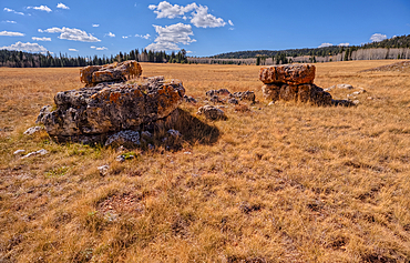
Lonely Boulders and exposed rock in Pleasant Valley, Kaibab National Forest just north of Grand Canyon North Rim, Arizona, United States of America
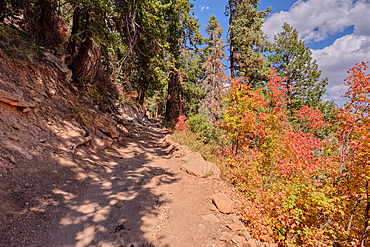
Looking back up the first leg of the North Kaibab Trail at Grand Canyon North Rim, UNESCO, Arizona, United States of America
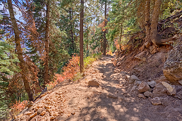
The upper leg of the North Kaibab Trail at Grand Canyon North Rim, UNESCO, Arizona, United States of America

The Coconino Overlook along the North Kaibab Trail at Grand Canyon North Rim, UNESCO, Arizona, United States of America
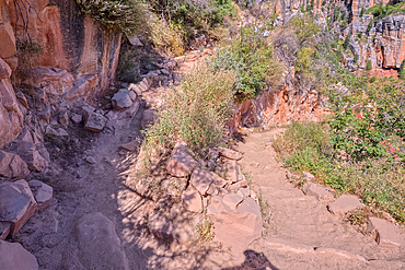
The 11th switchback along the North Kaibab Trail at Grand Canyon North Rim, UNESCO, Arizona, United States of America
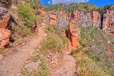
The 17th switchback along the North Kaibab Trail at Grand Canyon North Rim, UNESCO, Arizona, United States of America