Results
« Previous 1 … 4 5 6
585 results found

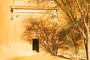
Thuraya Wellness lounge, Our Habitas AlUla, sustainable luxury resort in ancient oasis in canyons of Ashar Valley, Medina Province, Saudi Arabia

Thuraya Wellness lounge, Our Habitas AlUla, sustainable luxury resort in ancient oasis in canyons of Ashar Valley, Medina Province, Saudi Arabia

Swimming pool, Our Habitas AlUla, sustainable desert luxury resort in ancient oasis in canyons of the Ashar Valley, Medina Province, Saudi Arabia
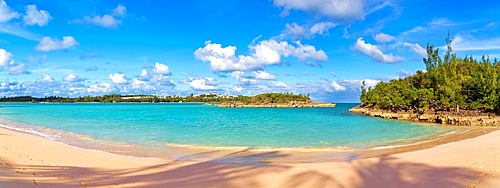
Turtle Bay, a popular sandy beach in Cooper's Island, St. George's parish, Bermuda, North Atlantic
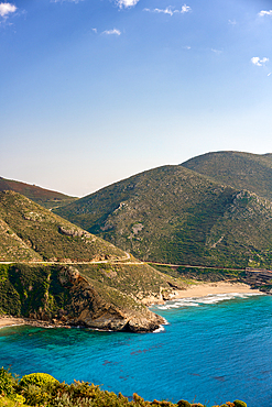
Marmari beach with turquoise sea water in Mani Peninsula, Peloponnese, Greece
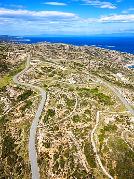
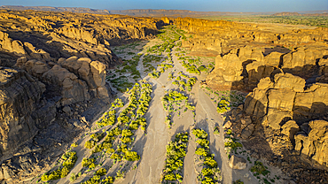
Drone aerial view of Kriaritsi project area with abandoned roads in the south of Greece, Sithonia, Chalkidiki, Greece
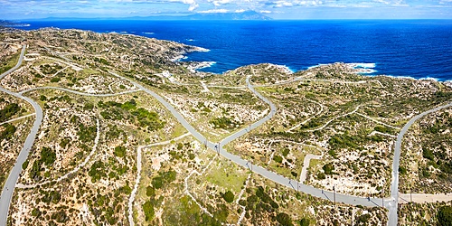
Drone aerial view of Kriaritsi project area with abandoned roads in the south of Greece, Sithonia, Chalkidiki, Greece
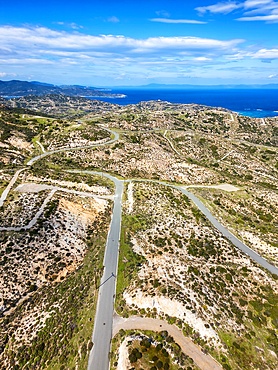
Drone aerial view of Kriaritsi project area with abandoned roads in the south of Greece, Sithonia, Chalkidiki, Greece
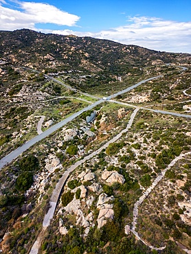
Drone aerial view of Kriaritsi project area with abandoned roads in the south of Greece, Sithonia, Chalkidiki, Greece
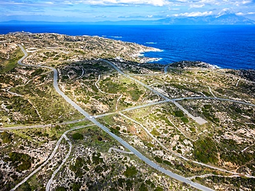
Drone aerial view of Kriaritsi project area with abandoned roads in the south of Greece, Sithonia, Chalkidiki, Greece

Ancient theatre at the Asclepieion of Epidaurus, UNESCO, Peloponnese, Greece
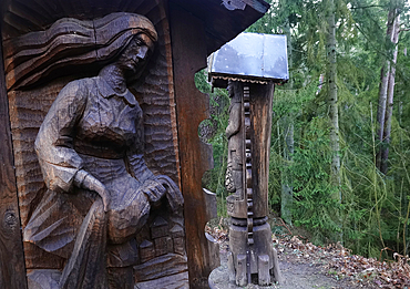
Woodcarvings, Lithuania
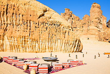
Sharaan Nature Reserve safari tour, AlUla, Medina Province, Saudi Arabia
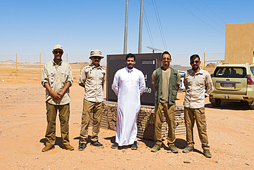
Guide and Ranger team of the Sharaan Nature Reserve, AlUla, Medina Province, Saudi Arabia

Helicopter on take-off area near the Maraya Theatre, in AlUla's Ashar Valley, Medina Province, Saudi Arabia
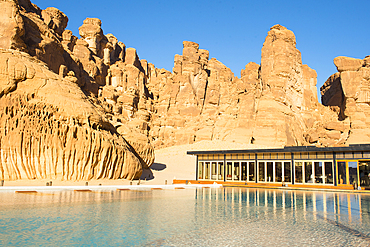
Swimming pool, surrounded by sandstone rock structures, Our Habitas AlUla, oasis in canyons of the Ashar Valley, Medina Province, Saudi Arabia
Relaxing by the Swimming pool, surrounded by sandstone rock structures, Our Habitas AlUla, in the Ashar Valley, Medina Province, Saudi Arabia
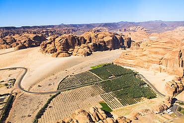
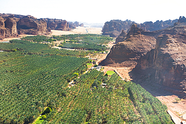
Aerial view from helicopter, of a farm in an ancient oasis in the desert with canyons of the Ashar Valley,AlUla, Medina Province, Saudi Arabia
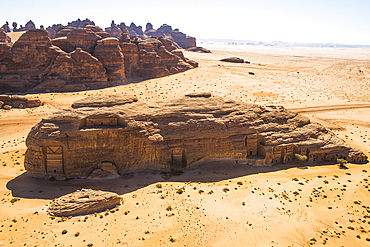
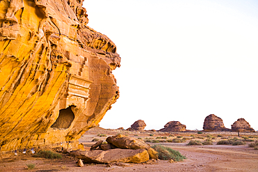
Aerial of tombs carved in sandstone rock of Jabal Banat (Qasr al-Bint), Hegra (Madain Salih), UNESCO, AlUla area, Medina Province, Saudi Arabia
Aerial of tombs carved in sandstone rock of Jabal Banat (Qasr al-Bint), Hegra (Madain Salih), UNESCO, AlUla area, Medina Province, Saudi Arabia

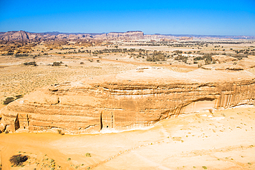
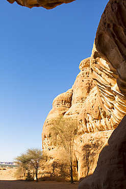
Aerial view of red sandstone formation, in the area of AlUla, Medina Province, Saudi Arabia
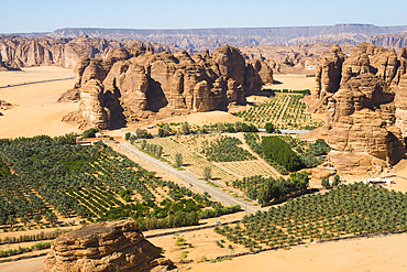
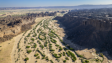
Aerial view of Palm grove and farms in the area of AlUla, Medina Province, Saudi Arabia
Aerial view of Palm grove and farms in the oasis of AlUla, Medina Province, Saudi Arabia
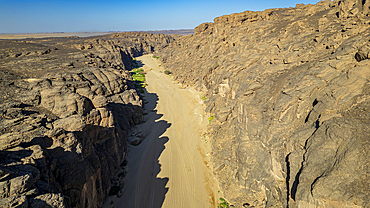
Entrance of the passage through the Siq channel at Jabal Ithlib area of Hegra (Madain Salih), UNESCO, AlUla, Medina Province, Saudi Arabia
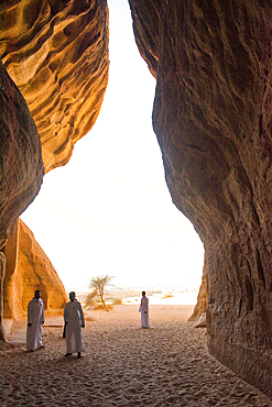
Passage through the Siq channel at Jabal Ithlib area within the Site of Hegra (Madain Salih), UNESCO, AlUla, Medina Province, Saudi Arabia
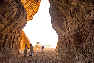
Passage through the Siq channel at Jabal Ithlib area within the Site of Hegra (Madain Salih), UNESCO, AlUla, Medina Province, Saudi Arabia
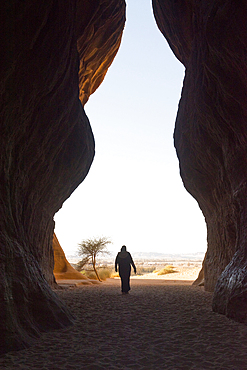
Passage through the Siq channel at Jabal Ithlib area within the Site of Hegra (Madain Salih), UNESCO, AlUla, Medina Province, Saudi Arabia
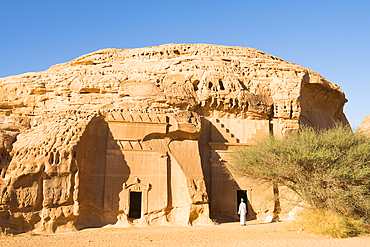
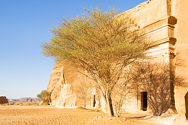
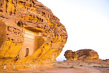
Tombs carved into sandstone rock of Jabal Banat (Qasr Al-Bint) area in site of Hegra (Madain Salih), UNESCO, AlUla, Medina Province, Saudi Arabia
Tombs carved into sandstone rock of Jabal Banat (Qasr Al-Bint) area in site of Hegra (Madain Salih), UNESCO, AlUla, Medina Province, Saudi Arabia
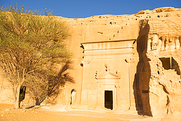
Tombs carved into sandstone rock of Jabal Banat (Qasr Al-Bint) area in site of Hegra (Madain Salih), UNESCO, AlUla, Medina Province, Saudi Arabia
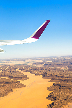
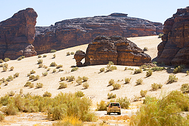
Aerial view from an aircraft of the desert in AlUla region, Medina Province, Saudi Arabia
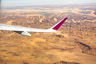
Aerial view from an aircraft of the desert in AlUla region, Medina Province, Saudi Arabia

Hamad International Airport of Doha, Qatar
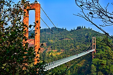
Suspension bridge leading into Huangling, Wuyuan County, Shangrao City, Jiangxi Province, China

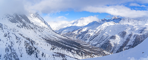
Kasprowy Wierch and the surrounding area in winter, Tatra mountains, Poland
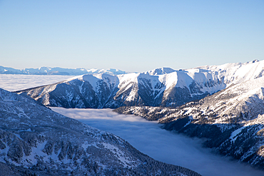
Kasprowy Wierch and the surrounding area in winter, Tatra mountains, Poland
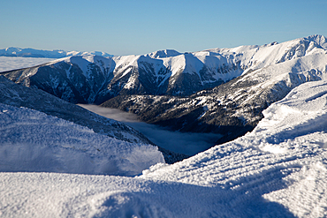
Kasprowy Wierch and the surrounding area in winter, Tatra mountains, Poland
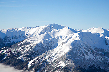
Kasprowy Wierch and the surrounding area in winter, Tatra mountains, Poland
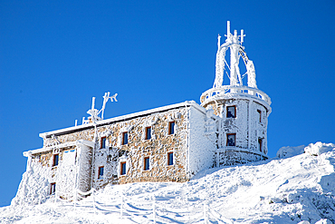
Kasprowy Wierch and the surrounding area in winter, Tatra mountains, Poland
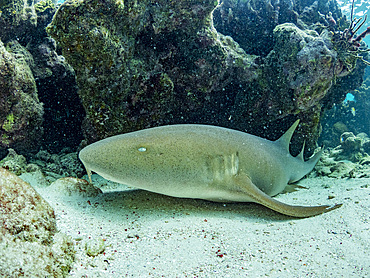
Nurse shark (Ginglymostoma cirratum), on the sand in Hol Chan Marine Preserve, inside the Mesoamerican Barrier Reef, Belize
View of snow covered Aosta Valley and mountains from Pavillon du Mont Frety in winter, Courmayeur, Aosta Valley, Italian Alps, Italy
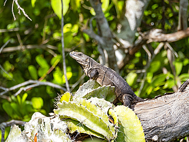
Black Spiny-tailed iguana (Ctenosaura similis), on New River near Lamanai, Belize
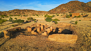
Aerial of Ouara, former capital of the Ouaddai Empire, Chad
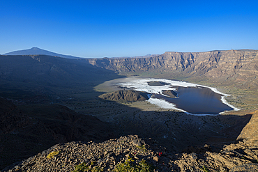
Aerial of the Trou du Natron volcanic crater and its natron lakes, Tibesti Mountains, Chad
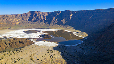
Aerial of the Trou du Natron volcanic crater and its natron lakes, Tibesti Mountains, Chad
Tousside volcano above Trou du Natron, Tibesti Mountains, Chad
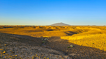
Aerial of the rocky mountains around Zouar, Tibesti Mountains, Chad
Aerial of the rocky mountains around Zouar, Tibesti Mountains, Chad
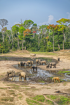
African forest elephant (Loxodonta cyclotis), Dzanga Bai, Dzanga Sangha National Park, UNESCO, Central African Republic
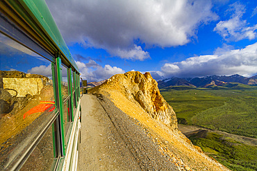
Riding the bus along the 92 mile-long road into Denali National Park, Alaska, United States of America
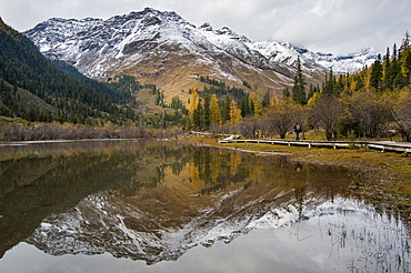
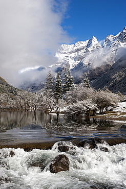
Mount Siguniang, an area of outstanding natural beauty in Sichuan Province, China, Asia

Coast around Llangrannog, Cardigan Bay, Ceredigion county, Wales, United Kingdom
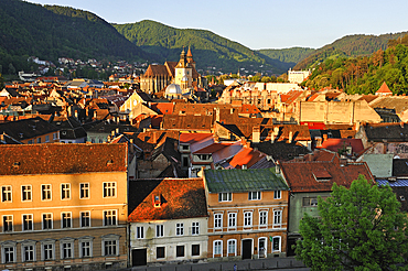
Historic city centre of Brasov, Transylvania, Romania

View of Kyoto Station interior during day, Shimogyo Ward, Higashishiokoji Kamadonocho, Kyoto, Honshu, Japan
Tombs carved into sandstone rock of Jabal Banat (Qasr Al-Bint) area in site of Hegra (Madain Salih), UNESCO, AlUla, Medina Province, Saudi Arabia

Tombs carved into sandstone rock of Jabal Banat (Qasr Al-Bint) area in site of Hegra (Madain Salih), UNESCO, AlUla, Medina Province, Saudi Arabia
Aerial of beautiful rock formations around Zouar, Tibesti Mountains, Chad
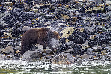
Adult brown bear (Ursus arctos) shaking water from its fur near whale carcass in Glacier Bay National Park, Alaska, United States of America
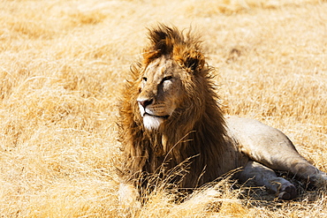
Lion (Panthera leo), Ngorongoro Crater Conservation Area, UNESCO World Heritage Site, Tanzania, East Africa, Africa

Black-winged Stilt (Himantopus himantopus), Ndutu Conservation Area, Serengeti, Tanzania, East Africa, Africa
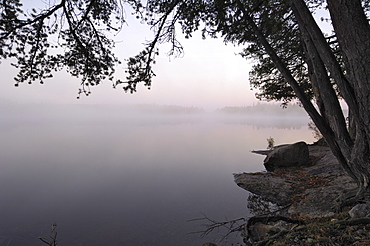
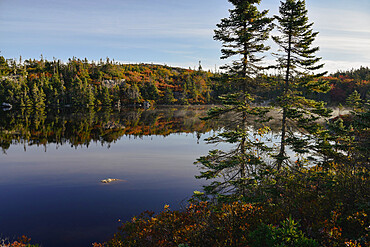
Misty morning, Malberg Lake, Boundary Waters Canoe Area Wilderness, Superior National Forest, Minnesota, United States of America, North America
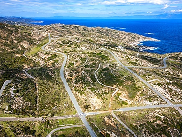
Drone aerial view of Kriaritsi project area with abandoned roads in the south of Greece, Sithonia, Chalkidiki, Greece
Tombs carved into sandstone rock of Jabal Banat (Qasr Al-Bint) area in site of Hegra (Madain Salih), UNESCO, AlUla, Medina Province, Saudi Arabia
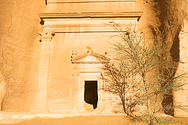
Tombs carved into the sandstone rock of Jabal Banat (Qasr al-Bint) area within site of Hegra, UNESCO, AlUla, Medina Province, Saudi Arabia
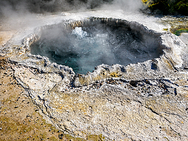
Natural pool of boiling water, geothermal area, Te Puia, Gisborne District, North Island, New Zealand, Pacific
Tombs carved into sandstone rock of Jabal Banat (Qasr Al-Bint) area in site of Hegra (Madain Salih), UNESCO, AlUla, Medina Province, Saudi Arabia
Tombs carved into the sandstone rock of Jabal Banat (Qasr al-Bint) area within site of Hegra, UNESCO, AlUla, Medina Province, Saudi Arabia
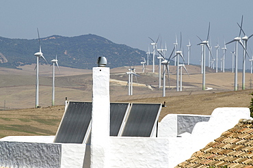
Spain. Wind turbines and houses with solar panels in rural areas in andalucia

Antique Assam Tea Farm, Sun Moon Lake National Scenic Area, Nantou county, Taiwan, Asia
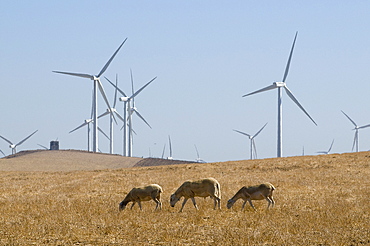
Spain. Wind turbines in rural areas in andalucia
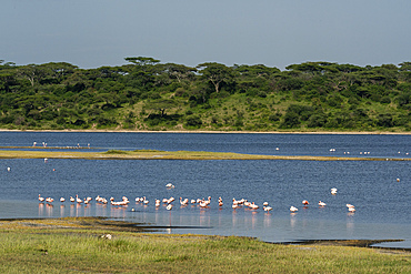
Greater flamingos (Phoenicopterus roseus) feeding at Lake Ndutu, Ndutu Conservation Area, Serengeti, Tanzania, East Africa, Africa
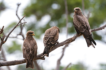
Yellow-billed kite (Milvus parasitus) and black kite (Milvus migrans) perching on a tree, Khwai Concession Area, Okavango Delta, Botswana, Africa
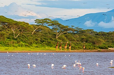
Masai giraffe (Giraffa camelopardalis tippelskirchi), Ndutu, Ngorongoro Conservation Area, UNESCO World Heritage Site, Serengeti, Tanzania, East Africa, Africa

Greater flamingos (Phoenicopterus ruber) on Lake Ndutu, Ngorongoro Conservation Area, Serengeti, Tanzania, East Africa, Africa
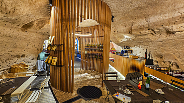
Cave hotel in Sassi di Matera, Basilicata, Italy, Europe
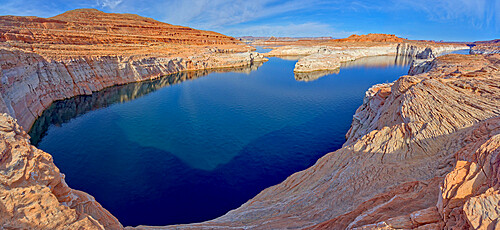
Lake Powell viewed from an overlook in the Wahweap Recreation Area near Page, Arizona, United States of America, North America

Lake Powell viewed from an overlook in the Wahweap Recreation Area near Page, Arizona, United States of America, North America

Leopard (Panthera pardus), Khwai Concession Area, Okavango Delta, Botswana, Africa
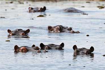
Hippopotamus (Hippopotamus amphibius), Khwai Concession Area, Okavango Delta, Botswana, Africa

Huge statue at a Buddhist temple, Sun Moon Lake, National Scenic Area, Nantou county, Taiwan, Asia
Peggy's Cove Conservation Area in Autumn, Nova Scotia, Canada, North America

Early in morning frost on trees in Mount Siguniang, an area of outstanding natural beauty in Sichuan Province, China, Asia
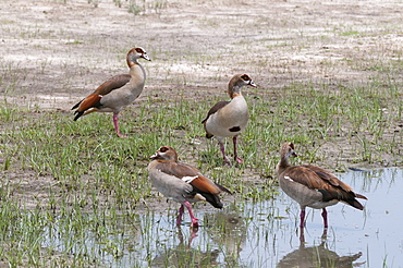
Egyptian geese (Alopochen aegyptiaca), Savuti Marsh area, Chobe National Park, Botswana, Africa

Huge statue at a Buddhist temple, Sun Moon Lake, National Scenic Area, Nantou county, Taiwan, Asia

Peggy's Cove Conservation Area in Autumn, Nova Scotia, Canada, North America
African openbill (Anastomus lamelligerus), Khwai Concession Area, Okavango Delta, Botswana, Africa
Mount Siguniang, an area of outstanding natural beauty in Sichuan Province, China, Asia
Early in morning frost on trees in Mount Siguniang, an area of outstanding natural beauty in Sichuan Province, China, Asia
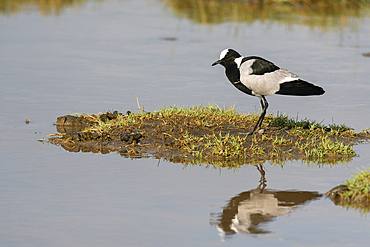
Blacksmith lapwing (Vanellus armatus), Ndutu Conservation Area, Serengeti, Tanzania, East Africa, Africa
Early in morning frost in Mount Siguniang, an area of outstanding natural beauty in Sichuan Province, China, Asia

Peggy's Cove Conservation Area in Autumn, Nova Scotia, Canada, North America
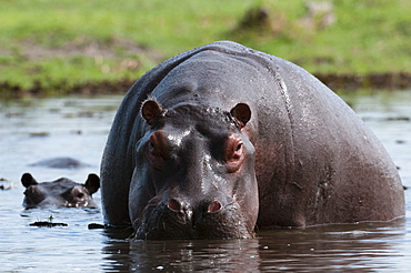
Hippopotamus (Hippopotamus amphibius), Khwai Concession Area, Okavango Delta, Botswana, Africa
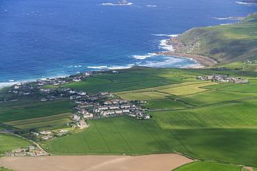
Aerial shot of Penzance area, Cornwall, United Kingdom, Europe
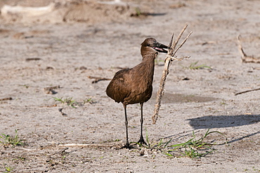
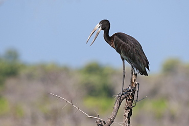
Hamerkop (Scapus umbretta), Khwai Concession Area, Okavango Delta, Botswana, Africa
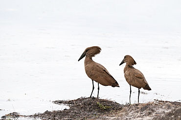
Hamerkop (Scapus umbretta), Khwai Concession Area, Okavango Delta, Botswana, Africa

Peggy's Cove Conservation Area in Autumn, Nova Scotia, Canada, North America
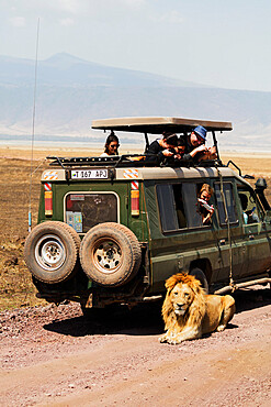
Tourists on a game drive watching a lion (Panthera Leo), Ngorongoro Crater Conservation Area, UNESCO World Heritage Site, Tanzania, East Africa, Africa
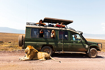
Tourists on a game drive watching a lion (Panthera leo), Ngorongoro Crater Conservation Area, UNESCO World Heritage Site, Tanzania, East Africa, Africa
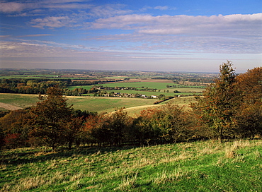
View from the Pegston Hills, an Area of Outstanding Natural Beauty, of Hertfordshire and Bedfordshire, England, United Kingdom, Europe
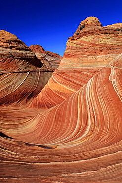
Coyote buttes north, the wave, sandstone formed by wind and water, paria wilderness area, arizona, usa