Results
« Previous 1 … 4 5 6 7 8 … 24 Next »
2347 results found
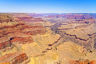
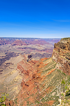
Grand Canyon, Pima Point, Grand Canyon National Park, UNESCO World Heritage Site, Arizona, United States of America, North America
Grand Canyon, Mohave Point, Grand Canyon National Park, UNESCO World Heritage Site, Arizona, United States of America, North America
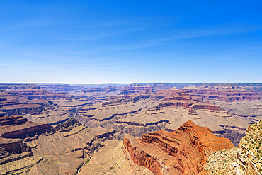
Grand Canyon, Hopi Point, Grand Canyon National Park, UNESCO World Heritage Site, Arizona, United States of America, North America

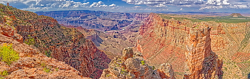
View of the Grand Canyon west of Navajo Point with a storm rolling in from the west, Arizona, United States of America, North America
Grand Canyon at sunset, Yaki Point, Grand Canyon National Park, UNESCO World Heritage Site, Arizona, United States of America, North America
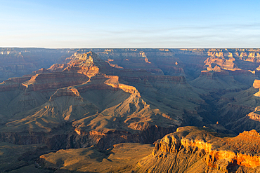
Grand Canyon at sunset, Yaki Point, Grand Canyon National Park, UNESCO World Heritage Site, Arizona, United States of America, North America
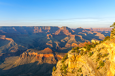
Grand Canyon at sunset, Yaki Point, Grand Canyon National Park, UNESCO World Heritage Site, Arizona, United States of America, North America
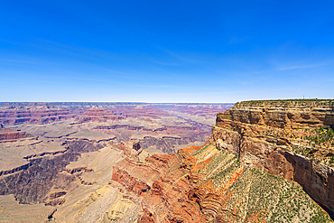
Grand Canyon, from Hermit Road near Mohave Point, Grand Canyon National Park, UNESCO World Heritage Site, Arizona, United States of America, North America
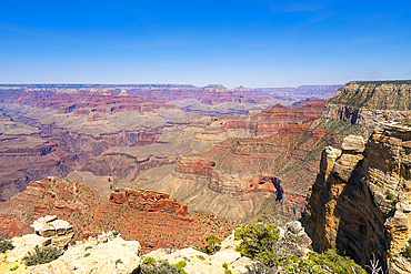
Grand Canyon, Maricopa Point, Grand Canyon National Park, UNESCO World Heritage Site, Arizona, United States of America, North America
Grand Canyon, from Hermit Road near Great Mohave Wall Viewpoint, Grand Canyon National Park, UNESCO World Heritage Site, Arizona, United States of America, North America
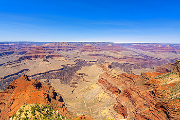
Grand Canyon, Mohave Point, Grand Canyon National Park, UNESCO World Heritage Site, Arizona, United States of America, North America
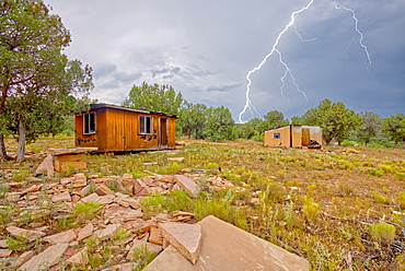
Lightning striking from a monsoon storm building up over the abandoned Mexican Quarry near Perkinsville, Arizona, United States of America, North America
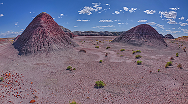
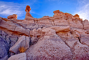
The Little Teepees on the north side of Haystack Mesa in Petrified Forest National Park, Arizona, United States of America, North America
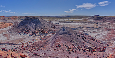
The east cliffs of Blue Mesa near sunset, Petrified Forest National Park, Arizona, United States of America, North America
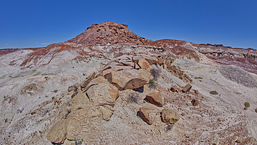
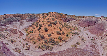
View of Anvil Hill and Crystal Butte from the summit of Crystal Mesa west of Hamilili Point in Petrified Forest National Park, Arizona, United States of America, North America
View of Crystal Mesa west of Hamilili Point in Petrified Forest National Park, Arizona, United States of America, North America
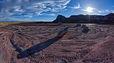
Goblin Garden west of Hamilili Point in Petrified Forest National Park, Arizona, United States of America, North America
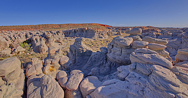
Goblin Garden west of Hamilili Point in Petrified Forest National Park, Arizona, United States of America, North America
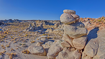
Goblin Garden west of Hamilili Point in Petrified Forest National Park, Arizona, United States of America, North America
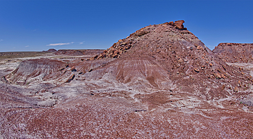
Anvil Hill west of Hamilili Point in Petrified Forest National Park, Arizona, United States of America, North America
Gray clay flats below Anvil Hill west of Hamilili Point in Petrified Forest National Park, Arizona, United States of America, North America
A sloping red sand dune above Hamilili Wash in Petrified Forest National Park, Arizona, United States of America, North America
Cape Royal Road winding through Fuller Canyon at Grand Canyon North Rim, UNESCO, Arizona, United States of America
Greenland Lake reduced to a mud hole, Grand Canyon North Rim, UNESCO, Arizona, United States of America
Greenland Lake reduced to a mud hole, Grand Canyon North Rim, UNESCO, Arizona, United States of America
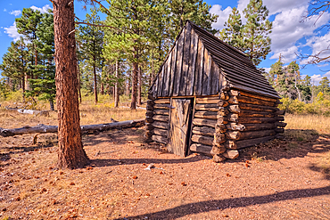
The historic Salt Cabin dating back to 1870s near Greenland Lake at Grand Canyon North Rim, UNESCO, Arizona, United States of America
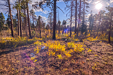
Burned forest area taken over by young Aspen trees in fall colors east of Greenland Lake, Grand Canyon North Rim, Arizona, United States of America
The west entrance of Supai Tunnel on North Kaibab Trail, Grand Canyon North Rim, UNESCO, Arizona, United States of America
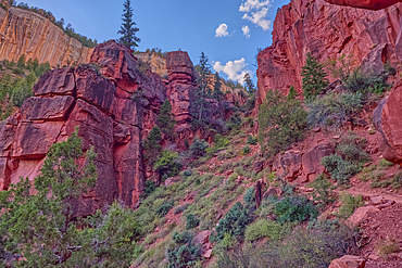
The Red Wall of sandstone east of Supai Tunnel on North Kaibab Trail, Grand Canyon North Rim, UNESCO, Arizona, United States of America
Red Wall cliffs of Roaring Springs Canyon on North Kaibab Trail, Grand Canyon North Rim, UNESCO, Arizona, United States of America
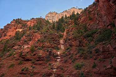
Ephemeral Spring on Red Wall of Roaring Springs Canyon, North Kaibab Trail, Grand Canyon North Rim, UNESCO, Arizona, United States of America
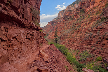
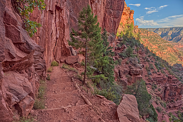
The sheer cliff of the Red Wall along the North Kaibab Trail, Grand Canyon North Rim, UNESCO, Arizona, United States of America
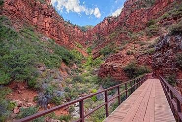
View above Red Wall Bridge crossing Roaring Springs Canyon, North Kaibab Trail, Grand Canyon North Rim, UNESCO, Arizona, United States of America
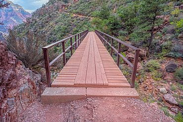
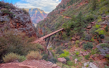
Red Wall Bridge crossing Roaring Springs Canyon on North Kaibab Trail, Grand Canyon North Rim, UNESCO, Arizona, United States of America
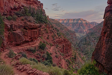
View of Roaring Springs Canyon along the North Kaibab Trail at Grand Canyon North Rim, UNESCO, Arizona, United States of America
View of the Roaring Springs Canyon cliffs from the Red Wall Bridge, Grand Canyon North Rim, UNESCO, Arizona, United States of America
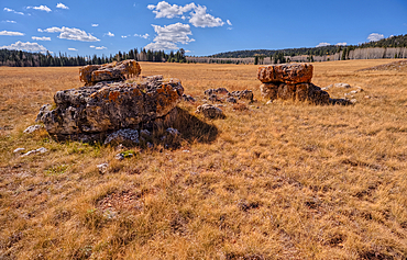
Lonely Boulders and exposed rock in Pleasant Valley, Kaibab National Forest just north of Grand Canyon North Rim, Arizona, United States of America
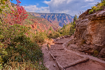
Looking back up the first leg of the North Kaibab Trail at Grand Canyon North Rim, UNESCO, Arizona, United States of America

The Coconino Overlook along the North Kaibab Trail at Grand Canyon North Rim, UNESCO, Arizona, United States of America
The 11th switchback along the North Kaibab Trail at Grand Canyon North Rim, UNESCO, Arizona, United States of America
The 17th switchback along the North Kaibab Trail at Grand Canyon North Rim, UNESCO, Arizona, United States of America
The 18th switchback along the North Kaibab Trail at Grand Canyon North Rim, UNESCO, Arizona, United States of America
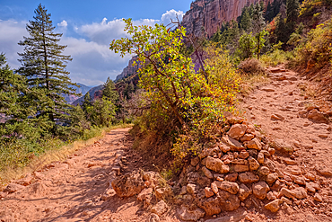
A curve in the North Kaibab Trail between Coconino Overlook and the Supai Tunnel Rest Area, Grand Canyon, Arizona, United States of America
The 20th switchback along the North Kaibab Trail at Grand Canyon North Rim, UNESCO, Arizona, United States of America
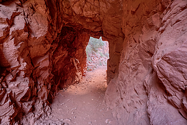
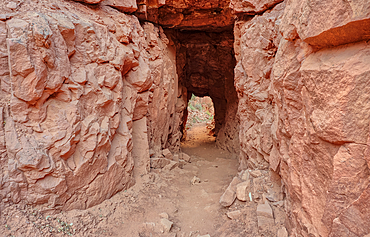
The interior of the Supai Tunnel along the North Kaibab Trail, Grand Canyon North Rim, UNESCO, Arizona, United States of America
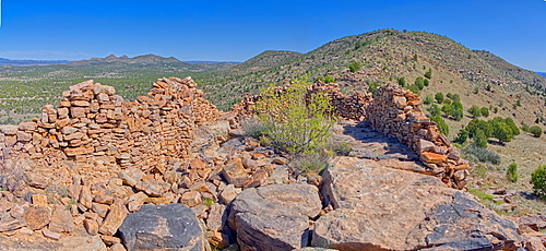
The Pueblo La Plata Indian Ruins near Silver Creek Canyon in the Agua Fria National Monument of Arizona. Located north of Black Canyon City.
The primitive Bloody Basin Road winding thru the Agua Fria National Monument north of Black Canyon City Arizona.
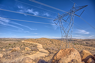
High Tension Power Lines stretching across Bloody Basin in Agua Fria National Monument north of Black Canyon City Arizona.
Look back up the freeway exit ramp for Bloody Basin Road in the Agua Fria National Monument of Arizona. Located north of Black Canyon City.
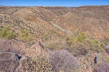
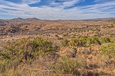
The Agua Fria River Canyon in the Agua Fria National Monument north of Black Canyon City Arizona.
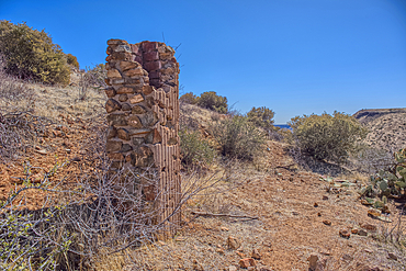
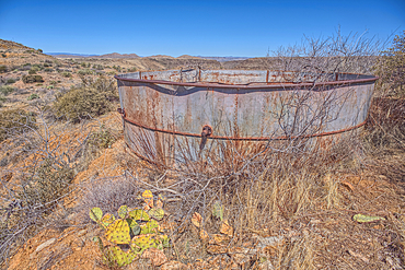
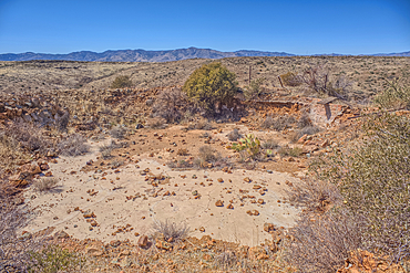
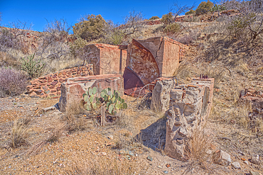
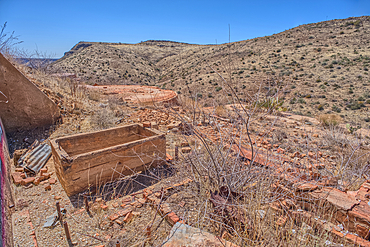
Remnants of the Richinbar Mine within the Agua Fria National Monument north of Black Canyon City Arizona. Mine was established in 1905 but was abandoned in 1940 when the company that owned it went bankrupt.
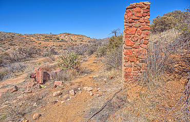
Remnants of the Richinbar Mine within the Agua Fria National Monument north of Black Canyon City Arizona. Mine was established in 1905 but was abandoned in 1940 when the company that owned it went bankrupt.
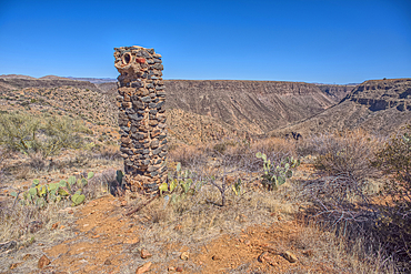
Remnants of the Richinbar Mine within the Agua Fria National Monument north of Black Canyon City Arizona. Mine was established in 1905 but was abandoned in 1940 when the company that owned it went bankrupt.
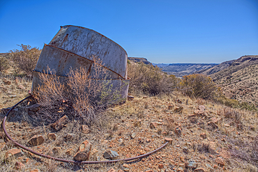
Remnants of the Richinbar Mine within the Agua Fria National Monument north of Black Canyon City Arizona. Mine was established in 1905 but was abandoned in 1940 when the company that owned it went bankrupt.
Remnants of the Richinbar Mine within the Agua Fria National Monument north of Black Canyon City Arizona. Mine was established in 1905 but was abandoned in 1940 when the company that owned it went bankrupt.
Remnants of the Richinbar Mine within the Agua Fria National Monument north of Black Canyon City Arizona. Mine was established in 1905 but was abandoned in 1940 when the company that owned it went bankrupt.
Remnants of the Richinbar Mine within the Agua Fria National Monument north of Black Canyon City Arizona. Mine was established in 1905 but was abandoned in 1940 when the company that owned it went bankrupt.
Remnants of the Richinbar Mine within the Agua Fria National Monument north of Black Canyon City Arizona. Mine was established in 1905 but was abandoned in 1940 when the company that owned it went bankrupt.
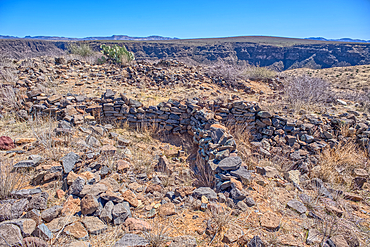
Ancient Indian Ruins near the historic Richinbar Mine in the Agua Fria National Monument north of Black Canyon City Arizona.
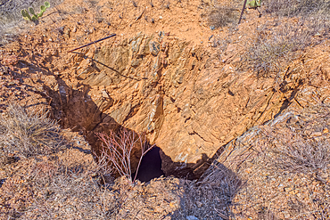
Open mine shaft at the Richinbar Mine within the Agua Fria National Monument north of Black Canyon City Arizona. Mine was established in 1905 but was abandoned in 1940 when the company that owned it went bankrupt.
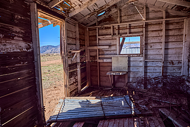
An abandoned cabin next to an active cattle corral in the Agua Fria National Monument north of Black Canyon City Arizona. Public land. No property release needed.
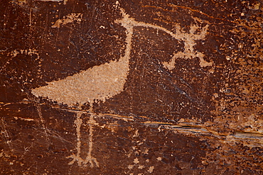
Bird petroglyph, Petrified Forest National Park, Arizona, United States of America, North America
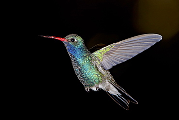
Male broad-billed hummingbird (Cynanthus latirostris) in flight, Madera Canyon, Coronado National Forest, Arizona, United States of America, North America
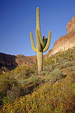
Saguaro cactus (Carnegiea gigantea) among Mexican gold poppy (Eschscholzia californica mexicana), Organ Pipe Cactus National Monument, Arizona, United States of America, North America
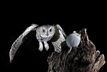
Western screech-owl (Megascops kennicottii) in flight, The Pond, Amado, Arizona, United States of America, North America
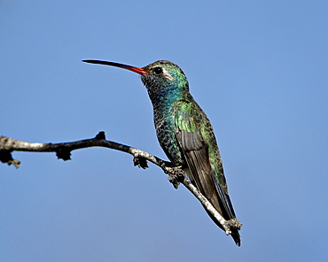
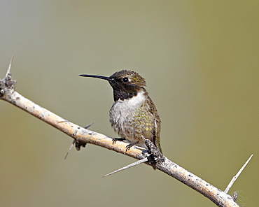
Broad-billed hummingbird (Cynanthus latirostris) perched, Patagonia, Arizona, United States of America, North America
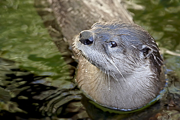
Captive river otter (Lutra canadensis) swimming, Arizona Sonora Desert Museum, Tucson, Arizona, United States of America, North America
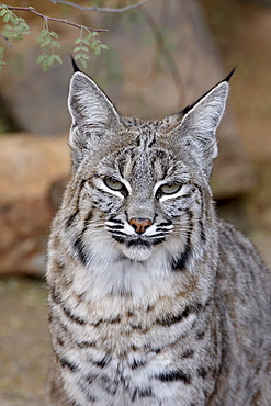
Bobcat (Lynx rufus) in captivity, Arizona Sonora Desert Museum, Tucson, Arizona, United States of America, North America

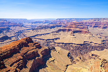
Grand Canyon view at sunset from the west side of Moran Point, Grand Canyon National Park, UNESCO World Heritage Site, Arizona, United States of America, North America
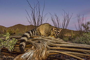
Captive ringtail (Bassariscus astutus) at sunset, Arizona Sonora Desert Museum, Tucson, Arizona, United States of America, North America
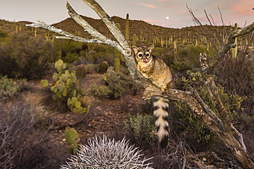
Captive ringtail (Bassariscus astutus) at sunset, Arizona Sonora Desert Museum, Tucson, Arizona, United States of America, North America
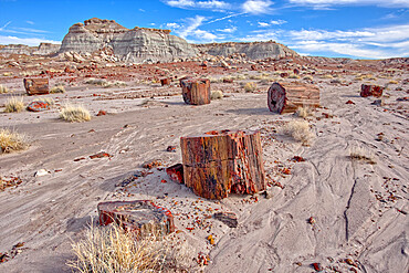
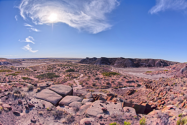
Shattered pieces of petrified wood in a sandy wash in the Jasper Forest of Petrified Forest National Park, Arizona, United States of America, North America
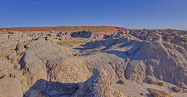
A Hoodoo of expansive clay called Bentonite in the Jasper Forest of Petrified Forest National Park, Arizona, United States of America, North America
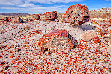
Shattered pieces of petrified wood in a sandy wash in the Jasper Forest of Petrified Forest National Park, Arizona, United States of America, North America
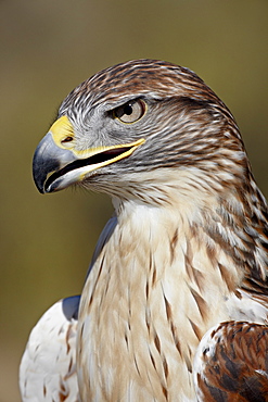
Ferruginous hawk (Buteo regalis) in captivity, Arizona Sonora Desert Museum, Tucson, Arizona, United States of America, North America
Pomeroy Tanks near Sycamore Falls, located in the Kaibab National Forest near Williams, Arizona, United States of America, North America
Black-chinned hummingbird (Archilochus alexandri), Sweetwater Wetlands, Tucson, Arizona, United States of America, North America
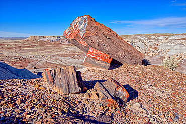
Large pieces of petrified wood in the Jasper Forest of Petrified Forest National Park, Arizona, United States of America, North America
Afternoon thunder shower, from Cape Royal Point, North Rim, Grand Canyon National Park, UNESCO World Heritage Site, Arizona, United States of America, North America
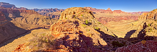
Grand Canyon view from western edge of Horseshoe Mesa, Grand Canyon National Park, UNESCO World Heritage Site, Arizona, United States of America, North America

Panorama view of Freya's Castle and Wotan's Throne from the southwest side of Cape Royal on Grand Canyon North Rim, Arizona, United States of America, North America
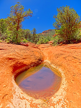
Sandstone bowl of captured rainwater reflecting the sky along Hog Heaven Trail in Sedona, Arizona, United States of America, North America
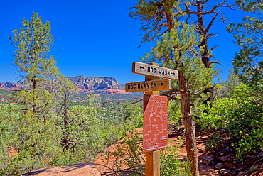
Hog Wash (Hog Heaven), the intersection of two trails on the Northwest side of the Twin Buttes in Sedona, Arizona, United States of America, North America
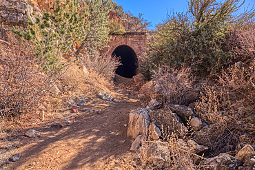
The north entrance of the historic Johnson Canyon Railroad Tunnel, Kaibab National Forest of Arizona, USA
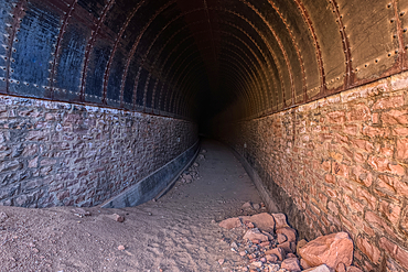
The north entrance of the historic Johnson Canyon Railroad Tunnel, Kaibab National Forest of Arizona, USA
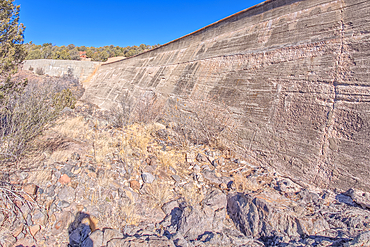
View from below the Stone Dam in the Kaibab National Forest, Arizona, USA
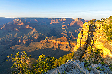
Grand Canyon with the historic Watch Tower on the far left, managed by the National Park Service, Grand Canyon National Park, UNESCO World Heritage Site, Arizona, United States of America, North America

A lone tree isolated just off shore in Watson Lake in Prescott, Arizona, United States of America, North America

The Watson Dam Spillway, the small dam holds back Watson Lake in Prescott, Arizona, United States of America, North America
Ancient Ruins on Sullivan Butte in Chino Valley, Arizona, United States of America, North America
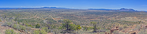
A super panorama of Chino Valley viewed from the summit of Sullivan Butte, Arizona, United States of America, North America
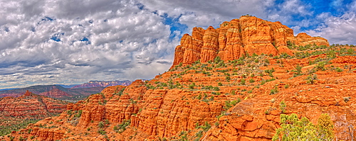
Panorama of Cathedral Rock from the south side just off the HiLine Trail, Sedona, Arizona, United States of America, North America

High angle view of Boulder Creek, the Watson Lake Loop Trail crosses this creek, Prescott, Arizona, United States of America, North America
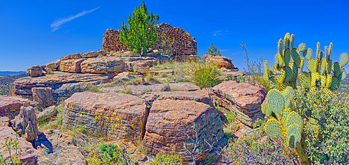
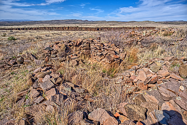
Ancient Indian ruins resembling an old fortress on top Sullivan Butte in Chino Valley, Arizona, United States of America, North America

View of the Secret Cove on the east side of Watson Lake in Prescott, Arizona, United States of America, North America
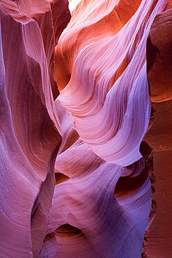
The colourful Navajo sandstone walls of Lower Antelope Canyon, sculpted by water into abstract patterns, Page, Arizona, United States of America, North America

View over Antelope Island from Wahweap Overlook, sunset, Lake Powell, Glen Canyon National Recreation Area, Page, Arizona, United States of America, North America
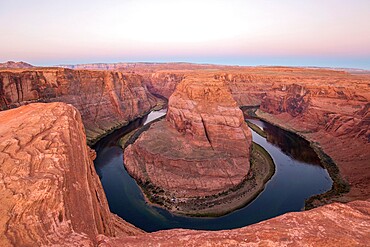
View from cliff edge over the Colorado River at Horseshoe Bend, dawn, Glen Canyon National Recreation Area, Page, Arizona, United States of America, North America
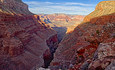
Hermit Creek Canyon viewed from Dripping Springs Trail in the Grand Canyon, Grand Canyon National Park, UNESCO World Heritage Site, Arizona, United States of America, North America

View of Hermit Creek Canyon from a cliff near Santa Maria Springs along the Hermit Trail, Grand Canyon National Park, UNESCO World Heritage Site, Arizona, United States of America, North America