Results
« Previous 1 … 4 5 6 7 8 … 17 Next »
1621 results found
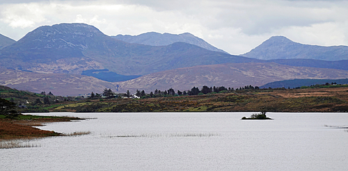
Mountain scenery in central Connemara, Co Galway, Ireland
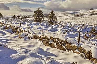
A snowy winter Dartmoor landscape, near Postbridge, Dartmoor National Park, Devon, Great Britain.
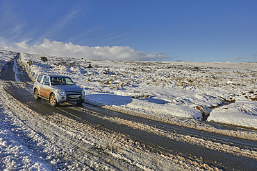
The B3212, one of the main roads across Dartmoor, in winter snow, near Moretonhampstead, Dartmoor National Park, Devon, Great Britain.
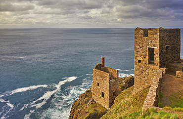
The cliffshide ruins of the engine house of Botallack tin mine, on the Atlantic coast near St Just, Cornwall, Great Britain.
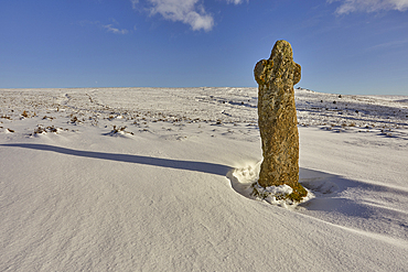
Bennett's Cross, an ancient granite monument, in winter snow, near Warren House, Dartmoor National Park, Devon, Great Britain.
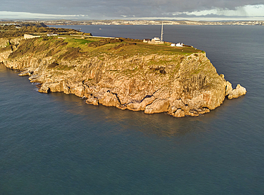
An early morning view of the cliffs at Berry Head, the southernmost point of Torbay, at Brixham, Torbay, Devon, Great Britain.
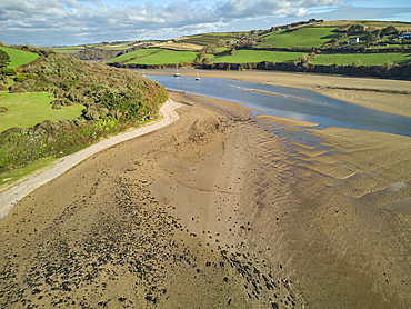
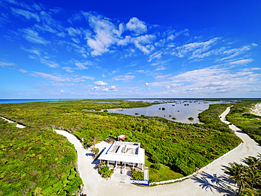
A low tide aerial drone view of the sandy shore and sand banks in the estuary of the River Avon, at Bantham, on the south coast of Devon, Great Britain.
A low tide aerial drone view of the sandy shore and sand banks in the estuary of the River Avon, at Bantham, on the south coast of Devon, Great Britain.
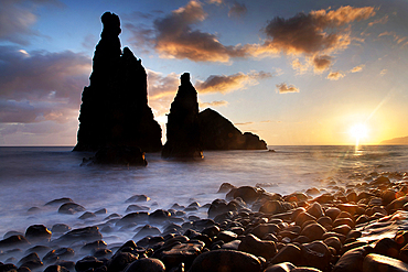
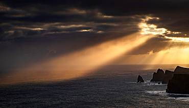
dramatic coastline with rocks of Madeira, Portugal
dramatic coastline with rocks of Madeira, Portugal
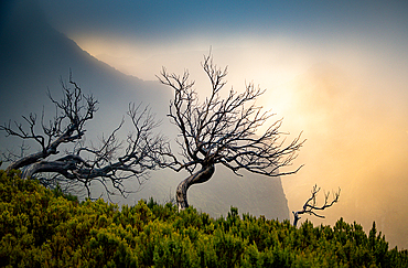
amazing sunrise in the mountains between Pico Do Arieiro and Pico Ruivo, Madeira, Portugal
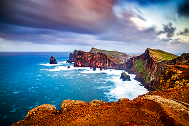
Amazing sunrise on the coast of Madeira

Evenki man on his sledge, Tura, Krasnoyarsk Krai, Evenki state, Russia

The town of Tura, Krasnoyarsk Krai, Evenki state, Russia

Ice road on the Yenisei river, Tura, Krasnoyarsk Krai, Evenki state, Russia
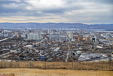
Overlook over Krasnoyarsk, Siberia, Russia

View from summit of Pico do Areeiro, Madeira
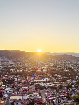
Cityscape seen from Cerro del Fortin at sunset, Oaxaca de Juarez, Oaxaca State, Mexico
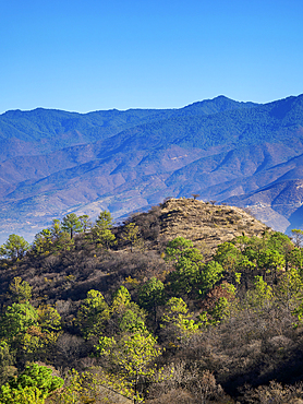
Landscape of Monte Alban, Oaxaca State, Mexico
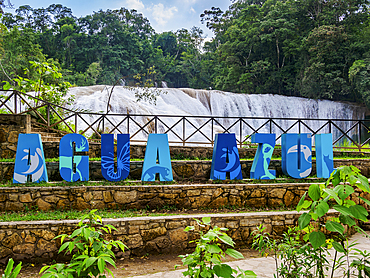
Agua Azul Waterfalls, Arroyo Agua Azul, Chiapas State, Mexico

Landscape seen from the road between Bethel Yochib and Tzinteel, Chiapas State, Mexico

Sumidero Canyon, Chiapas State, Mexico
Punta Sur, elevated view, Cozumel Island, Quintana Roo State, Mexico
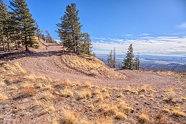
Forest Service Road that leads to the O'Leary Peak Watchtower and Overlook. Adjacent to Sunset Crater National Monument Arizona in the Coconino National Forest.
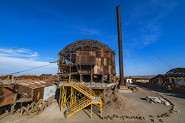
Santa Laura Salpeter mine, UNESCO World Heritage Site, Atacama desert, Chile, South America
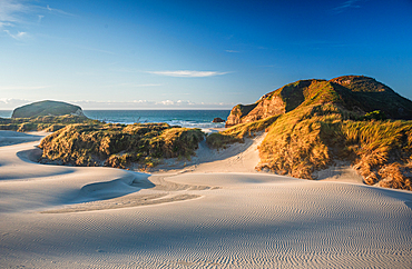
Curved Sand Dunes and Sea Stacks at Sunrise on Remote Wharariki Beach, Golden Bay, South Island, New Zealand
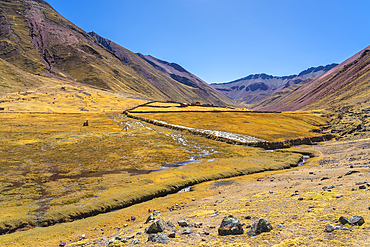
Stream in the Andes, near Rainbow Mountain, Pitumarca District, Cusco (Cuzco) Region, Peru, South America
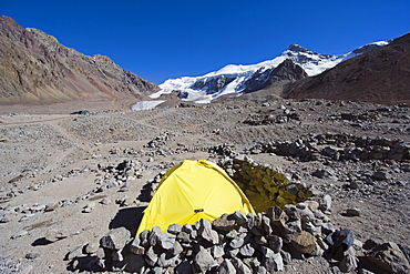
Tent at Plaza de Mulas base camp, Aconcagua 6962m, highest peak in the western hemisphere, Aconcagua Provincial Park, Andes mountains, Argentina, South America
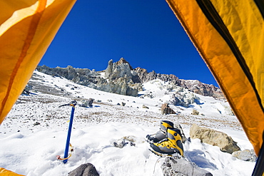
Looking out of a tent at White Rocks campsite, Piedras Blancas, 6200m, Aconcagua 6962m, highest peak in South America, Aconcagua Provincial Park, Andes mountains, Argentina, South America
Aerial view taken by drone of desert area near Capitol Reef National Park on a summer day, Hanksville, Utah, United States of America
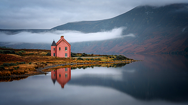
Abandoned pink house on Loch Glass, Highlands, Scotland, United Kingdom
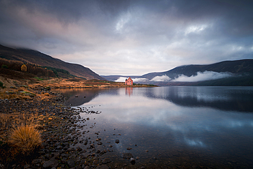
Abandoned pink house on Loch Glass, Highlands, Scotland, United Kingdom
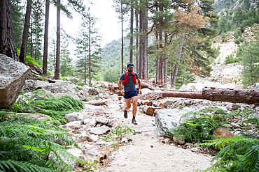
Trail runner on a mountain path, France
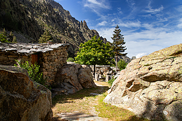
Mountain scenery, Island of Corsica, France
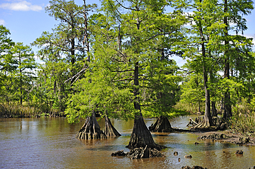
Cypress-lined backwater channel of Neches River, Beaumont, Texas, United States of America
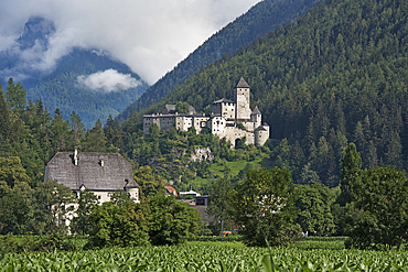
Taufers Castle, Campo Tures (Sand in Taufers), Valle Aurina, South Tyrol (Alto Adige), Italy
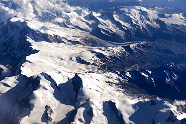
Summits of Alps viewed from an airplane over Europe

Four-wheel drive vehicle in the Sharqiya Sands, formerly Wahiba Sands, desert region, Sultanate of Oman, Arabian Peninsula
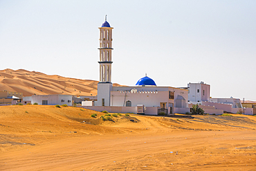
Mosque in The Sharqiya Sands, formerly Wahiba Sands, desert region, Sultanate of Oman, Arabian Peninsula
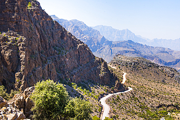
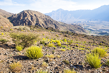
Track (Al Barida Road) on western slope of Djebel Ahkdar from Sharaf al Alamayn Pass, 2036m, to Bilad Sayt and Rustaq road, Oman, Arabian Peninsula
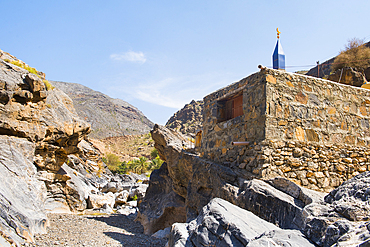
Small Mosque beside wadi near Al Hajir, on track on western slope of Djebel Ahkdar below Sharaf al Alamayn Pass, 2036m, Oman, Arabian Peninsula
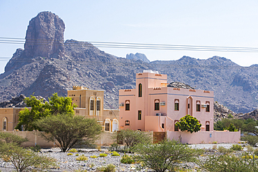
Isolated house near Al-Hamra in the region Ad Dakhiliyah, Akhdar Mountains, Sultanate of Oman, Arabian Peninsula
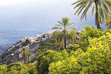
Wakan village, Western Hajar Mountains, border South Batinah Governorate and Al Dakhiliyah Governorates, Sultanate of Oman, Arabian Peninsula
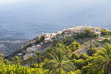
Wakan village, Western Hajar Mountains, border South Batinah Governorate and Al Dakhiliyah Governorates, Sultanate of Oman, Arabian Peninsula
Landscape around Wakan village, Western Al Hajar Mountains, border South Batinah and Al Dakhiliyah Governorates, Oman, Arabian Peninsula
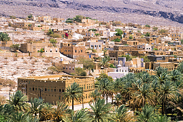
Al-Hamra village, Akhdar Jebel, Sultanate of Oman, Arabian Peninsula
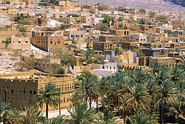
Al-Hamra village, Akhdar Jebel, Sultanate of Oman, Arabian Peninsula
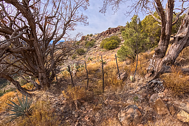
Boundary gate and cattle-proof fence between Coconino National Forest and Wet Beaver Creek Wilderness, Arizona, United States of America
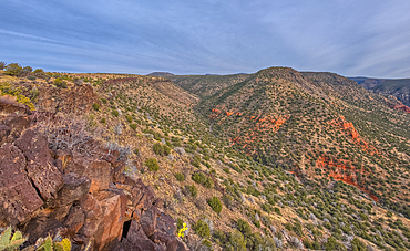
Casner Canyon in Wet Beaver Creek Wilderness viewed from White Mesa summit, in Coconino National Forest, Arizona, United States of America
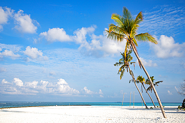
Amazing tropical island with palm trees, The Maldives, Indian Ocean
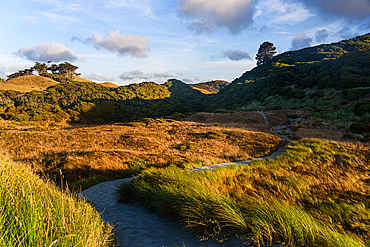
Golden Hills and Shadowed Valleys in Remote New Zealand Farmland at Sunset
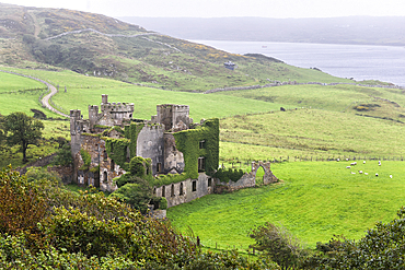
Clifden Castle in the rain, ruined manor house near Clifden, Connemara, County Galway, Connacht, Republic of Ireland
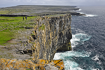
Cliffs viewed from Dun Aengus, prehistoric hill fort, Inishmore, largest of the Aran Islands, Galway Bay, County Galway, Connacht, Republic of Ireland
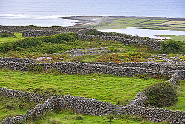
Enclosures with dry stone walls, Inishmore, largest of the Aran Islands, Galway Bay, County Galway, Connacht, Republic of Ireland
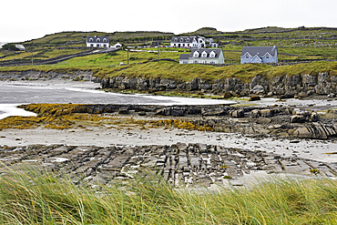
Hamlet near Aeer Arann Air field on the east end of Inishmore, largest of the Aran Islands, Galway Bay, County Galway, Connacht, Republic of Ireland
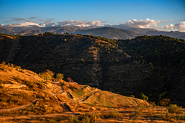
Sunset over the hills behind Granada and wide landscapes with the snowy Sierra Nevada behind, Granada, Andalusia, Spain
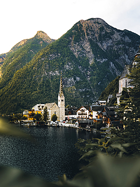
Scenic view of famous Hallstatt mountain village in the Austrian Alps in summer, UNESCO, Salzkammergut region, Hallstatt, Austria
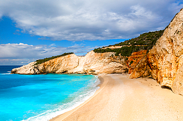
Porto Katsiki drone aerial view on Lefkada island, Ionian Islands, Greek Islands, Greece
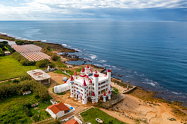
Drone aerial view of abandoned Fairytale Castle, by the sea, Agrilis Messinia, Peloponnese, Greece
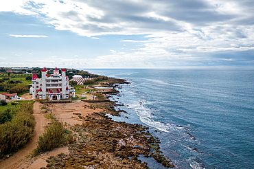
Drone aerial view of abandoned Fairytale Castle, by the sea, Agrilis Messinia, Peloponnese, Greece
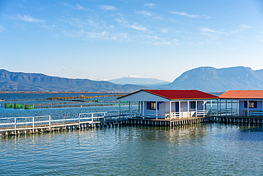
Traditional fishermen's houses built on the sea, Tourlida, Missolonghi Lagoon, Greece

Huab River Valley area, Damaraland, Kunene Region, Namibia, Africa
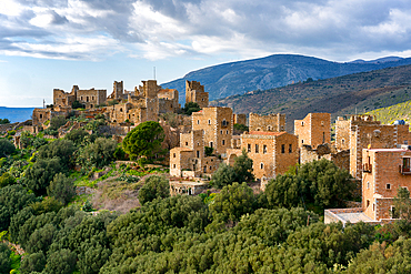
Vathia, abandoned village in the mountains of Mani Peninsula, Peloponnese, Greece
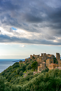
Vathia, abandoned village in the mountains of Mani Peninsula, Peloponnese, Greece
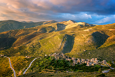
Vathia, abandoned village in the mountains of Mani Peninsula at sunset, Peloponnese, Greece

Vathia, abandoned village in the mountains of Mani Peninsula at sunset, Peloponnese, Greece
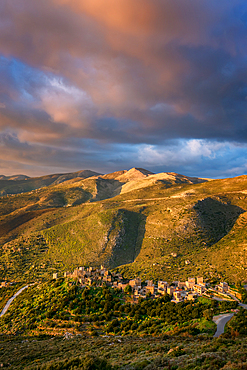
Vathia, abandoned village in the mountains of Mani Peninsula at sunset, Peloponnese, Greece
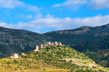
Vathia, abandoned village in the mountains of Mani Peninsula, Peloponnese, Greece
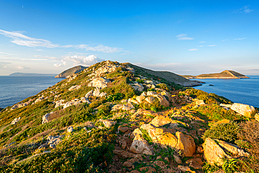
Cape Tainaron (Cape Matapan) landscape, the southernmost point of Greece, Mani Peninsula, Peloponnese, Greece

Cape Tainaron (Cape Matapan) landscape, the southernmost point of Greece, Mani Peninsula, Peloponnese, Greece

Boat on a beach bay at Cape Tainaron (Cape Matapan) at sunset, Mani Peninsula, Peloponnese, Greece
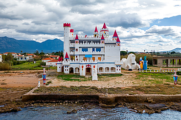
Drone view of abandoned Fairytale Castle, by the sea, Agrilis Messinia, Peloponnese, Greece
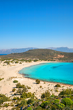
Simos beach with turquoise water, Elafonisos island, Greece
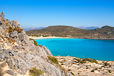
Simos beach with turquoise water, Elafonisos island, Greece
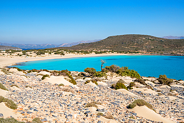
Simos beach with turquoise water, Elafonisos island, Greece
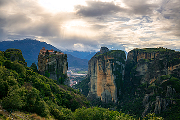
Meteora, ancient Holy Trinity Monastery, UNESCO, Kalabaka, Greece
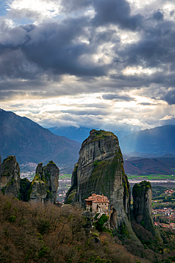
Meteora, ancient holy Monastery of Rousanos Saint Barbara, UNESCO, Kalabaka, Greece
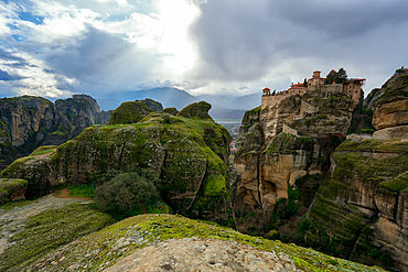
Meteora, ancient holy Monastery of Varlaam, UNESCO, Kalabaka, Greece

Meteora, ancient holy Monastery of Varlaam, UNESCO, Kalabaka, Greece
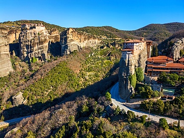
Drone aerial view of Meteora with ancient holy Monastery of Varlaam, UNESCO, Kalabaka, Greece
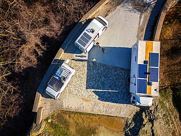
Drone aerial view of camper vans with solar panels on the roof, parked on a wild spot on the mountains in autumn, Kalabaka, Greece
Drone aerial view of camper vans with solar panels on the roof, parked on a wild spot on the mountains in autumn, Kalabaka, Greece
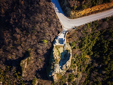
Drone aerial view of camper van parked on a wild spot by a beach, Thessaloniki, Greece
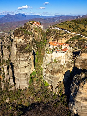
Drone aerial view of Meteora with ancient holy Monastery of Varlaam and Great Meteoron, UNESCO, Kalabaka, Greece
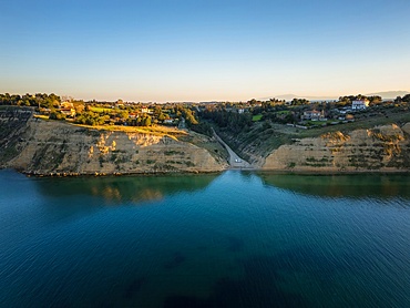
Drone aerial view of Lake Polyfyto mountain landscape and high bridge of Servia Neraida at sunset, Kozani, Macedonia, Greece
Drone aerial view of camper vans parked on a wild spot at Lake Polyfyto, Kozani, Macedonia, Greece
Drone aerial view of Kriaritsi project area with abandoned roads in the south of Greece, Sithonia, Chalkidiki, Greece
Drone aerial view of Kriaritsi project area with abandoned roads in the south of Greece, Sithonia, Chalkidiki, Greece
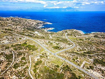
Drone aerial view of Kriaritsi project area with abandoned roads in the south of Greece, Sithonia, Chalkidiki, Greece

Drone aerial view of Kriaritsi project area with abandoned roads in the south of Greece, Sithonia, Chalkidiki, Greece
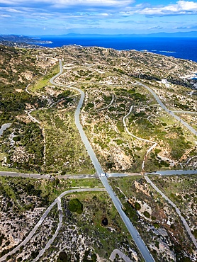
Drone aerial view of Kriaritsi project area with abandoned roads in the south of Greece, Sithonia, Chalkidiki, Greece

Drone top aerial view of camper van parked on a wild beach in Porto Koufo, Chalkidiki, Greece
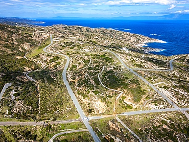
Drone aerial view of Kriaritsi project area with abandoned roads in the south of Greece, Sithonia, Chalkidiki, Greece
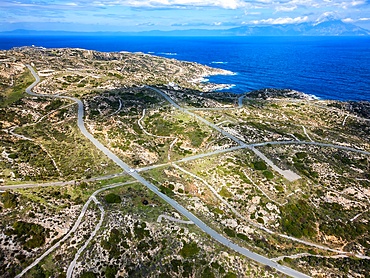
Drone aerial view of Kriaritsi project area with abandoned roads in the south of Greece, Sithonia, Chalkidiki, Greece
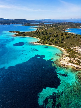
Diaporos island with wild beaches with turquoise water, drone aerial view, Chalkidiki, Greece
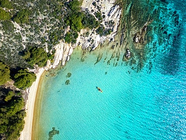
Diaporos island with wild beaches and a kayak on the turquoise water, drone top aerial view, Chalkidiki, Greece

Saint Fokas Orthodox chapel on the coast of Greece at sunset, Peloponnese, Greece
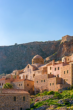
Historic stone houses in the mountain, Monemvasia, Laconia, Greece
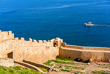
Monemvasia island historic city stone wall with a boat on the sea, Monemvasia, Laconia, Greece
Monemvasia island historic stone houses and churches, Monemvasia, Laconia, Greece