Results
« Previous 1 … 4 5 6 7 Next »
627 results found
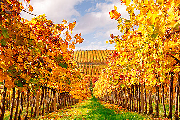
Yellow vineyards, converging lines from a low angle point of view, Italy, Europe
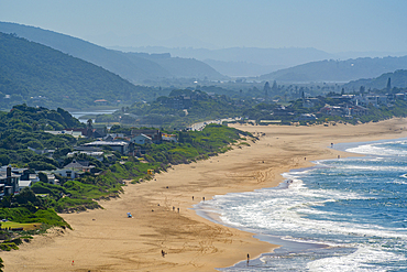
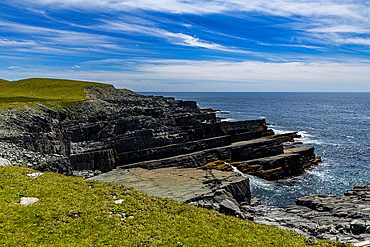
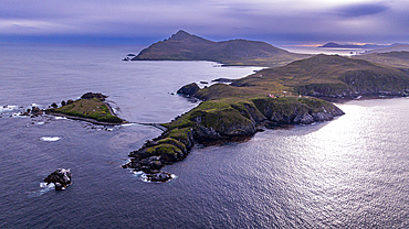
View of Indian Ocean and dramatic coastline at Wilderness from Dolphin Point, Wilderness, Western Cape, South Africa, Africa
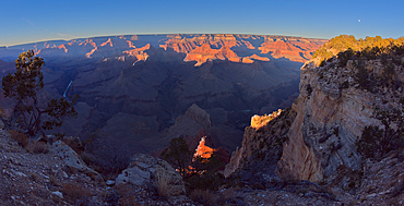
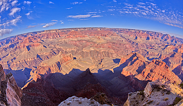
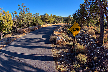
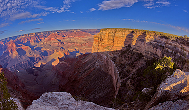
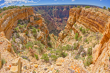
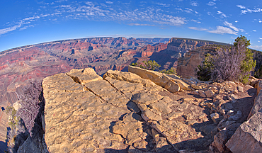
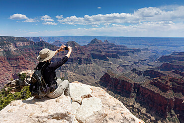
Grand Canyon viewed from Pima Point at sundown, Grand Canyon National Park, UNESCO World Heritage Site, Arizona, United States of America, North America
Grand Canyon viewed from Pima Point at sundown, Grand Canyon National Park, UNESCO World Heritage Site, Arizona, United States of America, North America

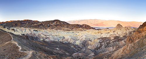
The Salt Flats of Badwater Basin, the lowest point in North America, Death Valley National Park, California, United States of America, North America
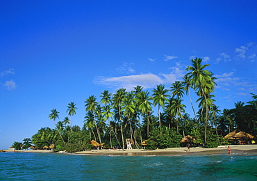
Pigeon Point, Tobago, Caribbean
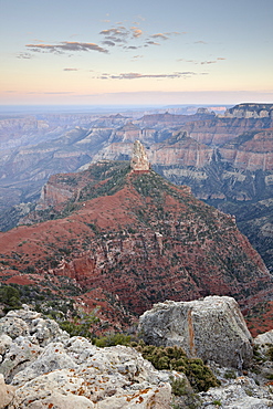
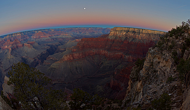
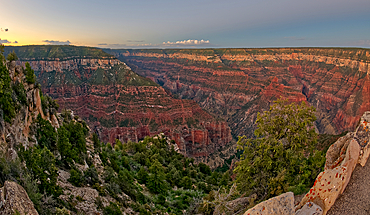
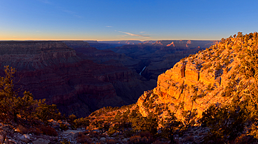
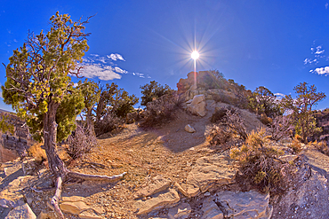
Mount Hayden at dusk from Point Imperial, North Rim, Grand Canyon National Park, UNESCO World Heritage Site, Arizona, United States of America, North America
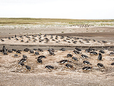
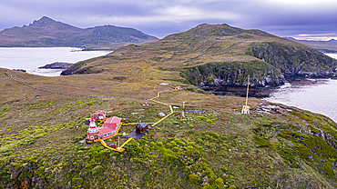
Gentoo penguins (Pygoscelis papua) at nesting site on Bull Point, East Island, Falkland Islands, South America
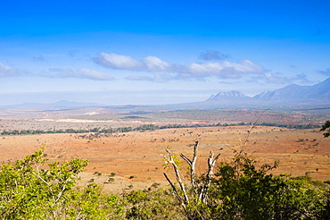
Kudu Point, Tsavo West National Park, Kenya, East Africa, Africa
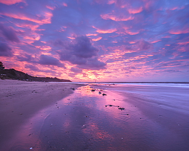
Intensely coloured and mirrored dawn sky looking towards Orcombe Point, Exmouth, Devon, England, United Kingdom, Europe
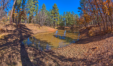
Two of three ponds called the Hearst Tanks, on Grand Canyon South Rim, located one mile east of Grandview Point, Grand Canyon National Park, UNESCO World Heritage Site, Arizona, United States of America, North America North America
Looking back from Mohave Point Overlook near sundown, Grand Canyon, UNESCO World Heritage Site, Arizona, United States of America, North America

View of Indian Ocean and dramatic coastline at Wilderness from Dolphin Point, Wilderness, Western Cape, South Africa, Africa
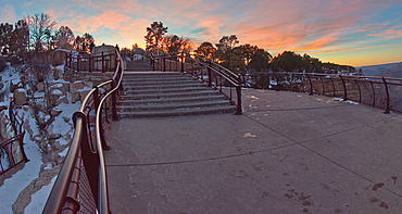
Steps down to Mather Point Overlook at Grand Canyon in winter after sunset, Grand Canyon, Arizona, United States of America, North America
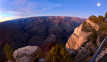
Grand Canyon viewed from Pima Point at sundown, Grand Canyon National Park, UNESCO World Heritage Site, Arizona, United States of America, North America
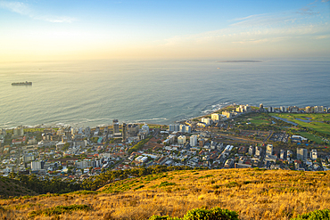
View of Sea Point in Cape Town from Signal Hill at sunset, Cape Town, Western Cape, South Africa, Africa
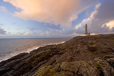
Ardnamurchan Lighthouse, at the westernmost point of the British mainland, west coast, Scotland, United Kingdom, Europe
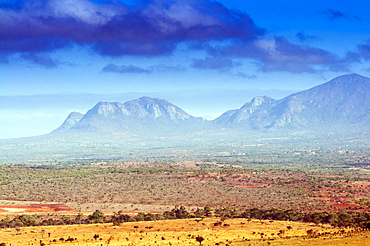
Kudu Point, Savannah and Taita Hills behind, Kenya, East Africa, Africa
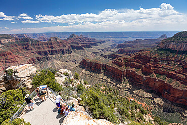
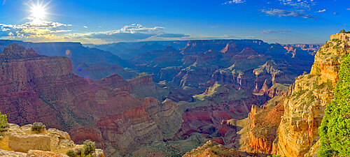
Uncle Jim Point viewed from Bright Angel Point on the North Rim of Grand Canyon at twilight, Grand Canyon National Park, UNESCO World Heritage Site, Arizona, United States of America, North America
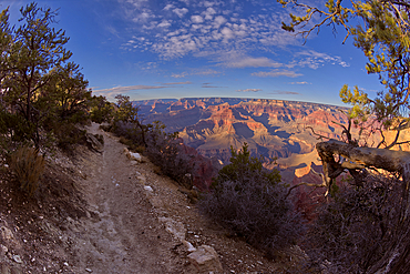
View of the North Rim of Grand Canyon National Park from Bright Angel Point, UNESCO World Heritage Site, Arizona, United States of America, North America
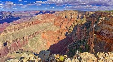
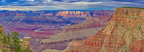
View of Lipan Point on the right from Pinal Point at Grand Canyon, with The Desert View Watchtower in the distance, Grand Canyon National Park, UNESCO World Heritage Site, Arizona, United States of America, North America
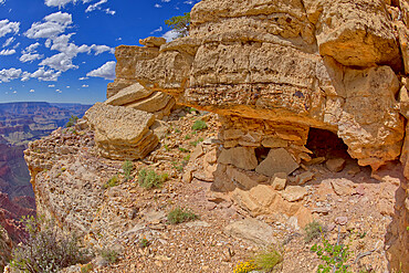
Ancient Indian Ruins on the edge of a cliff east of Papago Point at Grand Canyon, Grand Canyon National Park, UNESCO World Heritage Site, Arizona, United States of America, North America

Grand Canyon viewed from a cliff overlooking Papago Creek with Papago Point on the right, Grand Canyon National Park, UNESCO World Heritage Site, Arizona, United States of America, North America
Seascape from Nash Point looking across The Bristol Channel, South Wales, United Kingdom, Europe
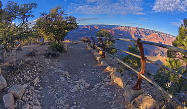
A dirt section of the rim trail between Hopi Point and Mohave Point, Grand Canyon, UNESCO World Heritage Site, Arizona, United States of America, North America

View of Indian Ocean and dramatic coastline at Wilderness from Dolphin Point, Wilderness, Western Cape, South Africa, Africa

View of Indian Ocean and dramatic coastline at Wilderness from Dolphin Point, Wilderness, Western Cape, South Africa, Africa
Neist Point, Isle of Skye, Inner Hebrides, west coast, Scotland, United Kingdom, Europe
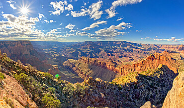
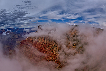
Grand Canyon view from Moran Point on a cloudy day with the clouds floating inside the canyon, Grand Canyon National Park, UNESCO World Heritage Site, Arizona, United States of America, North America

Monument of Cape Horn, southern most point in South America, Hornos island, Tierra del Fuego, Chile, South America
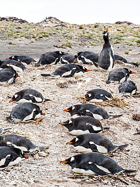
Gentoo penguins (Pygoscelis papua) at nesting site on Bull Point, East Island, Falkland Islands, South America
Zabriskie Point, Death Valley National Park, California, United States of America, North America
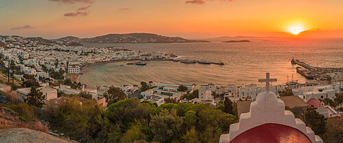
View of chapel and town from elevated view point at sunset, Mykonos Town, Mykonos, Cyclades Islands, Greek Islands, Aegean Sea, Greece, Europe
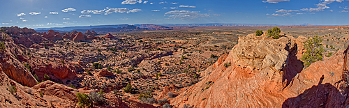
Panorama view of Grand Canyon from the cliffs of Powell Point, Grand Canyon, UNESCO World Heritage Site, Arizona, United States of America, North America

A steel picnic table near a cliff on the west side of Mohave Point at the Grand Canyon, UNESCO World Heritage Site, Arizona, United States of America, North America
The Greenway Trail that runs between Pima Point and Monument Creek Vista, Grand Canyon, Arizona, United States of America, North America

View of Sea Point and DHL Stadium in Cape Town from Signal Hill at sunset, Cape Town, Western Cape, South Africa, Africa
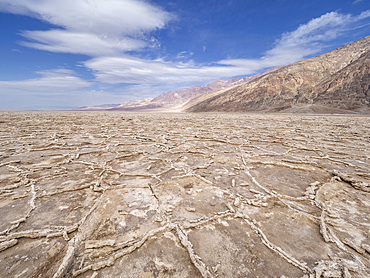
The Salt Flats of Badwater Basin, the lowest point in North America, Death Valley National Park, California, United States of America, North America
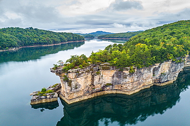
Rocky Point on Summersville Lake, West Virginia, United States of America, North America
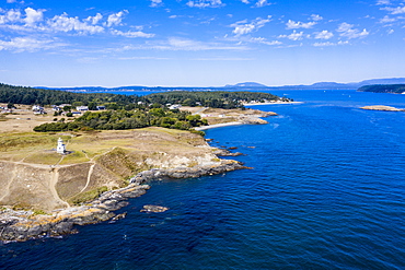
Aerial from Cattle Point lighthouse on San Juan island, San Juan islands archipelago, Washington State, United States of America, North America
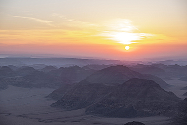
Sunrise from the top of the Umm ad Dami mountain, the highest point in the country, Jordan, Middle East
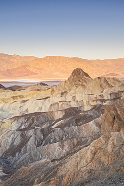
Zabriskie Point in Death Valley National Park, California, United States of America, North America
Grand Canyon northwest view from a rock island just beyond the tourist overlook of Lipan Point, Grand Canyon National Park, UNESCO World Heritage Site, Arizona, United States of America, North America
Grand Canyon viewed from the cliffs west of Moran Point with Coronado Butte on the far left, Grand Canyon National Park, UNESCO World Heritage Site, Arizona, United States of America, North America
Precambrian fossils, Mistaken Point, UNESCO World Heritage Site, Avalon Peninsula, Newfoundland, Canada, North America

Portable public toilet at Spanish Point Park, Pembroke Parish, Bermuda, Atlantic, North America

The Powell Memorial in the distance viewed from Hopi Point, Grand Canyon, UNESCO World Heritage Site, Arizona, United States of America, North America
Hopi Point in the distance viewed from the rim trail near Mohave Point, Grand Canyon, UNESCO World Heritage Site, Arizona, United States of America, North America
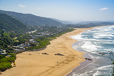
View of Indian Ocean and dramatic coastline at Wilderness from Dolphin Point, Wilderness, Western Cape, South Africa, Africa
Grand Canyon viewed from Pima Point at sundown, Grand Canyon National Park, UNESCO World Heritage Site, Arizona, United States of America, North America
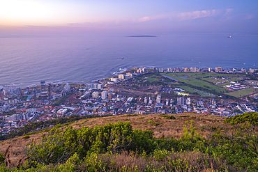
View of Sea Point in Cape Town from Signal Hill at dusk, Cape Town, Western Cape, South Africa, Africa
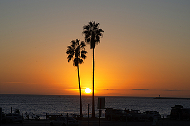
Sunset over the ocean and two palm trees in silhouettte, Dana Point, California, United States of America, North America
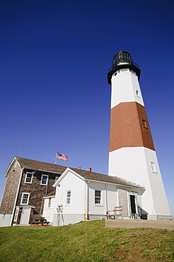
Montauk Point Lighthouse, Montauk, Long Island, New York State, United States of America, North America
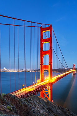
View of Golden Gate Bridge from Golden Gate Bridge Vista Point at dusk, San Francisco, California, United States of America, North America
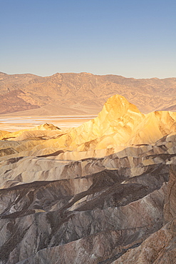
Zabriskie Point in Death Valley National Park, California, United States of America, North America
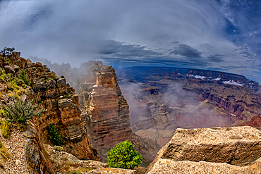
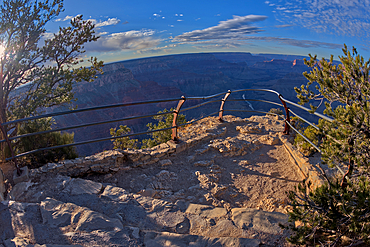
Fisheye view of a deep chasm near Papago Point at Grand Canyon with Zuni Point in the distance, Grand Canyon National Park, UNESCO World Heritage Site, Arizona, United States of America, North America
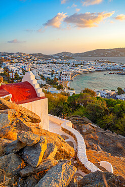
View of chapel and town from elevated view point at sunset, Mykonos Town, Mykonos, Cyclades Islands, Greek Islands, Aegean Sea, Greece, Europe
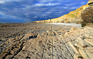
Cliffs at Nash Point, Glamorgan Heritage Coast, South Wales, United Kingdom, Europe
View from the cliffs of Powell Point behind the Powell Memorial, Grand Canyon, UNESCO World Heritage Site, Arizona, United States of America, North America
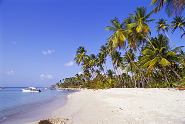
Beach at Pigeon Point, Tobago, Caribbean, West Indies, Central America
Aerial of Cape Horn, southern most point in South America, Hornos island, Tierra del Fuego, Chile, South America
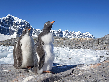
Molting gentoo penguins (Pygoscelis papua), Jougla Point, Wiencke Island, Antarctica, Polar Regions
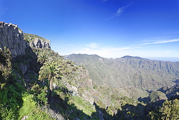
Degollada de Pereza y San Sebastian viewing point, Garajonay Parque National, near San Sebastian, La Gomera, Canary Islands, Spain, Europe
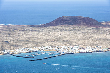
View over La Graciosa from Mirador del Rio observation point created by Cesar Manrique, Lanzarote, Canary Islands, Spain, Atlantic, Europe
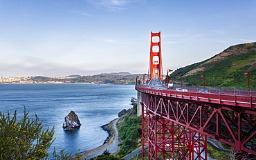
View of Golden Gate Bridge from Golden Gate Bridge Vista Point at sunset, San Francisco, California, United States of America, North America
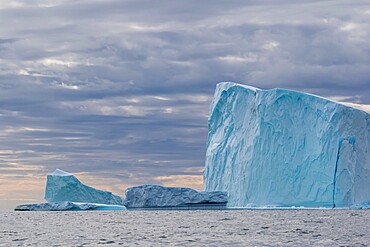
Huge icebergs at Cape Brewster, the easternmost point of the jagged and mountainous Savoia Peninsula, Greenland, Polar Regions
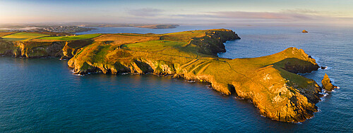
Aerial view of The Rumps cliffs and coastline near Pentire Point, North Cornwall, England, United Kingdom, Europe
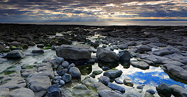
Seascape from Nash Point looking across The Bristol Channel, South Wales, United Kingdom, Europe
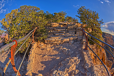
The safety railed stone cliff of the Mohave Point Overlook, Grand Canyon, UNESCO World Heritage Site, Arizona, United States of America, North America
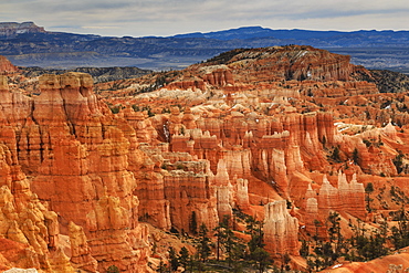
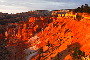
Hoodoos and cloudy sky in winter, Rim Trail near Sunrise Point, Bryce Canyon National Park, Utah, United States of America, North America
Aerial of Cape Horn, southern most point in South America, Hornos island, Tierra del Fuego, Chile, South America
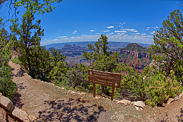
The Transept Trail sign where it branches off from the Bright Angel Point Trail on the North Rim of Grand Canyon, Grand Canyon National Park, UNESCO World Heritage Site, Arizona, United States of America, North America
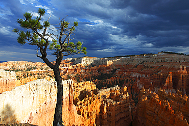
Bristlecone pine tree near Sunset Point, Bryce Canyon, Utah, United States of America, North America
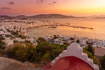
View of chapel and town from elevated view point at sunset, Mykonos Town, Mykonos, Cyclades Islands, Greek Islands, Aegean Sea, Greece, Europe
Glen Canyon Recreation Area with, on the left, Vermillion Cliffs National Monument and Marble Canyon, viewed from an observation point along US89 south of Page, Arizona, United States of America, North America
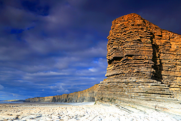
Cliffs at Nash Point, Glamorgan Heritage Coast, South Wales, United Kingdom, Europe
Zuni Point at Grand Canyon South Rim in the clouds viewed from Moran Point, Grand Canyon National Park, UNESCO World Heritage Site, Arizona, United States of America, North America
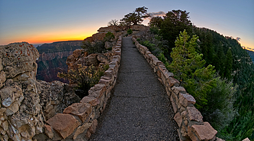
The paved pathway between Bright Angel Point and the visitor center at Grand Canyon North Rim at twilight, Grand Canyon National Park, UNESCO World Heritage Site, Arizona, United States of America, North America
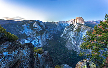
Half Dome and Yosemite Valley viewed from Glacier Point at dusk, Yosemite National Park, UNESCO World Heritage Site, California, United States of America, North America
View of the North Rim of Grand Canyon National Park from Bright Angel Point, UNESCO World Heritage Site, Arizona, United States of America, North America
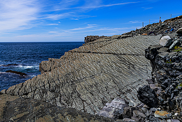
Precambrian fossils, Mistaken Point, UNESCO World Heritage Site, Avalon Peninsula, Newfoundland, Canada, North America
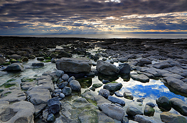
Seascape from Nash Point looking across The Bristol Channel, South Wales, United Kingdom, Europe
View from below the cliffs of Powell Point, Grand Canyon, UNESCO World Heritage Site, Arizona, United States of America, North America
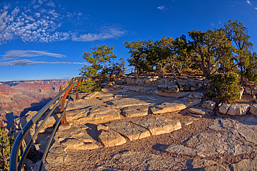
The safety railed stone cliff of the Mohave Point Overlook, Grand Canyon, UNESCO World Heritage Site, Arizona, United States of America, North America
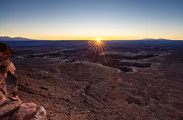
Sunrise at Grand View Point, Canyonlands National Park, Utah, United States of America, North America
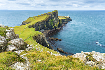
Neist Point lighthouse, Isle of Skye, Inner Hebrides, Scotland, United Kingdom, Europe
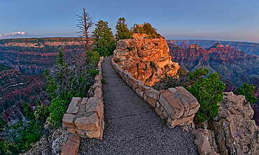
The paved pathway between Bright Angel Point and the visitor center at Grand Canyon North Rim at twilight, Grand Canyon National Park, UNESCO World Heritage Site, Arizona, United States of America, North America
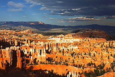
Looking east across Bryce Canyon from Sunset Point, Utah, United States of America, North America
Grand Canyon viewed before sunset, west of Papago Point, Grand Canyon National Park, UNESCO World Heritage Site, Arizona, United States of America, North America
Track leading to Mistaken Point, UNESCO World Heritage Site, Avalon Peninsula, Newfoundland, Canada, North America
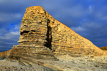
Cliffs at Nash Point, Glamorgan Heritage Coast, South Wales, United Kingdom, Europe
A rocky path to the Mohave Point Overlook, Grand Canyon, UNESCO World Heritage Site, Arizona, United States of America, North America
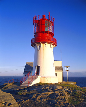
Lindesnes Fyr Lighthouse, southernmost point of Norway, south coast, Norway, Scandinavia, Europe
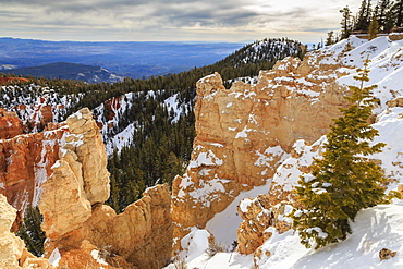
Rim edge, pine trees and snowy cliffs lit by morning sun with cloudy sky, Rainbow Point, Bryce Canyon National Park, Utah, United States of America, North America

Musken (Masske), a Sami village near Hellemobotn, the narrowest point of Norway, Nordland, Norway, Scandinavia, Europe
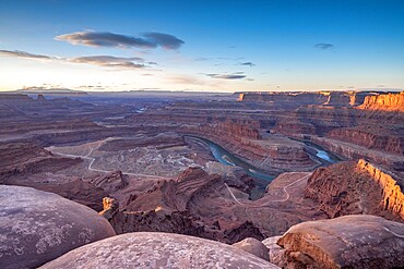
Canyon view from Dead Horse Point State Park, Utah, United States of America, North America
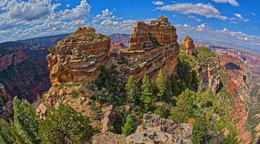
The summit of Tritle Peak off Roosevelt Point on Grand Canyon North Rim, Grand Canyon National Park, UNESCO World Heritage Site, Arizona, United States of America, North America
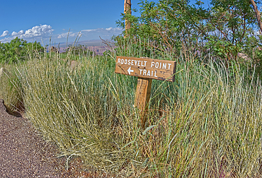
Wooden sign marking the way to Roosevelt Point on the North Rim of Grand Canyon, Arizona, United States of America, North America

Aerial from Cattle Point lighthouse on San Juan island, San Juan islands archipelago, Washington State, United States of America, North America
Bryce Canyon from Sunrise Point, early summer morning light, Bryce Canyon, Utah, United States of America, North America