Results
« Previous 1 … 4 5 6 7 8 … 59 Next »
5886 results found
Sand dunes at Murlough Nature Reserve, with views to Dundrum Bay, County Down, Ulster, Northern Ireland, United Kingdom, Europe
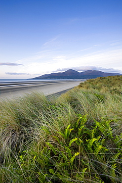
Ferns growing amongst the sand dunes at Murlough Nature Reserve, with views to Dundrum Bay and the Mountains of Mourne beyond, County Down, Ulster, Northern Ireland, United Kingdom, Europe
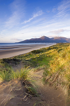
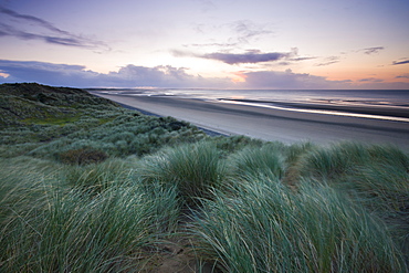
Sand dunes at Murlough Nature Reserve, with views to Dundrum Bay and the Mountains of Mourne beyond, County Down, Ulster, Northern Ireland, United Kingdom, Europe
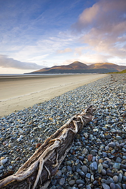
Drfitwood on Dundrum Bay looking towards the Mountains of Mourne, County Down, Ulster, Northern Ireland, United Kingdom, Europe
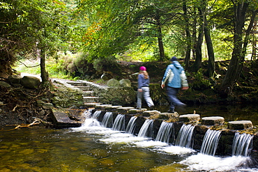
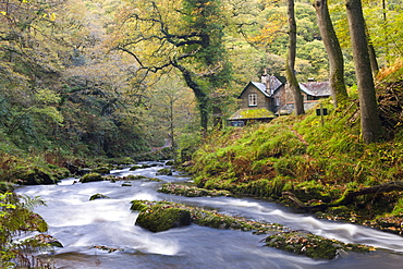
Walkers crossing stepping stones over a cascading stream in Tollymore Forest Park, County Down, Ulster, Northern Ireland, United Kingdom, Europe

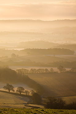
Looking across open countryside to Blackford and Luccombe, Exmoor National Park, Somerset, England, United Kingdom, Europe
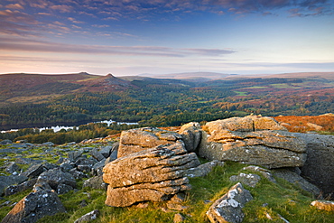
Burrator, Leather Tor and Sharpitor viewed from Sheepstor, Dartmoor National Park, Devon, England, United Kingdom, Europe
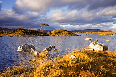
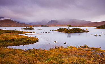
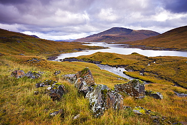
Lochan nah-Achlaise in autumn, Rannoch Moor, Highlands, Scotland, United Kingdom, Europe
Stream running through Rannoch Moor wilderness, Highlands, Scotland, United Kingdom, Europe
Stormy skies over Lochan Na H-Achlaise on Rannoch Moor in autumn, Highlands, Scotland, United Kingdom, Europe
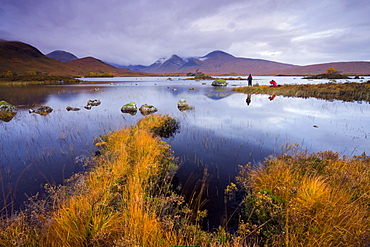
Photographers capturing the autumn colours beside Lochan Nah Achlaise on Rannoch Moor, Highlands, Scotland, United Kingdom, Europe
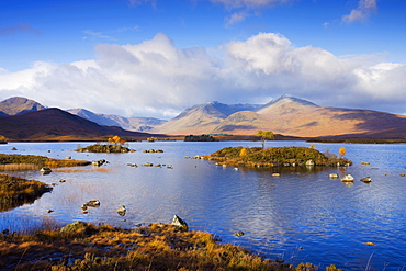
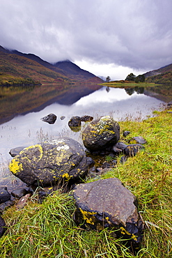
Lochan Na h-Achlaise on Rannoch Moor in the autumn, Highlands, Scotland, United Kingdom, United Kingdom, Europe
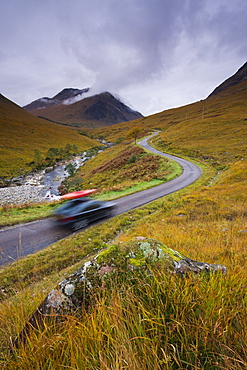
Touring the highlands of Scotland, Glen Etive, Highlands, Scotland, United Kingdom, Europe
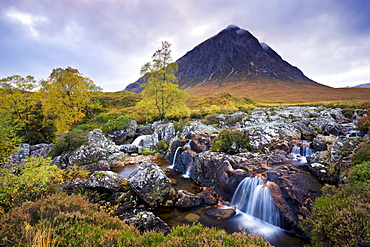
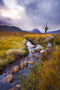
River Coupall and Buachaille Etive Mor in the autumn, Glen Etive, Highlands, Scotland, United Kingdom, Europe
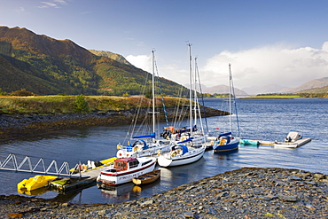
Yachts moored on Loch Linnhe at Ballachulish, Highlands, Scotland, United Kingdom, Europe
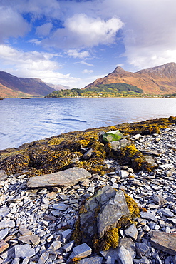
Looking across Loch Leven to Glencoe village and the Pap of Glencoe, Highlands, Scotland, United Kingdom, Europe
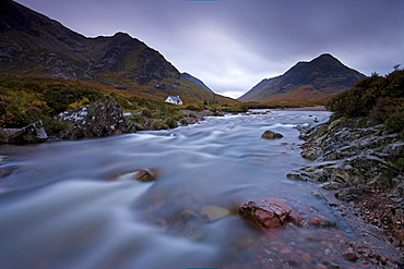
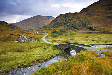
Lagangarbh cottage beside in River Coupall in Glen Coe, Highlands, Scotland, United Kingdom, Europe
Lochan Nah Achlaise on Rannoch Moor in the autumn, Highlands, Scotland, United Kingdom, Europe
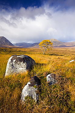
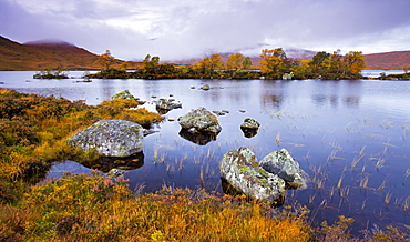
Autumn scenery on Rannoch Moor, Highlands, Scotland, United Kingdom, Europe
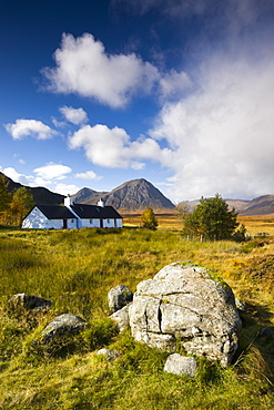
Cottage on Rannoch Moor near Buachaille Etive Mor, Highlands, Scotland, United Kingdom, Europe
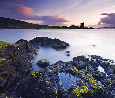
Castle Stalker, from the shores of Loch Linnhe near Port Appin, Highlands, Scotland, United Kingdom, Europe
Twilight on the shores of Loch Linnhe near Appin, looking out towards the silhouette of Castle Stalker, Highlands, Scotland, United Kingdom, Europe
Boulders on Loch Leven shoreline, Lochleven, Highlands, Scotland, United Kingdom, Europe
Autumn moorland and mountains beside Loch Quoich, Highland, Scotland, United Kingdom, Europe
Abandoned cottage near Kinloch Hourn in the Highlands, Scotland, United Kingdom, Europe
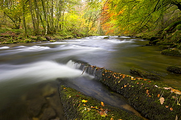
Watersmeet in the autumn, Exmoor National Park, Devon, England, United Kingdom, Europe
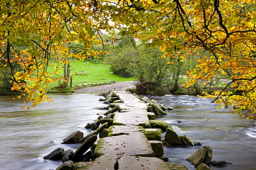
Tarr Steps clapper bridge in Autumn, Exmoor National Park, Somerset, England, United Kingdom, Europe
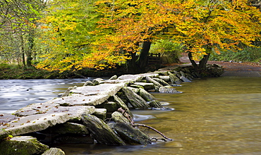
Autumn at Tarr Steps on the River Barle, Exmoor National Park, Somerset, England, United Kingdom, United Kingdom, Europe
Autumn colours beside the River Barle near Tarr Steps, Exmoor National Park, Somerset, England, United Kingdom, Europe
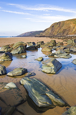
Rocks and rockpools on the beach at Sandymouth Bay, North Cornwall, England, United Kingdom, Europe
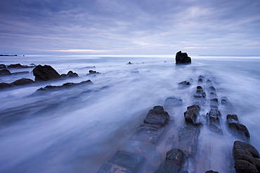
Waves rush over the rocky ledges at Sandymouth Bay in North Cornwall, England, United Kingdom, Europe
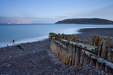
Weathered coastal defences at Porlock Weir in Exmoor National Park, with the evening lights of Wales visible across the Bristol Channel, Somerset, England, United Kingdom, Europe
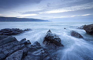
Surging tide at twilight, Coombesgate Beach, Woolacombe, Devon, England, United Kingdom, Europe
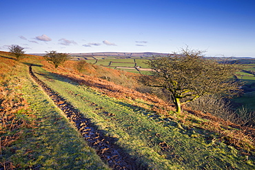
Bridleway on Winsford Hill, Exmoor National Park, Somerset, England, United Kingdom, Europe
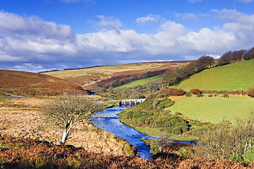
Landacre Bridge spanning the River Barle near Withypool, Exmoor National Park, Somerset, England, United Kingdom, Europe
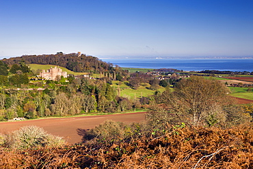
Dunster Castle and Conygar Tower, Exmoor National Park, Somerset, England, United Kingdom, Europe
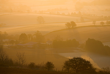
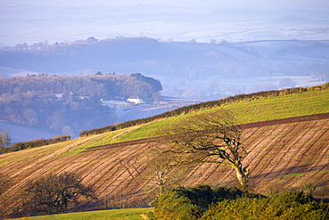
Farm bathed in golden morning sunlight on a frosty and misty winter morning, Raddon Hill, Devon, England, United Kingdom, Europe
Sheep grazing on Raddon Hill, overlooking frosty and misty countryside, Mid Devon, England, United Kingdom, Europe
Windswept tree on Raddon Hill with a misty rural landscape beyond, Near Crediton, Devon, England, United Kingdom, Europe
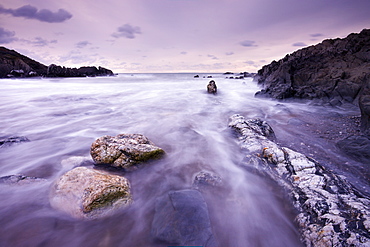
Rocky shore at Bossington Beach, Exmoor National Park, Somerset, England, United Kingdom, Europe
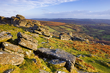
Sunlit granite outcrop at Hound Tor, Dartmoor National Park, Devon, England, United Kingdom, Europe
Winter morning sunshine glows on Hound Tor, Dartmoor National Park, Devon, England, United Kingdom, Europe
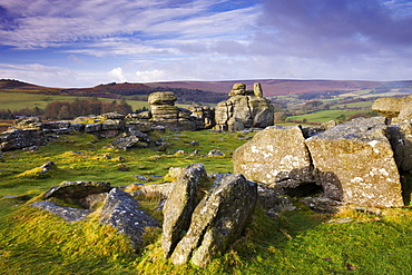
Granite boulders on Hayne Down, Dartmoor National Park, Devon, England, United Kingdom, Europe

Granite boulders on Hayne Down, Dartmoor National Park, Devon, England, United Kingdom, Europe
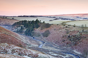
River Barle in the Cornham Brake valley on a frosty winter morning, Simonsbath, Exmoor National Park, Somerset, England, United Kingdom, Europe
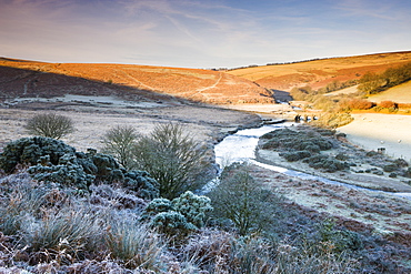
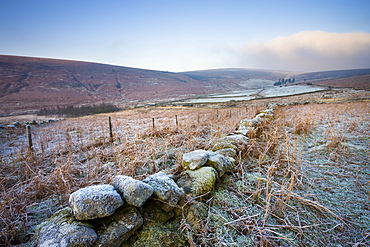
Sunlight thaws the frosted moorland landscape near Landacre Bridge, Exmoor National Park, Somerset, England, United Kingdom, Europe
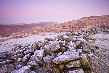
Frost coats the circular stone perimeter wall of the Bronze Age settlement of Grimspound in Dartmoor National Park, Devon, England, United Kingdom, Europe
Frost covered moorland landscape near Challacombe Down, Dartmoor National Park, Devon, England, United Kingdom, Europe
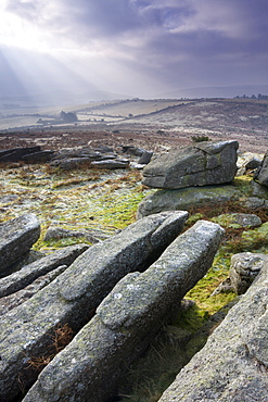
Frosted granite outcrop on Hayne Down, looking towards Hound Tor on the horizon, Dartmoor National Park, Devon, England, United Kingdom, Europe

Frozen moorland landscape on Hayne Down in Dartmoor National Park, Devon, England, United Kingdom, Europe
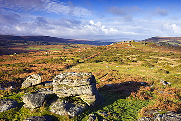
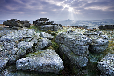
Granite outcrops on Hayne Down, Dartmoor National Park, Devon, England, United Kingdom, Europe

Frost covered granite rocks on the moorland at Hayne Down in Dartmoor National Park, Devon, England, United Kingdom, Europe
Roath Park, Cardiff, Wales, United Kingdom, Europe
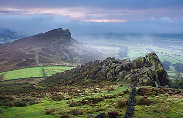
Morning mist and fog clear the landscape to reveal Hen Cloud and the gritstone rocks of the Roaches, Peak District, Derbyshire, England, United Kingdom, Europe
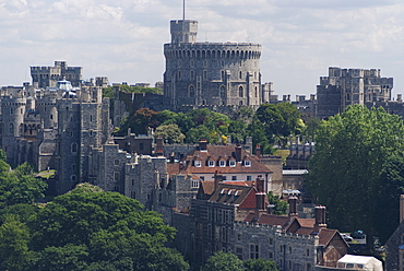
Aerial view, Windsor Castle, Windsor, Berkshire, England, United Kingdom, Europe
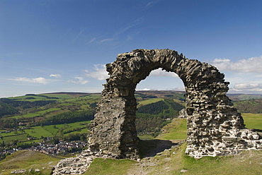
Ruins of Dinas Bran Castle and village of Llangollen below, Denbighshire, Wales, United Kingdom, Europe
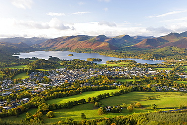
View over Keswick and Derwent Water from the Skiddaw Range, Lake District National Park, Cumbria, England, United Kingdom, Europe
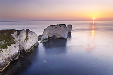
Old Harry Rocks, The Foreland or Handfast Point, Studland, Isle of Purbeck, Dorset, England, United Kingdom, Europe
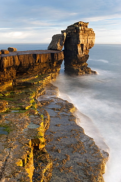
Pulpit Rock, Portland Bill, Isle of Portland, Dorset, England, United Kingdom, Europe
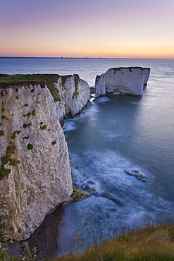
Old Harry Rocks, The Foreland or Handfast Point, Studland, Isle of Purbeck, Dorset, England, United Kingdom, Europe

Spa Deck with flower bath at Sasha Resort in Koh Samui, Thailand, Southeast Asia, Asia

Flower bath at the Badian Natural Spa at Badian Island Resort and Spa in Cebu, Philippines, Southeast Asia, Asia
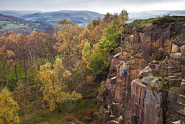
A rock climber ascends a cliff face formed by historic quarrying at Bole hill quarry on an autumn day in the Peak District, Derbyshire, England, United Kingdom, Europe
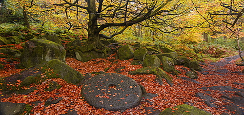
A millstone lies covered in red autumn leaves with the adjacent woodland in full autumn colour, Padley Gorge, Grindleford, Peak District National Park, Derbyshire, England, United Kingdom, Europe
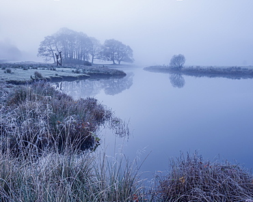
Reeds and trees on the banks of Elterwater coated in frost on a foggy autumn morning in the Lake District National Park, UNESCO World Heritage Site, Cumbria, England, United Kingdom, Europe
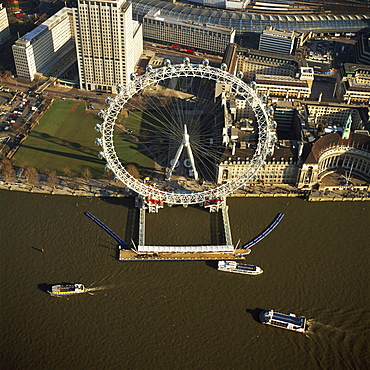
Aerial image of the London Eye (Millennium Wheel), South Bank of the River Thames, London, England, United Kingdom, Europe
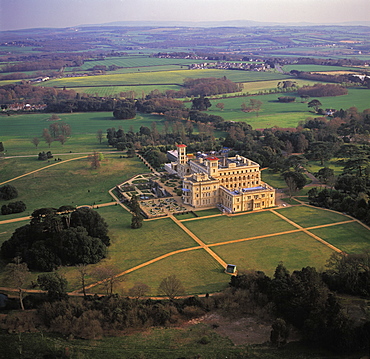
Aerial image of Osborne House, Isle of Wight, England, United Kingdom, Europe
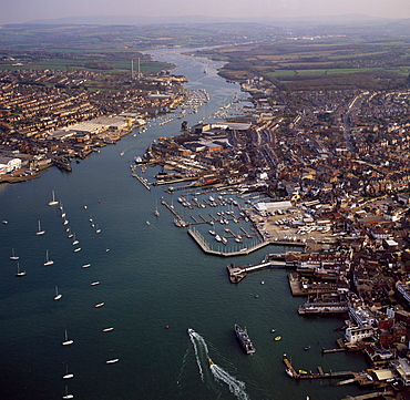
Aerial image of Cowes, on the west bank of the estuary of the River Medina facing the smaller town of East Cowes on the east bank, Isle of Wight., England, United Kingdom, Europe
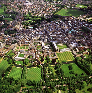
Aerial view of Cambridge including The Backs where several University of Cambridge colleges back on to the River Cam, Cambridge, Cambridgeshire, England, United Kingdom, Europe
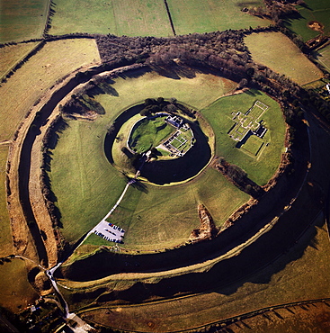
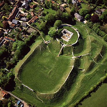
Aerial image of Old Sarum, the original site of Salisbury with castle ruins and cathedral foundations inside two high Iron Age banks (earthworks), Wiltshire, England, United Kingdom, Europe
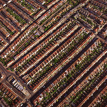
Aerial image of terraced housing, Portsmouth, Hampshire, England, United Kingdom, Europe

Aerial view of Peterborough Cathedral and city, Peterborough, Cambridgeshire, England, United Kingdom, Europe
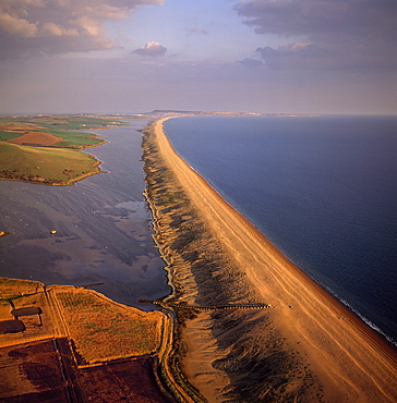
Aerial image of Chesil Beach (Chesil Bank), 29 km long shingle beach, a tombolo connecting mainland to the Isle of Portland, Jurassic Coast, UNESCO World Heritage Site, Dorset, England, United Kingdom, Europe
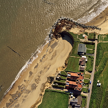
Aerial view of Happisburgh, showing precarious position of several houses as cliffs are eroded by coastal erosion, Norfolk, England, United Kingdom, Europe
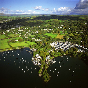
Aerial image of Bowness-on-Windermere, Lake Windermere, Lake District National Park, Cumbria, England, United Kingdom, Europe
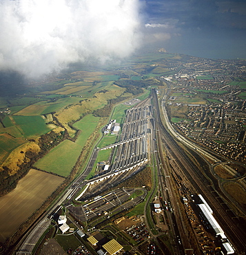
Aerial image of entrance to The Channel Tunnel (Chunnel) (Eurotunnel), beneath the English Channel, Kent, England, United Kingdom, Europe
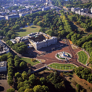
Aerial image of Buckingham Palace, City of Westminster, London, England, United Kingdom, Europe
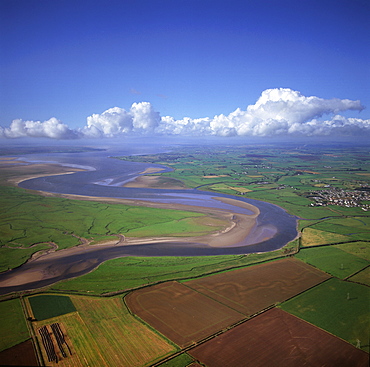
Aerial image of the River Esk flowing into Solway Firth, near Gretna Green, border between Cumbria in England and Dumfries and Galloway in Scotland, United Kingdom, Europe
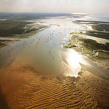
Aerial image of Blakeney Point, Norfolk, England, United Kingdom, Europe

Aerial image of Stonehenge, prehistoric monument and stone circle, UNESCO World Heritage Site, Salisbury Plain, Wiltshire, England, United Kingdom, Europe
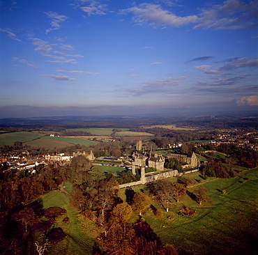
Aerial image of Battle Abbey (St. Martin's Abbey), built on the scene of the Battle of Hastings and dedicated to St. Martin, Battle, East Sussex, England, United Kingdom, Europe
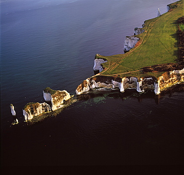
Aerial image of Old Harry Rocks, chalk stacks located directly east of Studland, north of Swanage, Dorset, England, United Kingdom, Europe
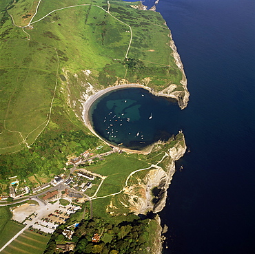
Aerial image of Lulworth Cove, a natural landform harbour, near West Lulworth, on the Jurassic Coast, UNESCO World Heritage Site, Dorset, England, United Kingdom, Europe
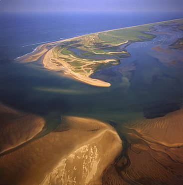
Aerial view of Blakeney Point, Norfolk, England, United Kingdom, Europe
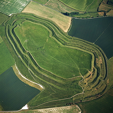
Aerial image of Maiden Castle, an Iron Age hill fort, Winterborne Monkton, near Dorchester, Dorset, England, United Kingdom, Europe

Aerial image of Brighton Pier (Palace Pier), Brighton, Sussex, England, United Kingdom, Europe
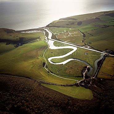
Aerial image of the Cuckmere River at Cuckmere Haven, Seven Sisters Country Park, East Sussex, England, United Kingdom, Europe
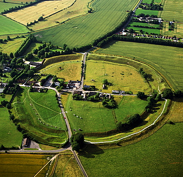
Aerial image of Avebury, Neolithic Monument, site of a large henge and several stone circles, UNESCO World Heritage Site, Wiltshire, England, United Kingdom, Europe
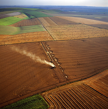
Aerial image of fields and harvest, Wiltshire, England, United Kingdom, Europe
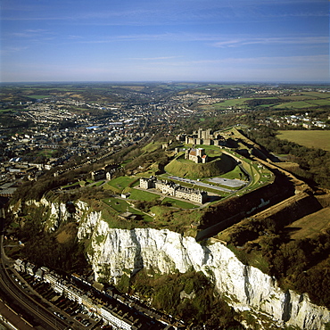
Aerial image of Dover Castle over the white Cliff of Dover, Kent, England, United Kingdom, Europe
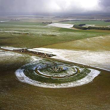
Aerial image of Stonehenge, prehistoric monument and stone circle in snow, UNESCO World Heritage Site, Salisbury Plain, Wiltshire, England, United Kingdom, Europe
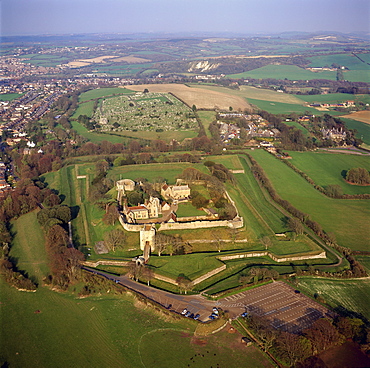
Aerial image of Carisbrooke Castle, a historic motte-and-bailey castle, Carisbrooke, near Newport, Isle of Wight, England, United Kingdom, Europe
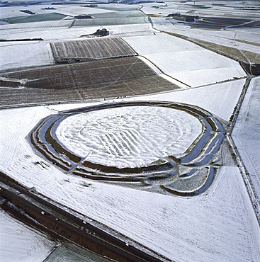
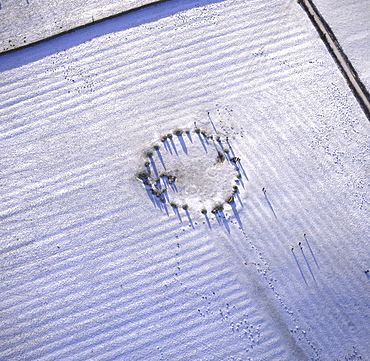
Aerial image of Yarnbury Castle, a hill fort, in snow, Wiltshire, England, United Kingdom, Europe
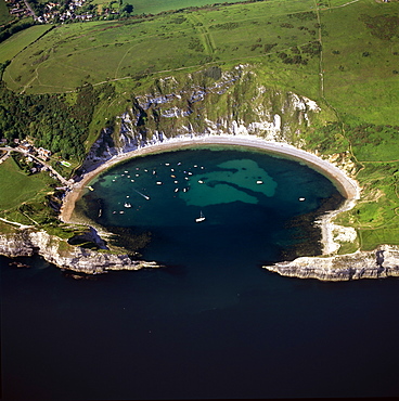
Aerial image of Lulworth Cove, a natural landform harbour, near West Lulworth, on the Jurassic Coast, UNESCO World Heritage Site, Dorset, England, United Kingdom, Europe
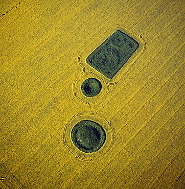
Aerial image of round and square Barrows at North Down in rape field, near Calstone Wellington, Wiltshire, England, United Kingdom, Europe
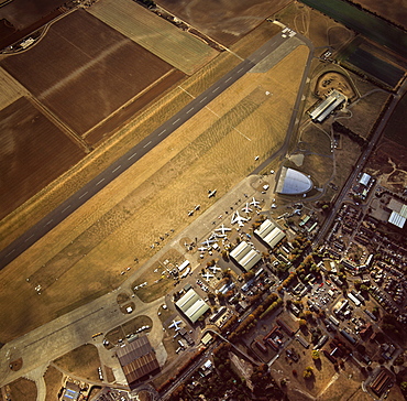
Aerial view of Duxford Aerodrome, now Imperial War Museum Duxford and the American Air Museum, Cambridgeshire, England, United Kingdom, Europe
Aerial image of Castlerigg Stone Circle, a prehistoric monument in snow, near Keswick, Lake District National Park, Cumbria, England, United Kingdom, Europe
Aerial view of Castle Acre, remains of a motte and bailey castle with extensive earthworks, Castle Acre, Norfolk, England, United Kingdom, Europe
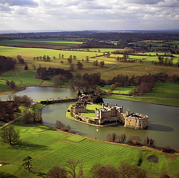
Aerial image of Leeds Castle and moat, a medieval castle, southeast of Maidstone, Kent, England, United Kingdom, Europe
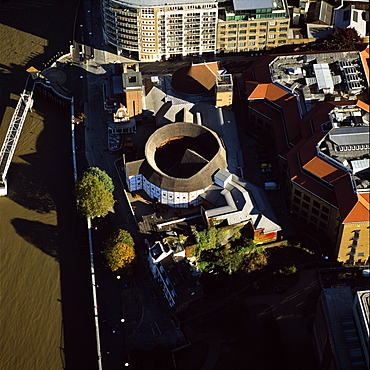
Aerial image of the Globe Theatre (Shakespeare's Globe) and the River Thames, London, England, United Kingdom, Europe