Results
« Previous 1 … 4 5 6
528 results found
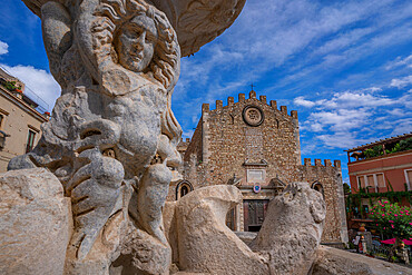
View of Duomo di Taormina and fountain in Piazza del Duomo in Taormina, Taormina, Sicily, Italy, Mediterranean, Europe
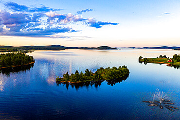
Clouds reflecting at sunset on Lake Inari, Inari, Lapland, northern Finland, Europe
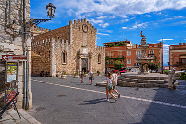
View of Duomo di Taormina and fountain in Piazza del Duomo in Taormina, Taormina, Sicily, Italy, Mediterranean, Europe
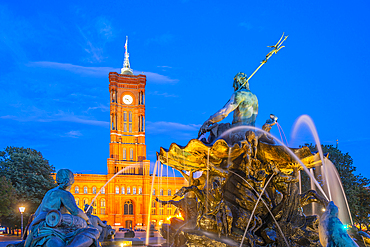
View of Rotes Rathaus (Town Hall) and Neptunbrunnen fountain at dusk, Panoramastrasse, Berlin, Germany, Europe
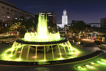
Fountain at Grand Park and Town Hall, Los Angeles, California, United States of America, North America
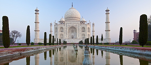
The Taj Mahal mausoleum southern view with reflecting pool and cypress trees, Uttar Pradesh, India
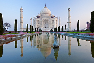
The Taj Mahal mausoleum southern view with reflecting pool and cypress trees, Uttar Pradesh, India
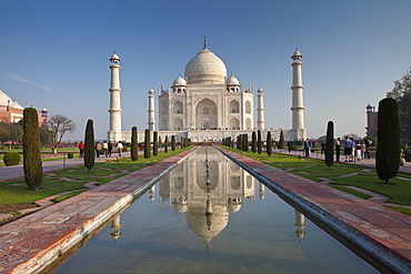
The Taj Mahal mausoleum southern view with reflecting pool and cypress trees, Uttar Pradesh, India
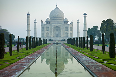
The Taj Mahal mausoleum southern view with reflecting pool and cypress trees, Uttar Pradesh, India
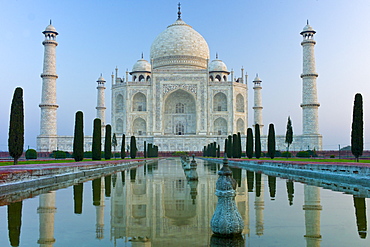
The Taj Mahal mausoleum southern view with reflecting pool and cypress trees, Uttar Pradesh, India
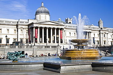
Fountains in front of National Gallery in Trafalgar Square, London, United Kingdom

Arab Spa, Arab bath, Cefala Diana, Palermo, Sicily, Italy, Mediterranean, Europe
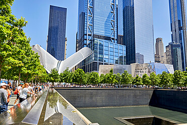
9/11 Memorial Fountain in New York City, New York, United States of America, North America
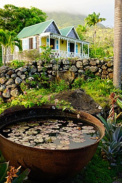
The Hermitage, Nevis, St. Kitts and Nevis, Leeward Islands, West Indies, Caribbean, Central America

The National Theatre of Nice in Nice, Alpes Maritimes, Cote d'Azur, French Riviera, Provence, France, Mediterranean, Europe
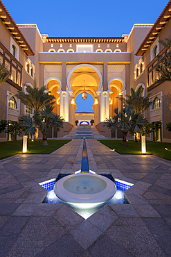
Water feature and architecture at night of luxury hotel, Saadiyat island, Abu Dhabi, United Arab Emirates, Middle East
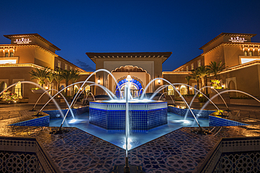
Rixos Saadiyat Island at night, Abu Dhabi, United Arab Emirates, Middle East.

Fountain at Villa Carlotta on Lake Como, Lombardy, Italian Lakes, Italy, Europe
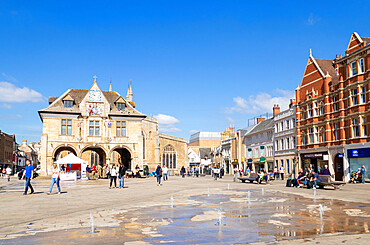
Peterborough Guildhall, Cathedral Square, Peterborough, Cambridgeshire, England, United Kingdom, Europe
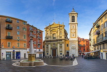
Sainte-Reparate Cathedral at Rossetti Square in the old town (Vieux-Nice), Nice, Alpes Maritimes, Provence-Cote d'Azur, French Riviera, France, Europe
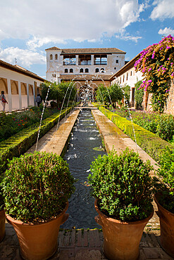
Generalife, Alhambra, UNESCO World Heritage Site, Granada, Andalucia, Spain, Europe
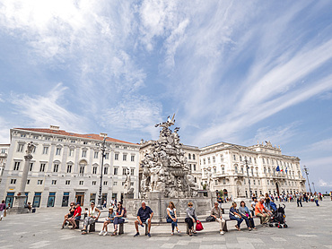
Palaces and fountain, Piazza dell'Unita d'Italia, Trieste, Friuli Venezia Giulia, Italy, Europe
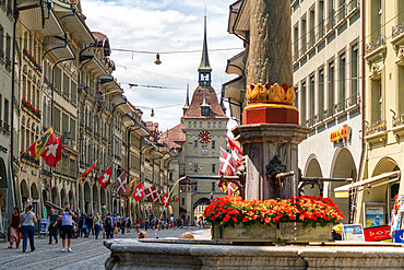
Tourists along Marktgasse, shopping street in the Old Town (Altstadt) with Kafigturm tower in background, Bern, Switzerland, Europe
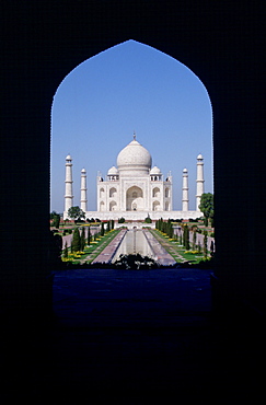
The Taj Mahal photographed through an arch, Agra, India
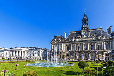
Town Hall, Tours, Loire Valley, Indre et Loire, Centre-Val de Loire, France, Europe

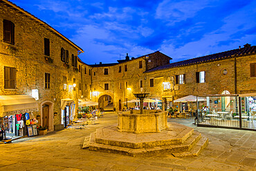
The Fontana Maggiore, Piazza Umberto I, Panicale, Umbria, Italy, Europe
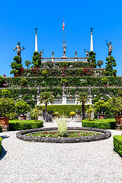
The gardens of Palazzo Borromeo, Isola Bella, Borromean Islands, Lake Maggiore, Stresa, Piedmont, Italian Lakes, Italy, Europe

The Hermitage, Nevis, St. Kitts and Nevis, Leeward Islands, West Indies, Caribbean, Central America
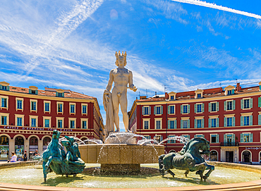
The Fountain of the Sun in Nice, Alpes Maritimes, Cote d'Azur, French Riviera, Provence, France, Mediterranean, Europe
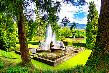
The botanical gardens of Villa Taranto, Pallanza, Lake Maggiore, Verbania District, Piedmont, Italian Lakes, Italy, Europe
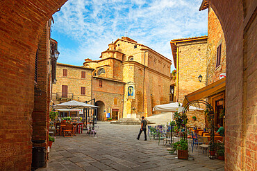
Piazza Umberto I, Panicale, Umbria, Italy, Europe
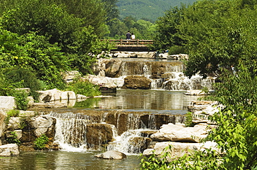
Waterfall feature at Beijing Botanical Gardens, Beijing, China, Asia
Piazza Umberto I, Panicale, Umbria, Italy, Europe

The Fountain of the Sun in Nice, Alpes Maritimes, Cote d'Azur, French Riviera, Provence, France, Mediterranean, Europe
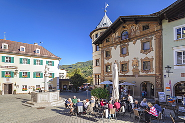
Cafe and Marmorner Brunnen Fountain in Berchtesgaden, Upper Bavaria, Bavaria, Germany, Europe
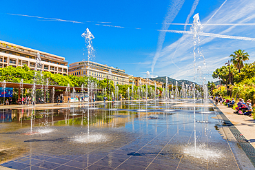
Fountains at Promenade du Paillon in Nice, Alpes Maritimes, Cote d'Azur, French Riviera, Provence, France, Mediterranean, Europe
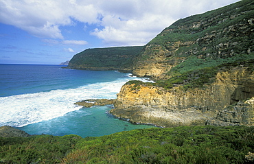
Remarkable Cave, an eroded coastal feature of arches and caves, south of Port Arthur, south east, Tasmania, Australia, Pacific
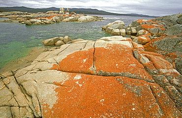
Granite outcrops with orange lichen, a feature of beautiful Freycinet National Park, south east, Tasmania, Australia, Pacific
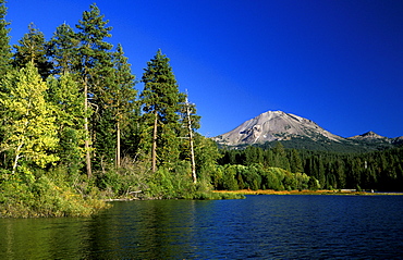
Manzanita Lake and the dormant 10,457ft Lassen Peak, the world's largest plug-dome volcano, in Lassen Volcanic National Park, an area of volcanic activities and features, Lassen Volcanic Park, Northern California, California, United States of America (USA), North America
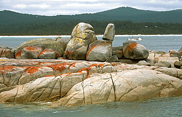
Granite outcrops with orange lichen, a feature of beautiful Freycinet National Park, south east, Tasmania, Australia, Pacific
The white flipper band of a Minke whale (Balaenoptera acutorostrata) is visible through the greenish water. This distinctive feature is characteristic of Minke whales of the northern hemisphere and the most obvious difference to their relatives in the Antarctic. St. Lawrence estuary, Canada
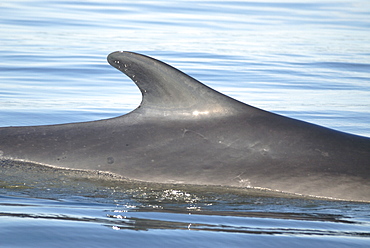
Tall dorsal fin of a Finback whale (Balaenoptera physalus) which is located far back along the dorsal ridge. This prominent feature is often used for identification. St. Lawrence estuary, Canada
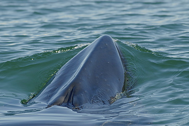
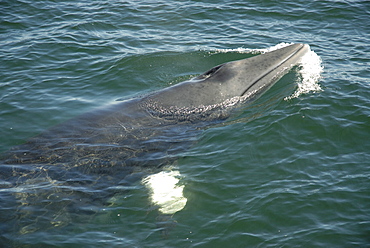
Minke whale (Balaenoptera acutorostrata) surfacing in the green coloured water. Although exposed, she still has both blowholes tightly closed. Note the pronounced ridge on the rostrum, a main feature of rorqual whales. St. Lawrence estuary, Canada Sequence 1/2.
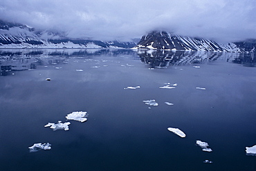
High arctic at midnight. Svalbard / Spitsbergen
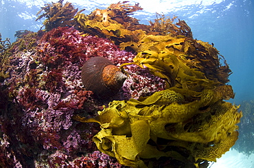
Jourdan's turban (turbo jourdani) large gastropod shell, reddish-brown, Rottnest Island reef, wild, day, marine protected area, free-diving off, cool temperate waters of Western Australia. MORE INFO: Marine plant common kelp, a dominant feature of the underwater landscape. Protected areas are covered in lush growth of diverse algae, also red algea are here.
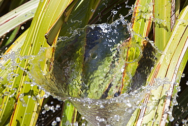
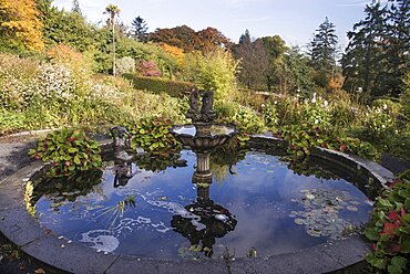
A water feature in the grounds of Penlee house in Penzance, Cornwall, England, United Kingdom, Europe
A water feature in the grounds of Penlee house in Penzance, Cornwall, England, United Kingdom, Europe
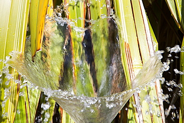
A water feature in a garden in Devon, England, United Kingdom, Europe
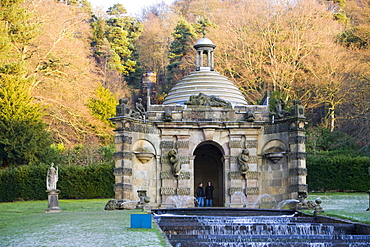
The Water Feature at Chatsworth Huose in Derbyshire, England, United Kingdom, Europe
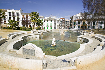
A water feature in Priego de Cordoba, Andalucia, Spain, Europe
A water feature in a garden in Devon, England, United Kingdom, Europe
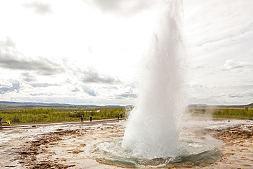
Strokkur geyser erupting, in the Geysir hot springs area, Haukadalur geothermal area, Southwest Iceland
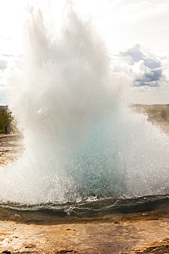
Strokkur geyser erupting, in the Geysir hot springs area, Haukadalur geothermal area, Southwest Iceland
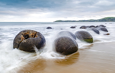
Moeraki Boulders, geological feature, round rock balls, washed by the waves of the surf at high tide, Coastal Otago, Moeraki, South Island, New Zealand, Oceania
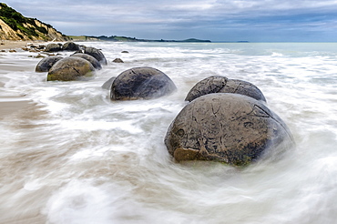
Moeraki Boulders, geological feature, round rock balls, washed by the waves of the surf at high tide, Coastal Otago, Moeraki, South Island, New Zealand, Oceania
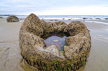
Moeraki Boulders, geological feature, round rock balls, some fragments lying broken in ruins on the beach, Coastal Otago, Moeraki, South Island, New Zealand, Oceania
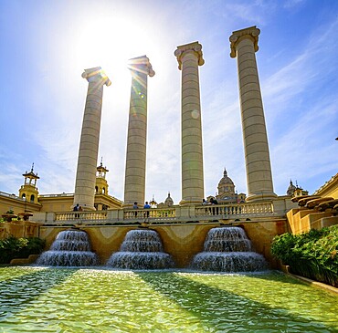
Water features in front of the Palau Nacional de Montjuic, National Palace at Montjuic, Museu Nacional d'Art de Catalunya, Barcelona, Catalonia, Spain
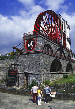
The Laxey Wheel transported the water from the Great Laxey Mining Company insideout till 1929, Isle of Man, Great Britain, Europa.
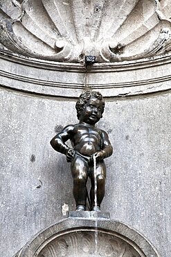
The Mannekin Pis in Brussels, is a famous statue of a boy urinating, Belgium, Europe

Garden, water feature, manor house, open air museum, La Granja, Esporles, Majorca, Balearic Islands, Spain, Europe
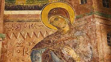
Detail of a fresco with Mary and gentle facial features, monastery, Moni Thari, near Gadouras reservoir, lonely mountain region, Rhodes, Dodecanese, Greek Islands, Greece, Europe
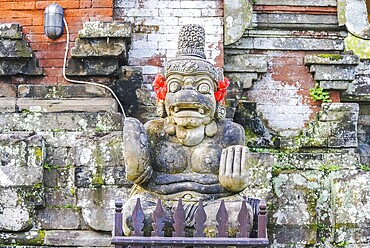
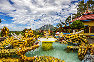
Pura Taman Ayun is a compound of Balinese temple and garden with water features located in Mengwi subdistrict in Badung Regency, Bali, Indonesia, Asia
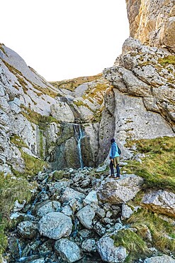
Hiker in blue jacket navigating rocky landscape near a small waterfall on mount txindoki, showcasing the rugged beauty of gipuzkoa, basque country
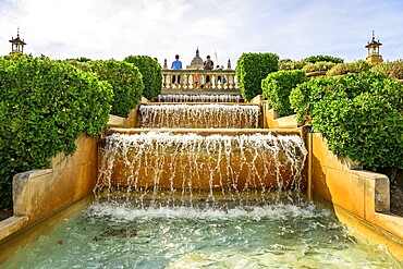
Water features in front of the Palau Nacional de Montjuic, National Palace at Montjuic, Museu Nacional d'Art de Catalunya, Barcelona, Catalonia, Spain, Europe

Concrete dam of Urfttalsperre reservoir, Eifel National Park, district of Euskirchen, North Rhine-Westphalia, Germany, Europe

Historical photograph from 1956 of the Hoehenpark Killesberg, water features and exhibition hall, Stuttgart, Baden-Wuerttemberg, Germany, Europe
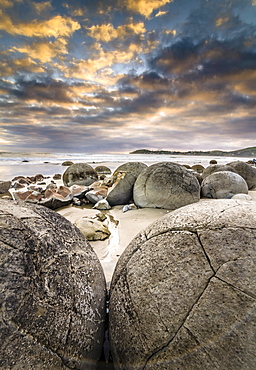
Moeraki Boulders, geological feature, round rock balls, some fragments lying broken in ruins on the beach, Coastal Otago, Moeraki, South Island, New Zealand, Oceania
The Water Tower, stainless steel water feature, fountain, by architect Nicholas Hare and artist William Pye, Roald Dahl Plass, Cardiff Bay, Cardiff, Caerdydd, Wales, United Kingdom, Europe

Nimoa Island - here the island mission will impress. The five-sided church features murals of island life and all mission buildings are surrounded by well maintained paths and gardens filled with flowering plants. Edged by jungle-covered mountains, postcard beaches and crystal clear waters - an island paradise indeed! The Louisiade Archipelago is a string of ten larger volcanic islands frequently fringed by coral reefs, and 90 smaller coral islands located 200 km southeast of New Guinea, stretching over more than 160 km and spread over an ocean area of 26,000 km? between the Solomon Sea to the north and the Coral Sea to the south. The aggregate land area of the islands is about 1,790 km? (690 square miles), with Vanatinai (formerly Sudest or Tagula as named by European claimants on Western maps) being the largest. Sideia Island and Basilaki Island lie closest to New Guinea, while Misima, Vanatinai, and Rossel islands lie further east. The archipelago is divided into the Local Level Government (LLG) areas Louisiade Rural (western part, with Misima), and Yaleyamba (western part, with Rossell and Tagula islands. The LLG areas are part of Samarai-Murua District district of Milne Bay. The seat of the Louisiade Rural LLG is Bwagaoia on Misima Island, the population center of the archipelago.
Nimoa Island - here the island mission will impress. The five-sided church features murals of island life and all mission buildings are surrounded by well maintained paths and gardens filled with flowering plants. Edged by jungle-covered mountains, postcard beaches and crystal clear waters - an island paradise indeed! The Louisiade Archipelago is a string of ten larger volcanic islands frequently fringed by coral reefs, and 90 smaller coral islands located 200 km southeast of New Guinea, stretching over more than 160 km and spread over an ocean area of 26,000 km? between the Solomon Sea to the north and the Coral Sea to the south. The aggregate land area of the islands is about 1,790 km? (690 square miles), with Vanatinai (formerly Sudest or Tagula as named by European claimants on Western maps) being the largest. Sideia Island and Basilaki Island lie closest to New Guinea, while Misima, Vanatinai, and Rossel islands lie further east.

Nimoa Island - here the island mission will impress. The five-sided church features murals of island life and all mission buildings are surrounded by well maintained paths and gardens filled with flowering plants. Edged by jungle-covered mountains, postcard beaches and crystal clear waters - an island paradise indeed! The Louisiade Archipelago is a string of ten larger volcanic islands frequently fringed by coral reefs, and 90 smaller coral islands located 200 km southeast of New Guinea, stretching over more than 160 km and spread over an ocean area of 26,000 km? between the Solomon Sea to the north and the Coral Sea to the south. The aggregate land area of the islands is about 1,790 km? (690 square miles), with Vanatinai (formerly Sudest or Tagula as named by European claimants on Western maps) being the largest. Sideia Island and Basilaki Island lie closest to New Guinea, while Misima, Vanatinai, and Rossel islands lie further east. The archipelago is divided into the Local Level Government (LLG) areas Louisiade Rural (western part, with Misima), and Yaleyamba (western part, with Rossell and Tagula islands. The LLG areas are part of Samarai-Murua District district of Milne Bay. The seat of the Louisiade Rural LLG is Bwagaoia on Misima Island, the population center of the archipelago.

Nimoa Island - here the island mission will impress. The five-sided church features murals of island life and all mission buildings are surrounded by well maintained paths and gardens filled with flowering plants. Edged by jungle-covered mountains, postcard beaches and crystal clear waters - an island paradise indeed! The Louisiade Archipelago is a string of ten larger volcanic islands frequently fringed by coral reefs, and 90 smaller coral islands located 200 km southeast of New Guinea, stretching over more than 160 km and spread over an ocean area of 26,000 km? between the Solomon Sea to the north and the Coral Sea to the south. The aggregate land area of the islands is about 1,790 km? (690 square miles), with Vanatinai (formerly Sudest or Tagula as named by European claimants on Western maps) being the largest. Sideia Island and Basilaki Island lie closest to New Guinea, while Misima, Vanatinai, and Rossel islands lie further east. The archipelago is divided into the Local Level Government (LLG) areas Louisiade Rural (western part, with Misima), and Yaleyamba (western part, with Rossell and Tagula islands. The LLG areas are part of Samarai-Murua District district of Milne Bay. The seat of the Louisiade Rural LLG is Bwagaoia on Misima Island, the population center of the archipelago.
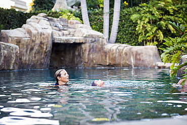
A Family Enjoys An Afternoon In The Pool On A Sunny Afternoon, Fountain Valley, California, United States Of America
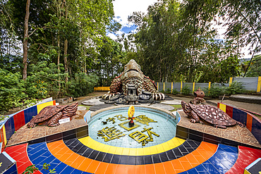
Vihara Buddhayan Buddhist Temple; Tomohon, North Sulawesi, Indonesia
Vihara Buddhayan Buddhist Temple; Tomohon, North Sulawesi, Indonesia
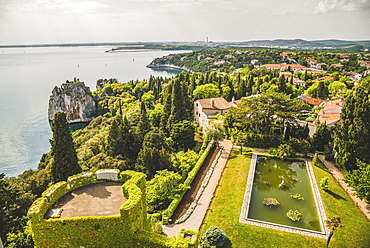
Landscaped grounds of Duino Castle and a view of the coastline of the Gulf of Trieste, Italy
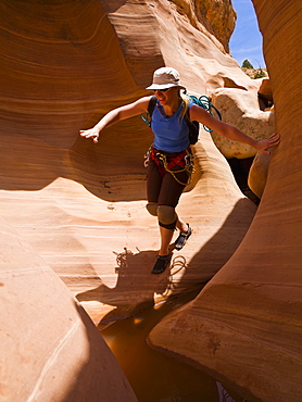
Female athlete navigating a slot canyon water feature, Hanksville, Utah, United States of America
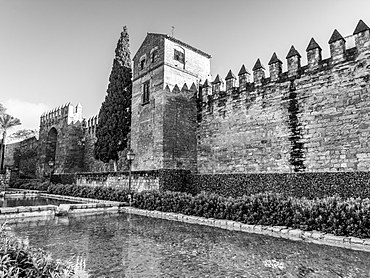
Roman walls of Cordoba, Cordoba, Andalusia, Spain
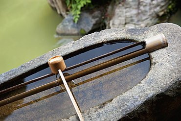
Water Feature In A Garden, Kyoto, Japan
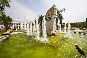
Monument of Prince Henry the Navigator, Dili, East Timor

New Zealand, North Island, Rotorua Thermal Pools with Maori girls in traditional dress
Ireland, County Westmeath, Mullingar, Belvedere House and Gardens A section of the restored gardens.

Female friends on beach with American flag, USA, Florida, Jupiter

Female friends jumping on beach, USA, Florida, Jupiter

Female friends on beach with American flag, USA, Florida, Jupiter

Female friends dancing on beach, USA, Florida, Jupiter

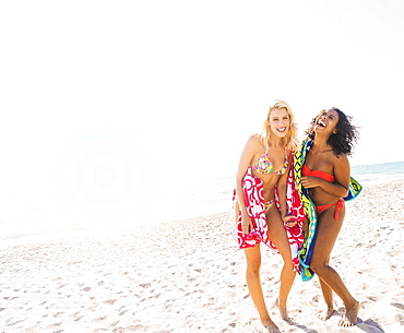
Female friends on beach
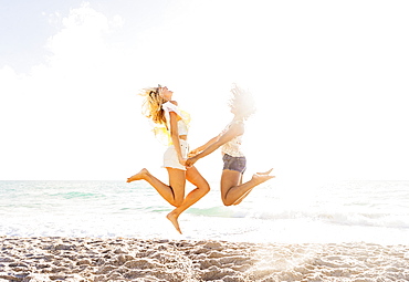
Female friends jumping on beach, USA, Florida, Jupiter
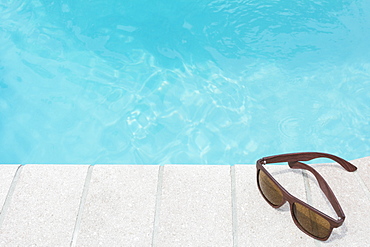
Sunglasses on pool side

Female friends on beach, USA, Florida, Jupiter
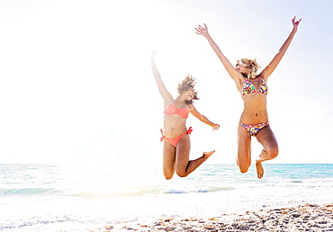
Female friends jumping on beach, USA, Florida, Jupiter
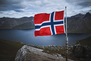
Norway, Senja, Norwegian flag with fjord and mountains in background

Female friends on beach, USA, Florida, Jupiter

Norway, Senja, Man and two tents near Segla mountain at sunset

Female friends on beach

Female friends on beach with American flag, USA, Florida, Jupiter
Female friends on beach, USA, Florida, Jupiter

Female friends on beach

Norway, Senja, Panoramic view of Segla mountain at sunrise

Female friends on beach, USA, Florida, Jupiter