Results
« Previous 1 … 5 6 7
646 results found
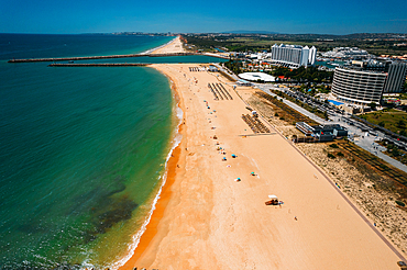
Aerial drone view of Praia de Vilamoura in Vilamoura, looking west, Algarve, Portugal, Europe
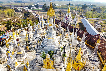
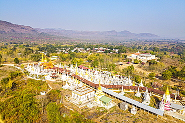
Aerial view by drone of pagodas, Inle Lake, Shan state, Myanmar (Burma), Asia
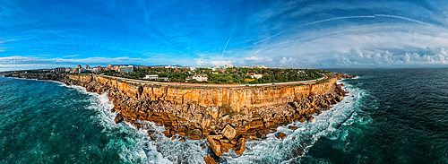
Aerial drone panoramic view of Cascais, Portuguese coastline, Portugal, Europe
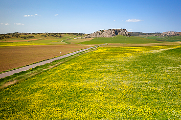
Drone aerial view of a road on a landscape with yellow flowers, Spain, Europe

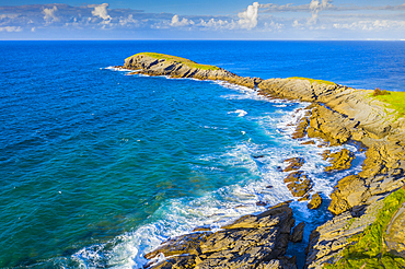
Aerial view by drone of Kaneohe Bay, Oahu Island, Hawaii, United States of America, North America

Aerial view by drone of Tunnels Beach, Haena State Park, Kauai Island, Hawaii, United States of America, North America

Aerial view by drone of Hanalei Bay pier, Kauai Island, Hawaii, United States of America, North America
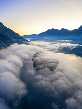
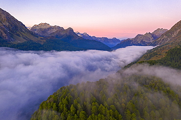
Lake Silvaplana and Sils hidden by the autumnal fog at dawn, aerial view by drone, Engadine, Canton of Graubunden, Switzerland, Europe
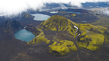
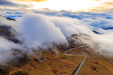
Aerial view taken by drone of Landmannalaugar mountain on a summer day, Iceland, Polar Regions
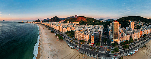
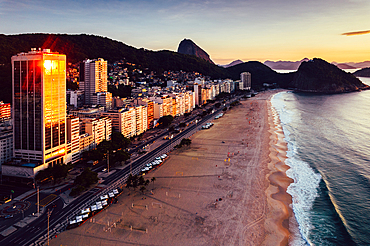
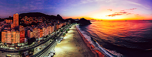
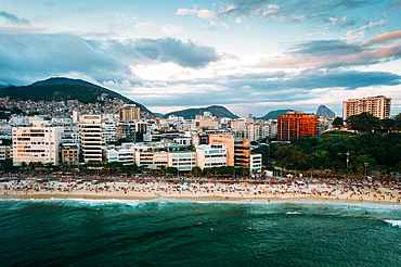
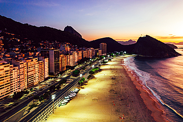
Aerial drone view of Copacabana Beach and urban setting at sunrise, UNESCO World Heritage Site, Rio de Janeiro, Brazil, South America
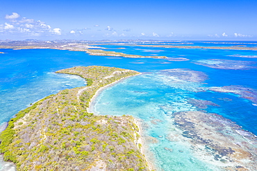
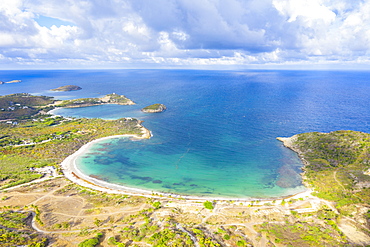
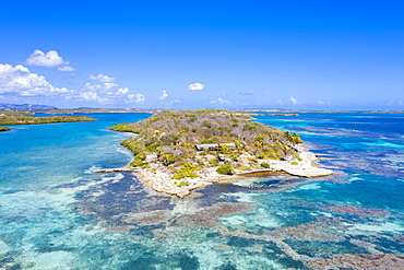
Aerial view by drone of Hermitage Bay and Pearns Point, Antigua, Antigua and Barbuda, Leeward Islands, West Indies, Caribbean, Central America

Aerial view by drone of Barichara, Santander, Colombia, South America

City drone aerial view at sunset with iconic Palace, Mafra, Portugal, Europe
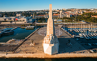
Aerial drone view of Padrao dos Descobrimentos (Monument of the Discoveries), a monument on the northern bank of the Tagus River estuary, Belem, Lisbon, Portugal, Europe

Aerial view by drone of Tunnels Beach, Haena State Park, Kauai Island, Hawaii, United States of America, North America
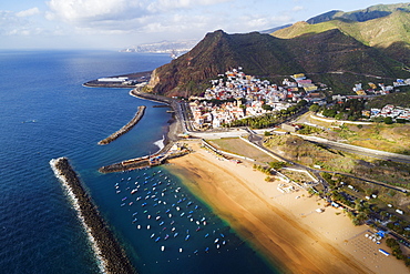
Aerial drone view of Playa de las Teresitas, San Andres, Tenerife, Canary Islands, Spain, Atlantic, Europe
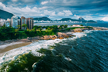
Aerial drone view of Leme Beach in the Copacabana district at sunrise with the iconic Sugarloaf Mountain in the background, UNESCO World Heritage Site, Rio de Janeiro, Brazil, South America
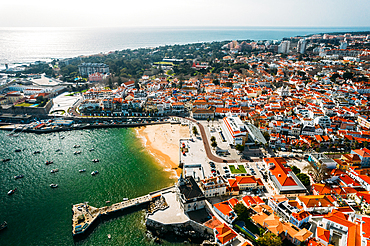
Aerial drone view of Cascais historic centre with the iconic Bay, 30km west of Lisbon on the Portuguese Riviera, Cascais, Portugal, Europe
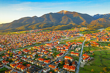
Aerial view by drone of Bansko and Pirin National Park, UNESCO World Heritage Site, Bankso, Bulgaria, Europe
Aerial view by drone of coral reef in the turquoise water of Caribbean Sea, Antilles, West Indies, Caribbean, Central America
Aerial view by drone of coastal road beside white sand beach, Caribbean, Antilles, West Indies, Caribbean, Central America
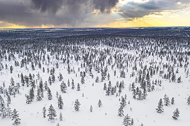
Trees in the snowy landscape of Urho Kekkonen National Park at sunset, aerial view, Saariselka, Inari, Lapland, Finland, Europe
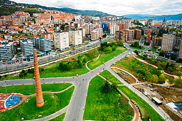
Aerial drone view of Etxebarria Park in Bilbao, Basque Country, Spain, Europe

Aerial view of lighthouse at Cap Formentor at sunset, Majorca, Balearic Islands, Spain, Mediterranean, Europe

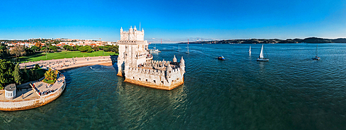
Aerial drone view of Belem Tower, UNESCO World Heritage Site, a 16th century fortification on the Tagus River, Belem, Lisbon, Portugal, Europe
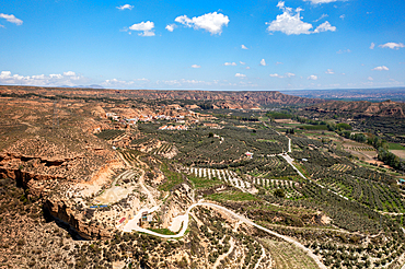
Drone aerial view of a road crossing a desert like landscape at Francisco Abellan Dam, Granada, Andalusia, Spain, Europe
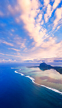
Sunrise over Le Morne and coral reef in the turquoise lagoon, aerial view by drone, Baie Du Cap, South Mauritius, Indian Ocean, Africa
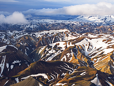
Aerial view taken by drone of Landmannalaugar mountain on a summer day, Iceland, Polar Regions
Aerial view taken by drone of Landmannalaugar mountain on a cloudy summer day, Iceland, Polar Regions
Aerial view by drone of Half Moon Bay washed by Caribbean Sea, Antigua, Leeward Islands, West Indies, Caribbean, Central America
Aerial drone view of Belem Tower, UNESCO World Heritage Site, a 16th century fortification on the Tagus River, Belem, Lisbon, Portugal, Europe
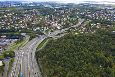
Aerial view by drone of Highway road in Gothenburg, Sweden, Scandinavia, Europe
Aerial view by drone of Highway, Triglav National Park, Upper Carniola, Slovenia, Europe
Foggy sunrise over woods of Maloja Pass at dawn, aerial view by drone, Engadine, Canton of Graubunden, Switzerland, Europe

Aerial view by drone of Danov Hill with 16th century minaret style clock tower, Plovdiv, Bulgaria, Europe
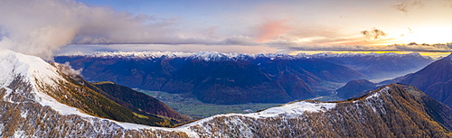
Sunset on the autumnal landscape of Scermendone Alp and Orobie Alps, aerial view by drone, Rhaetian Alps, Valtellina, Lombardy, Italy, Europe
Panoramic aerial drone view of Leme Beach in the Copacabana district at sunrise with the iconic Sugarloaf Mountain in the background, UNESCO World Heritage Site, Rio de Janeiro, Brazil, South America
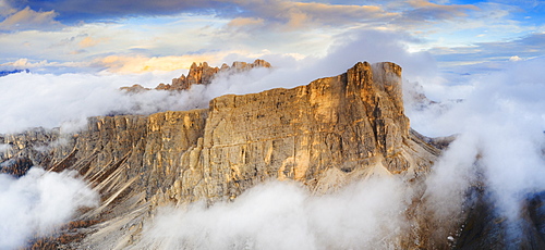
Aerial view by drone of sunset over Lastoi De Formin and Cima Ambrizzola in a sea of clouds in autumn, Giau Pass, Dolomites, Veneto, Italy, Europe
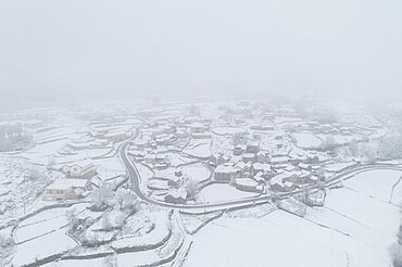
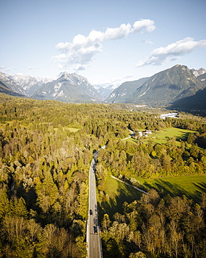
Drone aerial view of a road and remote village covered with snow in Vila Real, Norte, Portugal, Europe
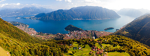
Aerial drone view of Lake Como from Narro, Tremezzina, Como, Lombardy, Italian Lakes, Italy, Europe
Aerial drone view of Ipanema Beach and neighbourhood, Rio de Janeiro, Brazil, South America
Aerial view by drone of fog over scenic road crossing Giau Pass in a sea of clouds at sunset, Dolomites, Belluno province, Veneto, Italy, Europe
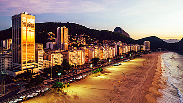
Aerial drone view of Leme Beach in the Copacabana district at sunrise with the iconic Sugarloaf Mountain in the background, UNESCO World Heritage Site, Rio de Janeiro, Brazil, South America

Aerial view of Cadiz, by drone, Andalucia, Spain, Europe
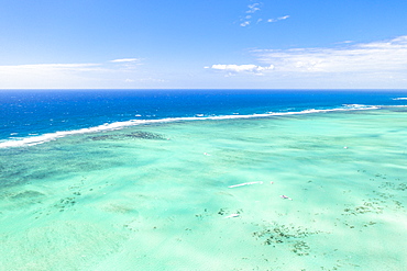
Turquoise coral reef meeting the blue Indian Ocean, aerial view by drone, Ile Aux Cerfs, Flacq district, Mauritius, Indian Ocean, Africa
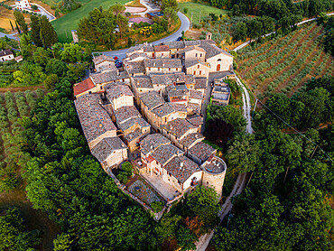
Aerial drone view of the village of Torre del Colle at sunset, Umbria, Italy, Europe
Aerial drone view of Leme Beach in the Copacabana district at sunrise with the iconic Sugarloaf Mountain in the background, UNESCO World Heritage Site, Rio de Janeiro, Brazil, South America

Aerial view, by drone, of Cadiz, Andalucia, Spain, Europe
Aerial view by drone of pagodas, Inle Lake, Shan state, Myanmar (Burma), Asia
Aerial view by drone of Hermitage Bay and Pearns Point, Antigua, Antigua and Barbuda, Leeward Islands, West Indies, Caribbean, Central America
Aerial drone view of Arpoador section of Ipanema Beach with Copacabana and Sugarloaf Mountain visible in the background, Rio de Janeiro, Brazil, South America
Aerial view by drone of coral reef in the turquoise water of Caribbean Sea, Antilles, West Indies, Caribbean, Central America
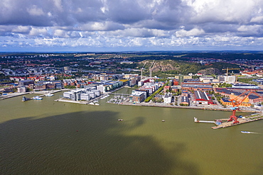
Aerial view by drone of Hesingen (Hisingen) island, Gothenburg, Sweden, Scandinavia, Europe
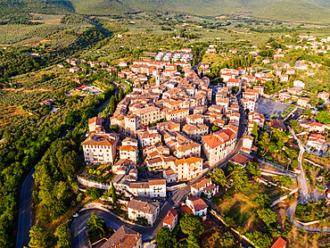
Aerial drone view of the village of Montecchio at sunset, Umbria, Italy, Europe
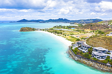
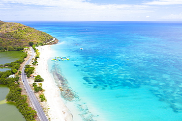
Aerial view by drone of Tamarind Hills luxury hotel ocean front and Ffryes Bay, Antigua, Antigua and Barbuda, Leeward Islands, West Indies, Caribbean, Central America

Cruise ship sailing in the Caribbean Sea at sunset, aerial view by drone, Antilles, West Indies, Caribbean, Central America
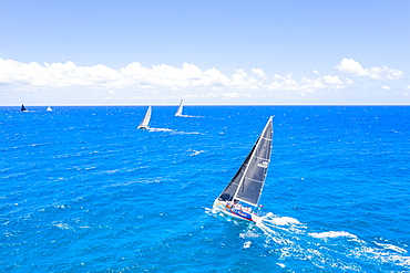
Aerial view by drone of sailing boats during a regatta, Antigua, Leeward Islands, West Indies, Caribbean, Central America
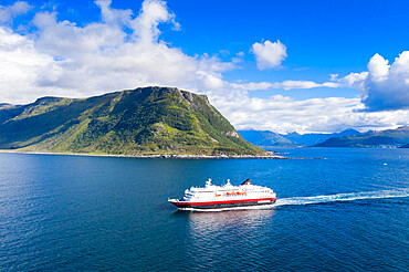
Aerial view by drone of Hurtigruten during a daily trip along the fjord, Alesund, More og Romsdal county, Norway, Scandinavia, Europe

Cruise ship sailing in the Caribbean Sea at sunset, aerial view by drone, Antilles, West Indies, Caribbean, Central America

Scenic view of waterfront, Gravedona, Lake Como, Italy
High angle view of waterfront cityscape
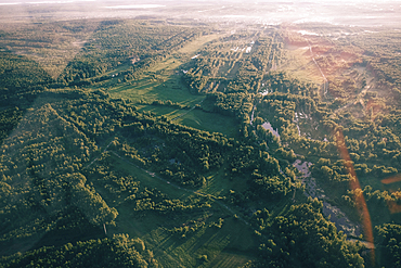
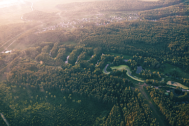
Aerial view of trees in landscape

Aerial view of airplane flying over trees
Aerial view of river and trees

Aerial view of airplane flying over trees
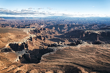
Aerial view of canyon, Moab, Utah, United States

Aerial view of river and trees
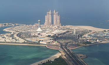
Aerial view of waterfront cityscape
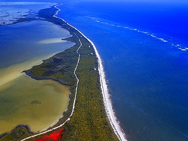
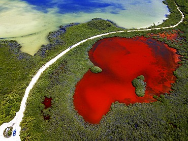
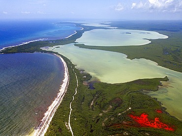
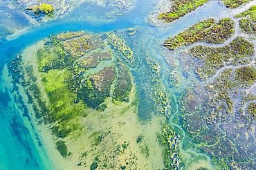
Aerial view of Punta Allen Sian Ka'an Reserve, Yucatan Peninsula, Mexico. Red lagoon near Boca Paila Bridge.
In the language of the Mayan peoples who once inhabited this region, Sian Ka'an means Origin of the Sky. Located on the east coast of the Yucatán peninsula, this biosphere reserve contains tropical forests, mangroves and marshes, as well as a large marine section intersected by a barrier reef. It provides a habitat for a remarkably rich flora and a fauna comprising more than 300 species of birds, as well as a large number of the region's characteristic terrestrial vertebrates, which cohabit in the diverse environment formed by its complex hydrological system.
Along its roughly 120 kilometres of coastline, the property covers over 400,000 hectares of land ranging from sea level to only ten m.a.s.l. The property boasts diverse tropical forests, palm savannah, one of the most pristine wetlands in the region, lagoons, extensive mangrove stands, as well as sandy beaches and dunes. The 120,000 hectares of marine area protect a valuable part of the Mesoamerican Barrier Reef and seagrass beds in the shallow bays. The lush green of the forests and the many shades of blue of the lagoons and the Caribbean Sea under a wide sky offer fascinating visual impressions.
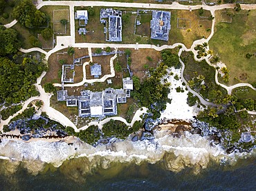
Aerial views of El Castillo and the Ruins of the Mayan temple grounds at Tulum, Quintana Roo, Yucatan, Mexico. Tulum is the site of a pre-Columbian Mayan walled city which served as a major port for Coba, in the Mexican state of Quintana Roo. The ruins are situated on 12 meter 39 ft tall cliffs along the east coast of the Yucatán Peninsula on the Caribbean Sea in the state of Quintana Roo, Mexico. Tulum was one of the last cities built and inhabited by the Maya; it was at its height between the 13th and 15th centuries and managed to survive about 70 years after the Spanish began occupying Mexico. Old World diseases brought by the Spanish settlers appear to have resulted in very high fatalities, disrupting the society, and eventually causing the city to be abandoned.
Aerial view of Punta Allen Sian Ka'an Reserve, Yucatan Peninsula, Mexico. Red lagoon near Boca Paila Bridge.
In the language of the Mayan peoples who once inhabited this region, Sian Ka'an means Origin of the Sky. Located on the east coast of the Yucatán peninsula, this biosphere reserve contains tropical forests, mangroves and marshes, as well as a large marine section intersected by a barrier reef. It provides a habitat for a remarkably rich flora and a fauna comprising more than 300 species of birds, as well as a large number of the region's characteristic terrestrial vertebrates, which cohabit in the diverse environment formed by its complex hydrological system.
Along its roughly 120 kilometres of coastline, the property covers over 400,000 hectares of land ranging from sea level to only ten m.a.s.l. The property boasts diverse tropical forests, palm savannah, one of the most pristine wetlands in the region, lagoons, extensive mangrove stands, as well as sandy beaches and dunes. The 120,000 hectares of marine area protect a valuable part of the Mesoamerican Barrier Reef and seagrass beds in the shallow bays. The lush green of the forests and the many shades of blue of the lagoons and the Caribbean Sea under a wide sky offer fascinating visual impressions.
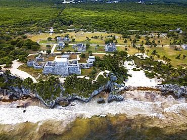
Aerial views of El Castillo and the Ruins of the Mayan temple grounds at Tulum, Quintana Roo, Yucatan, Mexico. Tulum is the site of a pre-Columbian Mayan walled city which served as a major port for Coba, in the Mexican state of Quintana Roo. The ruins are situated on 12 meter 39 ft tall cliffs along the east coast of the Yucatán Peninsula on the Caribbean Sea in the state of Quintana Roo, Mexico. Tulum was one of the last cities built and inhabited by the Maya; it was at its height between the 13th and 15th centuries and managed to survive about 70 years after the Spanish began occupying Mexico. Old World diseases brought by the Spanish settlers appear to have resulted in very high fatalities, disrupting the society, and eventually causing the city to be abandoned.
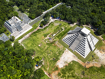
Aerial view of Mayan Ruin of Chichen Itza Archaeological Site Yucatan Peninsula, Quintana Roo, Caribbean Coast, Mexico
Aerial view of Punta Allen Sian Ka'an Reserve, Yucatan Peninsula, Mexico. Red lagoon near Boca Paila Bridge.
In the language of the Mayan peoples who once inhabited this region, Sian Ka'an means Origin of the Sky. Located on the east coast of the Yucatán peninsula, this biosphere reserve contains tropical forests, mangroves and marshes, as well as a large marine section intersected by a barrier reef. It provides a habitat for a remarkably rich flora and a fauna comprising more than 300 species of birds, as well as a large number of the region's characteristic terrestrial vertebrates, which cohabit in the diverse environment formed by its complex hydrological system.
Along its roughly 120 kilometres of coastline, the property covers over 400,000 hectares of land ranging from sea level to only ten m.a.s.l. The property boasts diverse tropical forests, palm savannah, one of the most pristine wetlands in the region, lagoons, extensive mangrove stands, as well as sandy beaches and dunes. The 120,000 hectares of marine area protect a valuable part of the Mesoamerican Barrier Reef and seagrass beds in the shallow bays. The lush green of the forests and the many shades of blue of the lagoons and the Caribbean Sea under a wide sky offer fascinating visual impressions.

Aerial view of Punta Allen Sian Ka'an Reserve, Yucatan Peninsula, Mexico
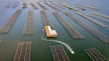
In Fangar Bay mussels and oysters are farmed. Ebro Delta Nature Reserve, Tarragona, Catalonia, Spain.
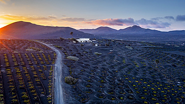
Vinery, La Geria, Lanzarote, Canary Islands, Spain
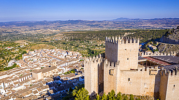
Renaissance castle and white village, Velez Blanco, Almeria, Andalucia, Spain,
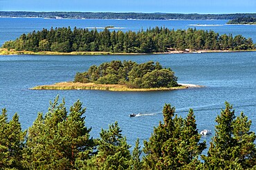
Aerial view of the islands in front Mossala Island Resort Southwest Finland archipelago. The archipelago ring road or Saariston rengastie is full of things to see, do and do. The Archipelago Trail can be taken clockwise or counter clockwise, starting in the historical city of Turku, and continuing through rural archipelago villages and astonishing Baltic Sea sceneries. The Trail can be taken from the beginning of June until the end of August.
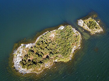
Aerial view of small island in front Mossala Island Resort Southwest Finland archipielago. The archipelago ring road or Saariston rengastie is full of things to see, do and do. The Archipelago Trail can be taken clockwise or counter clockwise, starting in the historical city of Turku, and continuing through rural archipelago villages and astonishing Baltic Sea sceneries. The Trail can be taken from the beginning of June until the end of August.
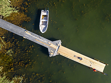
Aerial view of small dock in Korpo or Korppoo island, Korpostrom coast Southwest Finland Turku archipelago. The archipelago ring road or Saariston rengastie is full of things to see, do and do. The Archipelago Trail can be taken clockwise or counter clockwise, starting in the historical city of Turku, and continuing through rural archipelago villages and astonishing Baltic Sea sceneries. The Trail can be taken from the beginning of June until the end of August.
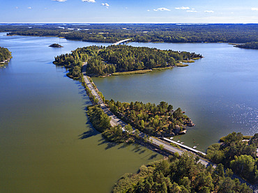
Aerial view of Kustavi small islands in Southwest Finland archipielago. The archipelago ring road or Saariston rengastie is full of things to see, do and do. The Archipelago Trail can be taken clockwise or counter clockwise, starting in the historical city of Turku, and continuing through rural archipelago villages and astonishing Baltic Sea sceneries. The Trail can be taken from the beginning of June until the end of August.
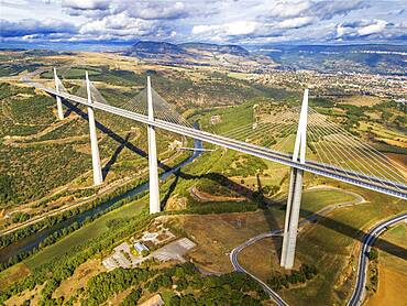
Aerial view Millau viaduct by architect Norman Foster, between Causse du Larzac and Causse de Sauveterre above Tarn, Aveyron, France. Cable-stayed bridge spanning the Tarn River Valley. A75 motorway, built by Michel Virlogeux and Norman Foster, located between Causses de Sauveterre and Causses du Larzac above Tarn River, Natural Regional Park of Grands Causses.
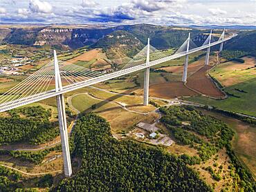
Aerial view Millau viaduct by architect Norman Foster, between Causse du Larzac and Causse de Sauveterre above Tarn, Aveyron, France. Cable-stayed bridge spanning the Tarn River Valley. A75 motorway, built by Michel Virlogeux and Norman Foster, located between Causses de Sauveterre and Causses du Larzac above Tarn River, Natural Regional Park of Grands Causses.
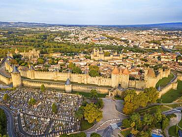
Aerial view of Carcassonne, medieval city listed as World Heritage by UNESCO, harboure d'Aude, Languedoc-Roussillon Midi Pyrenees Aude France
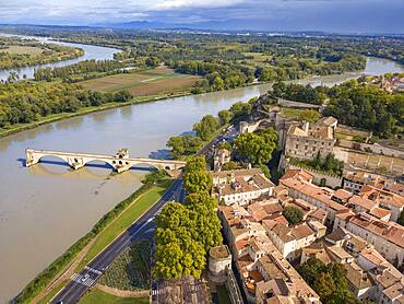
Aerial view of Avignon Bridge with Popes Palace and Rhone River at sunrise, Pont Saint-Benezet, Provence, France
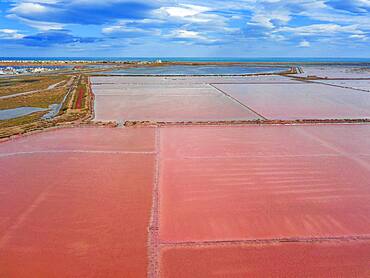
Salt production of Salins du Midi at Gruissan in Languedoc-Roussillon, France, Aude, Gruissan. Solar evaporaton salt pans salins. salt marshes, saline of Gruissan in aerial view.

Agricultural aerial landscape, Tierra Estella, Navarre, Spain, Europe

Quarry. Aerial view. Ancin area. Navarre, Spain, Europe

Agricultural area. Aerial view. Ayegui area. Navarre, Spain, Europe

Quarry. Aerial view. Ancin area. Navarre, Spain, Europe
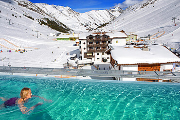
Kuhtai sky resort village and ski slopes near Innsbruck Tyrol Austria. Swimming pool of the Mooshaus Hotel.

Reedbed and river. Alloz reservoir. Navarre, Spain, Europe

Aerial view of a farmland with olive trees. Bargota, Navarre, Spain.

Aerial view of a young woman hiker lying on his back on a meadow. Aralar mountain range. Navarre, Spain, Europe.
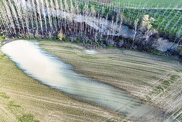
Aerial view of a farmland flooded close to a poplar grove. Murieta, Navarre, Spain, Europe.
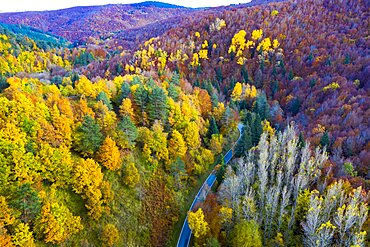
Aerial view of a decidual forest and road in autumn. Close to Irati area. Navarre, Spain, Europe.

Aerial view of a farmland with olive trees. Bargota, Navarre, Spain.
Coastal landscape. La Ballena. Sonabia (Castro Urdiales) Cantabria, Spain, Europe.
Salt marshes in a coastal aerial view. Oriᅢᄆon, Castro Urdiales, Cantabria.