Results
« Previous 1 … 5 6 7 8 Next »
788 results found
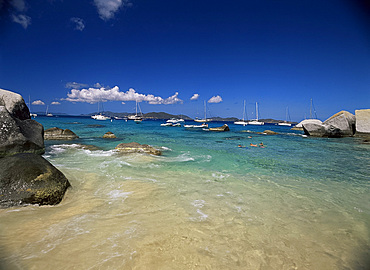
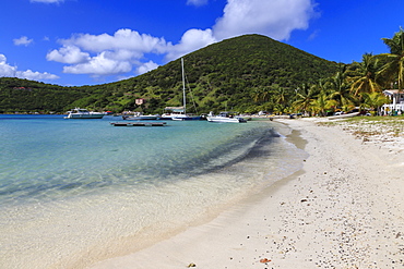
Swimmers and yachts at The Baths, Virgin Gorda, British Virgin Islands, West Indies, Caribbean, Central America

Boulders, The Baths, Virgin Gorda, British Virgin Islands, West Indies, Central America
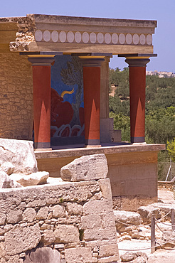
The north entrance passage containing a fresco of a charging bull at the Minoan site of Knossos, excavated in the early 20th century by British archaeologist Sir Arthur Evans, Crete, Greek Islands, Greece, Europe
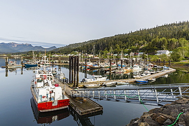
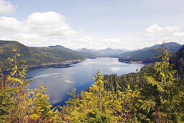
Queen Charlotte City Harbor, Bearskin Bay, Haida Gwaii (Queen Charlotte Islands), British Columbia, Canada, North America
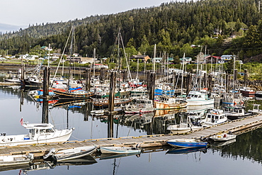
Queen Charlotte City Harbor, Bearskin Bay, Haida Gwaii (Queen Charlotte Islands), British Columbia, Canada, North America
Gentoo penguins (Pygoscelis papua), Port Lockroy British Antarctic Base, Wiencke Island, Antarctica, Polar Regions

The beach of Casteret, Guernsey, Channel Islands, United Kingdom, Europe
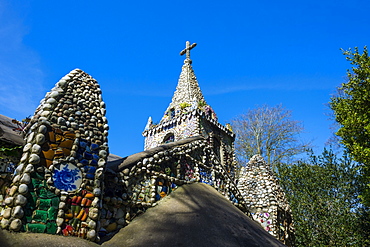
Wonderful ornamented Little Chapel, Guernsey, Channel Islands, United Kingdom, Europe
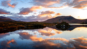
Sunset view across Lochain na h'achlaise at dawn, Rannoch Moor, Highland, Scotland, United Kingdom, Europe
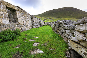
Main Street, evacuated village, Hirta, remote St. Kilda Archipelago, UNESCO World Heritage Site, Outer Hebrides, Scotland, United Kingdom, Europe
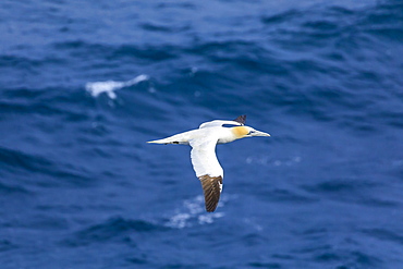
Northern Gannet (Morus bassanus) in flight, Stac Lee, island Marilyn, St. Kilda Archipelago, UNESCO World Heritage Site, Outer Hebrides, Scotland, United Kingdom, Europe
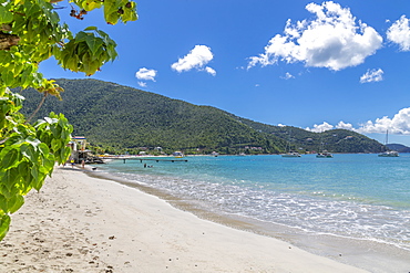
View of Cane Garden Bay Beach, Tortola, British Virgin Islands, West Indies, Caribbean, Central America
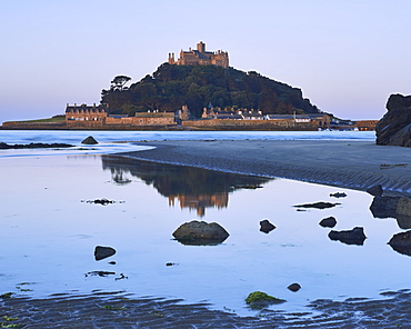
Twilight reflections of St. Michael's Mount in Marazion, Cornwall, England, United Kingdom, Europe
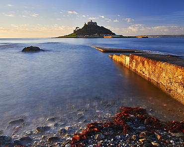
Winter sunrise at St. Michael's Mount in Marazion, Cornwall, England, United Kingdom, Europe
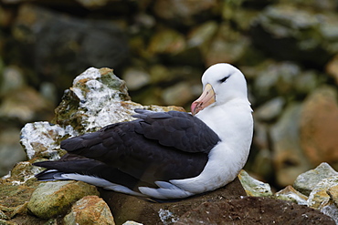
Nesting Black-browed Albatross (Thalassarche melanophris), New Island, Falkland Islands, British Overseas Territory, South America

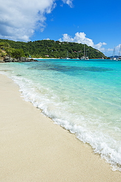
The Baths, Virgin Gorda, British Virgin Islands, Caribbean, West Indies, Central America
Gentoo penguins (Pygoscelis papua), Port Lockroy British Antarctic Base, Wiencke Island, Antarctica, Polar Regions
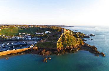
Castle of Mont Orgueil, Jersey, Channel Islands, United Kingdom, Europe
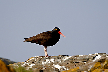
American black oystercatcher (black oystercatcher) (Haematopus bachmani), Mandarte Island, British Columbia, Canada, North America
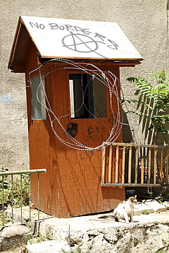
Cyprus. Abandoned houses along th Green Line in Nicosia dividing the Republic of Cyprus and Turkish controlled northern part. The United Nations Buffer Zone in Cyprus runs for more than 180.5?kilometres (112.2?mi) along what is known as the Green Line and has an area of 346?square kilometres (134?sq?mi). The zone partitions the island of Cyprus into a southern area effectively controlled by the government of the Republic of Cyprus (which is the de jure government for the entire island save for the British Sovereign Base Areas), and the northern area controlled by the Turkish army
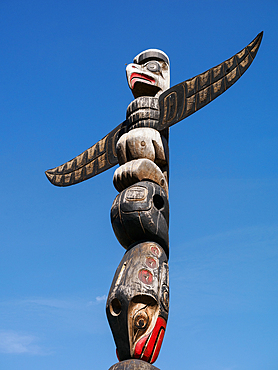
First Nations totem pole, Duncan, Vancouver Island, British Columbia, Canada, North America
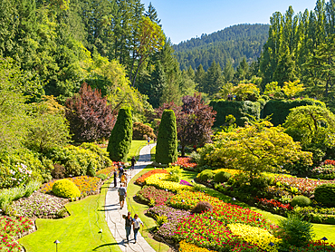
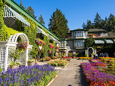
The Sunken Garden at Victoria's Butchart Gardens, planted in a former limestone quarry, starting in 1904, Victoria, Vancouver Island, British Columbia, Canada, North America

The Castle in the Snow, Fairy Glen, Isle of Skye, Inner Hebrides, Scotland, United Kingdom, Europe
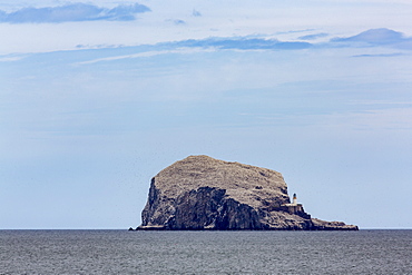
Bass Rock, a tiny uninhabited island in the Firth of Forth, home to a large colony of gannets, East Lothian, Scotland, United Kingdom, Europe
View over Pitcairn island, British Overseas Territory, South Pacific, Pacific
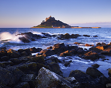
Winter dawn looking at St. Michael's Mount in Marazion, Cornwall, England, United Kingdom, Europe

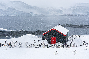
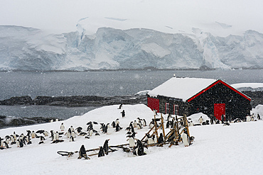
Former British Base A, now a museum and post office at Port Lockroy on tiny Goudier Island, Antarctica, Polar Regions
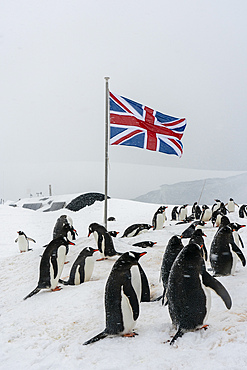
Gentoo penguins (Pygoscelis papua), Port Lockroy British Antarctic Base, Wiencke Island, Antarctica, Polar Regions
Qualicum Beach, Vancouver Island, British Columbia, Canada, North America
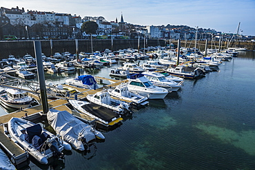
Sport boat harbour in Saint Peter Port, Guernsey, Channel Islands, United Kingdom, Europe
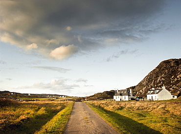
Two croft houses, Isle of Colonsay, Inner Hebrides, Scotland, United Kingdom, Europe
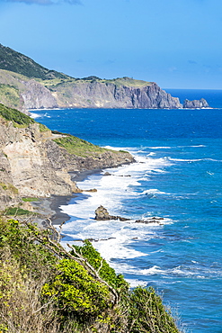
Coastline of Montserrat, British Overseas Territory, West Indies, Caribbean, Central America
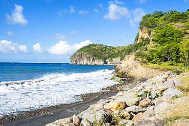
Volcanic sand beach, Montserrat, British Overseas Territory, West Indies, Caribbean, Central America
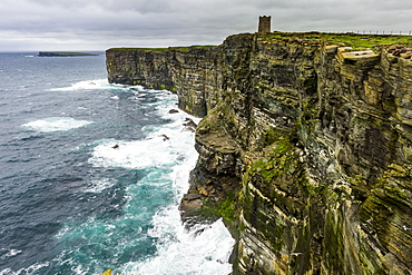
High above the cliffs, the Kitchener Memorial, Orkney Islands, Scotland, United Kingdom, Europe
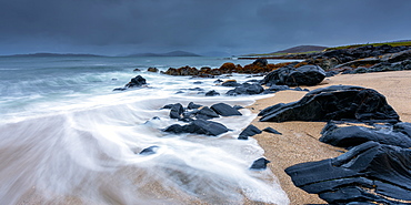
Isle of Harris Beach, Outer Hebrides, Scotland, United Kingdom, Europe
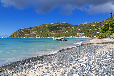
View of Cane Garden Bay Beach, Tortola, British Virgin Islands, West Indies, Caribbean, Central America

Aerial of Pitcairn island with St. Pauls Pool, British Overseas Territory, South Pacific, Pacific

Colourful winter sunrise at St. Michael's Mount in Marazion, Cornwall, England, United Kingdom, Europe
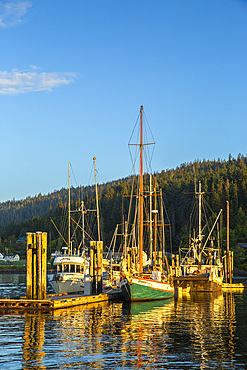
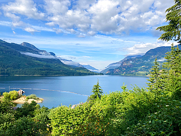
The harbor in the village of Queen Charlotte, Graham Island, Haida Gwaii, British Columbia.
Nitinat Lake, Carmanah Walbran Provincial Park, Vancouver Island, British Columbia, Canada, North America

Sand formations at Budle Bay, with Holy Island Castle in the distance, Northumberland, England, United Kingdom, Europe
Strathcona National Park, Vancouver Island, British Columbia, Canada, North America
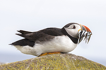
Puffin (Fratercula arctica) with sand eels, Farne Islands, Northumberland, England, United Kingdom, Europe

Isle of Skye, Inner Hebrides, Scotland, United Kingdom, Europe
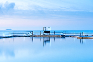
The Bathing Pools at La Vallette, St. Peters Port, Guernsey, Channel Islands, United Kingdom, Europe
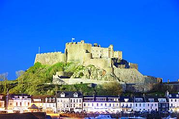
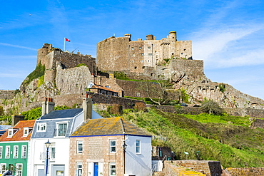
Mont Orgueil Castle (Gorey Castle), Gorey, Jersey, Channel Islands, United Kingdom, Europe
Mont Orgueil Castle (Gorey Castle), Gorey, Jersey, Channel Islands, United Kingdom, Europe
Mont Orgueil Castle (Gorey Castle), Gorey, Jersey, Channel Islands, United Kingdom, Europe
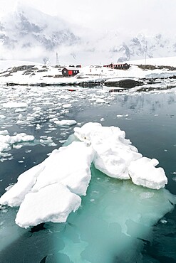
Former British Base A, now a museum and post office at Port Lockroy on tiny Goudier Island, Antarctica, Polar Regions
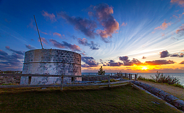
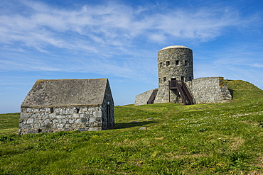
Martello Tower, with walls up to 11 feet thick and surrounded by dry moat, at Ferry Reach, built by the British Army in 1883 to protect the main channel into Bermuda, St. George's Island, Bermuda, Atlantic, North America

Sailing boats moored off the beach at the Baths, Virgin Gorda, British Virgin Islands, West Indies, Caribbean, Central America
Land's End, Cornwall, England, United Kingdom, Europe
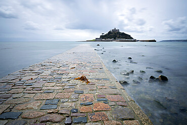
St. Michael's Mount and causeway, Marazion, near Penzance, Cornwall, England, United Kingdom, Europe
Carn Llidi looking toward Ramsey Island, Pembrokeshire, Wales, United Kingdom, Europe

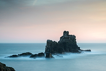
Newland Island off the coast of Pentire Point, North Cornwall, England, United Kingdom, Europe
Butchart Gardens, Victoria, Vancouver Island, British Columbia, Canada, North America
Cyprus. Abandoned houses along th Green Line in Nicosia dividing the Republic of Cyprus and Turkish controlled northern part. The United Nations Buffer Zone in Cyprus runs for more than 180.5?kilometres (112.2?mi) along what is known as the Green Line and has an area of 346?square kilometres (134?sq?mi). The zone partitions the island of Cyprus into a southern area effectively controlled by the government of the Republic of Cyprus (which is the de jure government for the entire island save for the British Sovereign Base Areas), and the northern area controlled by the Turkish army
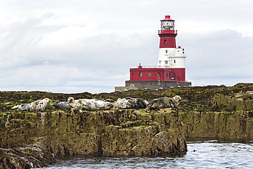
Grey seals (Halichoerus grypus) near Longstone lighthouse, Longstone Rock, Farne Islands, Northumberland, England, United Kingdom, Europe

Tortola, British Virgin Islands, West Indies, Caribbean, Central America

View over the coastline of Montserrat, British Overseas Territory, West Indies, Caribbean, Central America
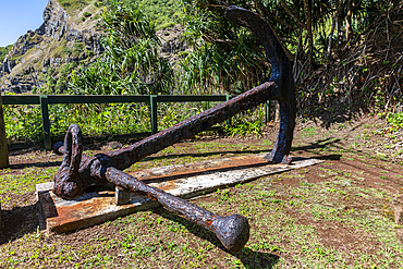
Anchor of the Bounty, Pitcairn island, British Overseas Territory, South Pacific, Pacific
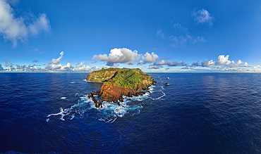
Panoramic aerial of Pitcairn island, British Overseas Territory, South Pacific, Pacific

Aerial view of North Sound, Virgin Gorda, British Virgin Islands, West Indies, Central America
Matello defence tower, Guernsey, Channel Islands, United Kingdom, Europe
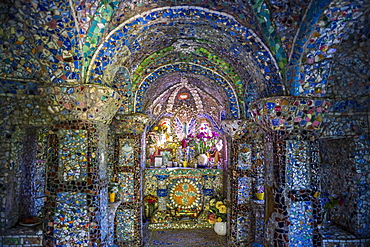
Wonderful ornamented Little Chapel, Guernsey, Channel Islands, United Kingdom, Europe
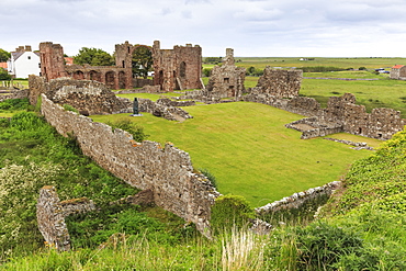
Lindisfarne Priory, early Christian site, and village, elevated view, Holy Island, Northumberland Coast, England, United Kingdom, Europe
Cyprus. Abandoned houses along th Green Line in Nicosia dividing the Republic of Cyprus and Turkish controlled northern part. The United Nations Buffer Zone in Cyprus runs for more than 180.5?kilometres (112.2?mi) along what is known as the Green Line and has an area of 346?square kilometres (134?sq?mi). The zone partitions the island of Cyprus into a southern area effectively controlled by the government of the Republic of Cyprus (which is the de jure government for the entire island save for the British Sovereign Base Areas), and the northern area controlled by the Turkish army
Sea bleached rocks, Isle of Colonsay, Inner Hebrides, Scotland, United Kingdom, Europe
View over Long Beach, Tortola, British Virgin Islands, West Indies, Caribbean, Central America
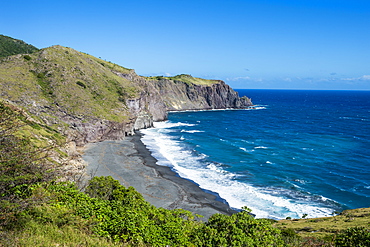
Coastline of Montserrat, British Overseas Territory, West Indies, Caribbean, Central America
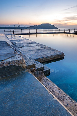
The Bathing Pools at La Vallette, St. Peters Port, Guernsey, Channel Islands, United Kingdom, Europe
Corbiere Point Lighthouse, Jersey, Channel Islands, United Kingdom, Europe

Jost Van Dyke island, British Virgin Islands, Caribbean, West Indies, Central America

Boulders in Spring Bay, The Baths, Virgin Gorda, British Virgin Islands, West Indies, Central America
Beach, green hills and yachts, Great Harbour, Jost Van Dyke, British Virgin Islands, West Indies, Caribbean, Central America
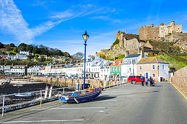
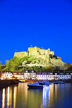
The town of Mont Orgueil and its castle, Jersey, Channel Islands, United Kingdom, Europe
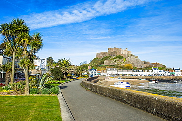
The town of Mont Orgueil and its castle, Jersey, Channel Islands, United Kingdom, Europe
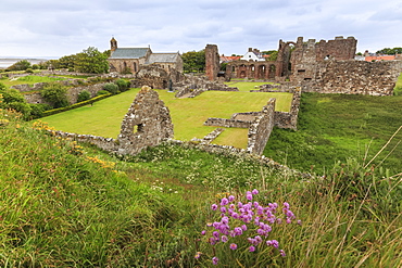
Lindisfarne Priory, early Christian site, and village, elevated view, Holy Island, Northumberland Coast, England, United Kingdom, Europe

View over White Bay, Jost Van Dyke, British Virgin Islands, West Indies, Caribbean, Central America

Aerial of Beef Island, British Virgin Islands, West Indies, Caribbean, Central America
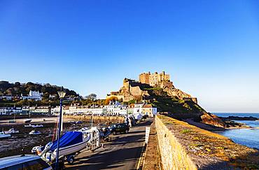
Mont Orgueil Castle (Gorey Castle), Gorey, Jersey, Channel Islands, United Kingdom, Europe
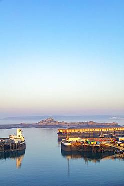
Port of St. Helier and Elizabeth Castle, Jersey, Channel Islands, United Kingdom, Europe

Village Bay through stone remains of evacuated village, Hirta, St. Kilda Archipelago, UNESCO World Heritage Site, Outer Hebrides, Scotland, United Kingdom, Europe

Main Street, evacuated village, Hirta, remote St. Kilda Archipelago, UNESCO World Heritage Site, Outer Hebrides, Scotland, United Kingdom, Europe

Spring dawn looking at St. Michael's Mount in Marazion, Cornwall, England, United Kingdom, Europe
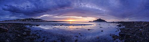
Winter dawn panorama of St. Michael's Mount and Marazion, Cornwall, England, United Kingdom, Europe
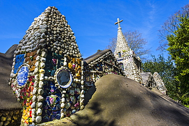
Wonderful ornamented Little Chapel, Guernsey, Channel Islands, United Kingdom, Europe
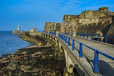
Cornet Castle, Saint Peter Port, Guernsey, Channel Islands, United Kingdom, Europe
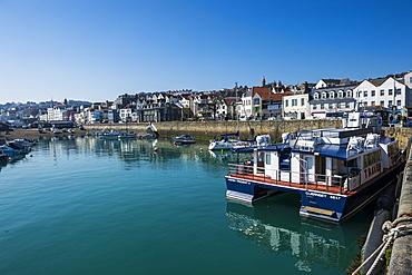
Seafront of Saint Peter Port, Guernsey, Channel Islands, United Kingdom, Europe

View over White Bay, Jost Van Dyke, British Virgin Islands, West Indies, Caribbean, Central America
Famous White Bay, Jost Van Dyke, British Virgin Islands, West Indies, Caribbean, Central America
Long bay beach, Beef island, Tortola, British Virgin Islands, West Indies, Caribbean, Central America
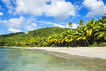
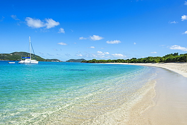
Brewers Bay, Tortola, British Virgin Islands, West Indies, Caribbean, Central America

Aerial of Virgin Gorda, British Virgin Islands, West Indies, Caribbean, Central America
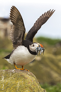
Puffin (Fratercula arctica) with sandeels, Farne Islands, Northumberland, England, United Kingdom, Europe
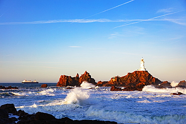
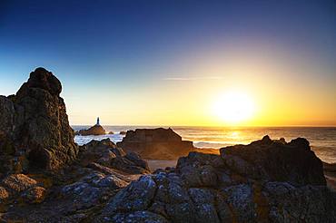
Corbiere Point Lighthouse, Jersey, Channel Islands, United Kingdom, Europe
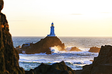
Corbiere Point Lighthouse, Jersey, Channel Islands, United Kingdom, Europe

Corbiere Point Lighthouse, Jersey, Channel Islands, United Kingdom, Europe
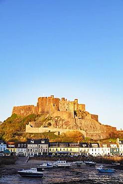
Mont Orgueil Castle (Gorey Castle), Gorey, Jersey, Channel Islands, United Kingdom, Europe
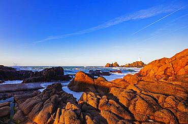
Corbiere Point Lighthouse, Jersey, Channel Islands, United Kingdom, Europe