Results
« Previous 1 … 5 6 7
609 results found
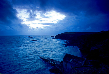
Dusk at Lizard Point in Cornwall, South West England. In the foreground is the old lifeboat station.
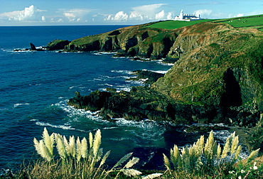
Lizard Lighthouse, Lizard Point, Cornwall, England
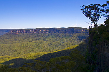
Tourists near Echo Point within Blue Mountains National Park, New South Wales, Australia.
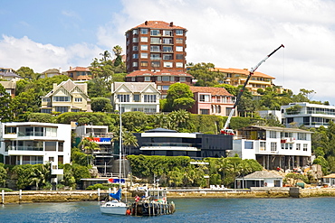
Waterfront residences, Point Piper, Double Bay, Sydney Harbour, Australia
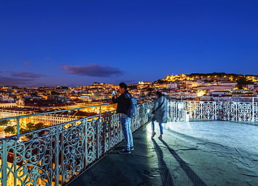
Twilight view of the Santa Justa Lift view point, Lisbon, Portugal, Europe
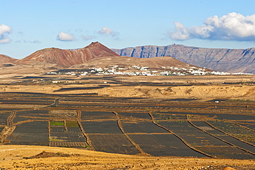
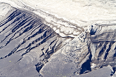
View across black volcanic cinder fields to the town of Soo and the Risco de Famara range with the highest point on the island at Penas del Cache radar site, Soo, Lanzarote, Canary Islands, Spain, Atlantic Ocean, Europe
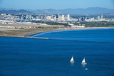
View over San Diego Bay from the Cabrillo National Monument, Point Loma, San Diego, California, United States of America, North America
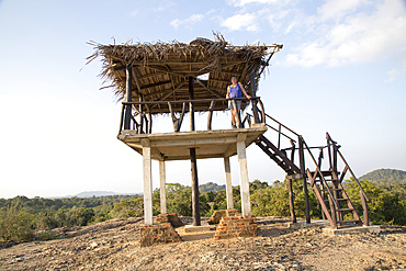
Landscape look-out point, Hurulu Eco Park biosphere reserve, Habarana, Anuradhapura District, Sri Lanka, Asia
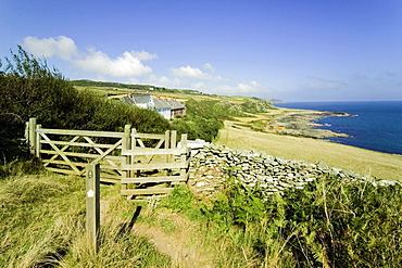
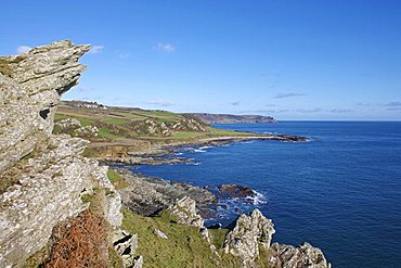
View from the Devon Coast Path at Prawle Point, South Hams, Devon, England, United Kingdom, Europe
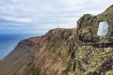
View over the cliffs from the Mirador del Rio observation point created by Cesar Manrique, Lanzarote, Canary Islands, Spain, Atlantic, Europe
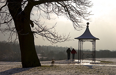
Couple looking at the London skyline at the Observation Point near Kenwood on Hampstead Heath, London
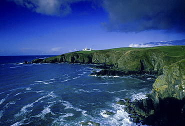
Lizard Point Lighthouse in Housel Bay, Cornwall, South West England
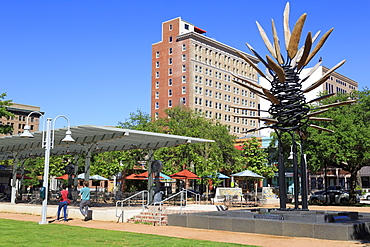
Points of View sculpture by James Surls in Market Square Park, Houston, Texas, United States of America, North America
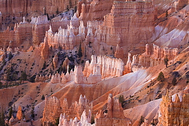
View from Sunrise Point at sunrise, Bryce Canyon National Park, Utah, United States of America, North America
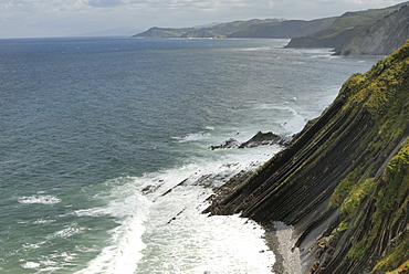
View from high point on the wild Basque coast, Euskadi, Spain, Europe
Langerstone Point and view towards Start Point from Prawle Point, Devon, England, United Kingdom, Europe
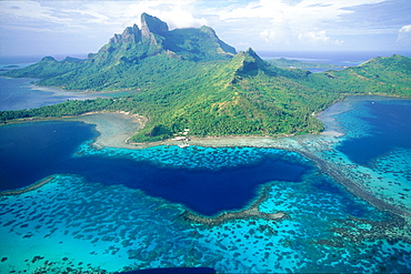
French Polynesia, Iles Sous-Le-Vent, Bora-Bora Island, Aerail View Of The Island And Lagoon, Mount Otemanu Is The Highest Point
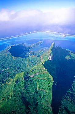
French Polynesia, Iles Sous-Le-Vent, Bora-Bora Island, Aerial View Of The Island And Lagoon, Mount Otemanu Peak Is The Highest Point
View across the Kitabule Swamp Forest at Pelican Point in Queen Elizabeth National Park in western Uganda.
View of the beach and town of Vila Baleira seen from the Portela lookout point on the Portuguese Atlantic isand of Porto Santo.
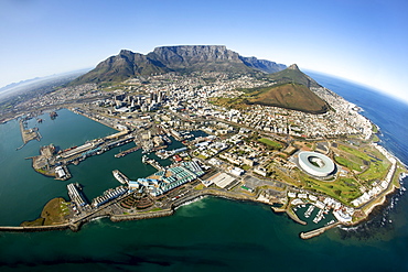
Aerial view of Cape Town showing Table Mountain, with Devil's Peak on the left, Lion's Head and Signal Hill on right, and the new Green Point stadium in the foreround, Cape Town, South Africa, Africa
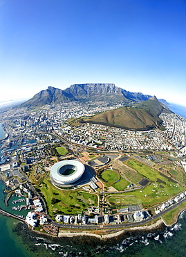
Aerial view of Cape Town showing Table Mountain, with Devil's Peak on the left, Lion's Head and Signal Hill on right, and the new Green Point stadium and suburb of Mouille Point in the foreround, Cape Town, South Africa, Africa
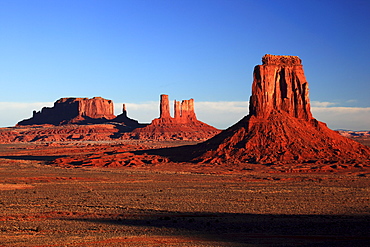
Monument valley, view near artist point, utah, usa
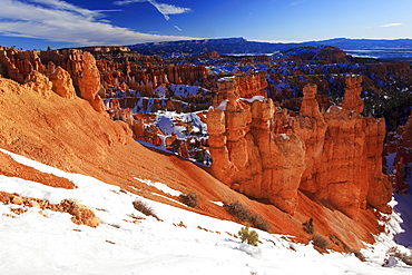
Bryce canyon in winter, view from sunset point, hoodoos at surise, bryce canyon national park, paunsaugunt plateau, utah, usa
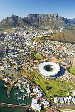
Aerial view of Cape Town showing Table Mountain, with Devil's Peak on the left, and the new Green Point stadium and Granger Bay marina in the foreround, Cape Town, South Africa, Africa
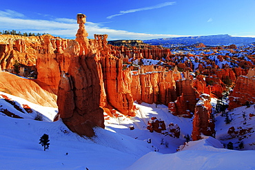
Bryce canyon in winter, view from sunset point, hoodoos at surise, bryce canyon national park, paunsaugunt plateau, utah, usa
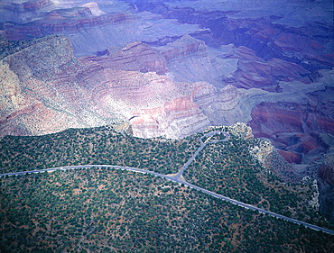
Usa, South West, Arizona, Grand Canyon National Park, South Rim, Aerial Of Mather Point Of View
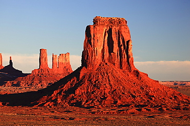
Monument valley, view near artist point, utah, usa
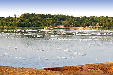
View of froth on the Victoria Nile River at the ferry crossing point in Murchison Falls National Park in Uganda.
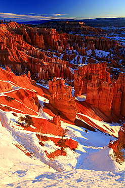
Bryce canyon in winter, view from sunset point, hoodoos at surise, bryce canyon national park, paunsaugunt plateau, utah, usa
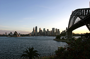
View of the city including the Harbour Bridge and Opera House, from Millson Point Park, Sydney, New South Wales, Australia, Pacific
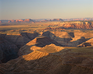
View from Muley Point Overlook towards Monument Valley, Utah, United States of America (USA), North America
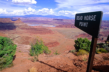
Usa, South West, Utah, Dead Horse Point, View Of Mountains And Canyon
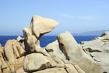
Granite rocks smoothed and sculpted by wind, weather and the sea into strange organic shapes, Campomoro Point, near Propriano, Corsica, France.

Aerial view of the Alaskan purse-seiner fishery for wild salmon off Point Augustus, Chichagof Island, Southeast Alaska, USA

Aerial view of the Alaskan purse-seiner fishery for wild salmon off Point Augustus, Chichagof Island, Southeast Alaska, USA. Note how full the net is of wild salmon as the net is retrieved onboard.
The beautiful sandstone cliffs at Punta Colorado (Red Point) on Isla San Jose in the Gulf of California (Sea of Cortez), Baja California Sur, Mexico.
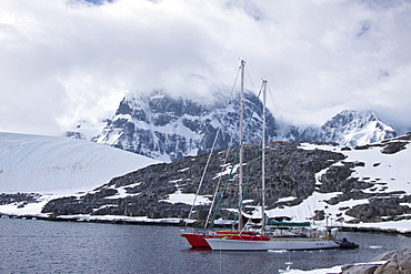
Private sailboats tied up at Alice Creek near Jougla Point, in Port Lockroy at the western end of Wiencke Island, Antarctica, Southern Ocean

Views of the volcanic island Surtsey (Icelandic, meaning "Surtur's island"), the southernmost point of Iceland
Views of the volcanic island Surtsey (Icelandic, meaning "Surtur's island"), the southernmost point of Iceland

Aerial view of the Alaskan purse-seiner fishery for wild salmon off Point Augustus, Chichagof Island, Southeast Alaska, USA.

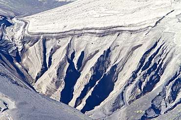
A view of the Polychrome (many-colored) Mountains from a lookout point on the park road inside Denali National Park and Preserve , Alaska, USA.

Views of the volcanic island Surtsey (Icelandic, meaning "Surtur's island"), the southernmost point of Iceland

A view of the Polychrome (many-colored) Mountains from a lookout point on the park road inside Denali National Park and Preserve , Alaska, USA.
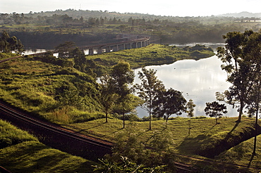
With a surface area of 68,800-úsquare kilometres (26,600-úsq-úmi), Lake Victoria is AfricaG®ös largest lake, and the largest tropical lake in the world. The Rail track meanders across Lake Victoria, just upstream from where the Victoria Nile river forms. This is the furthest point, and considered the source of the River Nile, the worldG®ös longest river. Jinja, Uganda, East Africa
Semyon Dezhnev settlement, abandoned and ruined, Cape Dezhnev (Chukotskiy Peninsular ) Russia, Asia. MORE INFO: cape that forms the easternmost mainland point of Eurasia. In 1898 it was officially renamed Cape Dezhnev, replacing Captain James Cook's 'East Cape', in honor of Semyon Dezhnyov, the first recorded European to round it (1648). There is a large monument to Dezhnev on the coast.
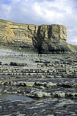
Nash Point, Heritage Coast, Vale of Glamorgan, South Wales, UK (rr)
Semyon Dezhnev settlement, abandoned and ruined, Cape Dezhnev (Chukotskiy Peninsular ) Russia, Asia. MORE INFO: cape that forms the easternmost mainland point of Eurasia. In 1898 it was officially renamed Cape Dezhnev, replacing Captain James Cook's 'East Cape', in honor of Semyon Dezhnyov, the first recorded European to round it (1648). There is a large monument to Dezhnev on the coast.
Semyon Dezhnev settlement, abandoned and ruined, Cape Dezhnev (Chukotskiy Peninsular ) Russia, Asia. MORE INFO: cape that forms the easternmost mainland point of Eurasia. In 1898 it was officially renamed Cape Dezhnev, replacing Captain James Cook's 'East Cape', in honor of Semyon Dezhnyov, the first recorded European to round it (1648). There is a large monument to Dezhnev on the coast.
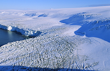
View of a land-based glacier calving into the sea. Hannah Point, Livingston Island, ntarctic Peninsula, Antarctica.

Aerial view of the purse-seiner fishery for salmon off Point Augustus, Chichagof Island, Southeast Alaska, USA. Bringing in the haul.

Aerial view of the purse-seiner fishery for salmon off Point Augustus, Chichagof Island, Southeast Alaska, USA. Closing the purse.

Glen Etive Valley and top of Loch Etive from high view point in Autumn featuring sun breaking through broken cloud. , Scotland
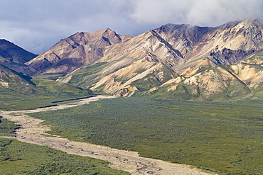
A view of the Polychrome (many-colored) Mountains from a lookout point on the park road inside Denali National Park and Preserve , Alaska, USA.

Aerial view of the purse-seiner fishery for salmon off Point Augustus, Chichagof Island, Southeast Alaska, USA. Skiff keeping the big boat out of the net. (RR)
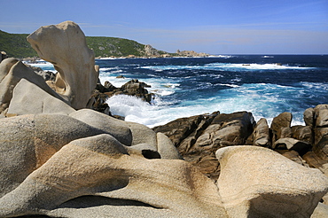
Granite rocks smoothed and sculpted by the weather and the sea into strange organic shapes, Campomoro Point, near Propriano, Corsica, France.

Aerial view of the purse-seiner fishery for salmon off Point Augustus, Chichagof Island, Southeast Alaska, USA. Closing the purse. (RR)
Semyon Dezhnev settlement, abandoned and ruined, Cape Dezhnev (Chukotskiy Peninsular ) Russia, Asia. MORE INFO: cape that forms the easternmost mainland point of Eurasia. In 1898 it was officially renamed Cape Dezhnev, replacing Captain James Cook's 'East Cape', in honor of Semyon Dezhnyov, the first recorded European to round it (1648). There is a large monument to Dezhnev on the coast.
People at Picton Point, evening light, autumn colours, Cleddau, Pembrokeshire, Wales, UK, Europe

Aerial view of the purse-seiner fishery for salmon off Point Augustus, Chichagof Island, Southeast Alaska, USA. Bringing in the haul. (RR)

Views of the volcanic island Surtsey (Icelandic, meaning "Surtur's island"), the southernmost point of Iceland
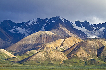
A view of the Polychrome (many-colored) Mountains from a lookout point on the park road inside Denali National Park and Preserve , Alaska, USA.
Views of the volcanic island Surtsey (Icelandic, meaning "Surtur's island"), the southernmost point of Iceland
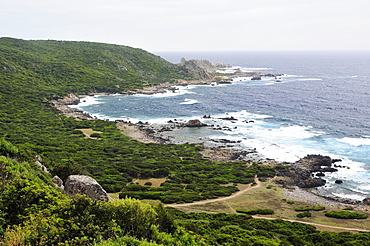
Rocky granitic coastline on a stormy day fringed by coastal maquis scrub, Campomoro Point, near Propriano, Corsica, France.

A view of the Polychrome (many-colored) Mountains from a lookout point on the park road inside Denali National Park and Preserve , Alaska, USA.

Spigot Point in Orne Harbour on the Antarctic Peninsula, Antarctica, Southern Ocean

Aerial view of the purse-seiner fishery for salmon off Point Augustus, Chichagof Island, Southeast Alaska, USA. Closing the purse. (RR)

Tower Point near Marloes, Wales, UK. (rr)

Aerial view of the purse-seiner fishery for salmon off Point Augustus, Chichagof Island, Southeast Alaska, USA. Closing the purse.

Aerial view of the purse-seiner fishery for salmon off Point Augustus, Chichagof Island, Southeast Alaska, USA. Closing the purse.

Rump point and Padstow bay in background. Cornwall, UK

Aerial view of the purse-seiner fishery for salmon off Point Augustus, Chichagof Island, Southeast Alaska, USA. (RR)

Evening light, autumn colours, Picton Point, Cleddau, Pembrokeshire, Wales, UK, Europe

Spigot Point in Orne Harbour on the Antarctic Peninsula, Antarctica, Southern Ocean
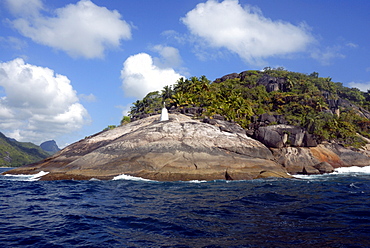
Lighthouse Point, granite and plam trees, coastal scenery, Mahe, Seychelles, Indian Ocean
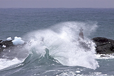
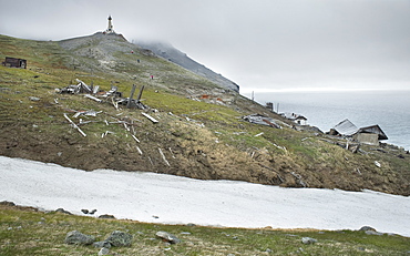
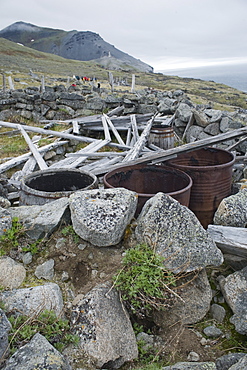
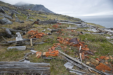
Heavy storm clouds and ice choked waters surround Point Wild on Elephant Island

Loch Awe high view point sunset. Argyll, Scotland

Aerial view of the purse-seiner fishery for salmon off Point Augustus, Chichagof Island, Southeast Alaska, USA.

Ben Cruachan with sun breaking through cloud illuminating mountain top, creating pink glow. Taken from Kilchrenan view point. Argyll, Scotland
Views of the Jougla Point, Antarctica. Jougla Point is located in Port Lockroy at the western end of Wiencke Island
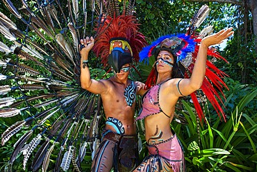
Mexican aztec dress gods at Grand Palladium White Sand Resort and Spa in Riviera Maya, Yucatan Peninsula, Quintana Roo, Caribbean Coast, Mexico.
Aztec clothing was generally loose fitting and did not completely cover the body. When the Spanish arrived in Mexico, the people were surprised to see them in their full armour, with only their faces exposed.
Aztec clothes were generally made of cotton (which was imported) or ayate fiber, made from the Maguey Cactus (also called the Century Plant or American Aloe). Women would weave the fibers into clothing, a task girls were taught as young teenagers. Because of their vast trading network, the Aztecs were able to make use of a beautiful array of dyes, creating the brilliant
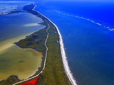
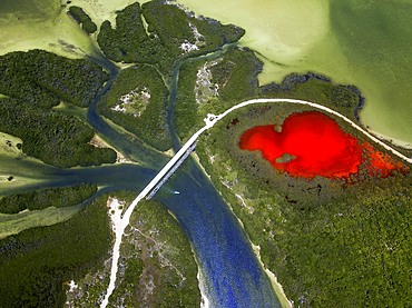
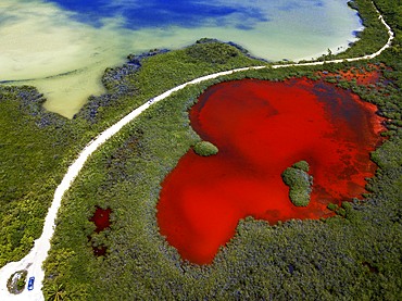
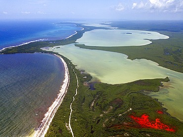
Aerial view of Punta Allen Sian Ka'an Reserve, Yucatan Peninsula, Mexico. Red lagoon near Boca Paila Bridge.
In the language of the Mayan peoples who once inhabited this region, Sian Ka'an means Origin of the Sky. Located on the east coast of the Yucatán peninsula, this biosphere reserve contains tropical forests, mangroves and marshes, as well as a large marine section intersected by a barrier reef. It provides a habitat for a remarkably rich flora and a fauna comprising more than 300 species of birds, as well as a large number of the region's characteristic terrestrial vertebrates, which cohabit in the diverse environment formed by its complex hydrological system.
Along its roughly 120 kilometres of coastline, the property covers over 400,000 hectares of land ranging from sea level to only ten m.a.s.l. The property boasts diverse tropical forests, palm savannah, one of the most pristine wetlands in the region, lagoons, extensive mangrove stands, as well as sandy beaches and dunes. The 120,000 hectares of marine area protect a valuable part of the Mesoamerican Barrier Reef and seagrass beds in the shallow bays. The lush green of the forests and the many shades of blue of the lagoons and the Caribbean Sea under a wide sky offer fascinating visual impressions.
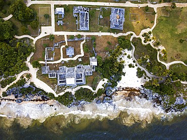
Aerial views of El Castillo and the Ruins of the Mayan temple grounds at Tulum, Quintana Roo, Yucatan, Mexico. Tulum is the site of a pre-Columbian Mayan walled city which served as a major port for Coba, in the Mexican state of Quintana Roo. The ruins are situated on 12 meter 39 ft tall cliffs along the east coast of the Yucatán Peninsula on the Caribbean Sea in the state of Quintana Roo, Mexico. Tulum was one of the last cities built and inhabited by the Maya; it was at its height between the 13th and 15th centuries and managed to survive about 70 years after the Spanish began occupying Mexico. Old World diseases brought by the Spanish settlers appear to have resulted in very high fatalities, disrupting the society, and eventually causing the city to be abandoned.
Aerial view of Punta Allen Sian Ka'an Reserve, Yucatan Peninsula, Mexico. Red lagoon near Boca Paila Bridge.
In the language of the Mayan peoples who once inhabited this region, Sian Ka'an means Origin of the Sky. Located on the east coast of the Yucatán peninsula, this biosphere reserve contains tropical forests, mangroves and marshes, as well as a large marine section intersected by a barrier reef. It provides a habitat for a remarkably rich flora and a fauna comprising more than 300 species of birds, as well as a large number of the region's characteristic terrestrial vertebrates, which cohabit in the diverse environment formed by its complex hydrological system.
Along its roughly 120 kilometres of coastline, the property covers over 400,000 hectares of land ranging from sea level to only ten m.a.s.l. The property boasts diverse tropical forests, palm savannah, one of the most pristine wetlands in the region, lagoons, extensive mangrove stands, as well as sandy beaches and dunes. The 120,000 hectares of marine area protect a valuable part of the Mesoamerican Barrier Reef and seagrass beds in the shallow bays. The lush green of the forests and the many shades of blue of the lagoons and the Caribbean Sea under a wide sky offer fascinating visual impressions.
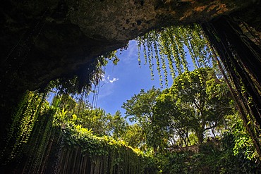
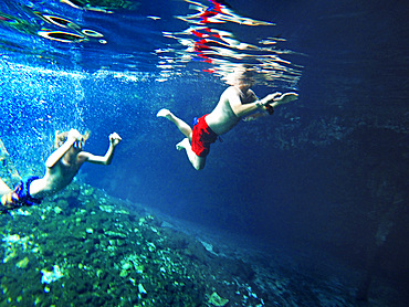
Cenote Ik Kil in Yucatan, Mexico, a natural pit, or sinkhole near Chichen Itza. Yucatan Peninsula, Quintana Roo, Mexico. Ik Kil was sacred to the Mayans who used this cenote for both relaxation and ritual services centuries ago.
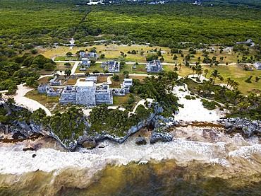
Aerial views of El Castillo and the Ruins of the Mayan temple grounds at Tulum, Quintana Roo, Yucatan, Mexico. Tulum is the site of a pre-Columbian Mayan walled city which served as a major port for Coba, in the Mexican state of Quintana Roo. The ruins are situated on 12 meter 39 ft tall cliffs along the east coast of the Yucatán Peninsula on the Caribbean Sea in the state of Quintana Roo, Mexico. Tulum was one of the last cities built and inhabited by the Maya; it was at its height between the 13th and 15th centuries and managed to survive about 70 years after the Spanish began occupying Mexico. Old World diseases brought by the Spanish settlers appear to have resulted in very high fatalities, disrupting the society, and eventually causing the city to be abandoned.
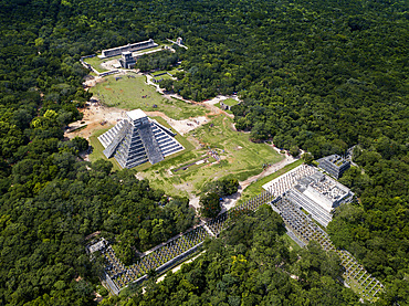
Aerial view of Mayan Ruin of Chichen Itza Archaeological Site Yucatan Peninsula, Quintana Roo, Caribbean Coast, Mexico
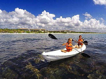
Kayakking in front of the beach of Grand Palladium White Sand Resort and Spa in Riviera Maya, Yucatan Peninsula, Quintana Roo, Caribbean Coast, Mexico
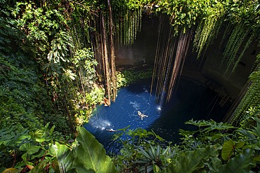
Swimming at Cenote Ik Kil in Yucatan, Mexico, a natural pit, or sinkhole near Chichen Itza. Yucatan Peninsula, Quintana Roo, Mexico. Ik Kil was sacred to the Mayans who used this cenote for both relaxation and ritual services centuries ago.
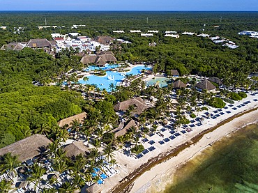
Aerial view of Grand Palladium White Sand Resort and Spa in Riviera Maya, Yucatan Peninsula, Quintana Roo, Caribbean Coast, Mexico
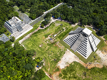
Aerial view of Mayan Ruin of Chichen Itza Archaeological Site Yucatan Peninsula, Quintana Roo, Caribbean Coast, Mexico
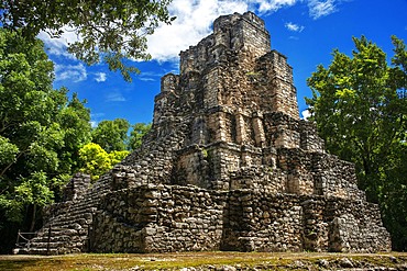
Estructura 8I-13 El Castillo at Chunyaxche Muyil Maya ruins, rainforest near Tulum, Yucatan Peninsula, Quintana Roo, Mexico
Aerial view of Punta Allen Sian Ka'an Reserve, Yucatan Peninsula, Mexico. Red lagoon near Boca Paila Bridge.
In the language of the Mayan peoples who once inhabited this region, Sian Ka'an means Origin of the Sky. Located on the east coast of the Yucatán peninsula, this biosphere reserve contains tropical forests, mangroves and marshes, as well as a large marine section intersected by a barrier reef. It provides a habitat for a remarkably rich flora and a fauna comprising more than 300 species of birds, as well as a large number of the region's characteristic terrestrial vertebrates, which cohabit in the diverse environment formed by its complex hydrological system.
Along its roughly 120 kilometres of coastline, the property covers over 400,000 hectares of land ranging from sea level to only ten m.a.s.l. The property boasts diverse tropical forests, palm savannah, one of the most pristine wetlands in the region, lagoons, extensive mangrove stands, as well as sandy beaches and dunes. The 120,000 hectares of marine area protect a valuable part of the Mesoamerican Barrier Reef and seagrass beds in the shallow bays. The lush green of the forests and the many shades of blue of the lagoons and the Caribbean Sea under a wide sky offer fascinating visual impressions.
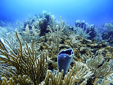
Underwater close up view of open coral polyp during a dive, Cancun, Quintana Roo, Mexico
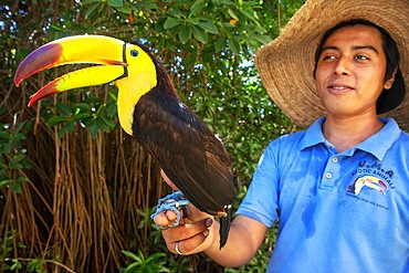
A Mexican staff member holds a tucan at Grand Palladium White Sand Resort and Spa in Riviera Maya, Yucatan Peninsula, Quintana Roo, Caribbean Coast, Mexico

Aerial view of Punta Allen Sian Ka'an Reserve, Yucatan Peninsula, Mexico
Gran Cenote de Tulum in Yucatan Peninsula, Quintana Roo, Mexico. There are thousands of cenotes dotted all over Mexico���s Yucatan Peninsula, and their existence is as much a defining characteristic of the region as is the distinct geological feature from which they result. Once revered by the ancient Mayans as sacred wells, they are now magnets for tourists, adventurers, and explorers alike.

Palms and old pier in Punta Allen Sian Ka'an Reserve, Yucatan Peninsula, Mexico.
In the language of the Mayan peoples who once inhabited this region, Sian Ka'an means Origin of the Sky. Located on the east coast of the Yucatán peninsula, this biosphere reserve contains tropical forests, mangroves and marshes, as well as a large marine section intersected by a barrier reef. It provides a habitat for a remarkably rich flora and a fauna comprising more than 300 species of birds, as well as a large number of the region's characteristic terrestrial vertebrates, which cohabit in the diverse environment formed by its complex hydrological system.
Along its roughly 120 kilometres of coastline, the property covers over 400,000 hectares of land ranging from sea level to only ten m.a.s.l. The property boasts diverse tropical forests, palm savannah, one of the most pristine wetlands in the region, lagoons, extensive mangrove stands, as well as sandy beaches and dunes. The 120,000 hectares of marine area protect a valuable part of the Mesoamerican Barrier Reef and seagrass beds in the shallow bays. The lush green of the forests and the many shades of blue of the lagoons and the Caribbean Sea under a wide sky offer fascinating visual impressions.

Mexican aztec dress gods at Grand Palladium White Sand Resort and Spa in Riviera Maya, Yucatan Peninsula, Quintana Roo, Caribbean Coast, Mexico.
Aztec clothing was generally loose fitting and did not completely cover the body. When the Spanish arrived in Mexico, the people were surprised to see them in their full armour, with only their faces exposed.
Aztec clothes were generally made of cotton (which was imported) or ayate fiber, made from the Maguey Cactus (also called the Century Plant or American Aloe). Women would weave the fibers into clothing, a task girls were taught as young teenagers. Because of their vast trading network, the Aztecs were able to make use of a beautiful array of dyes, creating the brilliant