Results
« Previous 1 … 6 7 8 9 10 … 26 Next »
2545 results found
dramatic coastline with rocks of Madeira, Portugal
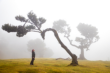
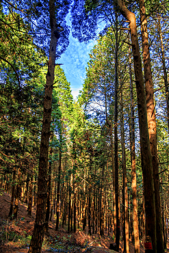
fanal laurel forest in madeira with majestic ancient trees
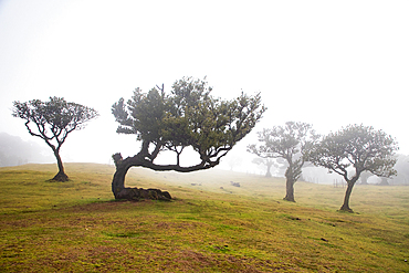
fanal laurel forest in madeira with majestic ancient trees
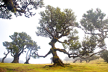
fanal laurel forest in madeira with majestic ancient trees
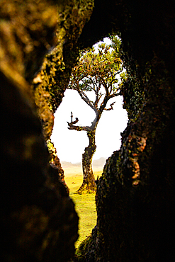
fanal laurel forest in madeira with majestic ancient trees
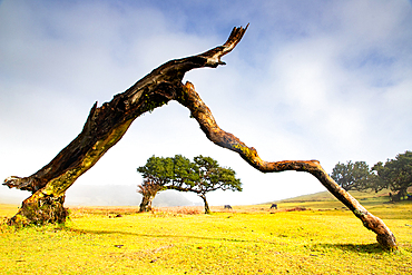
fanal laurel forest in madeira with majestic ancient trees
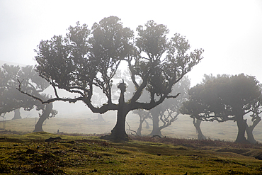
fanal laurel forest in madeira with majestic ancient trees
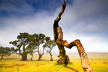
fanal laurel forest in madeira with majestic ancient trees
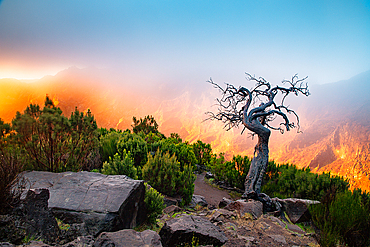
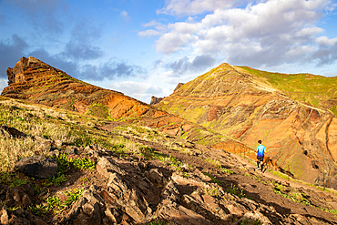
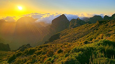
amazing sunrise in the mountains between Pico Do Arieiro and Pico Ruivo, Madeira, Portugal

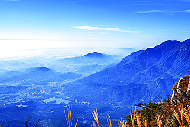
View from summit of Pico do Areeiro, Madeira

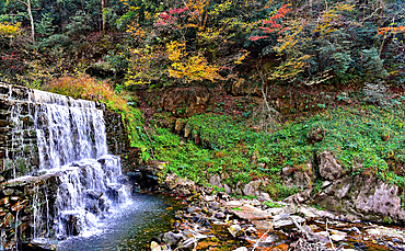
Agua d'Alto waterfall, San Vicente, Madeira

Dog sledding, Tura, Krasnoyarsk Krai, Evenki state, Russia

Evenki is doing dog sledding, Tura, Krasnoyarsk Krai, Evenki state, Russia

Evenki is doing dog sledding, Tura, Krasnoyarsk Krai, Evenki state, Russia

Evenki is doing dog sledding, Tura, Krasnoyarsk Krai, Evenki state, Russia

Evenki is doing dog sledding, Tura, Krasnoyarsk Krai, Evenki state, Russia

Old school snow schoes, Tura, Krasnoyarsk Krai, Evenki state, Russia

Traditional dressed Evenki hunter before a traditional Evenki Yurt in Tura, Krasnoyarsk Krai, Evenki state, Russia

Overlook over the Yenisei river, Tura, Krasnoyarsk Krai, Evenki state, Russia

Overlook over the Yenisei river, Tura, Krasnoyarsk Krai, Evenki state, Russia

Overlook over the Yenisei river, Tura, Krasnoyarsk Krai, Evenki state, Russia

Aerial of the Taiga around Tura, Krasnoyarsk Krai, Evenki state, Russia

Ice road on the Yenisei river, Tura, Krasnoyarsk Krai, Evenki state, Russia

Salekhard, Yamal Peninsula, Russia
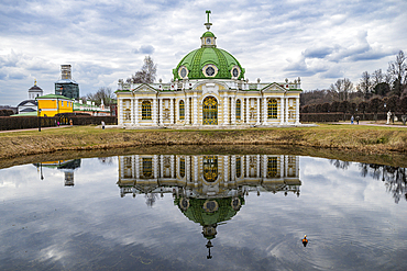
Kuskovo palace, Moscow, Russia
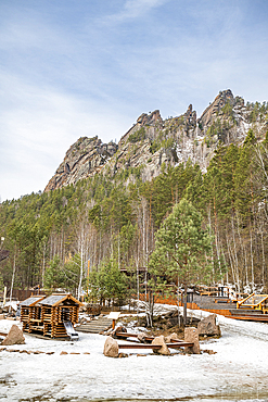
Skala Kitayskaya Stenka National Park, Krasnoyarsk, Siberia, Russia
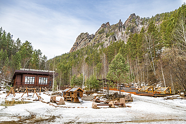
Skala Kitayskaya Stenka National Park, Krasnoyarsk, Siberia, Russia

View from summit of Pico do Areeiro, Madeira

View from summit of Pico do Areeiro, Madeira

View from summit of Pico do Areeiro, Madeira

Agua d'Alto waterfall, San Vicente, Madeira

Ponta de Sv�o Lourenv�o, Madeira

Tree, Funchal, Madeira

Sunset from summit of Pico do Areeiro, Madeira

Central mountains from near summit of Pico do Areeiro, Madeira

Central mountains from Curral das Freiras, Madeira

Roadside waterfall, central mountains, Madeira

Sunset, south coast, Madeira

Agua d'Alto waterfall, San Vicente, Madeira

Mountains near Funchal, Madeira

Agua d'Alto waterfall, San Vicente, Madeira
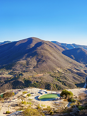
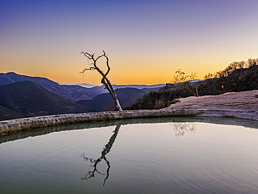
Hierve el Agua pools at sunset, elevated view, San Lorenzo Albarradas, Oaxaca State, Mexico
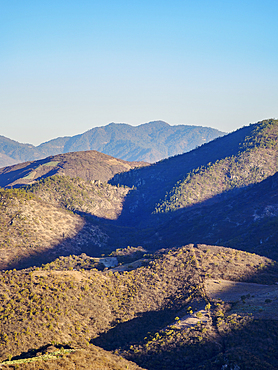
Landscape seen from Hierve el Agua at sunset, San Lorenzo Albarradas, Oaxaca State, Mexico
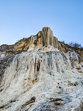
Petrified Waterfall at dusk, Hierve el Agua, San Lorenzo Albarradas, Oaxaca State, Mexico
Landscape seen from Hierve el Agua at sunset, San Lorenzo Albarradas, Oaxaca State, Mexico
Lone Tree by the pool, Hierve el Agua, dusk, San Lorenzo Albarradas, Oaxaca State, Mexico
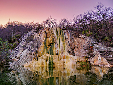
Petrified Waterfall at dusk, Hierve el Agua, San Lorenzo Albarradas, Oaxaca State, Mexico

Central mountains from above Funchal, Madeira
Sunset from summit of Pico do Areeiro, Madeira

Waterfall at Moteipa Trail, Palenque Archaeological Site, Palenque, Chiapas State, Mexico
Forest trail at Palenque Archaeological Site, Palenque, Chiapas State, Mexico

Waterfall at the Palenque Archaeological Site, Palenque, Chiapas State, Mexico

Landscape seen from the road between Bethel Yochib and Tzinteel, Chiapas State, Mexico
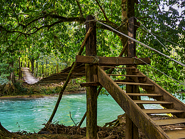
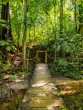
Hanging wooden bridge over Xanil River, Arroyo Agua Azul, Chiapas State, Mexico
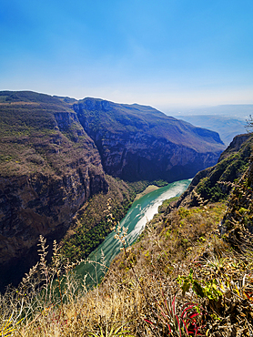
Sumidero Canyon, elevated view, Chiapas State, Mexico
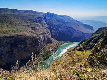
Sumidero Canyon, elevated view, Chiapas State, Mexico
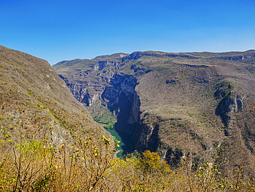
Sumidero Canyon, elevated view, Chiapas State, Mexico
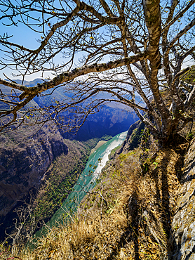
Sumidero Canyon, elevated view, Chiapas State, Mexico
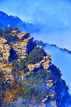
Wangjiang Pavilion from afar among rising clouds in Lushan (Mount Lu), Jiujiang City, Jiangxi, China. Lushan is a UNESCO World Heritage site, it is one of China's most famous mountains known for its natural beauty.
Wangjiang Pavilion from afar in Lushan (Mount Lu), Jiujiang City, Jiangxi, China. Lushan is a UNESCO World Heritage site, it is one of China's most famous mountains known for its natural beauty.
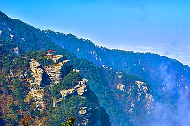
View of the town in Lushan (Mount Lu), Jiujiang City, Jiangxi, China. Lushan is a UNESCO World Heritage site, it is one of China's most famous mountains known for its natural beauty.

Shipwreck at Playa Punta Morena, Cozumel Island, Quintana Roo State, Mexico

Iguana at the rock with Caribbean Sea in the background, Paradise Beach, Tulum, Quintana Roo State, Mexico
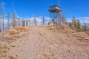
The fire watchtower on the summit of O'Leary Peak in the Coconino National Forest of Arizona. Adjacent to the Sunset Crater National Monument.
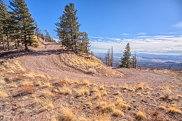
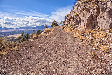
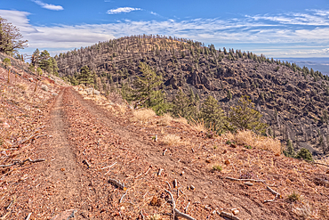
Forest Service Road that leads to the O'Leary Peak Watchtower and Overlook. Adjacent to Sunset Crater National Monument Arizona in the Coconino National Forest.
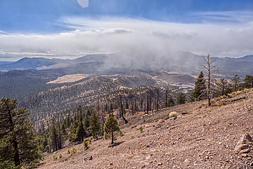
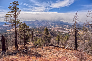
A snow squall storm building up over Humphrey's Peak. Viewed from O'Leary Peak in the Coconino National Forest of Arizona. Adjacent to Sunset Crater National Monument.
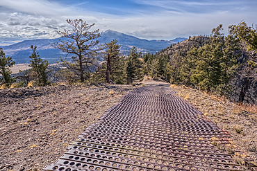
End of the Forest Service Road that leads to the O'Leary Peak Watchtower and Overlook. The metal grating is to add traction for vehicles. Adjacent to Sunset Crater National Monument Arizona in the Coconino National Forest.
A snow squall storm building up over Humphrey's Peak. Viewed from O'Leary Peak in the Coconino National Forest of Arizona. Adjacent to Sunset Crater National Monument.
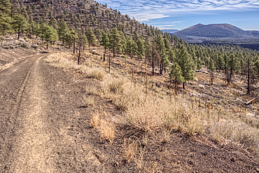
The Forest Service Road that leads to the summit of O'Leary Peak in the Coconino National Forest of Arizona.
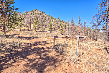
Gateway to the summit of O'Leary Peak in northern Arizona.
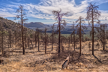
Dead trees from a past forest fire on the slope of O'Leary Peak in northern Arizona. Sunset Crater Volcano is in the background.
The eastern summit of O'Leary Peak in the Coconino National Forest of Arizona. Adjacent to the Sunset Crater National Monument.
Sunset Crater Volcano viewed from the forested slope of O'Leary Peak in northern Arizona.
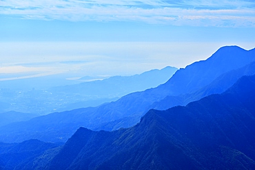
Spectacular view of misty mountains from Hanpo Pass at Lushan (Mount Lu), Jiujiang City, Jiangxi, China. Lushan is a UNESCO World Heritage site, it is one of China's most famous mountains known for its natural beauty.
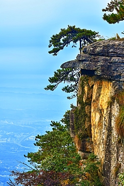
Dragon Head Cliff, Lushan (Mount Lu), Jiujiang City, Jiangxi, China. Lushan is a UNESCO World Heritage site, it is one of China's most famous mountains known for its natural beauty.
Hanpokou Pine Forest, Lushan (Mount Lu), Jiujiang City, Jiangxi, China. Lushan is a UNESCO World Heritage site, it is one of China's most famous mountains known for its natural beauty.
Lushan (Mount Lu), Jiujiang City, Jiangxi, China. Lushan is a UNESCO World Heritage site, it is one of China's most famous mountains known for its natural beauty.
Mist covered landscape from Wulao Feng (Five-Old-Man Peak) at Lushan (Mount Lu), UNESCO, Jiujiang City, Jiangxi, China
Mist covered landscape from Wulao Feng (Five-Old-Man Peak) at Lushan (Mount Lu), UNESCO, Jiujiang City, Jiangxi, China
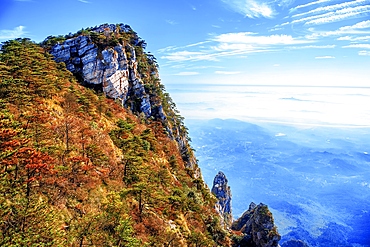
View of Wulao Feng (Five-Old-Man Peak) in Lushan (Mount Lu), UNESCO, Jiujiang City, Jiangxi, China
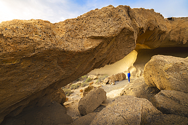
A tourist at Arco de Tajao during sunrise, El Poris de Abona, Santa Cruz de Tenerife, Tenerife, Canary Islands, Macaronesia, Spain, Western Europe

A tourist observes Teide volcano from La Ruleta viewpoint during sunset, Teide National Park, La Orotava, Santa Cruz de Tenerife, Tenerife, Canary Islands, Macaronesia, Spain, Western Europe
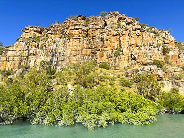
Mangroves in front of the King Leopold sandstone formations, Hunter River, Frederick Harbor, Kimberley, Western Australia, Australia, Pacific

Mitchell River waterfalls via helicopter from Swift Bay, Kimberley, Western Australia, Australia, Pacific
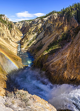
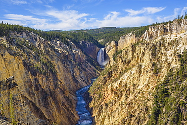
Grand Canyon of the Yellowstone River from Brink of the Lower Falls, Yellowstone National Park, UNESCO World Heritage Site, Wyoming, United States of America, North America
Artists Point looking towards Lower Falls, Grand Canyon, Yellowstone National Park, UNESCO World Heritage Site, Wyoming, United States of America, North America
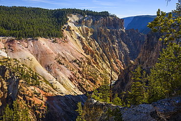
Grand Canyon of the Yellowstone River, Yellowstone National Park, UNESCO World Heritage Site, Wyoming, United States of America, North America
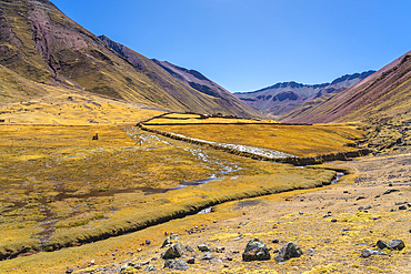
Stream in the Andes, near Rainbow Mountain, Pitumarca District, Cusco (Cuzco) Region, Peru, South America
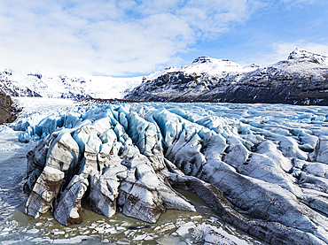
Aerial drone view of particular ice textures formed in the Svinafellsjokull glacier following global warming, Iceland, Polar Regions
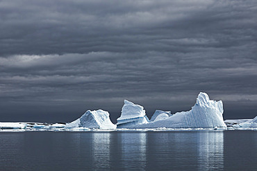
Icebergs with dark skies, Antarctica, Polar Regions

Iceberg against orange sunset sky, Antarctica, Polar Regions
Going down toward Santa Maria valley, Lucomagno area, Canton Ticino, Switzerland
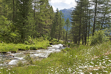
Torrent, Riva Valley (Val di Riva) (Reintal), adjacent to Ahrntal (Valle Aurina), South Tyrol (Alto Adige), Italy
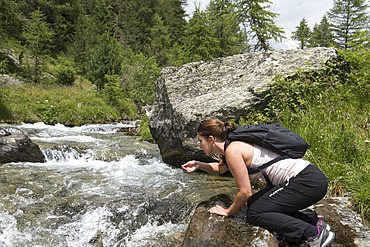
Rambler refreshing herself at the torrent, Riva Valley (Val di Riva) (Reintal), near Ahrntal (Valle Aurina), South Tyrol (Alto Adige), Italy
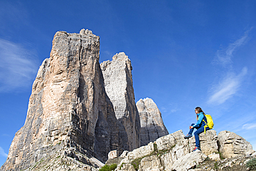
Hiker at the foot of the Tre Cime di Lavaredo (Three Peaks of Lavaredo), Three Peaks Nature Park, Dolomites, UNESCO, South Tyrol, Italy
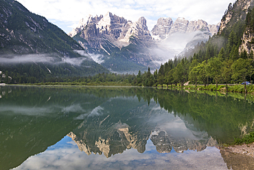
Durrensee Lake (Lago di Landro), Dobbiaco (Toblach), South Tyrol (Alto Adige), Italy
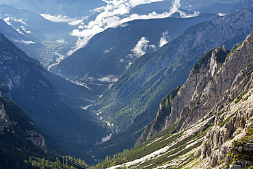
Val Marzon viewed from path connecting refuges Auronzo and Lavaredo, Three Peaks Nature Park, Dolomites, South Tyrol (Alto Adige), Italy
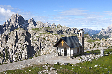
Cappella degli Alpini, Three Peaks Nature Park, Dolomites, South Tyrol (Alto Adige), Italy
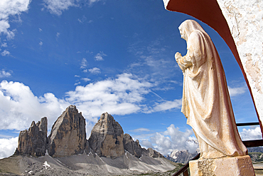
Statue at a corner of the Mountain Hut A.Locatelli-S.Innerkofler, Three Peaks Nature Park, Dolomites, South Tyrol (Alto Adige), Italy
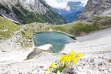
Alpine poppies above the Lago dei Piani inferiore, Three Peaks Nature Park, Dolomites, South Tyrol (Alto Adige), Italy