Results
« Previous 1 … 7 8 9 10 11 … 32 Next »
3115 results found
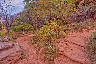
The 17th switchback along the North Kaibab Trail at Grand Canyon North Rim, UNESCO, Arizona, United States of America
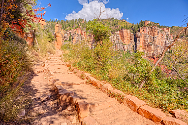
The 18th switchback along the North Kaibab Trail at Grand Canyon North Rim, UNESCO, Arizona, United States of America
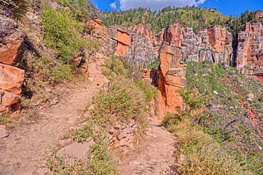
The 23rd switchback along the North Kaibab Trail at Grand Canyon North Rim, UNESCO, Arizona, United States of America
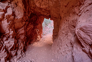
The interior of the Supai Tunnel along the North Kaibab Trail, Grand Canyon North Rim, UNESCO, Arizona, United States of America
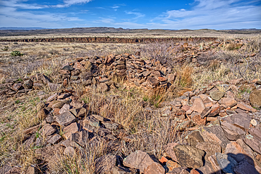
The Pueblo La Plata Indian Ruins near Silver Creek Canyon in the Agua Fria National Monument of Arizona. Located north of Black Canyon City.
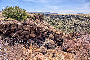
Ancient wall of the Fort Silver Indian Ruins overlooking Silver Creek Canyon in Agua Fria National Monument of Arizona. Located near the Pueblo La Plata ruins.
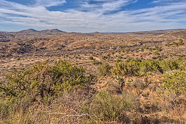
The primitive Bloody Basin Road winding thru the Agua Fria National Monument north of Black Canyon City Arizona.
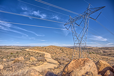
High Tension Power Lines stretching across Bloody Basin in Agua Fria National Monument north of Black Canyon City Arizona.
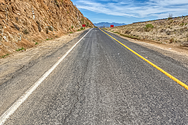
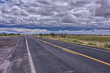
Look back up the freeway exit ramp for Bloody Basin Road in the Agua Fria National Monument of Arizona. Located north of Black Canyon City.
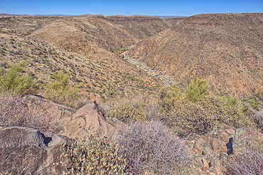
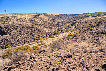
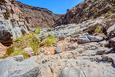
The Agua Fria River Canyon in the Agua Fria National Monument north of Black Canyon City Arizona.
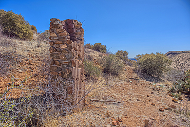
Remnants of the Richinbar Mine within the Agua Fria National Monument north of Black Canyon City Arizona. Mine was established in 1905 but was abandoned in 1940 when the company that owned it went bankrupt.
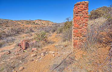
Remnants of the Richinbar Mine within the Agua Fria National Monument north of Black Canyon City Arizona. Mine was established in 1905 but was abandoned in 1940 when the company that owned it went bankrupt.
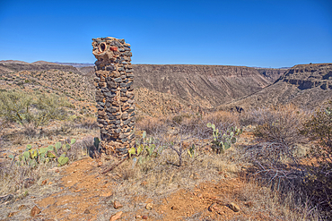
Remnants of the Richinbar Mine within the Agua Fria National Monument north of Black Canyon City Arizona. Mine was established in 1905 but was abandoned in 1940 when the company that owned it went bankrupt.
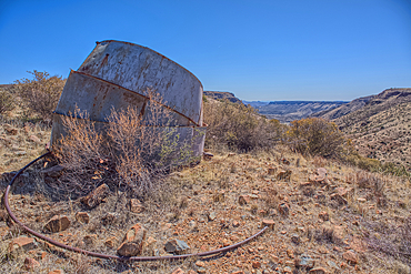
Remnants of the Richinbar Mine within the Agua Fria National Monument north of Black Canyon City Arizona. Mine was established in 1905 but was abandoned in 1940 when the company that owned it went bankrupt.
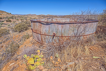
Remnants of the Richinbar Mine within the Agua Fria National Monument north of Black Canyon City Arizona. Mine was established in 1905 but was abandoned in 1940 when the company that owned it went bankrupt.
Remnants of the Richinbar Mine within the Agua Fria National Monument north of Black Canyon City Arizona. Mine was established in 1905 but was abandoned in 1940 when the company that owned it went bankrupt.
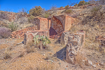
Remnants of the Richinbar Mine within the Agua Fria National Monument north of Black Canyon City Arizona. Mine was established in 1905 but was abandoned in 1940 when the company that owned it went bankrupt.
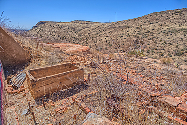
Remnants of the Richinbar Mine within the Agua Fria National Monument north of Black Canyon City Arizona. Mine was established in 1905 but was abandoned in 1940 when the company that owned it went bankrupt.
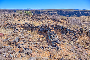
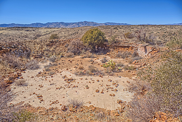
Ancient Indian Ruins near the historic Richinbar Mine in the Agua Fria National Monument north of Black Canyon City Arizona.
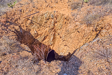
Open mine shaft at the Richinbar Mine within the Agua Fria National Monument north of Black Canyon City Arizona. Mine was established in 1905 but was abandoned in 1940 when the company that owned it went bankrupt.
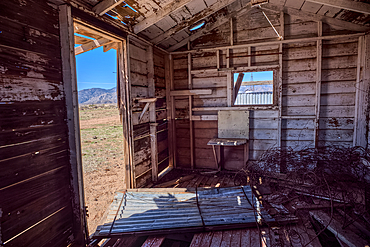
An abandoned cabin next to an active cattle corral in the Agua Fria National Monument north of Black Canyon City Arizona. Public land. No property release needed.
An unnamed tributary canyon that feeds into the Agua Fria River near the Sunset Point Rest Stop off of I-17 north of Black Canyon City AZ.

A sandstone hoodoo at Bryce Canyon National Park, Utah, USA. Hoodoos are pinnacles of rock shaped by the weather and erosion.
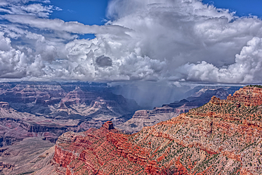
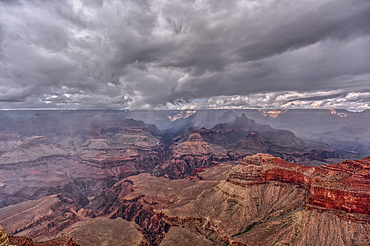
A rain storm over the North Rim of Grand Canyon National Park Arizona. Viewed from the Pipe Creek Vista on the South Rim.
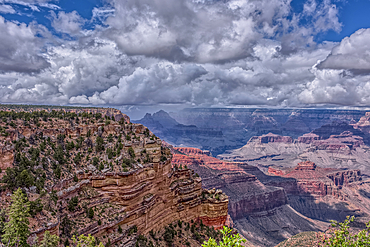
A rain storm over the North Rim of Grand Canyon National Park Arizona. Viewed from the Pipe Creek Vista on the South Rim.
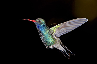
Male broad-billed hummingbird (Cynanthus latirostris) in flight, Madera Canyon, Coronado National Forest, Arizona, United States of America, North America
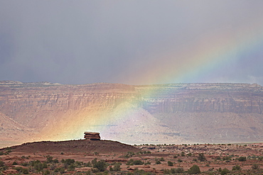
Rainbow, Canyon Country, Utah, United States of America, North America
The granite riverbed of the Agua Fria River Canyon in the Agua Fria National Monument of Arizona.
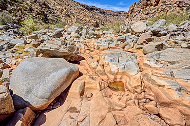
The granite riverbed of the Agua Fria River Canyon in the Agua Fria National Monument of Arizona.
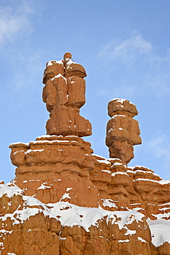
Red rock pillars with fresh snow, Red Canyon, Dixie National Forest, Utah, United States of America, North America
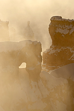
Foggy sunrise at Sunrise Point with snow, Bryce Canyon National Park, Utah, United States of America. North America
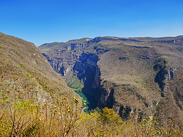
Sumidero Canyon, elevated view, Chiapas State, Mexico

Sumidero Canyon, Chiapas State, Mexico

View of Thor's Hammer from the Navajo Loop Trail in Bryce Canyon National Park, Utah, United States of America, North America

Grand Canyon view at sunset from the west side of Moran Point, Grand Canyon National Park, UNESCO World Heritage Site, Arizona, United States of America, North America

The Charcoal Kilns, bee-hive structure, designed by Swiss engineers, built by Chinese labourers in 1879, Panamint range, Emigrant Canyon Road, Death Valley National Park, California, United States of America, North America
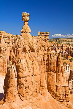
Thor's Hammer, an iconic hoodoo on the Navajo trail, a hiking trail through Bryce Amphitheater, Bryce Canyon National Park, Utah, United States of America, North America
A rain storm over the North Rim of Grand Canyon National Park Arizona. Viewed from Yavapai Point on the South Rim.
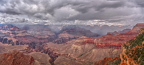
Panorama of a rain storm over the North Rim of Grand Canyon National Park Arizona. Viewed from Yavapai Point on the South Rim. Composed of 3 separate photos stitched together.
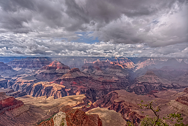
Rainy skies over the North Rim of Grand Canyon National Park Arizona. Viewed from Yavapai Point on the South Rim.
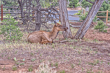
A female Elk relaxing under a tree near Yavapai Point at Grand Canyon South Rim Arizona.
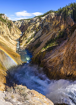
Grand Canyon of the Yellowstone River from Brink of the Lower Falls, Yellowstone National Park, UNESCO World Heritage Site, Wyoming, United States of America, North America
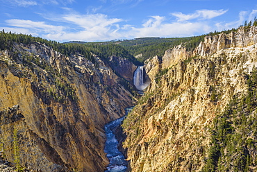
Artists Point looking towards Lower Falls, Grand Canyon, Yellowstone National Park, UNESCO World Heritage Site, Wyoming, United States of America, North America
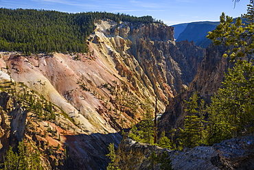
Grand Canyon of the Yellowstone River, Yellowstone National Park, UNESCO World Heritage Site, Wyoming, United States of America, North America
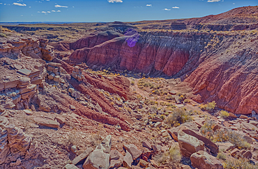
A canyon that drains into Dead Wash, Petrified Forest National Park, Arizona, United States of America
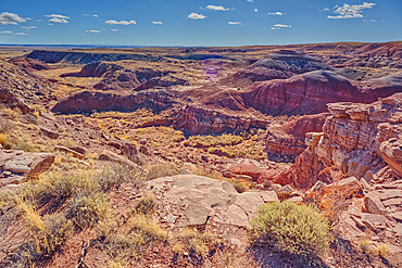
A canyon that drains into Dead Wash, Petrified Forest National Park, Arizona, United States of America
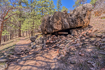
Indian Ruins along Cliff Springs Trail at North Rim in Grand Canyon National Park Arizona.
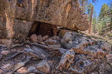
Indian Ruins along Cliff Springs Trail at North Rim in Grand Canyon National Park Arizona.
Hiking along the Sand Hollow Trail, Utah, United States of America, North America
Storm clouds building over Arizona State Route 64 that runs between Williams and Grand Canyon National Park.
State Route 64 heading north to Grand Canyon South Rim Arizona. Viewed thru the windshield of a moving vehicle. There may be some motion blur.
A sign along State Route 64 in Arizona marking 5 miles to Grand Canyon National Park. Viewed thru the windshield of a moving vehicle. There may be some motion blur.
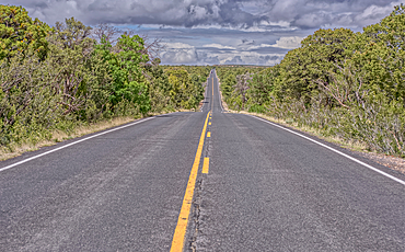
State Route 64 eastbound along Grand Canyon South Rim Arizona.
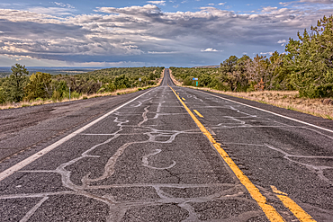
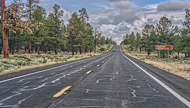
State Route 64 heading north to Grand Canyon South Rim Arizona.
Afternoon thunder shower, from Cape Royal Point, North Rim, Grand Canyon National Park, UNESCO World Heritage Site, Arizona, United States of America, North America
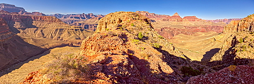
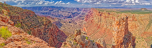
Grand Canyon view from western edge of Horseshoe Mesa, Grand Canyon National Park, UNESCO World Heritage Site, Arizona, United States of America, North America
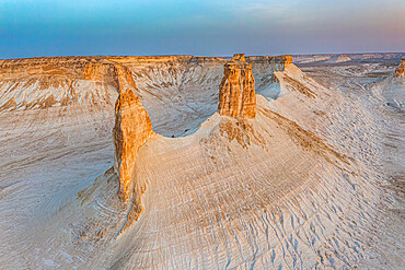
Canyon with sandstone walls in the Sharaan Nature Reserve, AlUla, Medina Province, Saudi Arabia

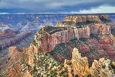
Panorama view of Freya's Castle and Wotan's Throne from the southwest side of Cape Royal on Grand Canyon North Rim, Arizona, United States of America, North America
View of San Francisco Peaks from a cliff at the end of the Telephone Trail north of Sedona with Oak Creek Canyon on the left, Arizona, United States of America, North America
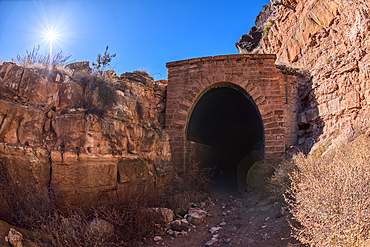
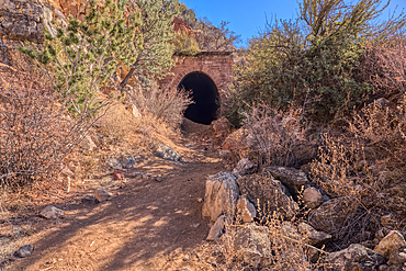
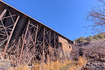
The south entrance of the historic Johnson Canyon Railroad Tunnel, Kaibab National Forest of Arizona, USA
The south entrance of the historic Johnson Canyon Railroad Tunnel, Kaibab National Forest of Arizona, USA

The south entrance of the historic Johnson Canyon Railroad Tunnel, Kaibab National Forest of Arizona, USA
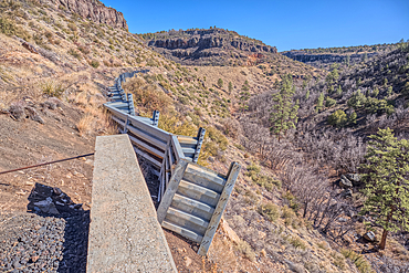
A metal retaining wall holding up the Johnson Canyon Railroad grade that has been damaged, Kaibab National Forest of Arizona, USA
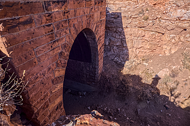
The north entrance of the historic Johnson Canyon Railroad Tunnel, Kaibab National Forest of Arizona, USA
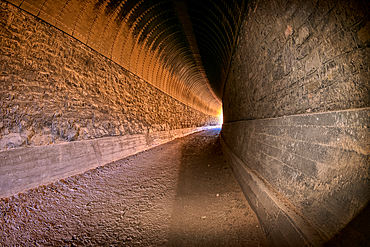
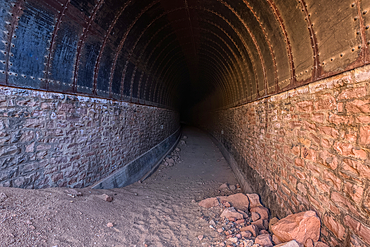
Interior view of the Johnson Canyon Railroad Tunnel, Kaibab National Forest of Arizona, USA
The north entrance of the historic Johnson Canyon Railroad Tunnel, Kaibab National Forest of Arizona, USA
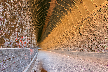
Interior view of the Johnson Canyon Railroad Tunnel, Kaibab National Forest of Arizona, USA
A metal retaining wall along the Johnson Canyon Railroad, Kaibab National Forest of Arizona, USA
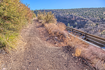
A section of the Johnson Canyon Railroad grade that has eroded away, Kaibab National Forest of Arizona, USA
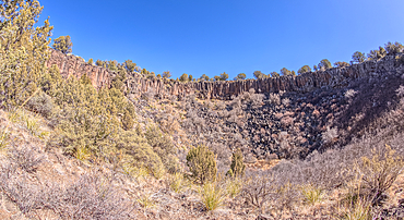
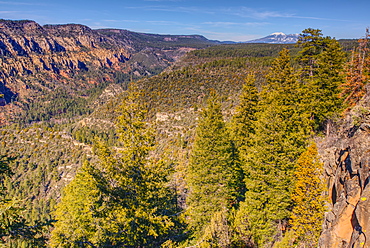
View from below the rim of the giant sinkhole known as Johnson Crater in the Kaibab National Forest near Ash Fork Arizona, USA

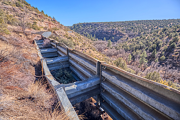
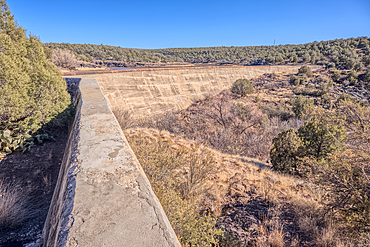
View from below the Stone Dam in the Kaibab National Forest, Arizona, USA
View from below the Stone Dam in the Kaibab National Forest, Arizona, USA
View from below the Stone Dam in the Kaibab National Forest, Arizona, USA
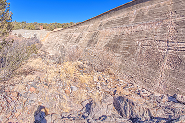
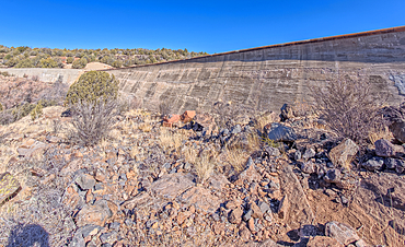
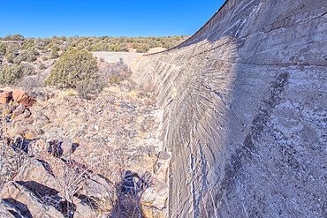
Johnson Canyon face of the Stone Dam in the Kaibab National Forest, Arizona, USA

Johnson Canyon face of the Stone Dam in the Kaibab National Forest, Arizona, USA
View from below the Stone Dam in the Kaibab National Forest, Arizona, USA
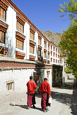
Monks at the Tibetan Buddhist Hemis Monastery, Ladakh region, state of Jammu and Kashmir, India, Asia
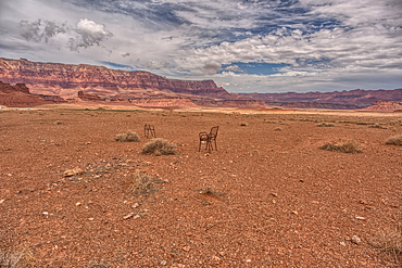
An abandoned lawn chair in view of Vermilion Cliffs near Marble Canyon Arizona from US89A on a mostly cloudy day. Located between the little town of Bitter Springs on the Navajo Reservation and the Vermilion Cliffs National Monument.
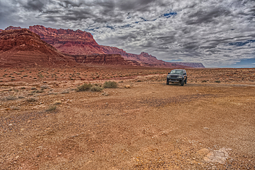
Vehicle parked next to Jackass Creek off of US89A near Echo Cliffs on the way to Vermilion Cliffs Arizona. Located on the Navajo Indian Reservation between Bitter Springs and Marble Canyon.
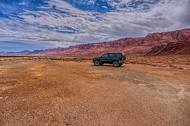
Vehicle parked next to Jackass Creek off of US89A near Echo Cliffs on the way to Vermilion Cliffs Arizona. Located on the Navajo Indian Reservation between Bitter Springs and Marble Canyon.
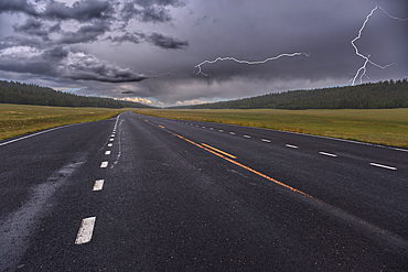
Lightning storm over Pleasant Valley in Kaibab National Forest Arizona, north of Grand Canyon North Rim.
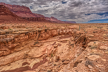
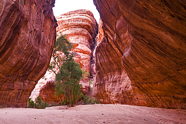
View of a small slot canyon called Jackass Creek off of US89A next to Echo Cliffs on the way to Vermilion Cliffs Arizona. Located on the Navajo Indian Reservation between Bitter Springs and Marble Canyon.
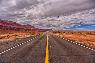
View of Echo Cliffs near Marble Canyon Arizona from US89A on a mostly cloudy day. This section of the cliffs is near the little town of Bitter Springs on the Navajo Reservation adjacent to the Vermilion Cliffs National Monument.
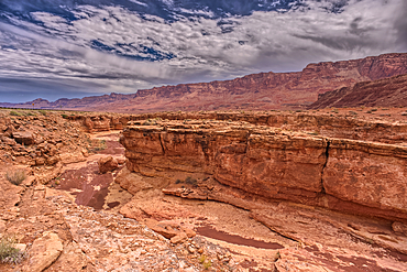
View of a small slot canyon called Jackass Creek off of US89A next to Echo Cliffs on the way to Vermilion Cliffs Arizona. Located on the Navajo Indian Reservation between Bitter Springs and Marble Canyon.
Highway 67 facing south in Pleasant Valley of Kaibab National Forest Arizona near sundown after a rain. North of Grand Canyon North Rim.
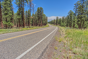
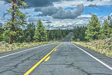
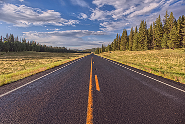
Highway 67 south of Jacob Lake Arizona facing southbound toward Grand Canyon North Rim.
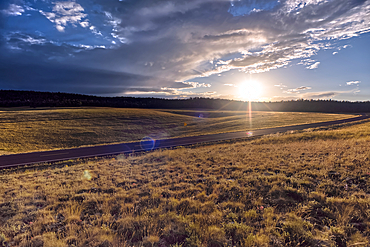
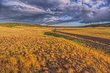
Rolling Hills in Pleasant Valley in the Kaibab National Forest north of Grand Canyon North Rim Arizona near sundown.
Grand Canyon with the historic Watch Tower on the far left, managed by the National Park Service, Grand Canyon National Park, UNESCO World Heritage Site, Arizona, United States of America, North America
Rolling Hills in Pleasant Valley in the Kaibab National Forest north of Grand Canyon North Rim Arizona near sundown.
Highway 67 facing north in Pleasant Valley of Kaibab National Forest Arizona near sundown after a rain. North of Grand Canyon North Rim.
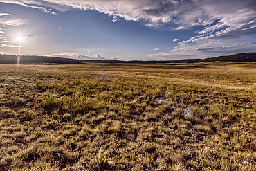
The rolling hills of Pleasant Valley in the Kaibab National Forest north of Grand Canyon North Rim Arizona near sundown.
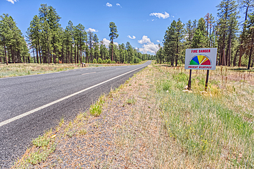
Taken on July 3rd, 2025, a warning sign of high wildfire danger along Highway 67 near Jacob Lake on the way to Grand Canyon North Rim Arizona. On July 4th, 2025, a massive wildfire broke out in this area from a lightning strike.
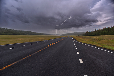
Lightning storm over Pleasant Valley in Kaibab National Forest Arizona, north of Grand Canyon North Rim.
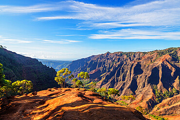
Waimea Canyon State Park, Kauai Island, Hawaii, United States of America, North America
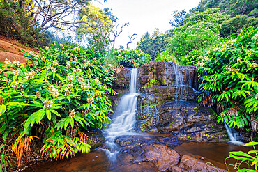
Waterfall, Waimea Canyon State Park, Kauai Island, Hawaii, United States of America, North America
Sunrise over Bozzhira Canyon, Ustyurt plateau, Mangystau, Kazakhstan, Central Asia, Asia

Camel caravan along Wadi Saba canyon towards salt mines, Asso Bhole, Dallol, Danakil Depression, Afar Region, Ethiopia, Africa

Aerial view of Oasis amidst rocks of Wadi Saba canyon, Melabday, Asso Bhole, Dallol, Danakil Depression, Afar, Ethiopia, Africa
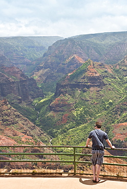
Waimea Canyon, Kauai, Hawaii, United States of America, North America
View from below the historic Bainbridge Steel Dam near Ash Fork, Kaibab National Forest, Arizona, United States of America